Report
On the first ascent to the summit of Tegeneklibashi
Via the South-Eastern ridge, category 1B (approximately) complexity AM LLC "Alpine Camps Management" "ADYL-SU 2022" October 31, 2022
I. Ascent Passport
| №№ p.p. | 1. General Information | |
|---|---|---|
| 1.1 | Full name, sports rank of the leader | Rastorguev Alexander Alekseevich, Master of Sports |
| 1.2 | Full name, sports rank of the participants | Fedorovich Ekaterina Aleksandrovna, 3rd sports rank |
| 1.3 | Full name of the coach | Rastorguev Alexander Alekseevich |
| 1.4 | Organization | LLC "Alpine Camps Management" |
| 2. Characteristics of the ascent object | ||
| 2.1 | Region | Caucasus. From Chiperazau pass to Gumači peak |
| 2.2 | Valley | Baksan valley |
| 2.3 | Section number according to the 2013 classification table | 2.4 |
| 2.4 | Name and height of the summit | Tegeneklibashi, 3502 m |
| 2.5 | Geographical coordinates of the summit (latitude/longitude), GPS coordinates | 43.165/42.352 |
| 3. Characteristics of the route | ||
| 3.1 | Name of the route | Via the South-Eastern ridge |
| 3.2 | Proposed category of complexity | 1B |
| 3.3 | Degree of route development | First ascent* (History unknown) |
| 3.4 | Character of the route relief | Rocky |
| 3.5 | Height difference of the route (GPS data) | 363 m |
| 3.6 | Route length | 925 m |
| 3.7 | Technical elements of the route | 1st cat. complexity rocks, firn ridge — 800 m 2nd cat. complexity rocks — 120 m 4th cat. complexity rocks — 5 m |
| 3.8 | Descent from the summit | 1. Via the ascent route — 200 m ridge, 1st cat. complexity. Then south — into a steep rocky couloir and via the SE couloir left — into a wide S couloir below the saddle at the start of the route. Then — via the ascent route. 2. Via the southern edge (see Fig. 1) and route description 1B via the S edge. |
| 3.9 | Additional characteristics of the route | The summit ridge in winter — with snow cornices, the descent couloir in the middle and lower parts — avalanche-prone. |
| 4. Characteristics of the team's actions | ||
| 4.1 | Time of movement | 1 day. 12 hours from Tegenekli settlement and back, including 3.5 hours ascent via the route |
| 4.2 | Overnights | no |
| 4.3 | Exit to the route | 7:00–12:00 Approach from Tegenekli settlement to the saddle under the start of the route. |
| 4.4 | Exit to the summit | 15:30 |
| 4.5 | Return to the base camp | 19:00 in Tegenekli settlement |
| 5. Responsible for the report | ||
| 5.1 | Full name, e-mail | Rastorguev A.A., ra@ualp.ru |
II. Ascent Description
1. Characteristics of the Ascent Object
1.1. General photo of the summit
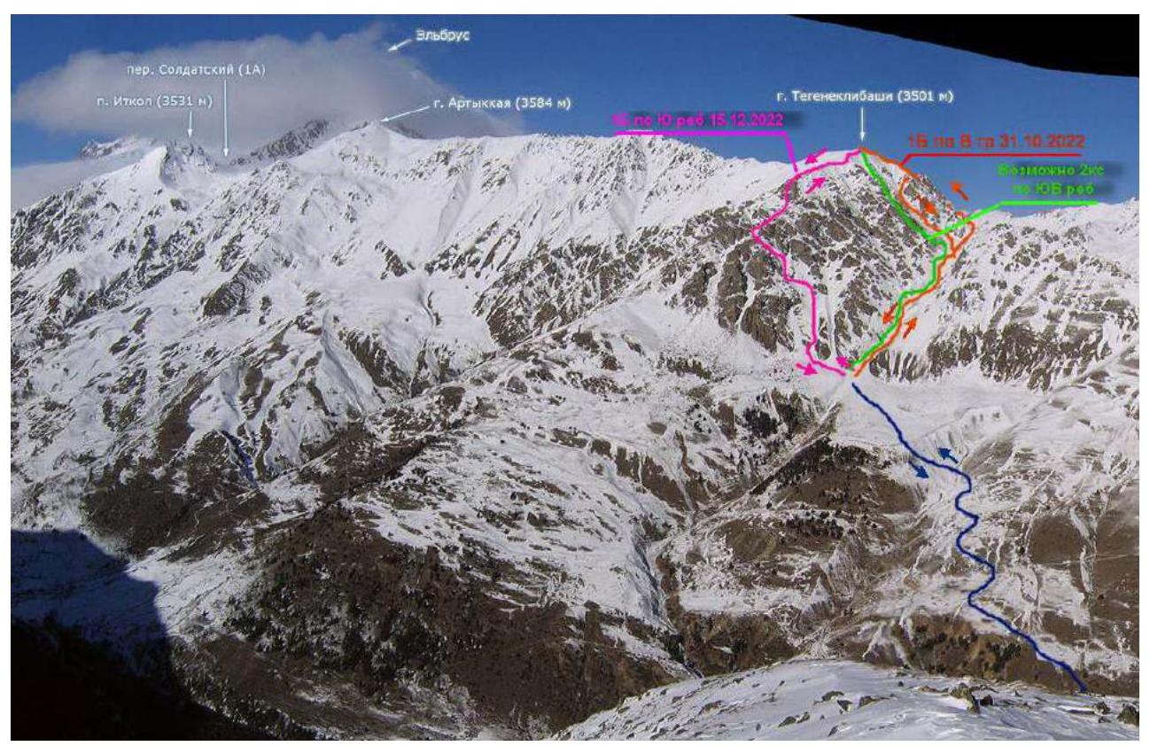
Fig. 1. Possible routes with an approach from Tegenekli settlement (based on a photo by Golubev M., https://caucatalog.ru/↗).
1.2. Photopanorama of the area
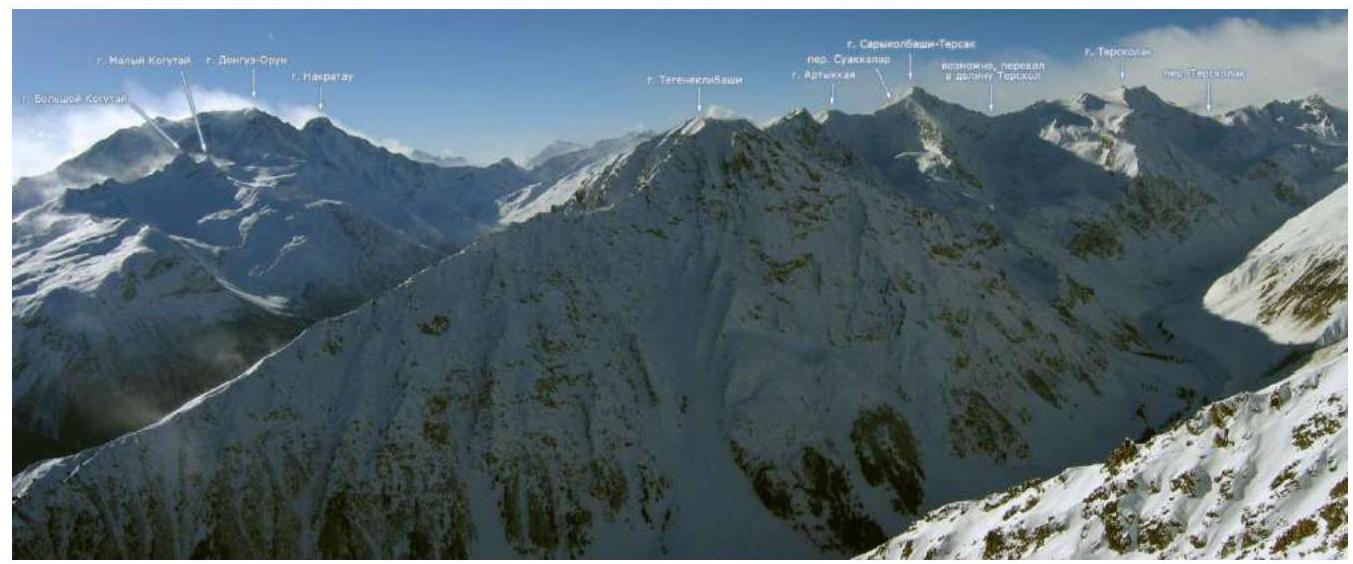
Fig. 2. Photopanorama of the area (photo by Golubev M., https://caucatalog.ru/↗)
1.3. Photo of the route profile

Fig. 3. Approach path and view of the main part of the route (photo by Fedorovich E.A.)
1.4. Geographical location of the area
The ascent object — Mt. Tegeneklibashi (3502 m) is located in the Caucasus mountains in the upper part of the Baksan valley. The rocky Tegenekli ridge is an eastern spur of Mt. Elbrus and is located northwest of the Tegenekli settlement (Elbrus district, Kabardino-Balkar Republic). Its length is 15 km.
The semantics of the locality name goes back to the Balkar tegenek — "thorn", "thorn bush". This part of the valley is overgrown with thorny bushes:
- barberry
- wild rose
- sea buckthorn
- juniper1
It is convenient to start the approach to the route in the Tegenekli settlement. Cross the second bridge from the bottom of the valley into the settlement and approach the southern slopes of the valley. Cross the high-voltage power line near the transformer substation and turn left — up onto a good, sometimes steep trail leading to the high-altitude pastures. Cross a stream in the direction of a grassy shoulder above a large rocky outcrop. On the shoulder, turn right — up to a col. Then follow trails, grassy slopes, staying in the stream bed up and left towards a clearly defined saddle in the eastern ridge of Tegeneklibashi peak.
From the start of the trail to the saddle — the beginning of the route:
- 4–5 hours of walking time
- with light backpacks
2. Characteristics of the Route
2.1. Technical photograph of the route
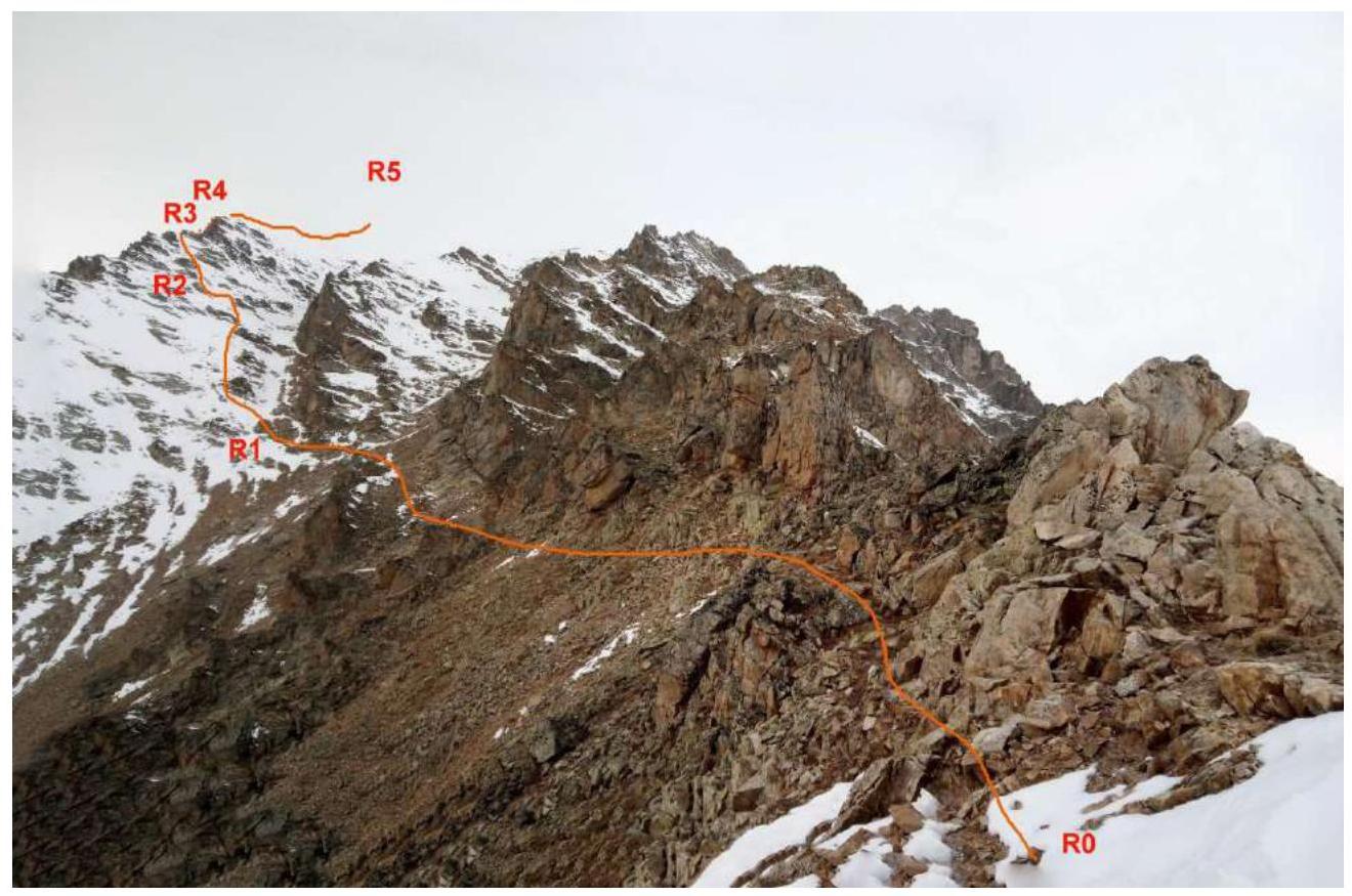
Fig. 4. Technical photo of the first half of the route.
2.2. Technical characteristics of the route sections
| Section № | Character of relief | Category of complexity | Length, m | Type and number of hooks |
|---|---|---|---|---|
| R0–R1 | Grassy and scree ledges | 1 | 200 | - |
| R1–R2 | Scree slope with rock outcrops | 1, 2 | 100, 20 | - |
| R2–R3 | Rocks, walls, and internal angle, sharp rocky ridge | 2 | 50 | loop, 2 stoppers |
| R3–R4 | Rocky wall 80° with a wide crack | 4 | 5 | stations on loops, 1 friend |
| R4–R5 | Rocky ridge | 2, 1 | 50, 200 | - |
| R5–R6 | Snow and firn, or simple rocky ridge | 1 | 300 | - |
2.3. Technical photographs of the route sections.
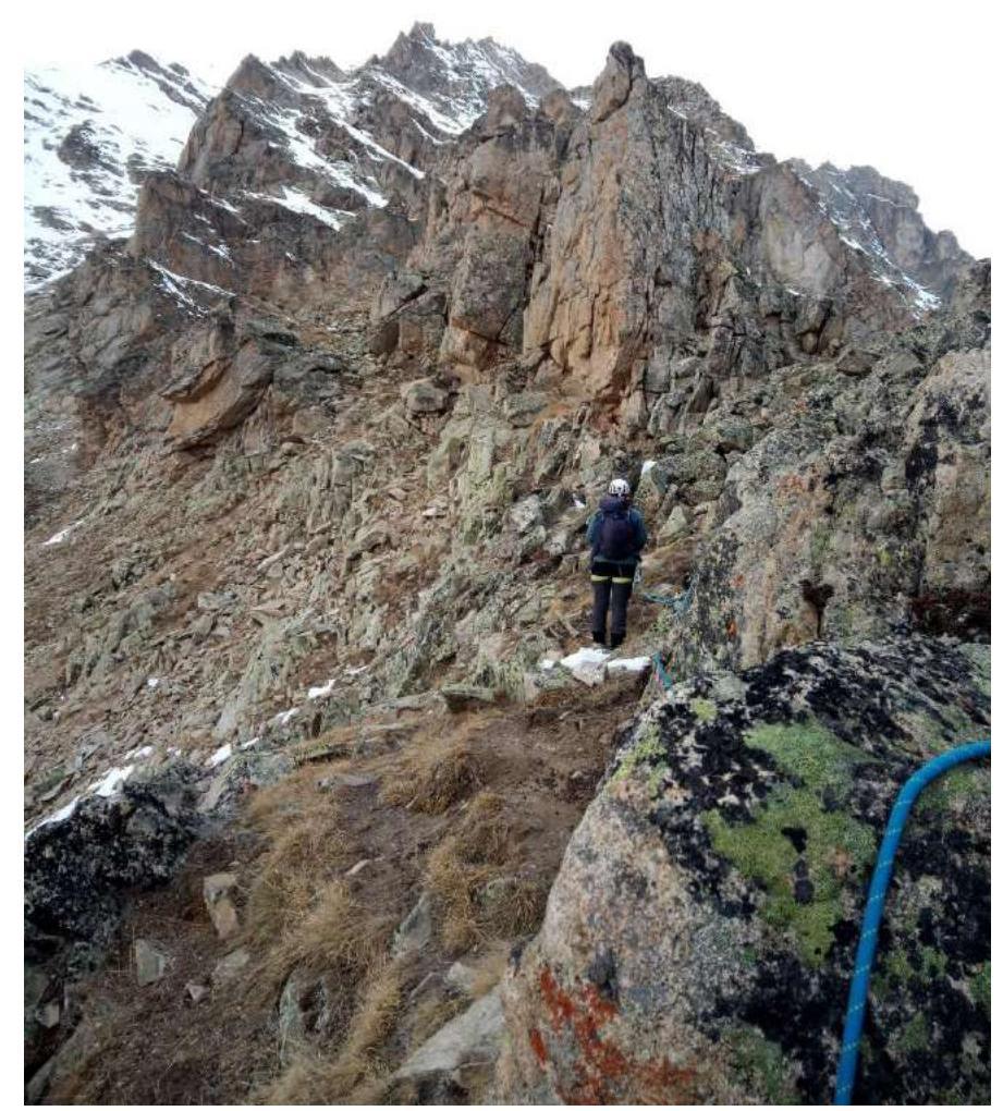
Fig. 5. On section R0–R1.
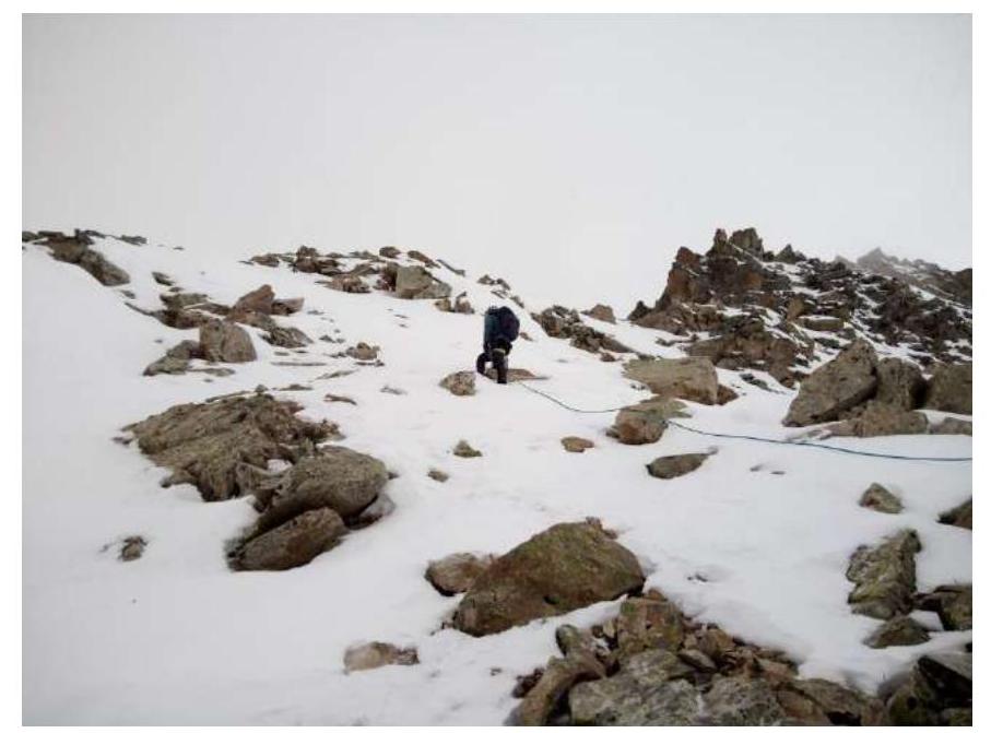
Fig. 6. On section R1–R2.

Fig. 7. On section R2–R3.
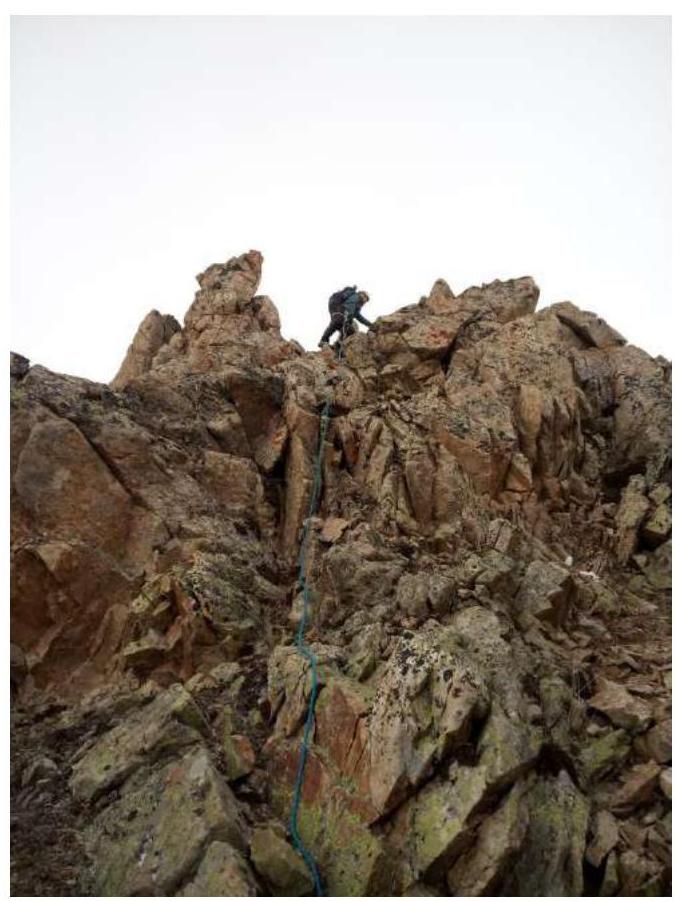
Fig. 8. Exit to the ridge R3.
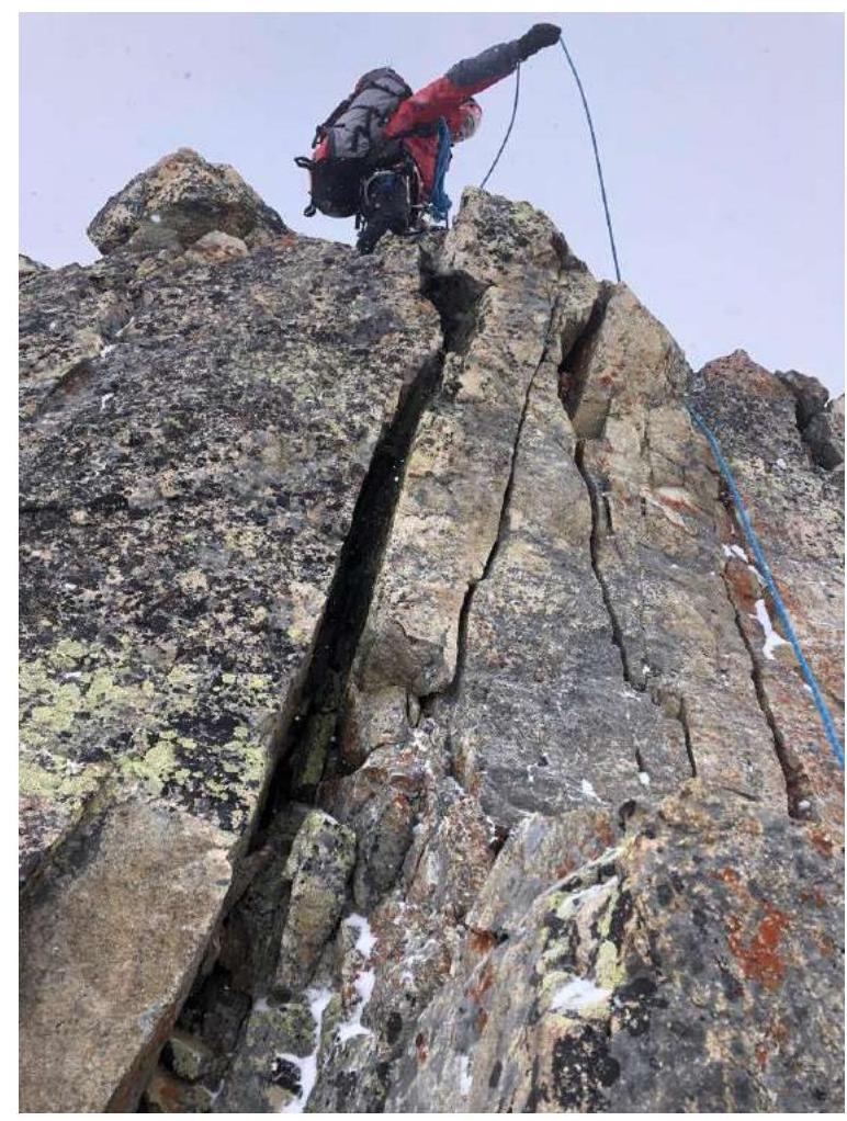
Fig. 9. Key section of the route R3–R4.
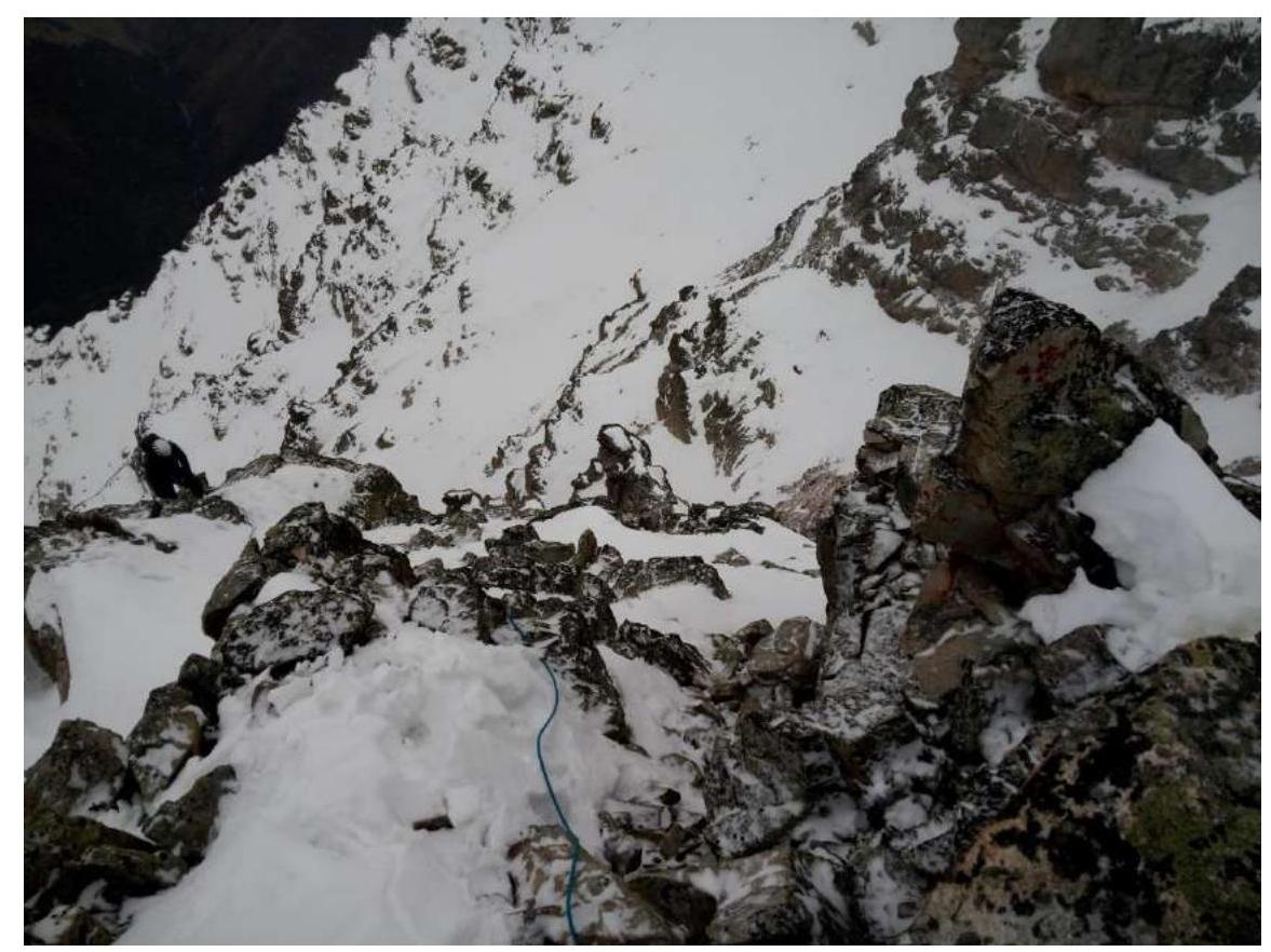
Fig. 10. Start of section R4–R5. Top view.
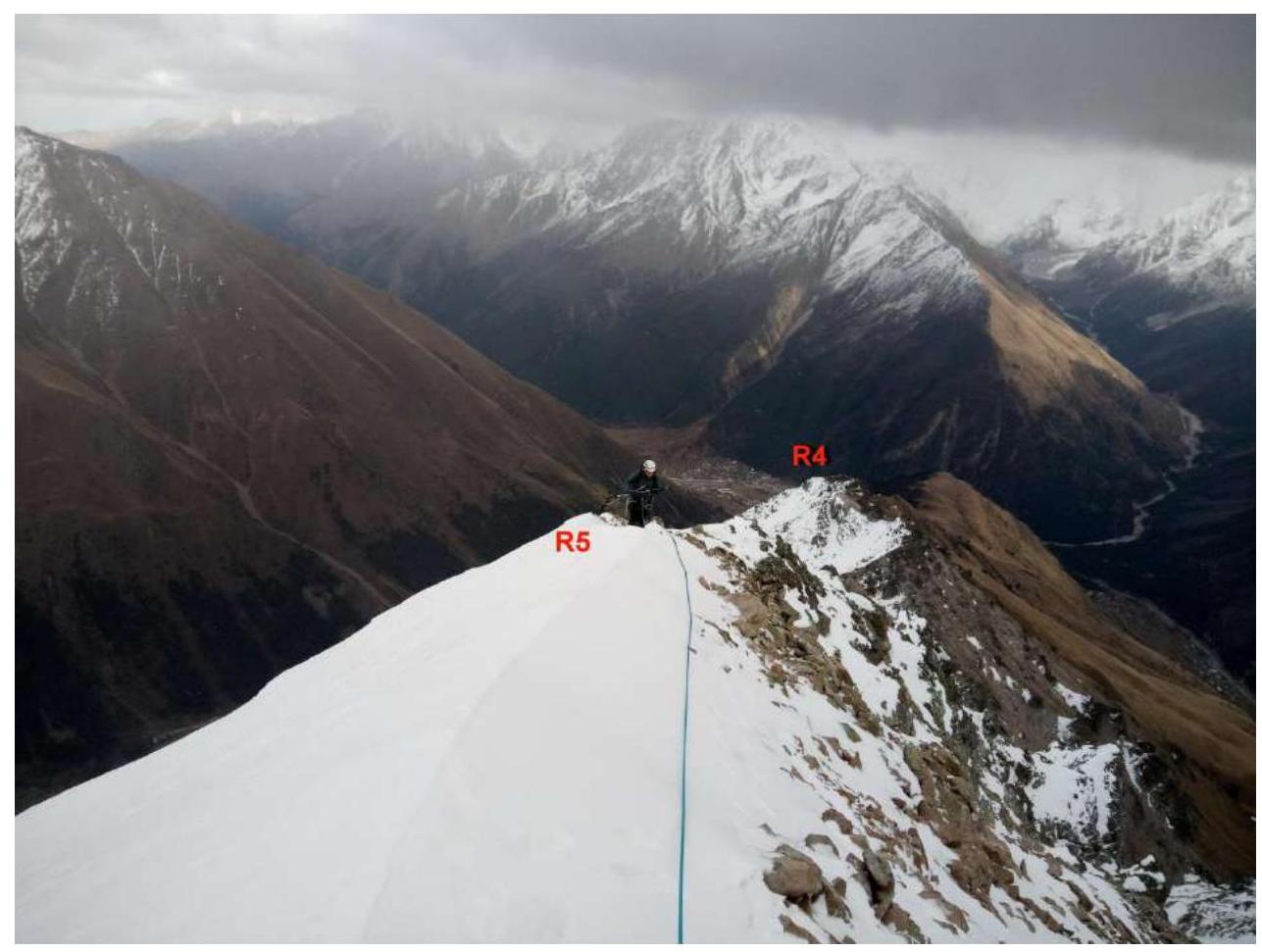
Fig. 11. Pre-summit ridge. Top view. R4–R5.
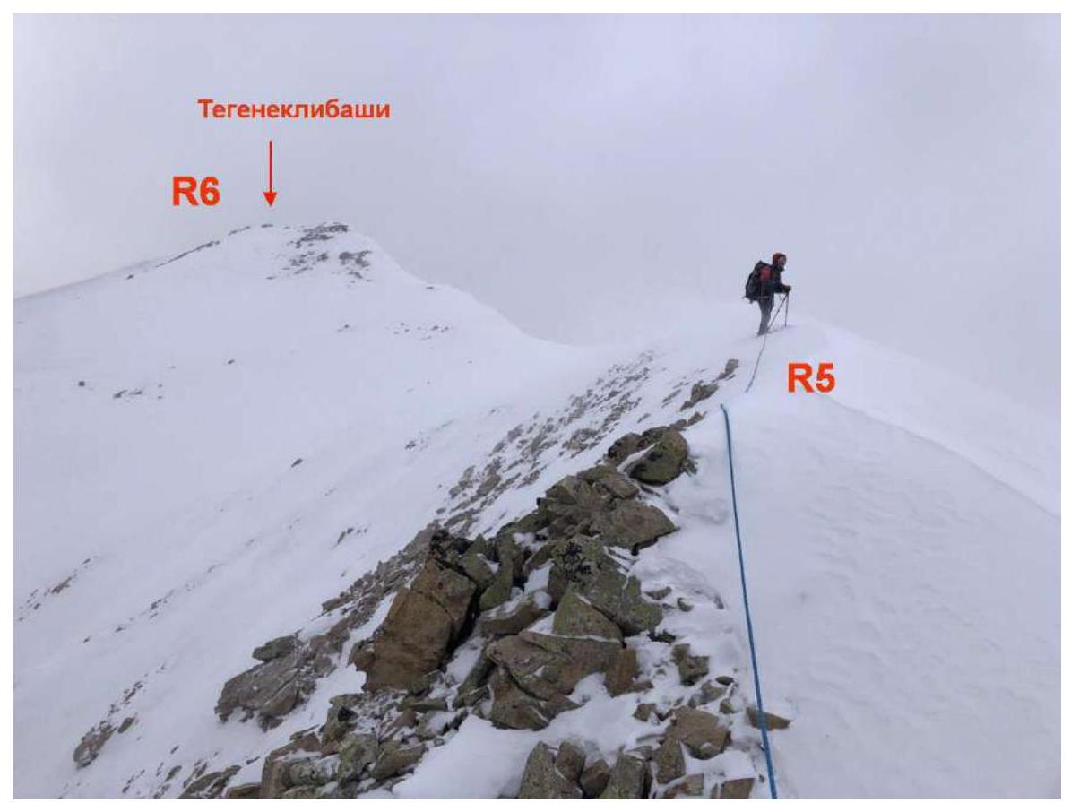
Fig. 12. Pre-summit ridge. Section R5–R6.
3. Characteristics of the Team's Actions
3.1. Brief description of the route passage.
| Section № | Description | Photo № |
|---|---|---|
| R0–R1 | From the saddle left upwards, left of the ridge, towards a long ridge against the sky, crossing two wide couloirs. Simultaneous movement in a rope team with terrain belay. | Fig. 4, Fig. 5. |
| R1–R2 | Up a scree slope with rock outcrops and simple rocks, exit below rocky walls to the right of the ridge. Simultaneous movement in rope teams with terrain belay. | Fig. 4, Fig. 6. |
| R2–R3 | Via rocky walls, ledges, and an internal angle — exit to a saddle on a sharp ridge. Station on a rocky outcrop. Limited space. Alternating movement with own intermediate belay points. | Fig. 4, Fig. 7, Fig. 8. |
| R3–R4 | Up a steep rocky wall with a wide vertical crack — ascent to a widening part of the ridge. Convenient station on a rocky outcrop. Alternating movement with own intermediate belay points. Key section of the route. | Fig. 9, Fig. 10. |
| R4–R5 | Via a rocky and scree (in winter, snowy) ridge to a firn pre-summit rise of the ridge. Simultaneous movement of rope teams on a shortened rope. Terrain belay. | Fig. 11. |
| R5–R6 | Via a simple rocky (in winter, snowy with cornices) ridge — exit to the summit. Terrain belay. | Fig. 12. |
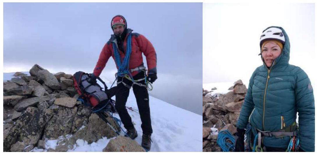
3.2. Photo on the summit with a control tour.
3.3. Assessment of the route's safety.
The route, like any ridge route, can be hazardous during a thunderstorm. In poor visibility, be cautious on section R0–R3 to avoid going right onto one of the two false ridges. No random rockfall was observed during the ascent. The grassy slopes of the approach to the route in summer, as well as the couloirs and slopes on the descent from the route, can be avalanche-prone during periods of:
- heavy snowfall
- spring snowmelt
Radio communication with the Ministry of Emergency Situations and MTS mobile communication work throughout the route.
3.4. Descent from the summit.
Descent from the summit, depending on the training goals of the group, is equally possible:
- via the ascent route to its beginning, or
- via the ascent route to the start of the rocky ridge with a deviation to the right (south) down into the SE couloir and via it left into a wide S couloir below the saddle at the start of the route.
Then down via the ascent trail to Tegenekli settlement. From the summit to the settlement — 3.5–4 hours. During a subsequent ascent to the summit via the southern edge, it became clear that it is simpler and faster to descend via it. See Fig. 1 and the corresponding route description.
The route corresponds to category 1B complexity year-round. Recommended for training groups at the NP-1 stage as a first ascent of category 1B, where the instructor has opportunities for safe practice of various technical techniques with novices during the ascent. Despite the apparent proximity of the summit, when completing the route in one day from camp to camp, the route requires:
- good endurance
- physical fitness of the participants.
Compiled and formatted by Rastorguev A.A., +7 918 460–55–66, ra@ualp.ru The report includes photographs by:
- Fedorovich E.A.
- Rastorguev A.A.
Footnotes
-
A. V. Tverdy, Toponymic Dictionary of the Caucasus ↩


