Report
on the first ascent of Peak 3545 (Peak Yubileiny) via the East Ridge, category 2B, by the team from the "SHKELDA" alpine camp
June 21, 2021
I. Ascent Passport
| № item | 1. General Information | |||||||||
|---|---|---|---|---|---|---|---|---|---|---|
| 1.1 | Full name, sports rank of the leader | Korolev Alexander Viktorovich, CMS | ||||||||
| 1.2 | Full name, sports rank of participants | 1. Belousov Alexey Georgievich, 3rd sports rank 2. Buyanov Yan Viktorovich, 2nd sports rank 3. Prigolovkina Alla Igorevna, 3rd sports rank 4. Rabdanov Bator Tsybanovich, 3rd sports rank | ||||||||
| 1.3 | Full name of the coach | Korolev Alexander Viktorovich | ||||||||
| 1.4 | Organization | LLC "SHKELDA" (alpine camp "SHKELDA") | ||||||||
| 2. Characteristics of the ascent object | ||||||||||
| 2.1 | Region | Central Caucasus | ||||||||
| 2.2 | Valley | Shkheldy (Adyl-Su) | ||||||||
| 2.3 | Number according to the 2013 classification table | 2.4 | ||||||||
| 2.4 | Name and height of the peak | Peak 3545 (Peak Yubileiny) | ||||||||
| 2.5 | Geographic coordinates (latitude/longitude), GPS coordinates (1) | By WGS Lat. 43°, 11′40.166 N Long. 42°, 37′28.389 E | ||||||||
| 3. Route Characteristics | ||||||||||
| 3.1 | Route name | Via the East Ridge | ||||||||
| 3.2 | Proposed category of difficulty | 2B | ||||||||
| 3.3 | Degree of route development | First ascent | ||||||||
| 3.4 | Terrain type | Rocky | ||||||||
| 3.5 | Elevation gain (altimeter or GPS data) | 650 m | ||||||||
| 3.6 | Route length | 1583 m | ||||||||
| 3.7 | Technical elements (total length of sections by category of difficulty, terrain type) | 1st cat. — 510 m — rocky 2nd cat. — 680 m — rocky 3rd cat. — 48 m — rocky | ||||||||
| 3.8 | Descent from the summit | Via the 1B category route to the Shkhelda valley — combined (rocky and snowy) | ||||||||
| 3.9 | Additional route characteristics | November to June — snowy; June to October — rocky, waterless | ||||||||
| 4. Team Actions | ||||||||||
| 4.1 | Time in motion (team's walking hours, in hours and days) | 15 hours 1 day | ||||||||
| 4.2 | Overnight stays | No | ||||||||
| 4.3 | Start of the route | June 23, 2021 | ||||||||
| 4.4 | Summit ascent | June 23, 2021 | ||||||||
| 4.5 | Return to base camp | June 23, 2021 | ||||||||
| 5. Report responsible | ||||||||||
| 5.1 | Full name, e-mail | Korolev Alexander Viktorovich, aleksandrkdiver@mail.ru |
* (1) — filled in only if the peak is not listed in the Electronic Russian Classifier of Mountain Routes
II. Ascent Description
- Characteristics of the Ascent Object
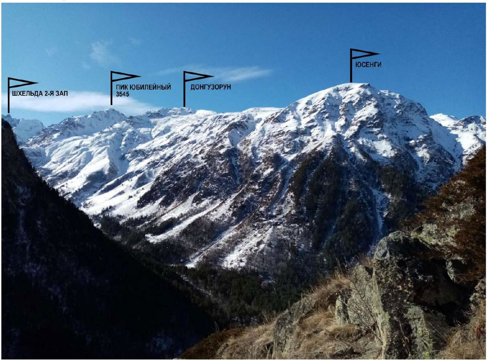
Photo 1. A. Korolev's route on Peak 3545 (Peak Yubileiny) via the East Ridge, category 2B, 2021. Photo from the Adyl-Su valley. Taken in April 2021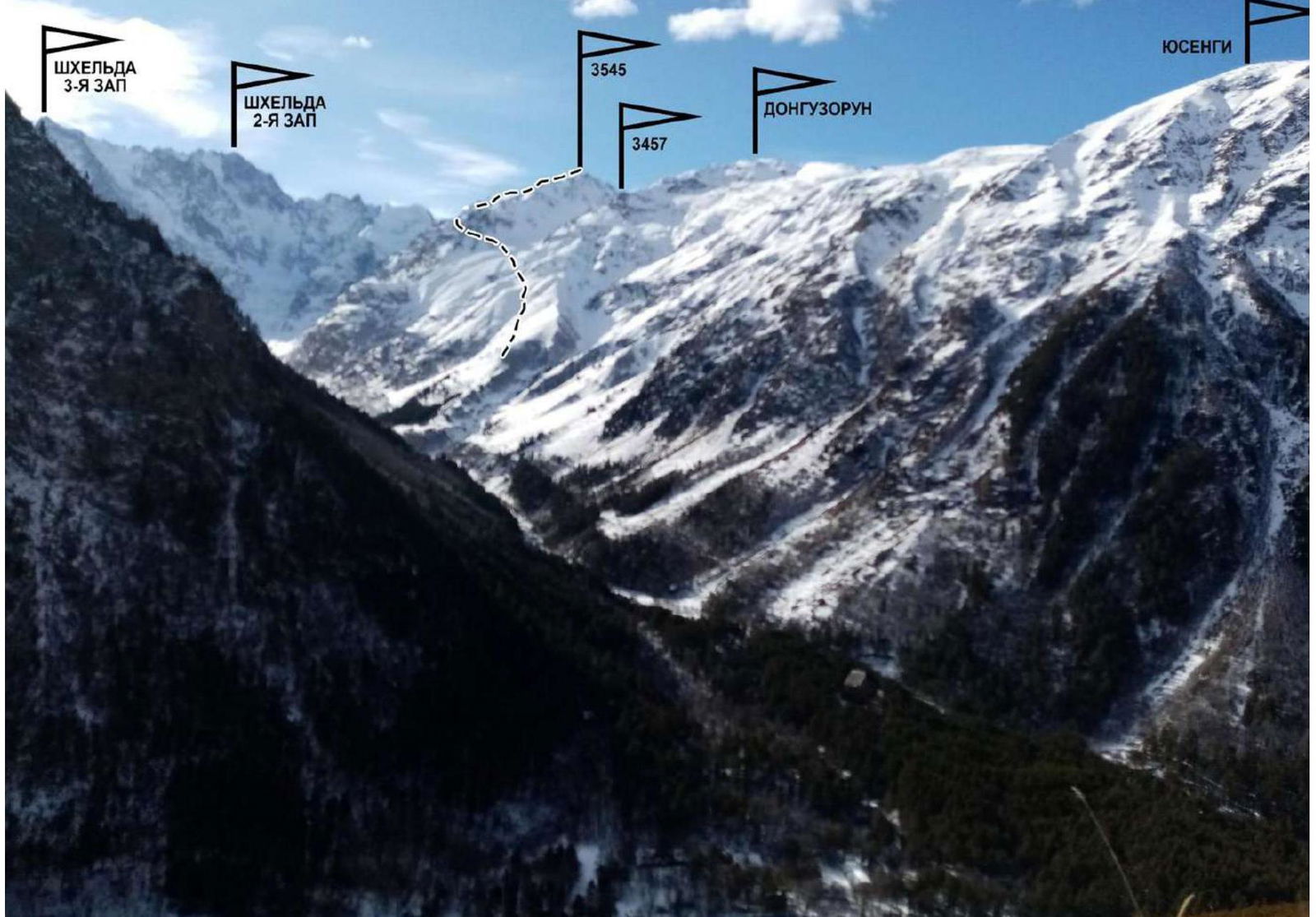
Photo 2. A. Korolev's route on Peak 3545 (Peak Yubileiny) via the East Ridge, category 2B, 2021. Photo from the Adyl-Su valley. Taken in April 2021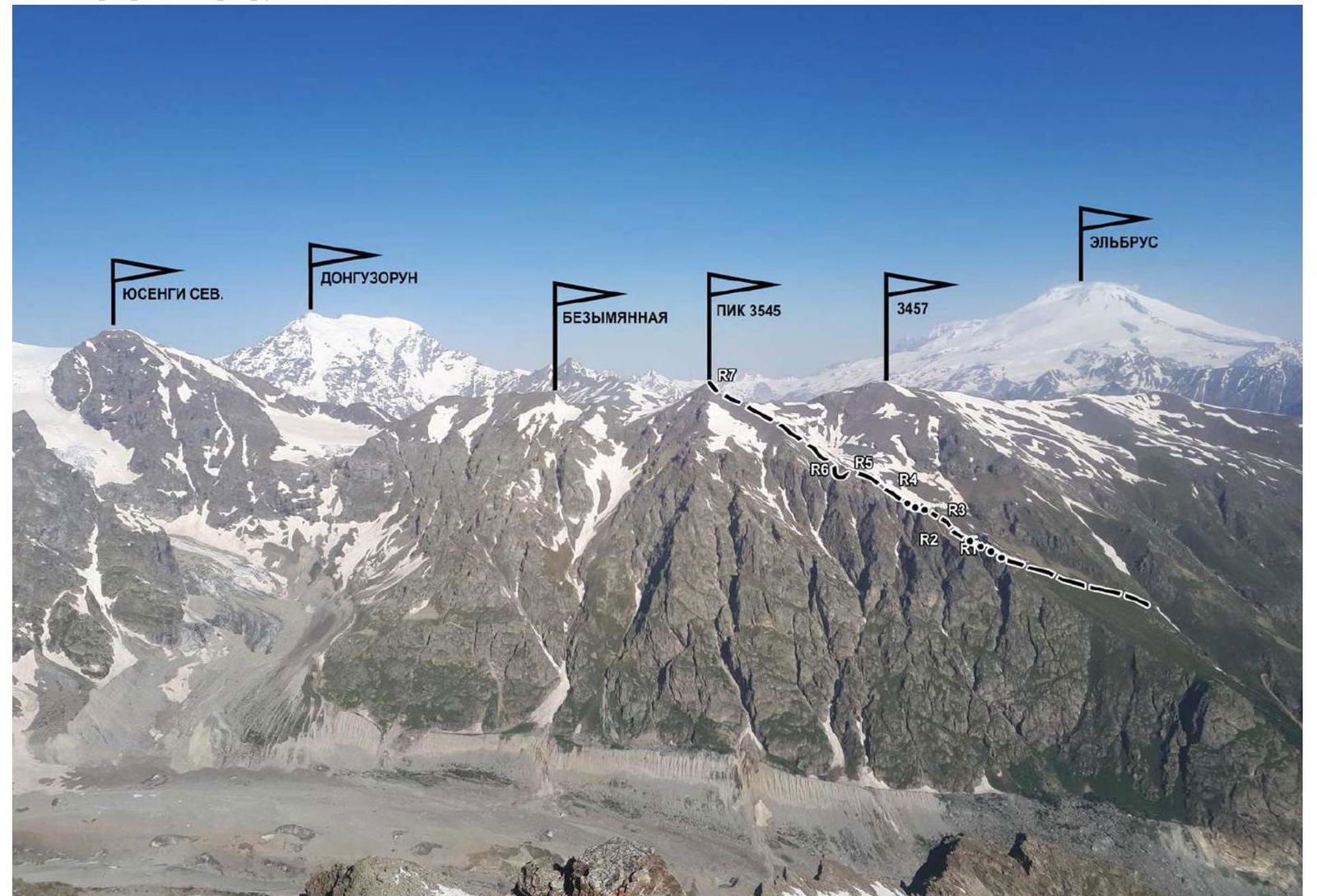
Photo 3. A. Korolev's route on Peak 3545 (Peak Yubileiny) via the East Ridge, category 2B, 2021. Photo from the slopes of Peak Kavkaz. Taken in June 2021
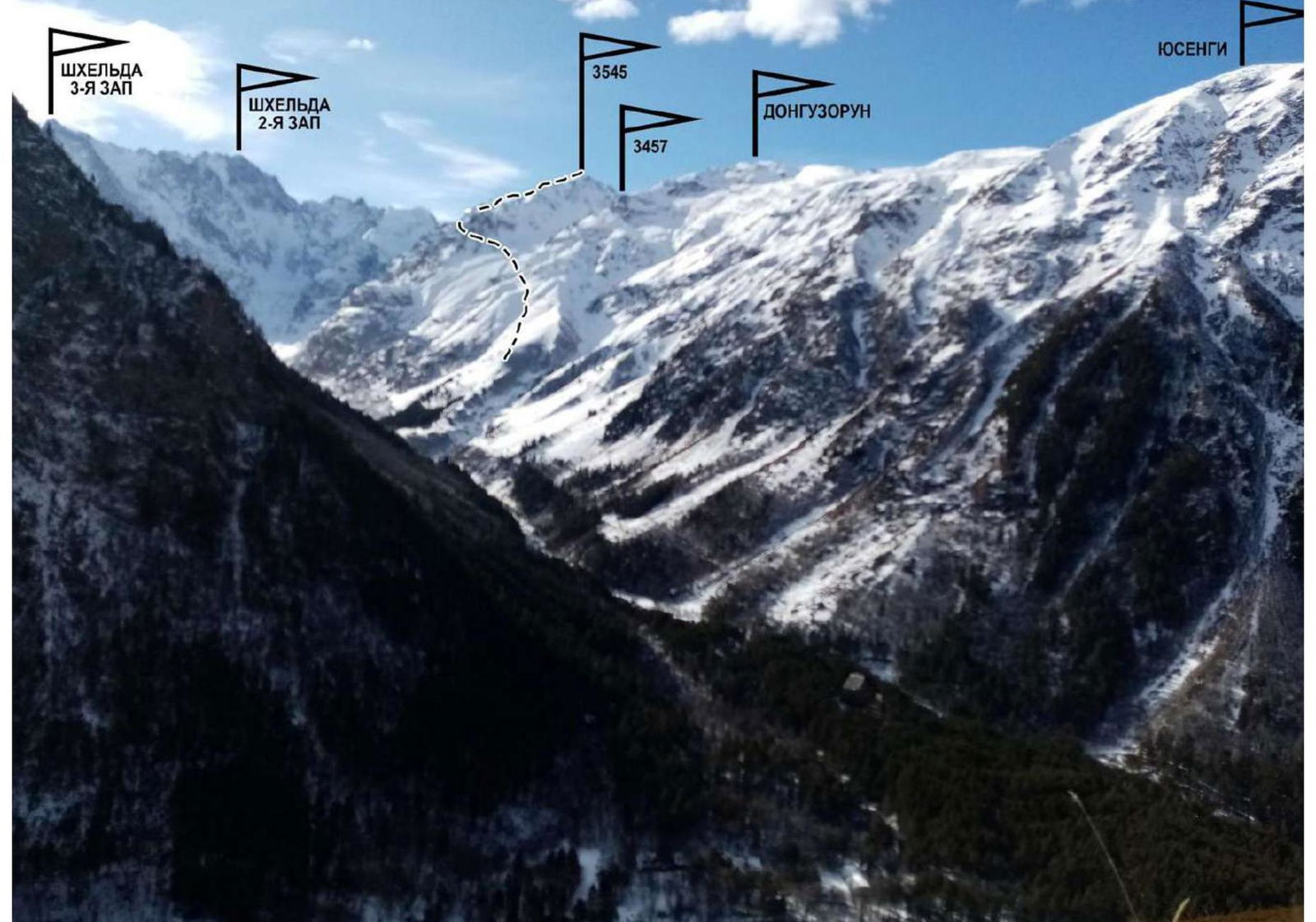
Photo 4. A. Korolev's route on Peak 3545 (Peak Yubileiny) via the East Ridge, category 2B, 2021. Photo from the Adyl-Su valley. Taken in April 2021
1.4. Map of the Area
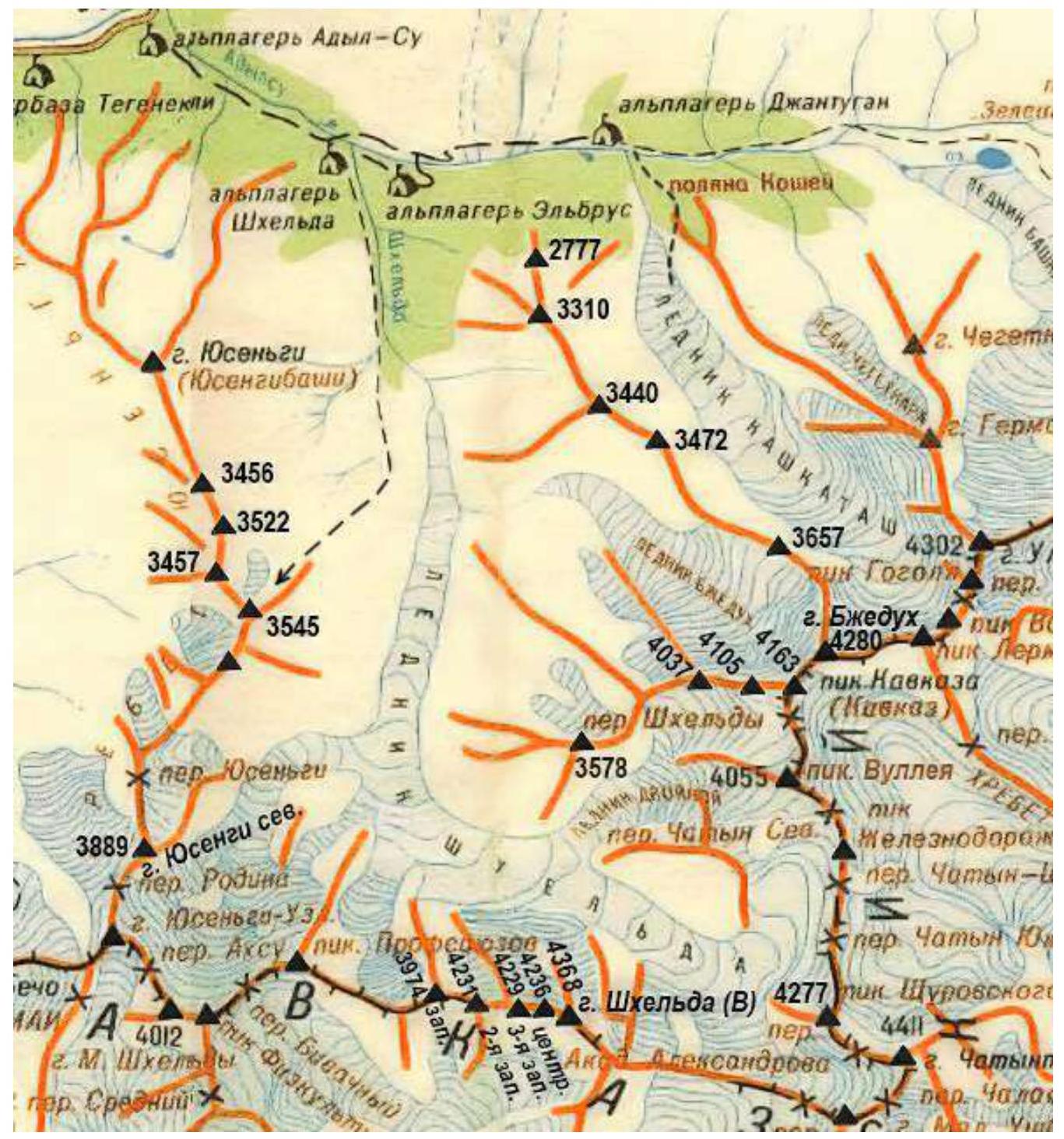
--- Path to the route start
The ascent object, Peak 3545, is located in the Yusengi ridge, near the "SHKELDA" alpine camp, which stands at the confluence of the Adyl-Su and Shkhelda rivers, three kilometers from the Baksan valley (Elbrus village).
The path to the assault (base) camp goes from the "SHKELDA" alpine camp along a trail in the Shkhelda valley. Cross a small bridge over a stream flowing from under Peak 3457 after 1 hour of walking. Ascend along the right bank of the stream. After 30-40 minutes of ascent, stop for the night before reaching the waterfall.
The assault camp is located here:
- The ascent from the "SHKELDA" alpine camp takes 1.5 hours;
- The approach from the overnight stay to the start of the route takes 2.5 hours.
The route to Peak 3545 is oriented to the East, and from November to mid-June, it has a combined character.
Ski tour enthusiasts make a transition from the Shkhelda valley to the Yusengi valley through a pass between Peaks 3545 and 3457 during the winter-spring season.
Climbers are treated to magnificent panoramas of:
- The Shkhelda valley
- Donguz-Orun
2. Route Characteristics
2.1. Technical Photograph of the Route
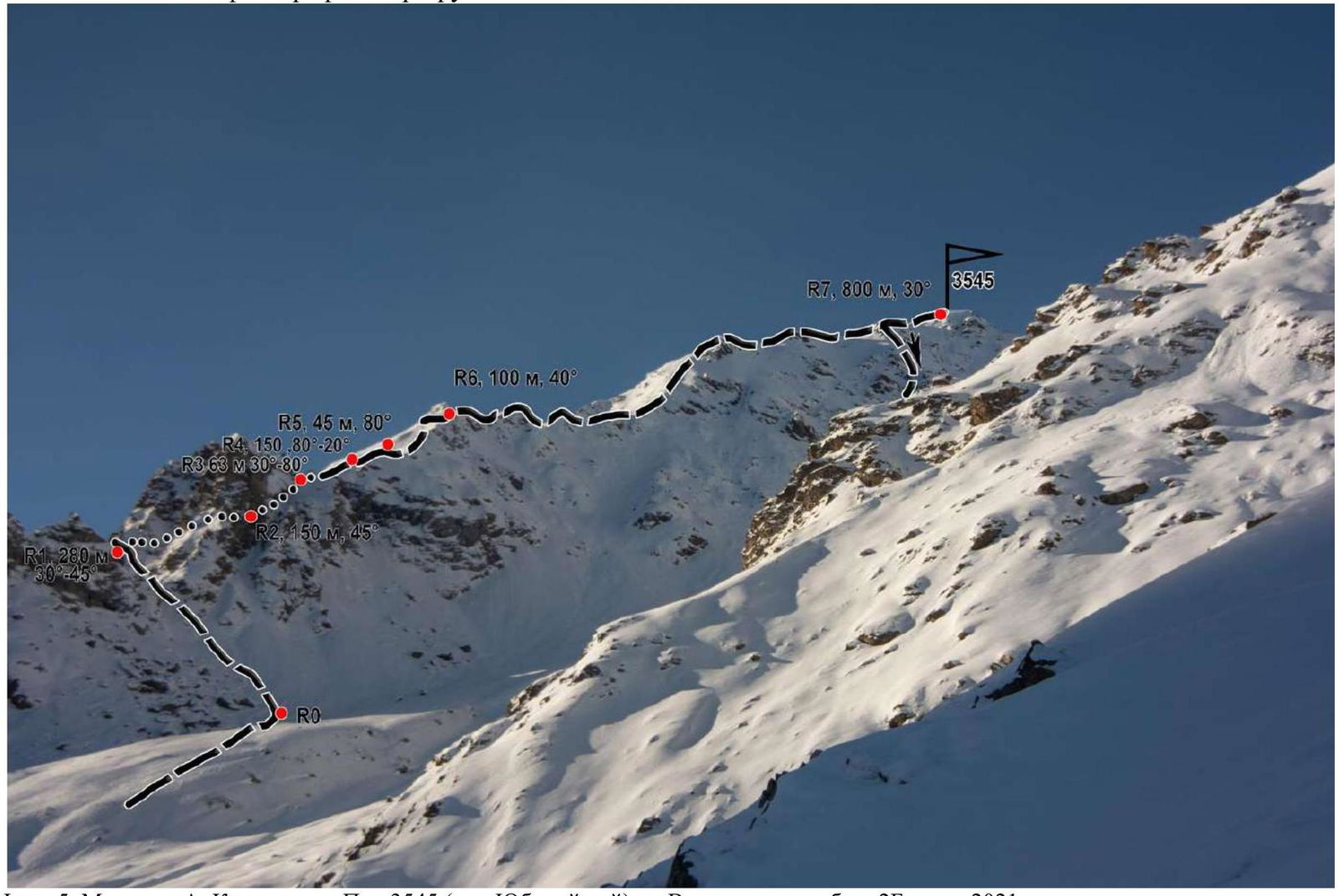
Photo 5. A. Korolev's route on Peak 3545 (Peak Yubileiny) via the East Ridge, category 2B, 2021. Taken in April 2021
2.2. Technical Characteristics of Route Sections
| № section | Terrain type | Category of difficulty | Length, m | Type and number of anchors |
|---|---|---|---|---|
| Start of the route from a gentle old moraine towards the rocky saddle (gap) between the 1st and 2nd gendarmes. | ||||
| R0–R1 | Ascend along large, then medium-sized scree, and then along an internal corner to reach the saddle. | - | 280 m, 30°–45° | Simultaneous movement |
| R1–R2 | Traverse the second gendarme on the left along grassy ledges and short rocky walls. Approach the start of an internal corner. | 1–2 | 100 m, 45° | Simultaneous movement. Station on a ledge — loop |
| R2–R3 | Traverse a "plug" on the left along a 3-meter wall. Then along an internal corner to the saddle. From the saddle, along a simple ridge to the left to a ledge. | 3–2–1 | 3 m — 80°, 50 m — 50°, 10 m — 30° | Station loop |
| R3–R4 | From a large rock, rappel into a snowy couloir. Exit the couloir onto a rocky wall and traverse it. Reach the summit of the next gendarme. Then descend to a saddle before a rocky wall. | 2 | 25–30 m, 30 m — 20°, 100 m — 40° | Station loop, 3 anchors |
| R4–R5 | Ascend along the right part of the wall to an internal corner under an overhanging rock. Along it, approach a difficult 8-meter wall with overhanging sections (poor protection, weak rocks). Then exit onto grassy ledges and a ridge. | 3 | 45 m — 80° | Station 1 anchor + loop |
| R5–R6 | Along the ridge, approach a steep rocky ascent of the next gendarme. Traverse the gendarme on the left along a ledge going down. Then along a rocky slope to reach the ridge. | 2 | 100 m, 40° | Station ledge, 1 anchor, loop |
| R6–R7 | Along the left side of the ridge, traversing small gendarmes — reach the summit. | 1–2 | 800 m, 30° | Simultaneous movement |
Descent. Descend 200 m along the ridge, then along a steep rocky counterfort going north (left). The descent initially goes along the left part of the counterfort, then enters a steep — up to 40° — snowy couloir, leading to scree ledges.
The descent to the valley floor takes 1.5 hours, and to the "SHKELDA" alpine camp — 4 hours. Stations:
- Loop (50 m)
- Ice axes
UIAA Symbol Route Diagram
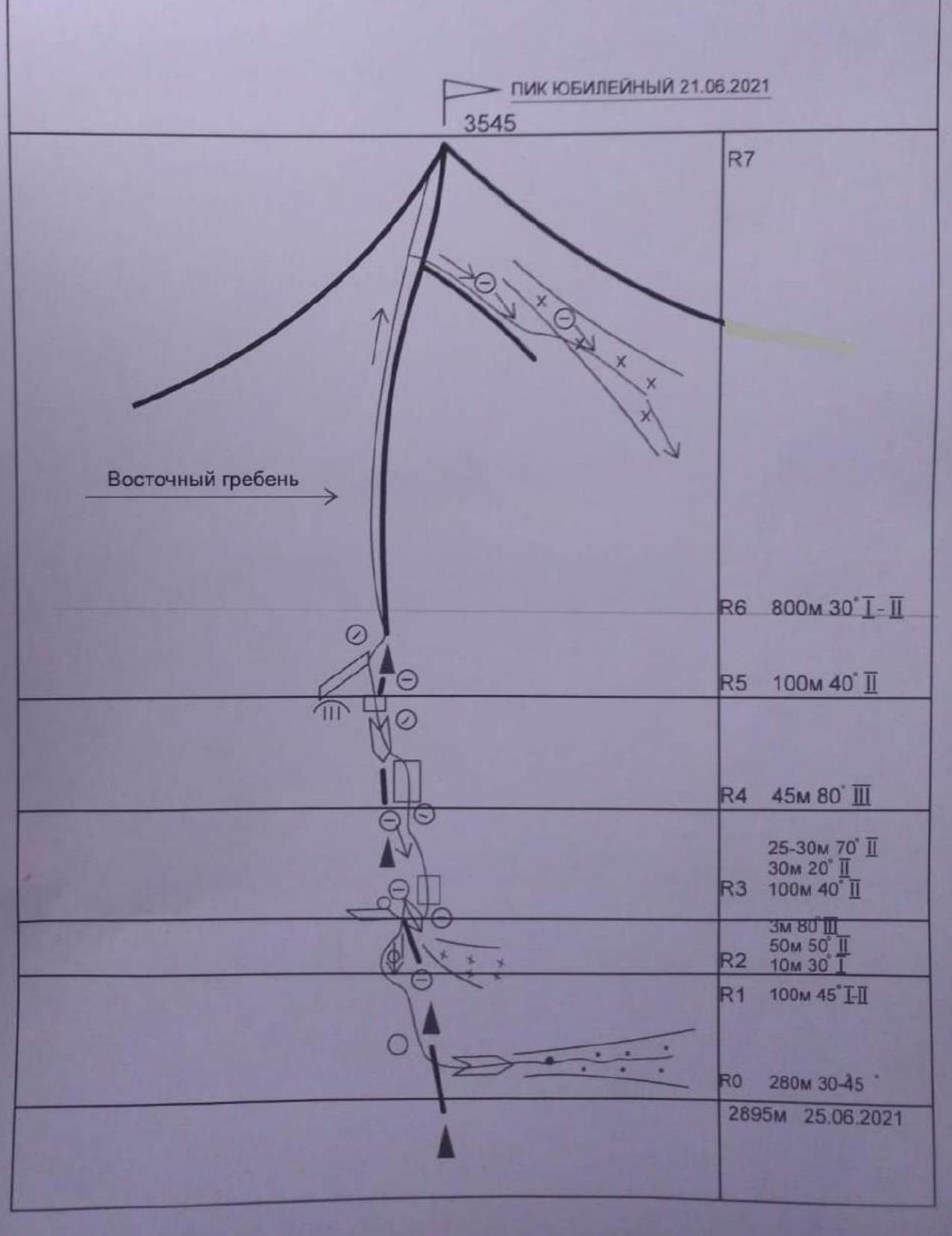 Peak Yubileiny, June 21, 2021
3545
R7
R6 800 m, 30° (1–2)
R5 100 m, 40° (2)
R4 45 m, 80° (3)
25–30 m, 70° (2)
30 m, 20° (2)
R3 100 m, 40° (2)
3 m, 80° (3)
50 m, 50° (2)
R2 10 m, 30° (1)
R1 100 m, 45° (1–2)
R0 280 m, 30–45°
East Ridge
2895 m, June 25, 2021
Peak Yubileiny, June 21, 2021
3545
R7
R6 800 m, 30° (1–2)
R5 100 m, 40° (2)
R4 45 m, 80° (3)
25–30 m, 70° (2)
30 m, 20° (2)
R3 100 m, 40° (2)
3 m, 80° (3)
50 m, 50° (2)
R2 10 m, 30° (1)
R1 100 m, 45° (1–2)
R0 280 m, 30–45°
East Ridge
2895 m, June 25, 2021
3. Team Actions
3.1. The team departed from the "SHKELDA" alpine camp at 4:00 and reached the route start by 8:00. The ascent to the saddle between the 1st and 2nd gendarmes took 1 hour. From the saddle to the summit, it took 5.5 hours. The most challenging part of the route was sections R2–R5, featuring steep rocky walls of 2nd-3rd category difficulty. The rocks were weak in some places. Movement was in rope teams. A control cairn was found at the end of section R2–R3. No human presence was detected on the summit; the team built their own cairn. The route is relatively safe. Communication with the alpine camp was stable. A second team completed the route in the same timeframe (July 2021).
This route surpasses routes to Viatou peak via the South Ridge in technical difficulty and length; it is equivalent to O. Aristov's route via the Northwest Ridge, category 2B.
The descent is described in section 2.3 and corresponds to category 1B. In summer, the route is rocky. Snowy sections do not pose technical difficulties.
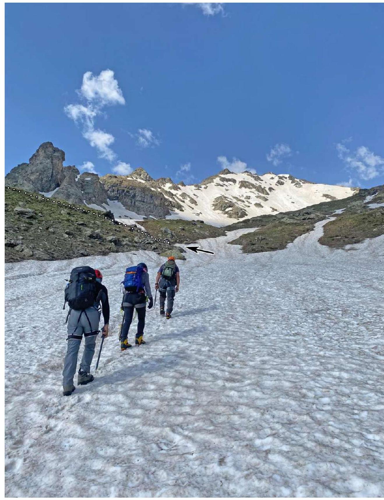
Photo 6. Approach to the route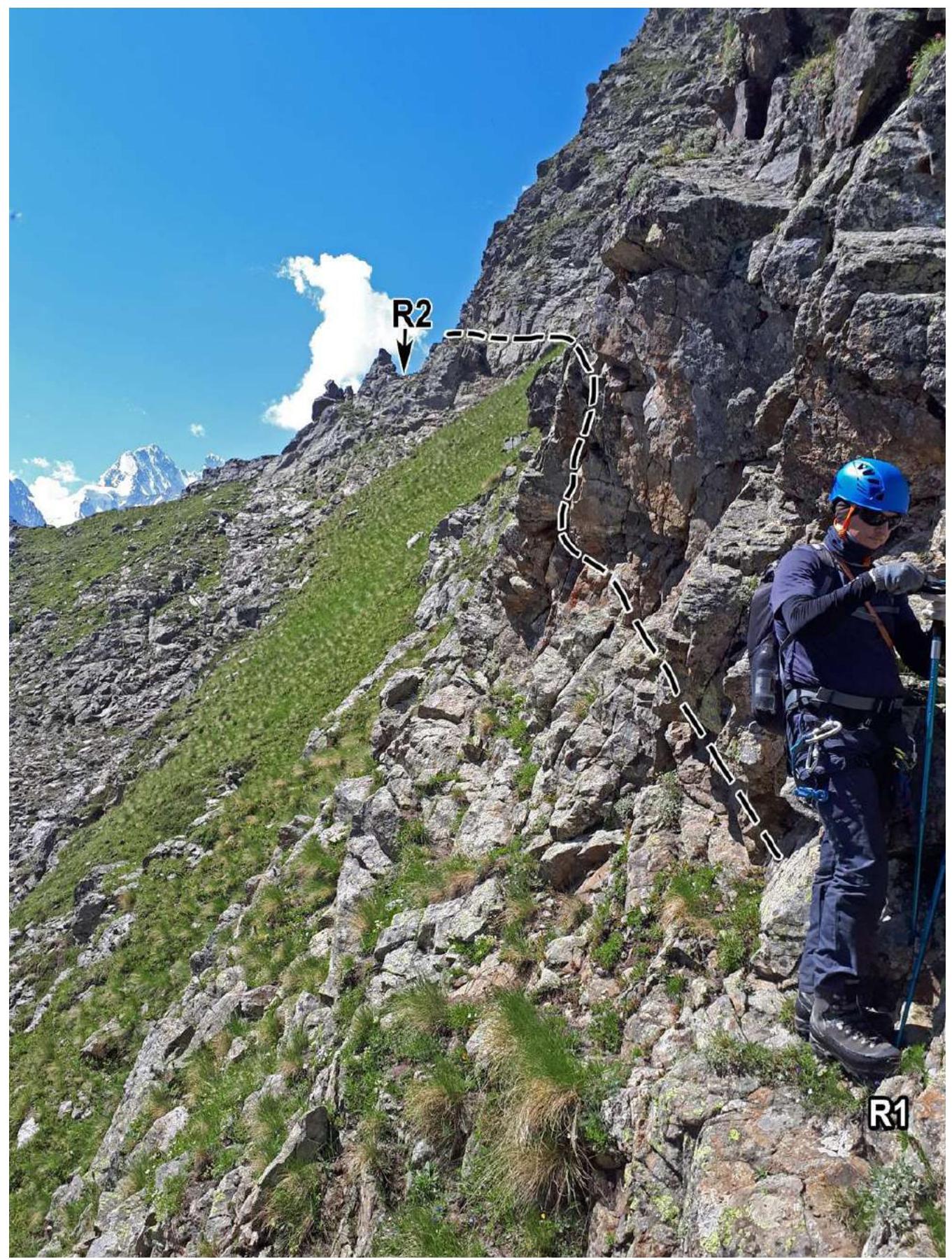
Photo 7. Section R1–R2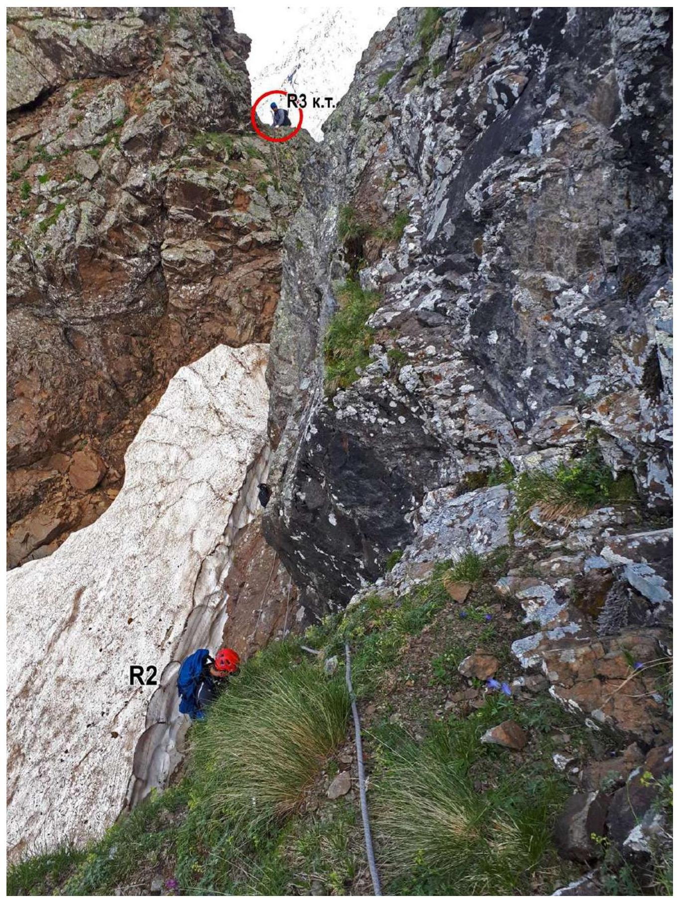
Photo 8. Section R2–R3, towards the Control Cairn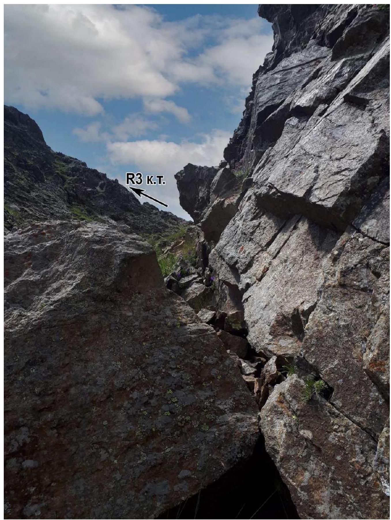
Photo 9. Section R2–R3, control cairn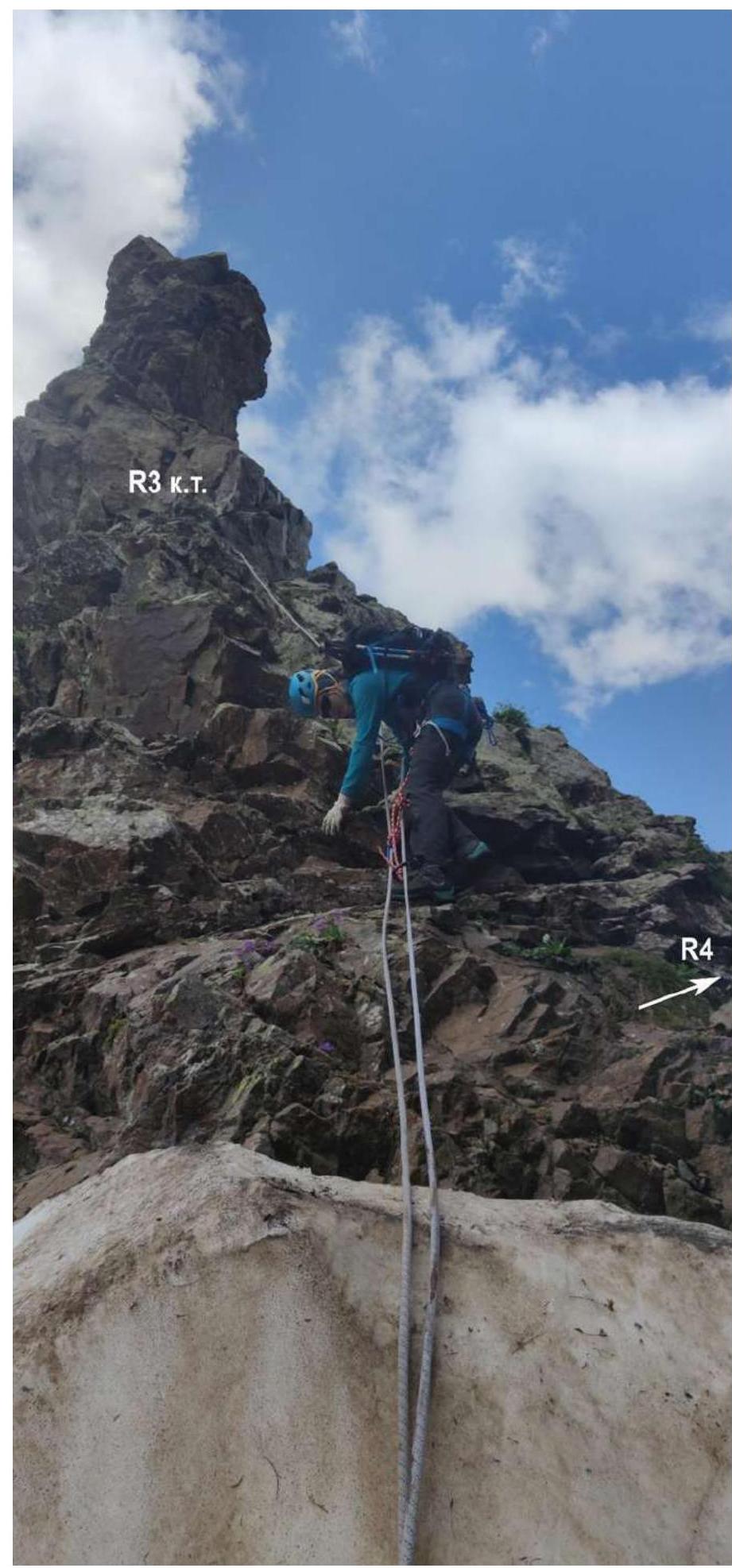
Photo 10. Section R3–R4
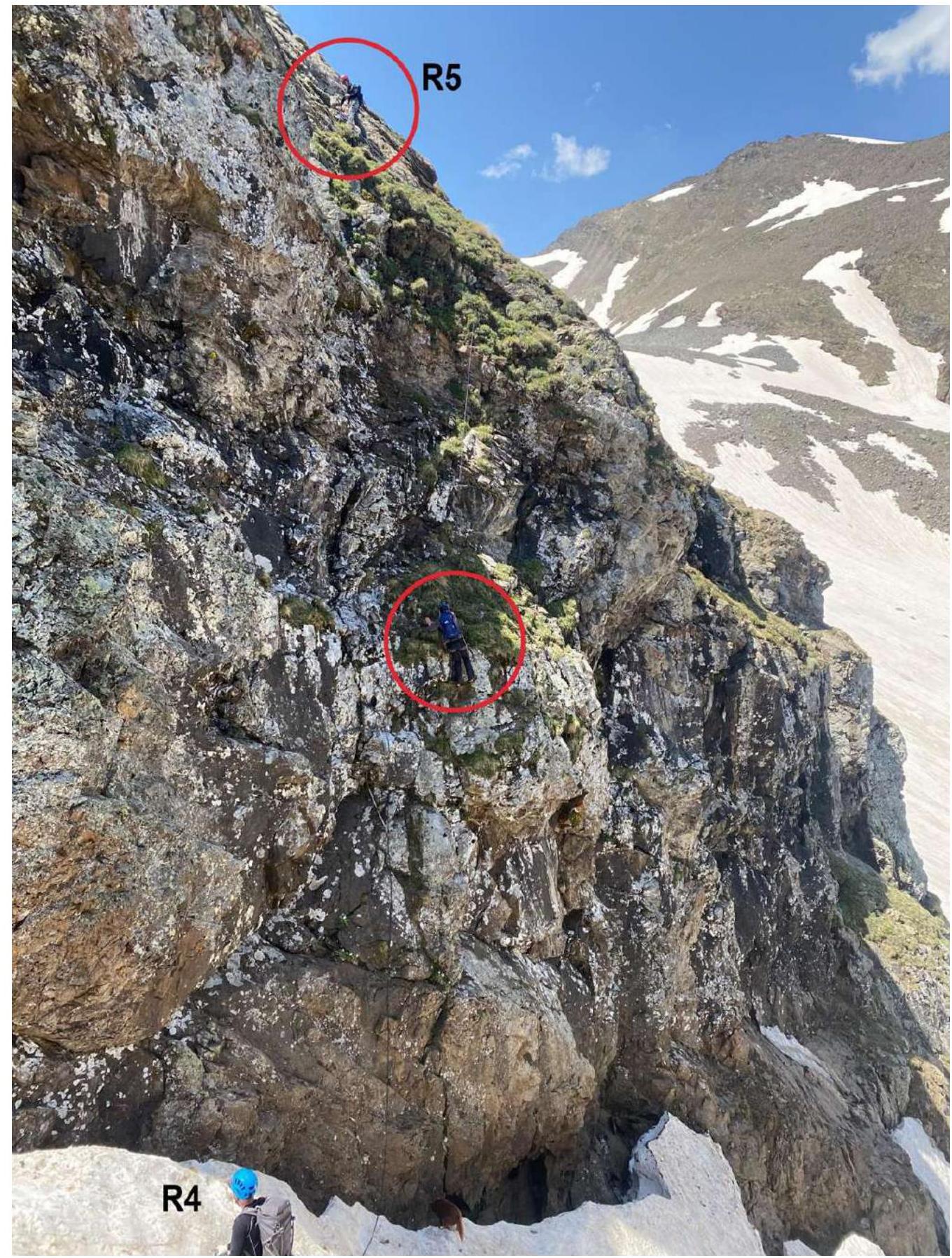
Photo 11. Section R4–R5, key section of the route