Report
on the first ascent of Peak MNR (SW) via the Eastern ridge, category 3B, by the team of alplager "SHKhelda" on July 15, 2022
I. Ascent Log
| № | 1. General Information | |
|---|---|---|
| 1.1 | Full name, sports rank of the leader | Korolev Alexander Viktorovich, Candidate Master of Sports |
| 1.2 | Full name, sports rank of the participants | 1. Murzich Alexander Yuryevich, 3rd category 2. Kovshik Vladimir Leonidovich, 3rd category 3. Titova Natalia Yuryevna, 3rd category |
| 1.3 | Full name of the coach | Korolev Alexander Viktorovich |
| 1.4 | Organization | LLC "SHKhelda" (alplager "SHKhelda") |
| 2. Characteristics of the ascent object | ||
| 2.1 | Region | Central Caucasus |
| 2.2 | Valley | Adyl-Su |
| 2.3 | Number according to the 2013 classification table | 2.4 |
| 2.4 | Name and height of the peak | Peak MNR (SW) |
| 2.5 | Geographic coordinates of the peak (latitude/longitude), GPS coordinates*(1) | |
| 3. Characteristics of the route | ||
| 3.1 | Name of the route | Via the Eastern ridge |
| 3.2 | Proposed category of difficulty | 3B |
| 3.3 | Degree of route exploration | First ascent |
| 3.4 | Character of the route terrain | Rocky |
| 3.5 | Elevation gain of the route (data from altimeter or GPS) | 335 m |
| 3.6 | Length of the route | 520 m |
| 3.7 | Technical elements of the route (total length of sections of various difficulty categories) with indication of terrain character (ice-snow, rocky) | I cat. diff. — 375 m — scree II cat. diff. — 85 m — rocky IV cat. diff. — 15 m — rocky V cat. diff. — 30 m — rocky V+ cat. diff. — 15 m — rocky |
| 3.8 | Descent from the peak | Via the ascent route — rocky |
| 3.9 | Additional characteristics of the route | Character of the route — rocky. From November to July, the approach to the route is snowy. |
| 4. Characteristics of the team's actions | ||
| 4.1 | Time of movement (team's walking hours, indicated in hours and days) | 12 hours, 1 day |
| 4.2 | Overnight stays | None |
| 4.3 | Start of the route | July 15, 2022, 5:00 |
| 4.4 | Reaching the peak | July 15, 2022, 14:00 |
| 4.5 | Return to the base camp | July 15, 2022, 17:00 |
| 5. Person responsible for the report | ||
| 5.1 | Full name, e-mail | Korolev Alexander Viktorovich, aleksandrkdiver@mail.ru |
* (1) — filled in ONLY if the peak is not listed in the Electronic Russian Classifier of Routes on Mountain Peaks
II. Ascent Description
1. Characteristics of the Ascent Object
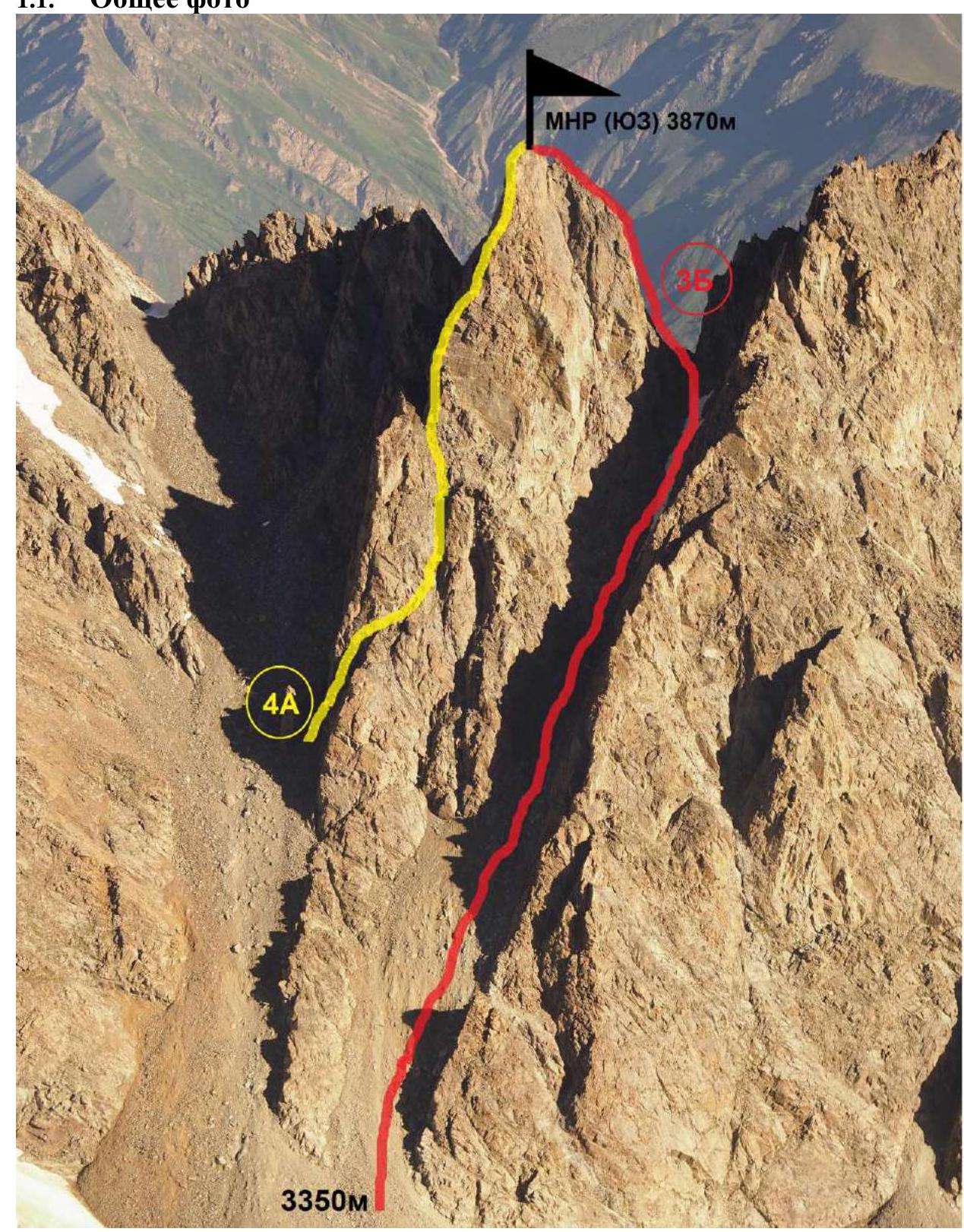
Photo 1.
- A. Korolev's route on Peak MNR (SW) via the Eastern ridge, category 3B, 2022. Date taken: July 12, 2022
- A. Nagorsky's route on Peak MNR (SW) via the Southern edge, category 4A.
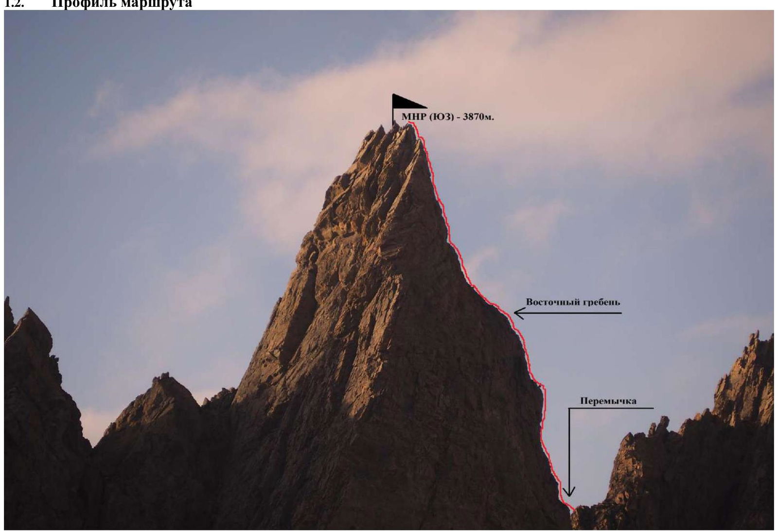
Photo 2. A. Korolev's route on Peak MNR (SW) via the Eastern ridge, category 3B, 2022. View from the south. Date taken: July 10, 2022
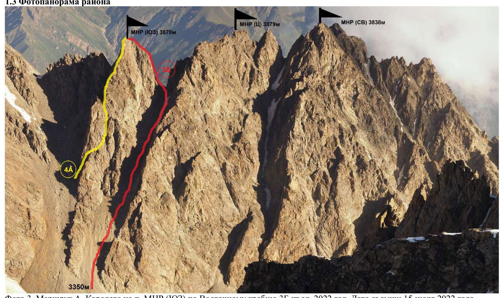
Photo 3. A. Korolev's route on Peak MNR (SW) via the Eastern ridge, category 3B, 2022. Date taken: July 15, 2022
1.4. Map of the region. --- Path of the group, --- Approach to the route
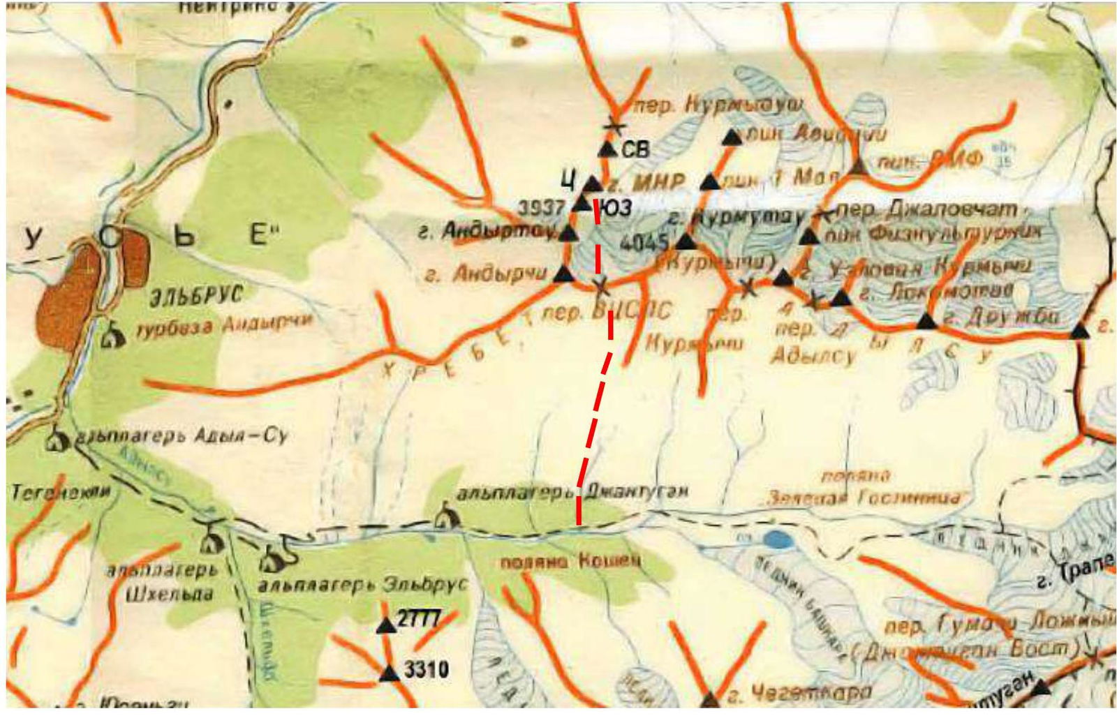
Geographic Location of the Region
The ascent object MNR (SW) is located in the spur of the Adyl-Su ridge. The path to the assault (base) camp goes from the alplager "SHKhelda" along the road into the Adyl-Su valley. After the "Dzhantugan" camp, turn left and ascend along the slope, then along the ridge to the VTsSPS pass (between the peaks Kurmytau and Andyrchi). Descend from the pass to the other side and set up camp. This is the assault camp, and the ascent from the alplager "SHKhelda" takes 6 hours. The approach from the camps to the start of the route takes 1 hour.
The route to MNR (SW) via the Eastern ridge is of a mixed character from November to mid-June.
Climbers are presented with magnificent panoramas of the Baksan valley and Mt. Elbrus.
2. Characteristics of the Route
2.1. Technical photograph of the route
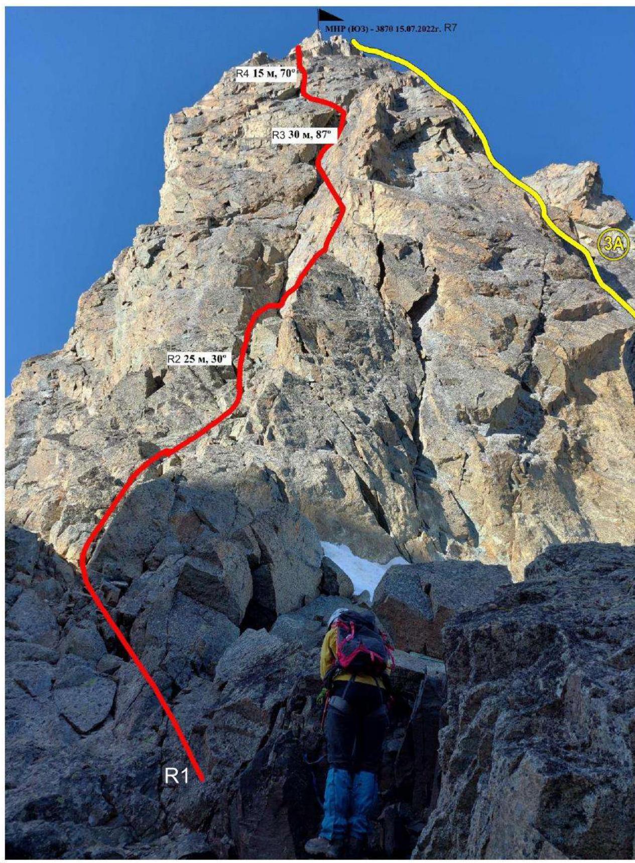
Photo 4.
- A. Korolev's route on Peak MNR (SW) via the Eastern ridge, category 3B, 2022. Date taken: August 12, 2022
- A. Zyuzin's route on Peak MNR (SW) from the south via the couloir of the Eastern ridge, category 3A, is located behind the saddle and goes along the Northern wall.
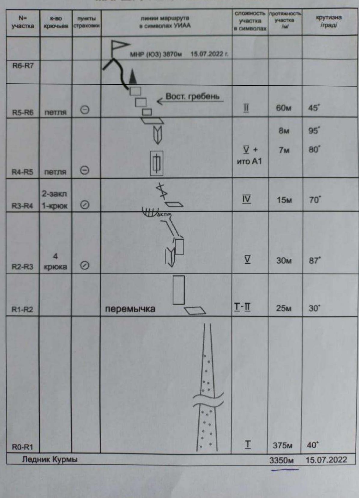
2.2. Technical characteristics of the route sections
| Section № | Character of the terrain | Category of difficulty | Length, m | Type and number of hooks |
|---|---|---|---|---|
| R0–R1 | Approach to the route from the couloir between Peak MNR (SW) and Peak MNR (C). Start of the route on the saddle between Peak MNR (SW) and Peak MNR (C) | I | 375 m, 35° | |
| R1–R2 | Ascent along the ledge to the left, then along simple destroyed rocks under the wall of the Eastern ridge, approach to the start of the inner corner. Station on a rocky outcrop | I–II | 25 m, 30° | Simultaneous movement |
| R2–R3 | Complex climbing along the slab to the right of the inner corner for 10 m and then to the left into the chimney for 20 m to the overhanging cornice. Control tour and station on hooks under the cornice | V | 30 m, 87° | Station on 4 hooks |
| R3–R4 | Exit from under the overhang to a small ledge to the left, then 15 m along the crack by free climbing | IV | 15 m, 70° | |
| R4–R5 | Further along the overhanging slab below with a slit, turning into an inner corner at the top onto a ledge. Station on an outcrop | V+ A1 | 8 m, 95°, 7 m, 80° | Station — loop |
| R5–R6, R7 | Along simple destroyed rocks of the Eastern ridge, bypassing a small gendarme to the left, exit to the peak | II | 60 m, 45° | Station — loop |
Descent – 2 options:
- Descent along the ascent route: rappel along the ridge to station R4, then 2 ropes rappelling to station R1. Descent along the couloir leading to the glacier.
- Descent via route category 2B.
Descent to the glacier takes 2 hours. To the camping site – 3 hours.
Equipment: Rocky hooks — 3 pcs, Nut — 12 pcs, Friends — 17 pcs, Loops — 3 pcs
ROUTE IN UIAA SYMBOLS
3. Characteristics of the Team's Actions
3.1. The team, departing at 5:00 from the camps on the eastern slope of the VTsSPS pass, reached the couloir by 8:00. The passage of section R1–R3 took 2 hours. From station R3 to station R5 — 3 hours. From station R5 to the peak — 1 hour of walking. The group reached the peak at 14:00.
The most challenging part of the route is sections R1–R4, representing steep rocky walls up to category V and V+. The rocks are solid. Movement is alternating, except for sections R0–R1 and R5–R7.
At the end of section R1–R2, a control tour (on one of the station hooks). Communication with the alplager only from the peak. At the camps, approach, and route, radio and phone communication are absent.
This route, in its technical complexity, surpasses the route from the south via the couloir of the Eastern ridge (3A), but its complexity is lower than that of the route via the Southern edge (4A) to Peak MNR (SW).
The descent is described in section 2.2 and corresponds to category 2B.
In the summer, the route is rocky. The encountered snowy sections do not present technical difficulties.

Photo 5. Exit to the saddle. Section R0–R1
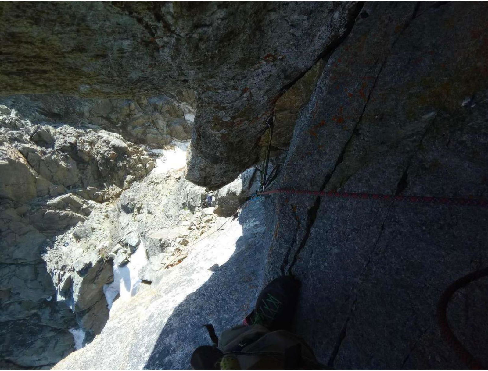
Photo 6. Section R1–R2. View from station R2 (Control tour). Key section of the route
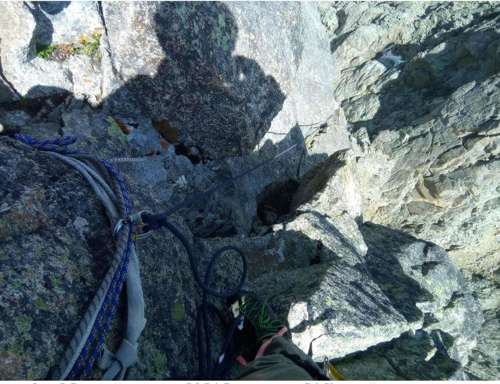
Photo 7. Upper part of section R3–R4. View from station R4. Key section of the route
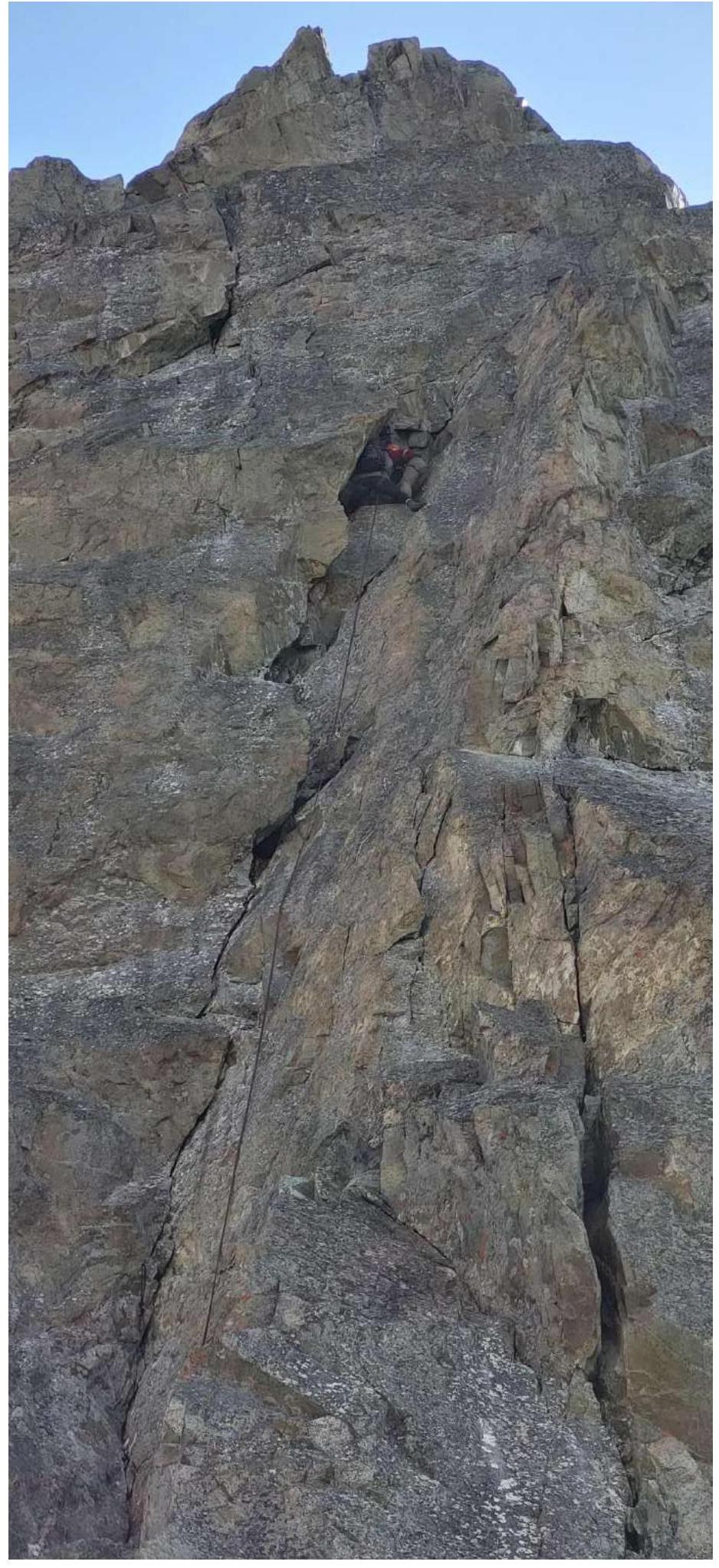
Photo 8. Section R1–R3

Photo 9. Section R1–R3
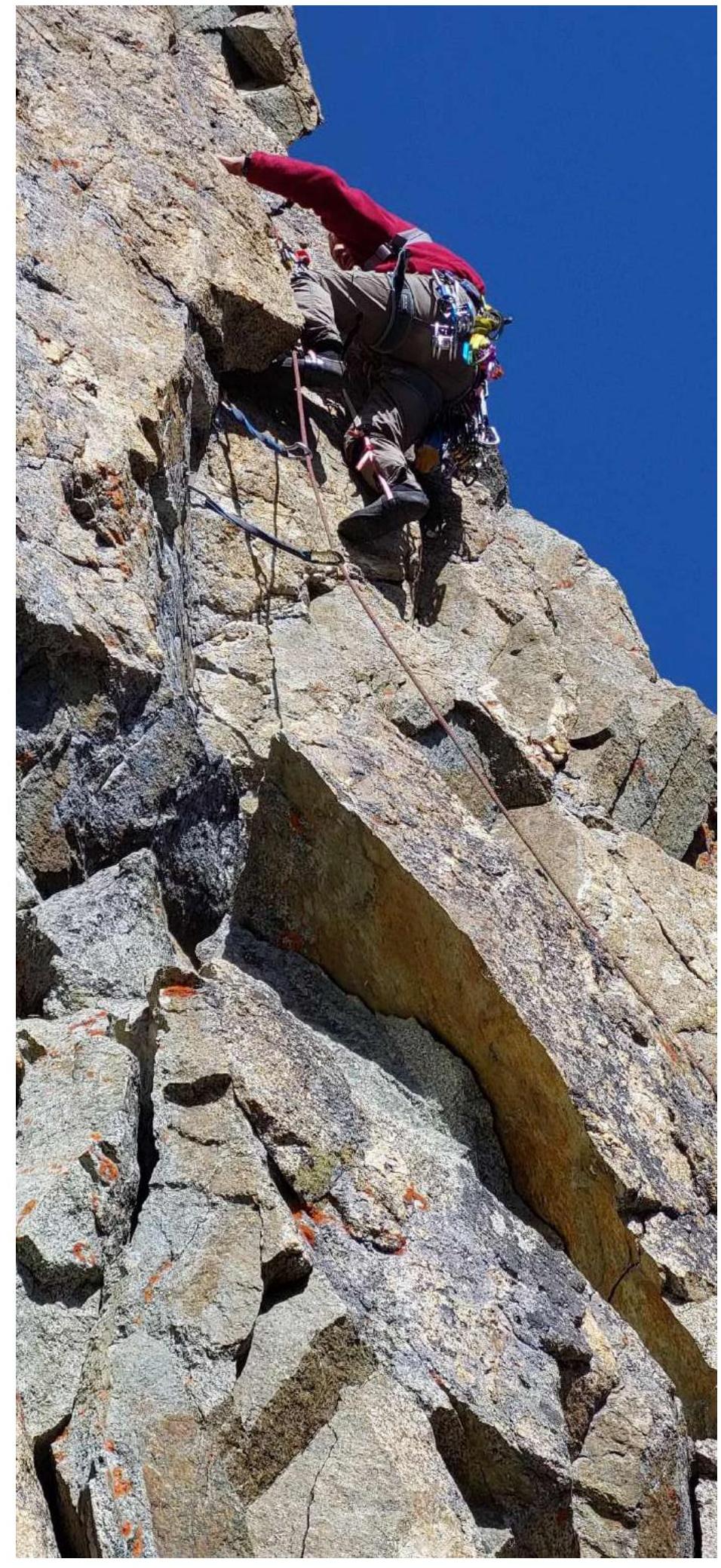
Photo 10. Section R2–R3
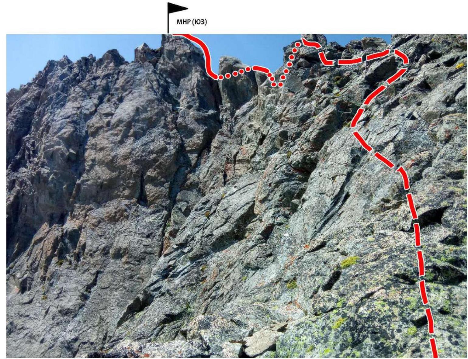
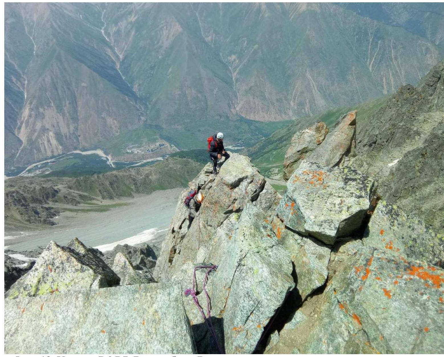
Photo 11. Section R6–R7. View from station R5 towards the peak

Photo 12. Section R6–R7. View of the ridge from the peak