Appendix No. 1 to the Unified Requirements for Classification Report
Report Form for Routes 1B–3B Category of Difficulty
REPORT ON THE FIRST ASCENT TO THE SUMMIT Sovetskiy Voyn VIA THE ROUTE OF 3B CATEGORY OF DIFFICULTY BY THE TEAM OF MAC "FREELINE" PYATIGORSK ON AUGUST 29, 2022
I. Climbing Passport
| No. | 1. General Information | |
|---|---|---|
| 1.1 | Full Name, Sports Rank of the Leader | Popov M.L., CMS |
| 1.2 | Full Name, Sports Rank of the Participants | Semenov M.A., MS Khadzhimustafarov M.A., 2nd sports rank |
| 1.3 | Full Name of the Coach | Motienko N.I., CMS |
| 1.4 | Organization | MAC "Freeline" |
| 2. Characteristics of the Climbing Object | ||
| 2.1 | Region | Caucasus, KBR |
| 2.2 | Valley | Valley of r. Kyrtik |
| 2.3 | Number of the Section According to the Classification Table 2013 | 2.4 |
| 2.4 | Name and Height of the Summit | p. Sovetskiy Voyn 4012 |
| 2.5 | Geographical Coordinates of the Summit (latitude–longitude), GPS coordinates *(1) | 43°19′330″ N 42°37′277″ E |
| 3. Characteristics of the Route | ||
| 3.1 | Name of the Route | p. Sovetskiy Voyn via the southeast wall |
| 3.2 | Proposed Category of Difficulty | 3B |
| 3.3 | Degree of Route Exploration | first ascent |
| 3.4 | Character of the Route Relief | rock |
| 3.5 | Height Difference of the Route (data from altimeter or GPS) | 351 m |
| 3.6 | Length of the Route (in meters) | 620 m |
| 3.7 | Technical Elements of the Route (total length of sections of various categories of difficulty with indication of the relief character (ice-snow, rock)) | I cat. diff. (rock) — 0 m. II cat. diff. (combination) — 105 m. III cat. diff. (rock) — 425 m. IV cat. diff. (rock) — 90 m. V cat. diff. — 0 m. Movement on closed glacier — 1000 m |
| 3.8 | Descent from the Summit | Via the east ridge 150 m and down the south wall to Mukal Glacier |
| 3.9 | Additional Characteristics of the Route | |
| 4. Characteristics of the Team's Actions | ||
| 4.1 | Time of Movement (team's walking hours, in hours and days) | 8 hours |
| 4.2 | Overnight Stays | no |
| 4.3 | Departure onto the Route | 8:00 August 29, 2022 |
| 4.4 | Arrival at the Summit | 13:00 August 29, 2022 |
| 4.5 | Return to the Base Camp | 16:00 August 29, 2022 |
| 5. Responsible for the Report | ||
| 5.1 | Full Name, e-mail | Popov Mikhail Lvovich mikl_popov@inbox.ru 89282657130 |
1. Characteristics of the Climbing Object
General photo of the summit Sovetskiy Voyn from p. 3811 (Nakhodka)
(red line — route of the first ascent 3B; yellow line — route 2A category of difficulty via the north ridge)
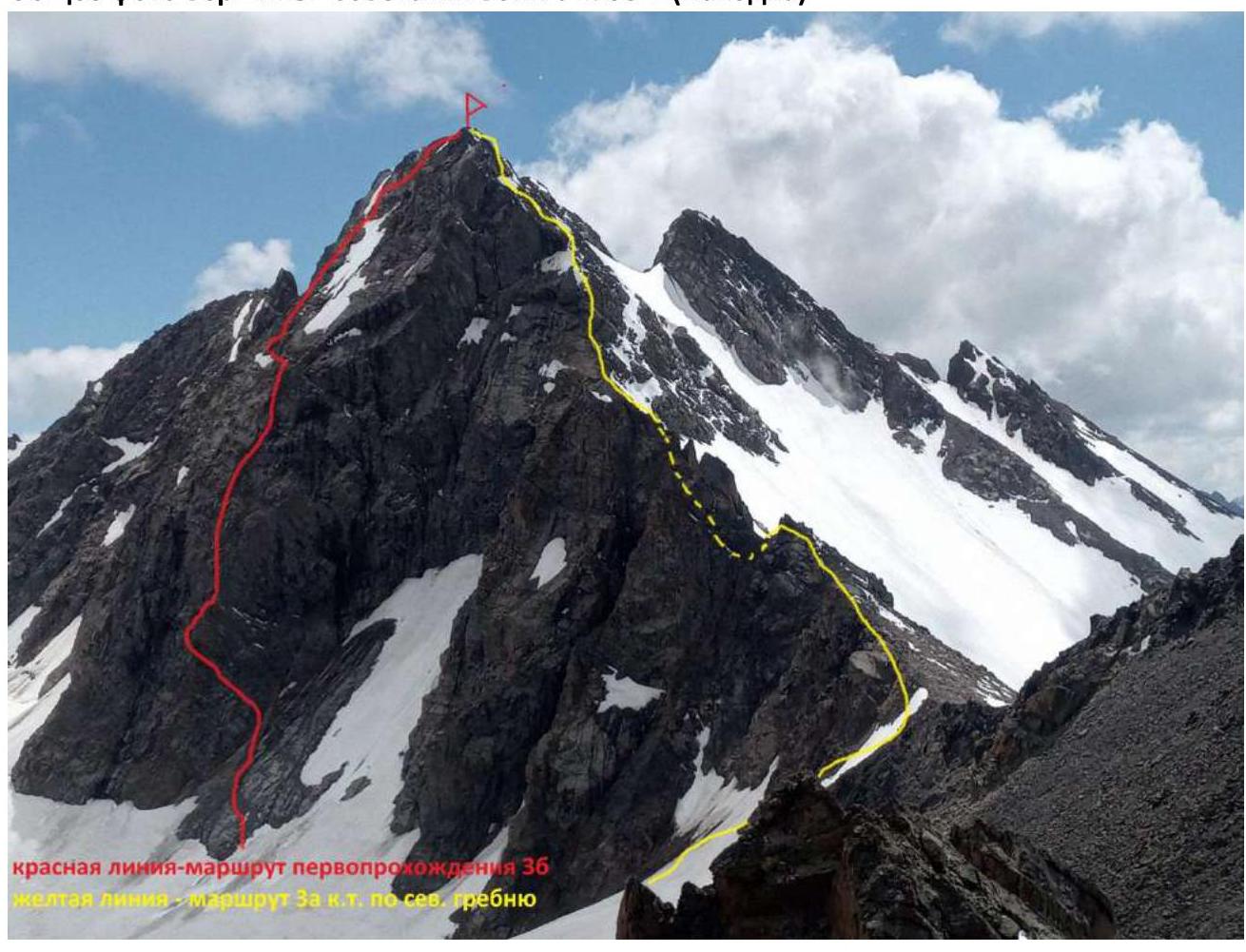
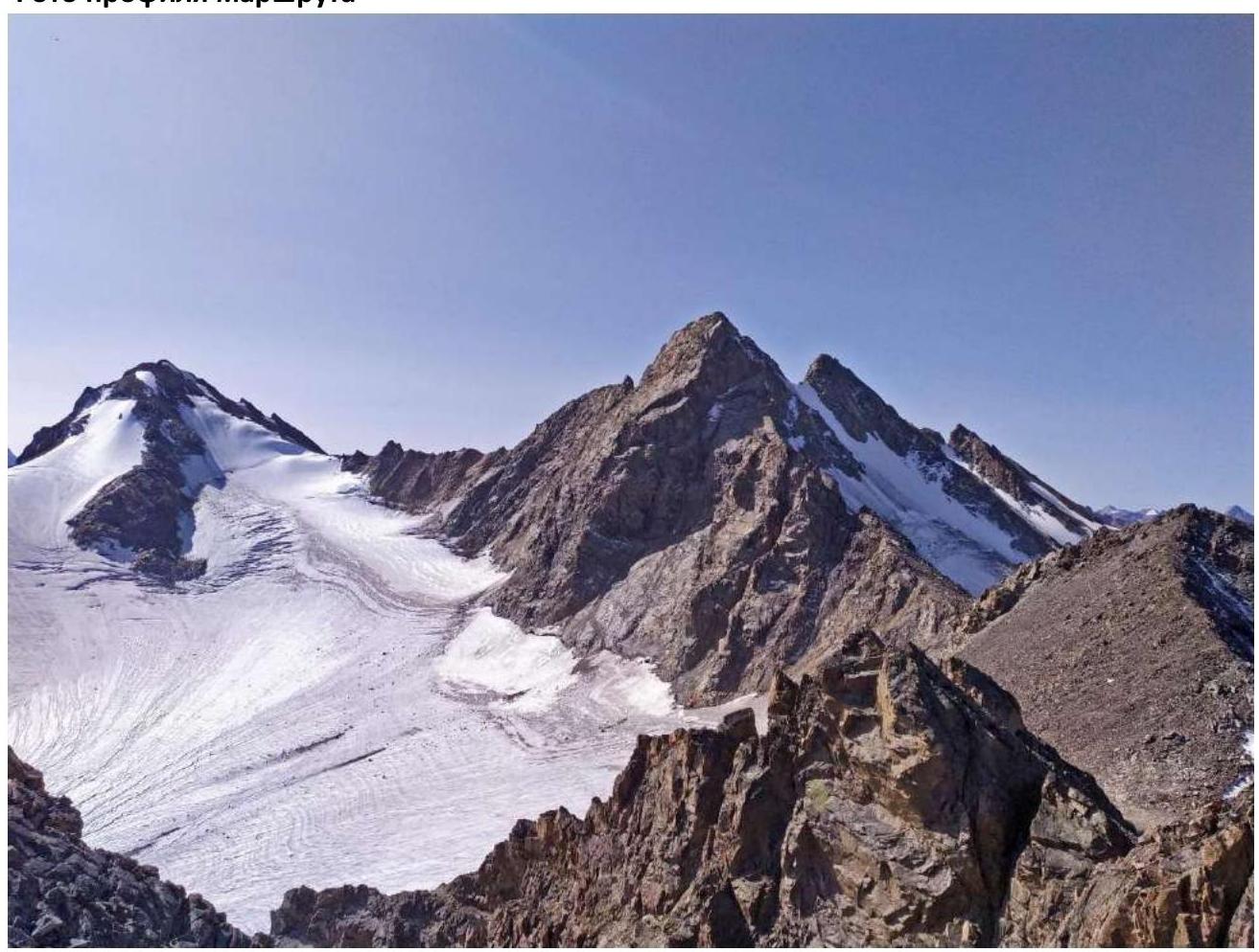
Photo of the route profile
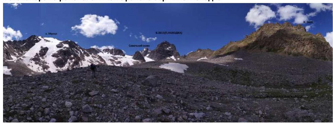
Panorama of the area. Photo from the area of the summit Nakhodka
Brief overview of the climbing area and description of the approach
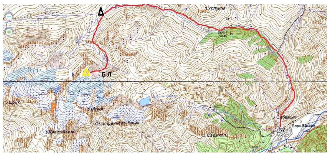
The climbing area is located in the part of the Lateral Ridge of the Central Caucasus, stretching from the summit Irik (4046 m) to the summit Mukal (3899 m). The object of the ascent — summit Sovetskiy Voyn — is located in the ridge between the summits Kezgen and Irikchat.
From the village Verkhniy Baksan along the dirt road to the valley of the river Kyrtik to the last kosha in the gorge at the confluence of the rivers Kyrtik and Mkara (15 km). The road from the village Verkhniy Baksan is passable for vehicles like Lada "Niva" and UAZ "Patriot". Then across the bridge over the river Mkara and along its orographic right bank, along the marked trail up to the edge of the "hanging valley" (3 km). Then to the left along the marked trail, bypassing p. 3428. In a convenient place, cross the river Mukal and move up along the scree along the ridge connecting v. 3428 and p. Nakhodka. After some time, the slope becomes gentler and turns into wide sandy fields. At the beginning of the glacier — a lake, here overnight stays. From the cars — 2 hours.
There is no mobile connection in the gorge. Border permits are not required.
2. Characteristics of the Route
Technical photos of the route


Technical characteristics of the sections of the route 3B category of difficulty.
| Section No. | Character of Relief | Category of Difficulty | Length, m | Type and Number of Hooks |
|---|---|---|---|---|
| R0–R1 | Rangklyuf, scree shelf | 2 | 70 | 0 |
| R1–R2 | destroyed rocks | 3+ | 35 | 2 |
| R2–R3 | destroyed rocks, blocks | 3; 3+ | 60 | 4 |
| R3–R4 | Monolithic rocks of internal corner | 4+ | 20 | 3 |
| R4–R5 | Blocks, destroyed rocks | 3+; 4+ | 40,40 | 6 |
| R5–R6 | Monolithic shelf | 3 | 40 | 2 |
| R6–R7 | Monolithic slabs | 3; 3+ | 100,20 | 8 |
| R7–R8 | Monolithic rocks | 3 | 100 | 7 |
| R8–R9 | Destroyed rocks | 3 | 30 | 2 |
| R9–R10 | Rock blocks | 4; 4+ | 30 | 3 |
| R10–R11 | Destroyed rocks | 2+ | 35 | 3 |
3. Characteristics of the Team's Actions
| Section No. | Description | Photo No. |
|---|---|---|
| R0–R1 | Overcome the rangklyuf along the "baaa" foreheads, wall 5 m 45° 3+ category of difficulty; and along the scree shelf 15° 2 category of difficulty towards the wall of the counterforce. Total 70 m. | 1 |
| R1–R2 | Not reaching the wall 8 m, turn right up along the wall on destroyed and smoothed rocks 35 m 45° 3+ category of difficulty to the first shelf, going to the right... | |
| R2–R3 | ...to the left up. Along the implicit, and then explicit shelf to the left up 25 m 3 category of difficulty to the destroyed internal corner, along it 35 m 55–60° 3+ category of difficulty to a small site. | 2 |
| R3–R4 | Turn around the outer corner to the left. Along the monolithic internal corner 20 m 4+ category of difficulty 75°. Exit to the wide bridge of the counterforce. Control tour. | 3; 4 |
| R4–R5 | Along the destroyed rocks and large blocks up 40 m 3+; and 40 m 4+ category of difficulty 65° to an implicit shelf, going to the left. | 5 |
| R5–R6 | Along the monolithic shelf to the left 40 m 3 category of difficulty. Transition to the left part of the counterforce. | 5 |
| R6–R7 | Along the monolithic smoothed slabs up, along the wall of the counterforce 100 m 45° 3; 3+ category of difficulty. Then exit to the right along the wall of the counterforce to its ridge 20 m 60° 3+ category of difficulty. Wide site. | 6 |
| R7–R8 | From the site through the wall 10 m 70° 4 category of difficulty and further up along the monolithic slabs 40° 3 category of difficulty 90 m. | 7 |
| R8–R9 | The slabs rest on a heavily destroyed internal corner 30 m 3 category of difficulty 45°. We approach the wall of large blocks. | 8 |
| R9–R10 | Along the wall 30 m 4; 4+ category of difficulty 70° to the scree shelf. | 9 |
| R10–R11 | From the shelf along simple destroyed rocks 35 m 2+ category of difficulty 30° ascent to the summit. |
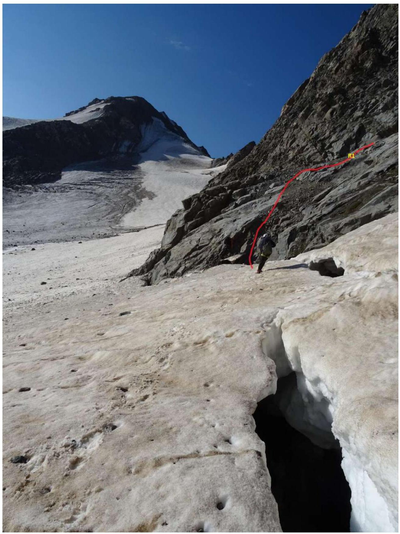
R0–R1 Fig. No. 1
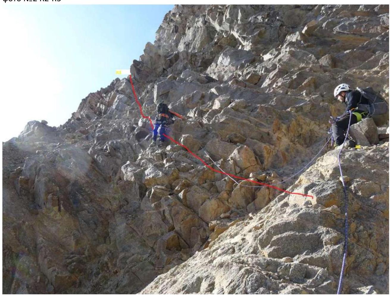
Photo No. 2 R2–R3

R3–R4 photo 3

Control tour photo 4

R4–R5; R5–R6 Fig. No. 5
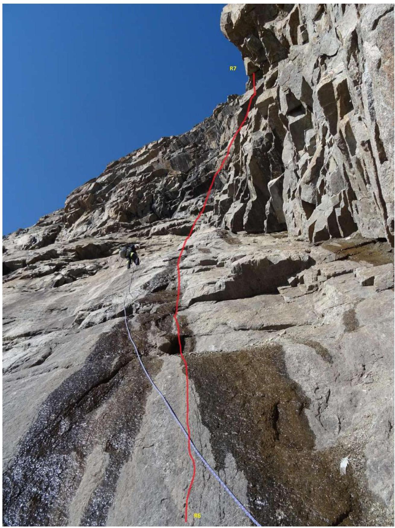
R6–R7 (fig. 6)
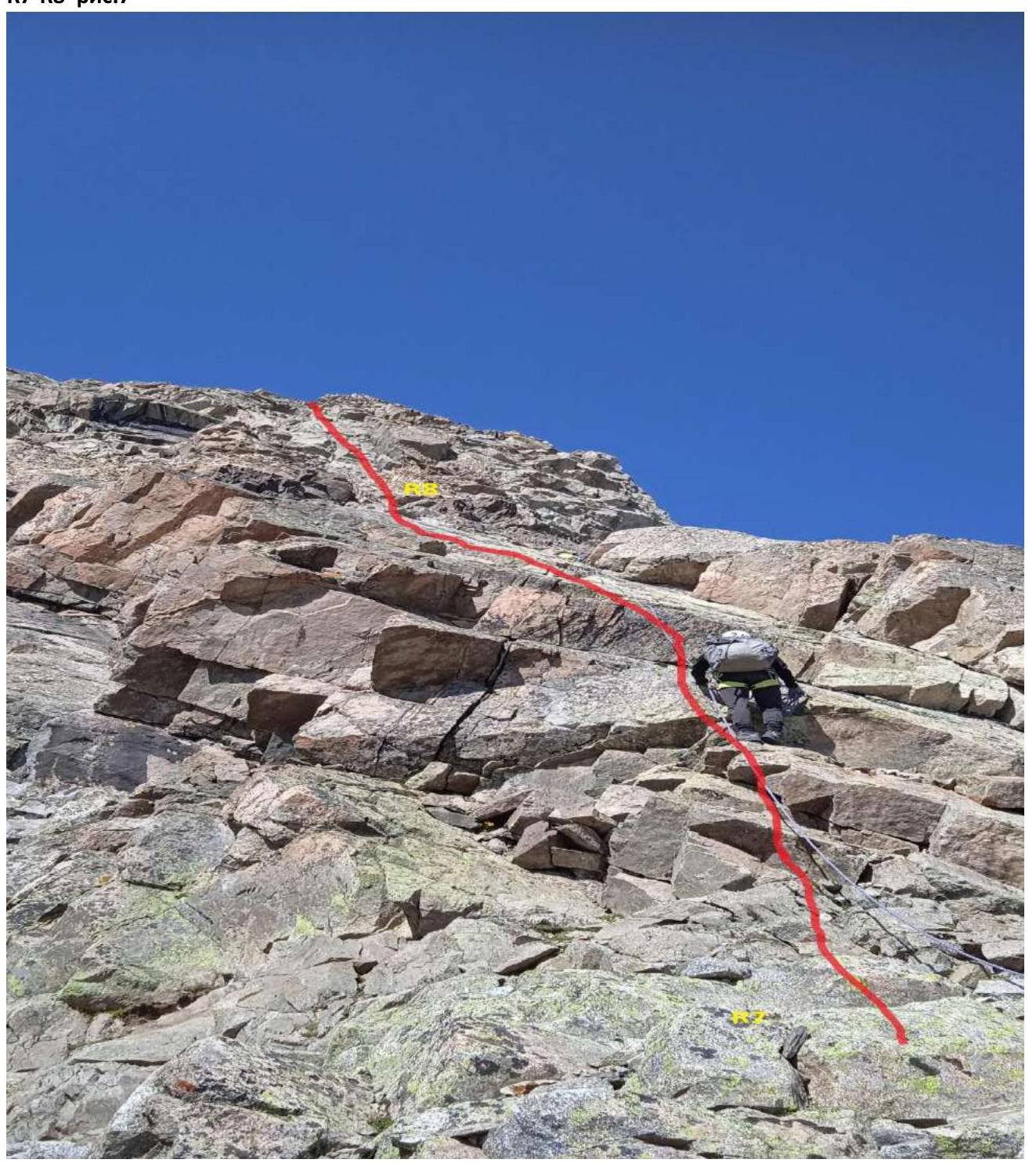
R7–R8 fig. 7
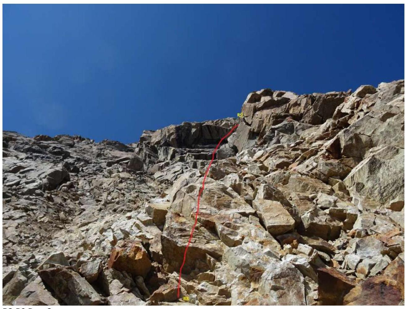
R8–R9 Fig. 8
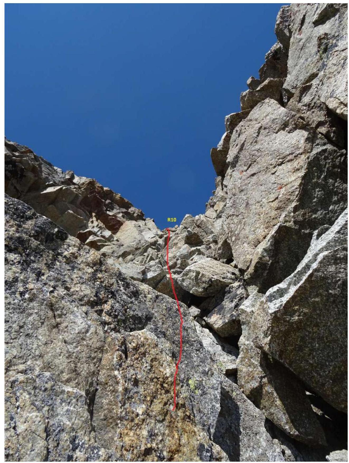
R9–R10 fig. 9
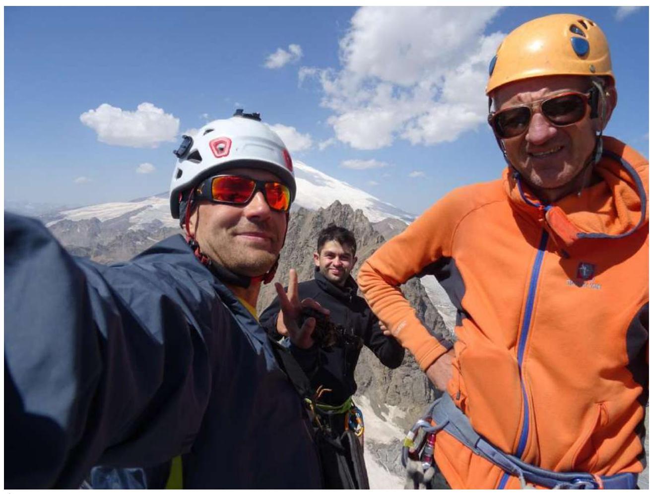
Photo on the summit
Conclusions and Recommendations
The route is logical and safe. In our opinion, it corresponds to 3B. Compared with a similar route on v. Cheget-tau 3B category of difficulty; 3B "Khrustalik" on v. Tyu-Tyu. The relief is convenient for setting insurance points. For insurance, the following were used: — medium and large cams, — hexes, — medium friends, — anchors.
In the first half of the summer, the section R6–R7 may be closed by snowboards. In this case, we recommend movement along the ridge of the counterforce.
Descent: — along the eastern ridge towards v. Kezgen 150 m to the drop of the ridge, — then down the southern wall along a large couloir on the right side — two rappels, — continue descent on foot along rock shelves 3 category of difficulty to the drops, — one more rappel to the right to the beginning of the couloir on the glacier.
You can descend along the route 2B category of difficulty, but this descent is much longer. Recommended for educational and sports ascents by a group of 2–4 people.