Peak KhFTI-80 via the S ridge. Ovcharenko V.D. Elbrus E ridge # 2.4
Report
On the first ascent of Peak KhFTI-80 via the southern ridge from Assol Pass
Team of climbers from the National Science Center "Kharkov Institute of Physics and Technology"
2009
Passport
- Elbrus region, Irik-Chat gorge, # 2.4
- Peak KhFTI-80, height 3760 m; via the southern ridge from Assol Pass; coordinates of the summit: 43°19′16″ ± 10″ N, 42°32′37″ ± 10″ E.
- Proposed category: 2B, first ascent.
- The route is rocky.
- Height difference from Assol Pass ~200 m, from the lake in the Paton Peak cirque ~450 m, from the overnight campsite ~800 m.
- Length: from the lake ~1250 m, from the overnight campsite ~4 km.
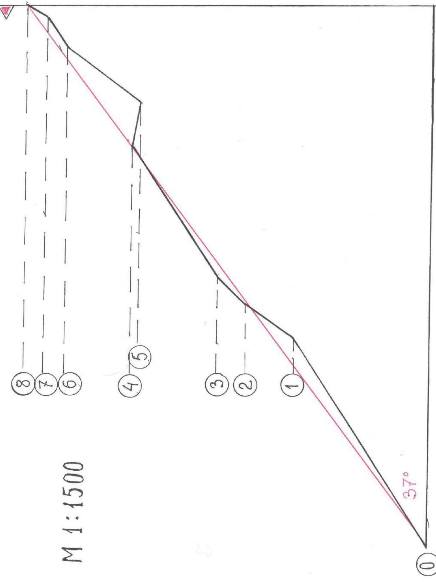
Average steepness of the summit bastion: 53°. Average steepness of the route from the pass to the summit: 37°.
- Number of chocks used on the route: 17; number of pitons: 6.
- Time taken from the overnight campsite: 7 hours.
- Leader: Ovcharenko Valery Davidovich, Master of Sports
Team members:
- Bratchenko Mikhail Ivanovich, 2nd category
- Beletsky Alexey Alexandrovich, 3rd category
- Borisenko Alexander Alexeevich, 3rd category
-
Coach: Ovcharenko V.D.
-
Departure to the route: July 23, 2009 at 6:00
Return to base camp: July 23, 2009 at 16:00
- Climbing event of the National Science Center "Kharkov Institute of Physics and Technology".

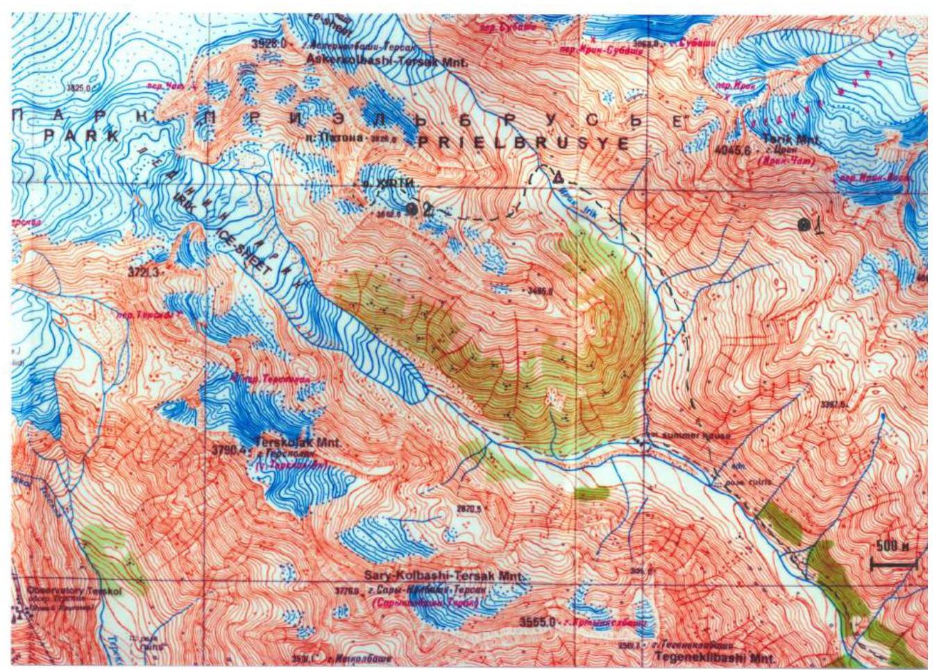
Map of Irik-Chat gorge. Scale 1:100,000. — — — — route; 1, 2 — photo shooting points
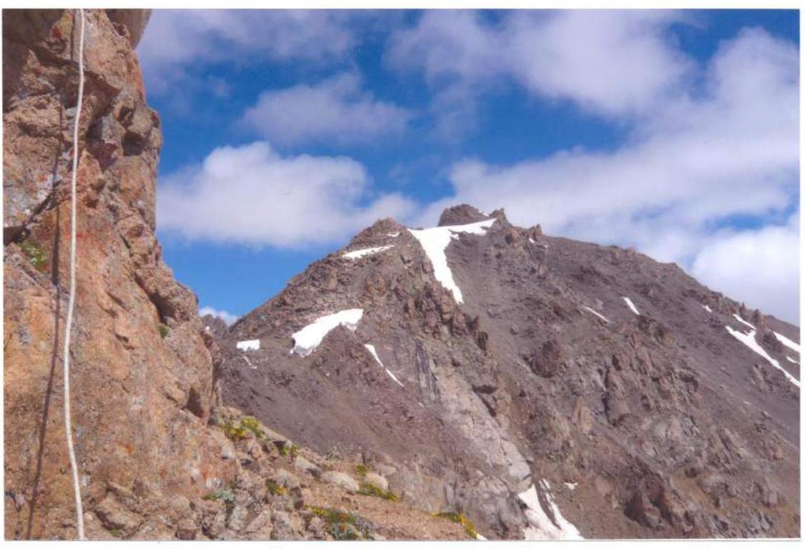
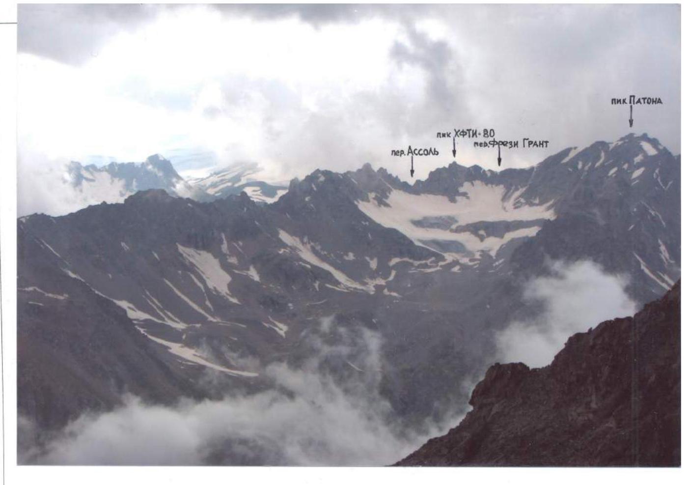 © 1. From the slopes of Soviet Warrior Peak.
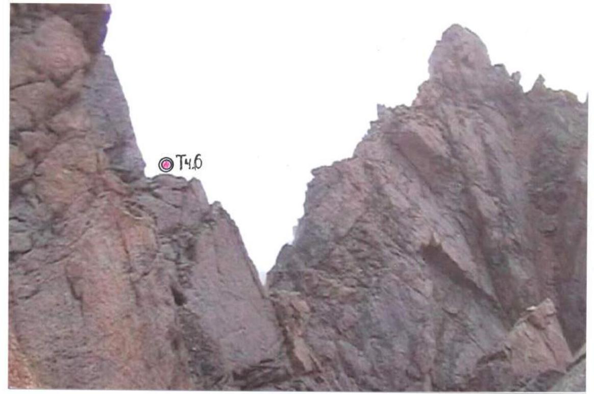
 © 2. From E ridge of S crest of 3662 Peak
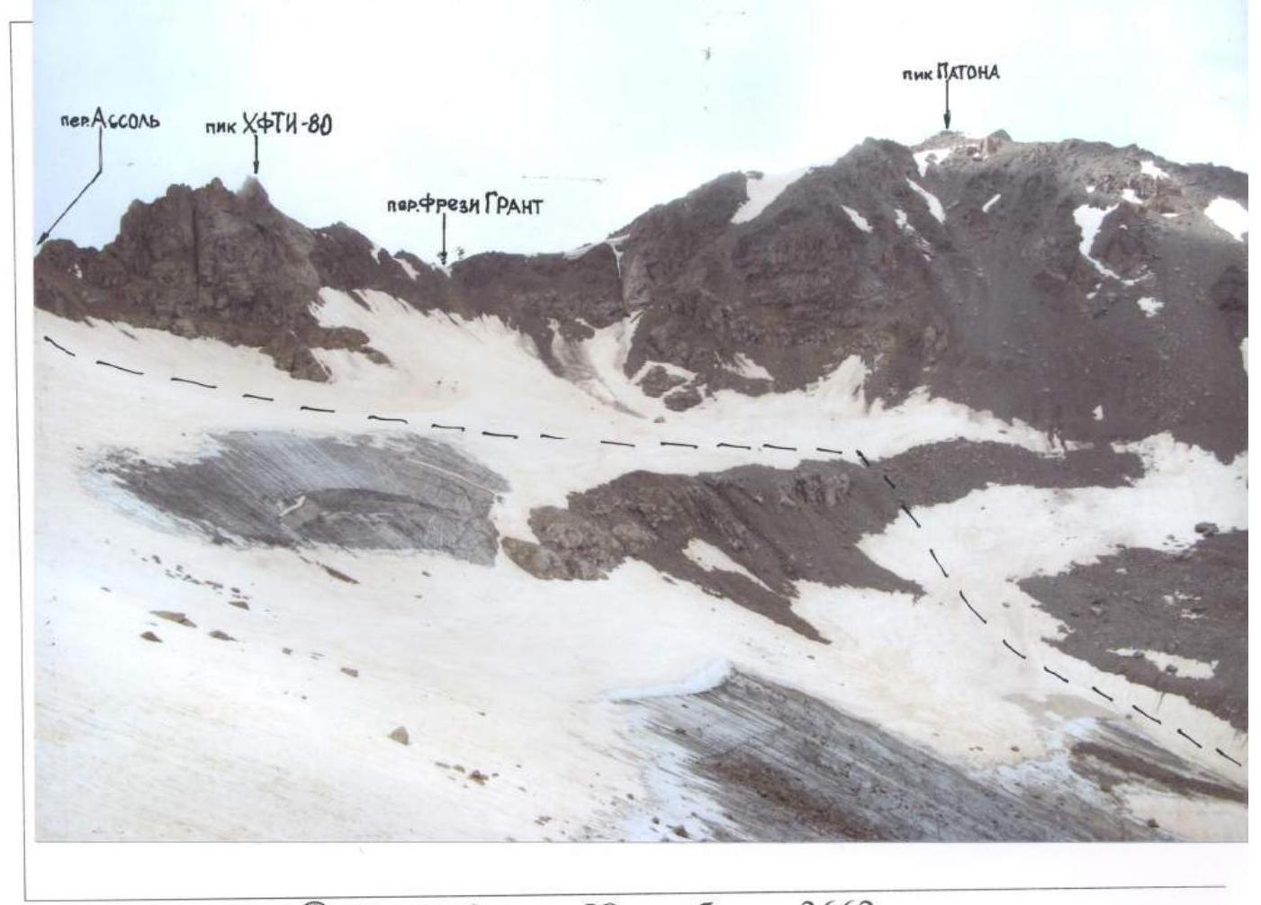
Below © 2. On the way from the lake.
Section R0–R1. In the background is the wall of section R1–R2
Brief description of the route
From the overnight campsite located on the last grassy clearing on the left bank of the Chat River (this is somewhat lower than opposite the edge of the eastern ridge of Paton Peak), upstream along the river ~150 m — crossing the river via stones.
Then along the grassy slopes of the eastern ridge of Paton Peak, bypassing it without gaining height, we reach a flat area (good spot for an overnight stay) ~1.5 km. Then along the grassy scree upwards between the "ram's foreheads" on the left and the slopes of the ridge on the right, staying closer to the "foreheads", we exit into the Paton Peak cirque. Along the fine scree in the direction of Paton Peak with minimal height gain to a small lake under the slopes of the eastern ridge. From the overnight campsite ~2.5 km, height ~3300 m.
Then along a snowy slope of moderate steepness in the direction of Paton Peak ~350 m and then along the coarse scree to the right of the "ram's foreheads" on the right, moving left towards Peak KhFTI-80, we enter a snowy cirque. Then along a gentle snowy slope with ups and downs in the direction of Assol Pass, keeping away from the slopes of Peak KhFTI-80 (rockfall hazard!). Then along steeper snow and a steep "live" scree, we reach Assol Pass, height ~3550 m. From the lake ~900 m. A note from a tourist from Tuapse was found (see below).
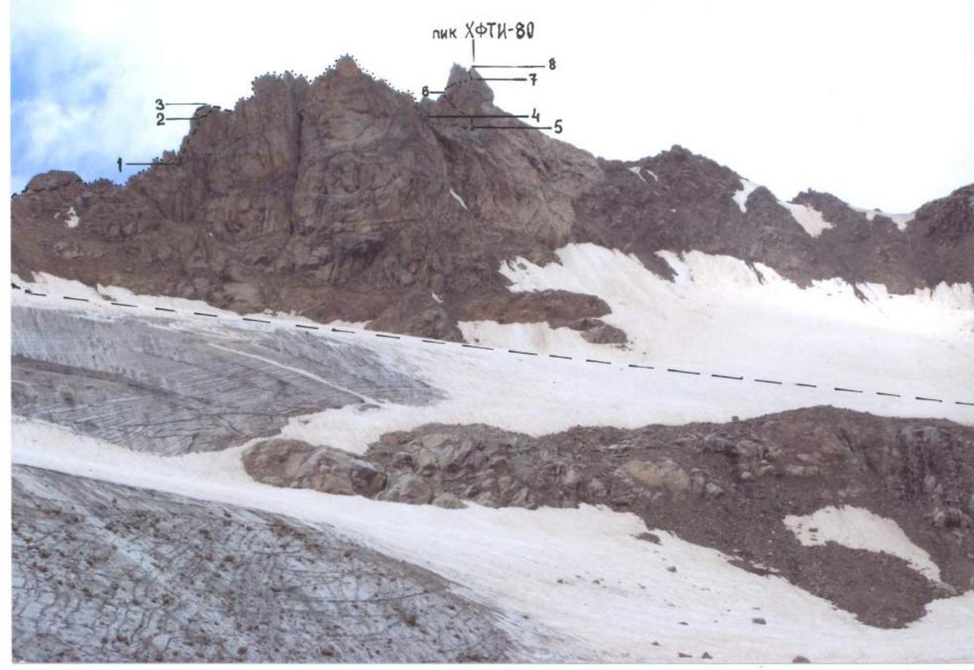
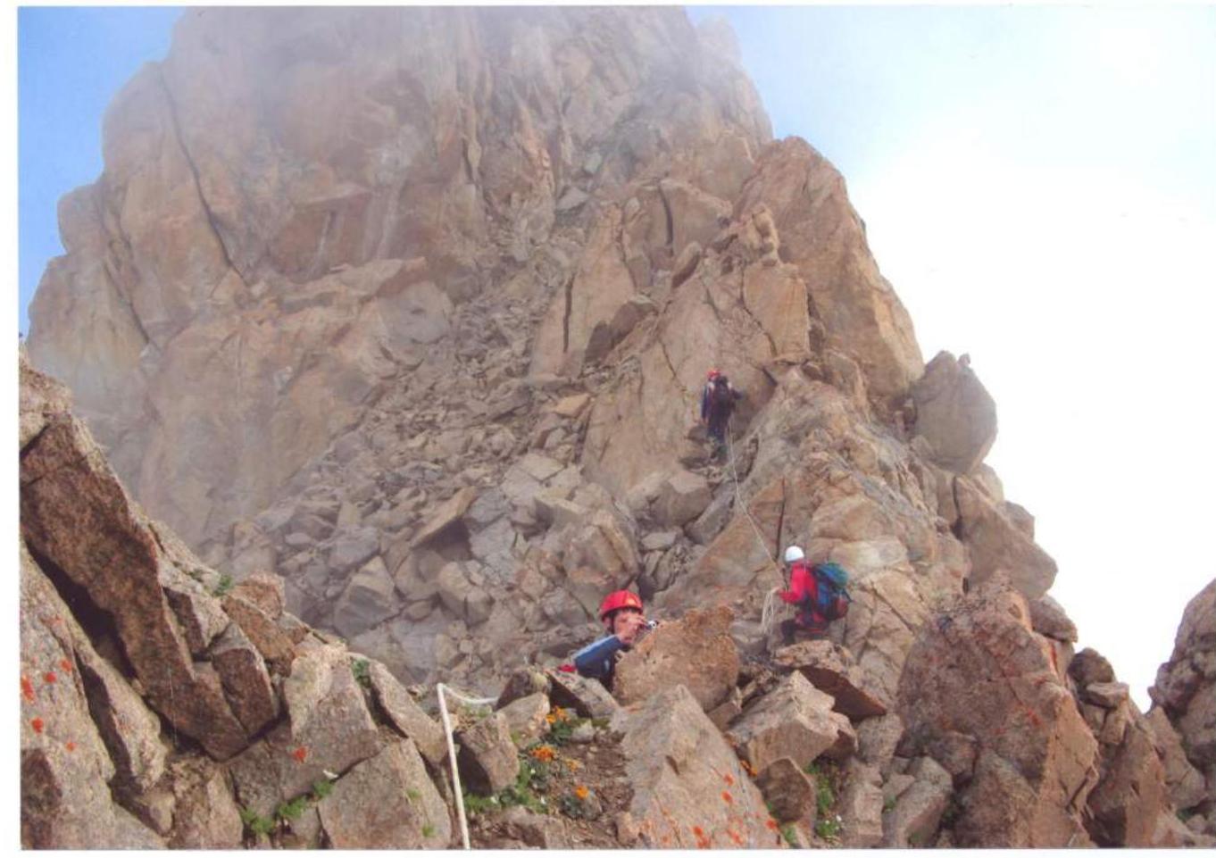
R0–R1. From Assol Pass along the ridge to a gendarme, which we bypass on the right, then again on the left side of the ridge along ledges and handholds, bypassing gendarmes on the ridge, sometimes on the left, sometimes on the right, to a wide gap in the ridge (~130 m).
R1–R2. Along the gap to the inner corner of the wall of a large gendarme. Up along the inner corner to a small overhanging section blocking the exit from the corner (30 m, belay).
R2–R3. The overhanging section at the top of the gendarme is bypassed on the left or right along indistinct ledges and handholds, exiting onto the ridge (~20 m).
R3–R4. Then along the ridge, mostly along ledges and handholds on its western side, we reach a wall. Up along the wall to a ledge, along which we bypass the ridge elevation and again exit onto the ridge (~80 m), which then becomes a sharp ridge.
R4–R5. Along the left steep (~70°) wall of the sharp ridge, a traverse (~6 m, careful belay) with a loss of height, and then along small ledges on the sharp ridge, which continues with a slight descent to a saddle before the pre-summit tower (~20 m).
R5–R6. From the saddle, rightwards, bypassing an overhang, up along a wall to a diagonal ledge, along which leftwards upwards to a notch on the edge between the western and southern walls of the tower (~45 m, belay).
R6–R7. Then through the notch (CP 6) along the western wall of the pre-summit tower leftwards upwards, bypassing the upper part of the tower along handholds and cracks, with some overhanging sections (belay), we exit to a saddle, or rather, to a narrow gap between the summit and the pre-summit tower (~20 m).
R7–R8. Through the gap — onto the southeastern wall of the summit, a traverse rightwards, bypassing an overhang (2–3 m, key section of the route), along a small ledge to a slab, and along it to an inner corner, up which to the summit (~15 m).
From the overnight campsite — 7 hours. On the summit, a "Peak KhFTI" plaque is attached in honor of the 80th anniversary of the Kharkov Institute of Physics and Technology. A note was found:

Note from the summit of Peak KhFTI
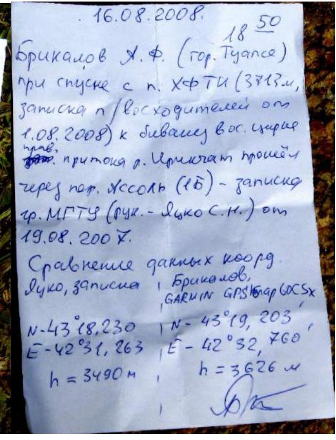
Note from Assol Pass

Descent from the summit via the 1B category route, i.e., along the northern ridge to Frezi Grant Pass and from there down to the lake in the Paton Peak cirque.
Route diagram in symbols, scale 1:800 (by height)
| Pitons | Rock | Chocks | Section | Length | Wall steepness | Category |
|---|---|---|---|---|---|---|
| R8 | ||||||
| 1 | 2 | R7 | 15 | 70° | III+ | |
| 1 | 3 | R6 | 20 | 60° | III | |
| 2 | 3 | R4 | 45 | 60° | II+ | |
| 2 | 1 | R5 | 20 | II+ | ||
| 2 | R3 | 80 | 45° | III | ||
| 2 | R2 | 20 | 60° | II+ | ||
| 4 | R1 | 30 | 50° | III | ||
| R0 | 130 | 30° | II |
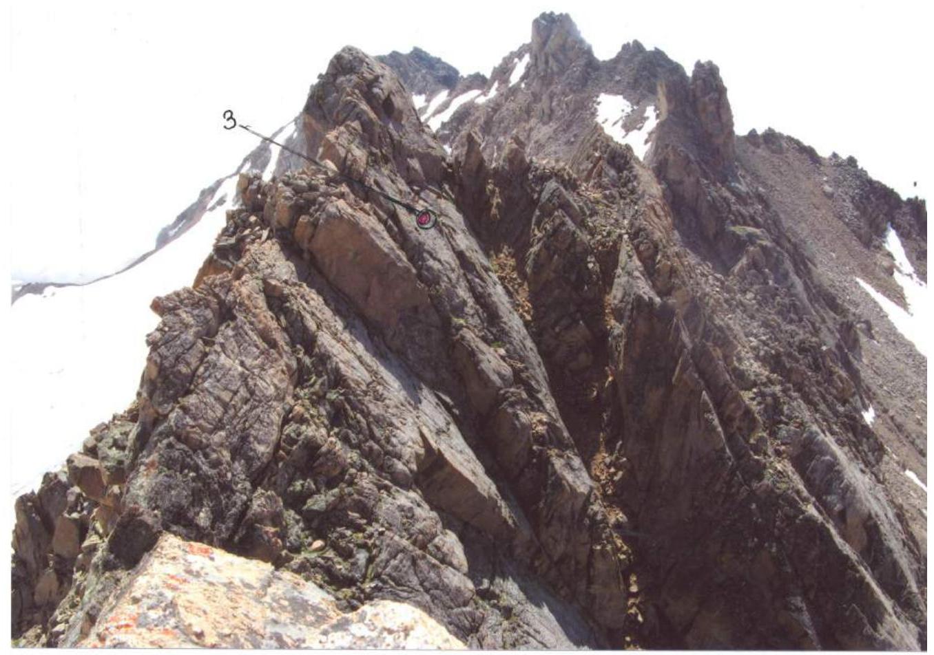
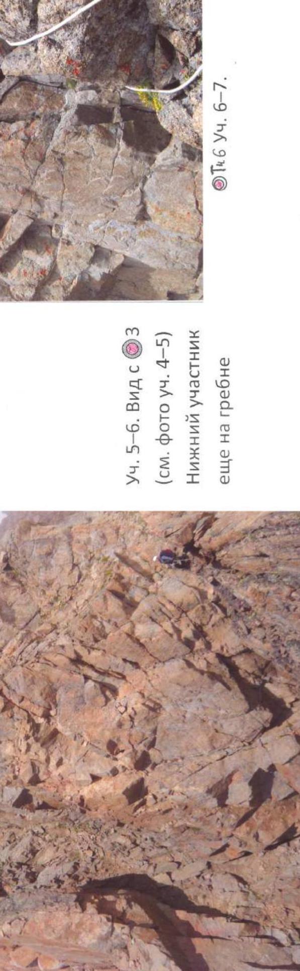
CP 6. R4–R5. View of the ridge from the wall of the pre-summit tower.
Start of R5–R6. Paton Peak from under the pre-summit tower
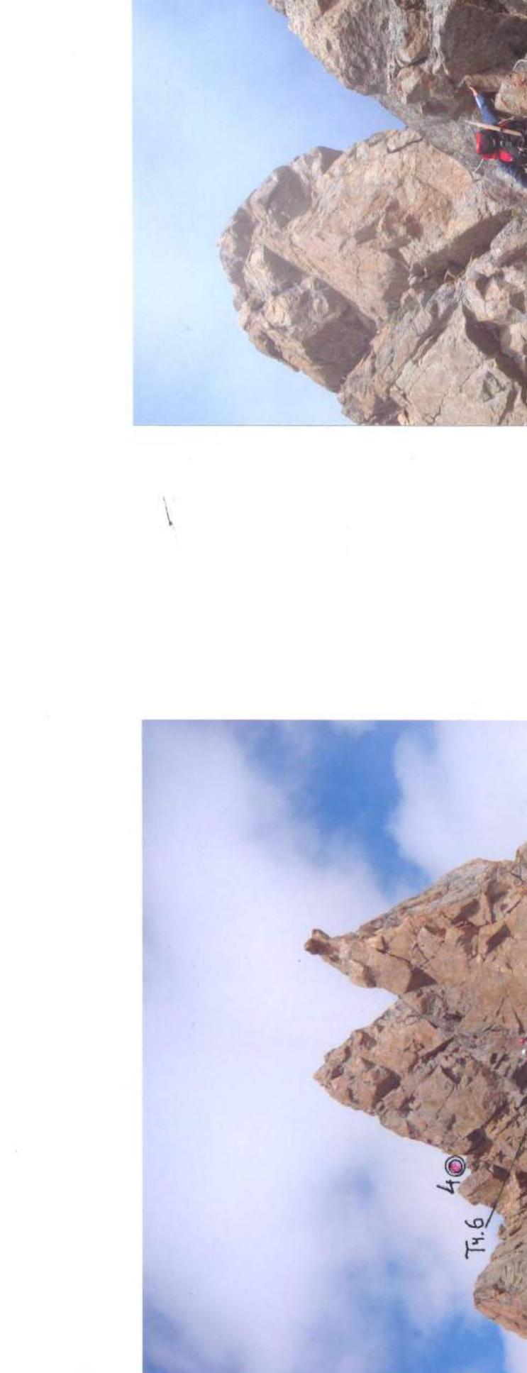
R5–R6. View from 3 (see photo R4–R5). The lower participant is still on the ridge
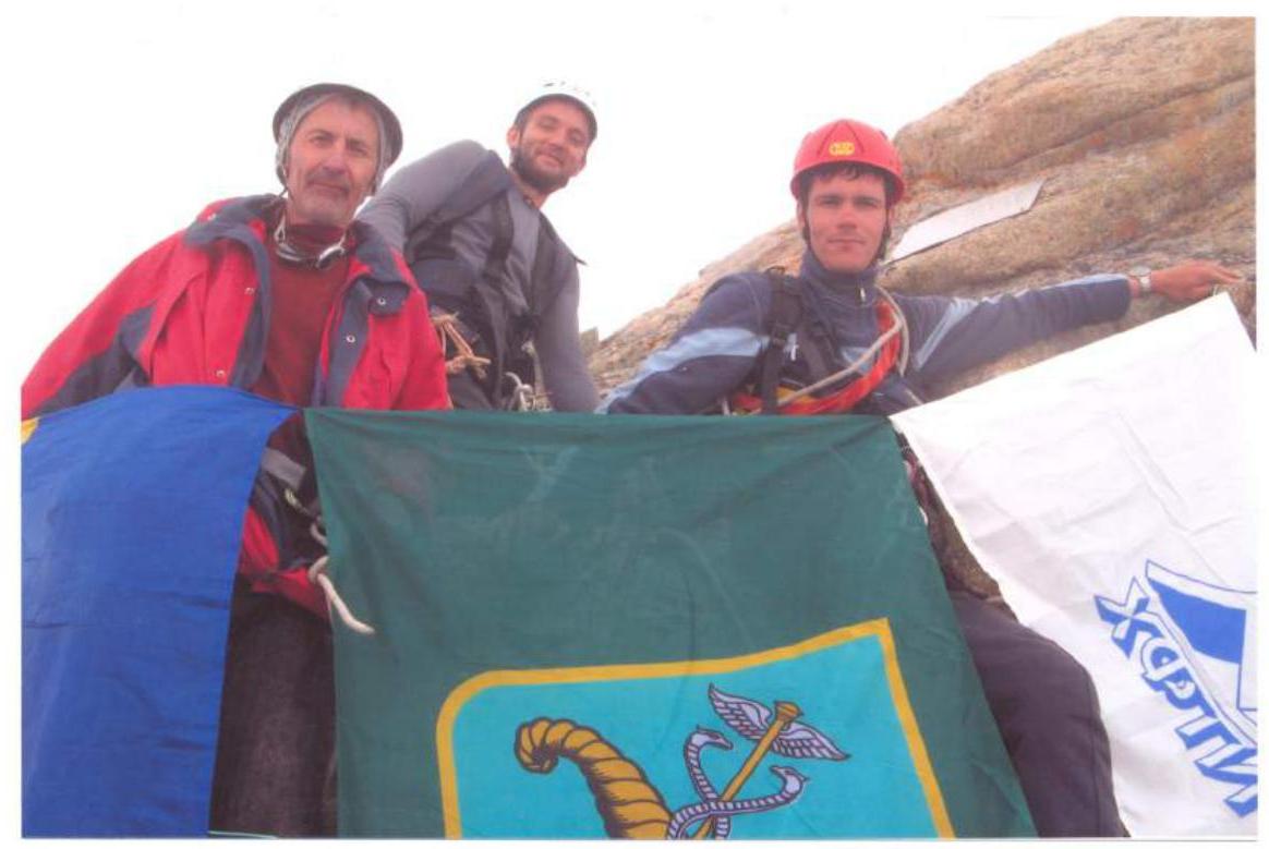
On the summit of Peak KhFTI-80.
View of R4–R5 and the "notch" on the edge of the pre-summit tower (CP 6) from 4 (see photo R5–R6). Frame from a 2008 video.
Protocol
of the first ascent to Peak KhFTI-80 via the southern ridge from Assol Pass.
Present:
- Head of NSC KhFTI climbing event, Master of Sports Ovcharenko V.D.;
- Head of rescue team, Candidate Master of Sports Bokov A.S.;
- Instructor, Candidate Master of Sports Kudin A.M.;
- Climbing team members.
V.D. Ovcharenko: We left the overnight campsite at 6:00, 150 m above the camp we crossed the Chat River, and after 2.5 hours we reached the lake in the Paton Peak cirque. Then, first along the snow, then along a steep coarse scree to the right of the "ram's foreheads", we entered the upper cirque. Along the snow, leftwards, practically without gaining height, we traversed in the direction of Assol Pass, keeping away from the rocks of Peak KhFTI-80. We were on the pass in ~1.5–2 hours. From the pass along the ridge northwards, bypassing gendarmes sometimes on the right, sometimes on the left along handholds and ledges on the ridge to the wall of a large gendarme (~130 m). Up along the inner corner of the gendarme's wall to an overhanging section, which is bypassed both on the left and on the right, exiting onto the ridge (50 m). Then along the ridge, mostly along handholds and ledges on its western side, to a wall, along which we again exit almost to the top of the ridge (~80 m). Then along the steep left wall of the ridge — a traverse leftwards downwards ("slippery" climbing, 6 m), and along small ledges we exit onto a narrow ridge ("knife-edge"), leading with a slight descent to a saddle before the pre-summit tower. From the saddle, rightwards upwards along a steep wall to a diagonal ledge, leading leftwards upwards to a "notch" on the edge between the western and southeastern walls of the pre-summit tower. Through the "notch" leftwards upwards along the western wall, bypassing the upper part of the tower, we exit to a crack between the summit and the pre-summit tower. Through it, we exit onto the southeastern wall of the summit. Then a traverse rightwards, bypassing a small overhang (key section of the route, 2–3 m), along small ledges to a slab, along which to an inner corner and up it to the summit. We were on the summit at 13:00. A note from a tourist from Tuapse was found. Descent was via the 1B category route, along the northern ridge to Frezi Grant Pass, from which down to the lake. We were back at the camp at 16:00. The route corresponds to 2B category. Some sections require sufficient rock climbing skills. The route is diverse in terrain and interesting in terms of climbing technique. If safety rules are followed, the route is safe.
M. Bratchenko (2nd category): The route is interesting and diverse in rock terrain, although it's a ridge route. Sections like the traverse along the "knife-edge" wall, bypassing the upper part of the pre-summit tower, and the traverse under the summit overhang require maximum attention and psychological stability, as there's a precipice below. I think these sections are more challenging than 2nd category.
A. Beletsky (3rd category): I liked the route. It's more interesting than the 2B route on Via-Tau. At least, some sections were memorable for their tension. And there are no such trails as on Via-Tau.
A. Borisenko (3rd category): I consider this route to be 2B category. Among the 2A category routes I've completed, it's the most diverse. Maybe it's a bit shorter, but in terms of complexity and diversity of rock terrain, it's much stronger.
A. Kudin (Candidate Master of Sports): When listening to your stories, and these are stories from rock climbing athletes, one gets the impression that the route is much more challenging, and you're being modest by proposing 2B category. But you know best. The southern ridge of Peak KhFTI-80 looks convincing.
A. Bokov (Candidate Master of Sports): Having heard the opinions of the instructor and the climbing team members, I think the route corresponds to 2B category.
Leader, release officer, Master of Sports of the USSR (Ovcharenko V.D.)
Head of rescue team, Candidate Master of Sports of the USSR (Bokov A.S.)