
Report on the First Ascent by the Team of the Multifaceted Mountaineering Club "Freeline" from Essentuki
TO THE SUMMIT 3428 m
via the northern counterfort of the northwestern ridge Presumably 4A category of difficulty
Leader: Donskov Andrey Mikhailovich
Coach: Motiienko Nikolai Ilyich
Essentuki 2017
Addresses:
357500, Stavropol Krai, Pyatigorsk, Mira St. 19, apt. 22 Donskov A.M. tel. +7-962-017-82-09 donskov91@mail.ru
357551, Stavropol Krai, Pyatigorsk, Engelsa St. 192 Semenova O.A. tel. +7-928-252-58-92 rijik001@yandex.ru
357524, Stavropol Krai, Pyatigorsk, Fuchika St. 8, building 3, apt. 41. Konstantinov G.A. tel. +7-988-860-73-77 bargest2008@gmail.com
357500, Stavropol Krai, Pyatigorsk, Sovetskaya St. 137 Motiienko N.I. tel. +7-928-361-90-66 nik-motienko@mail.ru
Climbing Passport
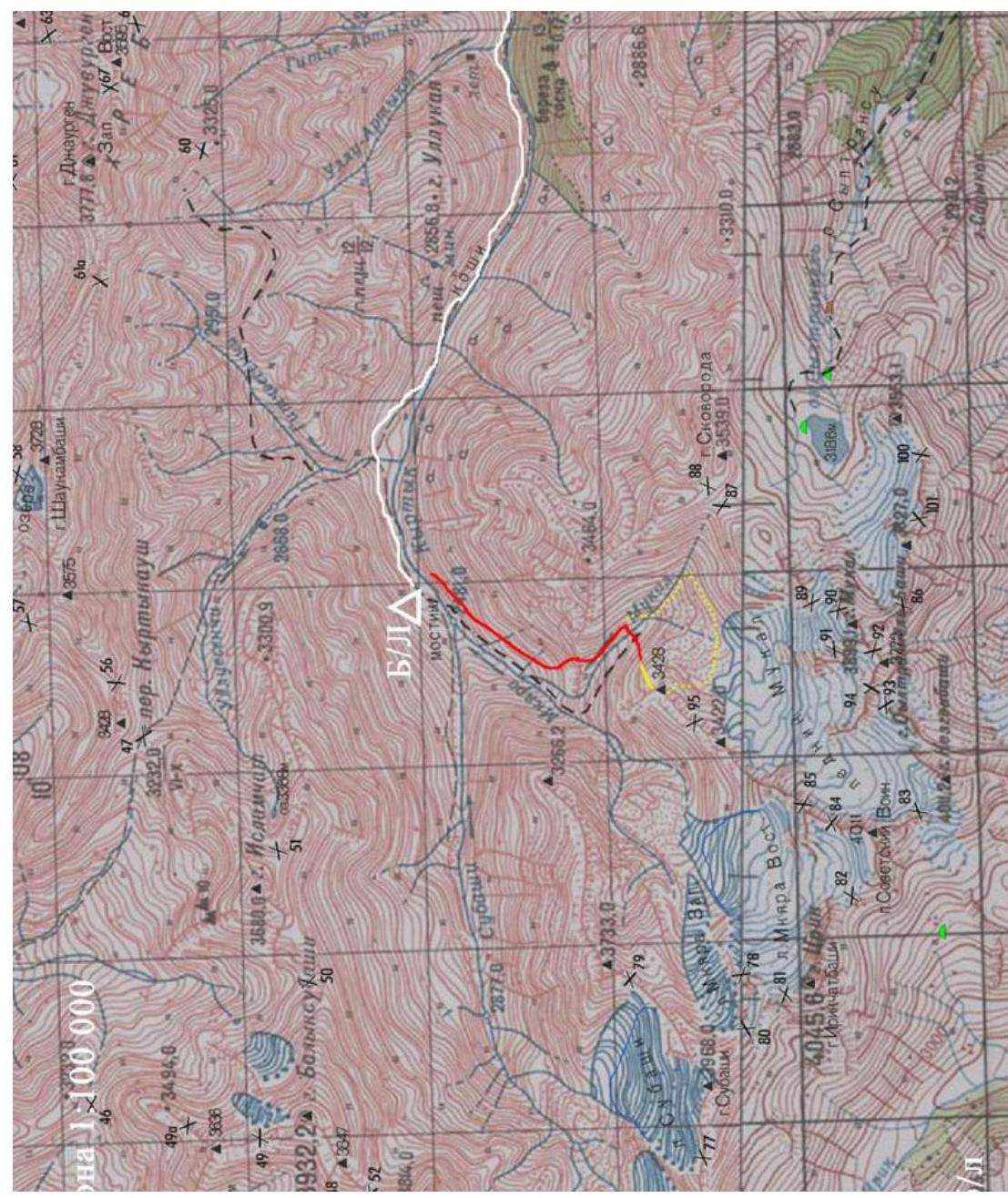
- Area 2.4. From Chiperaza Pass to Gumači summit (Baksan, Adylsu, Shhelda, Kyrtyk valleys)
- Summit 3428 m, via N counterfort of NW ridge
- Proposed category - 4A, first ascent
- Route type: rock climbing
- Height difference: 378 m
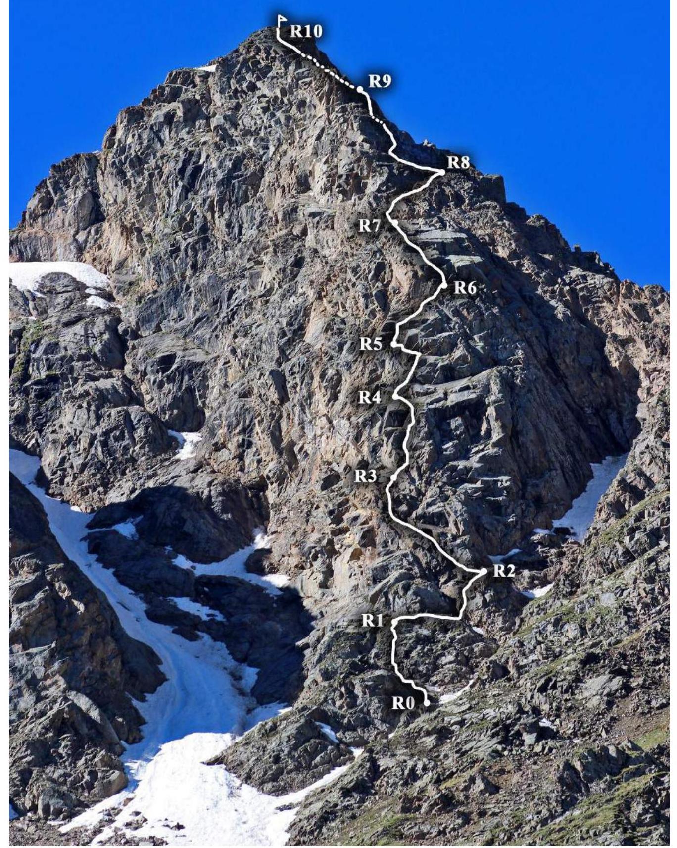
Route length: 503 m
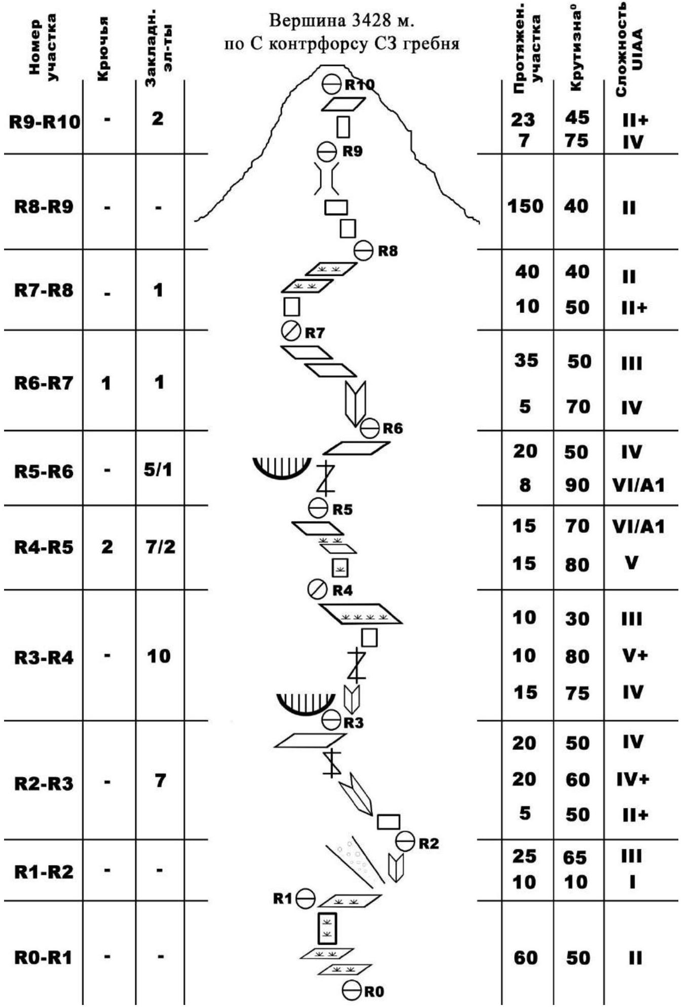
Section lengths:
- 1 – 10 m
- 2 – 288 m
- 3 – 70 m
- 4 – 87 m
- 5 – 25 m
- 6 – 23 m Average steepness:
- counterfort – 70°
- ridge – 40°
- Protection used:
Total/ETO – 36/3
- rock pitons – 3
- chocks – 33
- bolt hangers – 0 Protection left on the route:
- Total – 1
- rock pitons – 1
- Team's climbing hours: 13 h, 1 day including work on the route: 8 h 20 min, 1 day
- Leader:
Donskov Andrey Mikhailovich 1st sports category
Team members:
- Semenova Olesya Artemovna 1st sports category
- instr. 3 cat. № cert. 1838
- Konstantinov Gennadiy Andreevich 3rd sports category
- Coach: Motiienko Nikolai Ilyich CMS, instructor 1 cat. № cert. 754
- Base camp setup: July 1, 2017 Route started: 09:00 July 2, 2017 Summit reached: 17:20 July 2, 2017 Return to base camp: 20:10 July 2, 2017 Descent from the summit: via the southern slope
- Team: Multifaceted Mountaineering Club "FREELINE" Essentuki
- Report responsible: Donskov A.M. tel. +7-962-017-82-09 Email: donskov91@mail.ru
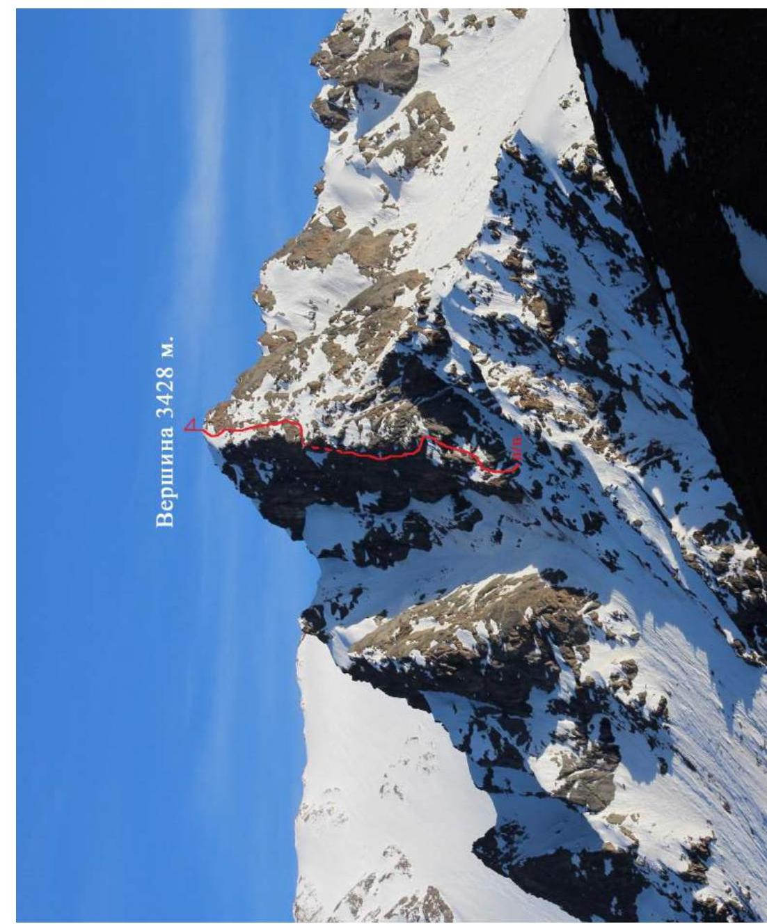
Summit 3428 m.
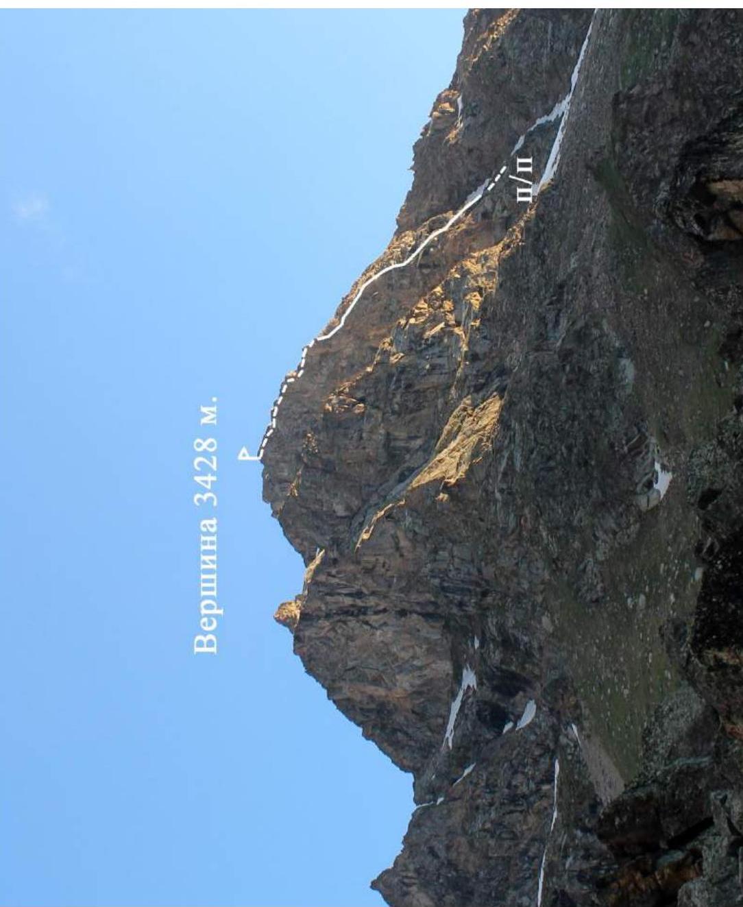
Summit 3428 m.

Brief overview of the climbing area
The climbing area is located in the part of the Lateral Ridge of the Central Caucasus, stretching from Irik summit (4046 m) to Mukal summit (3899 m). The object of the ascent – summit 3428 m – terminates a ridge stretching 3 kilometers northward from Sovetsky Voin summit (4012 m). It is bounded to the east by the Mukal river and to the west by the Mkara river, a tributary of the Kyrtyk river.
Geographic coordinates of the summit: 43°20′27.30″ N 42°38′26.36″ E. Approach description
From Verkhny Baksan village along a dirt road into the Kyrtyk river valley to the last cattle pen at the confluence of the Kyrtyk and Mkara rivers (15 km). The road from Verkhny Baksan is passable for vehicles like Lada "Niva" and UAZ "Patriot". Then across a bridge over the Mkara river and along its orographically right bank, following a marked trail uphill to the edge of a "hanging valley" (3 km). From here, the northern counterfort and the route line are clearly visible. A convenient bivouac site. There is no mobile phone coverage in the valley. Border permits are not required.
Summit 3428 m.
| Section | Pitons | Chocks | Section length | Steepness | Difficulty UIAA |
|---|---|---|---|---|---|
| R9–R10 | – | 2 | 23 | 45° | II+ |
| 7 | 75° | IV | |||
| R8–R9 | – | – | 150 | 40° | II |
| R7–R8 | – | 1 | 40 | 40° | II |
| 10 | 50° | II+ | |||
| R6–R7 | 1 | 1 | 35 | 50° | III |
| 5 | 70° | IV | |||
| R5–R6 | – | 5/1 | 20 | 50° | IV |
| 8 | 90° | VI/A1 | |||
| R4–R5 | 2 | 7/2 | 15 | 70° | VI/A1 |
| 15 | 80° | V | |||
| R3–R4 | – | 10 | 10 | 30° | III |
| 10 | 80° | V+ | |||
| 15 | 75° | IV | |||
| R2–R3 | – | 7 | 20 | 50° | IV |
| 20 | 60° | IV+ | |||
| 5 | 50° | II+ | |||
| R1–R2 | – | – | 25 | 65° | III |
| 10 | 10° | I | |||
| R0–R1 | – | – | 60 | 50° | II |
Route description
From the confluence of two couloirs under the northern counterfort, into the right couloir to a vertical 10-meter wall. Behind it, a series of sloping ledges lead left to the northern counterfort – here begins the route.
- R0–R1. Up left along ledges to a vertical wall. Under the wall on a grassy ledge, a convenient site for a belay station. Easy climbing, beware of loose rocks.
- R1–R2. Along the wall on a ledge right into the couloir (10 m) and then up right through an inside corner – exit onto a small shoulder. Belay station on a rock outcrop.
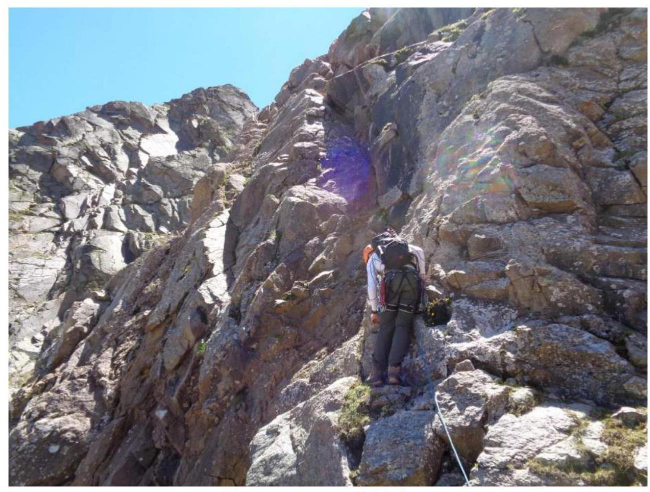
- R2–R3. From the shoulder, traverse left into a sloping inside corner and up its left edge – exit past a bend, then straight up – exit onto a wide, large-block balcony. Belay station in its central part under an overhanging wall on the right.
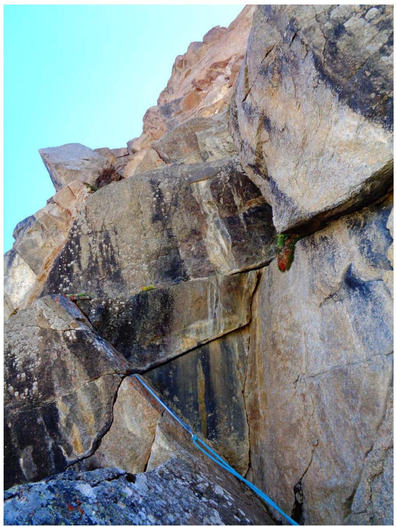
- R3–R4. Bypass the overhanging wall on the right via large blocks and then straight up a crack. After passing the crack, traverse right along a black sloping slab – exit onto an edge and then up left through a system of cracks overgrown with grass – exit under a vertical wall composed of blocks wedged in a "checkerboard" pattern. Rich terrain for medium-sized chocks and pitons.
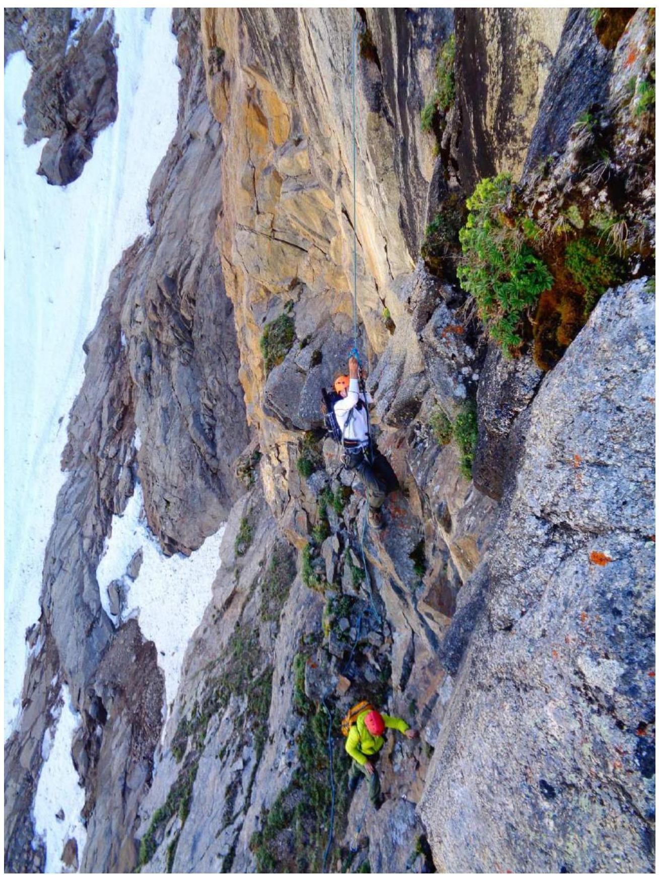
- R4–R5. From the station, up right towards a triangular-shaped grotto. From the grotto, left – through a system of smooth slabs and then to a vertical "black triangle". Rich terrain for medium chocks. First crux section.
- R5–R6. Up the right edge of the "triangle" and right. Then traverse right and up along reddish, crumbling rocks – exit onto a wide balcony. Second crux section.
- R6–R7. From the left part of the balcony, up into a faintly defined inside corner and then along slabs to reddish rocks.
- R7–R8. Bypass the reddish rock on the left, then along a ledge right – exit onto the northwestern ridge.
- R8–R9. Along the northwestern ridge towards the summit. Moderate rocks are overcome directly. Exit to an inside corner and up its right part to the ridge crest.
- R9–R10. Up a steep, sloping slab with little relief – exit onto the "roof", then along easy rocks to the summit.
The route features many loose rocks; organizing belay stations as per the first ascent description will make the team's work safer. For organizing belay points, it is convenient to use:
- medium-sized chocks or "camalots",
- pitons.
Descent from the summit is via a simple scree slope southward towards the Mukal glacier.
The route corresponds to the claimed category of difficulty. Recommended for sport climbing teams with experience on rock routes of at least 4B category.
Start of section R2–R3

Work on section R3–R4
Work on section R4–R5. Konstantinov G. on the rope, Semenova O. at station R4.
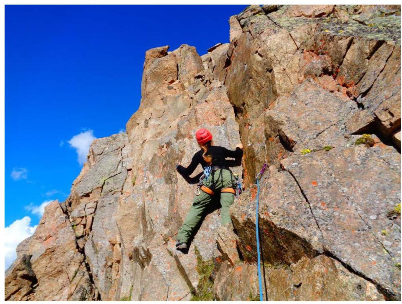
Start of section R5–R6
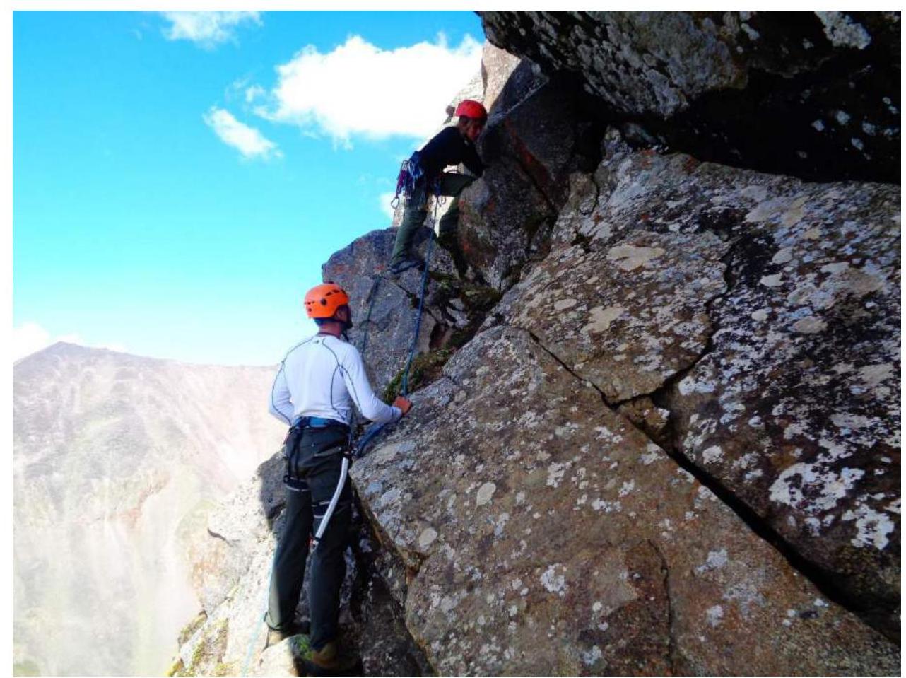
Start of section R6–R7
Section R6–R7
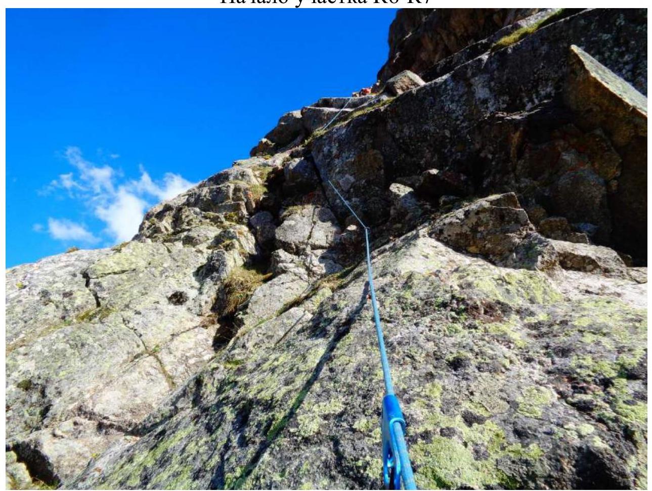
On section R9–R10
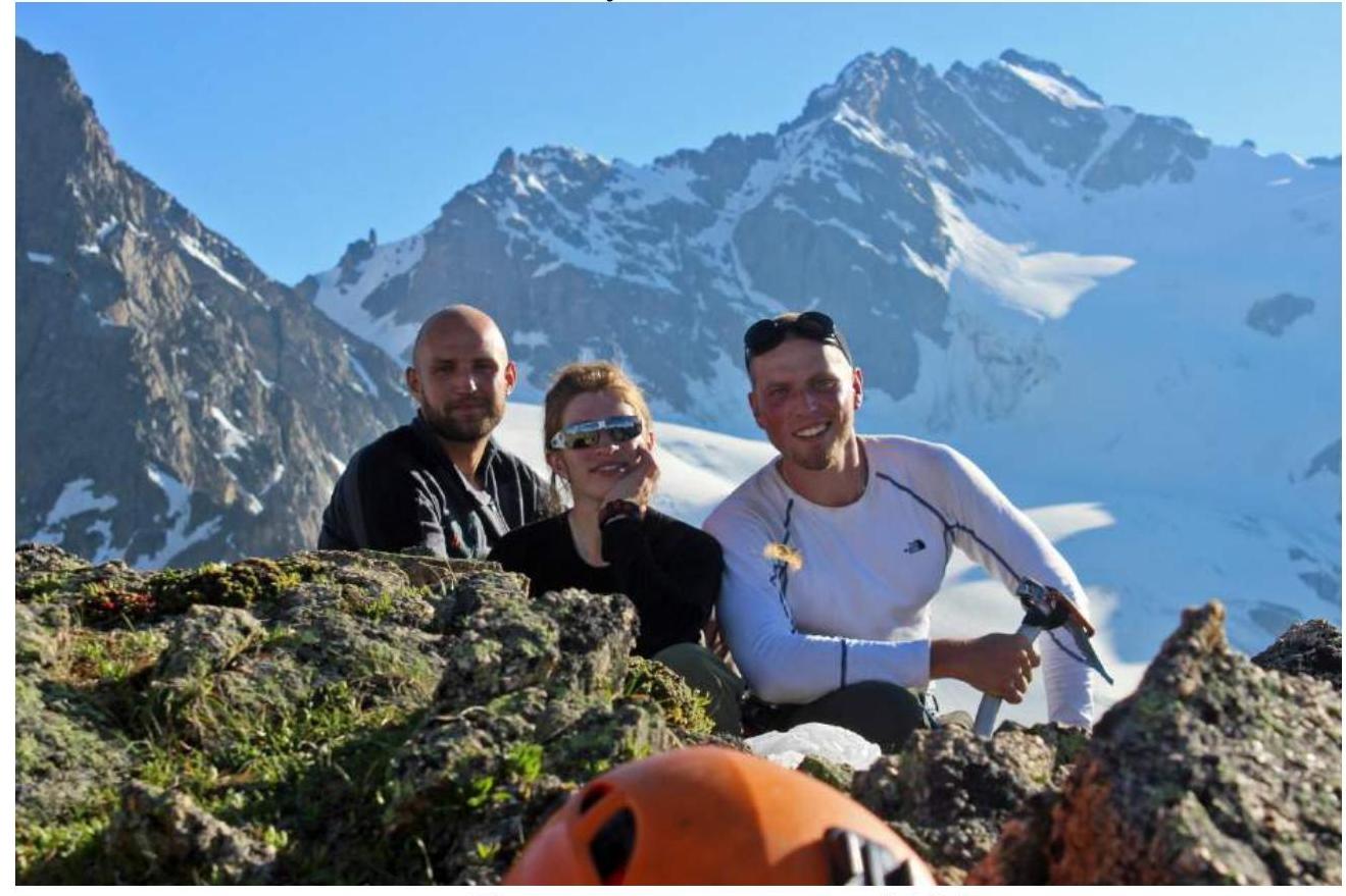
Team on summit 3428 m.
Comments
Sign in to leave a comment