- Climb characteristic: technically challenging.
- Climbing area: Adyl-Su gorge, Central Caucasus.
- Climbing route with indication of peaks and their heights: Cheget-Kara-Bashi peak via the northwestern ridge, 3667 m.
- Climb characteristic: height difference 750–800 m, average steepness from 45° to 60°, length of difficult section 15 m, 10 m, 40 m.
- Number of pitons: rock — 10, ice — –, drill — –.
- Number of walking hours: 10.
- Number of overnight stays and their characteristics: –.
- Team name: "Elbrus" alpine camp.
- Surname, name, patronymic of the leader, participants, and their qualifications:
- Plemyalkov Pavel Kirillovich — Master of Sports of the USSR.
- Radashkevich Evgeny Alexandrovich — Candidate Master of Sports.
- Slavinsky Pavel Frantsevich — Candidate Master of Sports.
- Grishchenko Valentin Anatolyevich — 1st category.
- Team coach: Plemyalkov L.K.
- Date of departure on the route and return: July 23, 1975 — July 23, 1975.
Route Description
to the summit of Cheget-Kara-Bashi via the northwestern ridge (approximately category 3B difficulty)
From the "Elbrus" camp along the road to the "Jan-Tugan" camp, then along the trail to the right moraine of the Kashkatash glacier and ascent to the "Turye Ozera" overnight stays. From the overnight stays, cross the glacier, heading towards the northwestern ridge of the Cheget-Kara-Bashi peak.
The route begins to the right of the couloir mouth. Along inclined slabs, we approach the black inner corner. Ascent along it is 15 m (pitons used for protection). We reach inclined shelves and along them approach under a 10 m inclined slab (1st checkpoint). Up the slabs 10 m (pitons used for protection). We approach a narrow rocky couloir, bypass it on the right with alternating protection along simple rocks, then along smooth slabs, we exit onto the ridge. Along the ridge (moderately difficult rocks), we reach the "Nos" gendarme and, bypassing it on the left, exit onto the northwestern ridge (2nd checkpoint).
Passing the "Nos" gendarme along inclined slabs (pitons used for protection).
Note: it is possible to bypass the "Nos" gendarme on the right with an exit to the 2nd checkpoint.
Along the destroyed ridge and easy rocks, we exit onto the pre-summit ridge and along it — to the summit.
From the start of the route — 8 hours. Descent along a category 2B route, described in Paumov's book "Baksan Valley". On the route during ascent, 10 rock pitons were hammered.
The route is evaluated by the group as approximately category 3B difficulty.
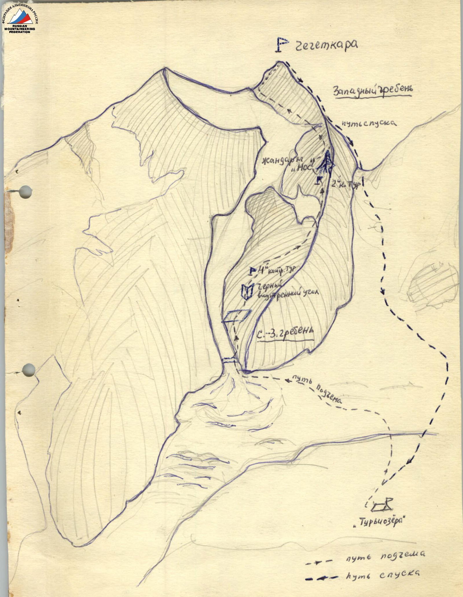
Route Diagram to Cheget-Kara peak
Western ridge Descent path "Nos" gendarme 2nd checkpoint 1st checkpoint Black inner corner Northwestern ridge Ascent path "Turye Ozera" Ascent path Descent path