Report on the First Ascent by the Team of the Multidisciplinary Climbing Club "FRILINE" from Essentuki
To the summit of Khazni-Bashi
via the south ridge and southwest wall Presumably 4B category of difficulty
Team Leader: Popov Mikhail Lvovich
Coach: Motienko Nikolai Ilyich
Essentuki 2019
Addresses:
357600, Stavropol Krai, Essentuki, Oktyabrskaya St., 434, apt. 59, Popov M.L. 8 928 265-71-30 mikl_popov@inbox.ru
357551, Stavropol Krai, Pyatigorsk, Engelsa St., 192, Semenova O.A. phone +7 928 252-58-92 rijik001@yandex.ru
357524, Stavropol Krai, Pyatigorsk, Fuchika St., 8, building 3, apt. 41. Konstantinov G.A. Phone +7 988 860-73-77 bargest2008@gmail.com
357551, Stavropol Krai, Pyatigorsk, Engelsa St., 108, Butov S.V. phone +7 918 780-93-73 yarkiyw3b@mail.ru
357500, Stavropol Krai, Pyatigorsk, Sovetskaya St., 137, Motienko N.I. phone +7 928 361-90-66 nik-motienko@mail.ru
Ascent Passport
- Region 2.4. From Chiperaza Pass to Gumaachi peak (Baksan, Adylsu, Shkhelda, Kyrtik valleys)
- Summit Khazni-Bashi via south ridge and southwest wall
- Proposed category of difficulty — 4B, first ascent
- Route type: rock
- Height difference: 470 m
Route length: 917 m
Section lengths:
- I cat. diff. — 0 m
- II cat. diff. — 415 m
- III cat. diff. — 208 m
- IV cat. diff. — 171 m
- V cat. diff. — 123 m
- VI cat. diff. — 0 m Average steepness:
- wall — 70°;
- ridge — 40°;
- Protection used: Total/ITC — 60/0 rock pitons — 5 chocks — 55 bolt hanger pitons — 0 Protection left on the route: Total — 0 rock pitons — 0
- Team's total climbing time: 13 hours, 1 day of which time on the route: 8 hours 30 minutes, 1 day
- Team Leader: Popov Mikhail Lvovich CMS Team members: Semenova Olesya Artemovna 1st sports category, instructor 3rd cat., cert. No. 1838 Konstantinov Gennadiy Andreevich 2nd sports category Butov Sergey Vasilievich 1st sports category, instructor 3rd cat., cert. No. 1181
- Coach: Motienko Nikolai Ilyich CMS, instructor 1st cat., cert. No. 754
- Route started: 6:00 AM July 2, 2019 Reached the summit: 2:30 PM July 2, 2019 Returned to base camp: 8:00 PM July 2, 2019 Descent from the summit: via the ascent route
- Team: Multidisciplinary Climbing Club "FRILINE" Essentuki
- Responsible for the report: Popov M.L. 8 928 265-71-30 mikl_popov@inbox.ru
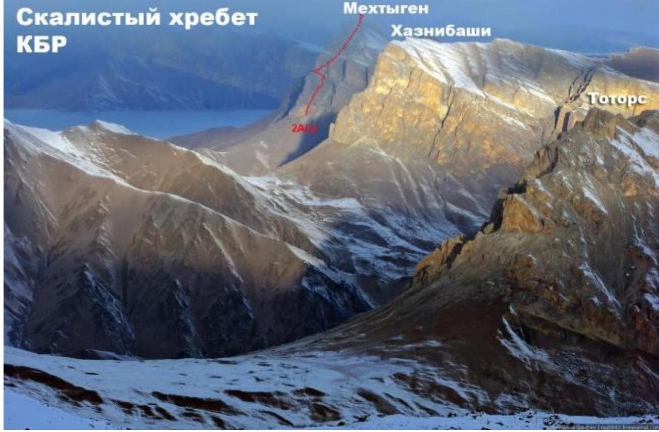
Rocky ridge of Kabardino-Balkaria Mehtygen Khaznibashi
Brief Overview of the Climbing Area
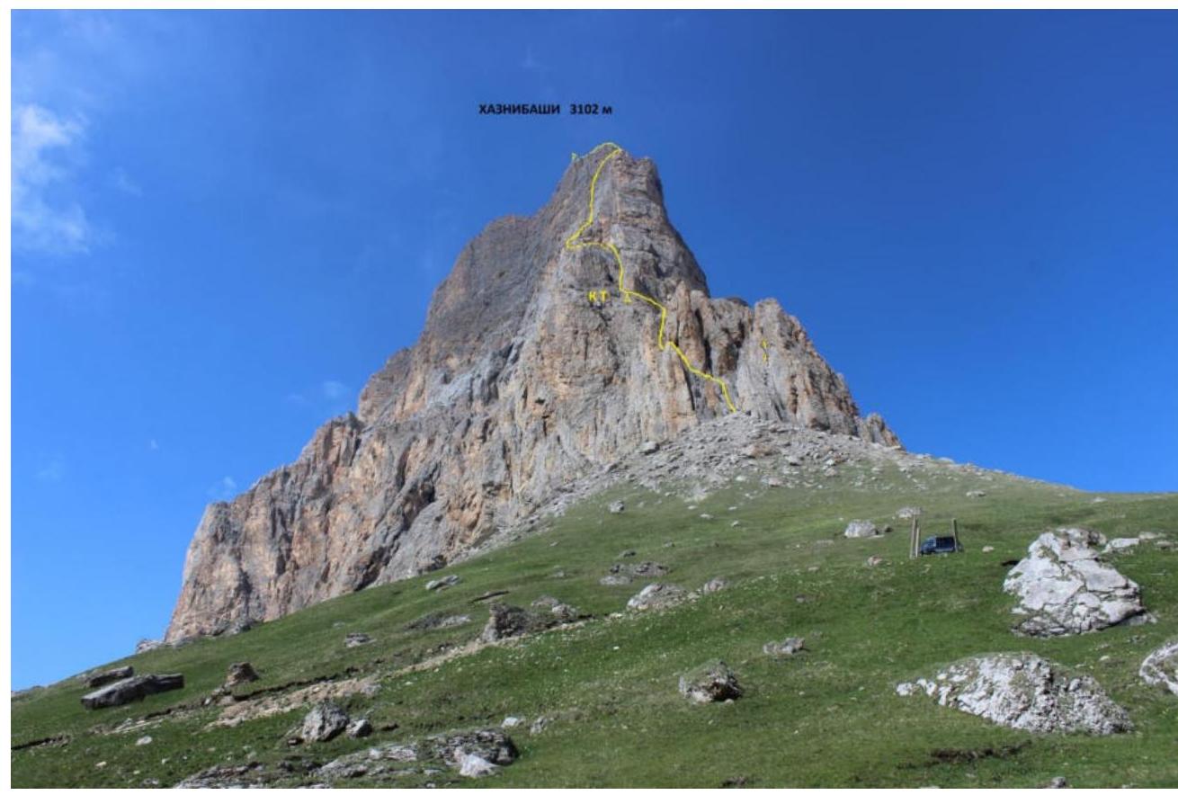
Khazni-Bashi is a mountain peak in the Rocky Ridge of the Central Caucasus. It is the highest point in the Lesken district of Kabardino-Balkaria. The mountain is located in the upper reaches of the Khaznidong River, near the border between the Lesken district of Kabardino-Balkaria and the Irafsky district of North Ossetia. The absolute height of the mountain is 3,102.5 meters above sea level.
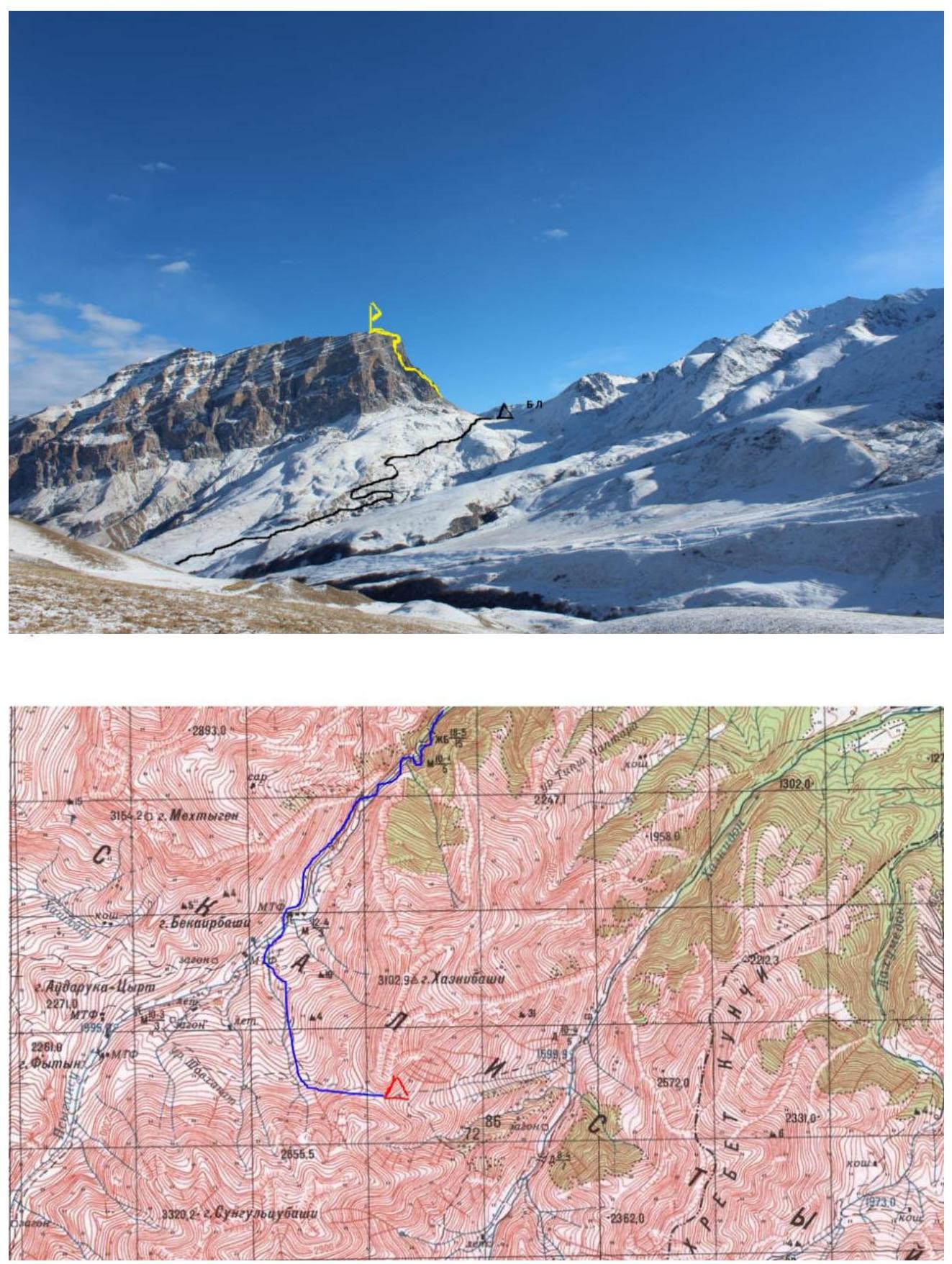
Approach Description
One can drive to the village of Verkhnyaya Zhemtala (138 km from Pyatigorsk) by any car. From Verkhnyaya Zhemtala, a dirt road goes up the Psygansu valley, passable by an SUV. After about 16 km, there is a bridge on the left; after crossing it, a steep serpentine road (3.5 km) leads to the Khazni pass. It's best to leave the car at the pass; there are good camping spots 50 meters below on the saddle of the pass. There is no water at the pass in summer, so it needs to be taken with you.
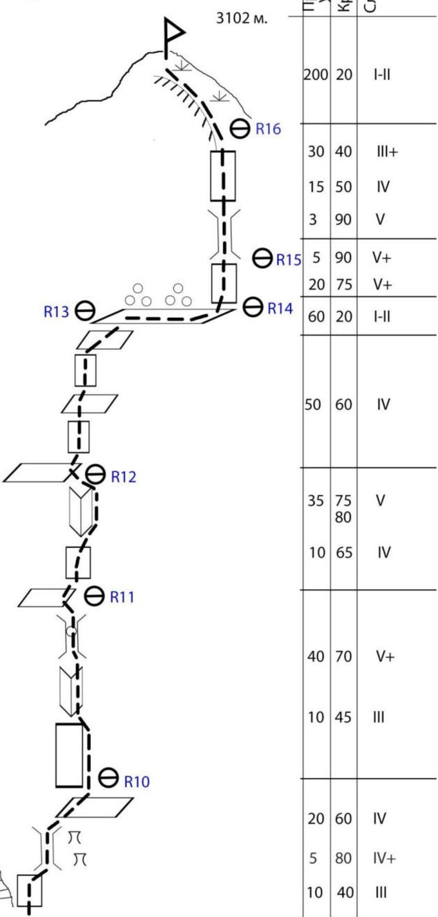
SUMMIT KHAZNI-BASHI via south ridge and southwest wall Presumably 4B category of difficulty 3102 m.
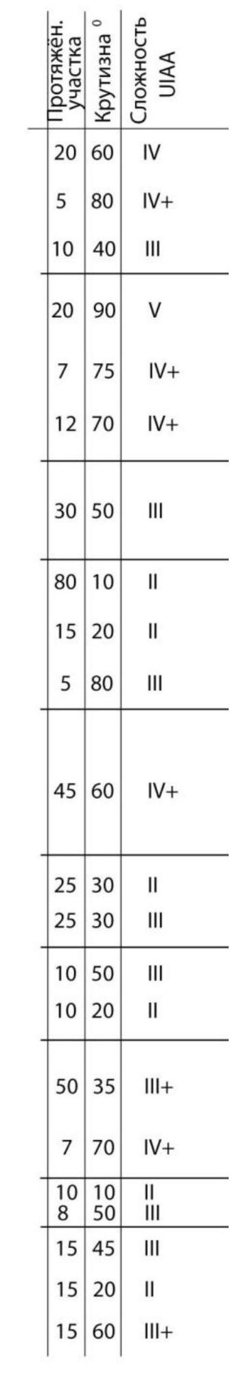
| Section | Pitons | Chocks | Section length | Steepness | UIAA Difficulty |
|---|---|---|---|---|---|
| R16–R17 | - | - | 200 | 20 | I–II |
| R15–R16 | - | 5 | 30 | 40 | III+ |
| 15 | 50 | IV | |||
| 3 | 90 | V | |||
| R14–R15 | 2 | 5 | 5 | 90 | V+ |
| 20 | 75 | V+ | |||
| R13–R14 | - | - | 60 | 20 | I–II |
| R12–R13 | - | 5 | 50 | 60 | IV |
| R11–R12 | 1 | 5 | 35 | 75–80 | V |
| 10 | 65 | IV | |||
| R10–R11 | 1 | 4 | 40 | 70 | V+ |
| 10 | 45 | III | |||
| R9–R10 | - | 6 | 20 | 60 | IV |
| 5 | 80 | IV+ | |||
| 10 | 40 | III | |||
| R8–R9 | - | 5 | 20 | 90 | V |
| 7 | 75 | IV+ | |||
| 12 | 70 | IV+ | |||
| R7–R8 | - | 4 | 30 | 50 | III |
| R6–R7 | - | - | 80 | 10 | II |
| 15 | 20 | II | |||
| 5 | 80 | III | |||
| R5–R6 | - | 3 | 45 | 60 | IV+ |
| R4–R5 | - | 2 | 25 | 30 | II |
| 25 | 30 | III | |||
| R3–R4 | - | - | 10 | 50 | III |
| 10 | 20 | II | |||
| R2–R3 | - | 3 | 50 | 35 | III+ |
| 7 | 70 | IV+ | |||
| R1–R2 | - | 1 | 10 | 10 | II |
| 8 | 50 | III | |||
| R0–R1 | - | 2 | 15 | 45 | III |
| 15 | 20 | II | |||
| 15 | 60 | III+ |
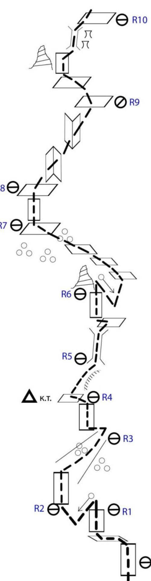
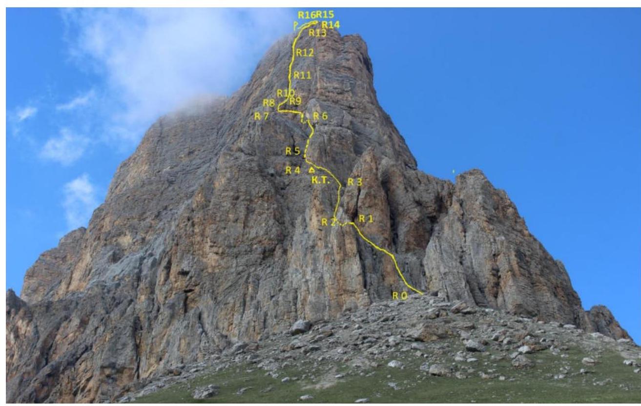
Technical Description of the Route, Presumably 4B Category of Difficulty, to the Summit of Khazni-Bashi via the South Ridge and Southwest Wall
R0–R1 The route starts from the top of a scree cone that abuts a small rock recess. Up the wall 60°, 3+ cat., 15 m to a ledge. Along the ledge left and up 15 m, 20°, 2 cat. to a wall. Up the wall 15 m, 45°, 3 cat. to a saddle.
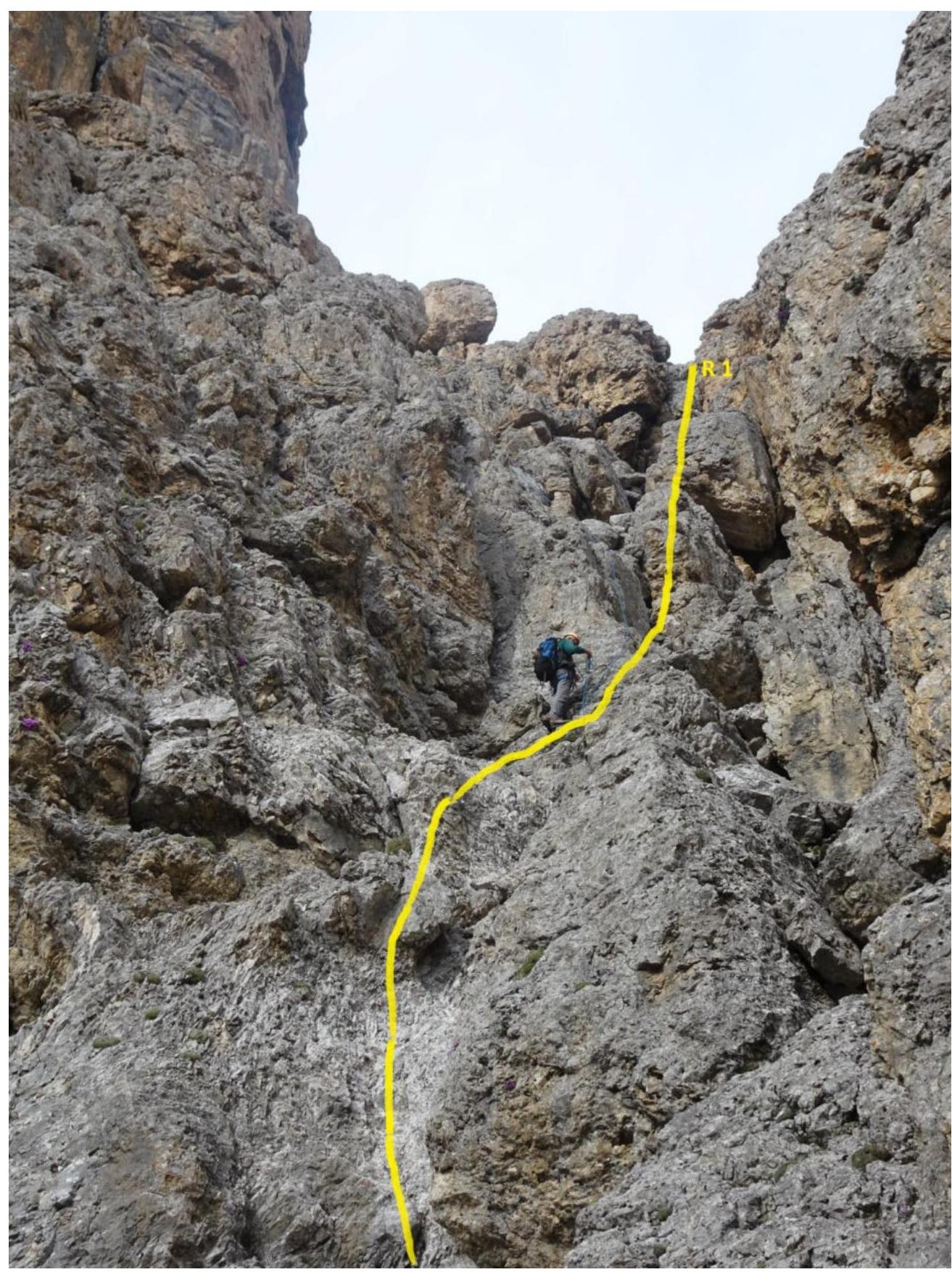
R1–R2 From the saddle, descend into a large scree-filled couloir 8 m, 50°, 3 cat., and cross it 10 m, 2 cat., 10°.
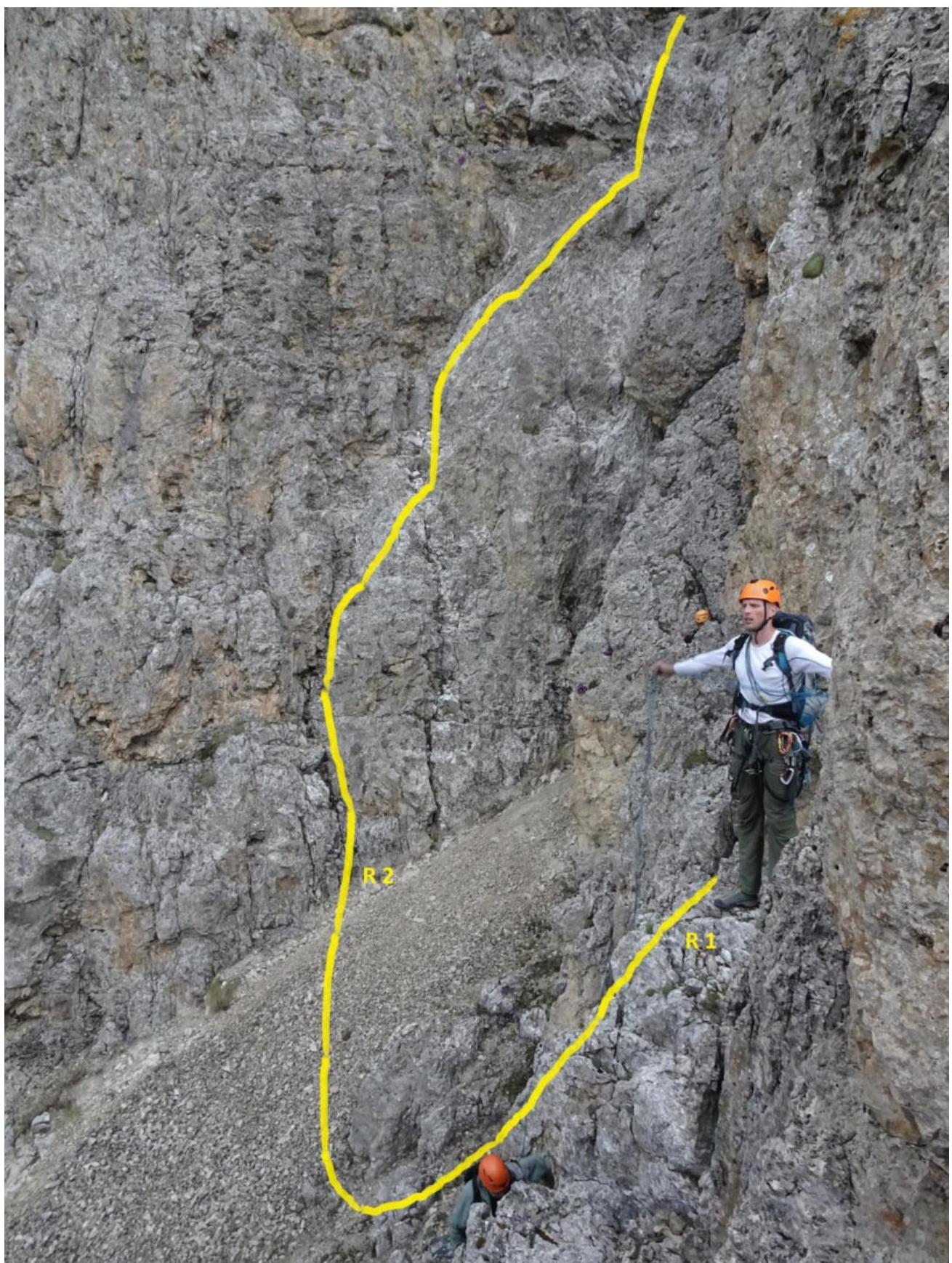
R2–R3 Up the opposite wall of the couloir 70°, 7 m, 4+ cat., to a more gentle slope, and then left back into the coulinging above the "ram's foreheads" that were bypassed via this wall. Up the destroyed rock in the couloir 50 m, 35°, 3+ cat.
R3–R4 After 50 m, the couloir turns right and then left again. At this point, cross it via scree 10 m, 2 cat., 20° to the opposite wall. Up the wall 50°, 3 cat., 10 m to a ledge. On the ledge, there's a cairn.
R4–R5 Up the left side of a small ridge 25 m, 30°, 3 cat. Enter a small cirque. Across simple ledges 30°, 2 cat., 25 m to the right angle of the cirque.
R5–R6 Up a chimney 20 m, 4+ cat., 60° to a saddle on the ridge coming from R4. Further along the ridge 65°, 25 m, 4+ cat., to a break. The ridge ends.
R6–R7 From the break, rappel 5 m, 3 cat., to a saddle. From it, left and down 15 m, 2 cat., into the cirque of the southwest wall. Along the wall, traverse right on ledges 80 m, 10°, 2 cat., to a small ridge coming down from the wall.
R7–R8 Up the rocks of the ridge 30 m, 50°, 3 cat., to a wide monolithic ledge.
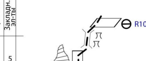
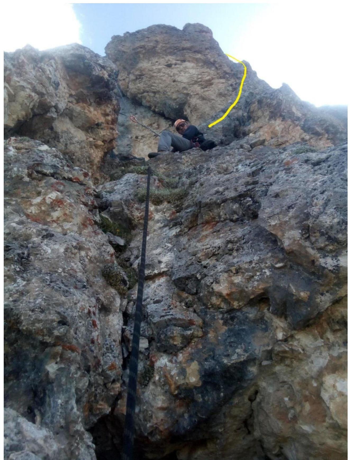
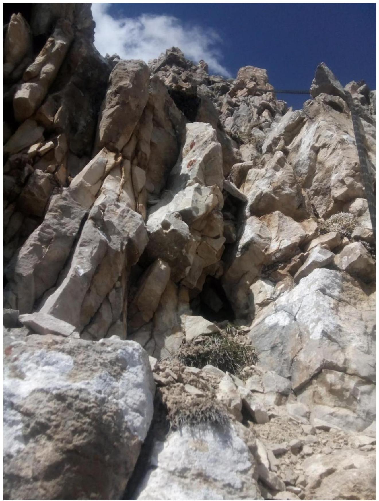
R8–R9 From the ledge, up and right on smoothed rocks 12 m, 70°, 4+ cat., and 7 m traverse right to an internal corner 75°, 4+ cat. Up the vertical internal corner 20 m, 5 cat., to a small ledge for two.
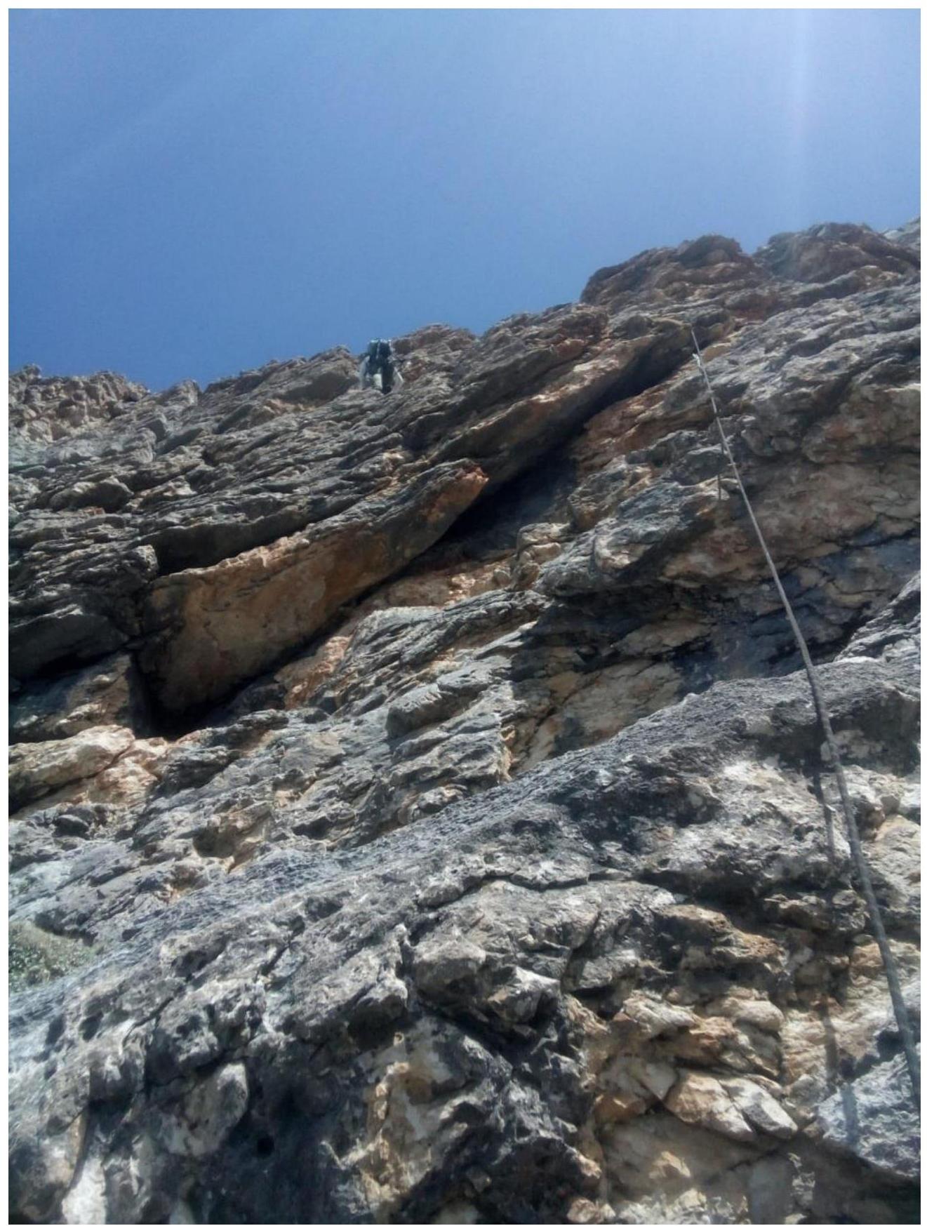
R9–R10 From it, left and up to a protruding rock 10 m, 40°, 3 cat. Up the rock 80°, 5 m, 4+ cat., to a large rock recess with a series of grottos. The recess ends in an overhang. Up it 20 m, 4 cat., 60° to a ledge. The overhang is bypassed on the right.
R10–R11 From the ledge up 10 m, 3 cat., 45° to a monolithic internal corner turning into a chimney with a plug. Up it 40 m, 70°, 5+ cat., to a wide scree-filled ledge.
R11–R12 Further up the wall 10 m, 4 cat., 65° to an internal corner. Up it 35 m, 75–80°, 5 cat., to a ledge.
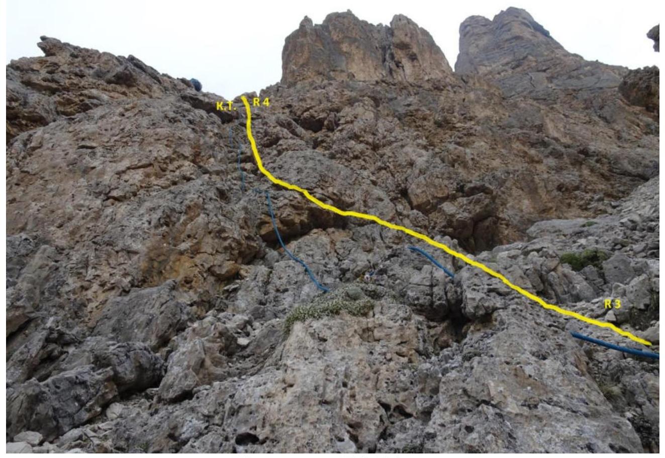
R12–R13 Up a system of scree-filled ledges 50 m, 60°, 4 cat., to a huge scree-filled ledge before the pre-summit tower.
R13–R14 Along the ledge right, bypassing the tower 60 m, 1–2 cat., 20°.
R14–R15 Up the southern, destroyed, rusty wall of the tower 20 m, 75°, 5+ cat. The steepness of the wall increases to an overhang. Here, traverse left 5 m, 90°, 5+ cat., to the edge of the tower.
R15–R16 From the edge starts a destroyed chimney, initially 3 m overhanging, 5 cat. Then 15 m, 50°, 4 cat. The chimney ends in a wall and a system of destroyed ledges 30 m, 3+ cat., 40°.
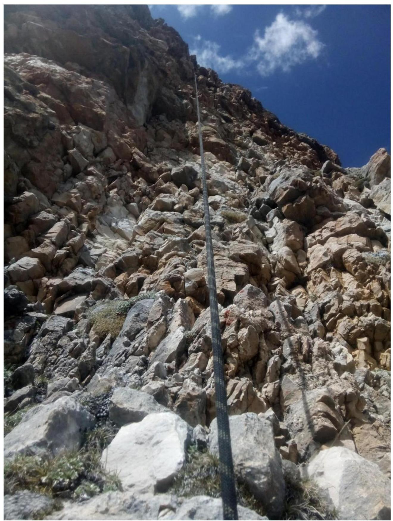
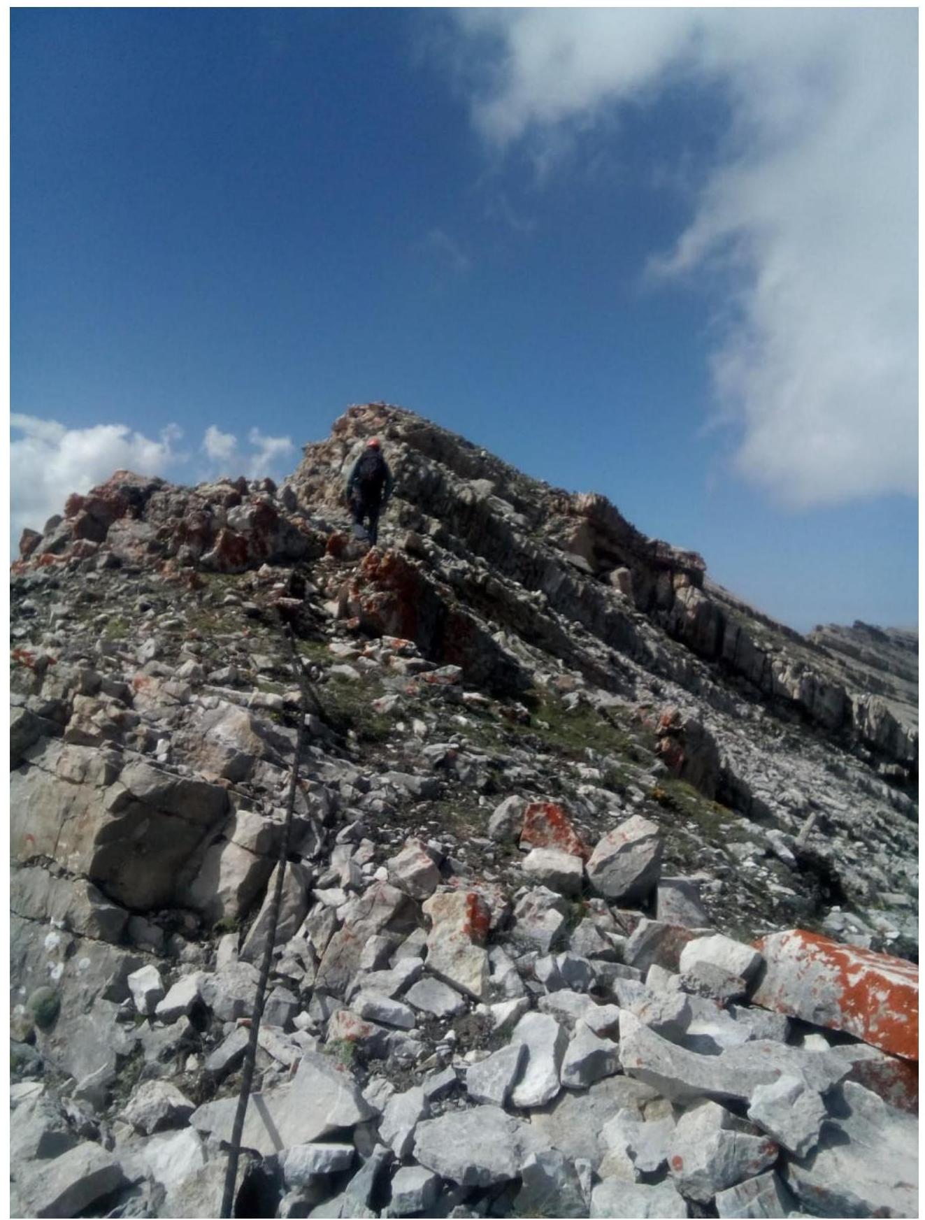
R16–R17 Along the pre-summit ridge 200 m, 20°, 1–2 cat. Descent via the ascent route with 7 rappels.
Recommendations: The route corresponds, in our opinion, to a strong 4B category of difficulty. The first part of the route to R7 is quite destroyed, with many loose rocks. There's a risk of dislodging a rock onto a partner in the R2–R3 couloir. The main part of the route is monolithic. Most difficult pitches have relief suitable for protection and active holds. "Friends" from small to medium were used actively. Chocks — medium and large. Pitons and anchors. The most unpleasant and difficult section is R14–R15. Difficult climbing on destroyed rocks with minimal possible protection. A few small "friends" are desirable.
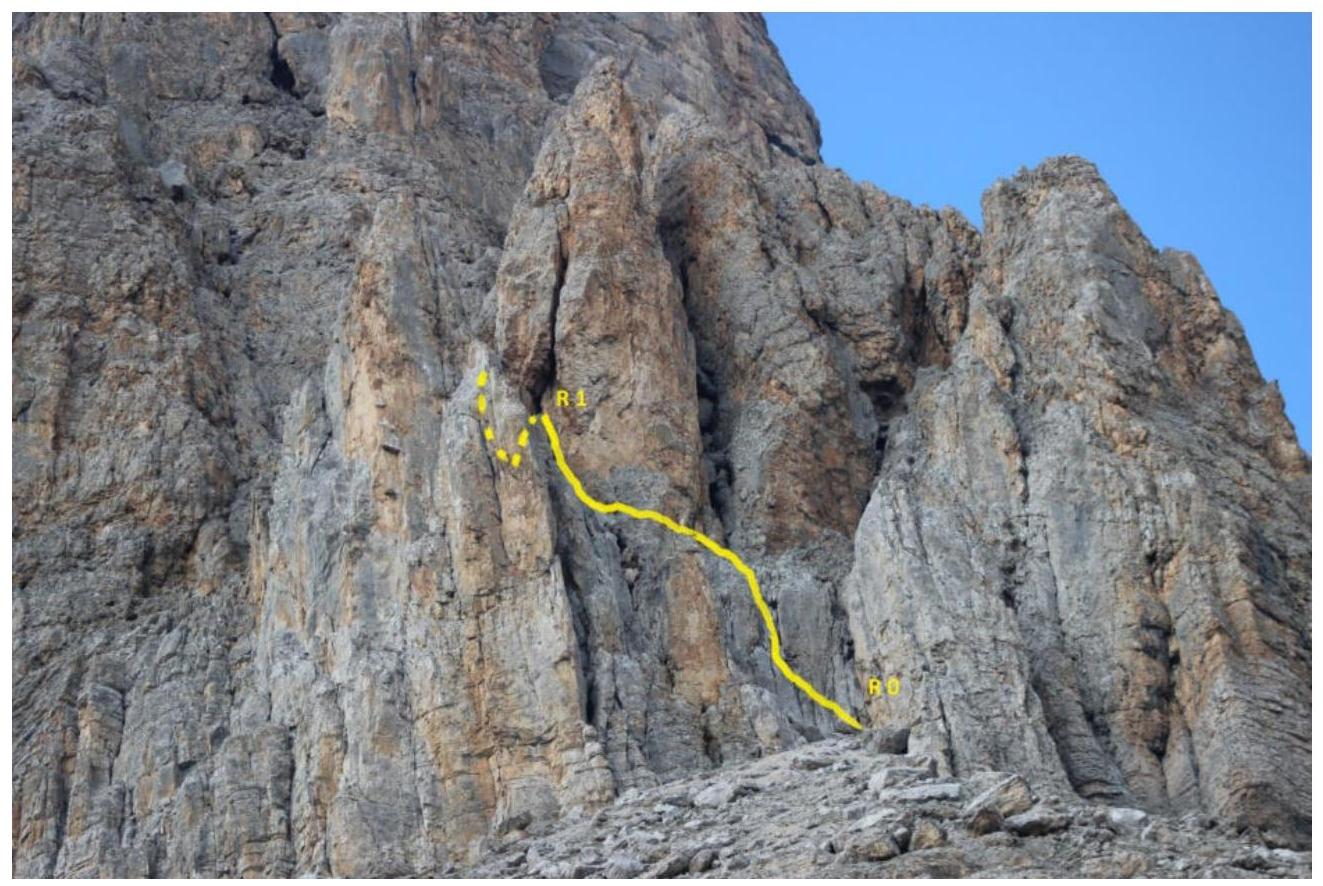
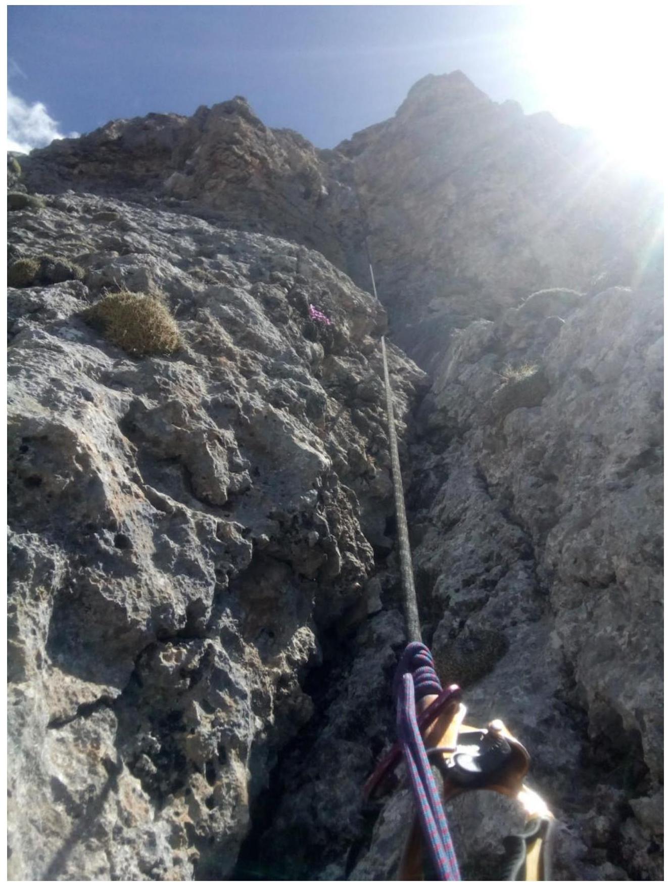
Section R0–R1
Continuation of section R0–R1
Section R1–R2
On section R3–R4
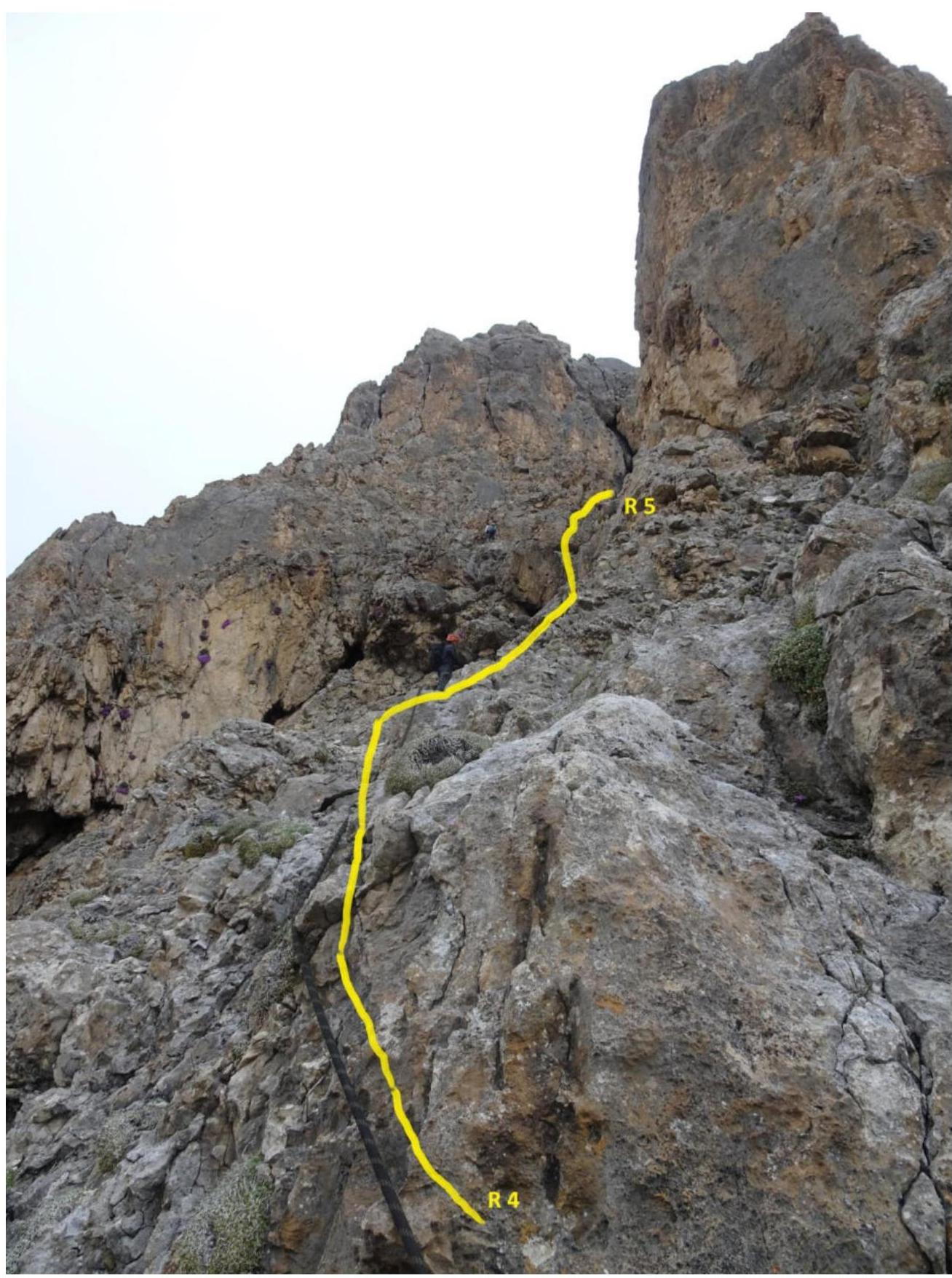
Section R4–R5

Section R5–R6
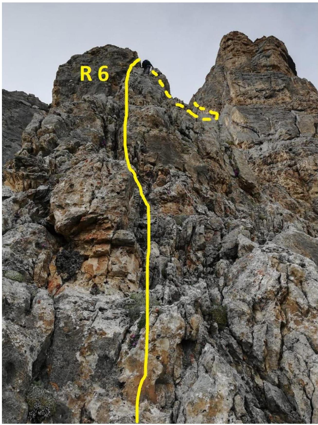
Continuation of section R5–R6
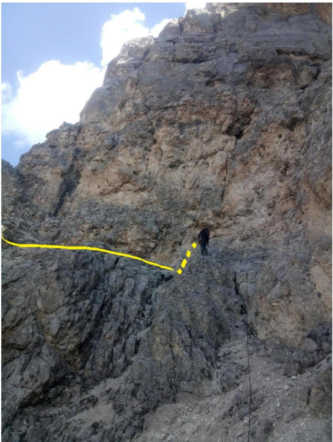
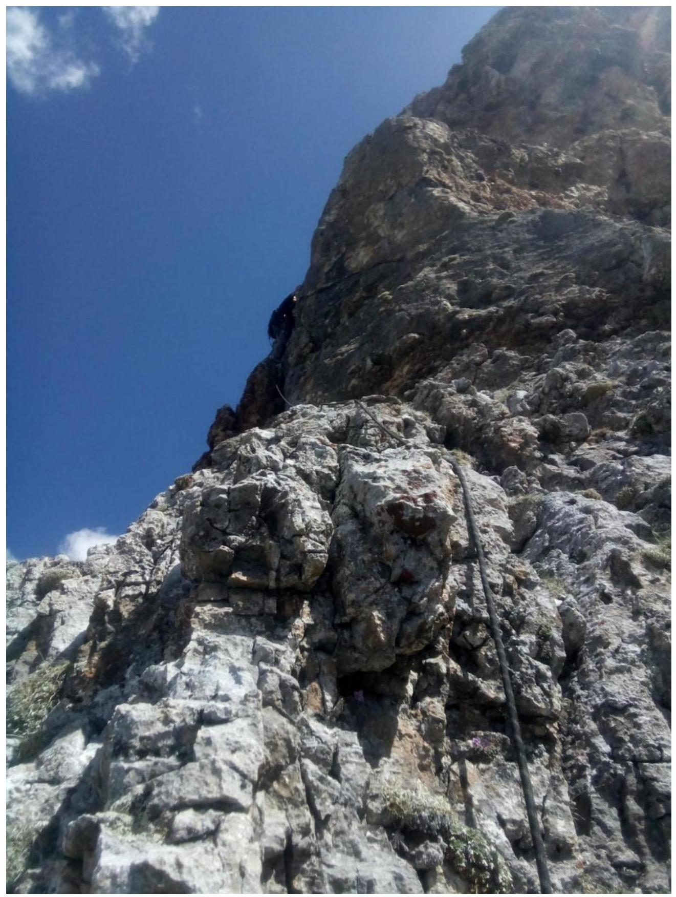
R6–R7
R7–R8
R8–R9
Start of section R9–R10
Continuation of section R9–R10
R10–R11

Section R10–R11 viewed from above
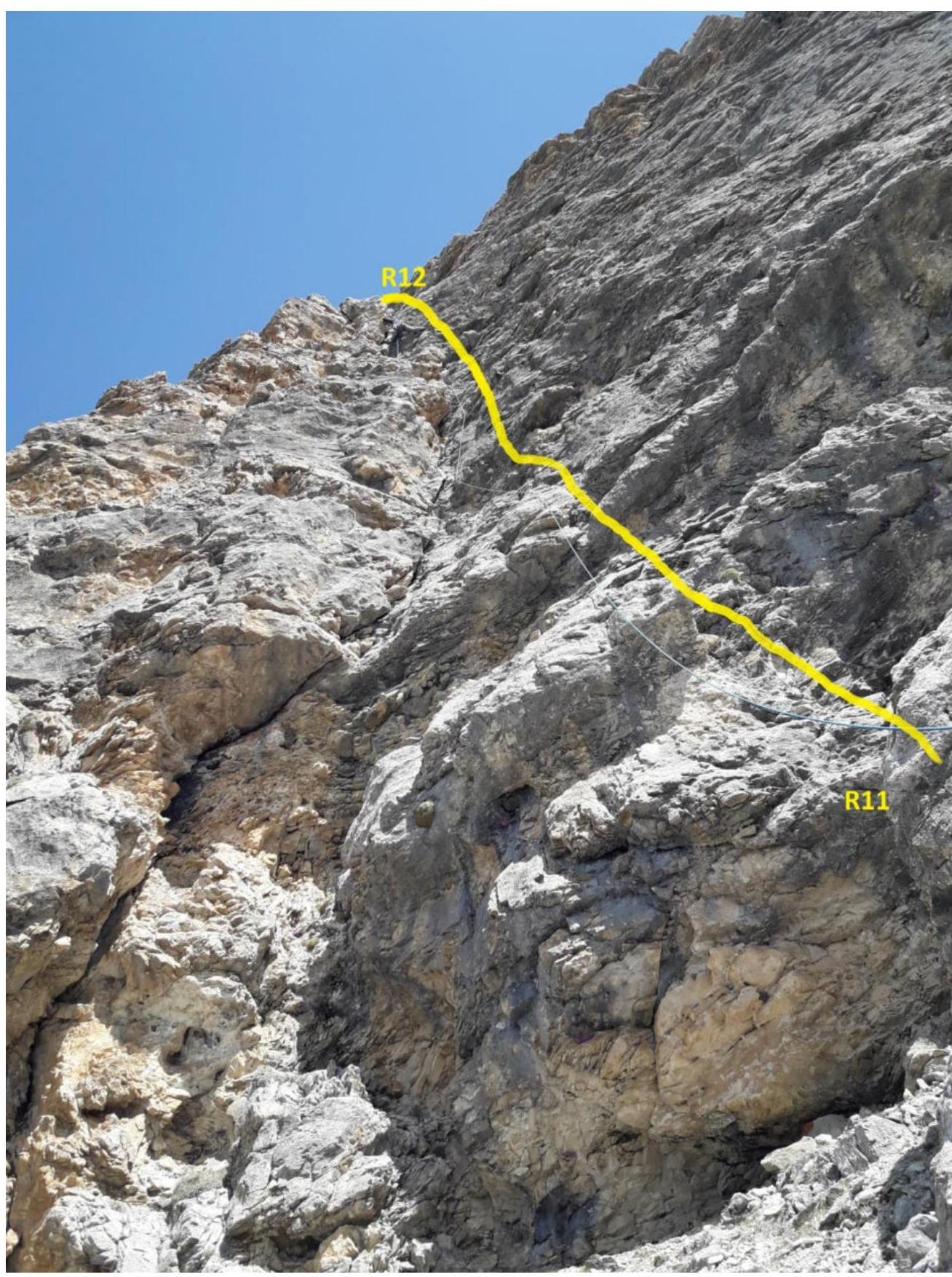
Section R11–R12
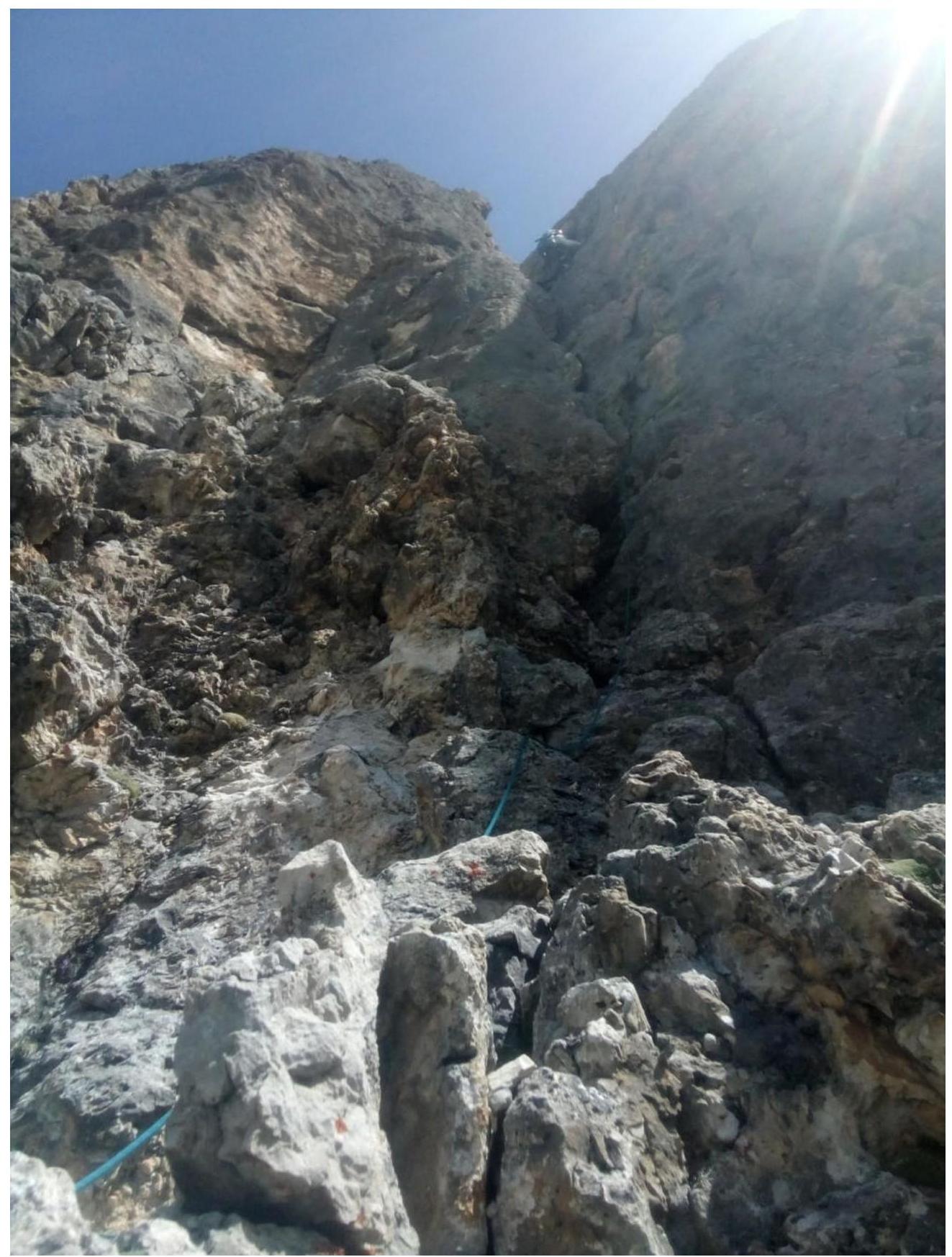
R12–R13
Section R14–R15
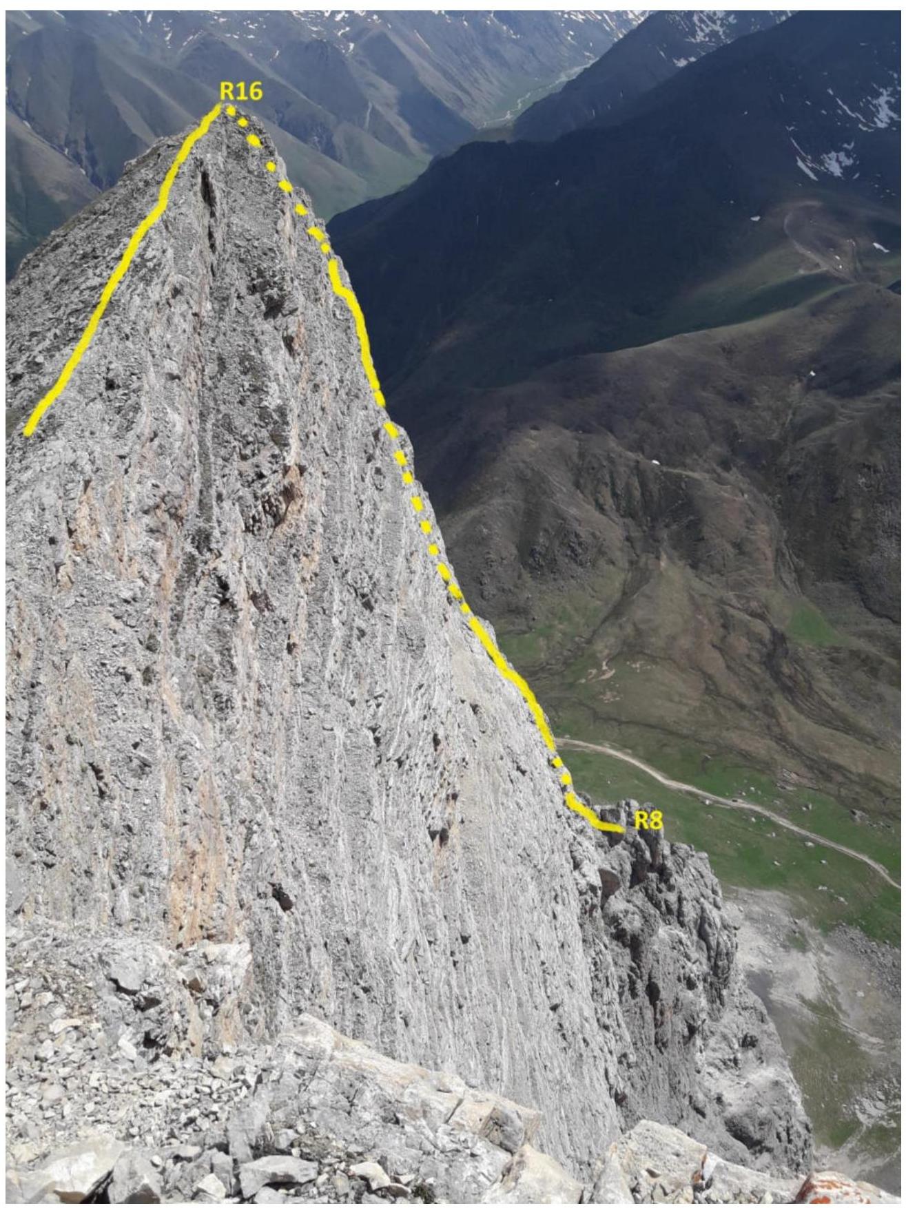
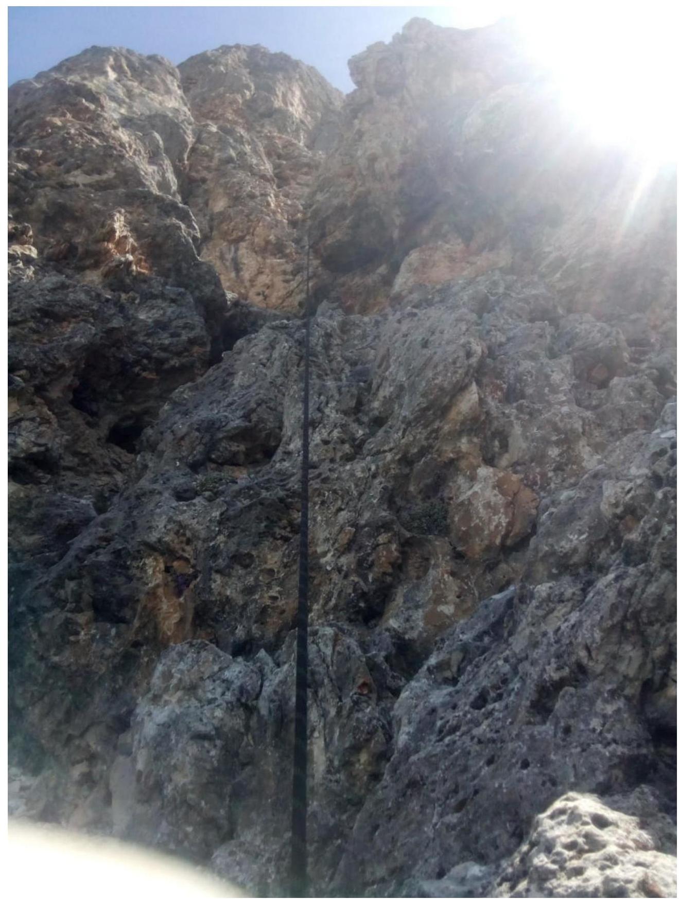
Sections R8–R16
R15–R16
R16–R17
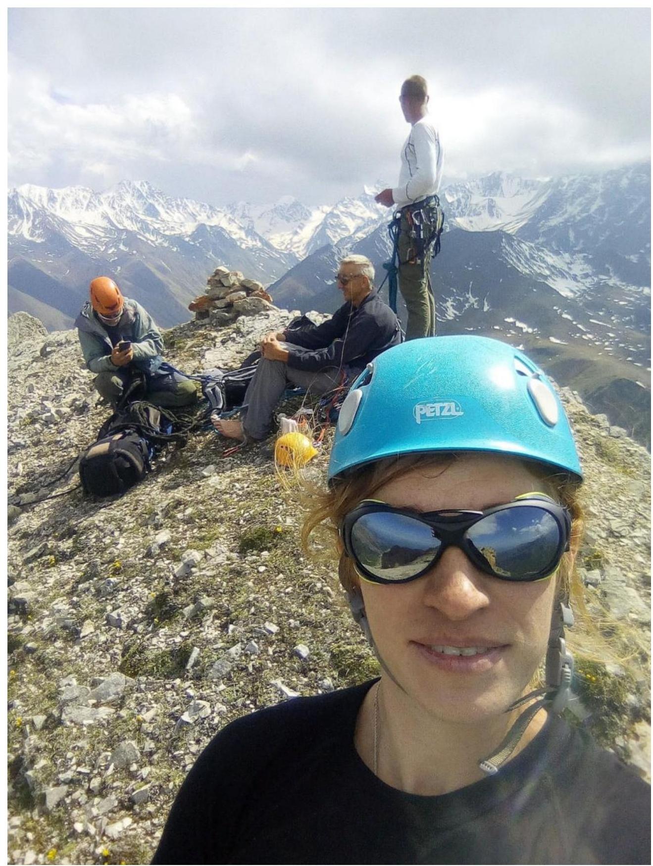
Photo at the summit