REPORT
on the ascent to peak 3930 (Paton Peak) in the Caucasus, made by participants of the Ukrainian scientific sports expedition
- Organization
Ukrainian Mountaineering and Rock Climbing Federation
- Location
Russia, Caucasus, Elbrus region
- Period
from August 4 to August 23, 2004
-
Leader: Simonenko V.K., senior coach: Gorbenko M.M.
-
Participants: 5 people
-
Climbing information:
| No. | Date of reaching the summit | Peak and route | Difficulty category | Leader, participants |
|---|---|---|---|---|
| 1 | August 14, 2004 | Via SE slope, partial traverse | 1B | Simonenko V.K. — leader, Shumikhin V.S., Lebedenko V.S., Ovcharenko V.D., Slavinsky P.S. |
| 2 | August 15, 2004 | Via S ridge, partial traverse | 1B | Ovcharenko V.D. — leader, Bakay A.S. |
| 3 | August 15, 2004 | Via N edge of E ridge | 2A | Gorbenko M.M. — leader, Shumikhin V.S. |
-
No qualification standards were set
-
No injuries or accidents occurred
Expedition leader: V.K. Simonenko
Senior coach: M.M. Gorbenko
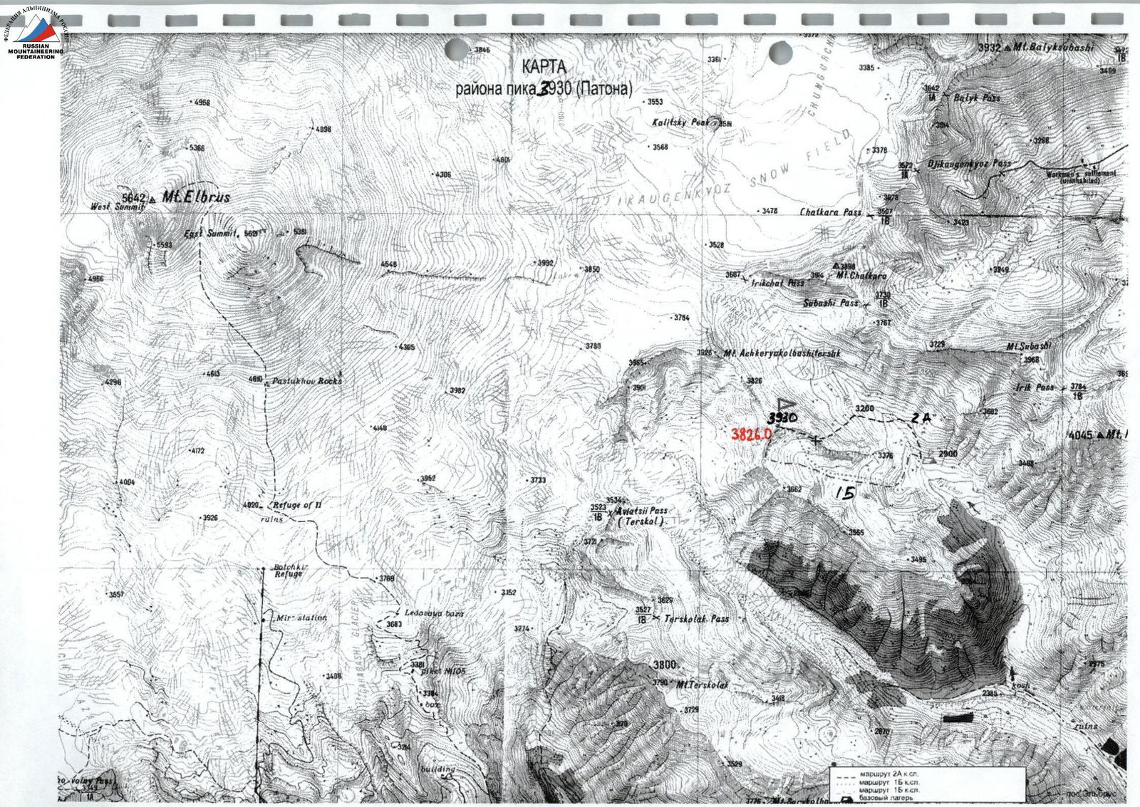
BRIEF OVERVIEW OF THE CLIMBING AREA
The Irikchat valley has long been known to mountaineers and hikers for its peaks Irikchat, Kezgenbashi, Soviet Warrior, passes Irikchat and Chat, and, of course, Elbrus towering above them all.
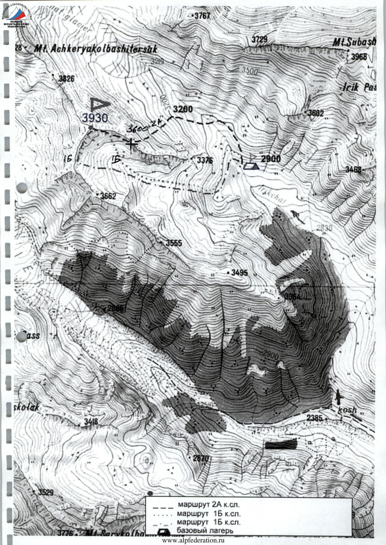
In the southeastern ridge of Elbrus, with the peak Askerkolbashi, which separates the basins of the Irik and Irikchat rivers, lies an unnamed nodal peak 3930. From it, a short ridge with an impressive rocky group of peaks — jandarms — branches off to the east.
Below them, in a picturesque green valley of Irikchat, there is a convenient location for a base camp (altitude 2900 m).
There is a small glaciation on both sides of the eastern ridge. In the summer of 2004 (July-August), peak 3930 was heavily snow-covered.
The approach from the village of Elbrus along the Irikchat valley to the camp is described in "Baksan Valley" by A. Naumov.
From the mountaineering camps under peak Irikchat, it takes another 1.5 hours to reach the base camp in the direction of the Irikchat pass.
3767
ROUTE SCHEME
to peak 3930 (Paton) via the Southern ridge and SE slope
ASCENT DOCUMENTATION
| 1. | Climbing area | Caucasus, Irikchat valley |
|---|---|---|
| 2. | Peak | 3930 m (Paton Peak) via N edge of E ridge |
| 3. | Difficulty category | 2A |
| 4. | Route characteristics: | |
| — Altitude difference | 700 m | |
| Average steepness of the edge (3300–3600 m) | 40° | |
| 5. | Pitons hammered: | |
| — Rock | 2 pcs. | |
| — Ice | 2 pcs. | |
| 6. | Climbing hours | 4 hours |
| 7. | Overnight stays | — |
| 8. | Participants | M.M. Gorbenko — 3rd sports category, V.S. Shumikhin — Master of Sports |
| 9. | Coach | M.M. Gorbenko — Honored Coach of Ukraine |
| 10. | Summit ascent | August 15, 2004 |
| Return to BC | August 15, 2004 | |
| 11. | Organization | Ukrainian Mountaineering and Rock Climbing Federation |
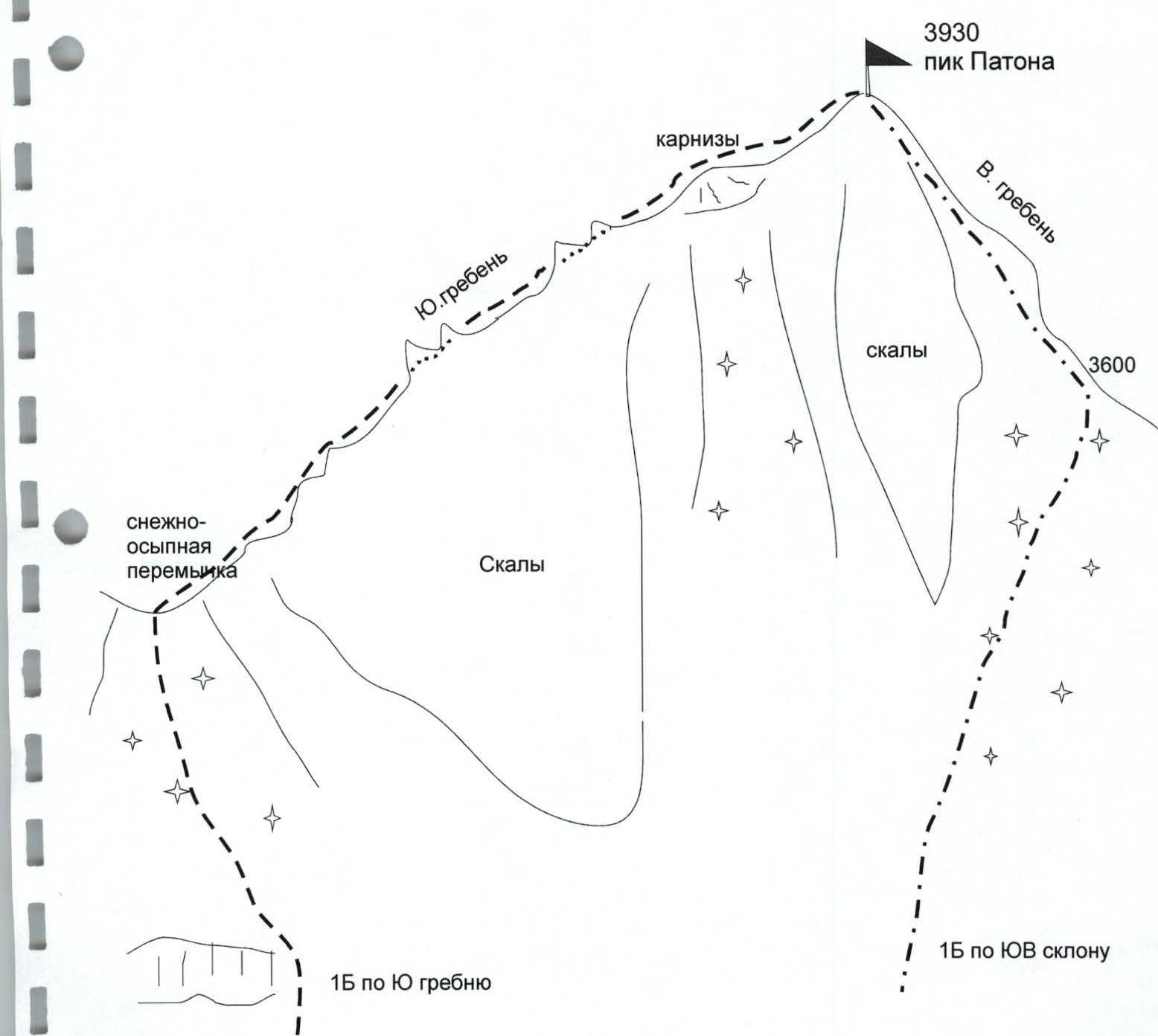
BRIEF DESCRIPTION OF THE ROUTE
to peak 3930 (Paton Peak) 2A category
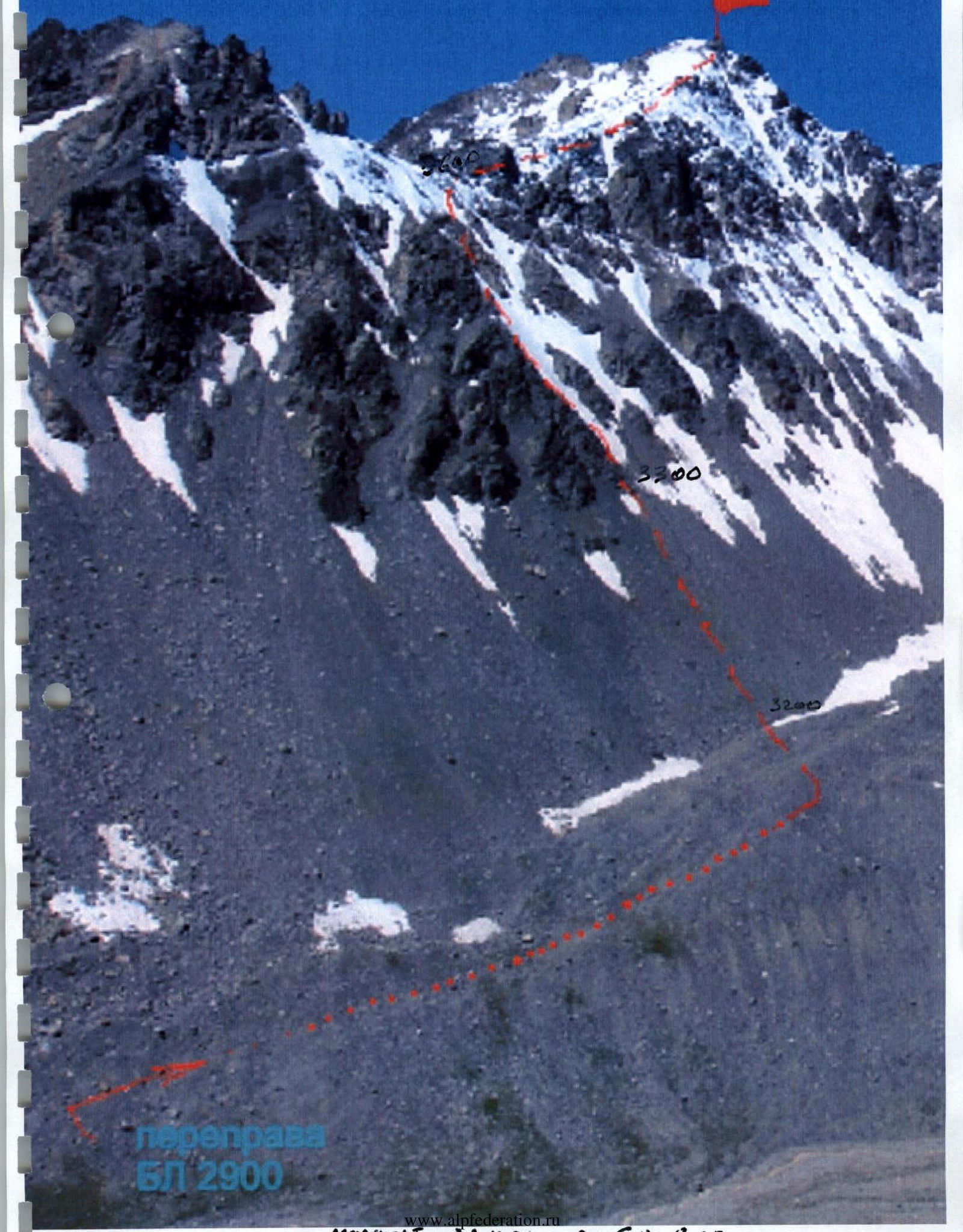
The approach to the route from the base camp takes 1 hour. The crossing of the Irikchat river is 15 minutes below the start of the route (near a large boulder). The route begins on the middle scree opposite the lateral moraine. The general direction is to the left of the saddle, heading towards the rocky trident, led by a steep edge. To the right lies the route to the saddle, category 1B, via a snowy slope with rocky "islands" — quite prone to rockfall and not recommended.
The approach to the rocks along the scree slope is 200 m, then 20 m along the snowy slope, and a transition to the rocky edge. The ascent along easy rocks with protection through ledges leads to the first jandarm, bypassed on the left; the second jandarm is bypassed on the right. A small 3-meter sheer rock wall is climbed "en face" with variable protection.
Above, there is a logical transition:
- to the right onto steep ice (crampons);
- along the ice — 60 m upwards.
Further, the slope becomes gentler, and along the snow (100 m), it leads to the saddle, approximate height 3600 m (equipment can be left here). From there, along easy scree-covered rocks, upwards to the right for 1 hour. The summit tower is ascended from the left. The route takes 4 hours.
The descent follows the ascent route to the saddle and then:
- down the southern slope into the snowy cirque of the hanging valley (via the route of category 1B);
- lower down, between the "ram's horns" rocks, to the right and down to the snowfield leading to the Irikchat river;
- crossing the river above the base camp by 250 m.
The route is recommended for training groups when completing the 3rd sports category.
UIAA SCHEME
of the route to peak 3930 (Paton) via the Northern edge of the Eastern ridge
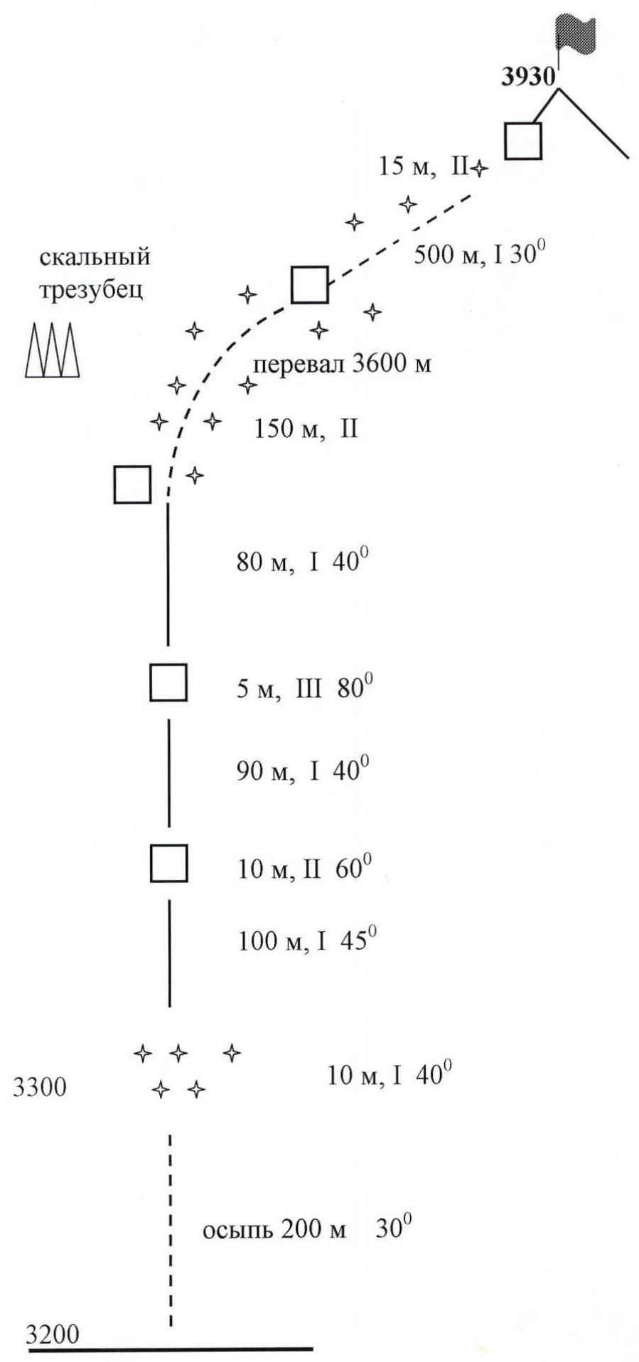
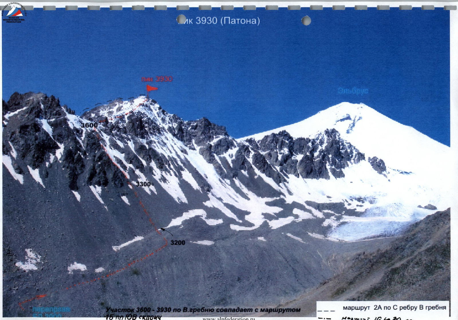
The section 3600–3930 along the E edge coincides with the route 1B via the SE slope of peak 3930.
Paton Peak. View when approaching the BC along the Irikchat valley. On the left — routes category 1B via the S ridge and SE slope. In the foreground — the eastern ridge leading to Paton Peak. On the right — the approach along the valley to the route category 2A.
Northern edge and route category 2A.
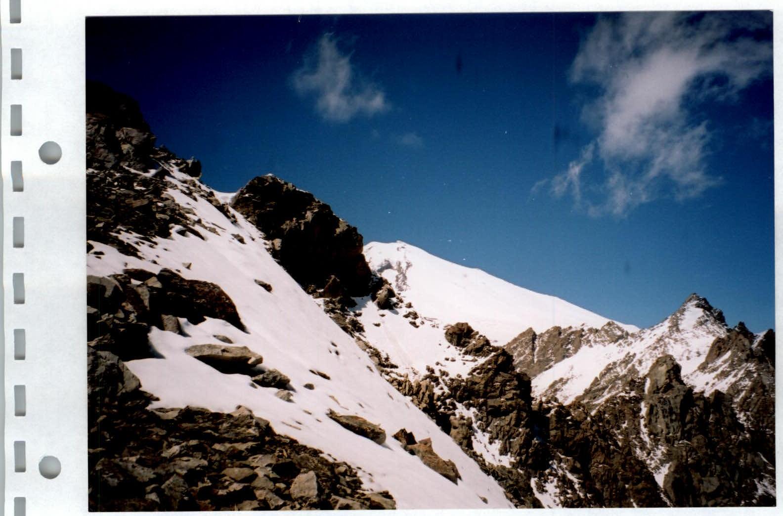
Ascent along the Northern edge (2A) to the 3600 m col.
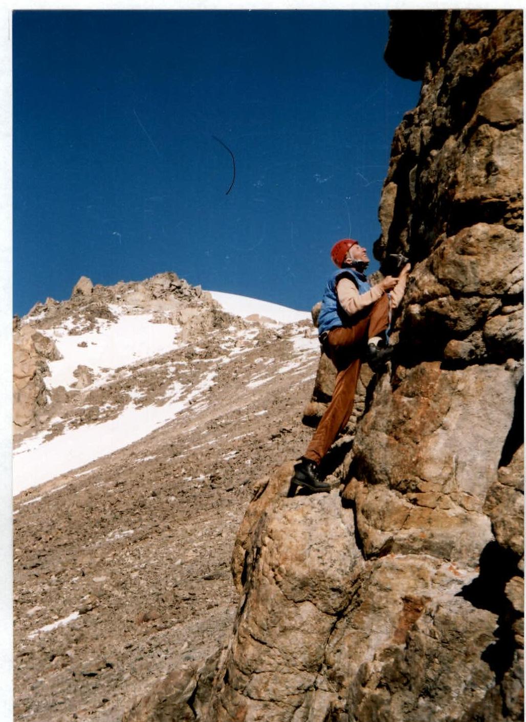
Passing the summit tower.
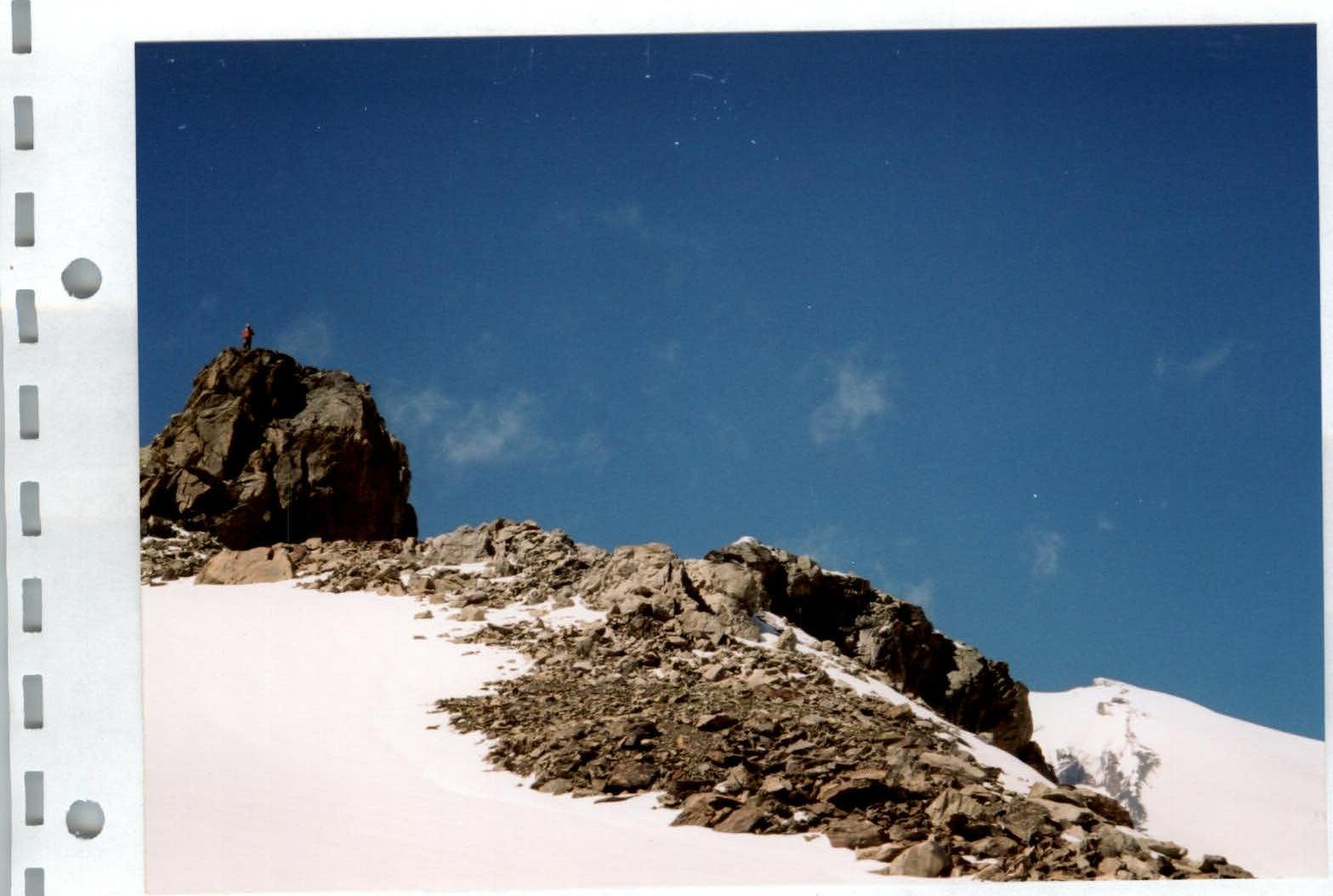
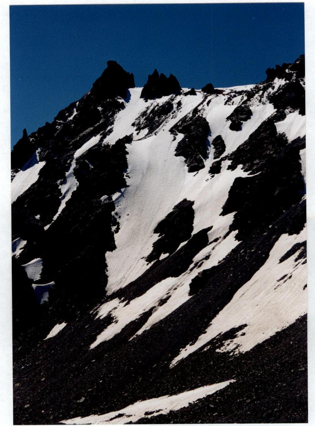
Summit tower of Paton Peak.
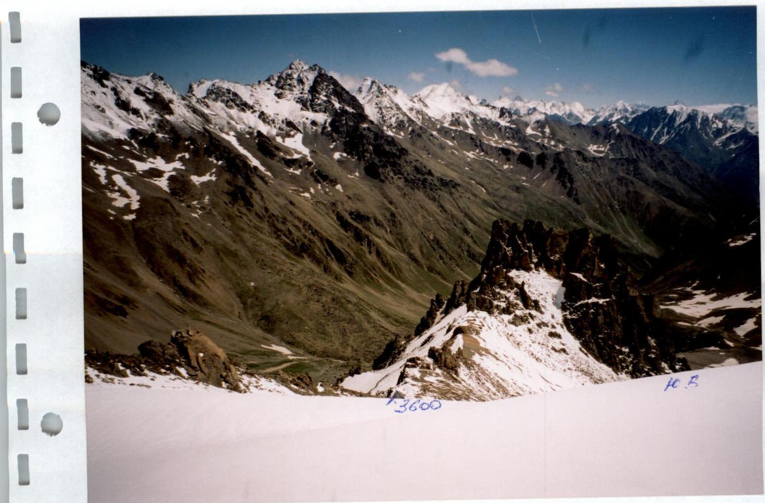
View from the summit 3930 (Paton) down to the SE snowy slope (1B) and the Irikchat river valley. In the background — peaks Irikchat, Kezgen, and Soviet Warrior (from left to right).