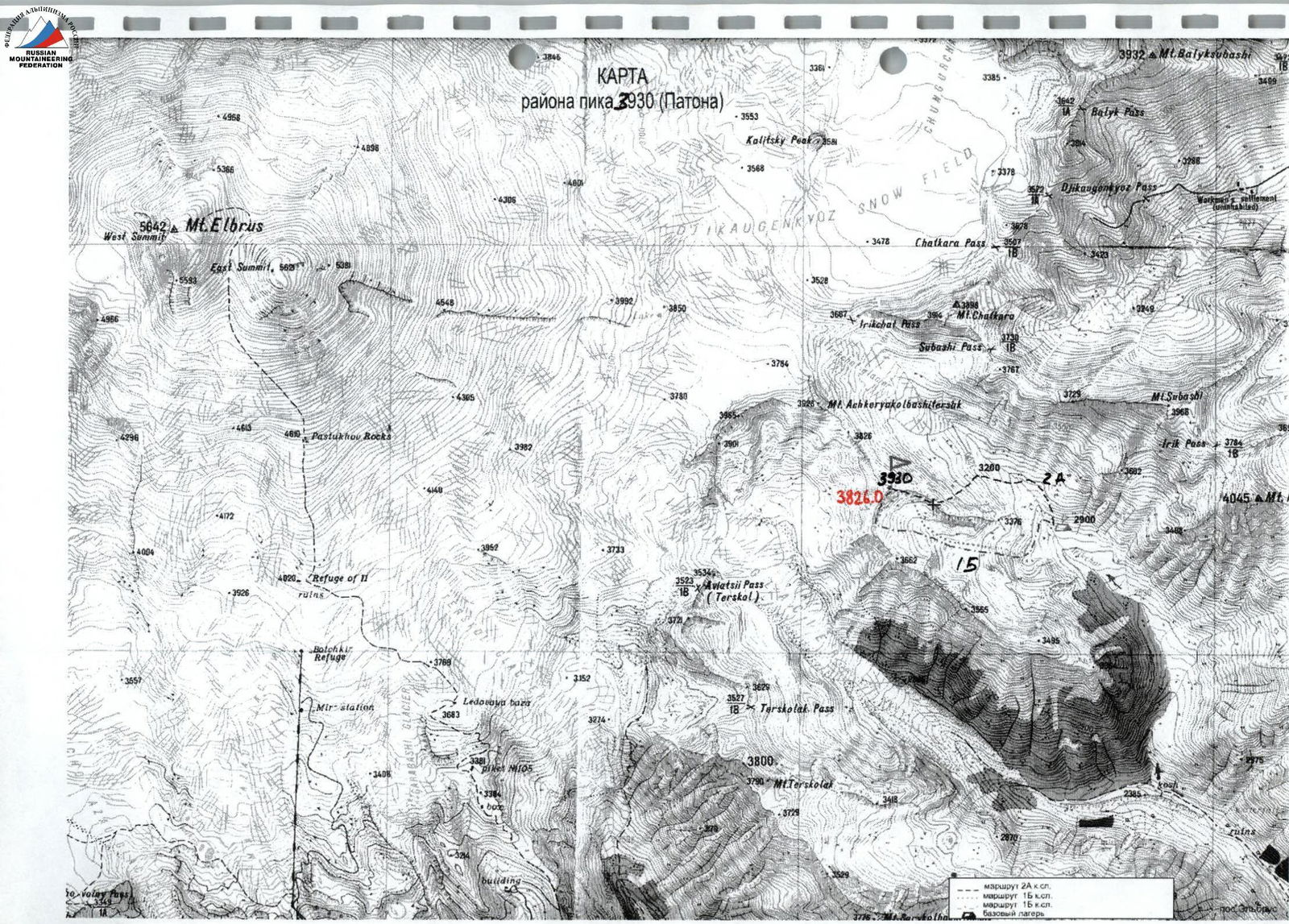

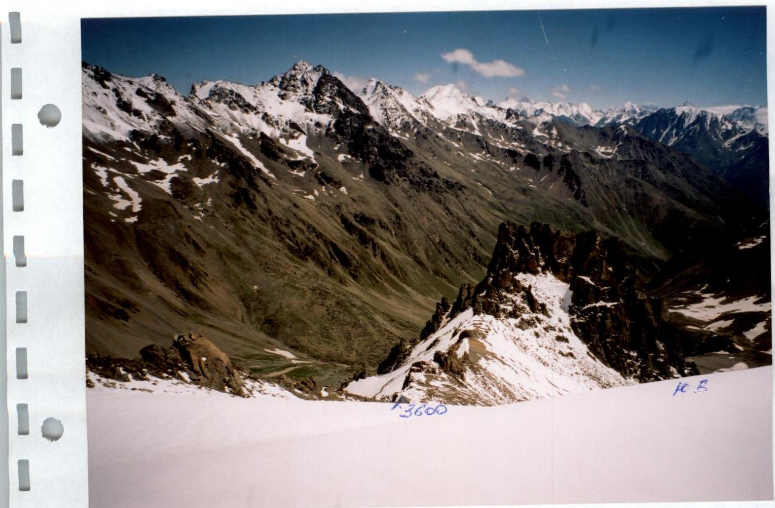
- 2A cat. difficulty route
- 1B cat. difficulty route
- 1B cat. difficulty route
- base camp
Report
on ascents to peak 3930 (Paton's peak) in the Caucasus, made by participants of the Ukrainian scientific and sports expedition
- Organization
Alpinism and Rock Climbing Federation of Ukraine
- Location
Russia, Caucasus, Elbrus region
- Period
from August 4 to August 23, 2004
-
Leader: Simonenko V.K. Senior coach: Gorbenko M.M.
-
Participants — 5 people
-
Information about ascents:
| No. | Date of reaching the summit | Summit and route | Cat. diff. | Leader, participants |
|---|---|---|---|---|
| 1 | 14.08.04 | Along SE slope, first ascent | 1B | Simonenko V.K. — leader, Shumikhin V.S., Lebedenko V.S., Ovcharenko V.D., Slavinsky P.S. |
| 2 | 15.08.04 | Along S ridge, partial ascent | 1B | Ovcharenko V.D. — leader, Bakay A.S. |
| 3 | 15.08.04 | Along N edge of S ridge, partial ascent | 2A | Gorbenko M.M. — leader, Shumikhin V.S. |
-
Qualification standards were not expected to be met
-
There were no injuries or accidents
Expedition leader V.K. Simonenko
Senior coach M.M. Gorbenko
Brief overview of the ascent area
The Irikchat gorge has long been known to mountaineers and mountain tourists for its peaks Irikchat, Kezgenbashi, Soviet Warrior, Irikchat and Chat passes, and, of course, Elbrus towering above all and closing the gorge.
In the southeastern ridge of Elbrus with the peak Askerkolbashi, which separates the basins of the Irik and Irikchat rivers, there is a nodal unnamed peak 3930. A short ridge with an impressive rocky group of peaks — gendarmes — extends east from it.
Under them, in the picturesque green valley of Irikchat, there is a convenient place for a base camp (altitude 2900 m).
There is a small glaciation on the left and right of the Eastern ridge. In the summer of 2004 (July — August), peak 3930 was heavily snow-covered.
The approach from the Elbrus village through the Irikchat gorge to the bivouac is described in "Baksan Valley" by A. Naumov. From the mountaineering camps under peak Irikchat to the base camp, it is necessary to walk another 1.5 hours towards the Irikchat pass.
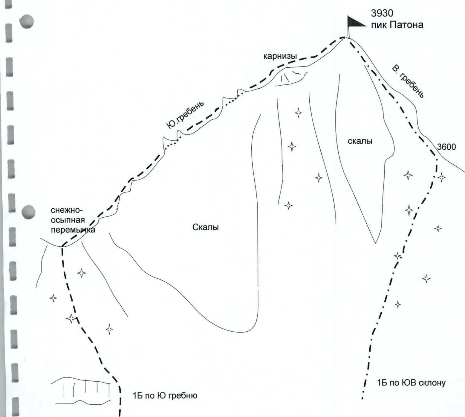
Scheme of routes
to peak 3930 (Paton's peak) along S ridge and SE slope
Ascent passport
| 1. | Ascent area | Caucasus, Irikchat gorge |
|---|---|---|
| 2. | Summit | 3930 m (Paton's peak) along S ridge |
| 3. | Cat. diff. | 1B, partial ascent |
| 4. | Route characteristics: | |
| — Height difference | 600 m | |
| — Average steepness of the edge | 30° | |
| 5. | Number of pitons driven: | |
| — Rock | --- | |
| — Ice | --- | |
| 6. | Duration | 4 hours |
| 7. | Overnight stays | --- |
| 8. | Participants | V.D. Ovcharenko — MS, A.S. Bakay — CMS |
| 9. | Coach | A.S. Bakay |
| 10. | Summit ascent | August 15, 2004 |
| Return to BC | August 15, 2004 | |
| 11. | Organization | Alpinism and Rock Climbing Federation of Ukraine |
Brief description of the route passage
to peak 3930 (Paton's peak) along S ridge, 1B cat. diff.
From the camps on the left (orographic) bank of the Irik river:
- crossing this river (200 m above the camps)
- ascent up along the grassy slopes and scree closer to the rocks of the Eastern ridge to the "ram's foreheads"
- further along the scree and snow to the tongue of the glacier towards Paton's peak
- ascent along the steep snowy-scree slope to the snowy saddle of the S ridge, north of the pass saddle.
From the camps — 3 hours.
Further up to the right along the S ridge, along the destroyed rocks and snowy ridges (cornices to the East) to the 15-meter summit tower. Along the rocks of the tower — to the summit. Simultaneous belay is recommended. The path from the saddle to the summit takes 1–1.5 hours.
Descent along the SE slope.
The section 3600–3930 along the Eastern ridge coincides with the 1B route along the SE slope of peak 3930.
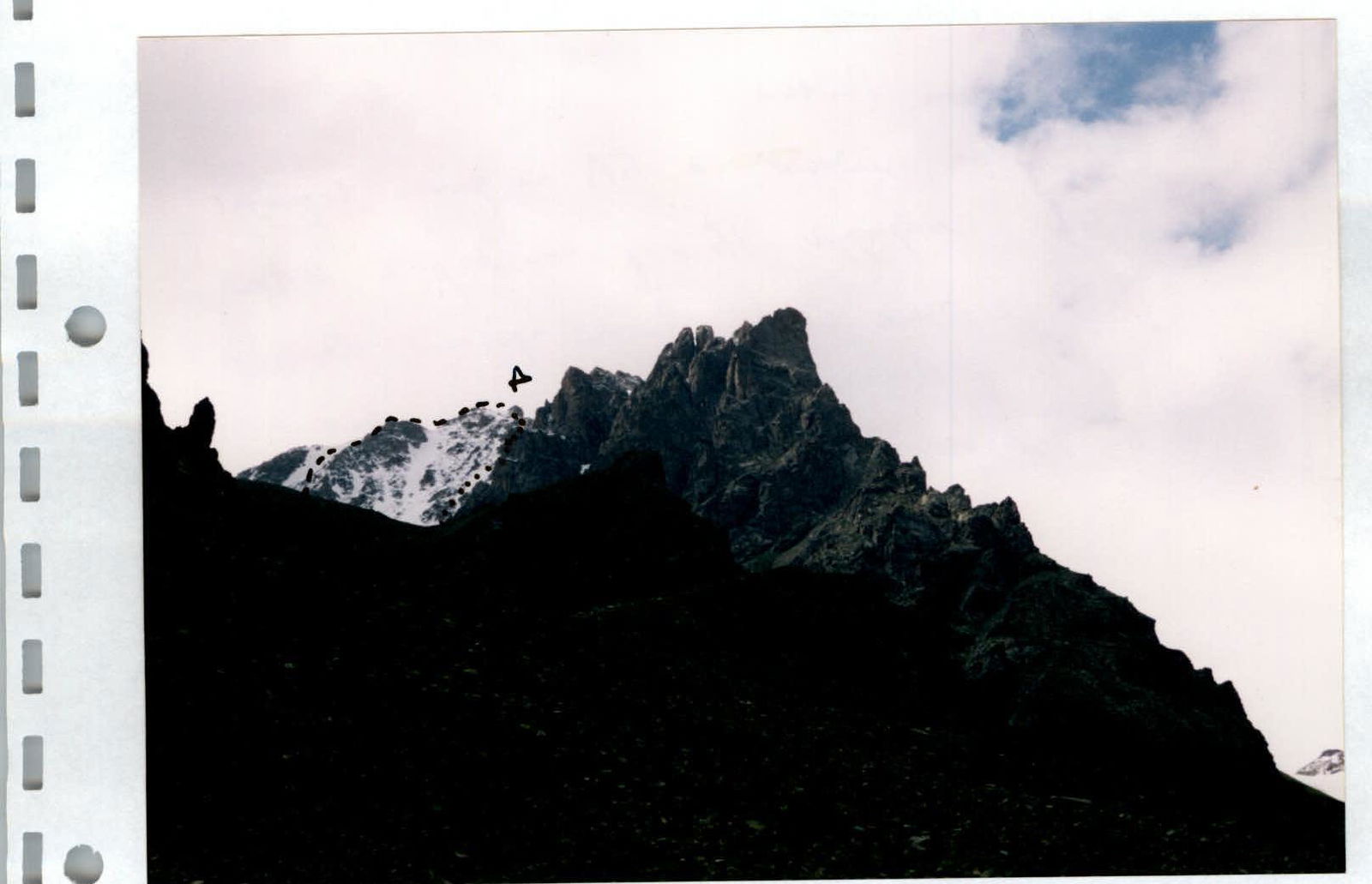
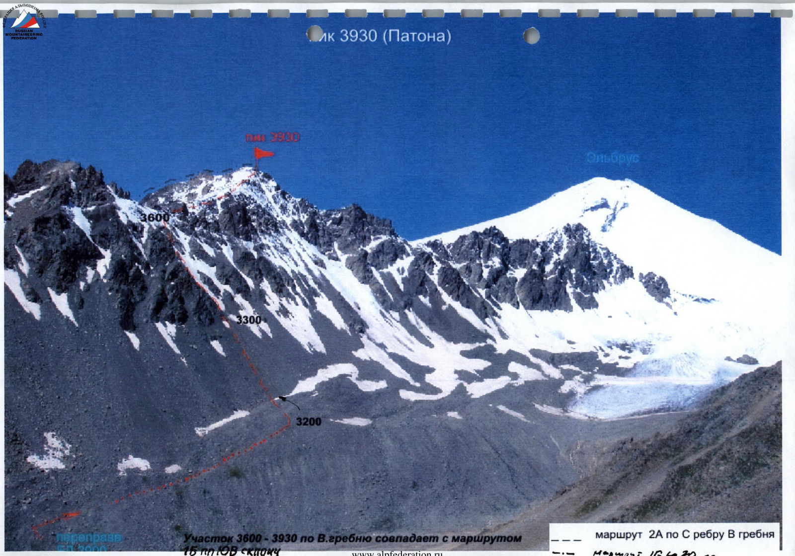
Paton's peak
View on the approach to BC along the Irikchat valley, on the left are the routes:
- 1B cat. diff. along S edge
- 1B cat. diff. along SE slope
In the foreground is the Eastern ridge leading to Paton's peak.
On the right is the entry to the 2A cat. diff. route along the valley.
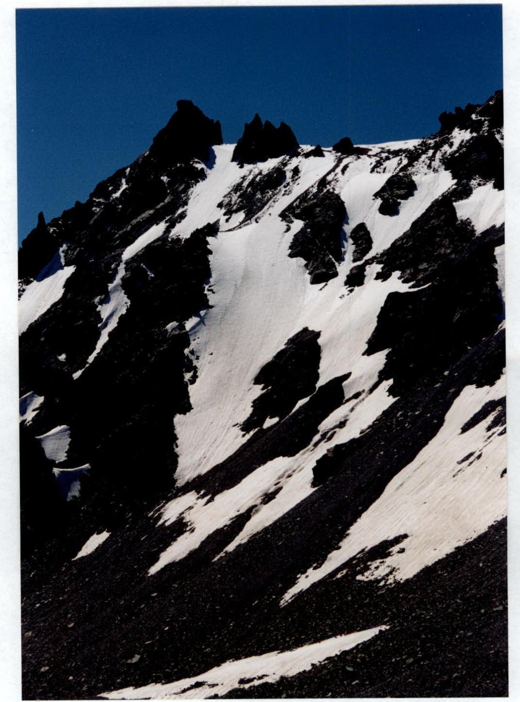
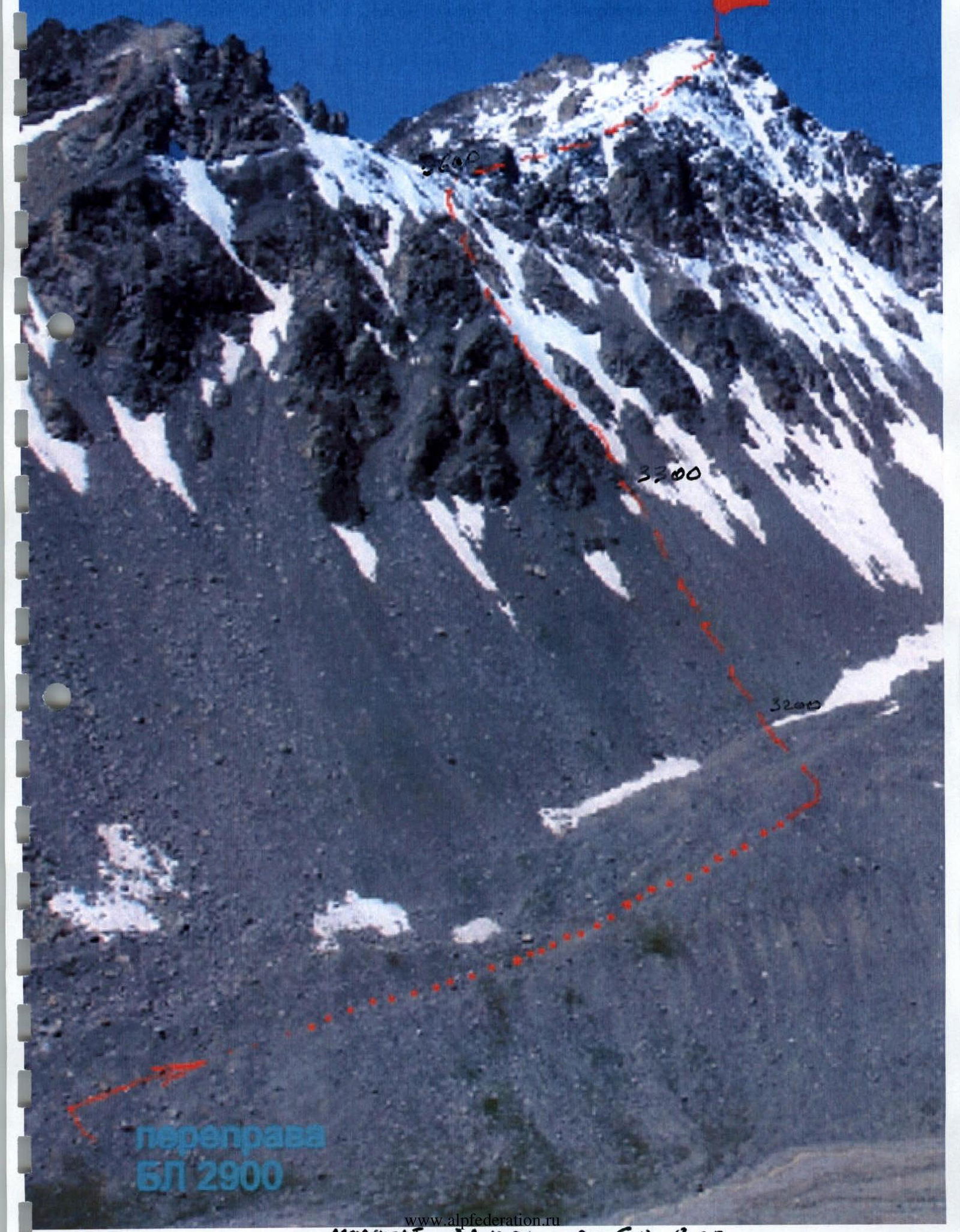
Northern edge and 2A cat. diff. route.

Ascent along the Northern edge (2A) to the 3600 m saddle.
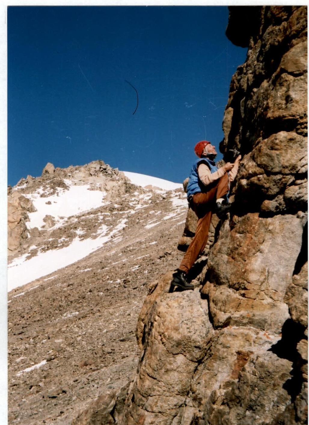
Passing the summit tower.
Summit tower of Paton's peak.
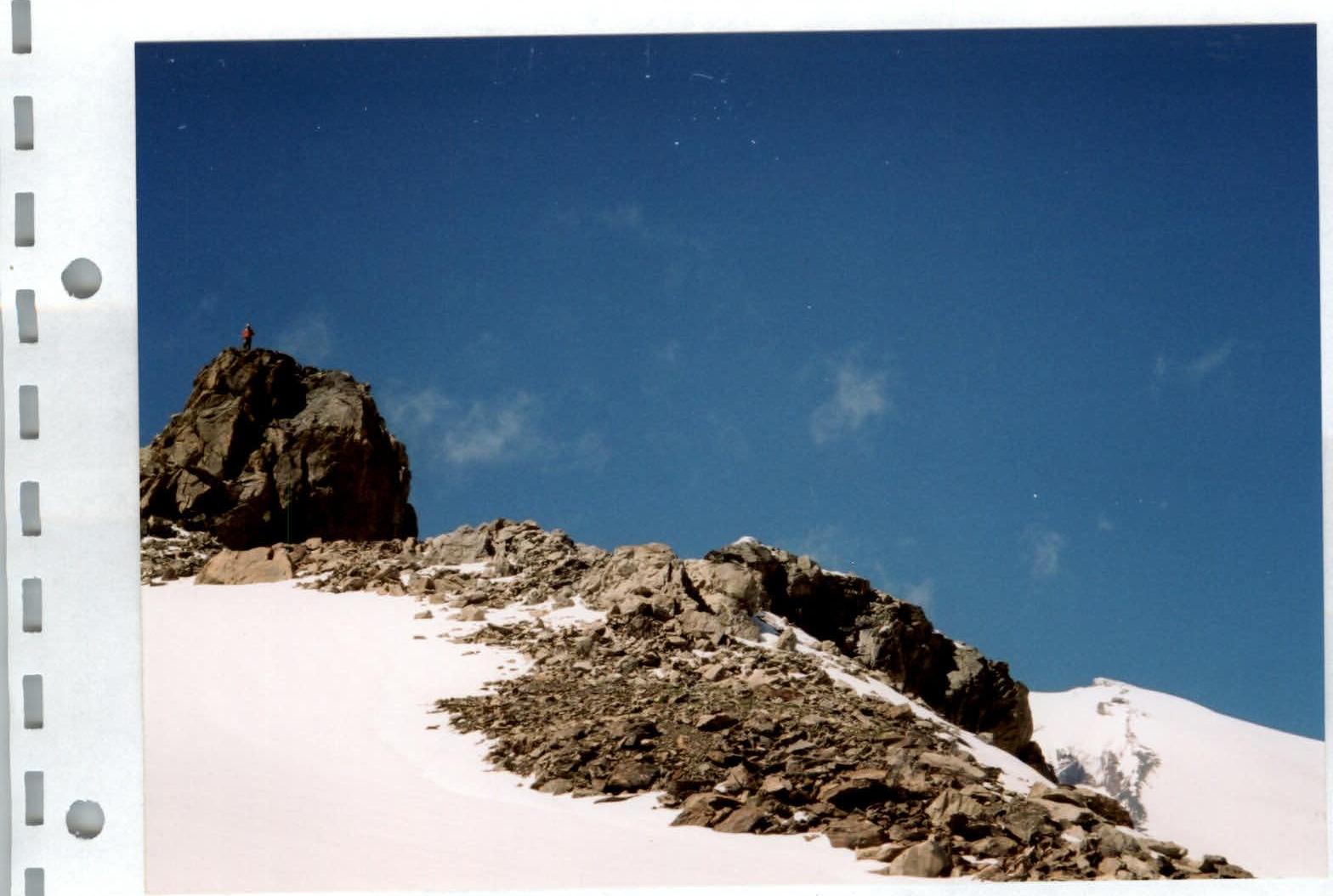
View from the summit 3930 (Paton's peak) down to the SE snowy slope (1B) and the Irikchat river valley. In the background are the peaks:
- Irikchat
- Kezgen
- Soviet Warrior (left to right)