Description
The description is compiled based on materials from the training section of the "Ullutau" alpine camp. From the "Ullutau" alpine base, ascend via the moraine to the "Cheget" campsites, and from there, head towards the "Gumachi" glacier, traversing the ascents of the 1st and 2nd stages (the latter being steeper in its upper part). From mid-July, crevasses are possible (in rope teams).
Alternative route: After passing the "Chotchat" stream, the trail branches off to the right and ascends a steep slope overgrown with rhododendrons to the shoulder of the Eastern ridge of the "Chotchat" peak. Turn right from the shoulder and follow the trail, traversing the orographically left (southern) slope, to reach the left-bank moraine until its end, where there are suitable sites. The journey from the alpine base takes 2–2.5 hours.
From the sites:
- ascend to the "Gumachi" glacier, overcoming the aforementioned ascents;
- continue to the "Gumachi" pass;
- to the left of the pass, a broad snow-ice slope of the Northern ridge is visible, with a gradual increase in steepness;
- move along the ridge towards a rocky gendarme;
- from the gendarme, descend along the ridge and then ascend a steep, narrow slope (with possible cornices) that leads to the pre-summit ridge and further to the summit of "Gumachi".
Movement is in rope teams with alternate belays or via fixed ropes. The return route follows the ascent path. The time required for the ascent from the moraine sites is 6–7 hours. Source: www.ullutau.ru↗ Kuznetsova Yulia

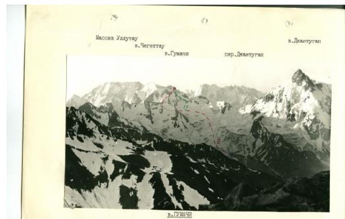
Photo taken on July 14, 1900, of the MEPS pass. Camera "Zabel-100", lens "LOBO T-22" — 70 mm.
1 — via E ridge (Declarativ 20) 18 cat., 2 — via N ridge (Spektrdov 30) 18 cat.