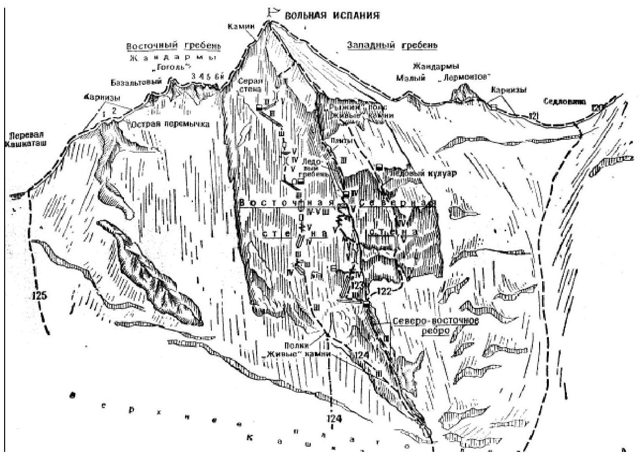
- Volnaya Ispaniya via West Ridge (Category III route)
From the "Dzhantugan" alpine camp (group of 4-8 people) ascend along the Adylsu gorge road. After 300 m, turn right off the road and descend to cross the Adylsu river on a temporary bridge, above the confluence of the stream from the Kashkatau glacier. From the bridge, the trail goes through a flat forest, then steeply ascends and exits onto the left-bank moraine of the Kashkatau glacier. Further ascent along the trail on the moraine ridge leads to platforms at its end. From here, it's possible to ascend 150-200 m up-left to platforms near the "Rusty" cliffs. The initial bivouac is on the platforms. From the "Dzhantugan" alpine camp, 3-4 hours.
From the platforms:
- Ascend along the talus and moraine alongside the glacier upwards
- Then descend to the glacier at the end of the talus
- Ascend on the left side of the glacier (beware of hidden crevasses!)
- Traverse the glacier's icefall from the left under the slopes of Ullukara peak (stonefall and icefall possible from Ullukara peak!)
- After the icefall, ascend a snowy slope to the right onto the upper snow plateau of the Kashkatau glacier
- On the plateau, ascend to the right towards the col of the ridge, located between Volnaya Ispaniya peak on the left and Bzhedukh peak on the right
From the upper snow plateau of the Kashkatau glacier:
- Ascend a steep, местами разорванному snow-ice slope, staying close to the slopes of Volnaya Ispaniya peak (avalanches and icefall possible from Bzhedukh peak!)
- It's better to traverse all crevasses on the slope from the left
- Overcome the large crevasse - bergschrund, crossing almost the entire snow-ice slope not far from the col, either on a snow bridge or by traversing it on the right
- After the crevasse, ascend a steep snowy slope and a small ice-snow pitch to the narrow snowy ridge of the col (beware of cornices!)
From the platforms near the "Rusty" cliffs on the left-bank moraine of the Kashkatau glacier, 4-5 hours.
At the col ridge, turn left and ascend the sharp ice-snow ridge (beware of cornices!) to a small platform. From the platform, move along the snow-ice slope on the right side of the sharp ridge (beware of cornices, belay!). Traverse the "Lermontov" gendarme from the left along a steep ice-snow slope (piton belay!). After the gendarme, descend slightly along a steep snowy (beware of cornices!) rocky ridge under the Small Gendarme.
Overcome the Small Gendarme directly via the moderately difficult rocky ridge. After the gendarme, ascend initially along a simple, местами moderately difficult snowy rocky ridge, then along a wide snowy slope. Further, ascend along a weakly expressed rocky gully and again along a snowy slope to exit onto the pre-summit ridge of the peak.
Ascend the summit of Volnaya Ispaniya along the heavily snowy (beware of cornices!) and eroded simple rocky ridge.
From the col, 3-4 hours. Descent via the ascent route to the col - 2-4 hours, with a bivouac on the col. Duration of the route - 3 days.
Special equipment for 4 people:
- main rope - 2×30 m
- auxiliary cordelette - 3 m
- rock pitons - 5-6
- ice screws - 4-5
- carabiners - 8
- rock hammers - 2
- crampons - 4 pairs
- tent - 1
Possible bivouac locations - on the col, snowy ridges, platform, and summit. "Baksan Valley", A.F. Naumov