2622
Traverse of Viatau from northeast to northwest, ~Category II route
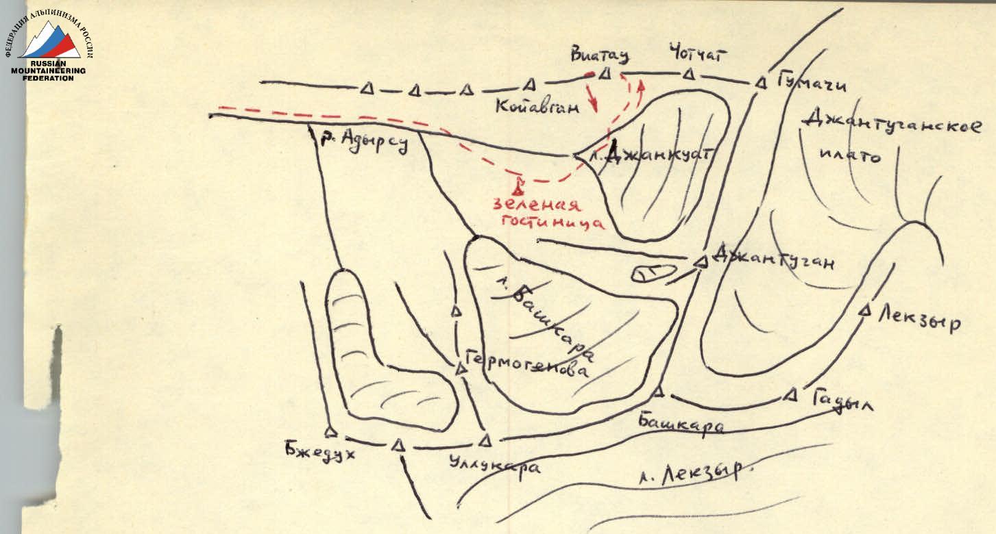
From the "Dzhangutugan" alpine camp, ascend along the trail on the right (orographic) bank of the Adyl-su River, then cross to its left bank via a bridge. Follow the trail along the left bank to the "Green Hotel" clearing. This is the initial bivouac site. The journey from the "Dzhangutugan" alpine camp takes approximately 2 hours.
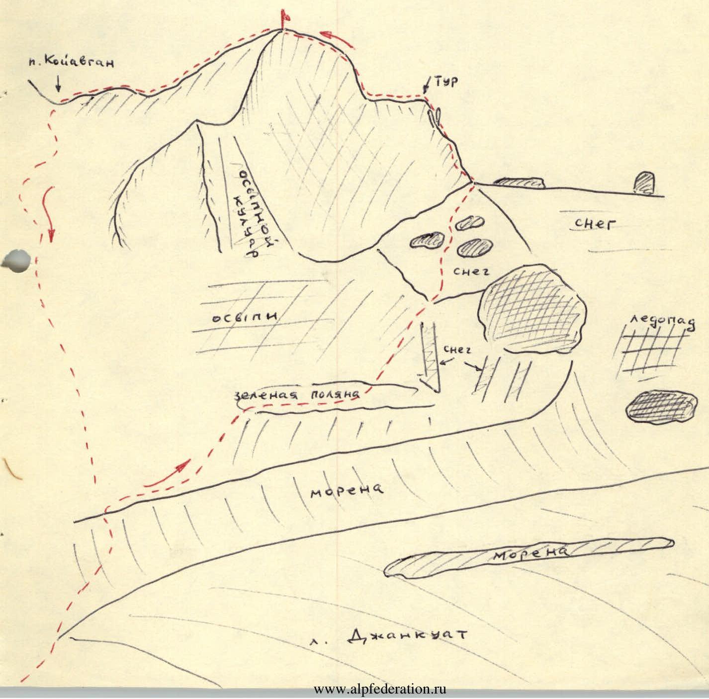
From the "Green Hotel," access the Dzhankuat Glacier and move upwards along it, sticking to its right side. After 350–400 m, turn left and ascend to the right-bank moraine at its lowest point. Continue the ascent along the moraine.
Having passed the foot of the Western ridge of Viatau peak, turn left, descend from the moraine, and ascend along the southern slopes of the Western ridge:
- initially along a grassy slope,
- then across small scree,
- followed by large scree,
- bypassing the base of the broad scree-filled Southern couloir (used by the Category I route),
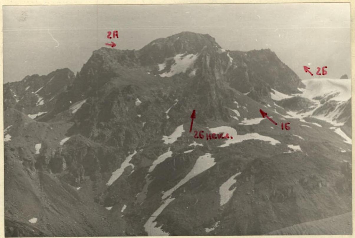
- continue along the scree at the base of the southeastern horizontal ridge to the right of Viatau peak (refer to Fig. I and Photo I).
After the scree, a snowfield begins with a slope of up to 30°. The path lies between small rocky outcrops resembling "sheep's foreheads." The journey from the "Green Hotel" to the southeastern ridge takes 3.5–4 hours.
The further path lies directly along the ridge (do not bypass via ledges as it complicates the route) across solid rocks with good relief (protection via numerous rock outcrops).
After 40 m, there is a gap in the ridge.
80 m further, two rock spires ("Rabbit Ears") stand on the ridge, 7–8 m high. The path lies between or to the right of the "ears."
30 m from the "ears," the ridge becomes almost horizontal. At the start of the horizontal section, there is a cairn. The length of the horizontal section is 40–50 m.
The ascent continues:
- initially across broken rocks for 10 m (do not bypass via ledges, proceed directly along the ridge);
- then 40 m across solid rocks - initially directly along the ridge, then transitioning to the left slope of the ridge towards a large speckled rock (with quartz veins) visible from the col;
- and further to the pre-summit scree fields.
A snow cornice may overhang to the north (towards the Adyr-su valley)!
The ascent to the summit takes 2.5–3 hours.
The descent from the summit follows the rocky columns of the Western ridge to the col.
From the col, descend to the Koyavgan pass via the Northern ridge:
- initially across simple, broken rocks of the ridge,
- then on the right side of steep slabs (the most challenging part of the descent) for 45–50 m (protection!);
- bypassing the ridge's jagged peaks and walls to the right,
- down the ridge to a small wall.
After the wall, descend to a col via the rocks on the right side of the Northern ridge. The descent takes 1.5 hours.
From the col, follow a simple, heavily broken, wide rocky ridge with snowy sections to the Koyavgan pass, then:
- across gentle snowy slopes,
- along a broad, snow-covered scree-filled couloir,
- to a small glacier located on the western slopes of the ridge connecting Viatau peak on the left and Koyavgan peak on the right,
- across scree to the trail leading to the "Green Hotel."
From the Koyavgan pass, it takes 1.5–2 hours.