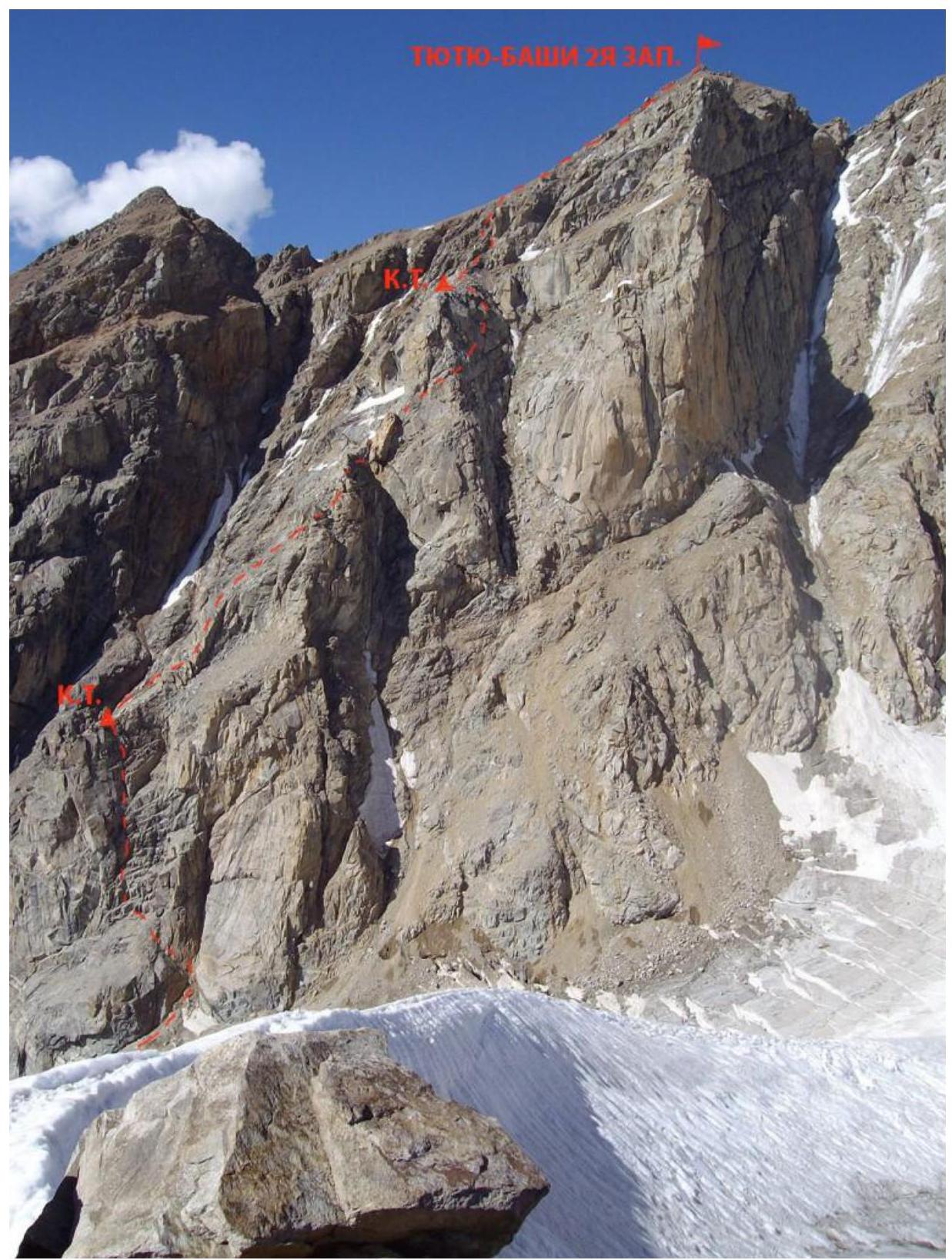
Tyutyu 2nd Western (4420 m). Route via the Southern ridge (“through the lens”), category 3B.
The Tyutyu peak is located in the northwestern branch of the Adyr spur of the Main Caucasian Range, between the Jailyk and Sullukol peaks. The first ascent was made by S. Goluvev via the Western ridge in 1914.
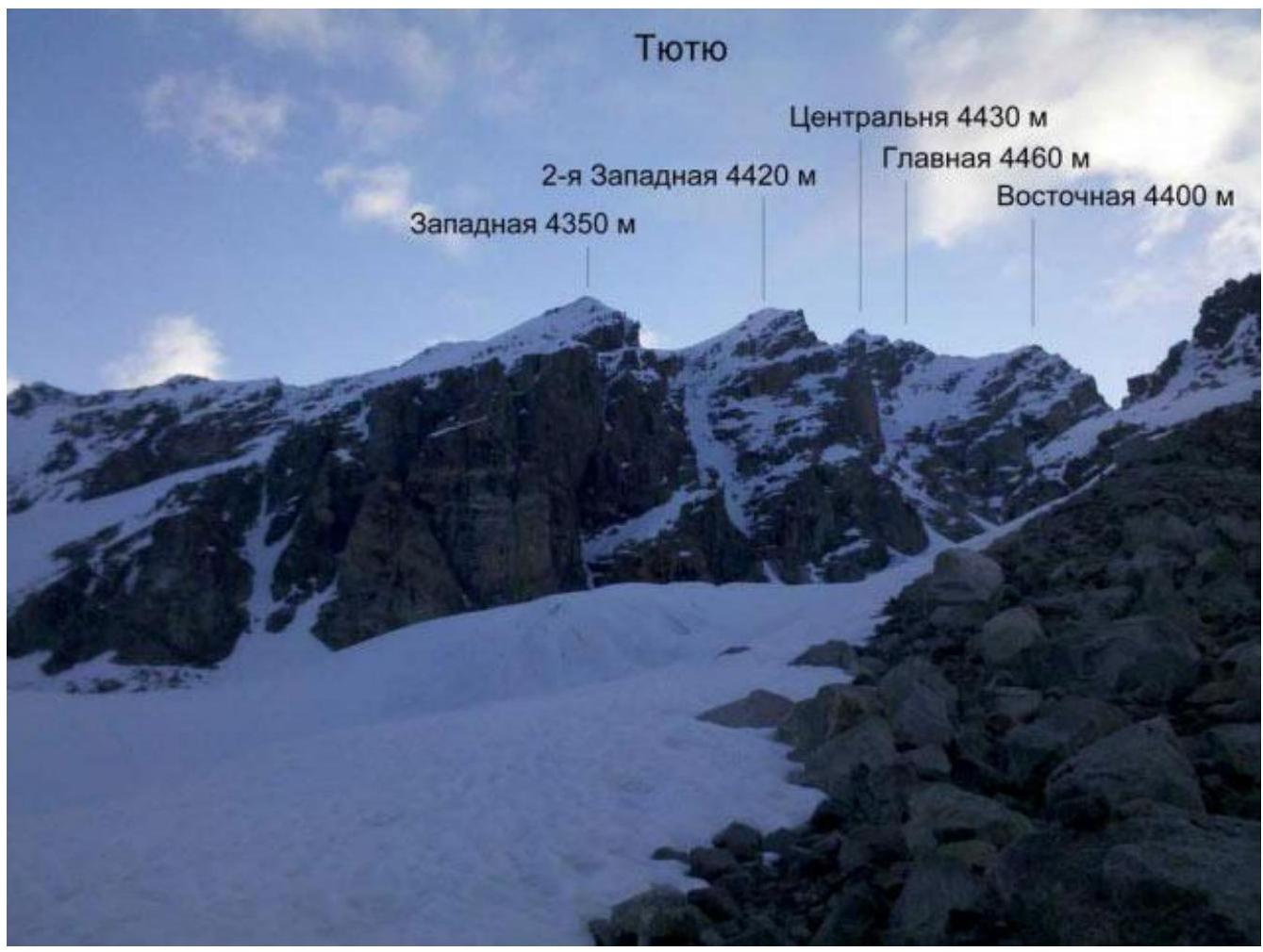
Tyutyu is a mountain massif consisting of:
- Eastern (4400 m),
- Main (4460 m),
- Central (4430 m),
- 2nd Western (4420 m),
- Western (4350 m)
peaks, located in the northwestern spur (Adyr ridge) of the Main Caucasian Range (Kabardino-Balkaria Republic), between the Adyr-Su and Tyutyu-Su rivers. The name translates from Balkarian as “barberry peak”.
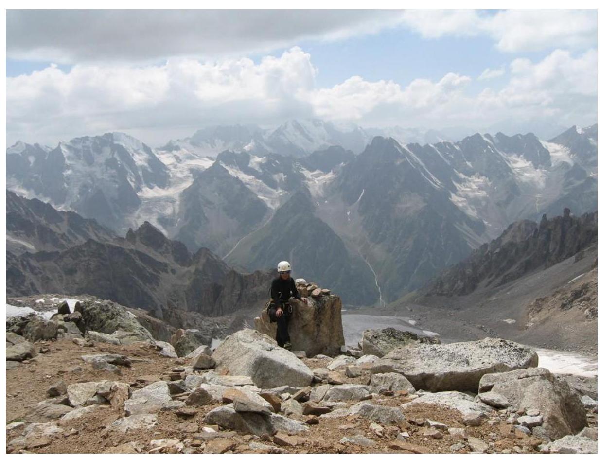
Tyutyu mountain massif
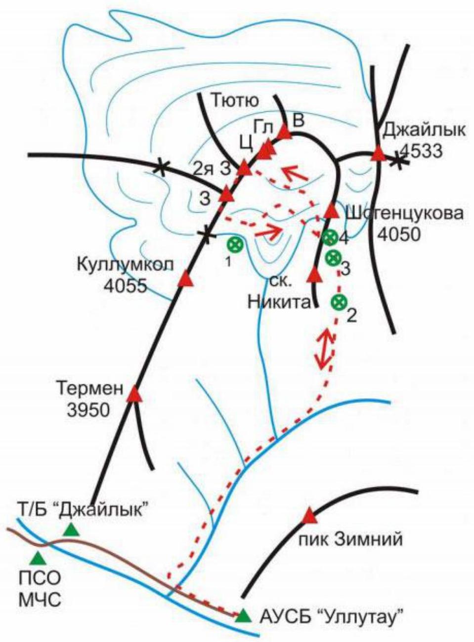
Overnight stays: 1 — Tyutuyskie, 2 — Rayskie, 3 — In a hollow, 4 — On Shogentsukov's shoulder
Area diagram
There are 18 routes to the peaks of the Tyutyu massif, 11 of them from the South, from the Adyr-Su gorge side.
The 2nd Western peak of the Tyutyu massif is the most technically interesting object for climbing Tyutyu from the South.
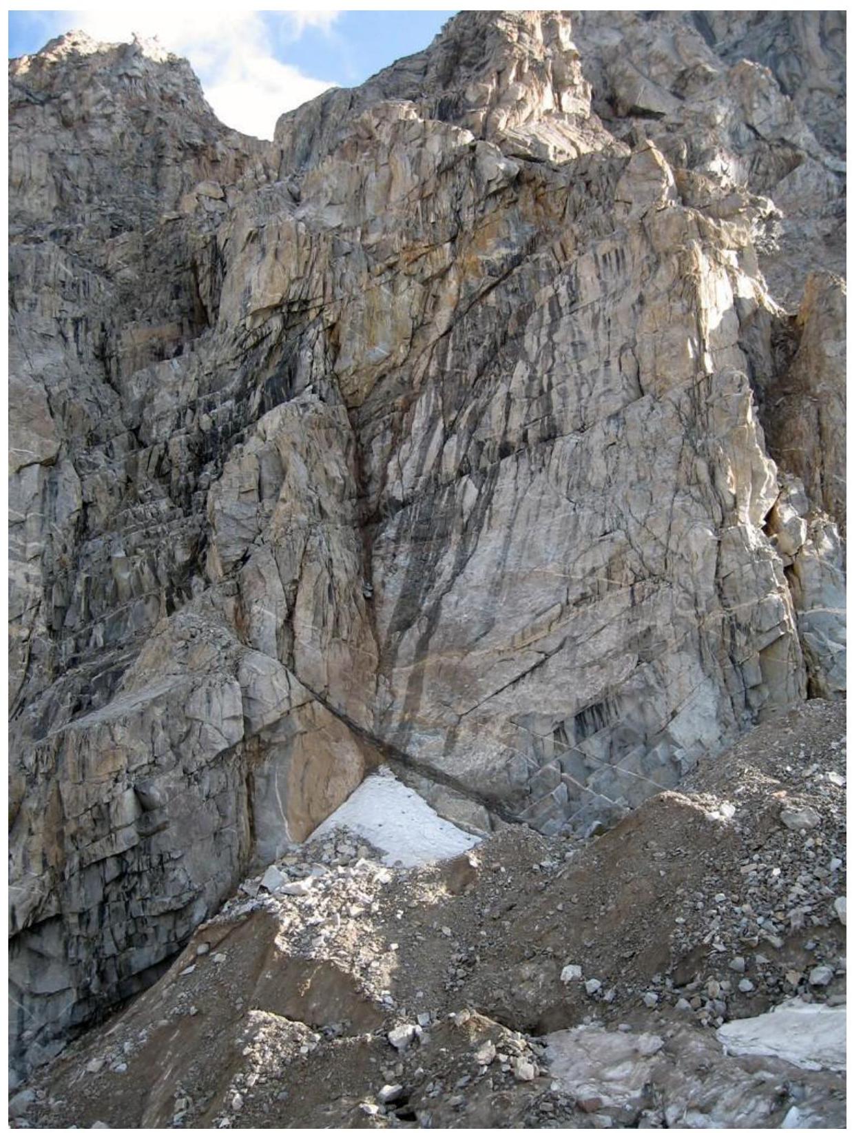
The relatively small but quite steep and monolithic Southern wall of the Southern ridge of this peak has potential for complex rock climbing.
Route description

Route diagram
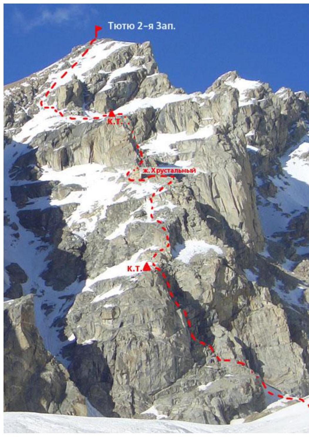
Thread of the route. Tyutyu 2nd Western (4420 m). Route via the Southern ridge (“lens”), category 3B.
Lower part of the "Through the Lens" route (3B)
Upper part of the "Through the Lens" route (3B)
This route is considered one of the most challenging "threes" in the area. As some instructors at the Ullu-Tau alpine camp say, “Lens” (3B) is a long-defrocked "five". I don't know about the "five", but I can assume that the route is quite a normal "four" based on my own feelings.
Approach to the route:
— From the "Shoulder", continue along the glacier: initially open and gentle, then the slope increases (crampons needed), and areas with closed crevices appear (recommended to be roped).
R0. From the "Rayskie nochyovki" go along the right side of the Zapadny Tyutyu glacier, then approach the right side of the Southern ridge of the Tyutyu 2nd Western peak, located between two steep snowy and icy rockfall-prone couloirs.
There is a small problem - not everyone finds this route immediately. In the Ullu-Tau alpine camp description, the route photo is taken in winter and from an unfortunate angle, making it difficult to understand where the route starts. I am posting several photos that, hopefully, will help resolve this issue.
The start of the "Through the Lens" route begins with a snowfield in the couloir, then along a diagonal ledge to the left
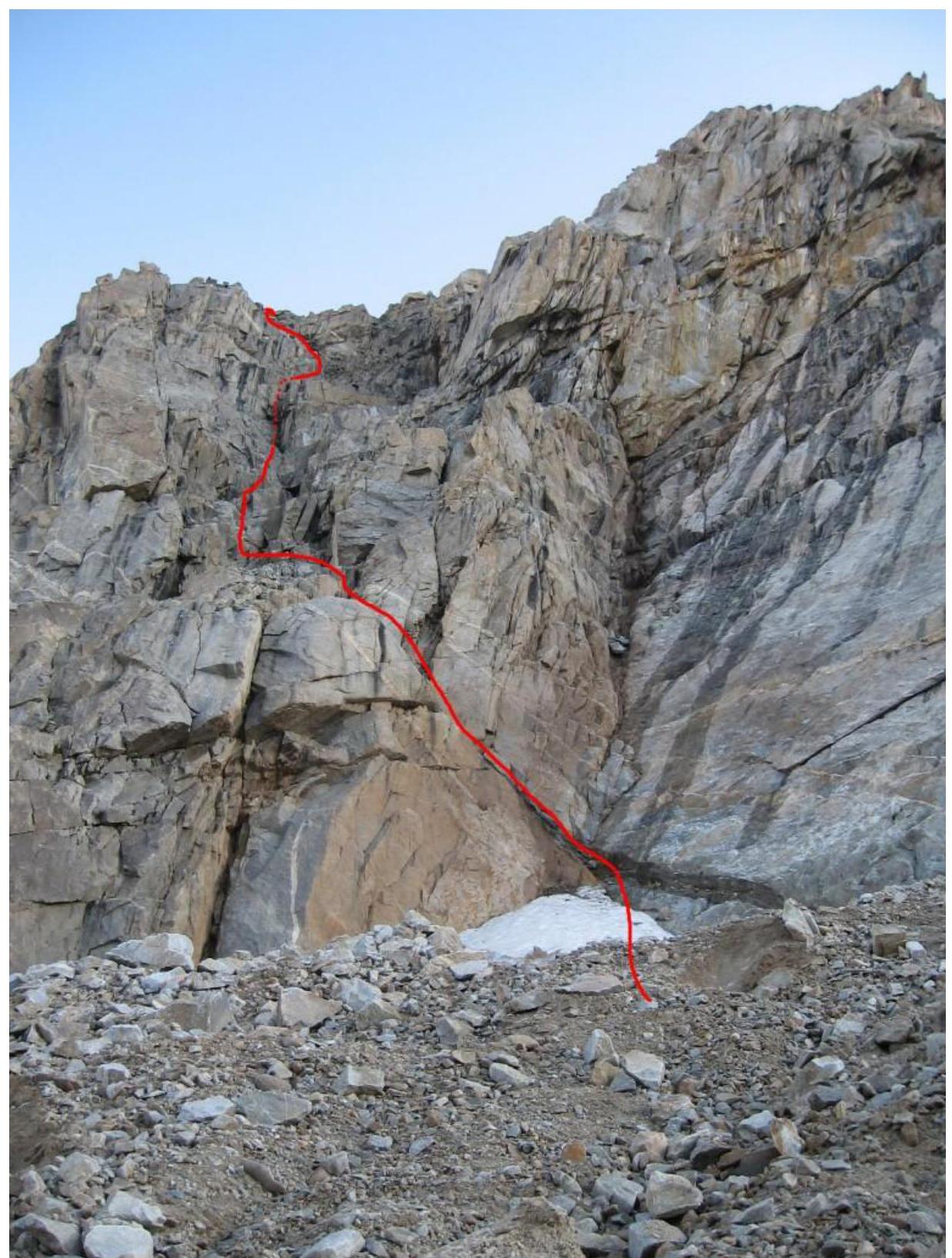
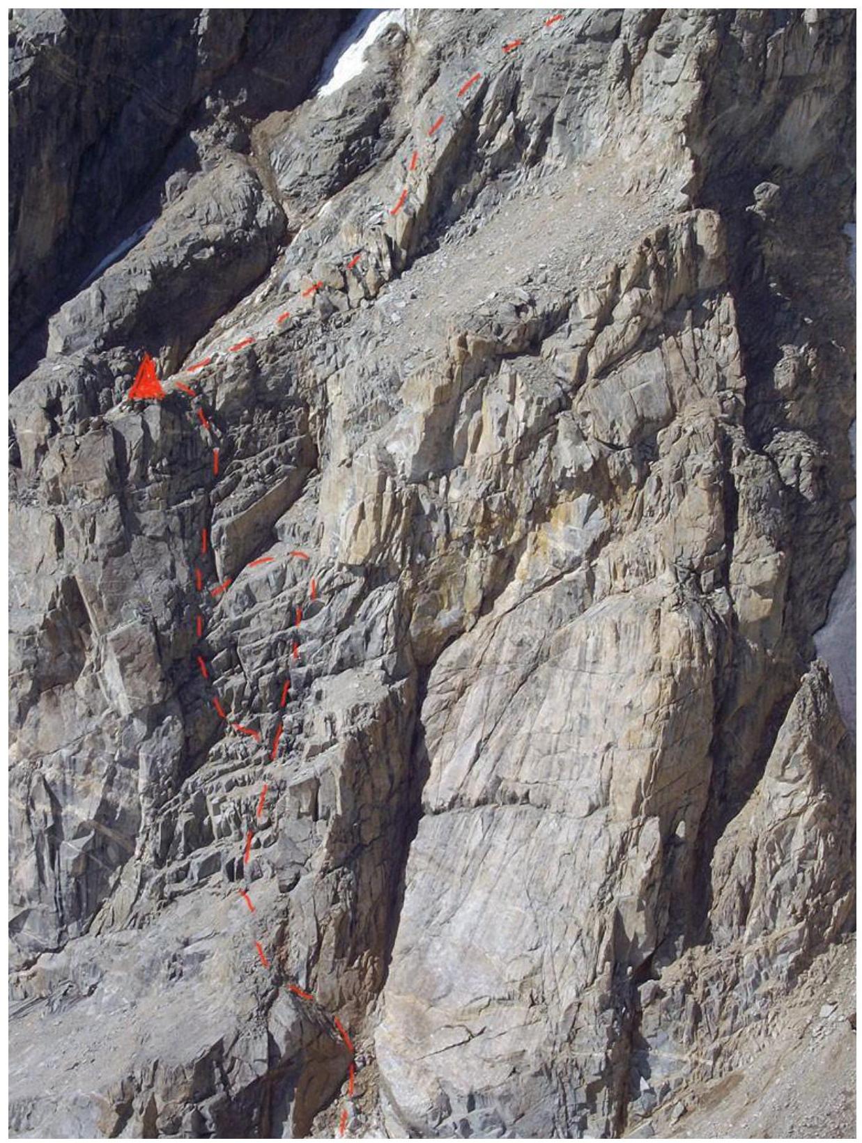
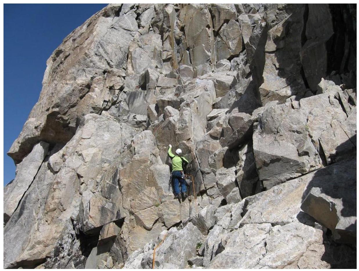
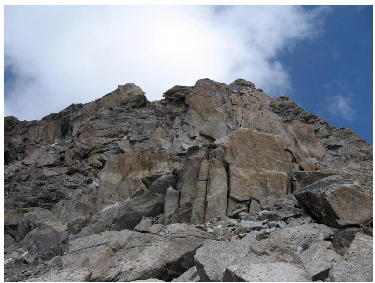
Lower part of the "Through the Lens" route (3B). High-resolution photo. The first part of the route (up to the control cairn on a large ledge) is entirely pleasant technical climbing with two cruxes (category 4):
— first 5 m (vertical wall) — second (steep inner corner) — 18 m
R1. From the glacier, from the right side of the rocky ascent of the Southern ridge, traverse left along a diagonal sloping snowy scree slope-ledge to a steep rocky couloir in the center of the Southern ridge.
Diagonal ledge (45° steepness).
— Be cautious — rockfall hazard in the couloir to the right. — Rocks also fall from the ledge itself, dislodged by the leader's rope.
Then climb steep simple rocks of the couloir (loose rocks, protection), then rocks of medium difficulty of an 8–10-meter wall (protection) to reach the scree slope of the couloir. To the left of the couloir on a ledge is a control cairn. R2. From the couloir — traverse right along a scree ledge along a low wall to an inner corner in it.
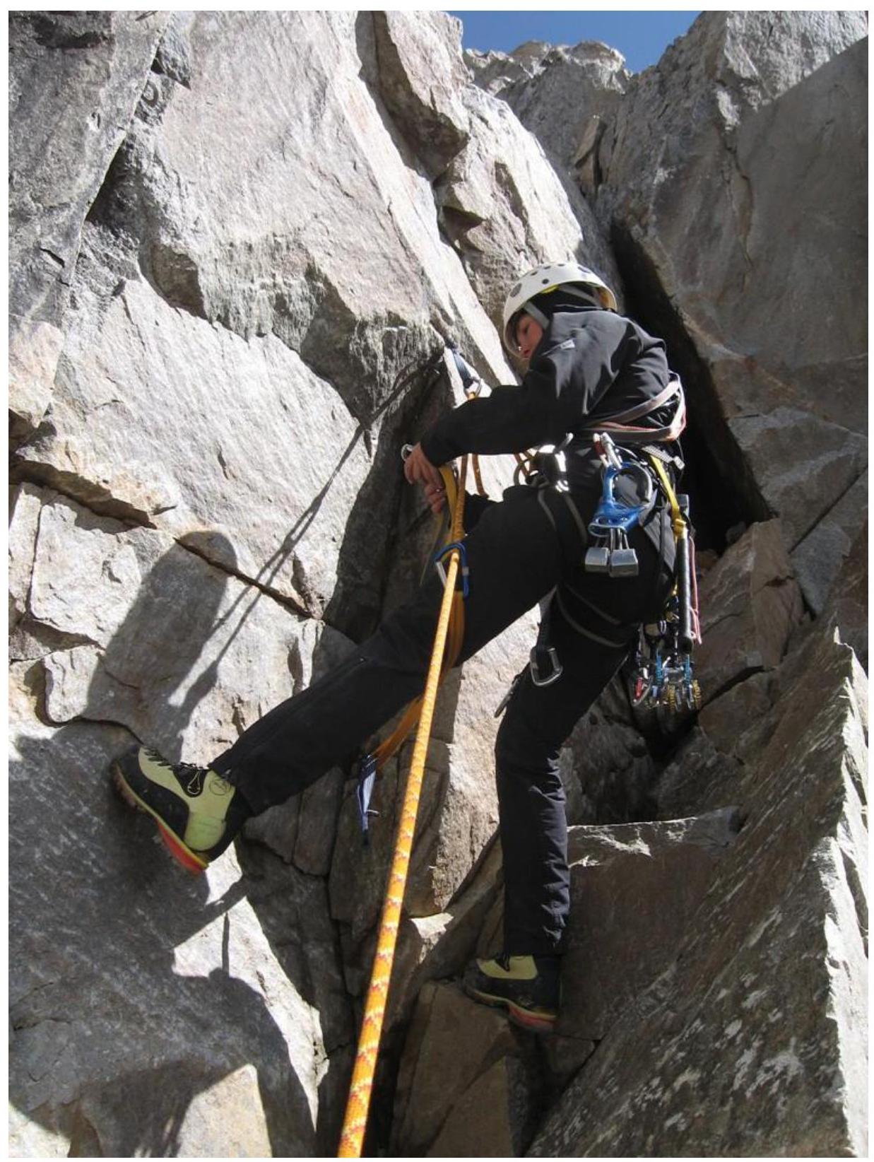
Second rope (after the scree ledge). Before the start of the first crux R3–R4.
R3–R4. Climb the inner corner (key point) to a wide gentle ledge and approach the wall directly, where a good belay can be set. Then traverse right along the wall and exit onto a large protruding platform via simple rocks.
Passing the first crux of the route (vertical wall 5 m, 4)

Section after the first crux. Start of the second crux (17–18 m, 4)
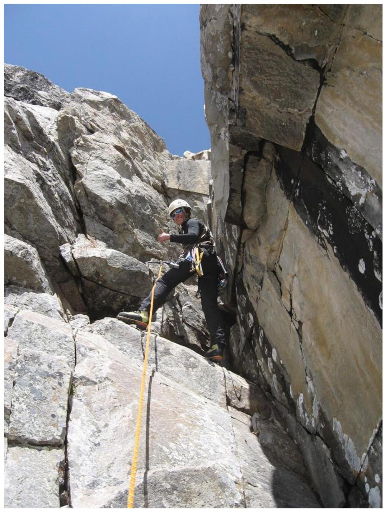
Passing the second crux of the route (steep inner corner 17–18 m, 4). When you pass the second crux and exit onto the ledge, I highly recommend setting a belay immediately, as the entire ledge is strewn with rocks of various sizes. If you start moving, the rope will immediately dislodge all the "goodies", and you may be left without a belayer...
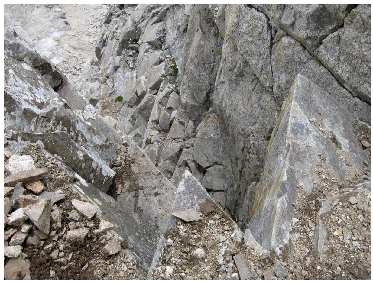
All that lies on the ledge after the second crux
Control cairn on the "Lens" route (3B)
Rocks "Vint" from the control cairn on a large ledge R5. Approach the "Crystal" gendarme along the platform and, bypassing the gendarme on the left, exit onto the col of the Southern ridge. From the col upwards, first along a narrow, then a wide, heavily damaged steep rocky ridge (pitons), gradually easing, exit under a large rocky ascent.
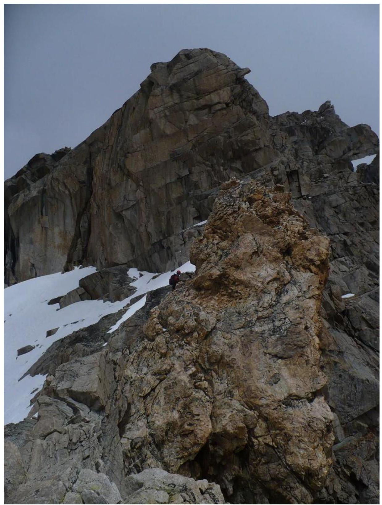
"Crystal" gendarme on the "Lens" route 3B R6. From under the ascent, traverse 80–100 m along steep slabs and ledges on the right side of the Southern ridge (protection) to approach the neck of the couloir. Under the neck, cross the couloir to the right (rockfall hazard) and climb simple rocks on the right side of the couloir neck to reach a scree (possibly snowy) slope.
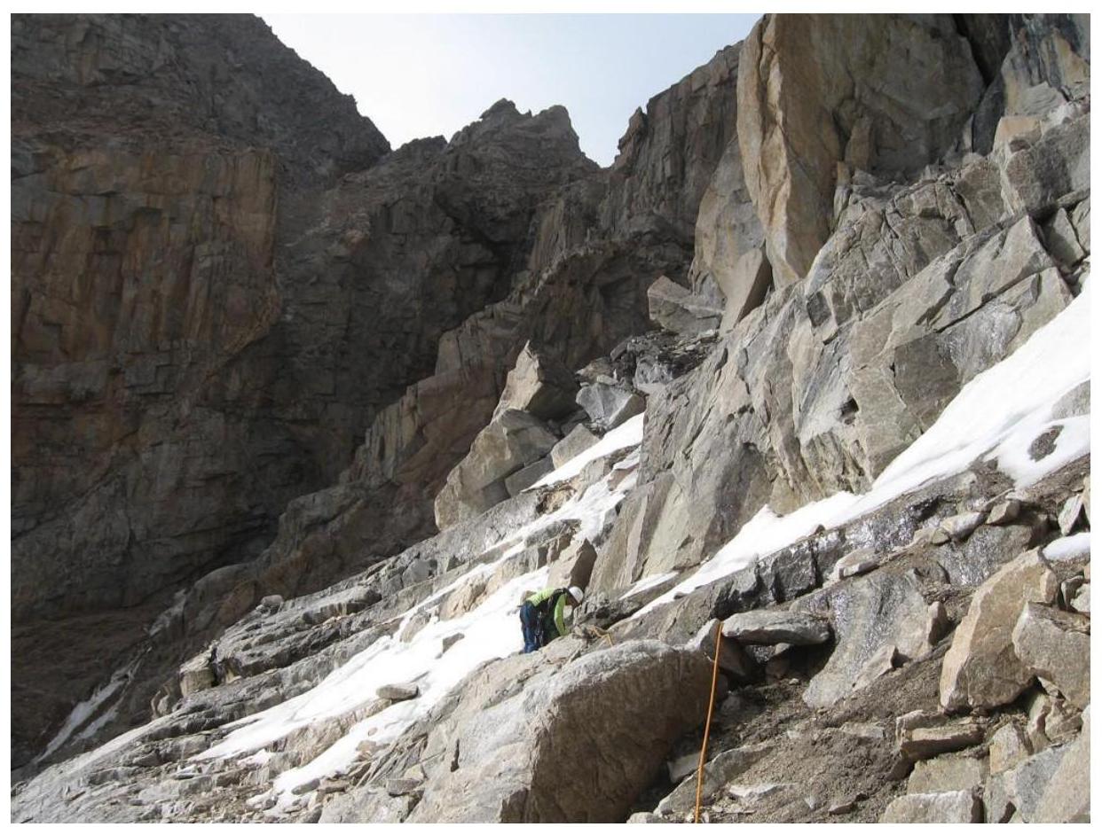
Start of the couloir R7–R8. Climb a gentle slope with rocky outcrops to approach the rocky ascent of the Tyutyu 2nd Western peak. Passing to the left along the ascent, cross a narrow couloir (rockfall hazard) and exit onto a scree slope via rocky outcrops. Climb a steep slope, then simple rocks of the Southern ridge to reach the Tyutyu 2nd Western peak. From the Zapadny Tyutyu glacier — 6–8 hours.
Descent via the Western ridge.
Recommended equipment:
— 50 m rope — pitons or anchors — rock hammer — set of nuts and cams (medium and large) — 5–6 long and medium slings — 7–8 quickdraws — lightweight crampons — ice axe
Author of the description and photos: Tatyana. Source: alpinist.biz