REPORT
ON THE FIRST ASCENT TO PANORAMNY (PANORAMA) PEAK VIA THE SOUTHEAST RIDGE, CATEGORY 3B DIFFICULTY, BY THE AUSB UZUNKOL TEAM FROM STAVROPOL August 16, 2023
I. Ascent Passport
| № | 1. General Information | |
|---|---|---|
| 1.1 | Full name, sports rank of the leader | Kirill Artemovich Klimonov, 1st sports rank |
| 1.2 | Full name, sports rank of the participants | Andrey Vladimirovich Dumbrovsky, 2nd sports rank |
| 1.3 | Full name of the coach | Nikolai Grigorievich Kobylyatsky |
| 1.4 | Organization | AUSB Uzunkol |
| 2. Characteristics of the Ascent Object | ||
| 2.1 | Region | Caucasus |
| 2.2 | Valley | Ullukam |
| 2.3 | Section number according to the 2020 classification table | 2.3 |
| 2.4 | Name and height of the peak | Panoramny (Panorama)* 3507 m |
| 2.5 | Geographical coordinates of the peak (latitude/longitude), GPS coordinates | 43.28614, 42.28814 |
| 3. Characteristics of the Route | ||
| 3.1 | Route name | Via the Southeast Ridge |
| 3.2 | Proposed category of difficulty | 3B |
| 3.3 | Degree of route exploration | First ascent |
| 3.4 | Character of the route terrain | Rocky |
| 3.5 | Elevation gain of the route (altimeter or GPS data) | 655 m |
| 3.6 | Route length (in meters) | 1782 m |
| 3.7 | Technical elements of the route (total length of sections with different difficulty categories, indicating terrain type: ice-snow, rocky) | 1st cat. diff.: grassy slope/rocks — 800 m 2nd cat. diff.: rocks — 200 m 2+ cat. diff.: rocks — 165 m 3rd cat. diff.: rocks — 470 m 3+ cat. diff.: rocks — 107 m 5+ cat. diff.: rocks — 40 m |
| 3.8 | Descent from the peak | Descent via route 2A towards South Panoramny pass along the South Ridge |
| 3.9 | Additional route characteristics | Water is absent on the route in mid-summer. Many streams on the way to the start of the route |
4. Characteristics of the Team's Actions
| 4.1 | Time of movement (team's walking hours, in hours and days) | 9 h 30 min |
|---|---|---|
| 4.2 | Overnight stays | Upper campsite |
| 4.3 | Departure to the route | 5:00 August 16, 2023 |
| 4.4 | Reaching the peak | 14:30 August 16, 2023 |
| 4.5 | Return to overnight stays | 17:45 August 16, 2023 |
| 5. Responsible for the report | ||
| 5.1 | Full name, e-mail | Kirill Artemovich Klimonov, klimonov.dev@gmail.com |
II. Description of the Ascent
1. Characteristics of the Ascent Object
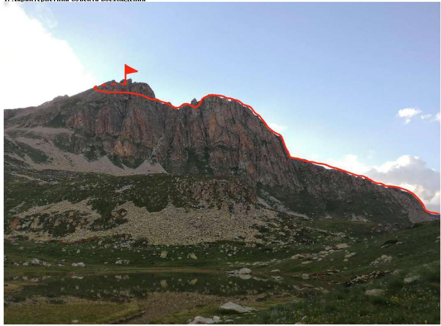
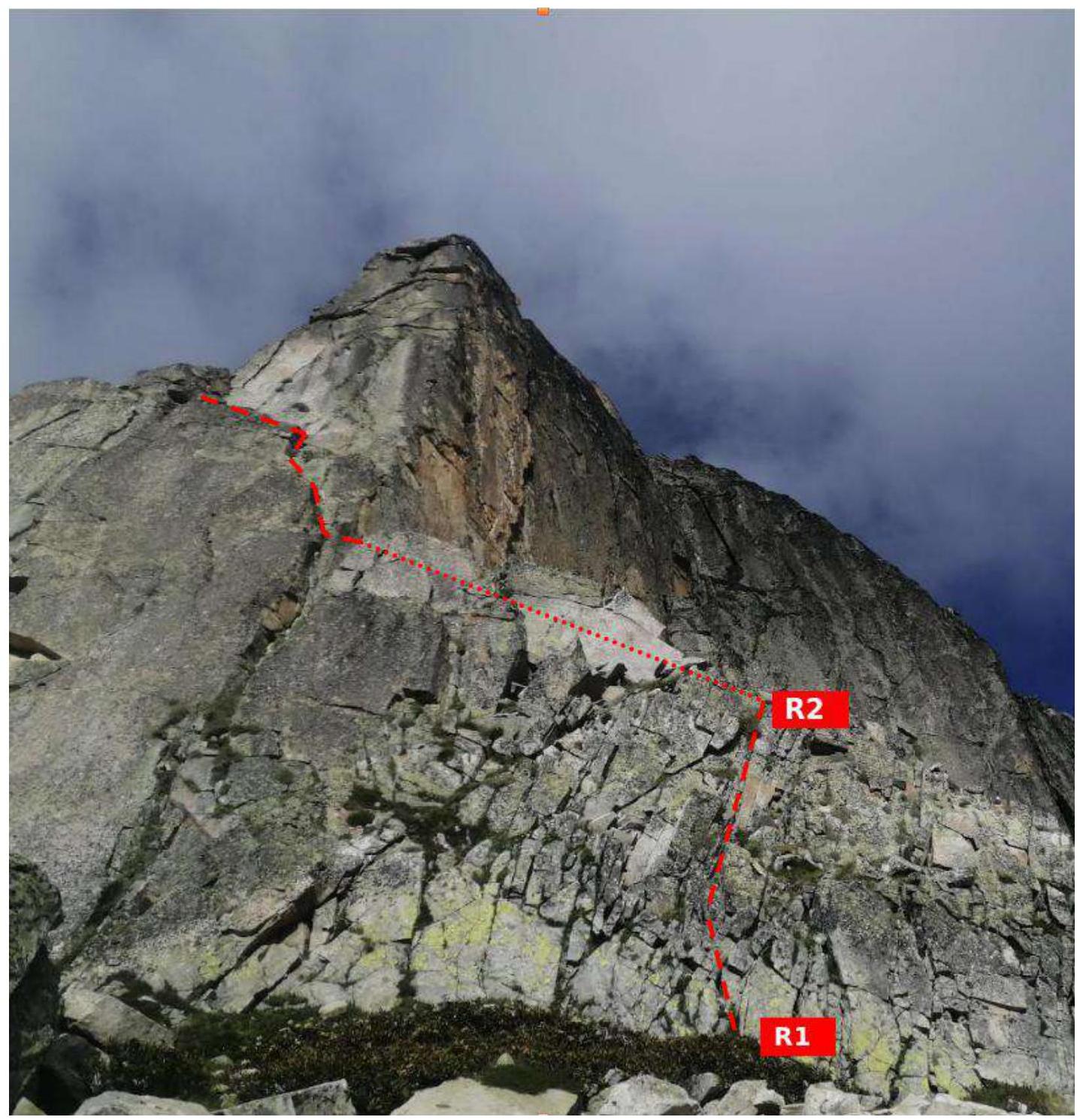
Photograph №1. General photograph of the route profile (taken on August 16, 2023, from the campsite near the lake).
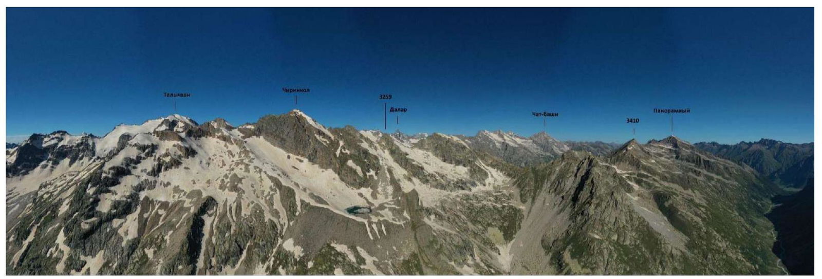
Photograph №2. Photopanorama of the area (taken on July 11, 2021, from the slopes of Kichkinekolskaya Bashnya peak).
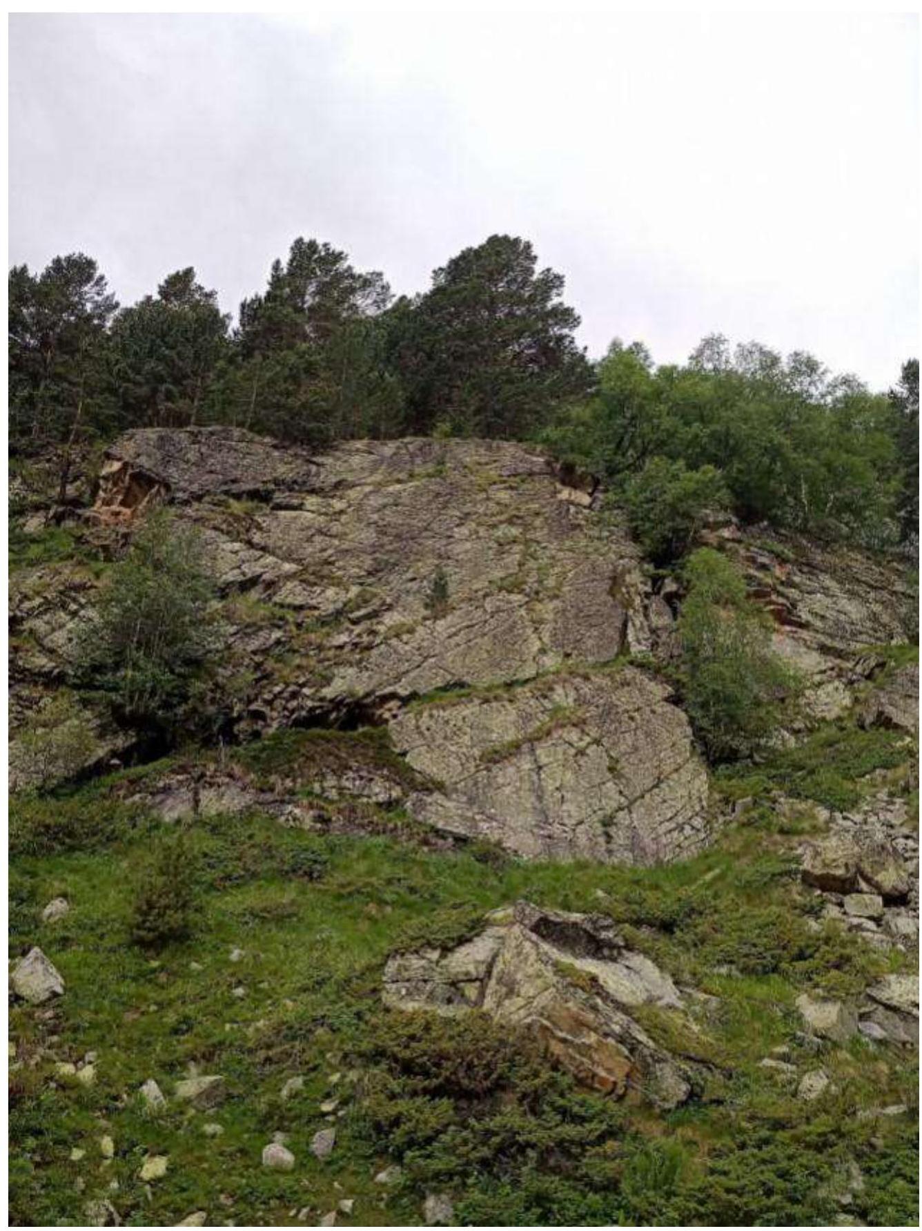
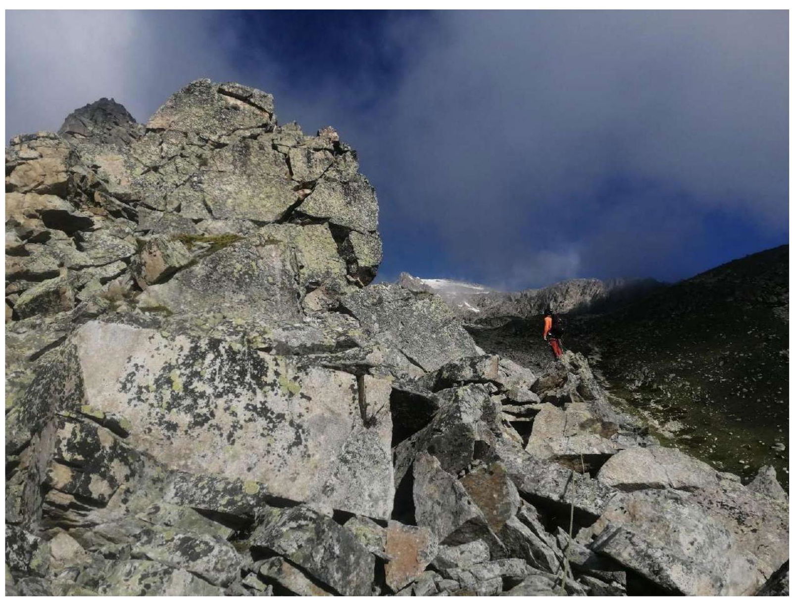
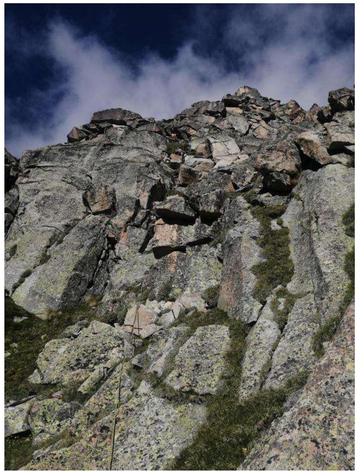
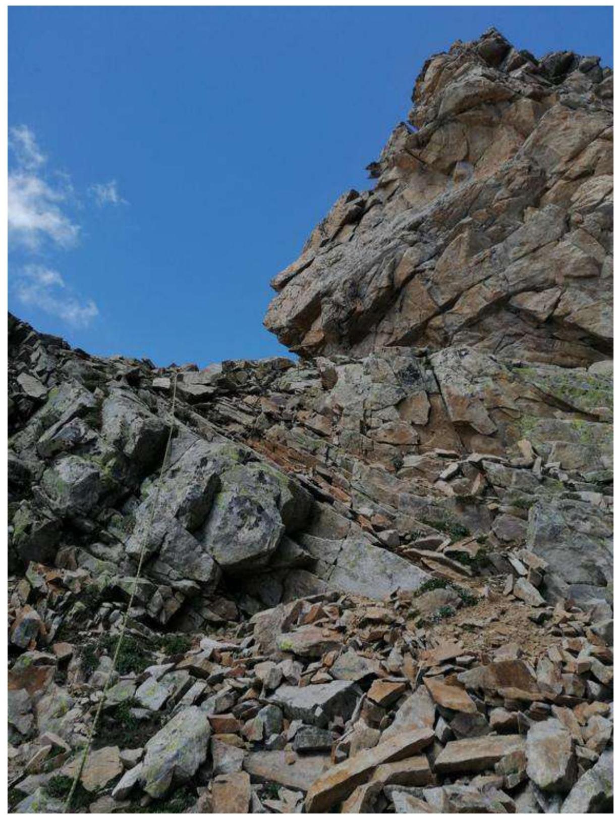
Photograph №3. Rocky wall.
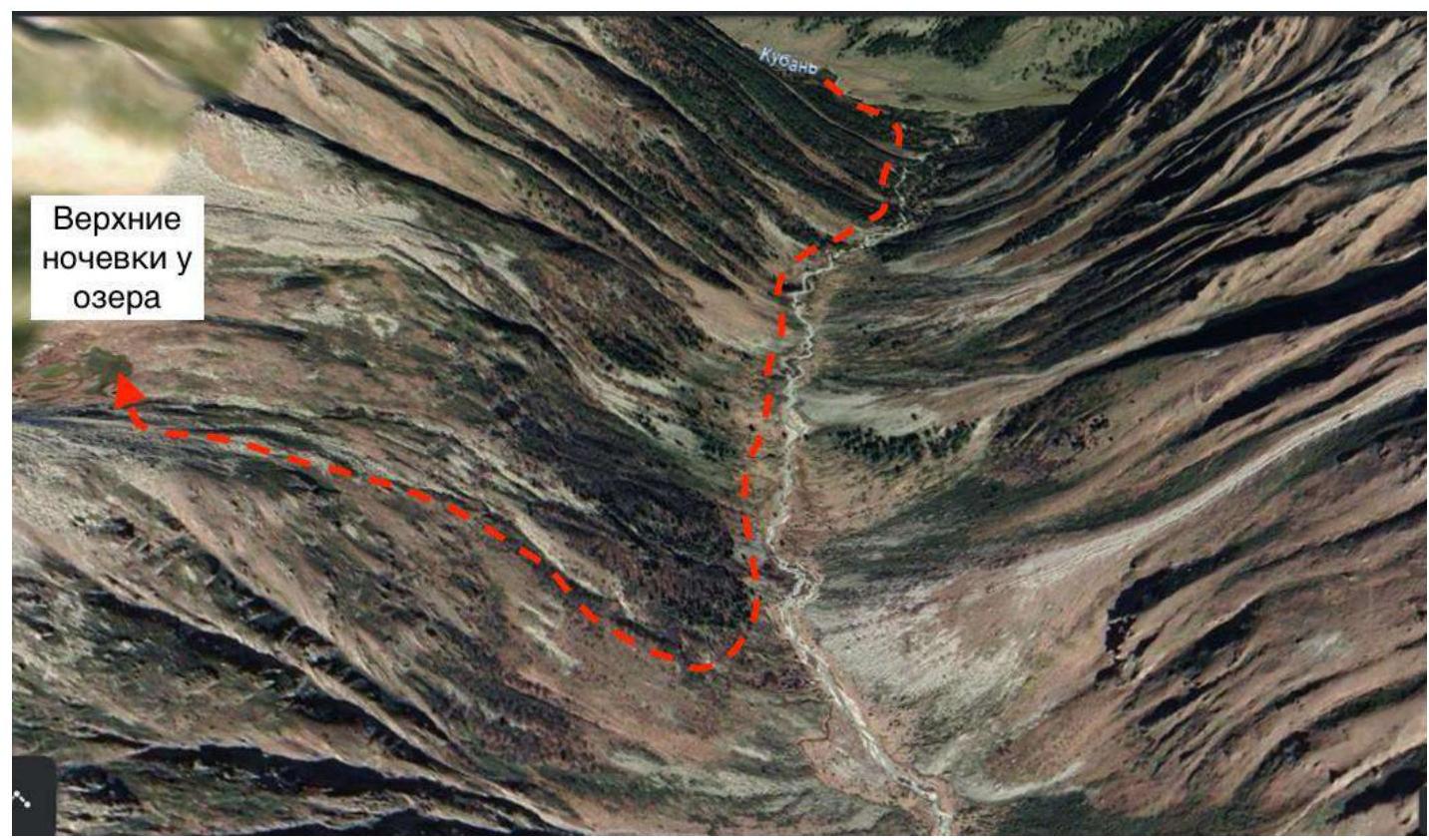
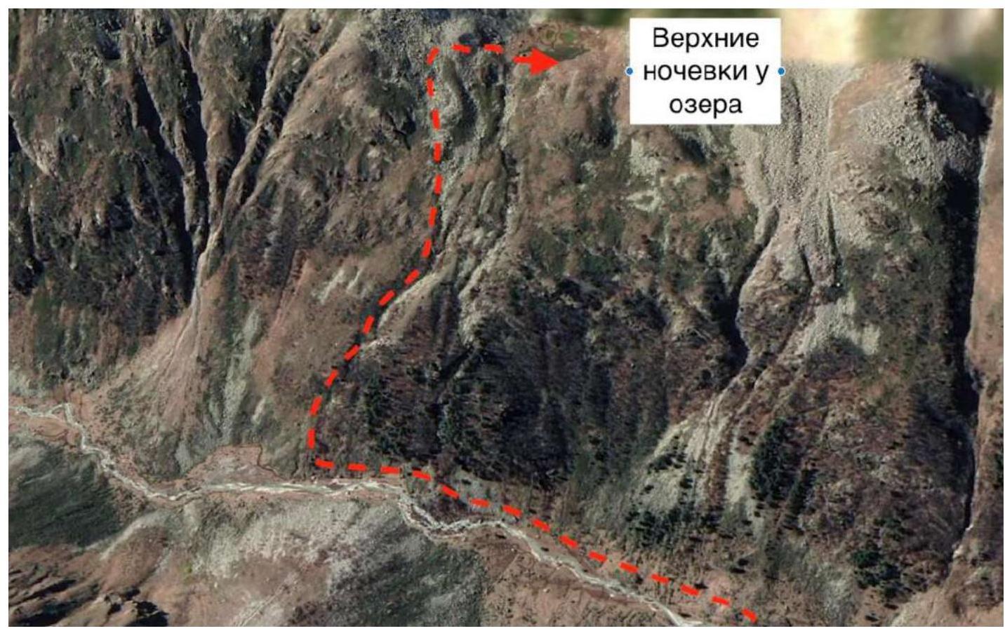
Photograph №4. Campsite. Ascent to the lake (source: https://earth.google.com/↗).
Photograph №5. Ascent to the campsite (source: https://earth.google.com/↗).
Map of the area (source: https://www.openstreetmap.org↗). Panoramny Peak (3507 m) is located in the Karachaevsky district of the Karachay-Cherkess Republic, in a spur of the Main Caucasus Range between the rivers Vostochny Kichkinokol and Chirincol.
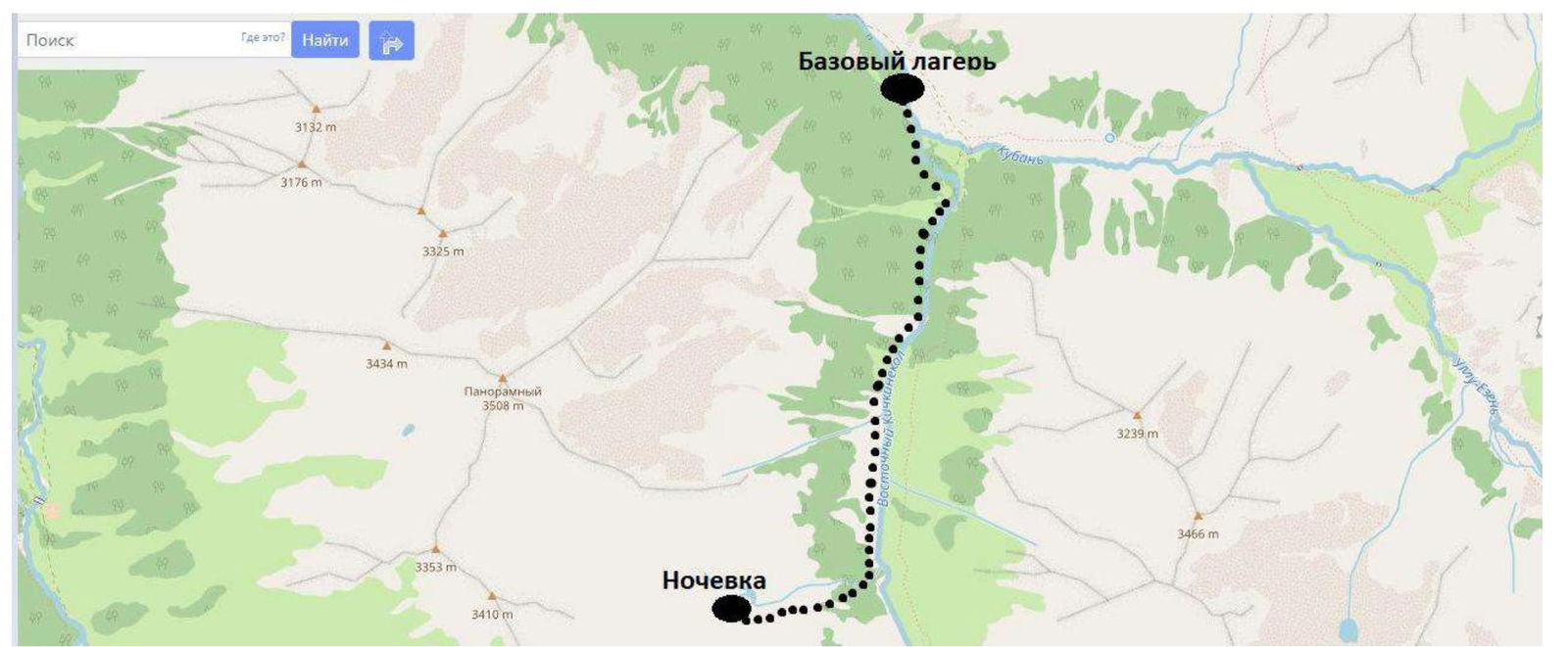
We set up our base camp at the confluence of the rivers Ullu-Kam (Kuban) and Vostochny Kichkinokol, in the house of the director of the Uzunkol recreation center, Enver (43.30166, 42.31656).
From the village of Khurzuk, one must travel along a dirt road towards the border outpost, the same road that leads to the Uzunkol recreation center. Immediately after the border outpost, there will be a fork. The road straight ahead leads to the Uzunkol recreation center; we need to turn left into the Ullu-Kam (Kuban) valley, towards the Khotyu-Tau pass. The road is somewhat worse than the one to Uzunkol; only an SUV can pass. It is possible to arrange for a car drop-off and accommodation at Enver's house (phone: 8 (928) 389-1972). The conditions are more than comfortable. The house is located 13.4 km from the border outpost.
The approach to the start of the route is made along the orographic left bank of the Vostochny Kichkinokol river. The trail periodically disappears, but there are cairns to navigate by. 1.5–2 hours (3.5 km) from the base camp, on the right-hand side, we pass a rocky wall (Photograph №3).
Approximately 200–250 meters from the rocky wall, where the forest zone ends, it is necessary to turn right towards the South Panoramny pass. The coordinates of the start of the ascent to the pass are (43.27291, 42.31575). There is no trail to the pass. Initially, the ascent begins on a:
- grassy, partially scree slope;
- not straight up, but slightly deviating to the right;
- between small forest patches.
Further, bypassing rocky outcrops, we reach the lake (43.2760925, 42.3074296), the campsite (assault camp). 1–1.5 hours from the rocky wall (2.5–3.5 hours from the base camp).

Photograph №6. Approach to the start of the route along a grassy slope.
Photograph №7. Landmark at the start of the route.
2. Characteristics of the Route
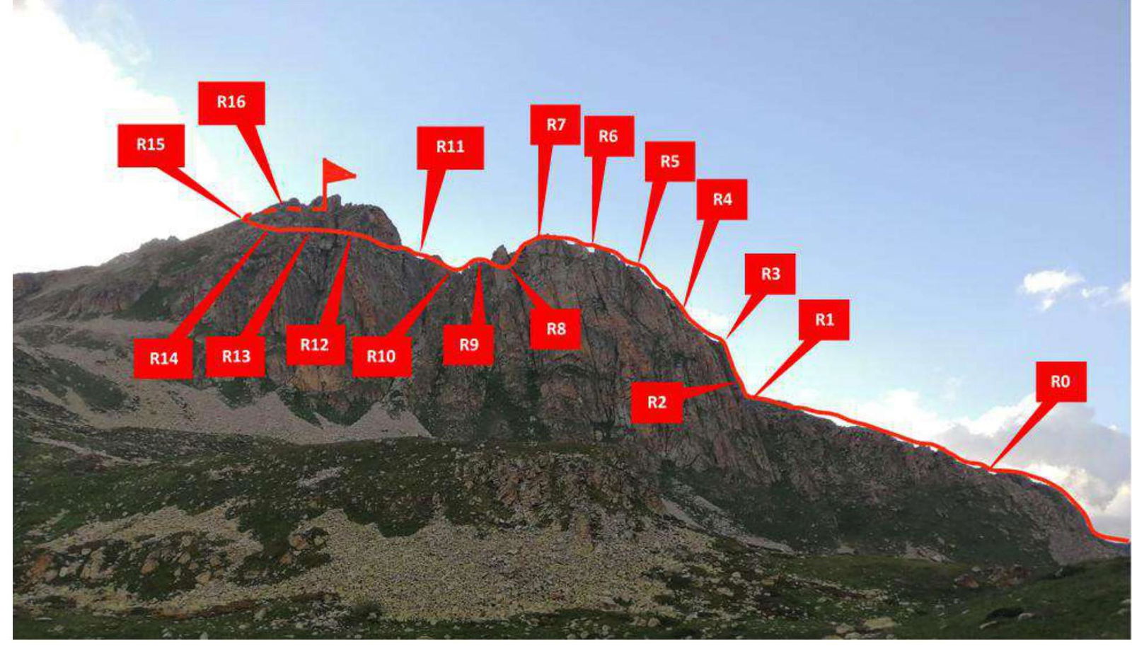
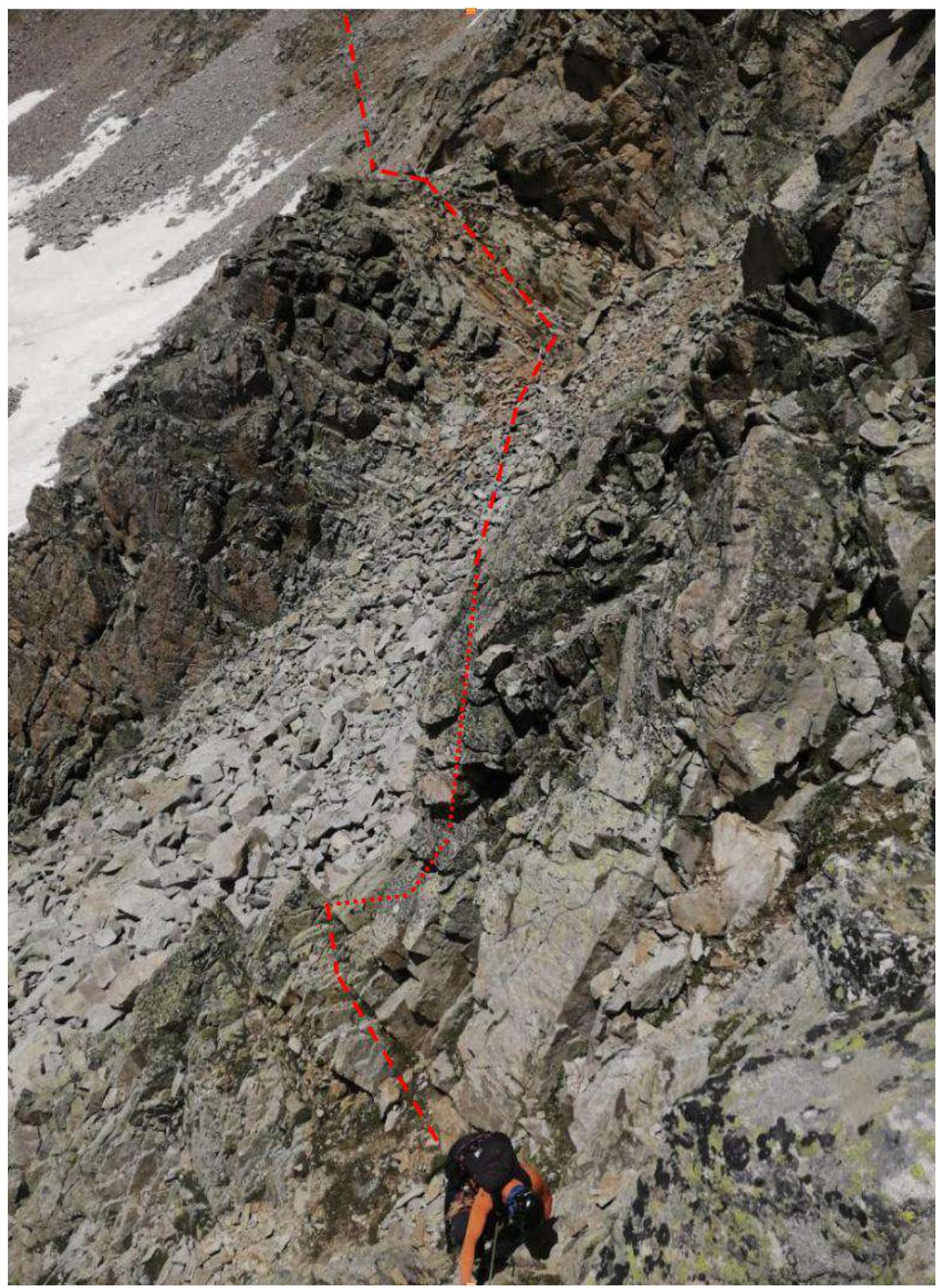
Photograph №8. Technical photograph of the route (taken on August 16, 2023, from the campsite near the lake).
Technical Characteristics of Route Sections
| Section № | Terrain Character | Category of Difficulty | Length, m | Type and Number of Hooks |
|---|---|---|---|---|
| R0–R1 | Rocky slope | 1 | 100 | 0 |
| R1–R2 | Rocky wall | 3+ | 6–7 | 1 anchor hook |
| R2–R3 | Rocky wall with a chimney | 5+ | 40 | 3 anchor hooks; 2 chocks |
| R3–R4 | Rocky-stony ridge | 3 | 60 | 5 chocks |
| R4–R5 | Rocky-stony ridge | 3+ | 50 | 6 chocks |
| R5–R6 | Ridge | 2+ | 50 | 0 |
| R6–R7 | Ridge | 3 | 50 | 0 |
| R7–R8 | Ridge | 3 | 40 | 0 |
| R8–R9 | Ridge | 1 | 200 | 0 |
| R9–R10 | Ridge | 3 | 50 | 2 chocks |
| R10–R11 | Ridge | 2+ | 35 | 0 |
| R11–R12 | Ridge | 1 | 500 | 0 |
| R12–R13 | Ridge | 2+ | 80 | 0 |
| R13–R14 | Ridge | 3 | 150 | 0 |
| R14–R15 | Rocky wall | 3+ | 50 | 4 chocks |
| R15–R16 | Ridge | 3 | 120 | 0 |
| R16–R17 | Ridge | 2 | 200 | 0 |
3. Characteristics of the Team's Actions
| Section № | Description | Photograph № |
|---|---|---|
| R0–R1 | Movement along the ridge to the right across rocky terrain. Simultaneous movement. 100 m, 15°, 1 | Photograph №9 |
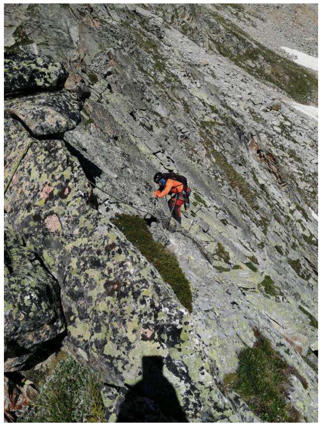
| R1–R2 | Movement through the center of the rocky wall to a ledge. Convenient station on a rock. Alternating movement. 7 m, 75°–80°, 3+ | Photograph №10, 11 |
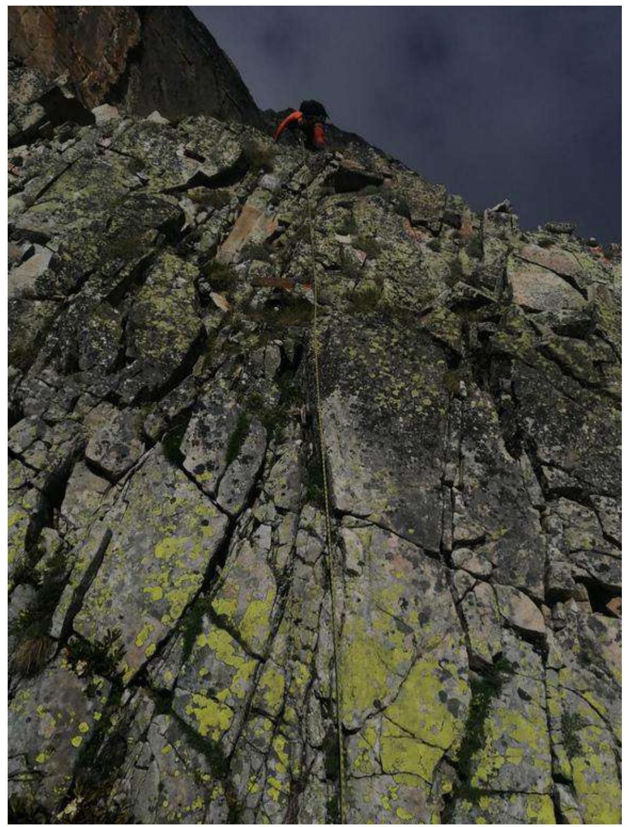
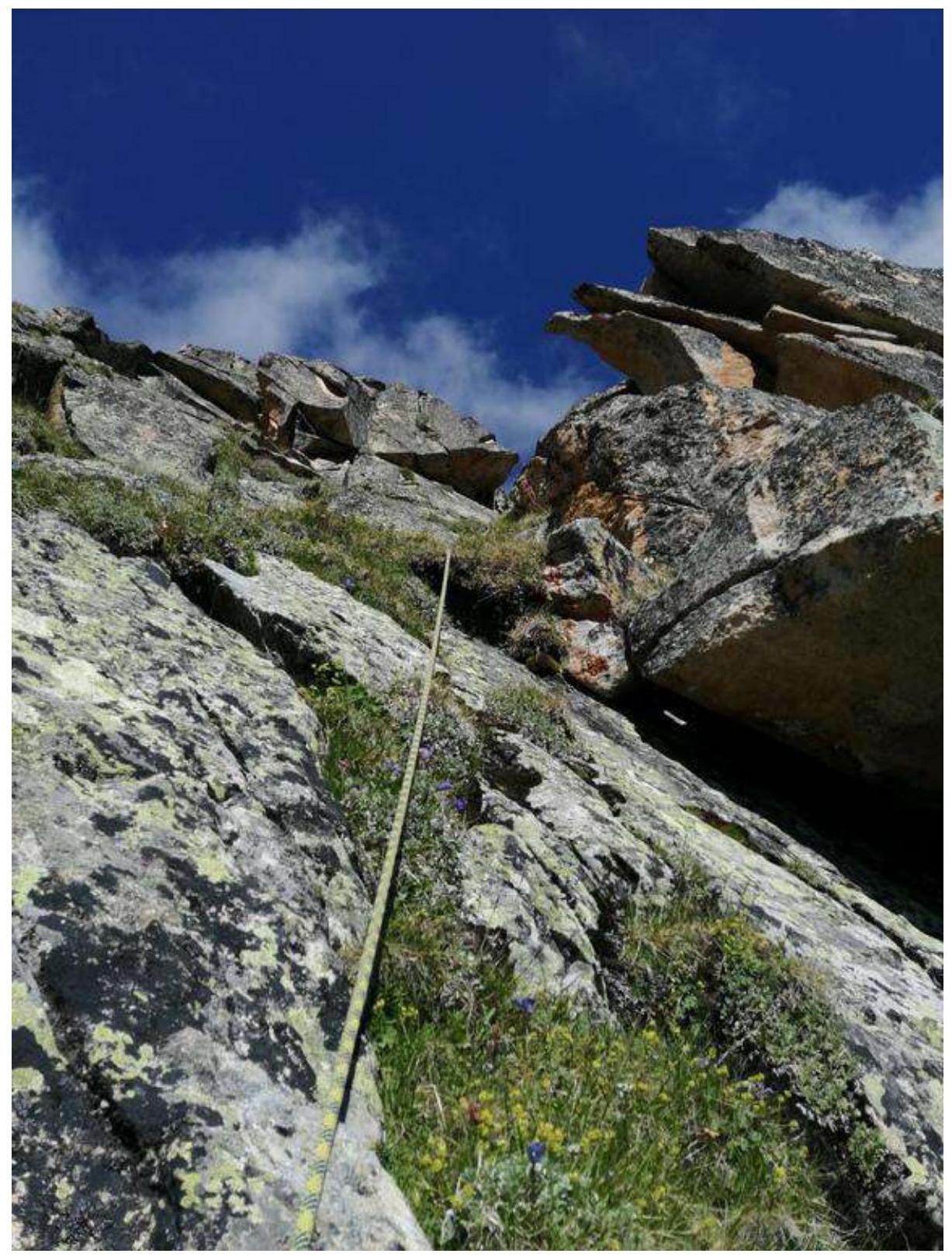
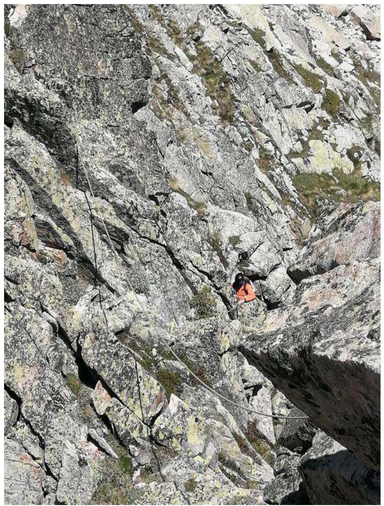
| R2–R3 | "Key to the route!" From the station upwards along the inner corner to a small ledge resting against a wide crack (chimney). Then, in a spread position through the chimney, continue moving left upwards to a wide ledge with a convenient station on a rock. Alternating movement. 40 m, 80°, 5+ | Photograph №12, 13 |
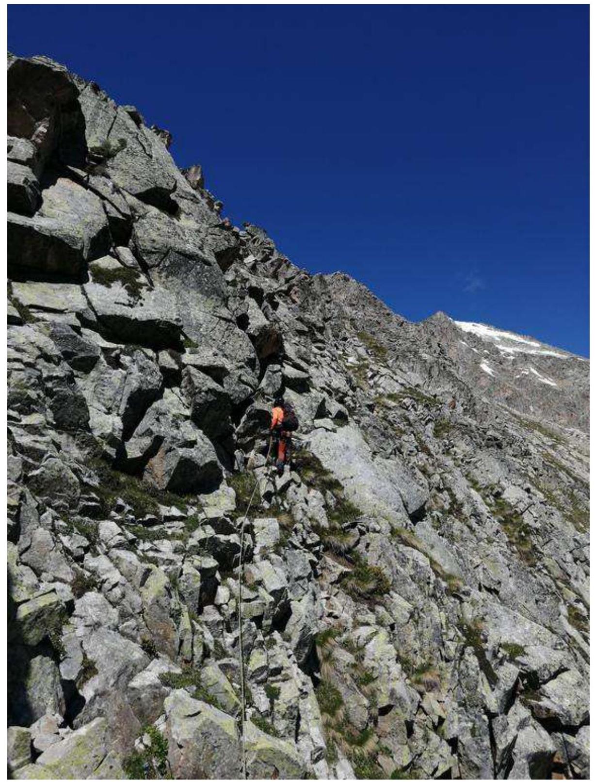
| R3–R4 | Wide ridge, movement along the central part. Alternating movement. 60 m, 55°, 3 | Photograph №14 |
| R4–R5 | Wide ridge, movement along the central part. Alternating movement. 50 m, 60°, 3+ | Photograph №15 |
| R5–R6 | Movement along the ridge. Alternating movement. 50 m, 15°, 2+ | Photograph №16 |
| R6–R7 | Movement along the ridge. Alternating movement. 50 m, 15°, 3 | Photograph №17 |
| R7–R8 | Movement along the ridge to a gendarme, then descent to the right about 15 m to a grassy ledge. Alternating movement. 40 m, 15°, 3 | Photograph №18, 19 |
| R8–R9 | Movement along the ridge in the direction of a large yellow gendarme across simple rocks. Simultaneous movement. 200 m, 10°, 1 | Photograph №20 |
| R9–R10 | Upward movement in the direction of the gendarme. Alternating movement. 50 m, 40°, 3 | Photograph №21 |
| R10–R11 | Movement to the gendarme, bypassing the gendarme to the right. Alternating movement. 35 m, 40°, 2+ | Photograph №21 |
| R11–R12 | Movement along a simple ridge to a pyramidal gendarme. Simultaneous movement. 500 m, 10°, 1 | Photograph №22 |
| R12–R13 | Descent to a wide area in the direction of a yellow gap, followed by an exit to a grassy ledge to a wide scree couloir. Alternating movement. 80 m, 30°, 2+ | Photograph №23, 24 |
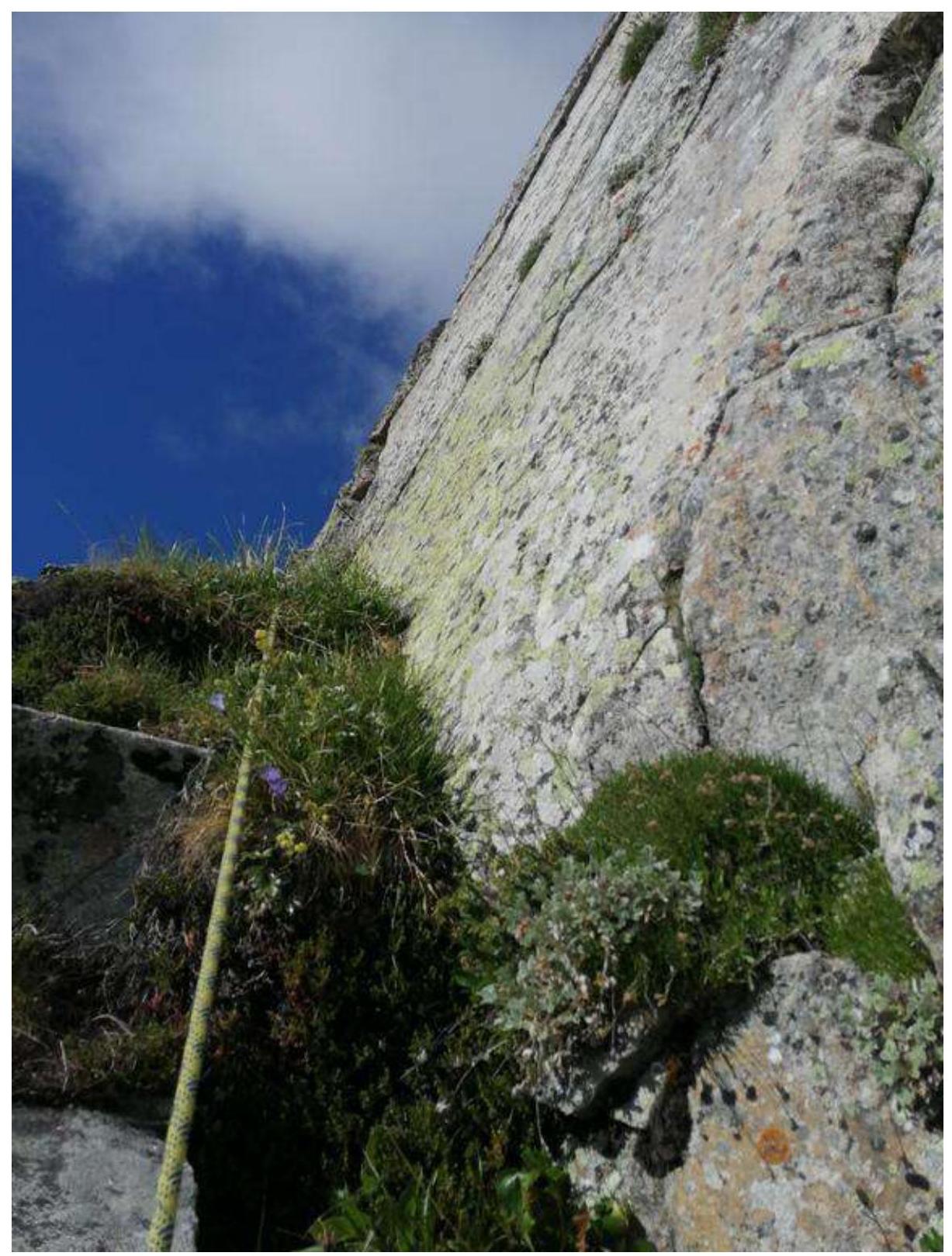
| R13–R14 | Movement along the scree couloir, exiting to the right part of the cirque, bypassing gendarmes to the left, to a ribbed rocky wall of green color. Alternating movement. 150 m, 30°, 3 | Photograph №25, 26 |
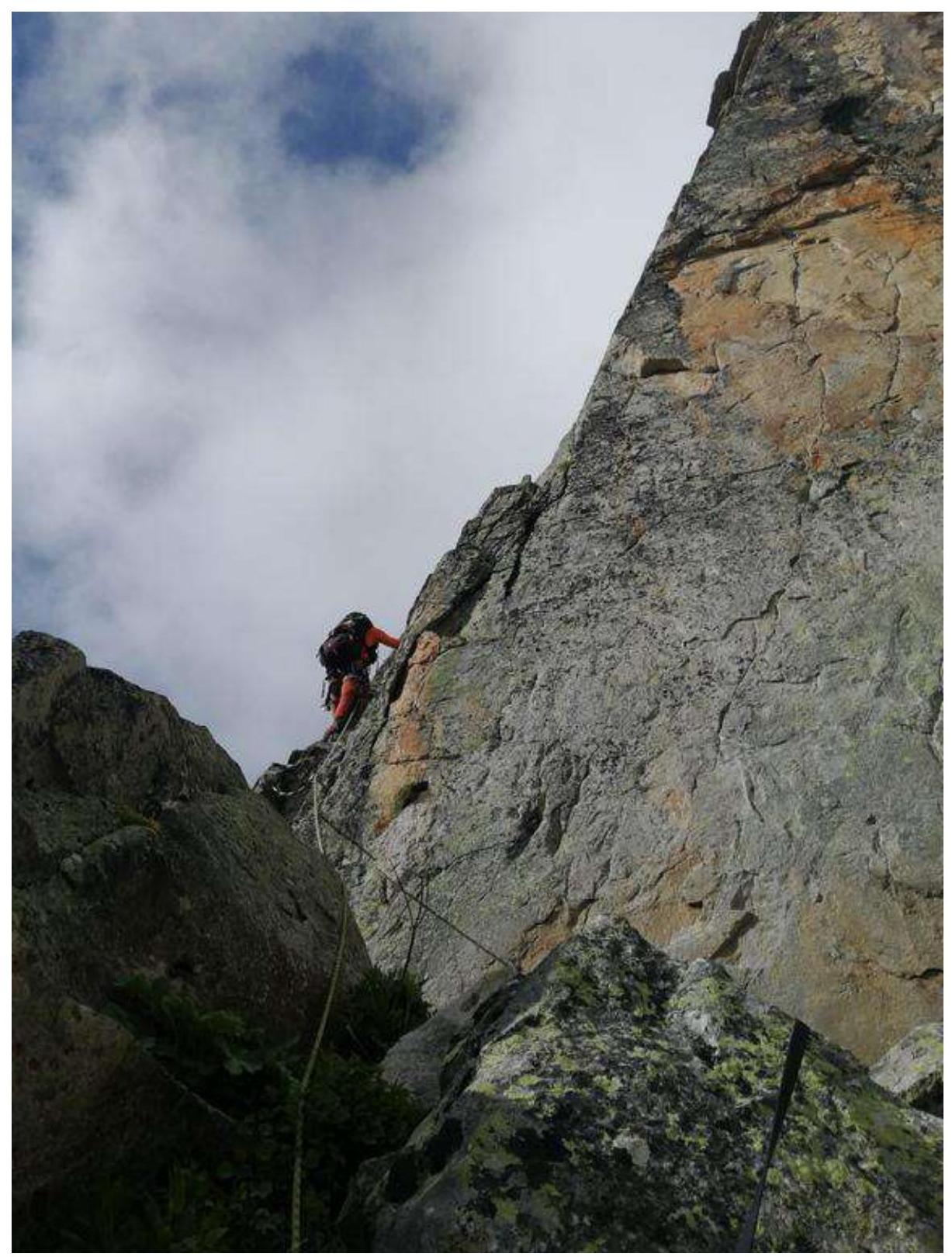
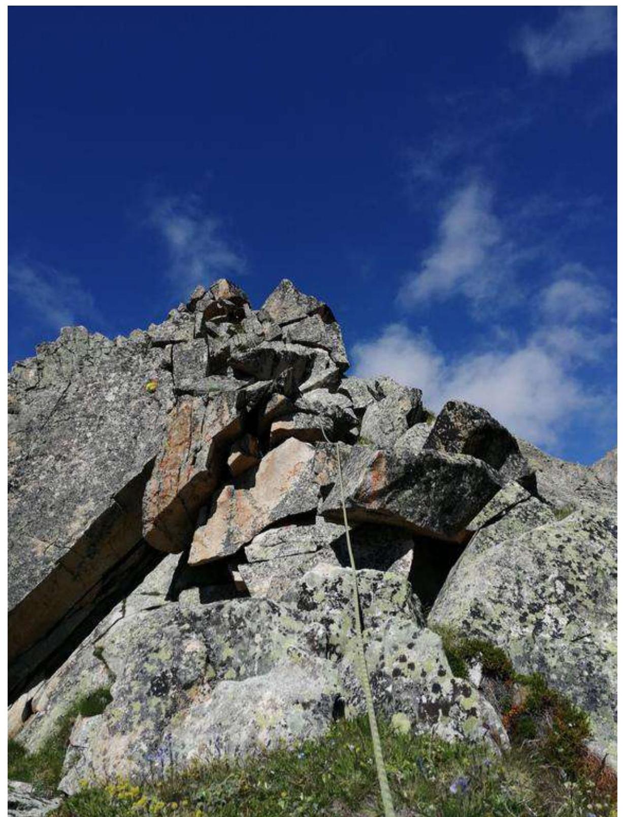
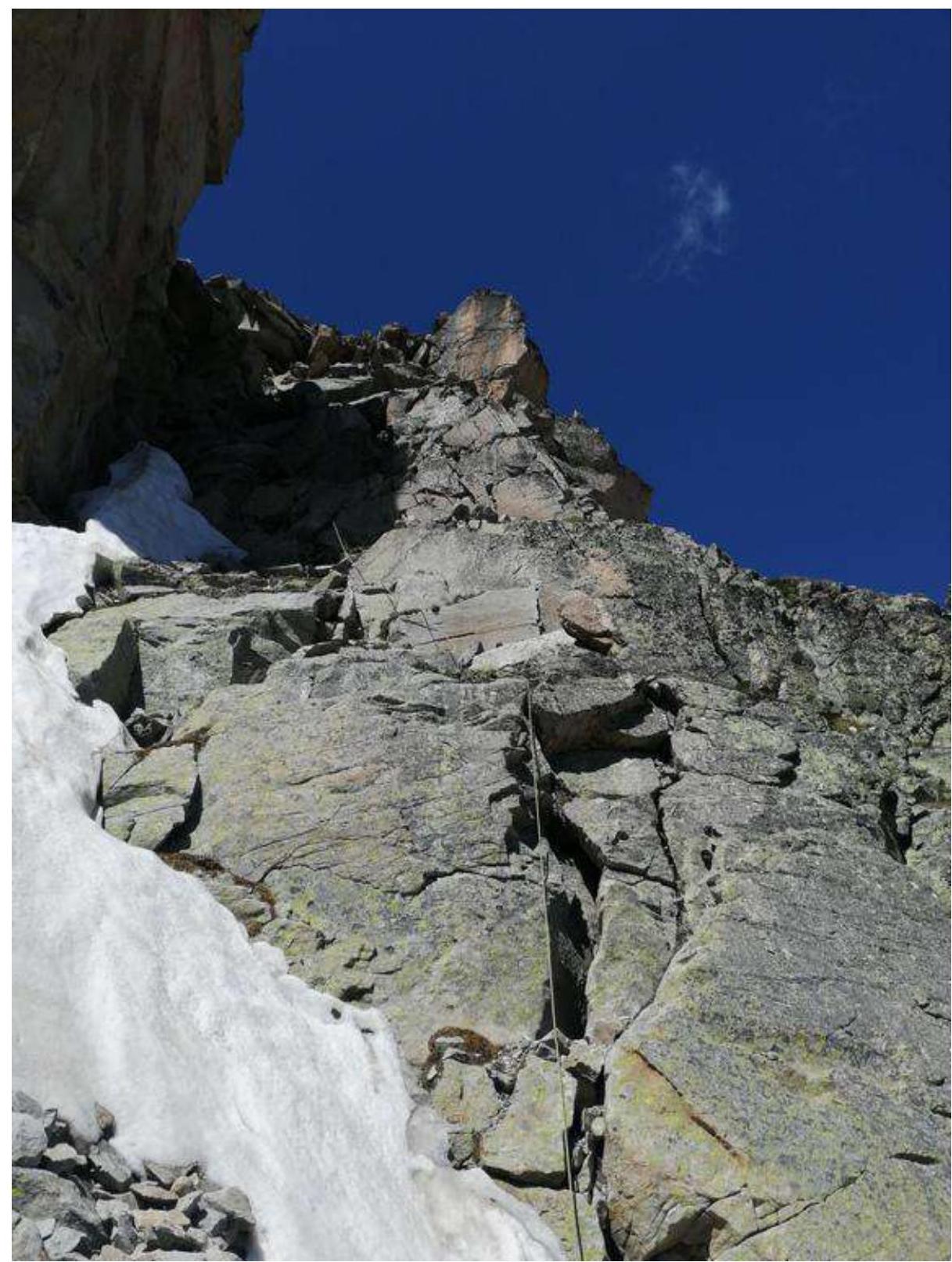
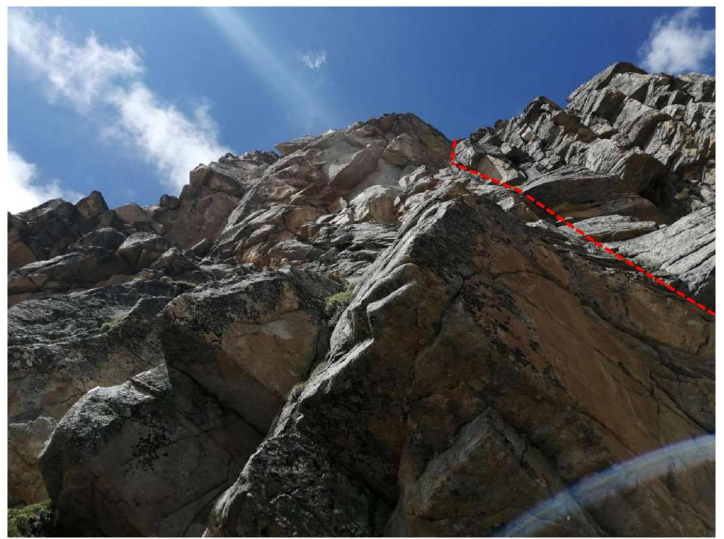
| R14–R15 | Movement to the right upwards along the rocky wall, exiting to the ridge. Alternating movement. 50 m, 70°, 3+ | Photograph №27 |
| R15–R16 | Movement along a wide rocky ridge upwards. Alternating movement. 120 m, 3 | Photograph №28 |
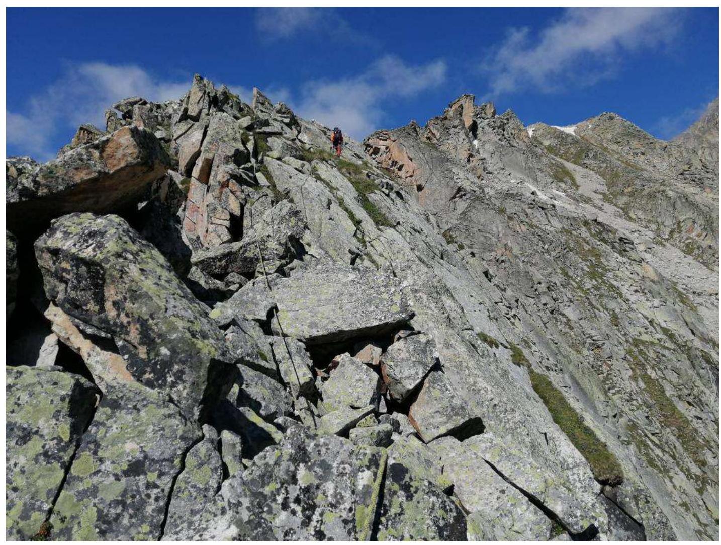
| R16–R17 | Movement along a wide rocky ridge to the peak. Simultaneous movement. 200 m, 2 | Photograph №29 |
Photograph №9. Section R0–R1.
Photograph №10. Section R1–R2 and R2–R3 ("Key to the route!").
Photograph №11. Section R1–R2 (movement through the center of the rocky wall).
Photograph №12. Section R2–R3. Start of movement. "Key to the route!"
Photograph №13. Section R2–R3. Grassy ledge after the inner corner before the chimney. "Key to the route!"
Photograph №14. Section R3–R4. Movement along the center.
Photograph №15. Section R4–R5. Along the ridge to the right.
Photograph №16. Section R5–R6. Movement along the right side of the ridge.
Photograph №17. Section R6–R7. Movement along the right side of the ridge.
Photograph №18. Section R7–R8. Descent to the right to a grassy ledge.
Photograph №19. Section R7–R8. Station after descent.
Photograph №20. Section R8–R9. Movement across simple rocks.
Photograph №21. Sections R9–R10, R10–R11. Movement in the direction of the gendarme, bypassing the gendarme to the right.
Photograph №22. Section R11–R12. Approach to the pyramidal gendarme, followed by a descent to the left.
Photograph №23. Section R12–R13. Descent to a wide area in the direction of a yellow gap.

Photograph №24. Section R12–R13. Movement along the ridge to the left across a grassy ledge.

Photograph №25. Section R13–R14. Movement along the scree couloir.
Photograph №26. Section R13–R14. Approach to the ribbed green wall.

Photograph №27. Section R14–R15. Rocky wall.

Photograph №28. Section R15–R16. Wide rocky ridge.
Photograph №29. Section R16–R17. Wide rocky ridge with an exit to the peak.
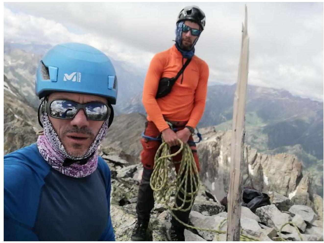
Photograph №30. The team on the peak at the control tour. From left to right: Dumbrovsky A. V.; Klimonov K. A.
Upon completing the ascent, a debrief was conducted, assessing the complexity of individual sections and the route as a whole. The route taken is considered safe. Considering the experience of previous ascents to peaks:
- Kara-Jash (via the North Ridge) — 4A
- Zaimov Peak — 2B
- Taulan (3226) — route through "Korona" — 3A
- Krogzor "Myrdy" — 2A
- 3130 — 2A
- Chat-Bashi — 3B
- Dolomity, South — 3B
- Dalar "along the ridge" — 5A
The route to Panoramny Peak 3507 m corresponds to a category 3B difficulty.
Recommendations for Climbers:
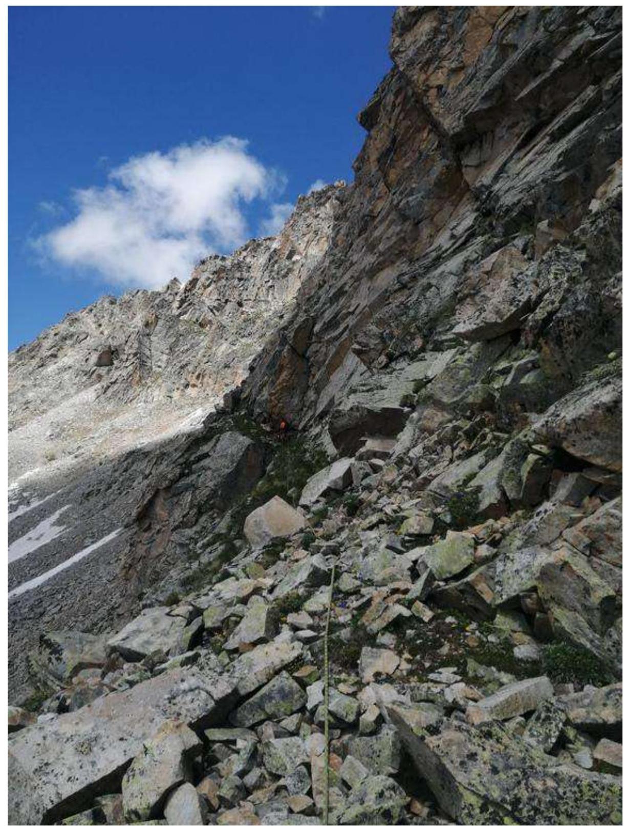
When planning an ascent to Panoramny Peak, it is advisable to set up an assault camp on the shoulder near the lake, immediately after ascending from the valley (Photograph №5).
To navigate the route, the following are required:
- 6 anchor hooks;
- a set of chocks;
- several large loops.
There is no water on the route. Due to the significant length of the route, it is necessary to ensure an adequate water supply. Mobile communication is absent throughout the route.