Report on the First Ascent
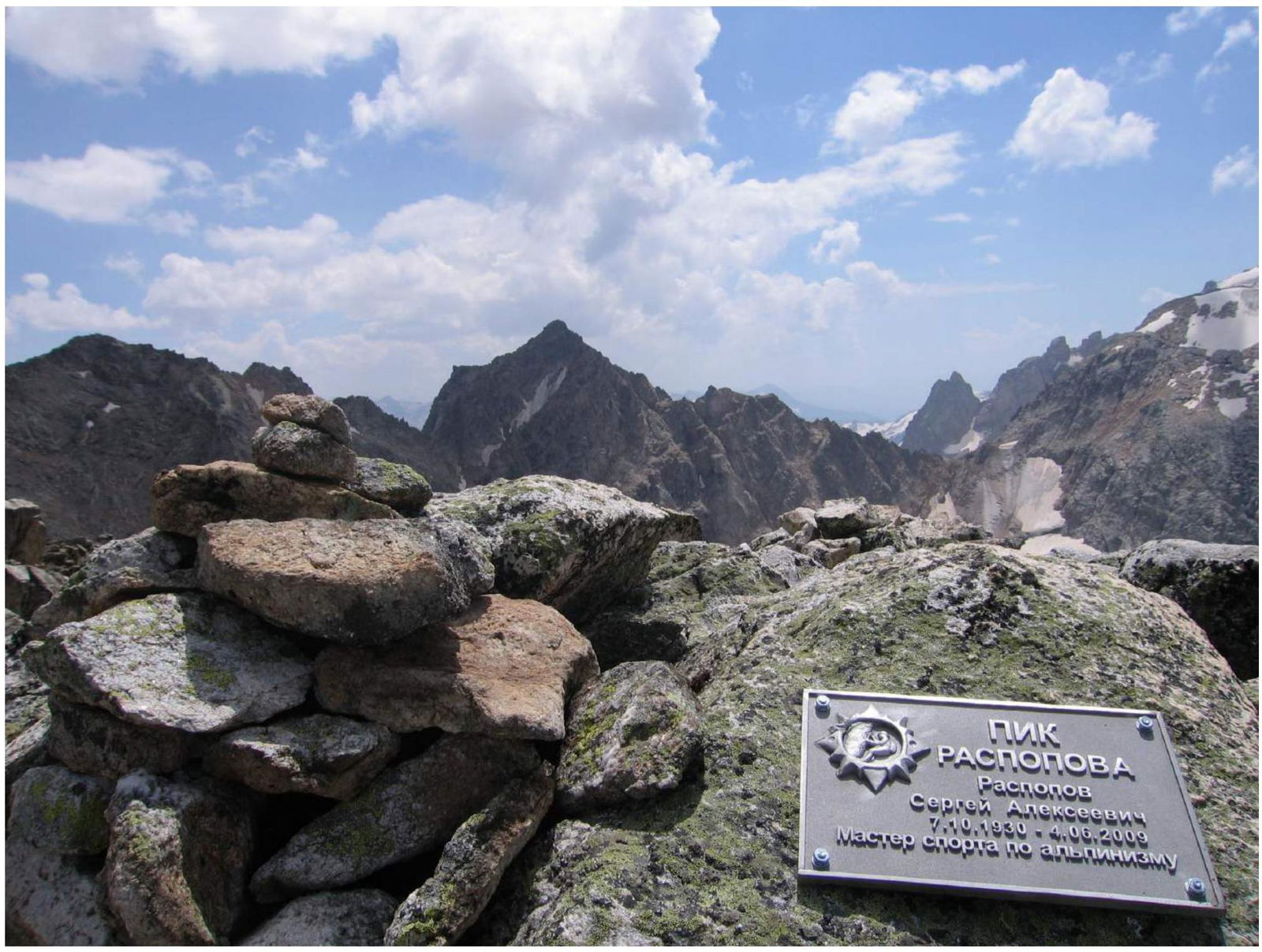
To Peak 3400 — Peak Raspopova (Western Caucasus, Uzunkol, August 2010)
The ascent was made by climbers from Rostov-on-Don with the goal of naming the previously unnamed peak 3400 after Raspopov Sergey Alekseevich, a Master of Sports, a pioneer of Rostov mountaineering, and a dedicated organizer of mountaineering events and mentor to climbers in the Rostov region.
Contact Information
All inquiries related to the report should be directed to:
- 344029, Rostov-on-Don, ul. Pervoy Konnoy Armii, 4a
- Club of Tourists and Climbers "Planeta"
- Phone +7 (863) 242–35–10, Phone/Fax +7 (863) 223–86–12
- http://www.club-planeta.ru↗
- e-mail: clubplaneta@aaanet.ru
- Ascent Leader: Petyakhev Vasily Nikolayevich

Ascent Details
- Western Caucasus, Uzunkol, Kichkinekol gorge.
- Peak 3400 m via the western ridge.
- Category of difficulty: 2B–3A.
- Route type: rock.
- Height difference (from the start of the route to the summit) — 400 m.
- Number of pitons used on the route:
- rock pitons — 5 pcs.
- camalots — 2 pcs.
- stoppers — 2 pcs.
- Team's travel time: 4 hours.
- Participants: Lysenko S.N. — 2nd sports category, Yakovlev A.A. — 2nd sports category.
- Leader: Petyakhev V.N.
- Departure for the route: 6:15, August 6, 2010.
- Summit reached: 10:17, August 6, 2010.
- Return to Base Camp: 12:23, August 6, 2010.
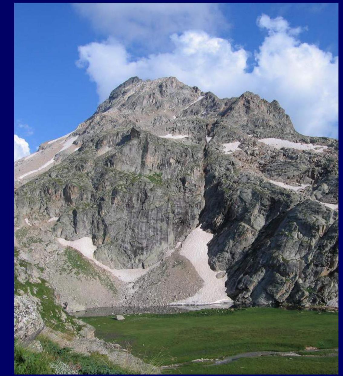

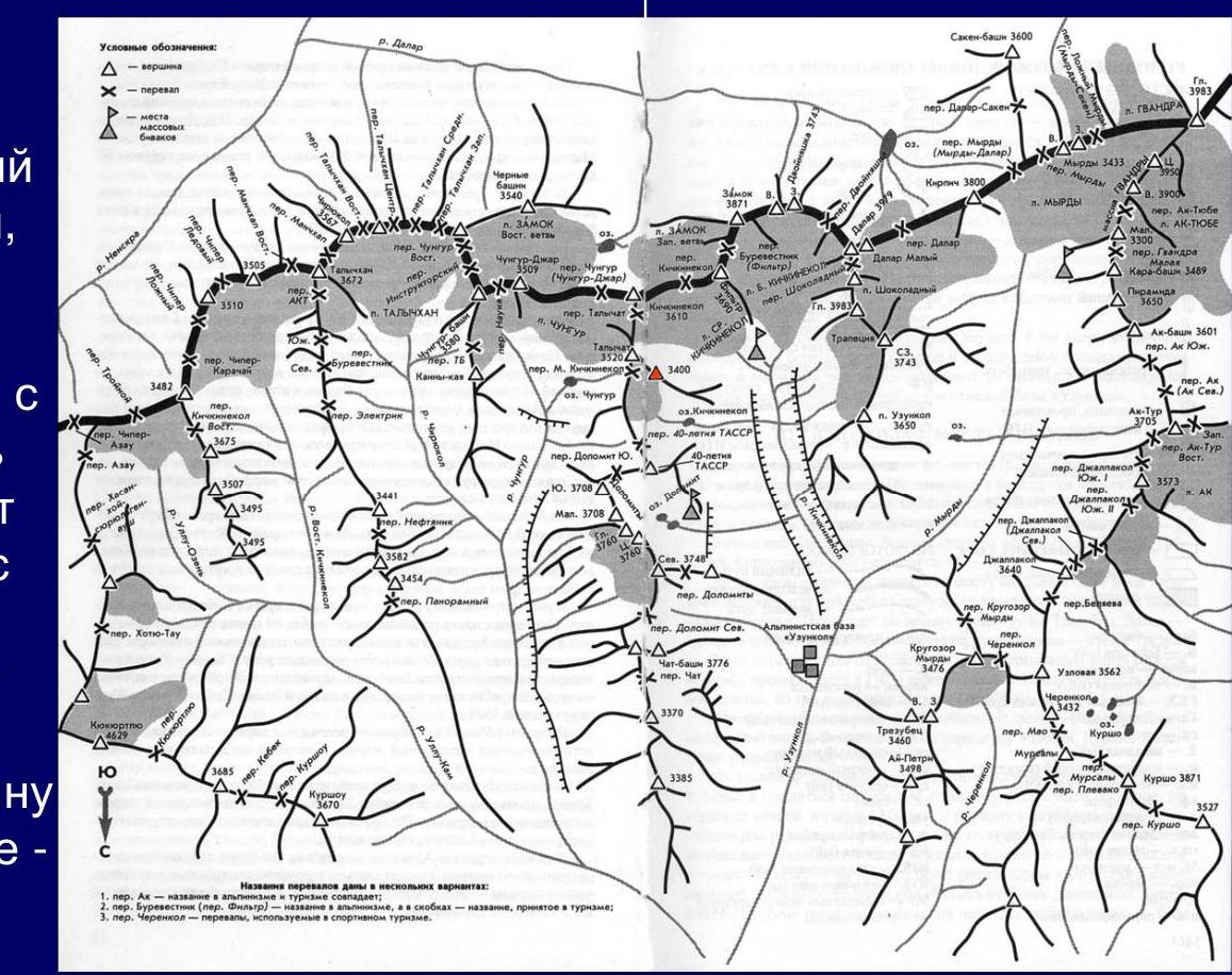
Map and Description of the Area
Area of the Uzunkol alpine camp. The peak is located in the western branch of the northern spur of the Main Caucasian Range (MCR), which starts from v. Kichkinekolbashi, passes through per. Talychat, v. Talychat, per. M. Kichkinekol, per. 40th Anniversary of the Tatar ASSR, and connects with v. 40th Anniversary of the Tatar ASSR. The western branch of the northern spur of the MCR begins from v. Talychat and is connected by a saddle to peak 3400.
Base camp is located directly under the peak, in the hanging valley by the "Kichkinekol" lake. The ascent to the valley from the Kichkinekol gorge, from the Uzunkol alpine camp, takes two hours of travel time.
Photopanorama of the Area

Technical Photographs of the Route
Taken on August 5, 2010, from a height of 2900 m, at a distance of 800 m from the object.
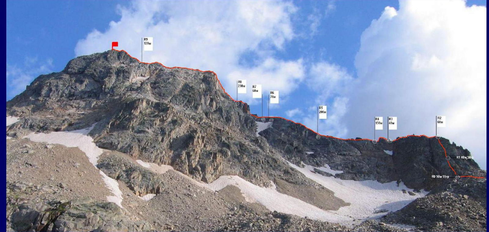
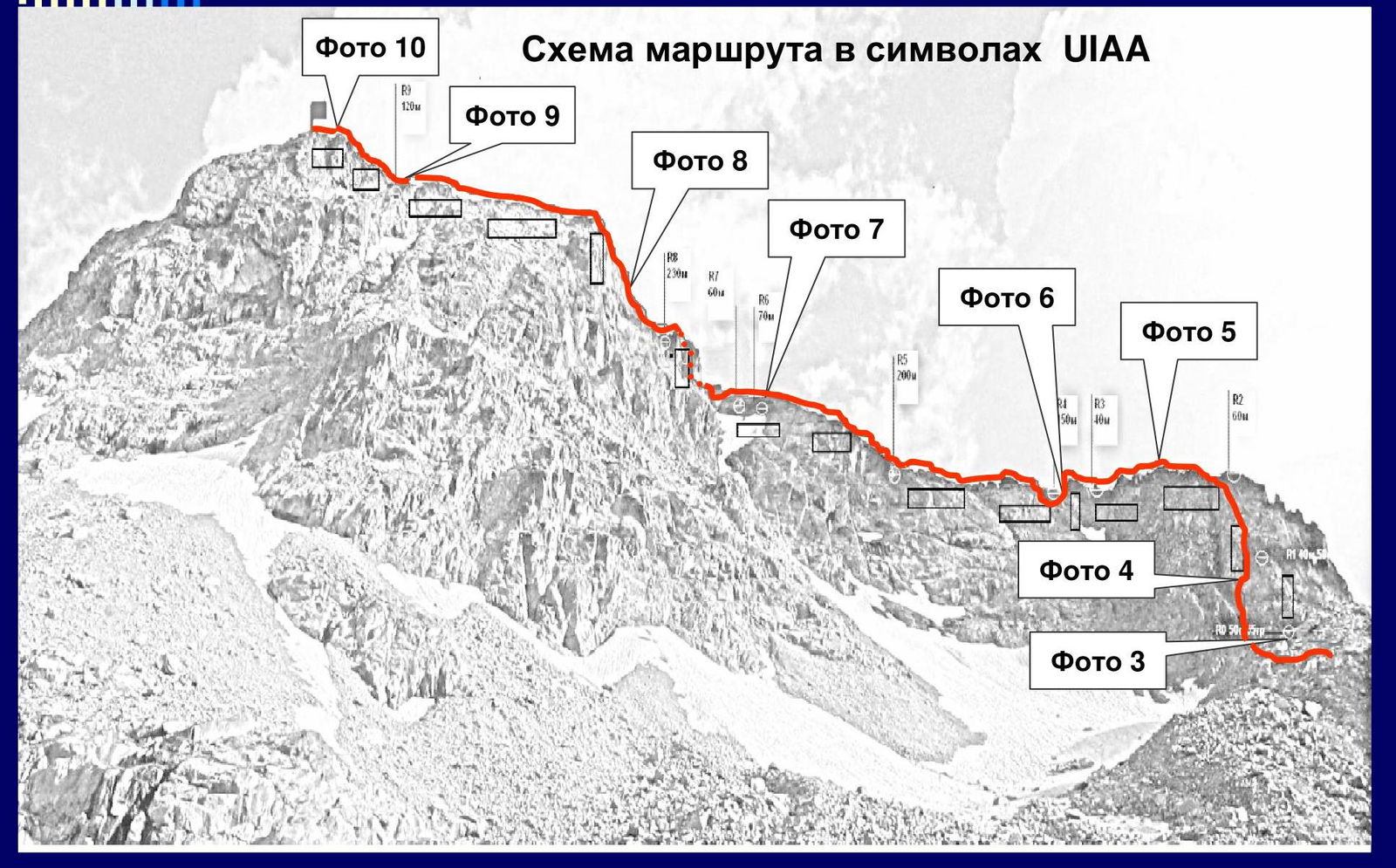
Photo 10. Route diagram in UIAA symbols
Route Description
From the bivouac site, ascend via the "ram's foreheads" to the southeastern rocky spur of peak 3400. Then, move up the grassy slopes towards the peak until the first sentinel (300 m). Bypass the sentinel on the left via grassy and scree horizontal and sloping ledges. Staying on the left side, ascend via large scree to under the edge of the southeastern ridge (link up here!). Ascend onto the ridge via a rocky edge to the right of the "rusty couloir" ("couloir is rockfall prone!").
Section R0–R1 — ascent along the edge of large blocks (50 m, 55°). In the middle of the edge, there is a belay station behind a rocky outcrop (photo 3).
Section R1–R2 — continue ascending along the edge (40 m, 50°) and exit onto the ridge. On the ridge, there is a belay station behind a rocky outcrop (photo 4).
Section R2–R3 — move along the left side of the destroyed rocky ridge for about 60 m until the "rusty rocky tooth" (photo 5).
Section R3–R4 — ascend the tooth "head-on". The first in the rope team is belayed to a rocky outcrop. After passing the rocky tooth, there is a convenient belay station on the ridge within 30–40 m (photo 6).
Section R4–R5 — move along the destroyed stony ridge and grassy ledges for about 150 m, simultaneous movement, until the beginning of the sharp rocky ridge.
Section R5–R6 — move along the narrow rocky ridge, alternating belays to outcrops. The length of this section is approximately 200 m (at the end of the ridge, there is a large boulder) (photo 7).
Section R6–R7 — exit to a sentinel via the destroyed ridge. Bypass the sentinel via ledges on the left side and exit onto the ridge to a rocky belay station, 10–15 m high (at the top, there is a rock in the shape of a piglet). The length of this section is approximately 70 m (photo 8).
Section R7–R8 — ascend the wall vertically (belays to rocky outcrops) onto the ridge. Here, there is a wide stony area (a convenient place for belaying).
Section R8–R9 — move along the ridge towards the pre-summit ascent, approximately 230 m.
Section R9–summit — at the beginning of the pre-summit ascent, the ridge is narrow with drops on both sides; organize belaying. Move directly along the ridge to the summit — 120 m (photos 9, 10).
Descent is via the ascent route!
Appendix
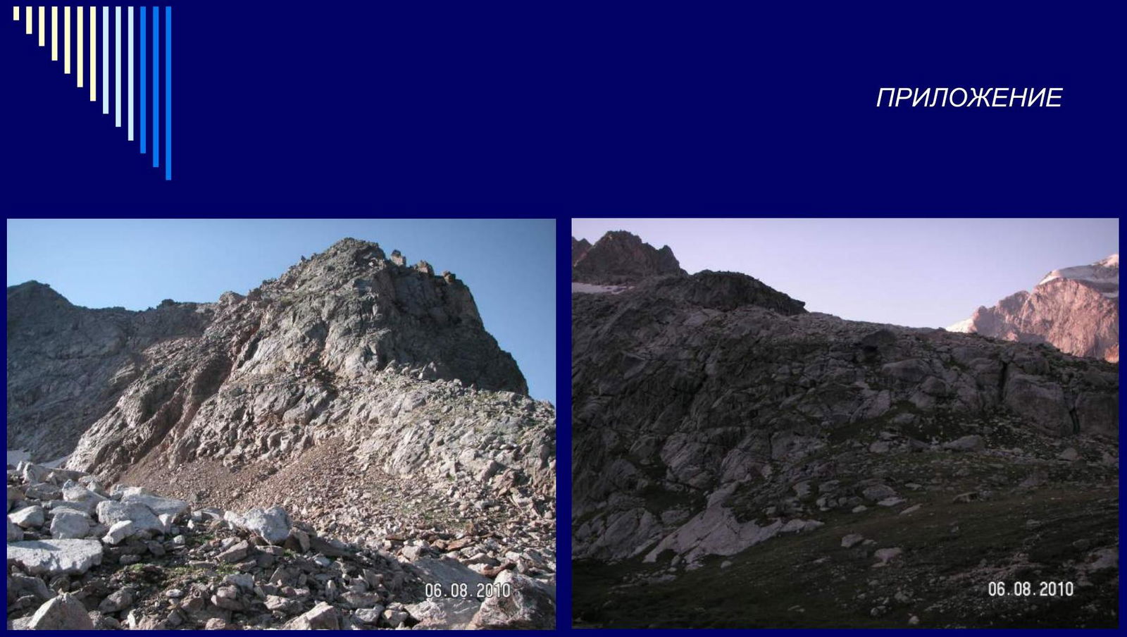
Photo 1. Start of the route
Photo 2. Approach to the route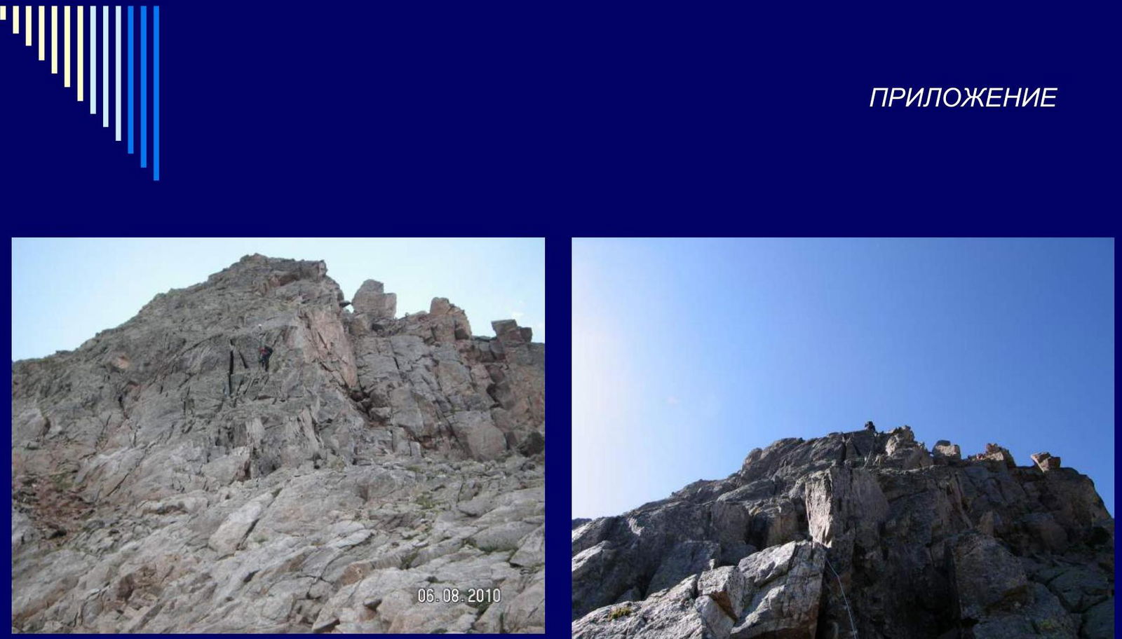
Photo 3. Section R0–R1
Photo 4. Section R1–R2
Photo 5. Section R2–R3
Photo 6. Section R3–R4

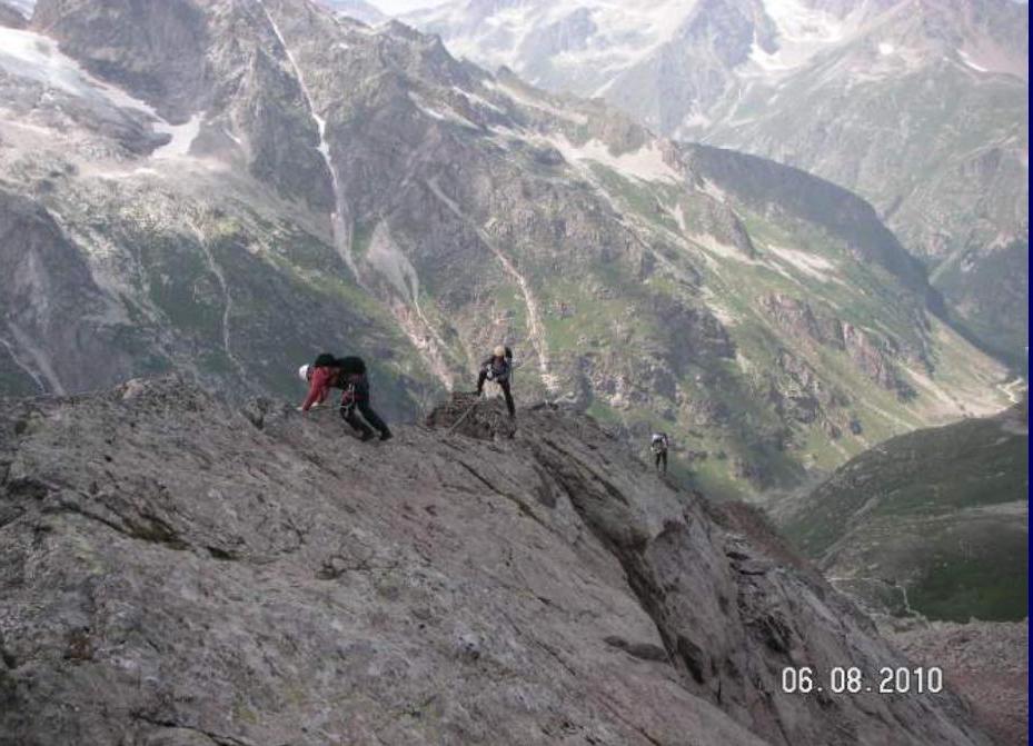
Photo 7.1. Section R4–R5
Photo 7.2. Section R4–R5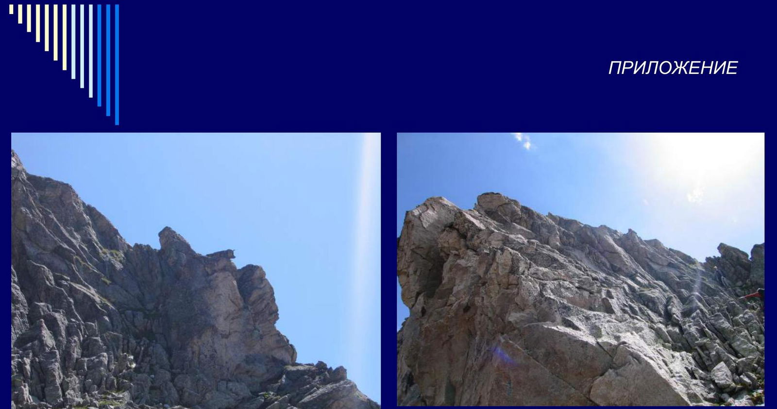
Photo 8.1. Section R7–R8
Photo 8.2. Section R7–R8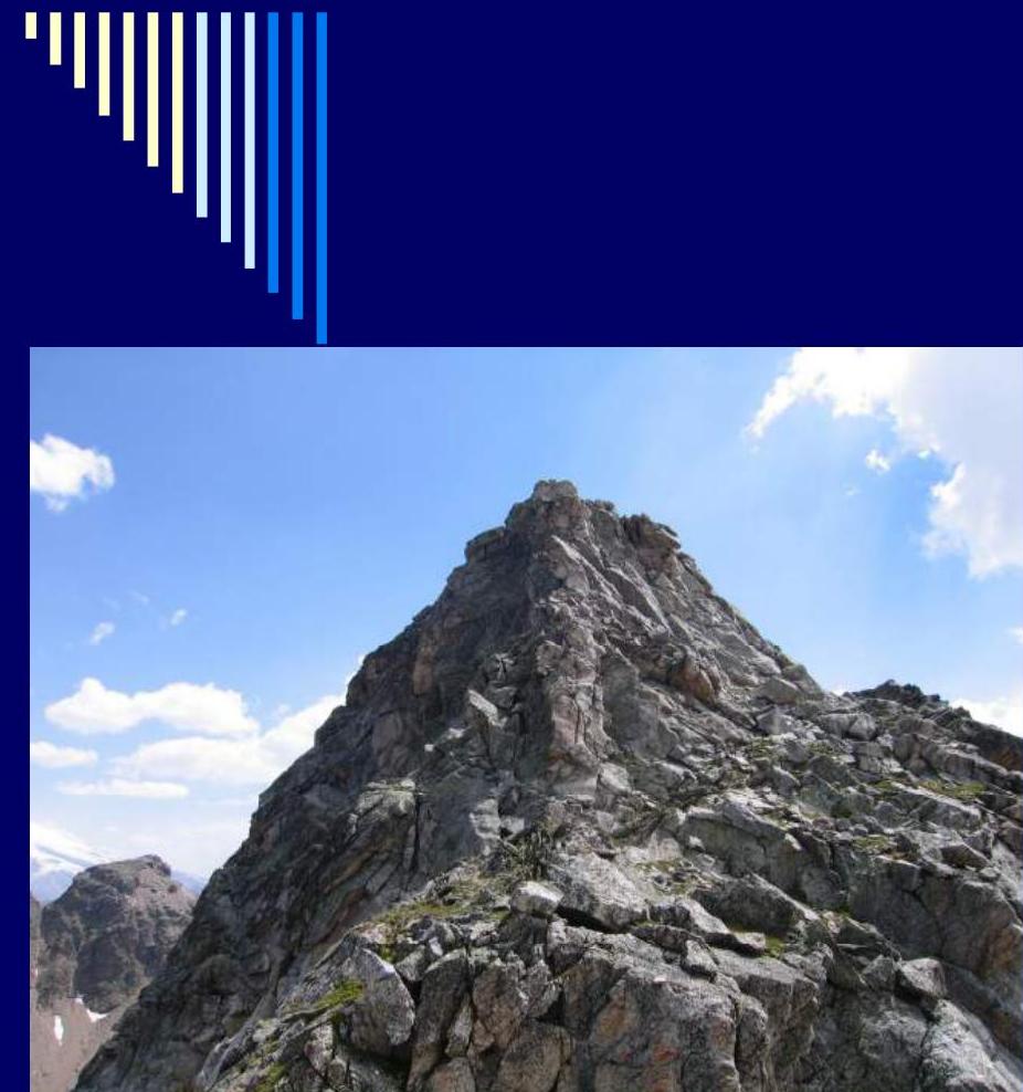
Photo 9.1. Section R8–R9

Photo 9.2. Section R8–R9
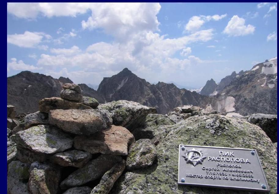
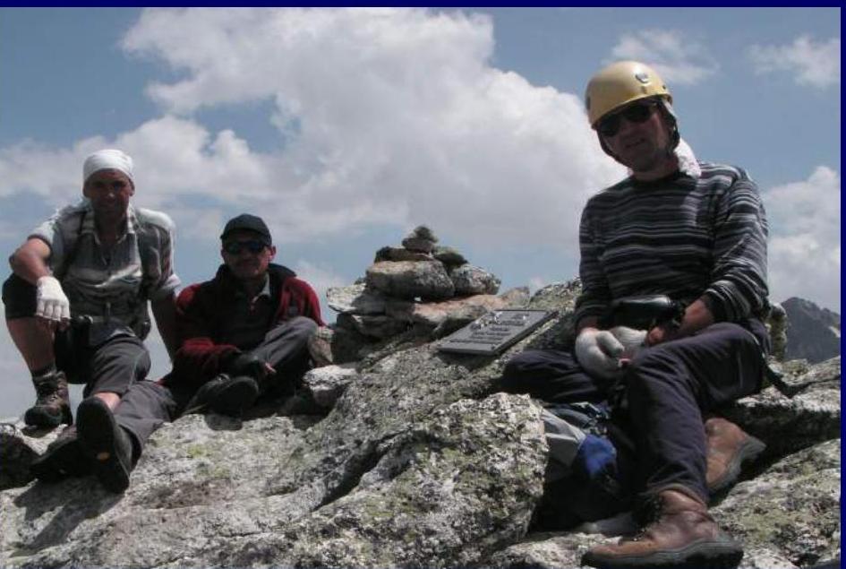
Photo 10.1. Summit
Photo 10.2. Summit