
ASCENT PASSPORT
- Ascent category — rock
- Ascent area — Western Caucasus from Marukh pass to Nakhar pass
- Peak, its height, ascent route: peak Razdelny, 3300 m via south-west ridge, rock, first ascent
- Proposed category of difficulty — 2A
- Route characteristics: height difference — 200 m (from the beginning of the ridge) length of sections: 1st cat. diff. — 1600 m 2nd cat. diff. — 192 m 3rd cat. diff. — 25 m Total — 1817 m Average steepness 25–30°
- Pitons hammered: for belay: rock 2, ice –, bolt –, protection 7 for ITO: rock –, ice –, bolt –, protection –
- Number of travel hours — 4 h
- Number of nights and their characteristics — none.
- Full name of the leader, participants, their qualification:
- Shvyrev Andrey Glebovich — Candidate for Master of Sports
- Mangilev Valery Georgievich — 2nd sports category
- Team coach — Gorbachevsky A.D.
- Date of departure on the route and return — August 5, 1987.
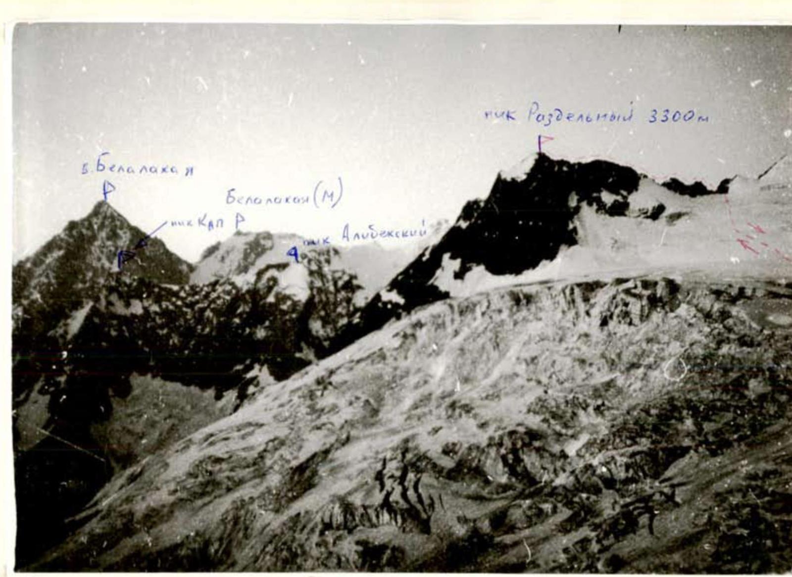
 Photo of the general view of the PEAK
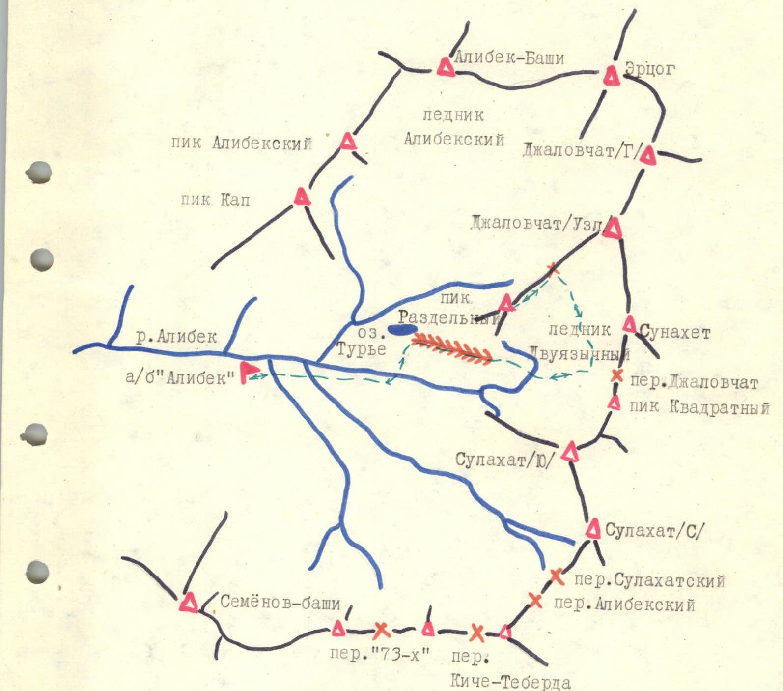 Fig. Map of the ascent area.
BRIEF DESCRIPTION OF THE APPROACH TO THE ROUTE
From Alibek AUSB along the trail to Turye Lake. Bivouac. From the bivouac, ascent to the moraine descending from under Dvuyazychny Glacier. From the moraine, exit to the "ram's foreheads" and further to Dvuyazychny Glacier. Further ascent along the center of the glacier to Jalovchat pass (left of peak Kvadratny). Before the last ice-snow ascent to the pass, turn left to the rocky island. The island is bypassed from below.
From Alibek AUSB, the approach to the start of the route takes 4–5 h.
BRIEF EXPLANATION FOR THE DIAGRAM
From the rocky island, ascent to the saddle between peak Razdelny and peak Jalovchat (Uzlovaya) along a snowy slope. From the saddle along a sharp ridge to the 25-meter wall of the first ascent. The wall is overcome head-on (climbing of medium difficulty, piton belay). On the first ascent, there is a control cairn.
Further along the ridge to the 12-meter wall of the second ascent. The wall is passed head-on.
The third ascent is led by two paths. You can climb up the 20-meter wall or to the left of it along the inner corner.
Further 250 m along a simple ridge. Before the summit, there is a sharp ridge with 3–4-meter walls. Climbing of medium difficulty.
From the rocky island, the ascent to the summit takes 4–5 h. Descent via the ascent route.
 Diagram of the ascent route to peak Razdelny via the south-west ridge
- R1: 100 m, 15° 1 (from Jalovchat pass)
- R2: 60 m, 35° 2
- R3: 100 m, 15° 1
- R4: 25 m, 60° 3
- R5: 100 m, 20° 1, control cairn
- R6: 12 m, 55° 2
- R7: 180 m, 25° 1
- R8: 20 m, 50° 2
- R9: 250 m, 25° 1
- R10: 100 m, 40° 2
- R11: 70 m, 25° 1
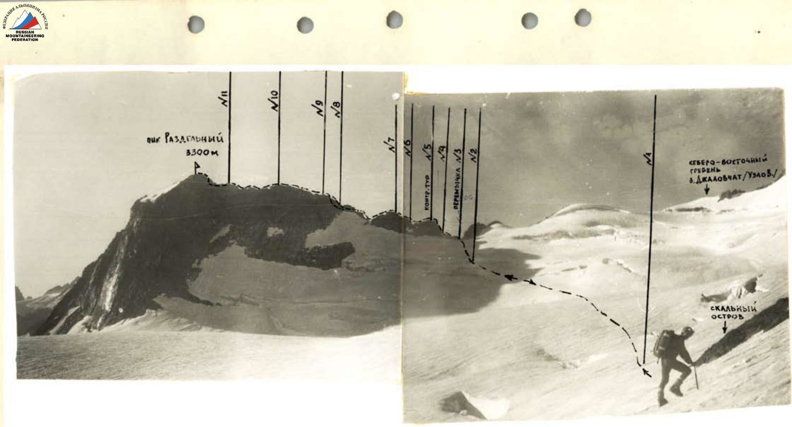 Photo of the general view of the route to peak Razdelny via the SW ridge. The photo was taken from the rocky island at the beginning of the ascent to the ridge.
 Profile of the route (photo from Dvuyazychny Glacier)
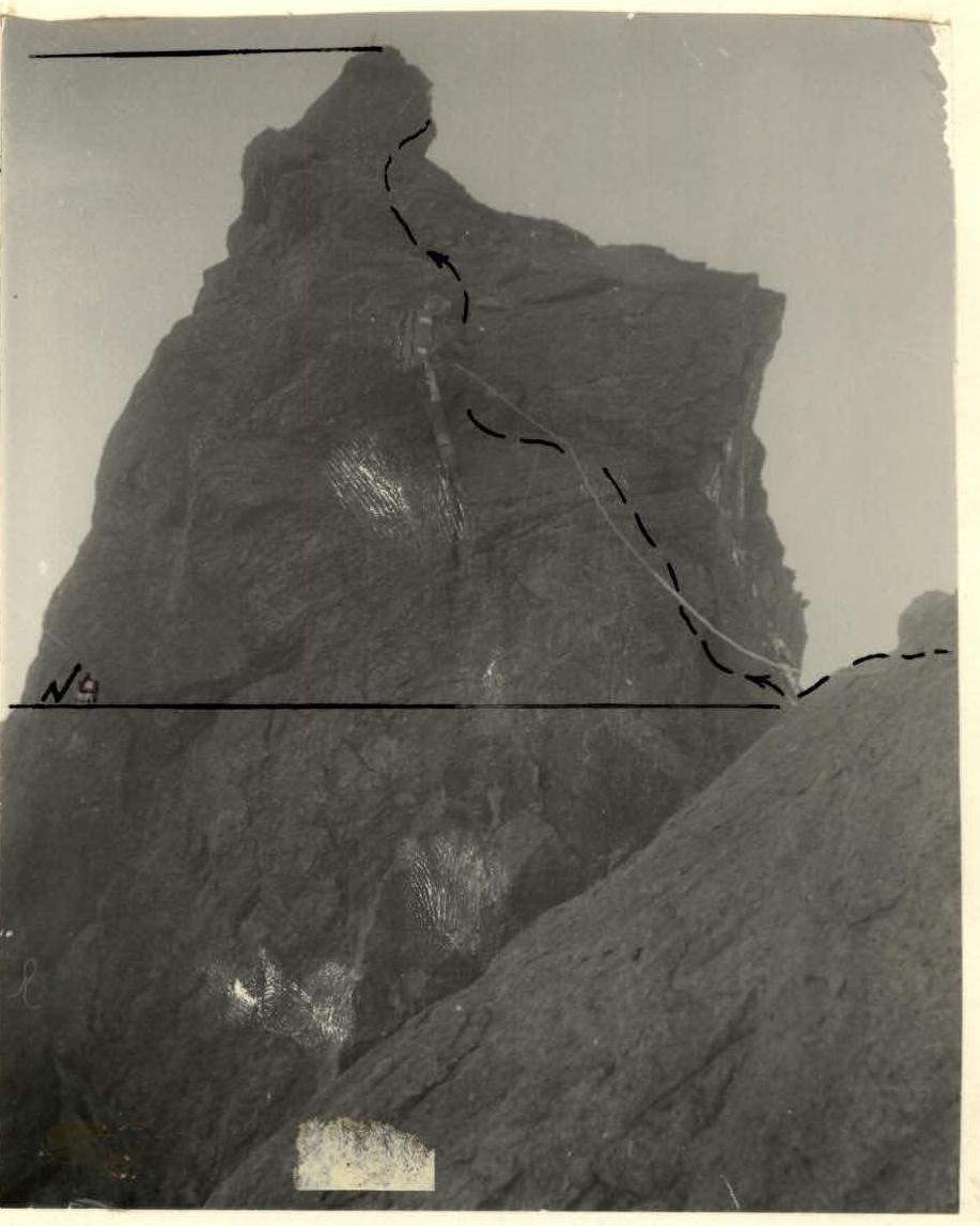 Photo of section #4. The key section of the route along the SW ridge of peak Razdelny. The photo was taken from section #3.
Comments
Sign in to leave a comment