Ascent Passport
I. ASCENT CLASS
- ASCENT AREA, RIDGE
- PEAK, ITS HEIGHT, ASCENT ROUTE, NATURE OF THE ROUTE
- Rocky
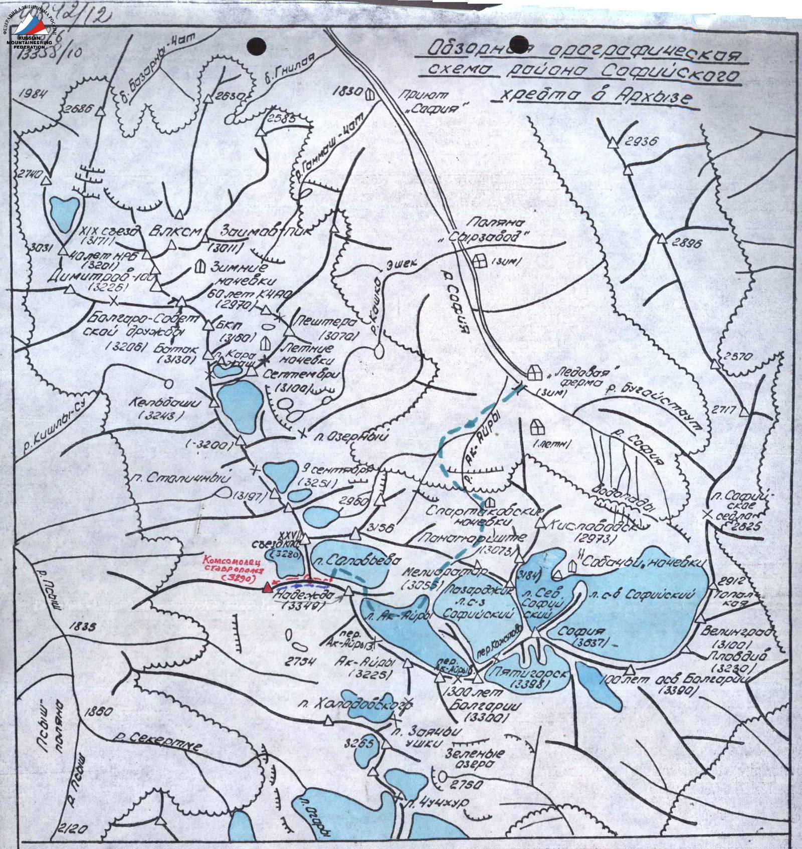
- Western Caucasus, North-Western spur of the Sofiyskiy ridge, Psysh river basin
- “Komsomolets Stavropolya” (as named by the first ascenders), 3290 m, via the Eastern ridge, snow-rocky
- PROPOSED DIFFICULTY CATEGORY — 2A
- ROUTE CHARACTERISTICS
- Height difference — 350 m, average steepness — 45°
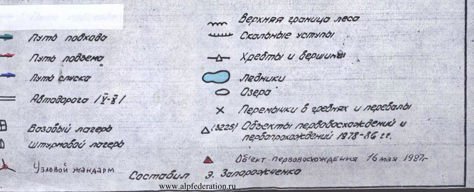
- NUMBER OF PITONS DRIVEN
- 6 placed nuts
- NUMBER OF TRAVEL HOURS
- 6
- NUMBER OF NIGHTS AND THEIR CHARACTERISTICS
- The route is completed within daylight hours
- ASCENDERS' COMPOSITION
Leader
- Zaporozhchenko E., CMS
Participants
- Gavrilov I., CMS
- Sharshakov A., 2nd category
- Grebenyuk A., 2nd category
- Orlov K., 2nd category
- Kruglov A., 3rd category
- Gomelauri N., 3rd category
- Starykh V., 3rd category
- TEAM COACH
- Popov V.P., Master of Sports of the USSR
- DATE OF ASCENT AND DESCENT
- May 16, 1987
- ORGANIZATION
- Stavropol Krai Sports Committee

General view of the first ascent route to the summit "Komsomolets Stavropolya" (3290 m)
forepeak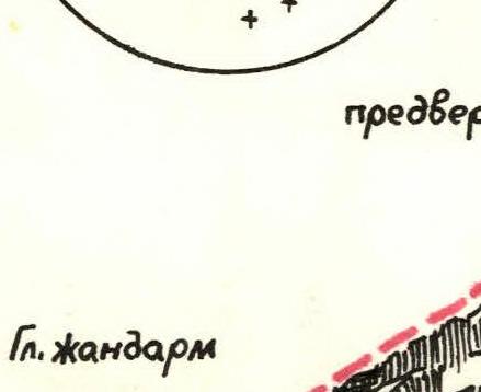
Main
gendarm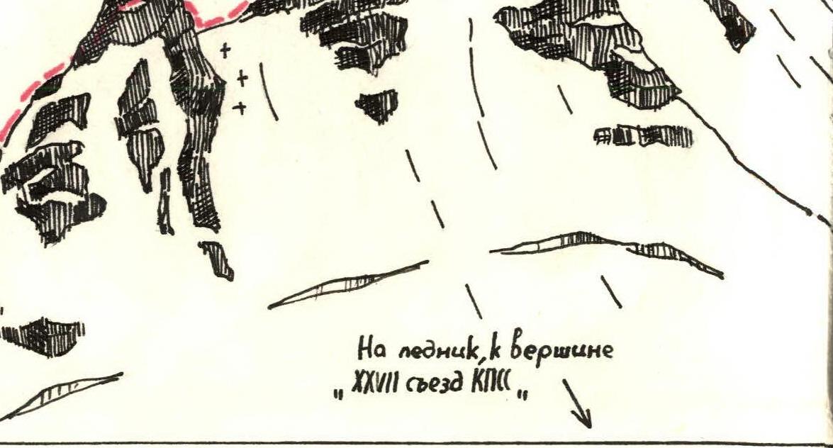
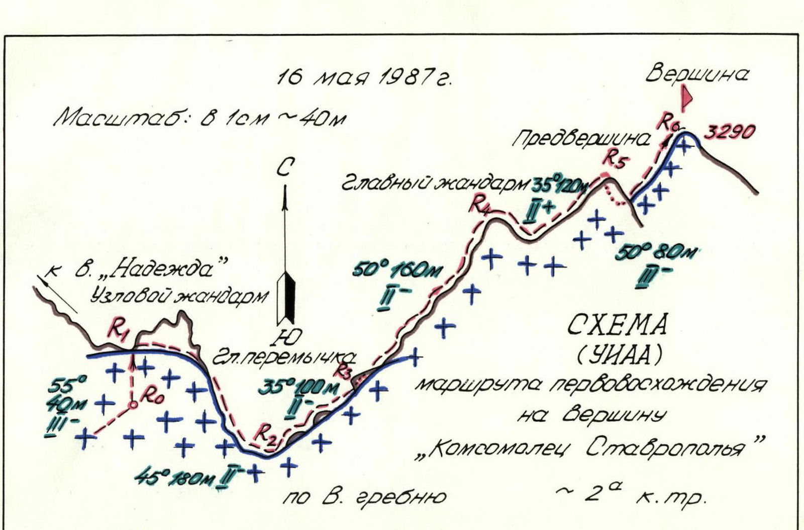
Scheme of the first ascent route to the summit "Komsomolets Stavropolya"
The unnamed peak 3290 m towers alone above the Psysh river gorge, being pushed far to the west along the ridge, which has the dominant peak Nadezhda (3349 m, classified route 1B category) and branches through the Uzlovoy gendarm to the peak 3290 m and peak named after the XXVII Congress of the CPSU (3280 m, see the overview orographic scheme). The first ascent to the latter was made on February 20, 1986.
The present first ascent was organized by the Krai Komsomol Committee and the Krai Federation in honor of the XX Congress of the Komsomol and was made on May 16, 1987.
From the "Ledovaya ferma" base camp (the farm has not existed since 1987), the path goes in the direction of the Ak-Ayry pass. After reaching the Ak-Ayry glacier, one should turn up to the right and through the pass in the eastern ridge of the Nadezhda peak, exit under the snow-ice slopes of this peak and bypass them from the north, approximately along the edge of the Solovyova glacier, in the direction of the Uzlovoy gendarm, until a sharp increase in the slope steepness at its base.
This path should be overcome very early, before dawn, so that it would be possible to pass under the slopes of Nadezhda in the first half of the day when returning from the summit.
Route description
Section R0–R1. Towards the site on the Western ridge of the Nadezhda peak (granit-gneisses) to the left of the Uzlovoy gendarm straight up, in three pitches, on steep (55°) snow, 40 m, 3.
Section R1–R2. Traverse to the right along the border of snow and rocks of the Uzlovoy gendarm (2-3 placements in rock crevices), 80 m, until connecting with the ridge leading to the peak named after the XXVII Congress of the CPSU, transition to the Western ridge of the gendarm and on the left side of the ridge, on snow, 100 m down, to the Main saddle, 2.
Section R2–R3. Along the snow-firn slope, bypassing separate rock outcrops on the left, through a rise, under an overhanging rock 3 m high, 100 m, 2.
Section R3–R4. Bypass the overhang on the left, on heavily destroyed rocks, straight along the ridge, under the Main gendarm. Climb onto it, via a crack straight "head-on" — 20 m, climbing 1+ category. On the gendarm — belay. The total length of the section is about 160 m, d ~ 50°. Average difficulty category 2.
Section R4–R5. (Photo 1) Descent down a 3-meter ledge and along a sharp snow-covered destroyed ridge with belay for rock outcrops (banded granite), bypassing small walls on the left, to the forepeak — 35°, 120 m, 2+.
Section R5–R6. (Photo 2, 3, 4) Descent from the forepeak, first along a heavily destroyed complex rocky ridge, followed by 5 m along an inner corner (3), traverse along slabs 5 m (3). Then descent to a saddle 3 m (3). Ropes are necessary, 3-4 placements. Average steepness 80°. The key point of the route. From the saddle — ascent up a steep (55°) firn (crampons), bypassing frozen blocks on the left, ascent (2.5 ropes) to the summit. Overall complexity of the entire section 3.
Descent via the ascent route. The summit cairn was built for the first time. On May 17, a second group of climbers from the "Arkhyz-87" event reached the summit. The first ascenders and participants of the second ascent overcame the route from the base camp (~1900 m) to the base camp within daylight hours.
The Krai Federation petitions to name the peak "Komsomolets Stavropolya".
Compiled by:
- E. Zaporozhchenko
- A. Kruglov