Shaan-Kaya — 9
Author: Alexander Lavrinenko, Odesa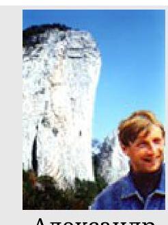
Shaan-Kaya is located near Alupka. It is not part of the South Ridge, but is protruded towards the sea, in front of the Alupka wall. The wall's height difference is about 250 m. In the central part, the wall overhangs. There are 6 routes laid on the wall (Note: as of December 2001, 8 routes have been climbed), all are of 6th category of difficulty.
Alexander Lavrinenko
To get to Shaan-Kaya, you need to:
- Get to the Alupka "Pitomnik" stop
- From there, go up the road
- Pass through the vineyards
- Get on a dirt road, which leads practically under the wall
Water is available at a spring within 15 minutes walk from the wall.
The remaining routes are located significantly to the left and right of the center. The routes on the left part are more destroyed.
On the Grishchenko route (№5 on the photo):
- The lower part is quite monotonous — poor bolt placement, occasional climbing, but mostly using artificial aids (ИТО).
- The upper part is more monolithic and less spoiled by bolts.
I have no information about the leftmost route.
The routes on the right part of the wall are more interesting:
Grishchenko Route 5Б, VI, A2, 285 m (№2 on the photo). Passes through the right part of the wall. The route is mainly through cracks, with a lot of free climbing. Time to complete — 5–6 hours.
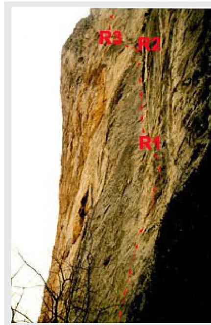
Lower part of the Grishchenko route
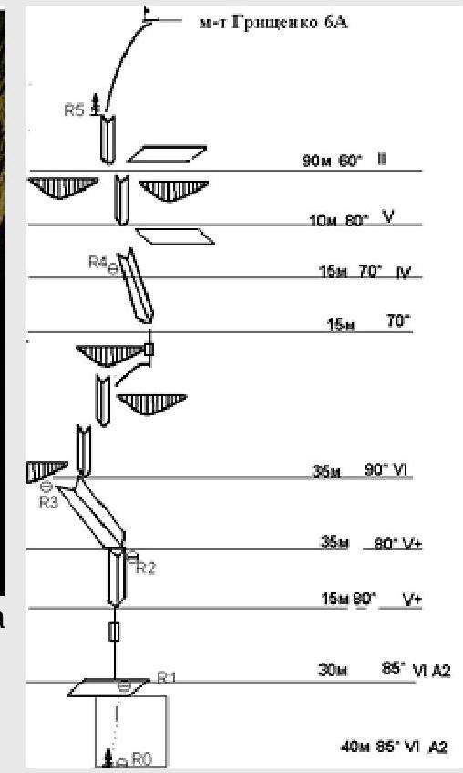
The route starts from a large tree growing close to the wall. First meters are climbed using the tree, then via a bolted path, with occasional free climbing, to reach a ledge. R0–R1 (40 m, VI, A2, 85°)
Then up through a crack (using chocks and friends), transitioning into an internal corner. Insurance point is on a small shelf (bolts, pitons). R1–R2 (45 m, VI, A2, 85°)
Up the internal corner — left under a small overhang. R2–R3 (35 m, V+, 80)
Then, through the overhang, up — right through internal corners and cracks, bypassing a small ledge on the right, to reach a more gentle slope (35 m, VI, A2, 90), then up simple rock (15 m, III, 70°). R3–R4 From the insurance point up through steep, destroyed rock (25 m, V, 80°), then through simple rock to a large pine tree (30 m, II, 60°). R4–R5
Further up through simple rock to the summit. R5–R6 (60 m, II)