Mshatka-Kaya — 13 hours
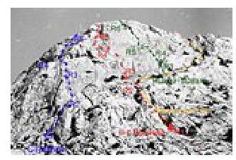
Hi-Res photo of Mshatka-Kaya Mt. “Lishayov's Route” — red line on the photo
“Lishayov's Route” (5A)
Mt. Crimea
Back to the main page of the “Mshatka-Kaya” essay.
Author: Alexander Lavrinenko (“Odessit”), Odessa
The route (“Fantika”) goes along the central bastion about a hundred meters to the right of the “Strelka”. It is rarely climbed as many people are not aware of its existence.
The start of the route coincides with the “Triangle on the left” 3B route.
After the first rope (50 m 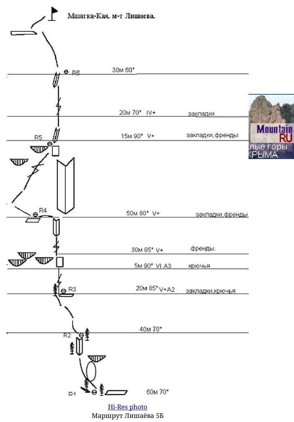 70°
IV), move up-left and climb towards a large pine tree. (50 m 70° IV).
70°
IV), move up-left and climb towards a large pine tree. (50 m 70° IV).
From the pine tree, climb up a thin crack 20 m (85° V+A2), then make a difficult move to a vertical slit formed by a huge “patch” and the main wall (5 m 90° VIA3). Continue along the slit, climbing up 30 m (85° V+), then traverse left to a ledge with a small tree (insurance point).
Then move left, then up-left along the slit (50 m 80° V+). From the insurance point, climb through a small overhang to a slit, and up the slit (15 m 90° V+), then the rocks become simpler, and after 40 m, reach the summit.
Route description by sections
R0–R1 Simple rocks 100 m 50–60° I
R1–R3 Climb internal corners and small walls to reach a large pine tree. (100 m 70° IV)
R3–R4 Thin crack (small nuts, pitons) 20 m 85° V+A2, vertical wall 5 m 90° VIA3 (pitons), steep slit 30 m 85° V+ (friends)
R4–R5 Free climbing up a steep slit right-up. (pitons, nuts) 50 m 80° V+.
R5–R6 Climb through an overhang with difficult moves to a slit, and up the slit (nuts, friends) 15 m 90° V+, then simpler rocks (70° IV–III)
R6–R7 Climb simple rocks (70–60° III–II) to the summit.