Maly Kilse-Burun — 2
Via the center of the south face and the southwest ridge, 4B (Y — 10 m) (Yu. Lishaev's route («Fanika»), 1973)
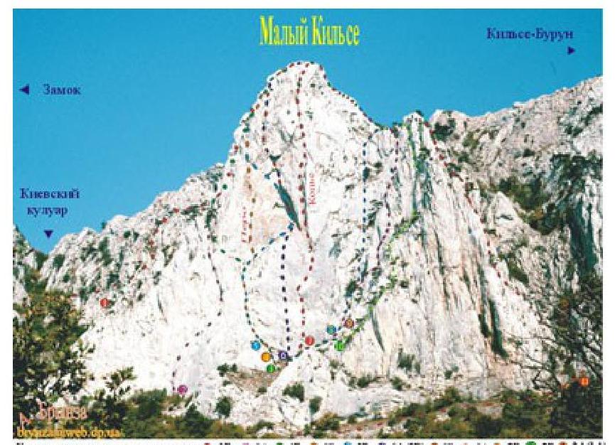
The approach to the route is roughly the same as in route 2. Having ascended the scree slope under the south face of the summit, exit onto a rocky ledge under its central part (section R0).
On section R1–R2 — upwards along gentle slabs to the base of a small counterfort. Then upwards along it (section R2–R3), first through a cleft, and then along an internal corner to a small depression (R1–R2: 20 m, 60°, II; R2–R3: 40 m, 80°, IY+).

On section R3–R4 — first straight up, and then left and up under the left side of a long and narrow flake. Further (section R4–R5) upwards along a sheer 10-meter cleft, located on the left side of the flake, which was named "Pen" («Перо») by the first ascenders (R3–R4: 30 m, 65°, II; R4–R5: 10 m, 85°, Y).
On section R5–R6 — first traverse 8 m to the left to a wide internal corner, and then upwards along it (section R5–R6: 30 m, 60°, III).
On section R6–R7 — upwards along an internal corner. An overhanging section in the upper part is bypassed on the left (section R6–R7: 40 m, 70°, IV).
On section R7–R8 — first up the wall to the right, and then up a chimney. On the final section — upwards along steep walls to the summit (R7–R8: 40 m, 70°–III; R8–summit: 30 m, 60°, III). The length of the main part of the route is 240 m. The ascent takes 4–5 hours. P.S. In recent years, the route is rarely climbed.
Eamcogna cnoewcna agogonae: (1) 1Е (1) 1А (1) (1) (1) (1) (1) (1) (1) (1) (1) (1)