Ascent Passport
- Kola Peninsula. Khibiny mountain range. Otkol Cirque. Classification table section number: #8.6
- Peak name — Poachvumchorr, 1095 m, to the bastion. Route name "PV".
- Assumed — 4B cat. dif. First ascent.
- Route type: rock.
- Route elevation gain: 650 m by altimeter. Route length: 610 m. Length of sections with 5 cat. dif. — 45 m.
- Pitons left on the route: total — 3; including bolted — 0. Total artificial climbing aids (ITOs) used: 0 points.
- Team's climbing hours: 7 hours.
- Group: leader — Andreev A.B. — CMS Participants:
- Korzhakov N.Yu. — 2nd sports category
- Babenko S.R. — 2nd sports category
- Antipov S.Yu. — 2nd sports category
- Marchenko D.V. — 2nd sports category
Route approach: August 20, 2009 Summit reach: August 20, 2009 Return to base camp: August 20, 2009
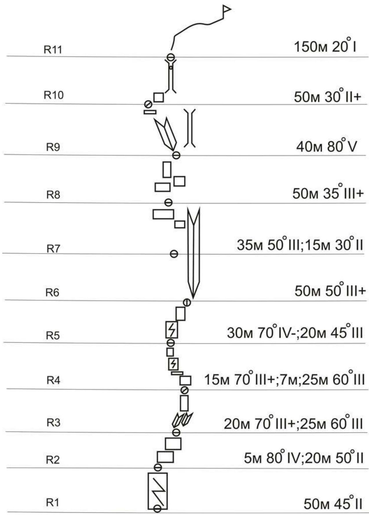
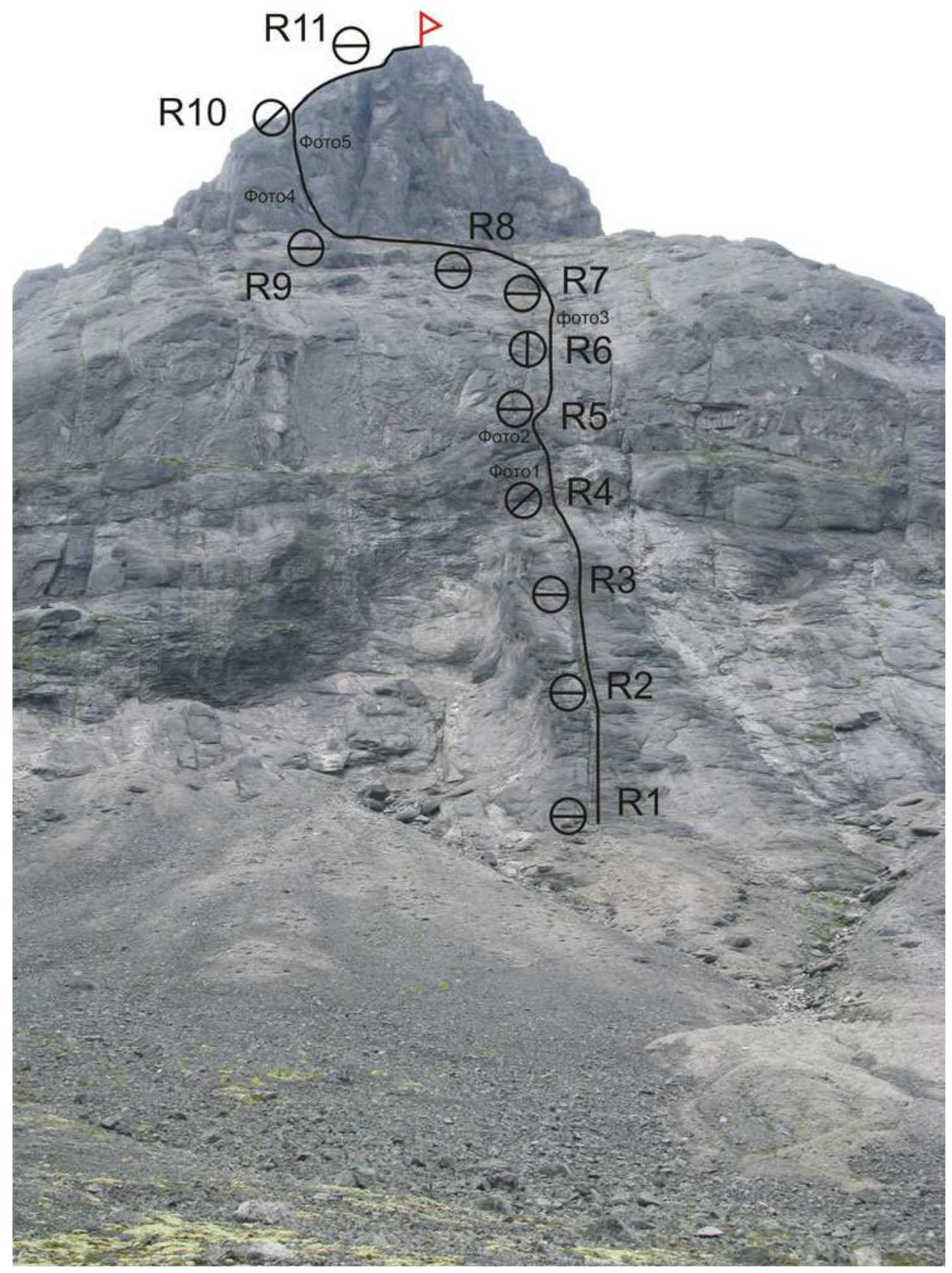
Description of the "PV" Route
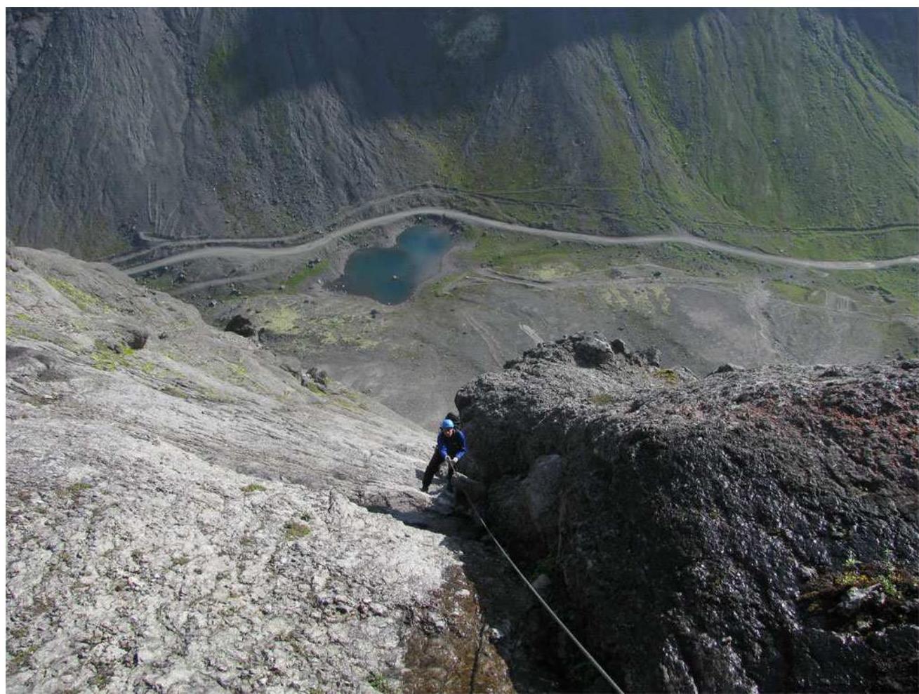
Approach to the route from the Kukisvumchorr pass to a huge bastion. The starting point of the route is a large crack directed vertically upwards. To the left of the crack, a plaque is attached in memory of deceased climbers. From the pass — 30 minutes.
R1–R2: Up the large crack vertically under a small wall. 50 m, 45°.
R2–R3: Wall 5 m, 80° 4; then along a series of slabs under a double internal angle 45 m, 55° 3.
R3–R4: Up the internal angle, under a slab. 20 m, 70° 3. The slab leads to a wide crack forming an internal angle. 25 m, 60° 3.
R4–R5: Up the crack to a ledge. 15 m, 70° 3. Rocks are wet! Traverse left along the ledge 7 m under a wall. Then 25 m, 60° 3.
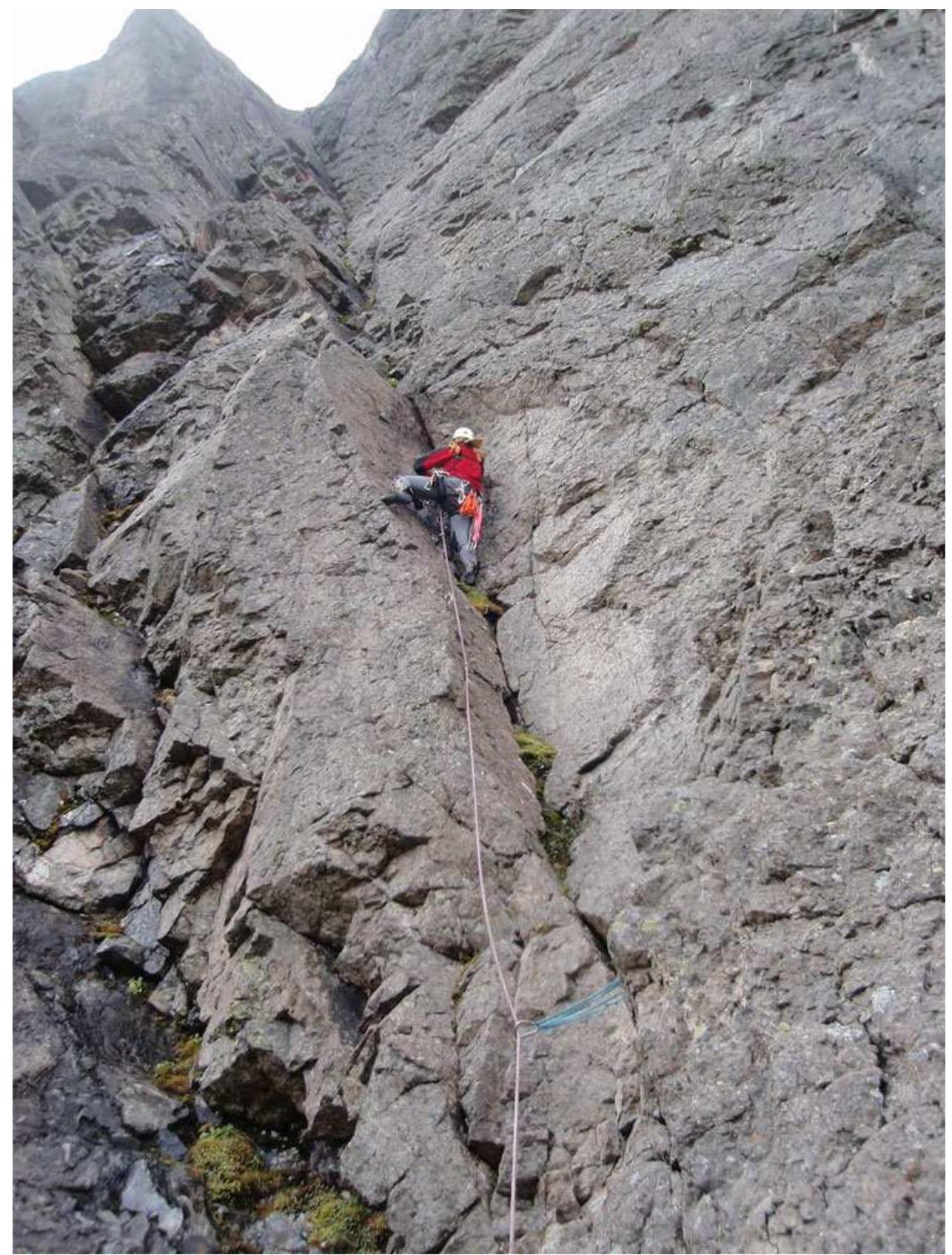
R5–R6: Up a series of cracks 30 m, 70° 3–4 and exit to gentle slabs. Along the slabs, further right under a large internal angle 20 m, 45° 3. No protection. Station in the internal angle.
R6–R7: Up the wet internal angle. 50 m, 50°, 3.
R7–R8: Further up the angle to an implicit fault in the left wall 35 m, 50°, 3. Exit from the angle into the fault onto gentle ledges 15 m, 30°, 2. If you don't exit the angle in time, you end up on smoothed rocks flooded with water. Protection on the largest Friends.
R8–R9: Along simple rocks, exit to a large talus ledge. 50 m, 35°, 3. On the ledge, there is a possibility of an overnight stay.
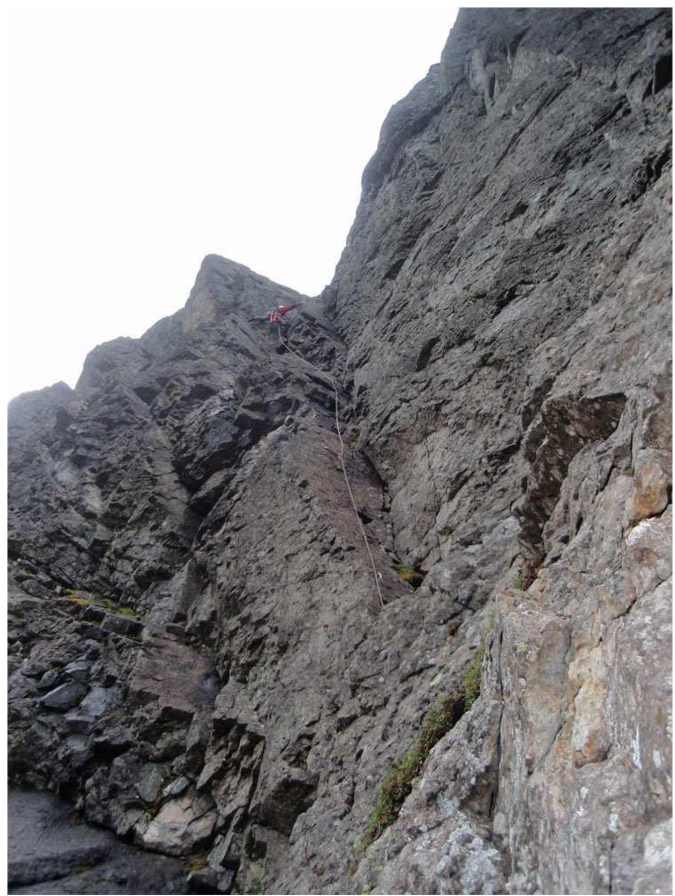
R9–R10: To the left of a large chimney, a series of internal angles can be seen, leading under the summit. 10 m from the ledge, a piton is driven. Up the internal angle and left 40 m, 80° 5. Live rocks in the angle! Exit from the angle onto an inclined ledge. Organizing a station is problematic! It's recommended to move left along the ledge because if you make a station directly above the angle, there's a high probability of rockfall from the taut rope! Continue further when the whole group is on the ledge.
R10–R11: From the inclined ledge, back to the right into a wide chimney with a plug. Then upwards, to the exit onto the ridge. 50 m, 30°, 2.
R11–R12: Exit to the summit along the ridge. 150 m, 20°, 1.
Control turn is laid out with stones on the summit.
Rocks on the route are smoothed and extremely unreliable! The route is rockfall-prone throughout its entire length. Recommended number of participants — no more than 4.
Descent from the summit: — Option 1 — To the left of the route, there is a huge fault from the foot to the ridge. Descent inside the fault: 4 rappels of 25 m each. — Option 2 — Down the ridge of Mt. Poachvumchorr to simple sections. Approximately 700 m along the ridge. — Option 3 — To the opposite side from the route, into the valley of the Poachjok River.
150 m 20°
Digited by Google
Digited by Google
Digited by Google