Ascent Passport
Region — Subpolar Urals. Ridge — Narod-Ityin ridge (kряж). Gorge — Bolshaya Lemva river valley. Mountain massif — Parnokaiz. Section number according to KMGV-2001 — #8. "Other mountain systems, massifs". Name of the summit — 1098.3 (Khatanzeisky Mt.). Height — 1098.3 m. Route name — via the central counterfort of the eastern slope. First ascent. Proposed category of difficulty — 1B cat. diff. (rocky). Note: The Alpinism Federation of the Komi Republic requests the classification commission of the FAR to credit the group of pioneers for the ascent of 2A cat. diff.
Height difference — 500 m. Route length — 8 km. Average steepness of the main (technical part) of the route — 55°. Average steepness of the entire route — 30°. Sections of 3, 4, 5, and 6 cat. diff. — none. No hooks left on the route. Time spent by the team on the ascent:
- Approach to the base camp (conserved geologists' base "Lemva") from Pachvoz settlement – 2 days.
Ascent from the base camp (conserved geologists' base "Lemva") – 6 hours.
In a pair: Maltsev S.L. (1st sports category, instr. 3 cat., Ukhta) – Donyushko E.N. (3rd sports category, Ukhta).
Coach — Zhuravlev Sergey Vasilyevich (CMS, instr. 2 cat. – cert. #1124, Syktyvkar).
Senior coach — Fomenko Felix Nikolaevich (CMS, instr. 1 cat. – cert. #7, Ukhta).
Departure on the route — 8:00, August 6, 2006. Reaching the summit — 12:30, August 6, 2006. Return to the base camp — 15:00, August 6, 2006.
Alpinist event: Volunteer youth alpine scientific-sports expedition "Heights of the Native Land–2006", dedicated to the 85th anniversary of the statehood of the Komi Republic.
Organizers of the expedition:
- Alpinism Federation of the Komi Republic.
- Non-profit partnership "Club of Northern Travels 'Sauk-Pai'".
- Club of tourists and alpinists of Ukhta.
Alpinism Federation of the Komi Republic, NP "Club of Northern Travels 'Sauk-Pai'", Club of tourists and alpinists of Ukhta
Report on the first ascent
Mountain region: Subpolar Urals. Gorge: Bolshaya Lemva river valley. Ridge: Narod-Ityin ridge (kряж). Mountain massif: Parnokaiz. Summit: 1098.3 m (Khatanzeisky Mt.). Route: via the central counterfort of the eastern slope. Proposed category of difficulty for inclusion in the KMGV of the Alpinism Federation of Russia: 1B cat. diff. (rocky). (To credit the group that made the first ascent as a climb of 2A cat. diff.). In a pair: Maltsev S.L. – Donyushko E.N. Date of the ascent: August 10, 2006. Alpinist event: Volunteer youth scientific-sports alpine expedition "Heights of the Native Land–2006", dedicated to the 85th anniversary of the statehood of the Komi Republic.
Senior coach
AF of the Komi Republic Fomenko F.N. (CMS, instr. 1 cat. cert. #7, Ukhta).
Deputy for safety (nachspas) AF of the Komi Republic Zhuravlev S.V. (CMS, instr. 2 cat. – cert. #1124, badge – #6190, Syktyvkar).
Report prepared by: expedition leader: Zhuravlev Sergey Vasilyevich.
Address: 167000, Syktyvkar, Internatsionalnaya str., 97, apt. 12.
Phone: (8212) 24–24–91 (home), E-mail: Zhur58@Rambler.Ru.
Syktyvkar, 2006.
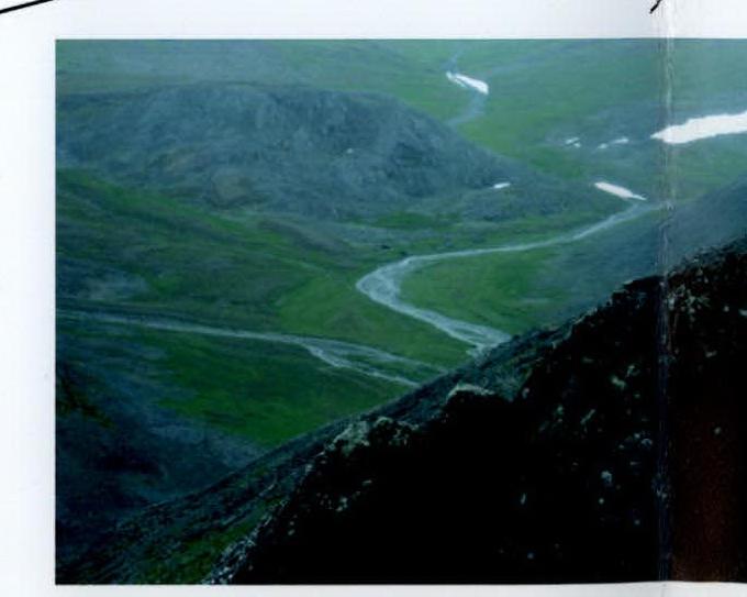
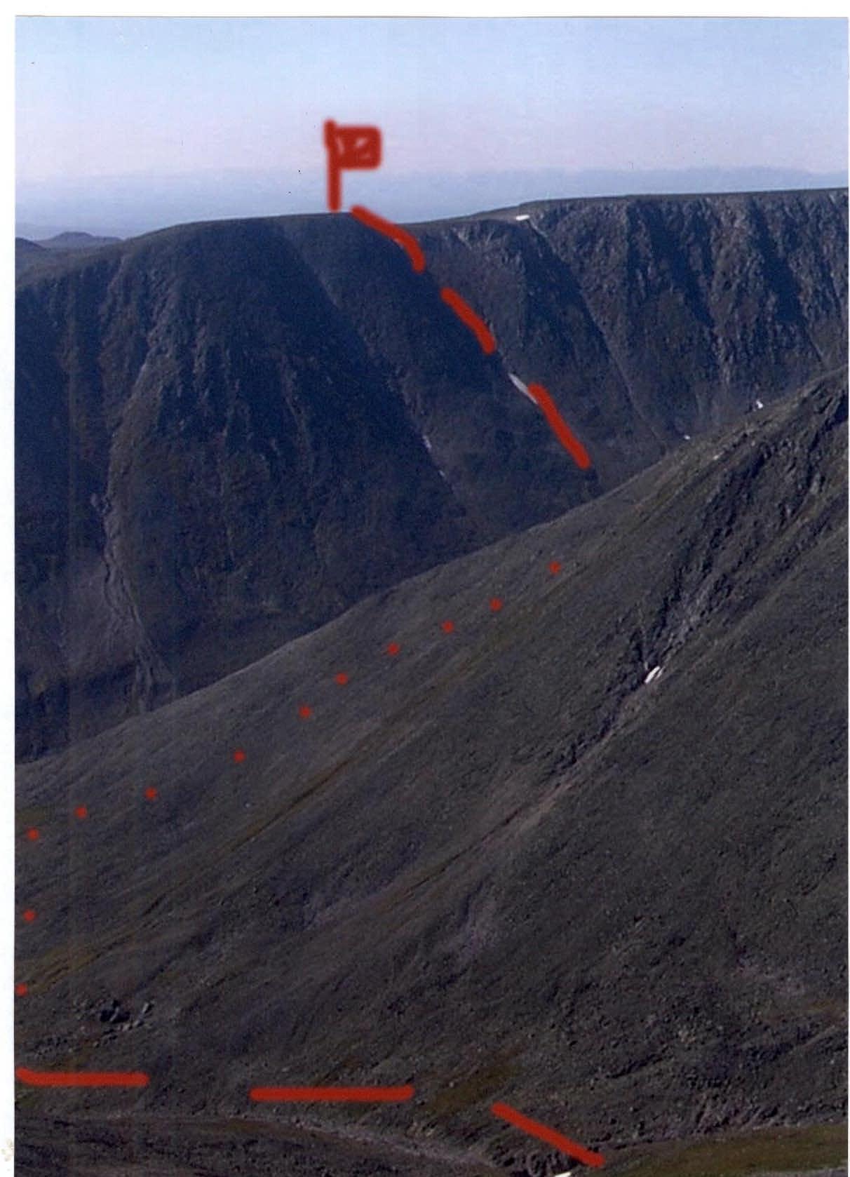 View of the summit 1098.3 (Khatanzeisky Mt.) from the slope of the eastern Pernashor.
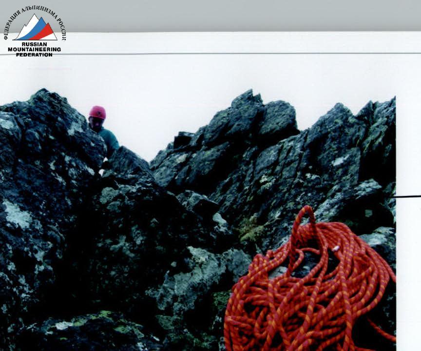
Characteristic rocks of the upper, ridge part of the eastern counterfort.
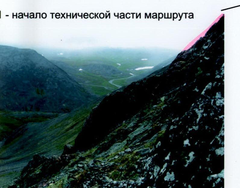
Start of the technical part of the route.
Characteristic rocks of the upper part of the eastern counterfort.
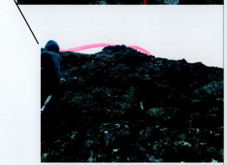
Photographs of the main — characteristic places of the route.
Description of the summit (OSV)
The summit 1098.3 (Khatanzeisky Mt.) is located in the Parnokaiz mountain massif of the Narod-Ityin ridge of the Subpolar Urals.
The summit 1098.3 is located in the southern part of the Parnokaiz massif. It is a table-type mountain. The summit is pronounced, has its geodetic height mark – 1098.3 m above sea level. From the south and southwest, long scree slopes lead to the summit. From the east and southeast — a cirque with rock counterforts leading to the summit.
The name of the summit is not on the map. The summit does not have a local name among the reindeer herders – Ob Komi from the village of Saranpaul, who graze their herds in the Bolshaya Lemva river valley in the summer. The name Khatanzeisky Mt. was given during a monitoring expedition in honor of the Izhma reindeer herder — Hero of the Great Patriotic War, who died during the liberation of Hungary, Andrey Khatanzeisky.
Description of the route (OSP)
Approaches: from the bivouac in the upper reaches of the Bolshaya Lemva river (conserved geologists' base "Lemva": 3 barracks + bathhouse) go down the river valley to the Pernashor stream, cross the stream, then reach a nameless stream, cross it on large stones. Then, traversing the eastern slope, approach the base of the rock counterfort.
Technical part of the route: the rock counterfort in the lower part, large-block scree, then a jagged, heavily destroyed ridge. It is uniform in technical complexity throughout and does not have a pronounced key section. Along the ridge, laying the rope around protrusions and large blocks, ascend to the summit. The summit is an inclined to the south scree plateau of a table mountain.
Descent path: down the eastern scree slope, which does not present technical difficulties.
Equipment (for a pair):
- climbing rope 10 mm × 50 m — 1 pc.
- carabiners — 5 pcs.
- hammer SK — 1 pc.
- hooks SK – 5 pcs.
- chocks – 5 pcs.
- quickdraws – 5 pcs.
- cordelettes – 2 pcs.
Time spent on the ascent in a pair: 6 hours.
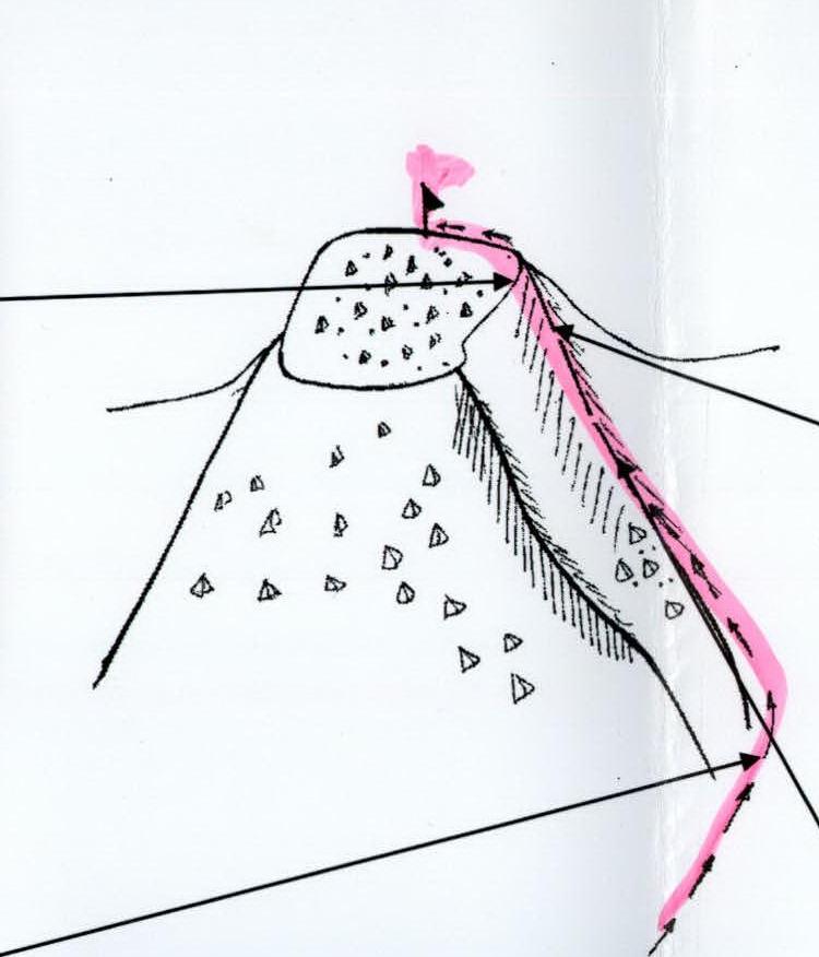
Diagram in UIAA signs
Summit: 1098.3 m (Khatanzeisky Mt.). Route: via the central counterfort of the eastern slope.
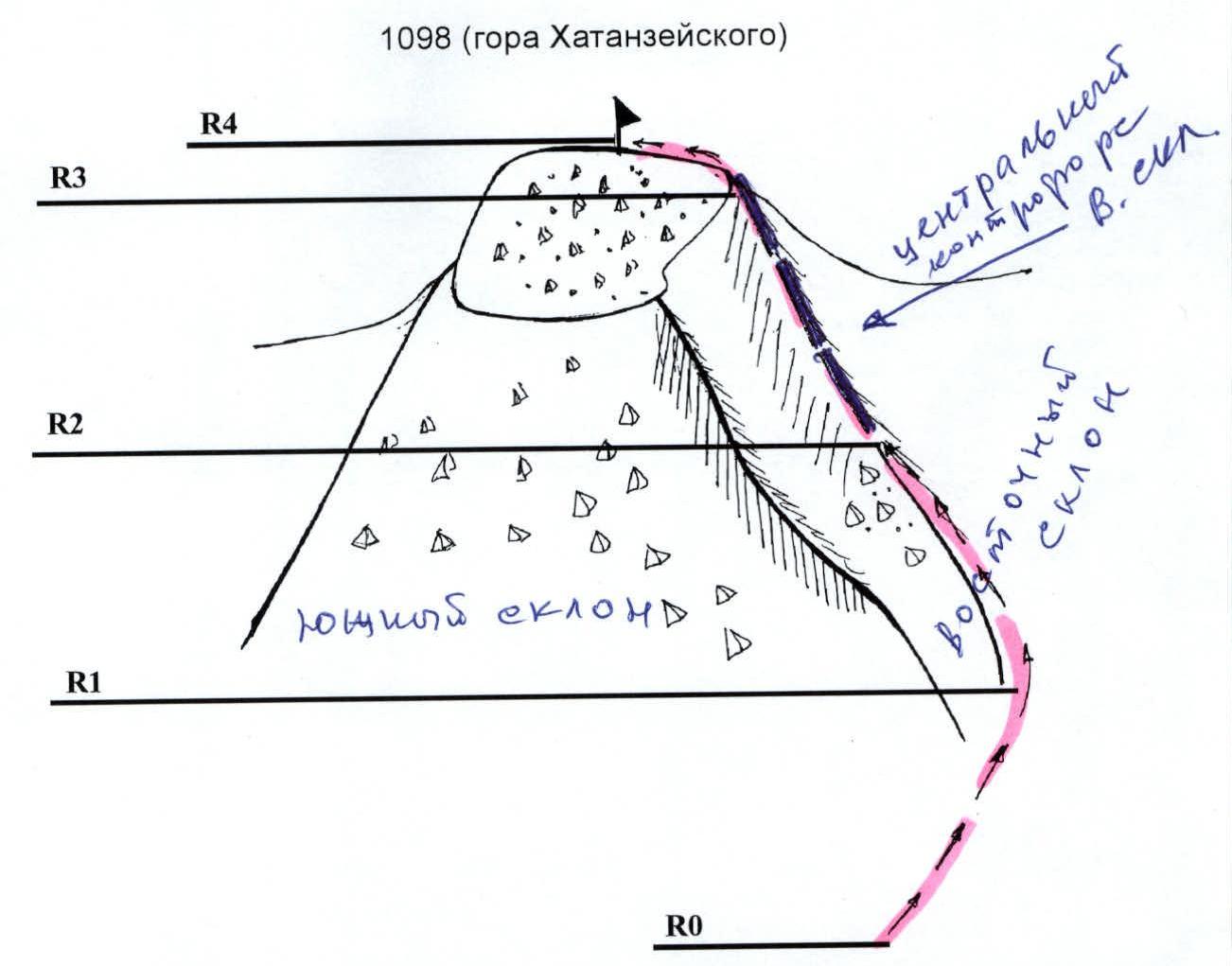
R0 — Base camp: conserved geologists' base "Lemva".
R0–R1: Approach to the start of the route.
- Mountain tundra.
- Scree.
Section length: 1000 m. Steepness: 15°. Technical difficulty level: non-categorical.
R1–R2: Ascent along the scree slope to the base of the rock counterfort.
Large-block and medium-block scree slope. Section length 500 m, steepness 35°. Difficulty level non-categorical, 1st cat. diff.
R2–R3. Passage of the rock counterfort (key to the route!). Rock ridge. Simple rocks. Section length 80 m, steepness 45°, technical difficulty level 1+, 2 cat. diff. Simultaneous movement, with laying the rope around:
- protrusions.
- large rock blocks.
R3–R4. Passage of the upper part of the counterfort. Simple, heavily destroyed rocks. Section length 200 m, steepness 50°, technical difficulty level 2 cat. diff. Simultaneous movement, with laying the rope around protrusions and large rock blocks.
R4 — summit 1098.3 (Khatanzeisky Mt.). R4–R0 — descent along the ascent path or down the eastern slope.
Schematic map of the summits of the Parnokaiz mountain massif (out of scale)
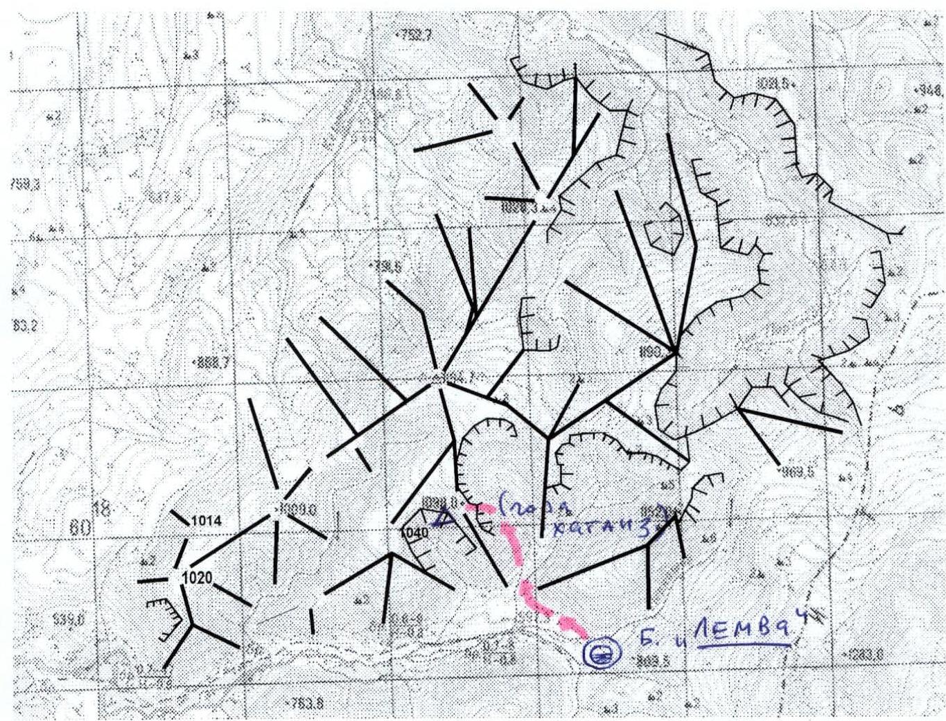
1098 (Khatanzeisky Mt.), route: via the eastern counterfort 1B cat. diff. (rocky).
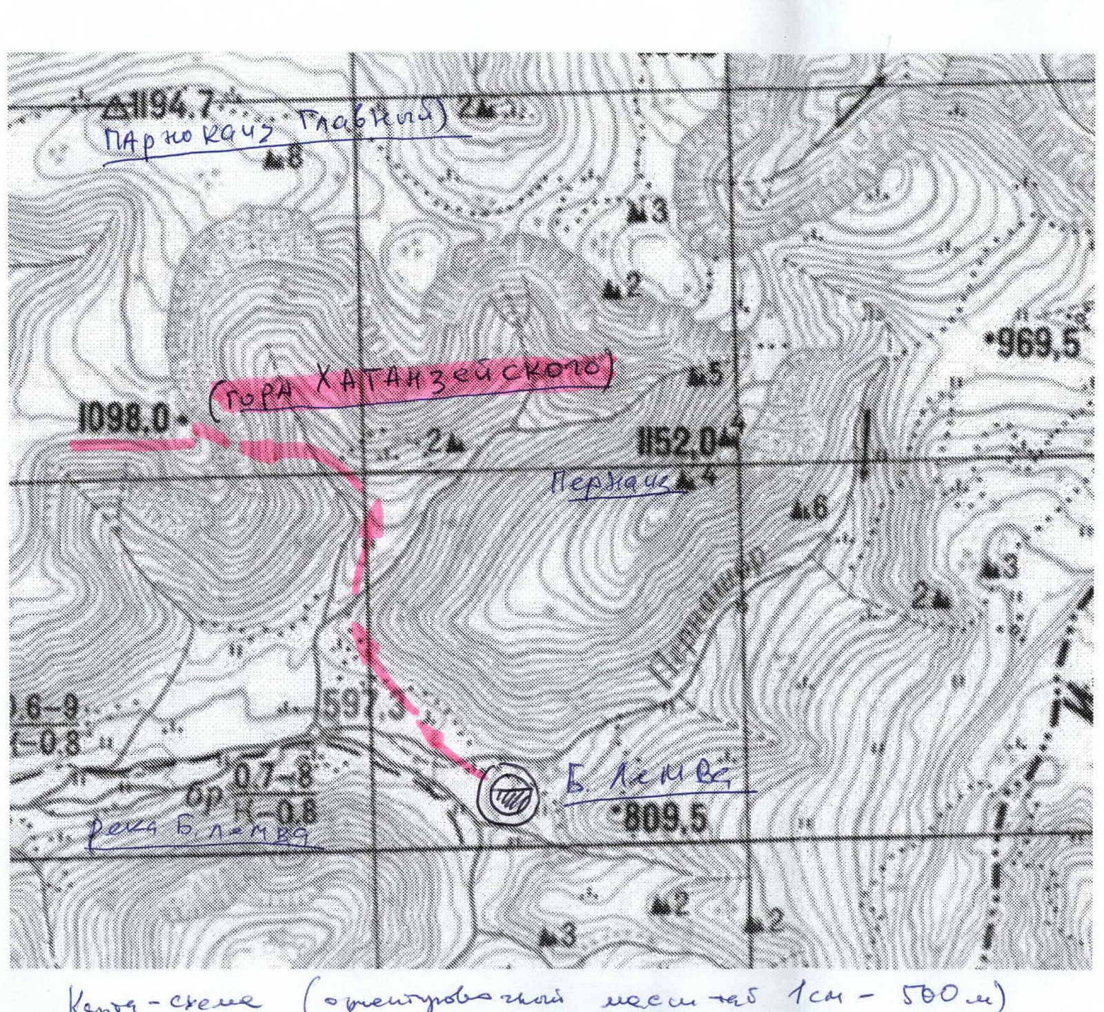 Schematic map (approximate scale 1 cm – 500 m).
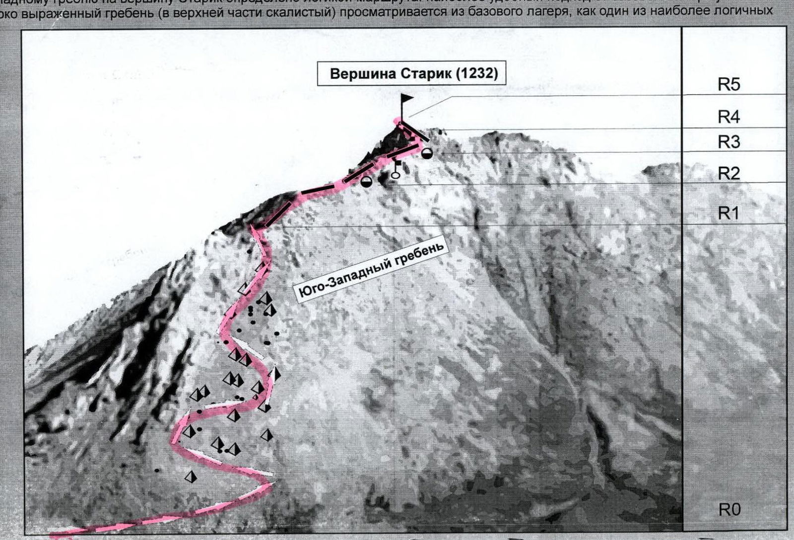
Starik summit (1232)
Via the southwestern ridge 1B cat. diff. (rocky)
Description of the summit: Starik summit is located in the mountain horseshoe of the Balbanyu river valley between Bar kov summit and Starukha summit. One of the significant landmarks for determining the summit – Maly Balbanty lake. Starik summit is located on the right bank of the Balbanyu river, which flows through Maly Balbanty lake. This is an elongated, heavily destroyed mountain with a long rock ridge and rock remnants at the summit.
The passage of the route along the southwestern ridge to Starik summit is determined by the logic of the route: the most convenient approach from the base camp near the reindeer herders' camp by Maly Balbanty lake. A pronounced ridge (rocky in the upper part) is visible from the base camp as one of the most logical paths to the summit.
Route diagram in UIAA signs
R0–R1 — approach from the bivouac near the reindeer herders' camp by Maly Balbanty lake to the all-terrain road leading to the Syures tract.
Ascent along the scree rock slope to the sub-summit (500 m, 55°, n.c.).
R1–R2 — ascent along the rock ridge (500 m, 1–1+ cat. diff.).
In winter conditions — installation of handrails, in summer — alternate belay.
R2–R3 — key to the route. (Rock ridge 200 m, 2–2+ cat. diff.).
R3–R4 — exit to the pre-summit ridge. Simultaneous movement along the rocks. (Rock ridge, 300 m, 1 cat. diff.).
R4–R5 — exit to the summit.
R5 — Starik summit. R5–R6 — movement along the heavily destroyed rock northern ridge towards Bar kov summit to the scree "green" couloir.
R6–R7 — descent along the scree "green" couloir to the Balbanty river valley (rocks 1 cat. diff., scree, kurums, n.c.).
R7–R0 — return to the base camp to the reindeer herders' camp.