Ascent Passport
Mountain region — Polar Urals
Mountain range — Rai-Iz massif
Gorge — Nyrdvomen-Shor river valley.
Section number according to KMGV-2001 – № 8. "Other mountain systems and massifs".
Name of the summit – 1159 ("Dinozavr Glavnyy").
Height 1159 m
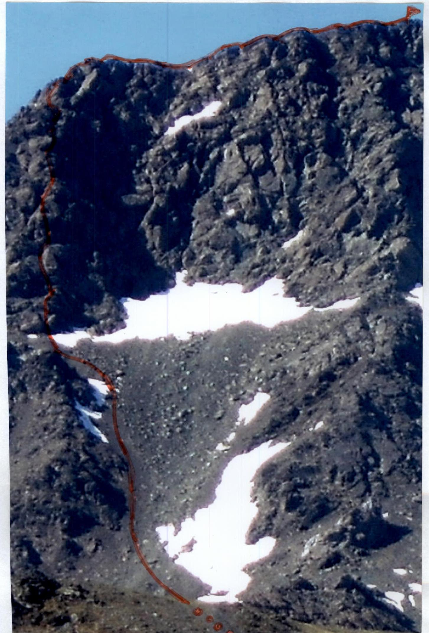
Route name — via the bastion of the eastern edge of the northern wall
Category of difficulty – 5A cat. diff.
Route character – rock
Height difference – 960 m (according to the map of the General Staff of the Russian Federation: the initial mark of the route — the location of the base camp at the edge of the Nyrdvomen-Shor river — 199 m, the geodetic mark of the summit above sea level — 1159 m).
Route length — 1500 m, technical part — 800 m.
Technically difficult sections — sections of 5 cat. diff. – 4; 6 cat. diff. – 1.
Average steepness of the main (technical) part of the route – 80°.
Hooks left on the route – 10.
Hooks used – 16, placements – 24.
Team's working hours – 18 hours.
Group composition: leader S. V. Zhuravlev (Candidate for Master of Sports, instructor 2nd category, Syktyvkar), P. A. Bondaruk (2nd sports category, Syktyvkar), Yu. V. Valuzhis (2nd sports category, Syktyvkar), M. P. Kunevich (2nd sports category, Syktyvkar), V. A. Toropov (2nd sports category, Syktyvkar).
Departure to the route — 4:00, July 8, 2007.
Ascent to the summit — 22:15, July 8, 2007.
Return to the base camp — 0:30, July 9, 2007.
Organization conducting the mountaineering event:
- "Mountaineering expedition of the Alpinism Federation of the Komi Republic"
- NP "Club of Northern Travels 'Sauk-Pai'" (Syktyvkar)
- Club of tourists and mountaineers of Ukhta
Dates of the mountaineering event — from June 25 to July 10, 2007.
Senior coach — releasing
FARK (Alpinism Federation of the Komi Republic)
F. N. Fomenko (Candidate for Master of Sports, instructor-methodologist 1st category, cert. № 07, Ukhta)
Senior coach — releasing
mountaineering event
S. V. Zhuravlev (Candidate for Master of Sports, instructor-methodologist 2nd category, cert. № 1124, Syktyvkar)
Alpinism Federation of the Komi Republic
Syktyvkar, 2007
 V.1159 ("Dinozavr Glavnyy") N wall.
- ROUTE VIA THE BASTION OF THE E. EDGE OF THE N WALL 5A (rocky)
- DESCENT PATH VIA THE 3rd SW CULVERT FROM THE WALL
Description of the Summit
The summit 1159 ("Dinozavr Glavnyy") is located in the Rai-Iz massif of the Polar Urals, within the Yamalo-Nenets Autonomous Okrug of the Russian Federation beyond the Arctic Circle.
A characteristic feature of the routes to this summit is the long approaches across talus slopes, followed by the passage of technically complex rocks made of dense formations. The height difference from the start of the route (mark above sea level 199 m) to the summit 1159 is more than 800 m.
The summit 1159 ("Dinozavr Glavnyy") is included in the list of classified summits. The first routes to this summit were laid by Ukhta mountaineers during the winter seasons of 95–99 from the southeast. They also gave the mountaineering name to the summit, as it does not have an independent name.
From the valley of the Nyrdvomen-Shor stream, the most convenient location for a base camp — a large larch-alder oasis in the tundra — the summit is easily recognizable by its pronounced rocky walls and buttresses on the northern and northwestern walls.

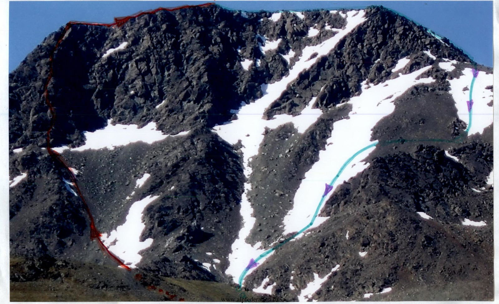
Technical photo of the route from the Nyrdvomen-Shor river valley (left — western edge of the wall)
Description of the Route
Route: via the bastion of the eastern edge of the northern wall. From the Nyrdvomen-Shor river valley, the route is clearly visible as it is bounded by a pronounced buttress to the east (left) of the rocky massif of the northern wall of the summit 1159 ("Dinozavr Glavnyy").
Approach: Moving from the bivouac in the Nyrdvomen-Shor river valley (see the attached map-scheme), bypass to the right (in the direction of travel) the green bald peak and ascend to a large rocky outlier. From the rocky outlier, we approach the talus culvert between two rocky, destroyed buttresses of the eastern and western edges of the northern wall. Then, adhering to the right (in the direction of travel) side of the eastern buttress, we ascend along the talus to a talus saddle. Then we approach under the wall of the bastion. Under the wall, on a talus terrace, is the control cairn marking the start of the route. The location is convenient for organizing ties and preparing the group for the ascent. If necessary, a tent can be set up on the talus saddle. Then the technical part of the route begins.
Technical part of the route: The route logically begins from the center of the rocky edge with a small, smoothed rocky slab, followed by a small inclined wall, leading to an inclined internal corner of medium complexity. The internal corner leads to a small shelf under a rocky wall with complicated climbing featuring a rocky shelf in the center and a three-meter section at the top of complex climbing. The wall leads to an oblique talus shelf (to the right). At the top of the shelf is a convenient place to organize a basic belay station. Next is a complex internal corner. Very difficult climbing. Holds and footholds are minimal; all intermediate belay points are only in the crack at the junction of the monolithic walls of the internal corner. The exit from the internal corner is quite complicated as it is carried out on heavily destroyed rocks. (Subjective rockfall danger!) Unreliable intermediate belay points. After the internal corner, we exit onto an inclined shelf. Then, through the "Corridor" chimney (an inclined chimney to the left in the direction of travel), we exit onto an inclined slab-like shelf. From the shelf, there is a straightforward movement along the rocky wall under an overhang. The overhang is bypassed on the left along a series of small shelves and internal corners of 3–5 m, which lead to the small rocky shelf before a pronounced inclined internal corner. On the shelf is a convenient place for a basic belay station. Next, along a small internal corner (5 m) and an oblique talus shelf, we approach a small chimney leading to the right. The exit is along the chimney to the base of an inclined wall under the second overhang. The overhang is bypassed on the right along a rocky ridge, followed by an exit to a convenient shelf for organizing a basic station. It is convenient to organize a station near the "Korona" jammer. Then movement is along an oblique talus shelf under a cornice bounded on both sides by mirror-like rocky monoliths. A psychologically difficult place. The cornice is bypassed on the left in the direction of travel along the "mirror". (For the oblique traverse, sky-hooks are used. Section – 7 m). Points for organizing belay — the junction of two slabs. Difficult climbing leading to another cornice, from which we traverse to the right and ascend to the first cornice along difficult rocks. A landmark to move towards is the "Treugolnik" outcrop. It forms a convenient shelf leading to the right. After the outcrop, the ascent is along the upper part of the right "mirror". Difficult climbing along monolithic smoothed rocks leads to a shelf with a stone block "Pale ts" (Finger). On the shelf, it is convenient to organize a basic belay station. Above the shelf with the stone "Pale ts" is a large overhang. Bypassing this cornice is the key point of the route. Along a weakly pronounced, very difficult, but short — 5–7 m — internal corner to the left of the cornice, we exit onto a heavily jagged rocky ridge. Along the rocky ridge with simple climbing on dense rocks, we exit under an internal corner. This internal corner is passed through the center. Climbing is above average. In the middle part of the corner, ladders were used for movement on IT. The corner leads to the summit ridge. Then, along a simple rocky ridge, we exit to the summit.
The summit is well expressed, composed of large blocks. Climbing is not difficult. On the summit is a triangulation marker.
Descent from the summit — the safest route is: "Along the center of the eastern slope and the eastern ridge" (1B). In the summer period, this is a safe, not steep, prolonged snowy couloir allowing the group to descend with minimal time loss to the geological all-terrain road. The most difficult section during descent is crossing the upper reaches of the Nyrdvomen-Shor along snow bridges, the passage of which in the summer requires the organization of belay.
Equipment: for a sports group of four people:
- main rope — 3 pcs., 10 mm × 50 m
- rock pitons — 12 pcs.
- placement elements — 25 pcs.
- station loops — 10 pcs.
- quickdraws — 10 pcs.
- carabiners — 18 pcs.
- sky-hooks — 2 pcs.
- stove (gas burner) — 1 pc.
- pot — 1 pc.
- personal equipment — for each participant.
Note to the Instructor
- The route requires good rock climbing skills and is not recommended for groups of climbers who have not had experience on ascents of 5 cat. diff.
- In the summer, anti-mosquito nets and anti-mosquito creams, gels are required for the group.
- The resource of the polar day allows the route to be climbed at any time of day.
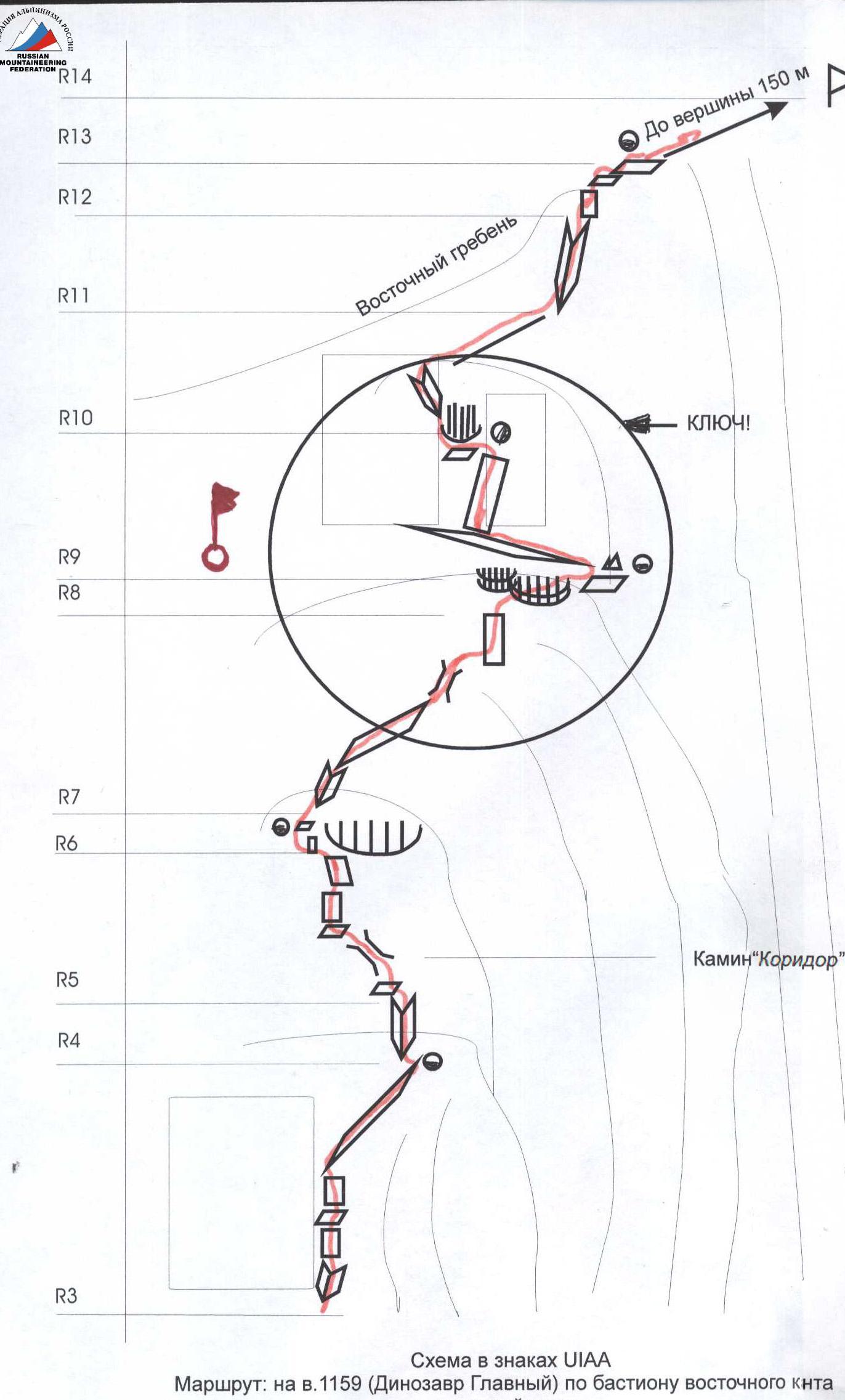
Graphic Profile of the Technical Part of the Route with Indication of the Most Difficult Sections
Summit: 1159 ("Dinozavr Glavnyy")
Route: via the bastion of the eastern edge of the northern wall
Scale: 1 cm — 50 m
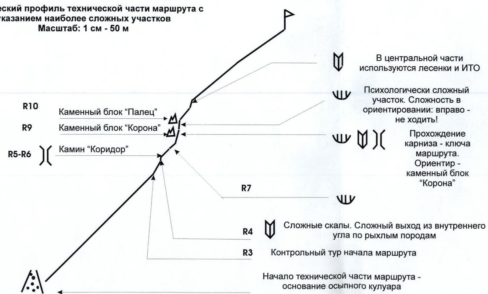
In the central part, ladders and IT are used Psychologically complex section. Difficulty in orientation: do not go to the right! Passage of the cornice — the key to the route. Landmark — stone block "Korona" Difficult rocks. Difficult exit from the internal corner on loose rocks Control cairn marking the start of the route Start of the technical part of the route — base of the talus couloir
Enlarged Scheme of the Passage of the Key Section
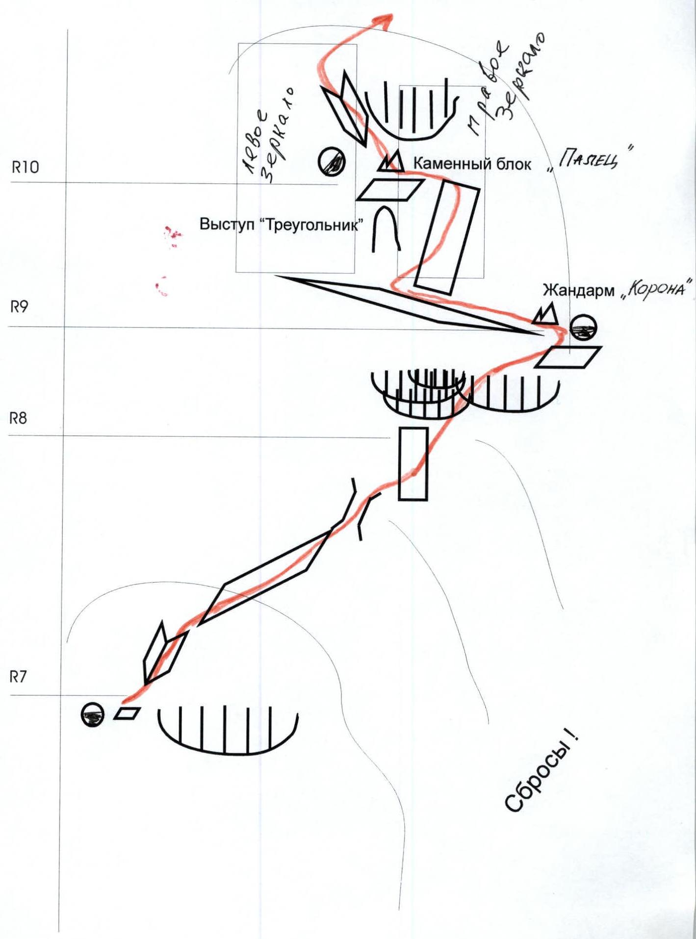
Left "mirror" Outcrop "Treugolnik" Right "mirror" Stone block "Pale ts" (Finger) Jammer "Korona" Scree!
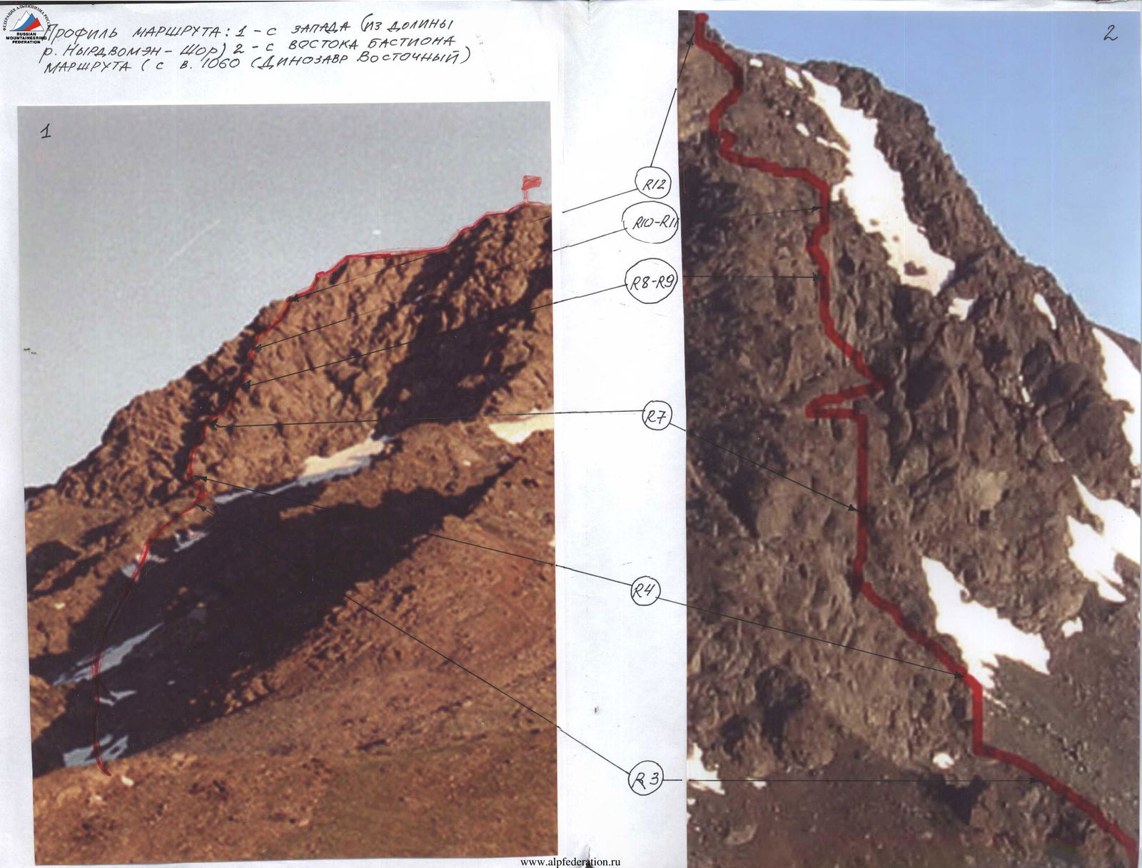
Route profile: 1 — from the west (from the Nyrdvomen-Shor river valley), 2 — from the east of the bastion of the route (from v. 1060 "Dinozavr Vostochnyy")
| Section | Length | Steepness | Difficulty | Pitons | Placements | Photo № |
|---|---|---|---|---|---|---|
| R14 | ||||||
| R13 | 150 m | 35° | 2 cat. diff. | 0 | 24 | |
| R12 | 150 m | 35–40° | 2 cat. diff. | 0 | 32 | №8а |
| R11 | 25 m | 75° | 4 cat. diff. | 5/3 IT, ladders | 6 | №8 |
| R10 | 40 m | 50° | 2 cat. diff. | 0 | 0 | |
| R9 | 10 m | 85° | 5 cat. diff. | 0 | 3 | №7–7а, №75–76 |
| R8 | 15 m | 80° | 5 cat. diff. | 2 | 2 | |
| 10 m | 70–85° | 6 cat. diff. | 2 | IT, sky-hook | №6–6а–6б | |
| 20 m | 60° | 3 cat. diff. | 0 | 5 | ||
| 5 m | 70° | 4 cat. diff. | 0 | 1 | ||
| R7 | ||||||
| R6 | 13 m | 45° | 3 cat. diff. | 0 | 3 | №5–5а |
| 35 m | 45°, 30° | 3 cat. diff., 2 cat. diff. | 0 | 8 | №4–4а | |
| R5 | ||||||
| R4 | 10 m | 85° | 5 cat. diff. | 3 | 2 | №3 |
| 3 m | 80° | 5 cat. diff. | 2/2 | 12 | №2 | |
| 35 m | 55–60° | 2 cat. diff., 3 cat. diff. | №1 |
Technical Description of the Route to the Scheme in UIAA Signs
R0 — base camp in the larch oasis of the Nyrdvomen-Shor river.
R0–R1 — Base camp — crossing the Nyrdvomen-Shor river.
Crossing the Nyrdvomen-Shor river ford (depth 40–60 cm; during the period of abundant snowmelt, the organization of perline belay is required). Section length — 500 m, steepness – 10°. Difficulty level – non-categorical.
R1–R2 — bypassing the green bald peak and approaching the rocky outlier. Mountain tundra, rocky fields. Section length – 2500 m. Section steepness: initially 30–45°, in the upper part 45–50°. Difficulty level – non-categorical.
R2–R3 Approach to the base of the talus couloir and ascent along the talus slope along the destroyed buttress to the talus terrace at the base of the eastern edge. Large-block talus, snow. Section length – 400 m. Section steepness – 45–50°. Difficulty level – 2 cat. diff. Belay during movement across large rocky blocks — gymnastic. On the terrace at the base of the edge is the control cairn marking the start of the route.
R3–R4 Passage of walls-slabs and internal corner. Passage of an oblique talus shelf. Rocks. Convenient holds and footholds, abundant number of cracks and fractures for organizing belay points. Section length — 40 m. Steepness — 55–60°. Difficulty level — from 2 cat. diff. Wall before exiting to the talus shelf 3 m — 5 cat. diff. Belay is alternate.
R4–R5 – Passage of the internal corner. Smoothed rocks. Steep internal corner with a minimum of cracks for organizing belay. Subjectively dangerous exit from the internal corner on loose rocks with unreliable intermediate belay points. Section length – 10 m. Section steepness – 85°. Difficulty level – 5 cat. diff. Belay is piton, using placement elements. Quickdraws are mandatory to reduce friction. Movement of participants is alternate, organization of perlines.
R5–R6 – Approach to the first cornice via the "Corridor" chimney. Rocks. Chimney, shelves, and oblique wall. Section length – 35 m. Section steepness: at the beginning 30°, at the top – 45°. Difficulty level: in the lower part – 2 cat. diff., in the upper part – 3 cat. diff.
R6–R7 – Bypassing the cornice with an exit to a shelf under an oblique internal corner. The cornice is bypassed on the left along a series of shelves. Section length – 13 m. Section steepness – 45°. Difficulty level – 3 cat. diff. Belay is piton, using placement elements. Quickdraws are mandatory to reduce friction. Movement of participants is alternate, organization of perlines.
R7–R8 – Approach to the second cornice via an internal corner, chimney, and technically complex wall. Inclined internal corner: Length — 5 m. Steepness — 70°. Difficulty level — 4 cat. diff. Slab with destroyed areas: Length — 20 m. Steepness — 60°. Difficulty level — 3 cat. diff. Chimney: Length — 5 m. Steepness — 70°. Difficulty level — 4 cat. diff. Rocky wall: Length — 10 m. Steepness — 70–85°. Difficulty level — 5 cat. diff. Oblique traverse along the "mirror" is carried out using sky-hooks (7 m).
R8–R9 Bypassing the second cornice. Approach to the "Korona" jammer. Passage of the key point of the route. The cornice is bypassed on the left along a complex trajectory: first along a rocky shelf under the second overhang of the cornice, then an oblique traverse along complex rocks (to the rocky outcrop "Treugolnik"), exit to the right onto the upper part of the main cornice, then along a complex wall with a crevice to a rocky shelf with a stone block "Pale ts" (Finger). Section length – 15 m. Section steepness – 80°. Difficulty level 5 cat. diff. Belay is piton, using placement elements. Quickdraws are mandatory to reduce friction. Movement of participants is alternate, organization of perlines.
R9–R10 – Bypassing the third cornice. Rocks. Internal corner. Psychologically complex section, difficult in orientation. Length – 10 m. Steepness – 85°. Difficulty level – 5 cat. diff. Belay is piton, using placement elements. Quickdraws are mandatory to reduce friction. Movement of participants is alternate, organization of perlines.
R10–R11 – Passage of a jagged, heavily destroyed rocky ridge. Rocky, talus ridge. Length — 40 m. Steepness — 50°. Difficulty level – 2 cat. diff. Movement is simultaneous.
R11–R12 – Passage of an internal corner. Rocks. Technically complex in the middle part internal corner. Length – 25 m. Steepness – 75°. Difficulty level – 4 cat. diff. In the middle part, IT and ladders were used. Belay is piton, using placement elements. Quickdraws are mandatory to reduce friction. Movement of participants is alternate, organization of perlines.
R12–R13 – Exit to the junction of ridges. Jagged rocky ridge. Large rocky blocks, large-block talus. Length — 150 m. Steepness — 35–40°. Difficulty level – 2 cat. diff. Movement is simultaneous, on a shortened rope, using rocky outcrops and large stone blocks for belay.
R13–R14 – Passage of the summit ridge. Rocks. Jagged, flattening towards the summit ridge. Large rocky blocks, large-block talus. Length – 150 m. Steepness – 35°. Difficulty level – 2 cat. diff.
R14 — summit 1159 ("Dinozavr Glavnyy"). R14–R0 – descent along the center of the eastern slope. Talus, snow. Crossing the Nyrdvomen-Shor river along snow bridges. (Snow bridges in the summer are subjectively dangerous!). All-terrain road across the mountain tundra. Section length — 4–5 km. Difficulty level — in the upper part – 1 cat. diff., in the lower part – non-categorical.
Photos of Technical Sections
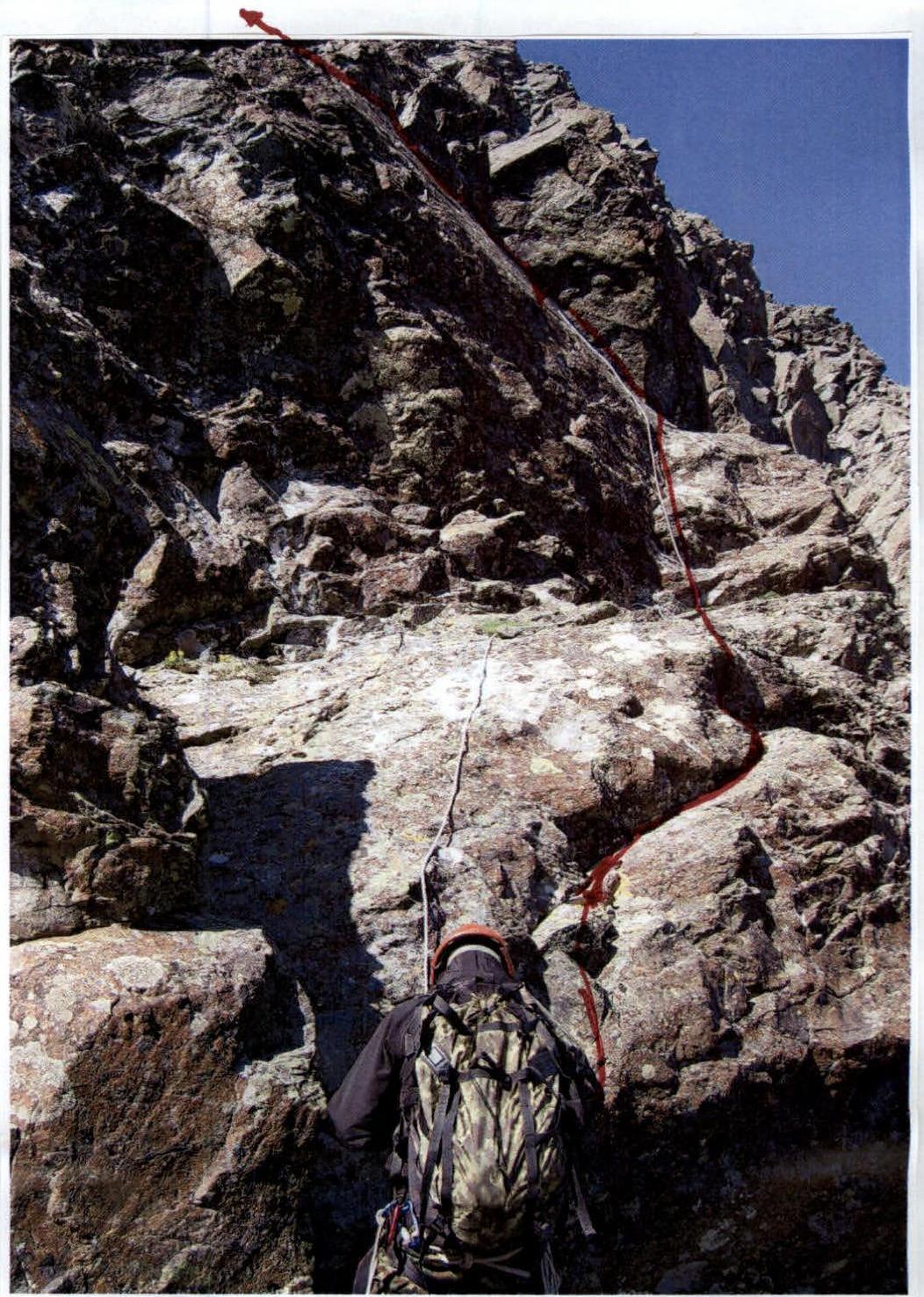
Photo №1. Lower part of section R3–R4.
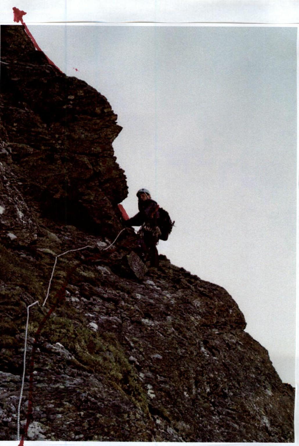
Photo №2. Upper part of section R3–R4.
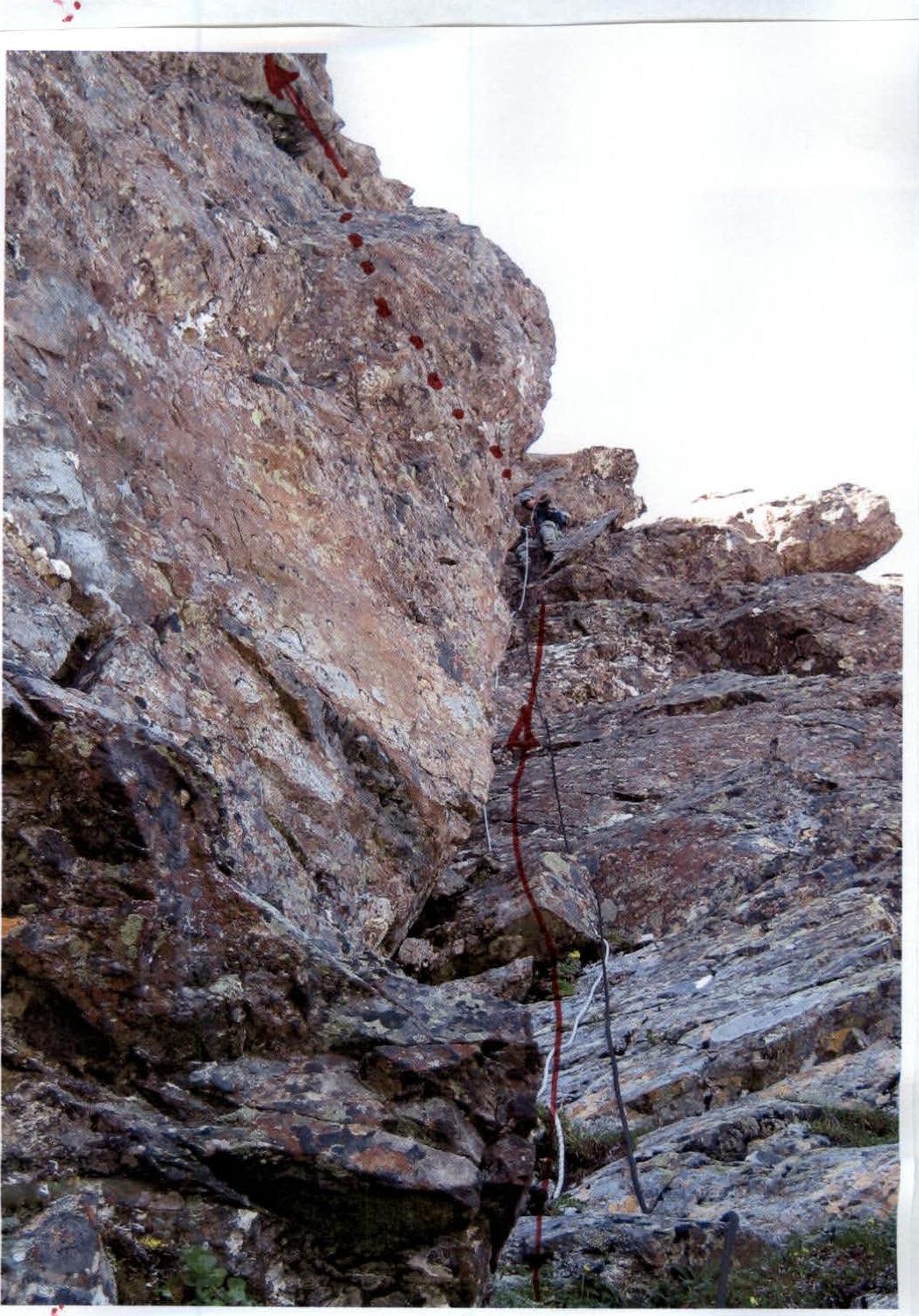
Photo №3. Section R4–R5.
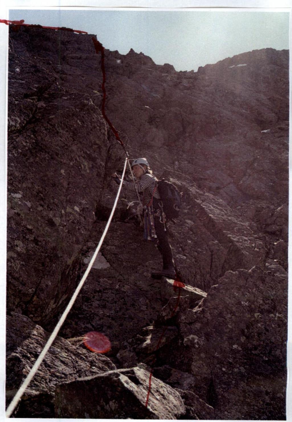
Photo №4. Section R5–R6. Lower part.
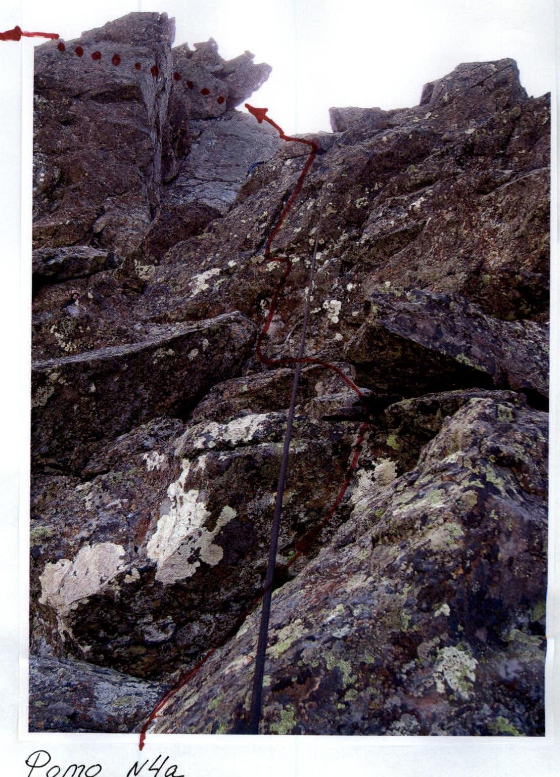
Photo №4а. Section R5–R6. Upper part.
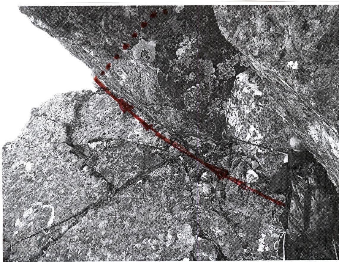
Photo №5. Section R6–R7. Lower part. Entrance to the cornice.
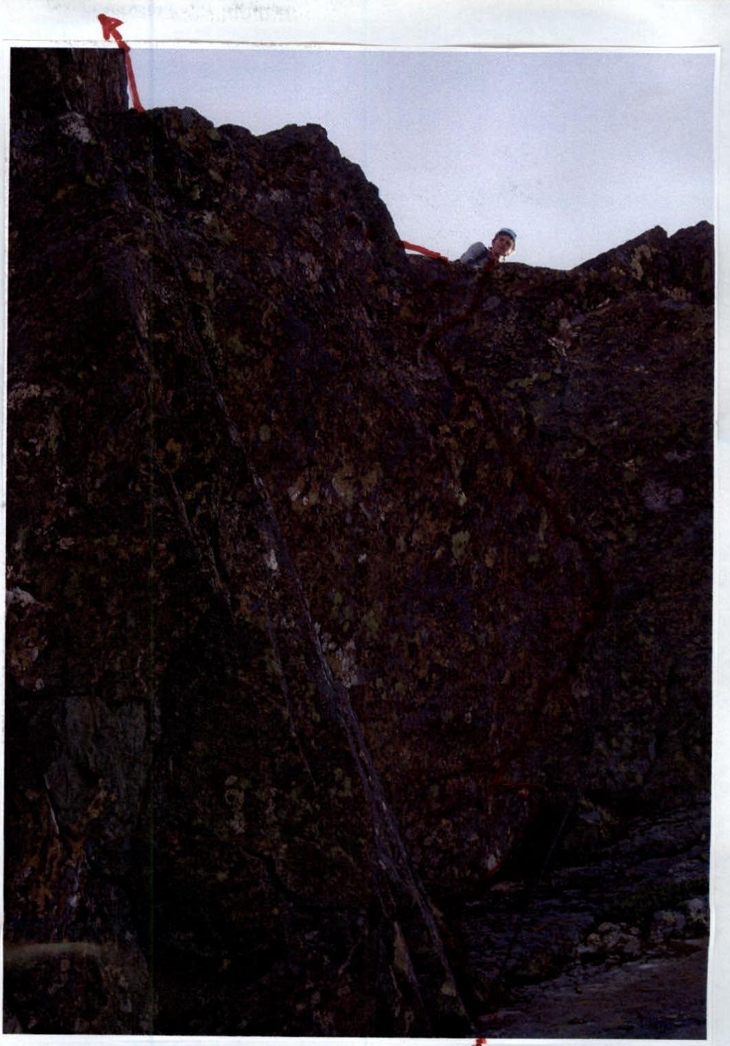
Photo №5а. Section R6–R7. Upper part.
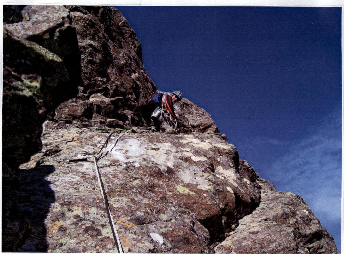
Photo №6. Section R7–R8. Lower part.
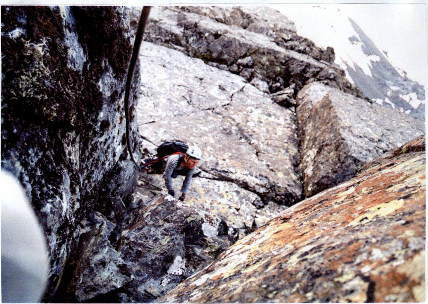
Photo №6а,б. Section R7–R8. Key to the route. Passage of the cornice.
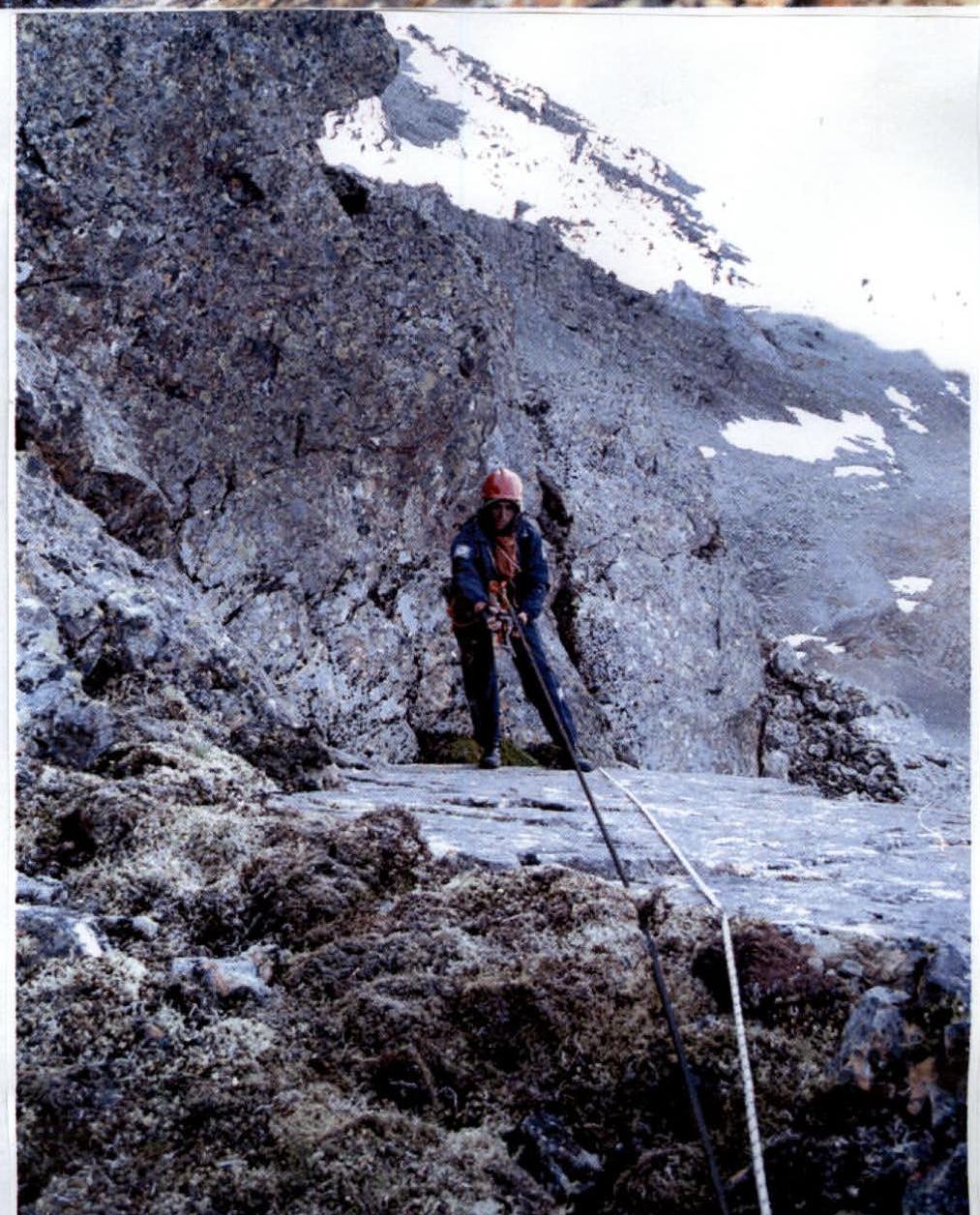
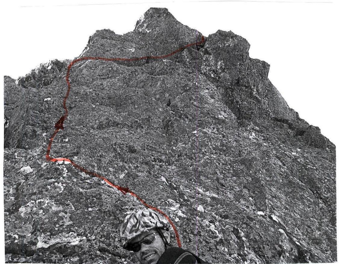
Photo №7
Section R9. Jammer "Korona".