Climbing Passport
Mountain region — Polar Urals
Mountain range — Rai-Iz massif
Gorge — Nyrdvomen-Shor river valley.
Section number according to KMGV-2001 — № 8. "Other mountain systems and massifs".
Name of the peak — 1159 (Dinozavr Glavny).
Height — 1159
Route name — via the fourth buttress of the central rock massif of the northern wall of the western ridge
Category of difficulty — 4A category.
Route character — rock climbing
Height difference — 950 m (according to the map of the General Staff of the Russian Federation: initial mark — 199 m, summit — 1159).
Route length — 4–5 km
Technically difficult sections — 5 sections, 6 — none.
Average steepness of the route — 50°, technical part of the route — 70°.
Pitons on the route — left — 2, used — 8, chocks — 24.
Team's walking hours — 14.
Group composition:
- team leader M. P. Kunevich (2nd sports category, Syktyvkar)
- V. A. Toropov (2nd sports category, Syktyvkar)
Departure to the route — 06:00, June 27, 2007.
Reaching the summit — 16:00, June 27, 2007.
Return to the base camp — 20:00, June 27, 2007.
Organizations conducting the alpine event: "Alpinistskaya ekspeditsiya Federatsii alpinizma Respubliki Komi, Non-Commercial Partnership 'Klub severnykh puteshestviy 'Sauk-Pay' (Syktyvkar)" and Club of tourists and alpinists of Ukhta.
Dates of the alpine event — from June 25 to July 10, 2007.
Senior coach — FARК (Federation of Alpinism of the Republic of Komi) release officer
F. N. Fomenko (CMS, 1st category instructor-methodologist, ud. № 07, Ukhta)
Senior coach — release officer of the alpine event
S. V. Zhuravlev (CMS, 2nd category instructor-methodologist, ud. № 1124, Syktyvkar)
Federation of Alpinism of the Republic of Komi, Syktyvkar, 2007.
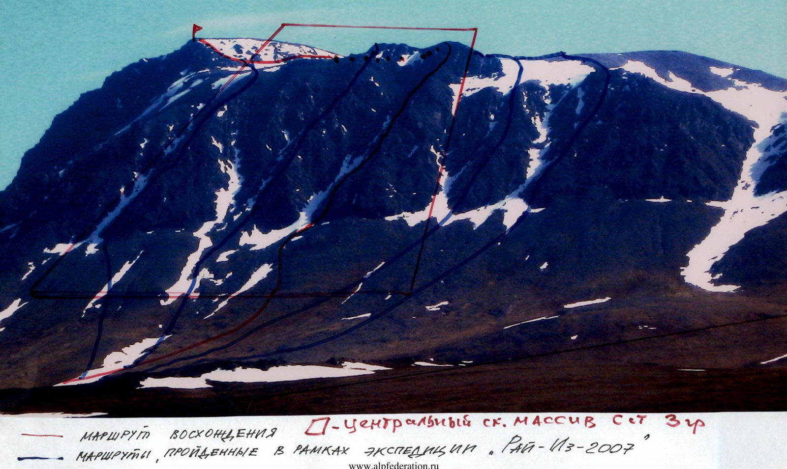
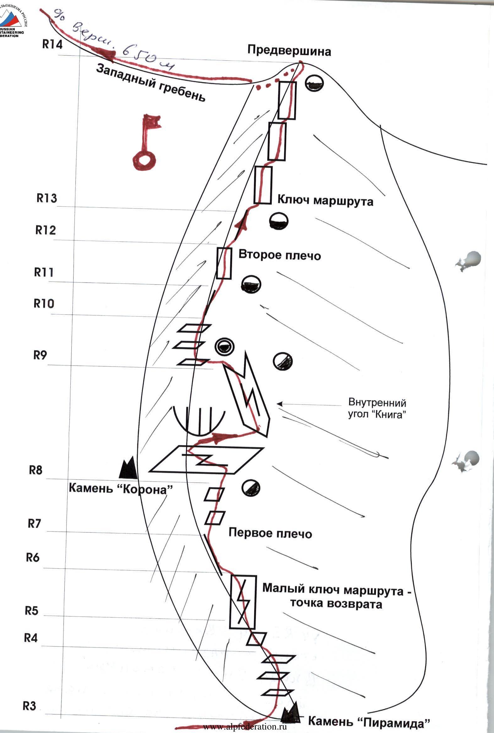
Peak 1159 (Dinozavr Glavny). Northern wall of the western ridge.
Description of the peak
Peak 1159 (Dinozavr Glavny) is located in the Rai-Iz massif of the Polar Urals, within the Yamalo-Nenets Autonomous Okrug of the Russian Federation, beyond the Arctic Circle.
A characteristic feature of the routes to this peak via the northern wall of the western ridge is the complex rock buttresses with an abundance of various rock reliefs, ranging from small inclined walls and slabs to long internal corners, often ending in cornices at the beginning, and prolonged movement along the heavily destroyed, rock-scree ridge when ascending to the summit. Another feature of the peaks of the Polar Urals is the sequential increase in difficulty from the start of the route to the summit tower.
The height difference from the start of the route (water level mark at the base camp in the Nyrdvomen-Shor river valley above sea level 199 m, summit — 1159) is over 800 meters.
Peak 1159 (Dinozavr Glavny) is included in the list of classified peaks. The first routes to this peak were laid by Ukhta alpinists during the winter seasons of 1995–1999. They also gave the peak its alpinist name, as it did not have an independent name.
From the valley of the Nyrdvomen-Shor stream, the most convenient location for a base camp — a large larch-alder oasis in the tundra — the peak is easily recognizable by its pronounced rock walls and buttresses of the northern and northern walls of the western ridge.

Peak: 1159 (Dinozavr Glavny). Route: via the fourth buttress of the central rock massif of the northern wall of the western ridge
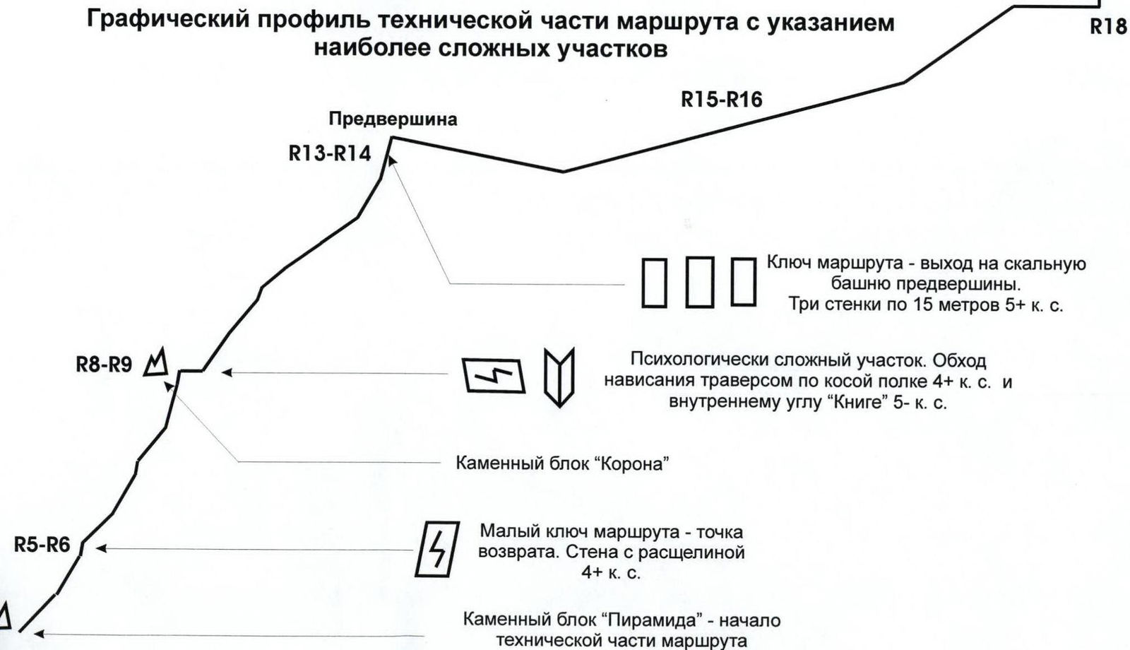
Graphical profile of the technical part of the route indicating the most difficult sections

 Route profile
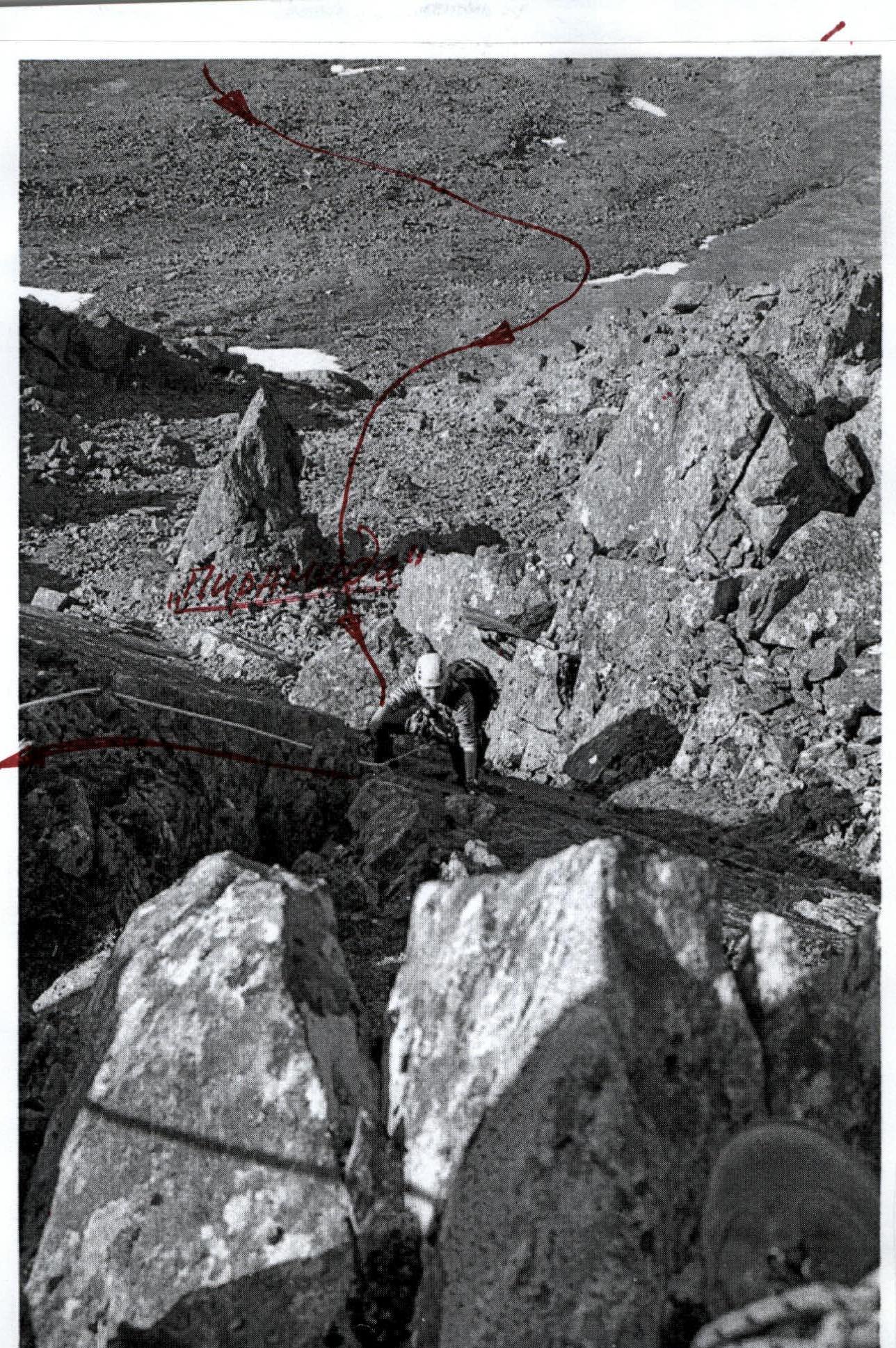
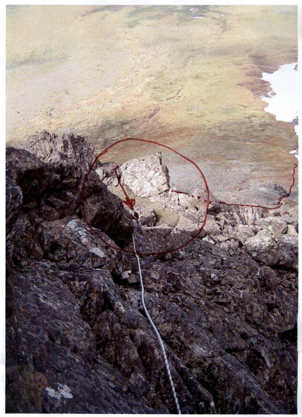
 Section R3–R4. Upper part of the wall with a fault. Below, the stone block "Pyramid" is visible — the beginning of the technical part of the route.
"Pyramid" stone
| Section | Length | Steepness | Difficulty | Pitons | Chocks | Photo № |
|---|---|---|---|---|---|---|
| R13 | 50 м | 80° | 5 | 6/2 | 18 | №18 |
| R12 | 150 м | 35°–20 | 2, 1 | 0 | 0 | № |
| R11 | 45 м | 40°, 70° | 2, 3 | 2 | 6 | № |
| R10 | 100 м | 45° | 2, 2 | 0 | Loops — 8 | №6 |
| R9 | 50 м | 50° | 3 | 0 | 12 | №5 |
| R8 | 20 м, traverse 5 м | 85° | 5, 4 | 4/0 | 4/2 | №4 |
| R7 | 50 м | 75°, 60° | 3 | 2 | 12 | №3 |
| R6 | 50 м | 50° | 2 | 0 | 0 | № |
| R5 | 15 м | 80° | 4 | 0 | 4 | №4, №2 |
| R4 | 50 м | 60° | 3, 3 | 0 | 11 | № |
| R3 | 30 м | 50° | 2, 2 | 0 | 0 |
Technical description of the ascent scheme in UIAA signs
R0 — base camp in the larch oasis of the Nyrdvomen-Shor river.
R0–R1 — Base camp – crossing the Nyrdvomen-Shor river. Crossing the Nyrdvomen-Shor river by wading (depth 40–60 cm, during the period of abundant snowmelt, organization of rope safety is required). Section length — 500 m, steepness — 10°. Level of difficulty — non-categorized.
R1–R2 — bypassing the green bald peak and approaching the rock remnant on the green talus. Mountain tundra, scree fields. Section length — 2500 m. Steepness of the section: initially 30–45°, in the upper part 45–50°. Level of difficulty — non-categorized.
R2–R3 — traversing the talus and snow slopes, ascending via destroyed rocks to the "Pyramid" stone block for organizing a rope team. Large-block scree, snow. Section length — 200 m. Steepness of the section — 45–50°. Level of difficulty — 1. Safety during movement across large rock blocks — gymnastic. Control point of the route start — at the "Pyramid" stone.
R3–R4 — Series of oblique rock shelves. Rocks. Convenient holds and footholds, abundant cracks and faults for organizing belay points. Section length — 30 m. Steepness — 50°. Level of difficulty — 2, 2. Alternate belaying.
R4–R5 — exit to the buttress ridge. Monolithic smooth rocks. Oblique wall with an abundance of holds and cracks for organizing belay. Passed diagonally from left to right. Section length — 50 m. Steepness of the section — 55–60°. Level of difficulty — 3, 3. Piton belay, using chocks. Mandatory use of extensions to reduce friction. Participants move in turns.
R5–R6 — passing the wall with a cleft. Minor route key (turning point in case of bad weather or insufficient technical preparedness of the group). Monolithic rocks. Section length — 15 m. Steepness of the section — 80°. Level of difficulty — 4. Group movement with alternate belaying. Exit to a convenient rock shelf on the right side of the ridge.
R6–R7 — movement along the ridge composed of large rock blocks. Rock ridge. Section length — 50 m. Steepness of the section — 50°. Level of difficulty — 2. Movement — alternate. Belay from rock projections. Exit to the first shoulder of the ridge to a convenient shelf for setting up a bivouac.
R7–R8 — passing a series of ridge walls. Monolithic rocks in the form of four walls, each 15 m. Section length — 50 m. Steepness of the section: in the lower part — 60°, in the upper part — 75°. Level of difficulty — 3. Movement — alternate. Belay — piton, using chocks. Exit to the "Korona" rock block.
R8–R9 — bypassing the overhang on the ridge. Traversing an inclined slab with a cleft and passing the internal corner "Kniga". Monolithic rocks. Traverse to the right along an inclined slab with a longitudinal cleft (psychologically complex spot: overhang above, drop-offs below): length — 5 m, slab inclination — 85°, slab width — 2.5 m, level of difficulty — 4. Organization of belay is complicated — along a single cleft. Movement — alternate. Passing the internal corner with a cleft — "Kniga": difficult climbing using friction, minimal holds and belay points (holds and belay points only within the cleft of the internal corner "Kniga"). Section length — 20 m. Steepness — 85°. Level of difficulty — 5. Exit to a grotto.
R9–R10 — passing a series of oblique, inclined shelves with an exit to the buttress ridge. (Section R9 — convenient spot for a bivouac, spacious shelf for setting up a tent, presence of a stream from a snow patch). Rocks. Section length — 50 m. Steepness — 45–50°. Level of difficulty — 3. Movement — alternate. Organization of belay through rock projections, loops on projections.
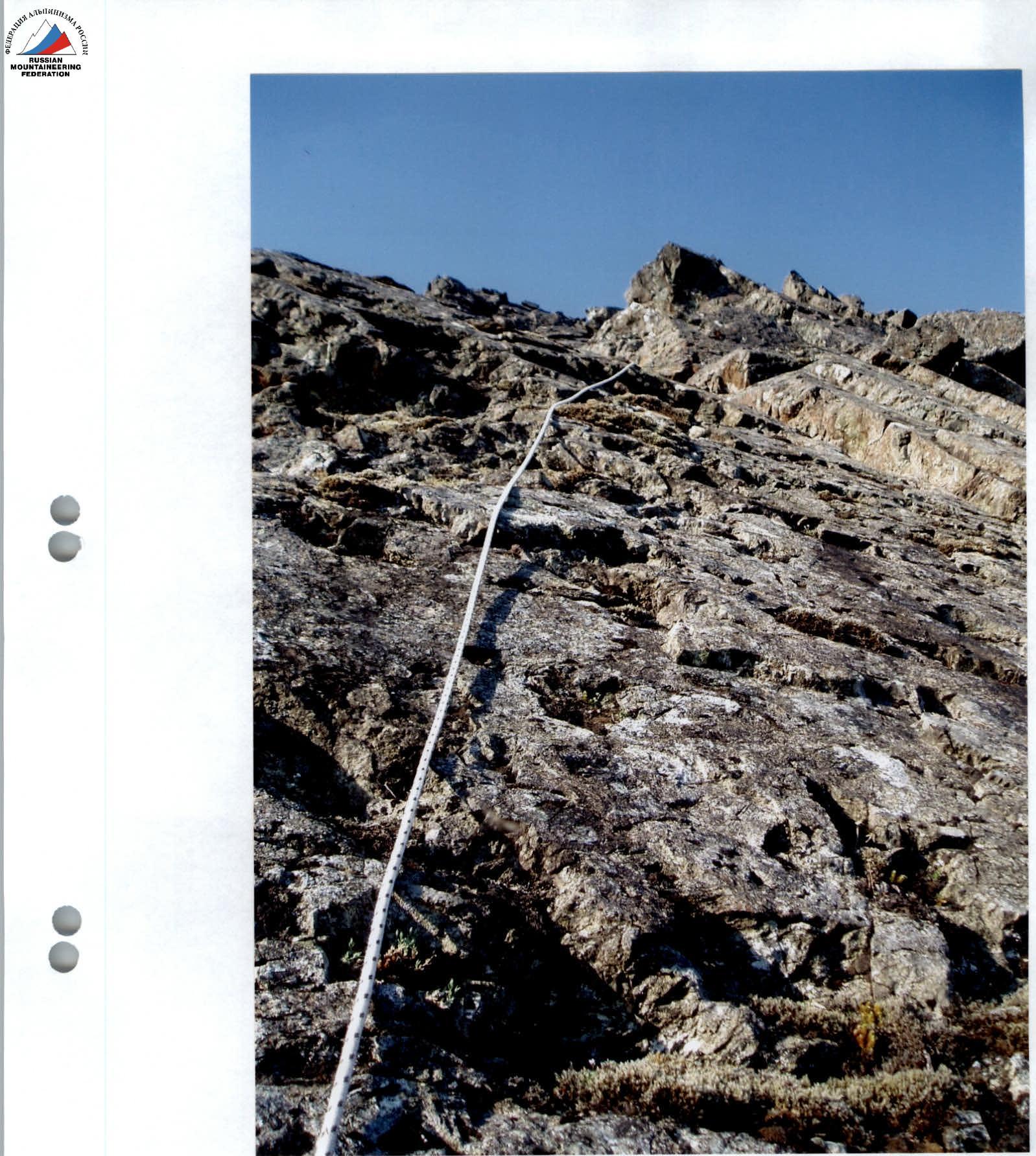
R10–R11 — passing the rock ridge. Rocks. Section length — 100 m. Steepness — 45°. Level of difficulty — 2, 2. Simultaneous movement.
R11–R12 — passing a rock wall and exiting to the second shoulder of the buttress ridge via rock shelves. Rocks. Section length — 45 m. Steepness of the section: in the lower part — 70°, in the upper part — 40°. Level of difficulty: in the lower part — 3, in the upper part — 2, 2. Movement — simultaneous. Organization of belay through rock projections, loops on projections.
R12–R13 — approach along the destroyed rock-scree shoulder of the buttress ridge under the massif of the pre-summit rock tower. Rocks. Section length — 150 m. Steepness of the section 35–20°. Level of difficulty — 2, 1. Movement — simultaneous. Organization of belay through rock projections, loops on projections.
R13–R14 — passing the rock walls of the pre-summit. Monolithic rocks. Section length — 50 m. Steepness of the section — 70–80°. Level of difficulty — 5. Technically difficult climbing on steep rocks with minimal holds ( small holds for 2–3 fingers)! Movement — alternate. Belay — piton, using chocks (recommended to use "Parus" stopper №0–№4). Exit to the pre-summit.
R14–R15 — descent to the pre-summit plateau. Scree destroyed rock ridge. Section length — 150 m. Steepness of the section 15°. Level of difficulty — n/c. Movement — simultaneous. Gymnastic belay.
R15–R16 — approach along the plateau under the summit rock dome. Scree. Section length — 400 m. Steepness of the section — 5°. Level of difficulty — n/c. Movement — simultaneous. Gymnastic belay.
R16–R17 — passing the rock massif of the summit dome and exiting along the ridge to the summit. Rocks. Section length — 150 m. Steepness of the section 35°. Level of difficulty — 2, 2. Movement — simultaneous, on a shortened rope. Organization of belay through rock projections.
R18 — summit 1159 (Dinozavr Glavny).
R18–R0 — descent along the center of the eastern slope. Scree, snow. Crossing the Nyrdv) river by snow bridges. (Snow bridges in summer are subjectively hazardous!). All-terrain vehicle road across mountain tundra. Section length — 4–5 km. Level of difficulty — in the upper part — 1, 1, in the lower part — non-categorized.
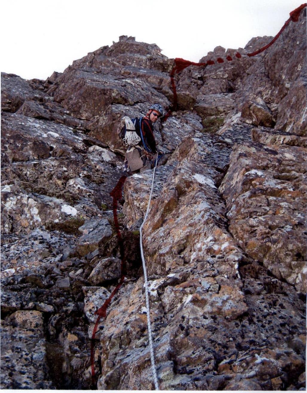 R5–R6. Wall with a fault (lower part). Photo №1.
 Section R5–R6. Wall with a cleft. №2.
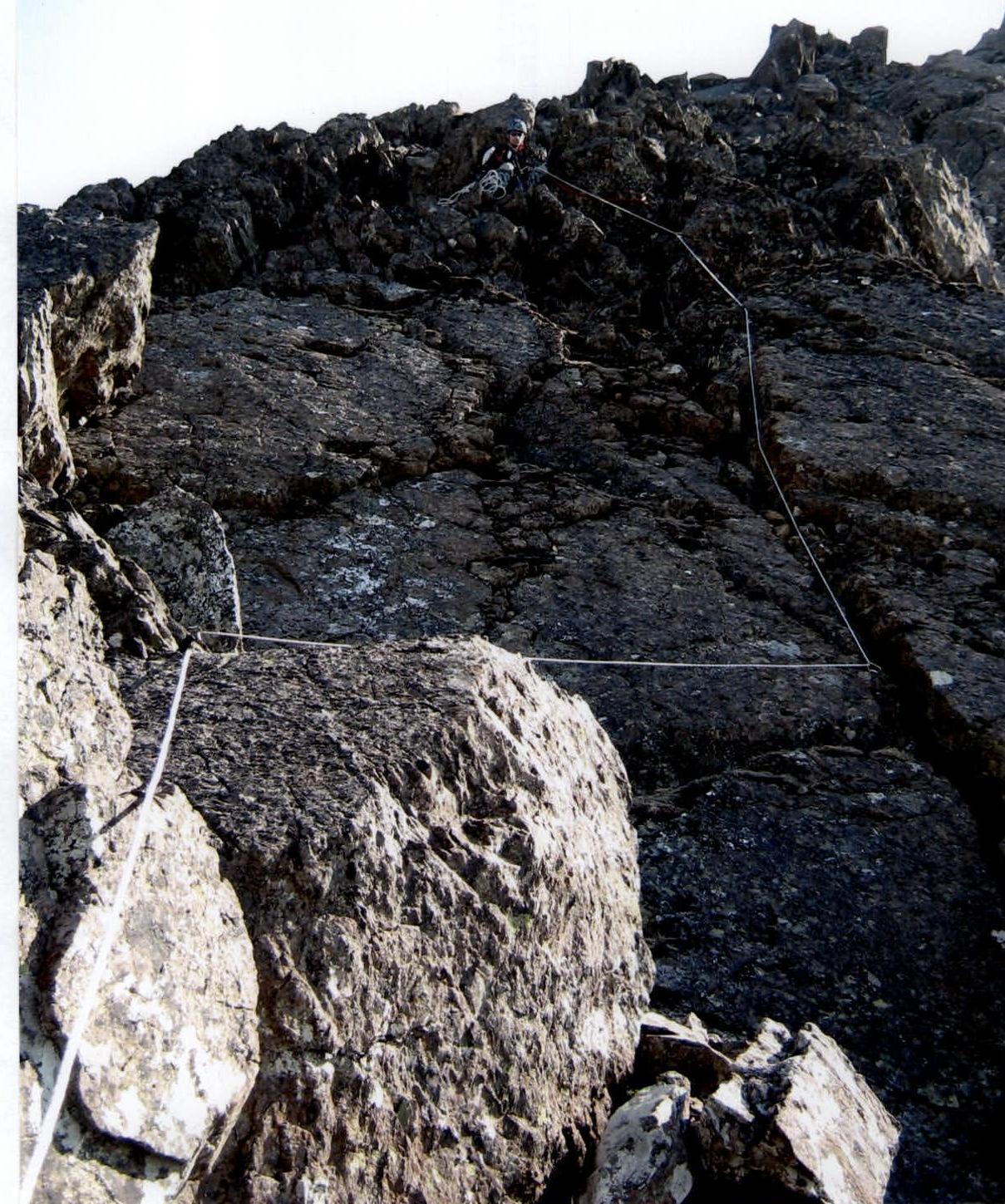
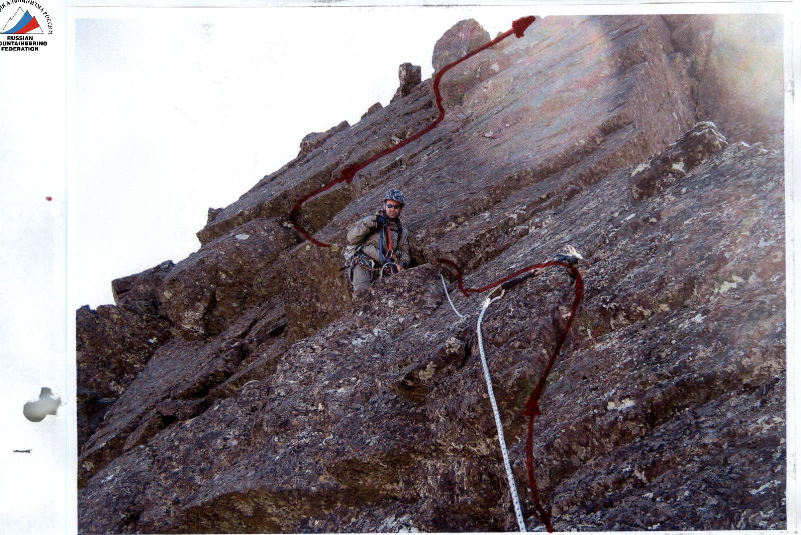
 R7–R8. Photo №3.
 R7–R8
R7–R8
 On section R8–R9 (traverse). №4.
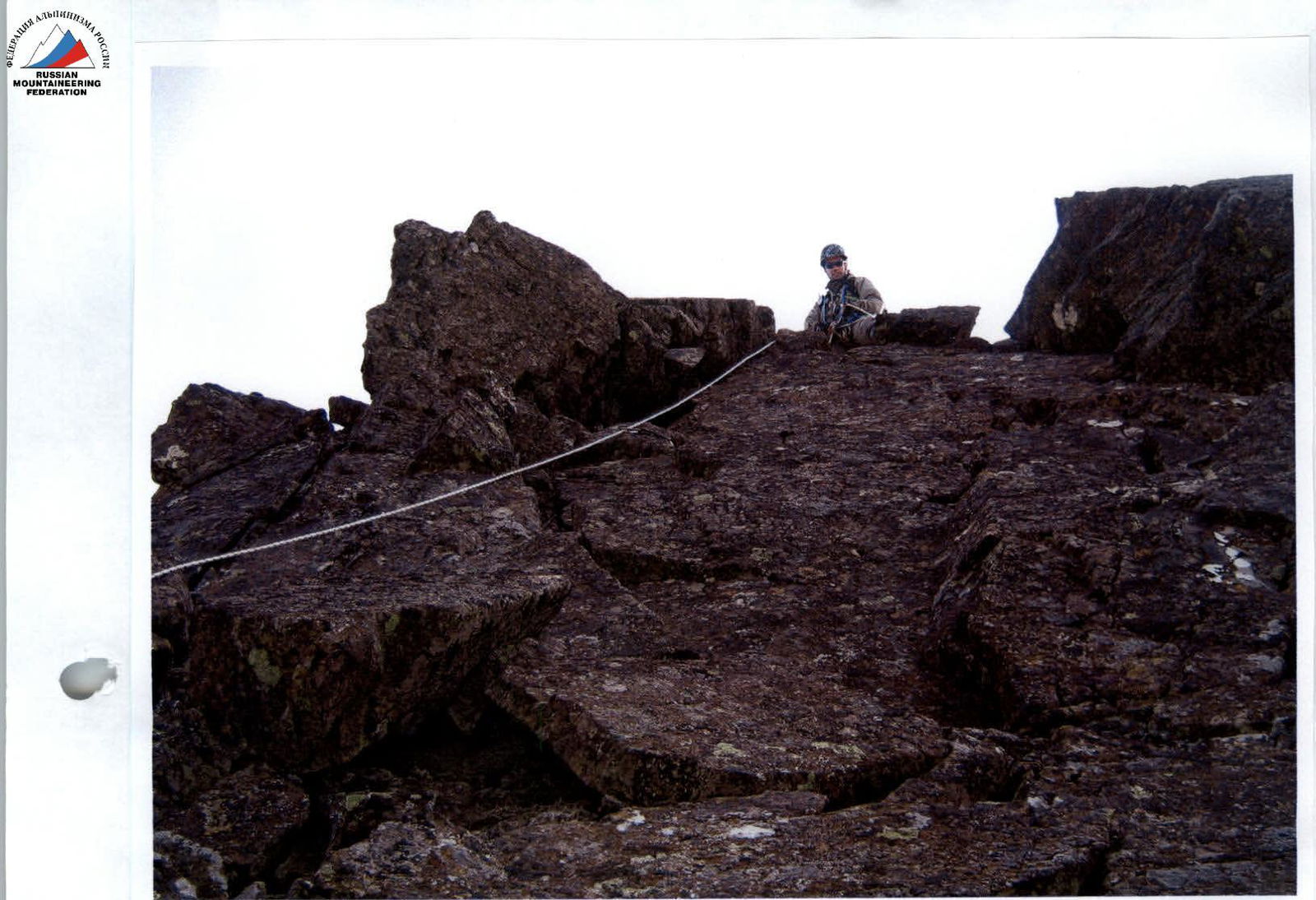
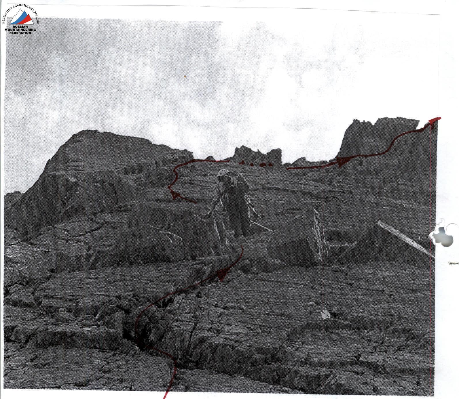
 Section R9–R10. Below, a platform for a bivouac is visible. Photo №5.
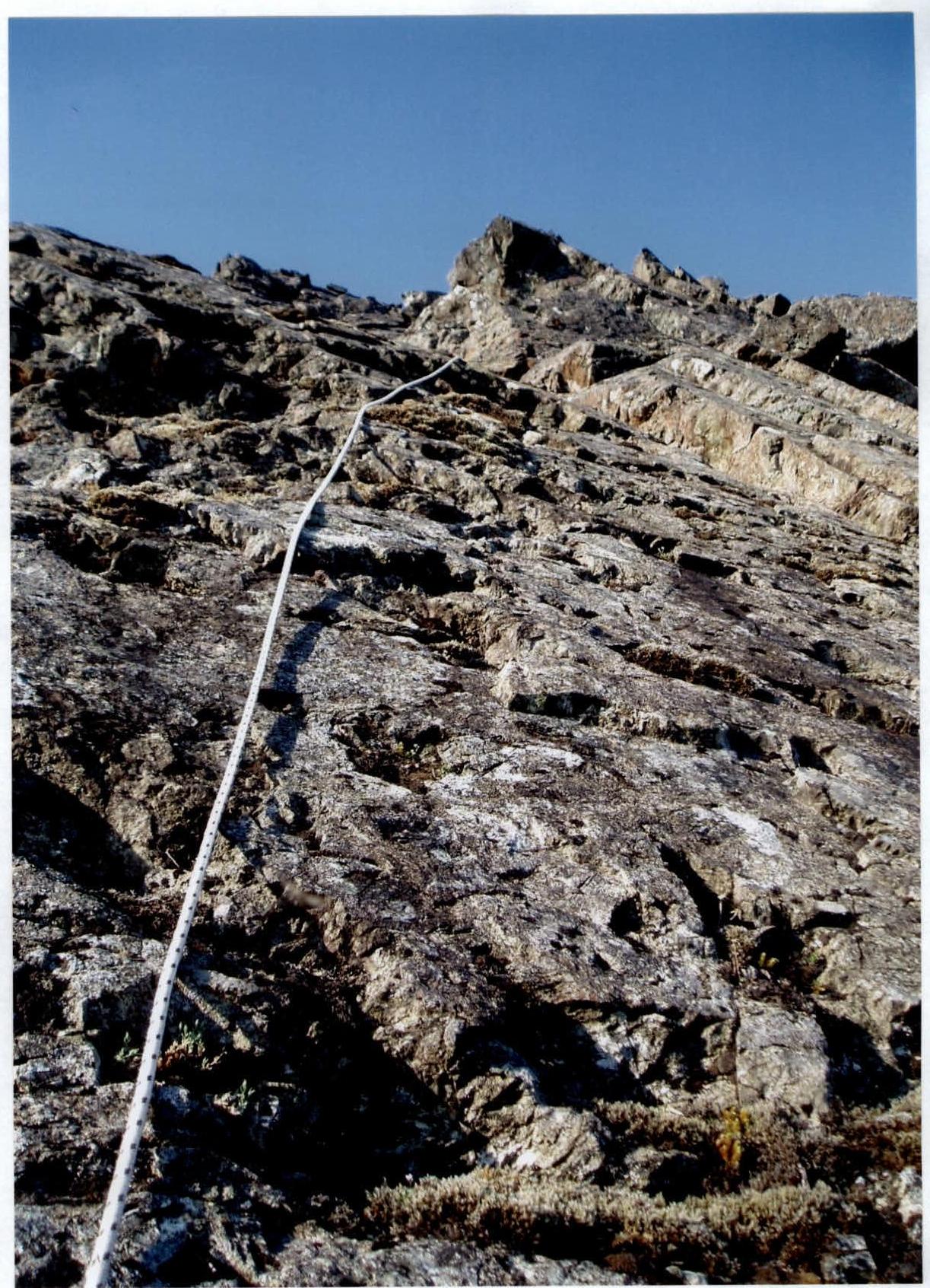
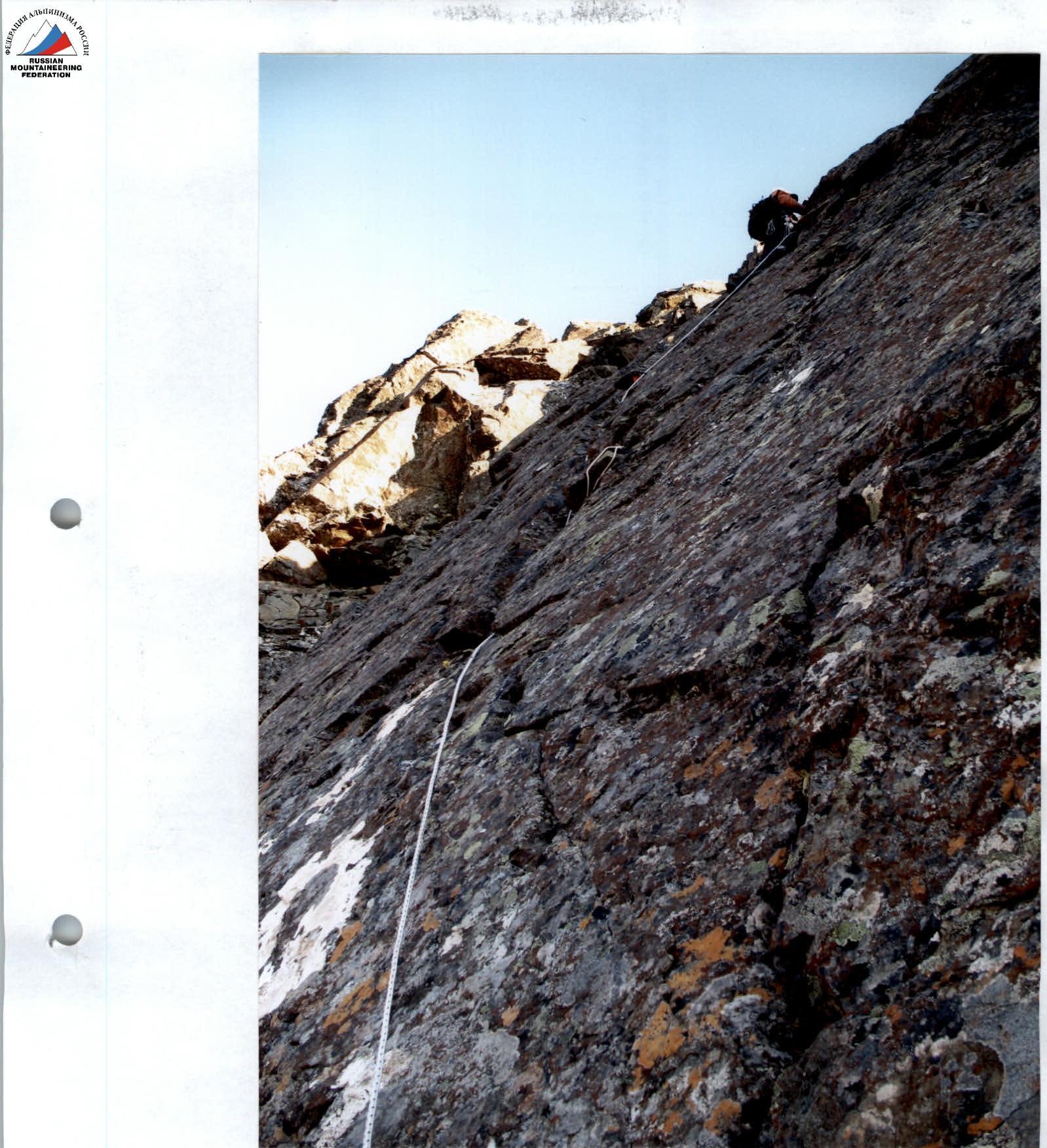
 R10–R11. №6.
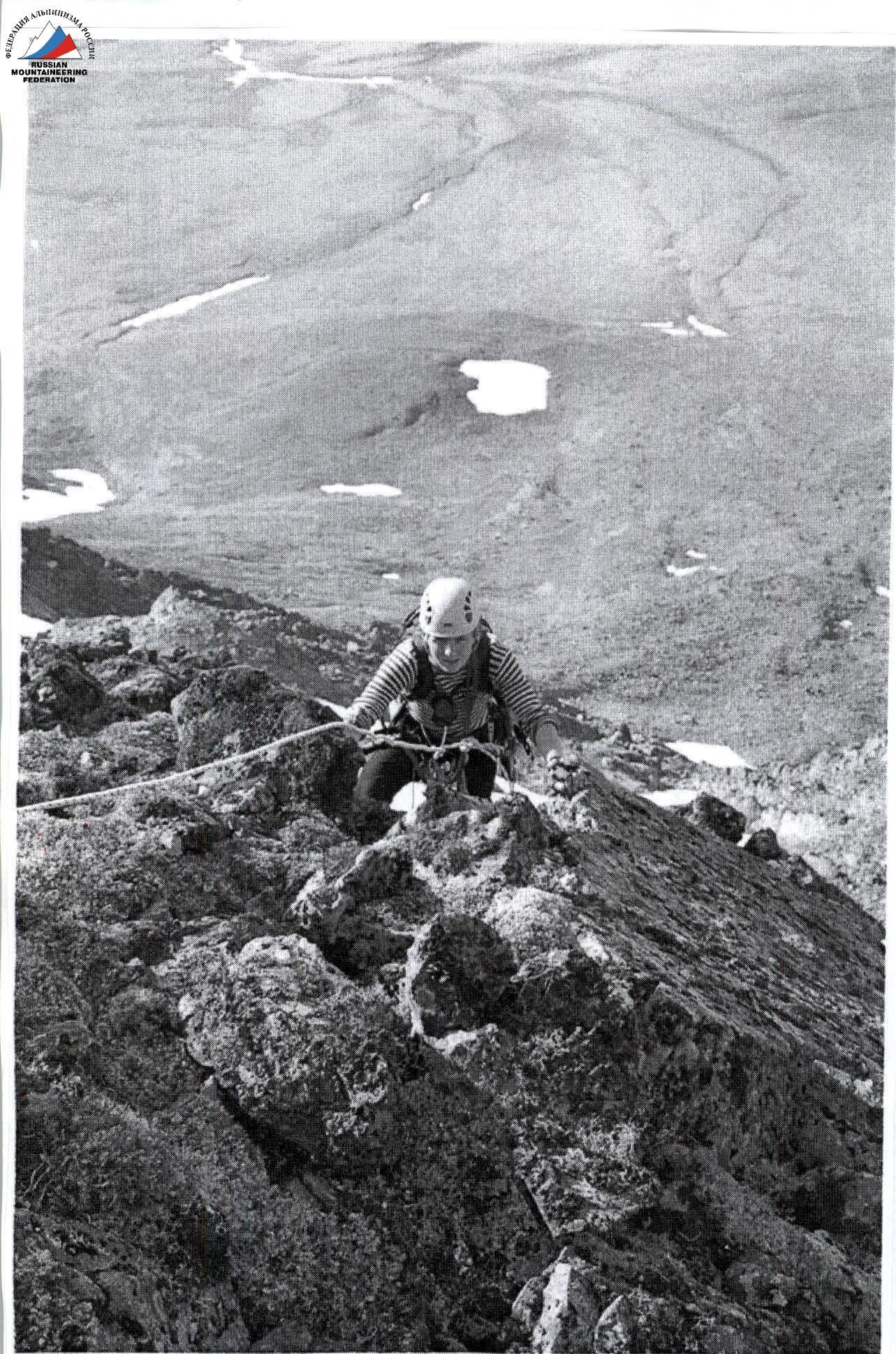
 Section R13–R14 (lower). №7.
 Section R13–R14 (upper). №8.