Alpinism School
Rock climbing class
REPORT
First ascent of peak 3446 m: North Peak AKF, from the east via the north ridge. Afghanistan, Lal mishan mountains, Munti dzh mountain range.
Category I instructor-methodologist Bogolyubov V.V.
Ascent Passport
- Ascent class
Rocky.
- Ascent region — Afghanistan, Lal mishan mountains, Munti dzh mountain range.
- Peak, route — First ascent of peak 3446 m; North Peak AKF, from the east via the north ridge.
- Expected category difficulty 1B
- Height difference:
1406 m
- Total route length — 5560 m
- Length of key sections 40 m
- Of which 2nd category difficulty
40 m 6. Number of pitons driven:
- rock
- ice
- закладок
- bolt
- Number of walking hours/days 10 h
- Leader Full Name Bogolyubov V.V. sports title CMS (Candidate for Master of Sports)
- Participants Full Name Trainees 19 people sports title novice
- Coach Full Name Bogolyubov V.V. sports title CMS
- Departure for the route 6:00 Date May 28, 2009
- Reaching the summit 13:10 Date May 28, 2009
- Return 16:00 Date May 28, 2009 North Peak AKF 3446 m
1B
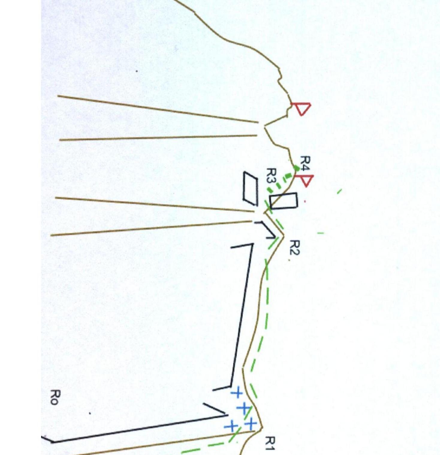 Route
description
Route
description
| Section N | Cat. dif. | Steepness | Length | Belay | Notes |
|---|---|---|---|---|---|
| R0–R1 | 1 | 30* | 2000 m | ||
| R1–R2 | 1 | 20* | 2000 m | Simultaneous belay | |
| R2–R3 | 1 | 25* | 520 m | Simultaneous belay | |
| R3–R4 | 2 | 50* | 40 m | Simultaneous belay on ledges |
R0–R1. The ascent starts from the east along a scree slope turning into a rocky ridge with rock outcrops. Before reaching the north ridge, there are snowfields about 40–60 meters long. After reaching the ridge, there is a wide platform.
R1–R2. The ridge is initially wide, and after 100 meters, there is the first gendarme, which is bypassed on the left. After that, the ridge becomes narrow, composed of large blocks, and is partially covered with scree. Belay is simultaneous through ledges.
R2–R3 — A slight descent along the ridge and exit to the western slope. Belay is simultaneous through ledges.
R3–R4 — Ascent along the slope to the summit via rocky ledges and walls 2–3 m high, with a steepness of up to 50°. Belay is simultaneous on ledges.
R4–R0 — Descent via the ascent route.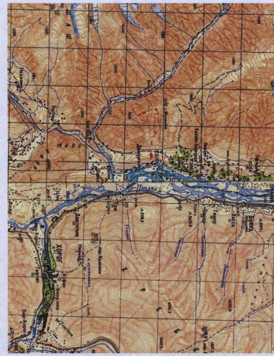 □
□