
Report
On the ascent of the CSKA team named after Demchenko to the summit of Trezenta (3609 m) via the N ridge and NE crest, 2A cat. diff. Graian Alps, Vаль d'Aosta region (Valle d'Aosta), Gran Paradiso National Park
Leader: A. V. Yurkin Senior coach: E. V. Kuznetsova
Climbing Passport
-
Graian Alps (Italy). Gran Paradiso region. № 10.3 (according to KGBM 2011)
-
Mount Trezenta (3609 m) via N ridge and NE crest.
-
Proposed category: 2A cat. diff.
-
Route type: combined
-
Height difference: 550 m
Route length: 1100 m. Average slope:
- Main part of the route: 45°;
- Entire route: 40°.
-
Pitons left on the route: Total — ; including expansion bolts —
-
Team's total climbing time: 4.5 hours (not including descent)
-
Leader: Yurkin A. V., CMS
Team members:
- Kuznetsova Yu. P., 1st sports category
- Vershinin V. N., 2nd sports category
- Vovk S. V., 2nd sports category
-
Coach: Kuznetsova E. V.
-
Departure from Base Camp: July 5, 2012, 8:00 AM. Route started: July 5, 2012, 9:30 AM. Summit reached: July 5, 2012, 1:00 PM. Return to Base Camp: July 5, 2012, 3:00 PM. Descent from the summit: via 1A cat. diff. on the NW crest to Vittorio Emanuele hut.
-
Organization: CSKA named after Demchenko (Moscow) training camp
-
Person responsible for the report: Yurkin A. V.
Email: S2_aleks@mail.ru
General photo of the summit.
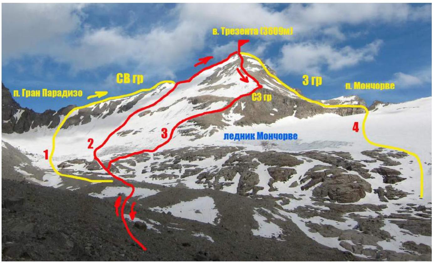
Routes on Mount Trezenta
- Route via NE crest (M. Baretti, A. Blanchetti, 1867) 2A-2B cat. diff.
- Route via N ridge and NE crest. 2A cat. diff.
- Via NW crest and NW wall (G. Bobba, C. Therisod, G. Noro, 1894) 1A cat. diff.
- Route via W crest (G. Yeld, Henry, 1883) 1B-2A cat. diff.
The photograph was taken from the Moncorve glacier moraine on July 3, 2012.
Photo of the route profile on the right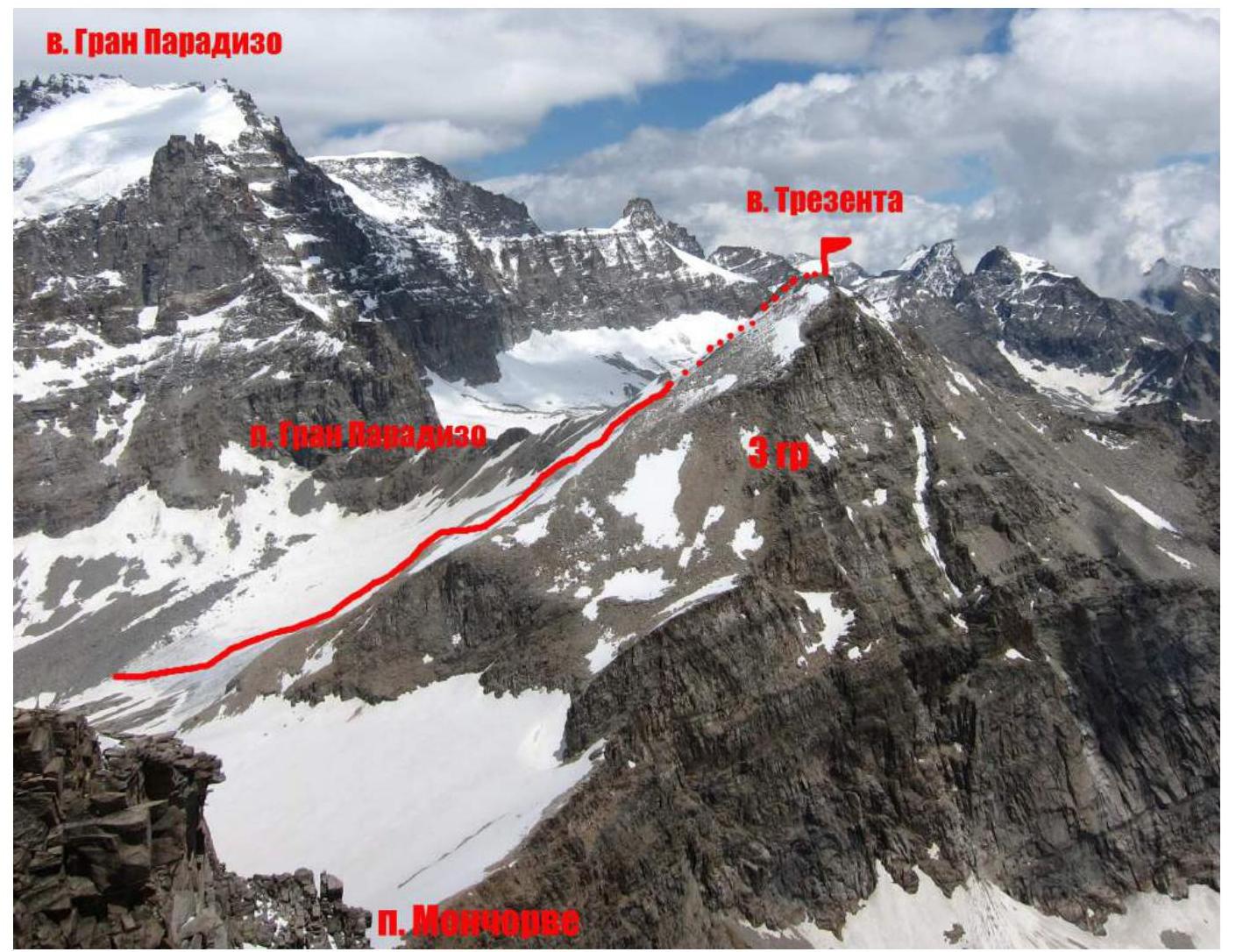
Panorama of the area.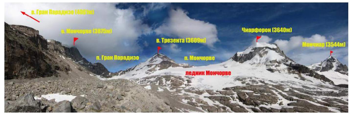 Overview
of the Gran Paradiso area.
Overview
of the Gran Paradiso area.
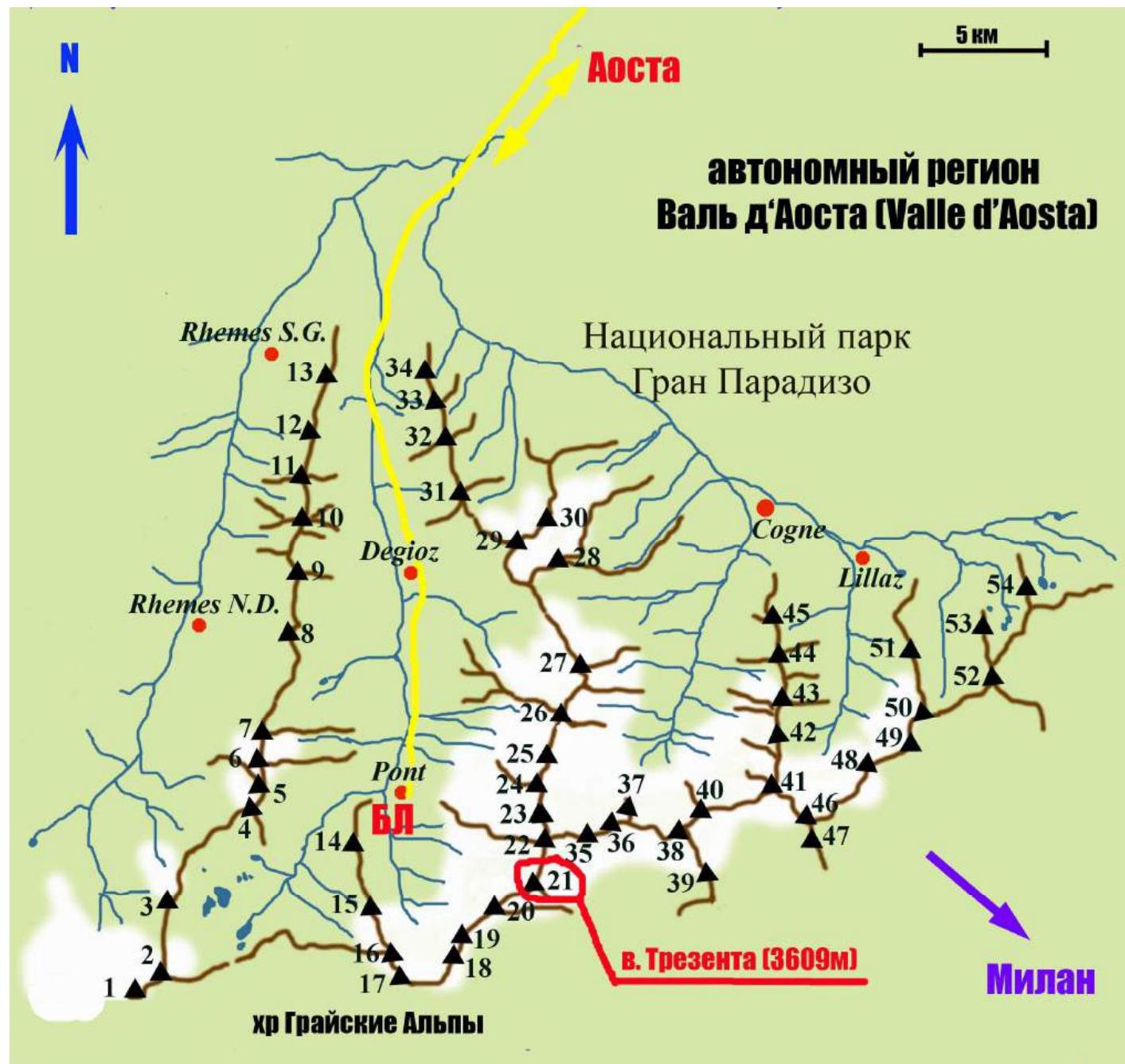
| Peak designations (with heights) on the map: | |
|---|---|
| 1. Punta Galisia 3346 m | 28. Punta Rossa della Grivola 3630 m |
| 2. Punta Basei 3338 m | 29. La Grivola 3969 m |
| 3. Punta Gran Vaudala 3272 m | 30. Grivoletta 3514 m |
| 4. Taou Blanc 3438 m | 31. Gran Nomenon 3488 m |
| 5. Aouillé 3440 m | 32. Mont Favret 3173 m |
| 6. Cima di Entrelor 3430 m | 33. Punta Valletta 2793 m |
| 7. Punta Percià 3227 m | 34. Becca Piana 2271 m |
| 8. La Roletta 3384 m | 35. Punta Ceresole 3777 m |
| 9. Punta Bianca 3427 m | 36. Testa della Tribolazione 3642 m |
| 10. Punta Bioula 3414 m | 37. Testa di Valnontey 3562 m |
| 11. Punta del Ran 3272 m | 38. Becca di Gay 3621 m |
| 12. Punta Chamoussière 2942 m | 39. Becco Meridionale della Tribolazione 3360 m |
| 13. Monte Paillasse 2414 m | 40. Roccia Viva 3650 m |
| 14. Cima dell'Arolley 2996 m | 41. Torre del Gran San Pietro 3692 m |
| 15. Cima di Seiva 3075 m | 42. Punte Patri 3581 m |
| 16. Punta Fourà 3411 m | 43. Punta Valletta 3356 m |
| 17. Mare Pércia 3385 m | 44. Punta di Valmiana 3244 m |
| 18. Denti del Broglio 3454 m | 45. Punta Fenilia 3053 m |
| 19. Becca di Monciair 3544 m | 46. Punta d'Ondezana 3452 m |
| 20. Ciarforon 3642 m | 47. Becco di Valsoera 3369 m |
| 21. La Tresenta 3609 m | 48. Punta delle Sengie 3408 m |
| 22. Becca di Moncorvè 3875 m | 49. Monveso di Forzo 3322 m |
| 23. Gran Paradiso 4061 m | 50. Grande Arolla 3246 m |
| 24. Piccolo Paradiso 3923 m | 51. Punta della Tsesère 3117 m |
| 25. Becca di Montandayné 3838 m | 52. Torre di Lavina 3308 m |
| 26. Herbetet 3778 m | 53. Punta di Acque Rosse 2952 m |
| 27. La Gran Serra 3552 m | 54. Punta Nera 3064 m |
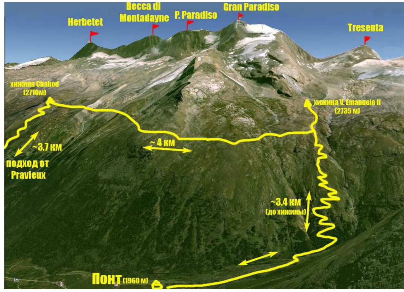
Approach route from the Base Camp (Pont campsite) to Vittorio Emanuele II hut.
The summit of Trezenta (La Trezenta) 3609 m, which was the goal of the ascent, is located in the Gran Paradiso National Park area. The park is situated in the Graian Alps mountain range in the autonomous region of Valle d'Aosta in northern Italy.
The highest point in the Gran Paradiso area is 4061 m, making it the seventh highest peak in the Alps (Mont Blanc being the first).
The Valle d'Aosta region is heavily mountainous, featuring some of the most iconic Italian and Alpine peaks such as Monte Bianco (Mont Blanc), Grand Jorasses, Cervino (Matterhorn), and Gran Paradiso.
Most climbing routes of interest are found in the Gran Paradiso mountain range. With peak elevations between 3500-4000 m, the area offers a variety of terrain including rock, ice, and snow. Many combined routes are available, with the majority being 1-4 category difficulty, and some 5th category routes.
The ascent to Trezenta was part of the CSKA named after Demchenko (Moscow) training camp in June-July 2012. The Base Camp was set up at the Pont campsite, the highest and last settlement in the Valsavaranche valley, at an elevation of 1950-2000 m.
The actual climb started from the Vittorio Emanuele II hut, located at the foot of Gran Paradiso at 2732 m. The approach from Pont takes about 2 hours via a comfortable trail.
Trezenta is situated in the ridge between Ciarforon 3642 m and Becca di Moncorvè 3875 m. The geographical coordinates of the summit are 45°29′57.08″ N 7°15′50.48″ E.
Description of route sections.
| Section | Length, m | Angle, deg | Terrain type | Category of difficulty | Number of pitons |
|---|---|---|---|---|---|
| R0–R1 | 400 | 20–30 | Snow-ice | I | |
| R1–R2 | 300 | 40 | Snow-ice | II | |
| R2–R3 | 150 | 20–35 | Rocks-snow | I | |
| R3–R4 | 150 | 45 | Rocks | II-III | |
| R4–R5 | 100 | 20 | Rocks | I |
Technical photo of the route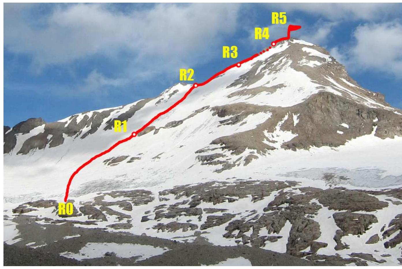
Brief description of the route passage by sections.
R0–R1 After crossing the glacier moraine and gentle "ram's foreheads," start moving up the glacier towards the left edge of the rocky outcrops. In the second half of the day, falling rocks from the cliffs are possible.
R1–R2 Bypass the rocky outcrops on the left, then move up to the right. Orient towards the col (saddle) in the ridge. Snow-ice terrain. Use ice axes for belaying; in areas with less snow, use ice screws. Reach the col.
R2–R3 From the col, move upwards. The ridge is initially gentle, then becomes steeper. Caution! Live rocks on the sloping slabs!
R3–R4 Ascend the rocky ridge (partly destroyed) on the right side. Bypass the first "gendarme" on the left. Belay using folds and outcrops. Continue according to the terrain conditions. Stations are conveniently located. After bad weather, the rocks may be icy; it's best to move in crampons.
R4–R5 Ascend the right rocky part of the ridge to reach the gentle pre-summit area. A large metal cross is installed at the summit.
Descent is via the NW wall and NW ridge on scree and snowfields. To start the descent, move about 50 m back along the NE crest, where the descent trail begins. Descent takes 1-1.5 hours. Caution! In poor visibility, avoid going too far to the right in the middle and lower sections to prevent rockfall.
The route is generally considered relatively safe. Potential hazards related to rockfall occur in the second half of the day, particularly in the middle and lower parts of the wall section. This is especially relevant during descent.
Photo illustration of the report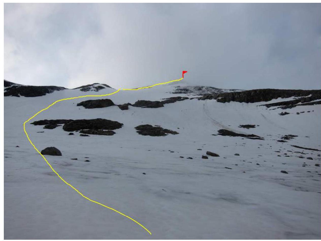
Photo 1. Lower part of the route.
Photo 2. Section R1–R2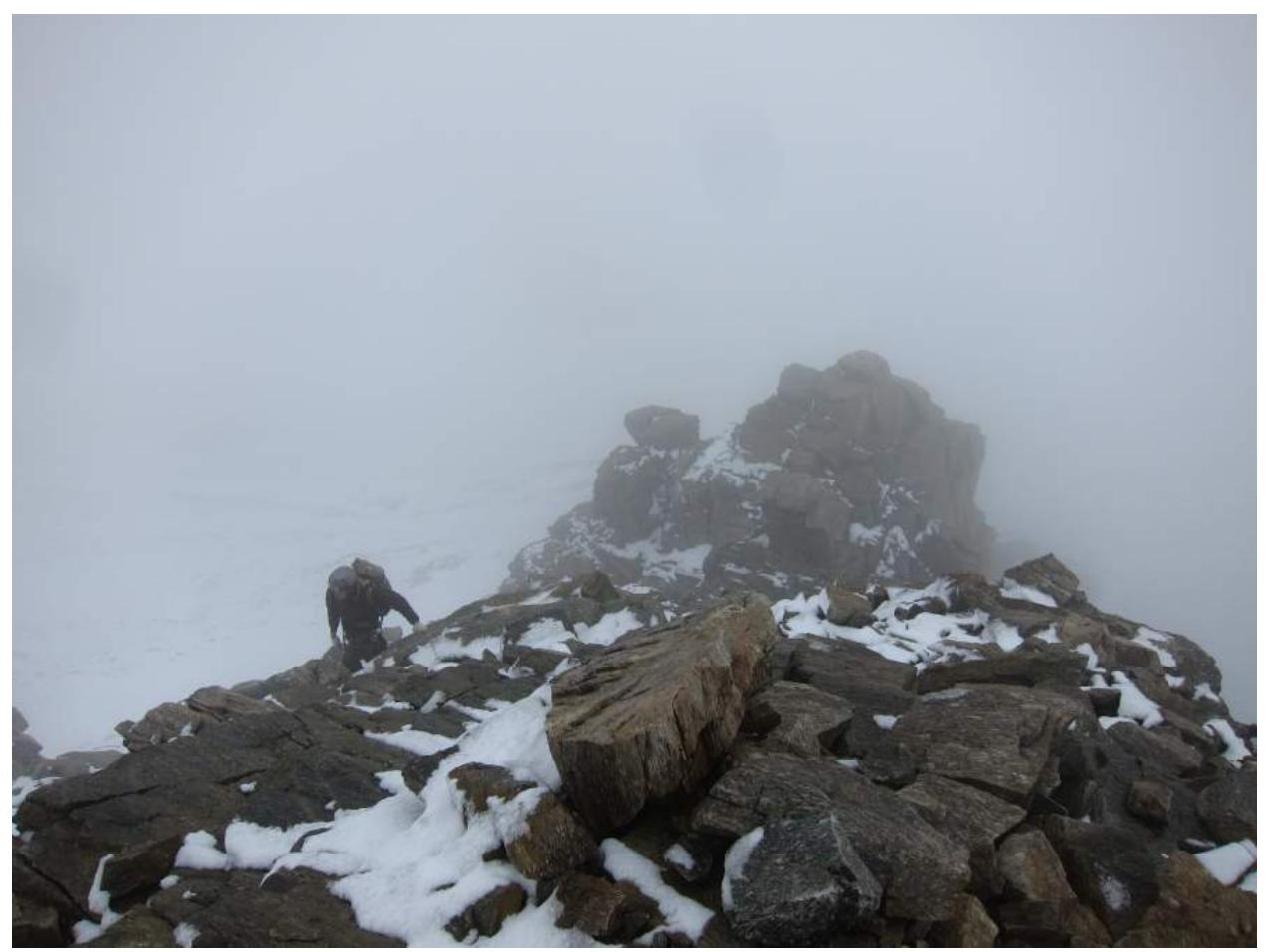
Photo 3. Section R3–R4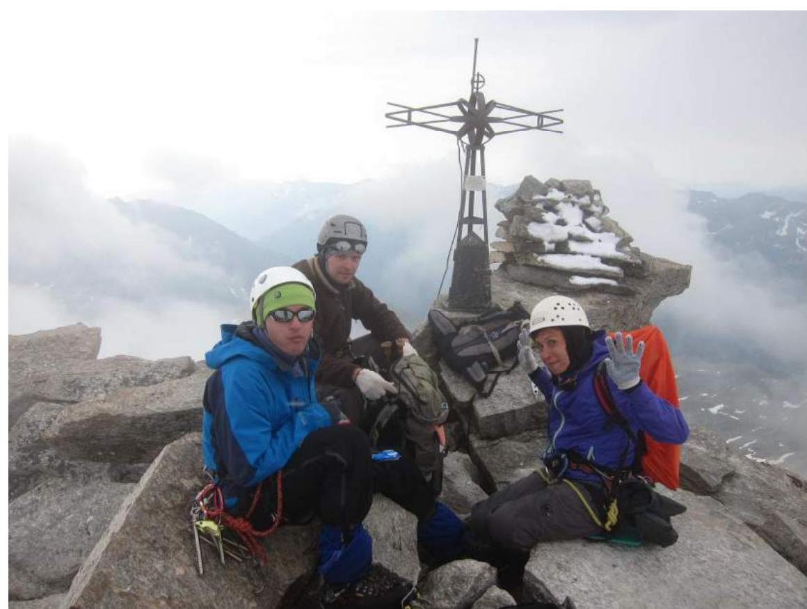
Photo 4. Group at the summit of Trezenta
Photo 5. Note left by the previous group at the summit. The notebook with records is stored in a metal container within the summit cross.
Comments
Sign in to leave a comment