Route to the summit of Mont Blanc 4810 m via the Northwest slope.
Proposed category of difficulty
2B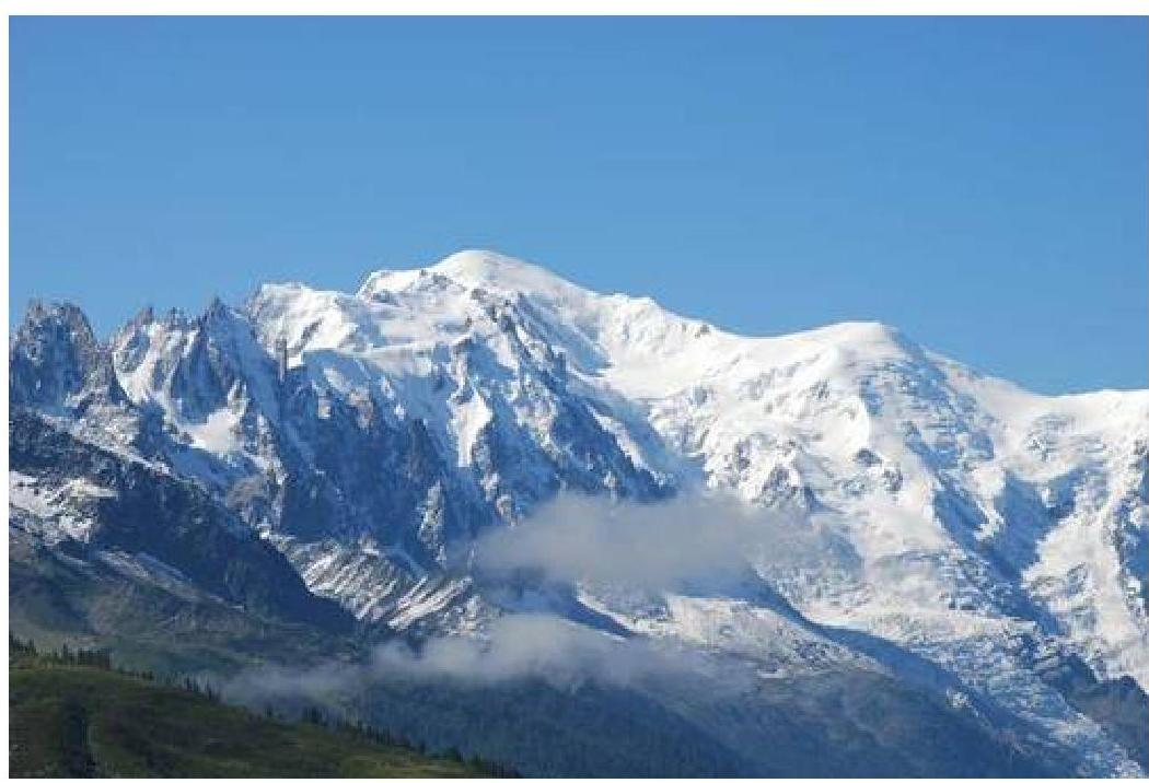
Route Passport
- Mont Blanc via the Northwest slope, Chamonix, Savoy Alps, France 4810 m.
- Proposed category of difficulty 2B.
- Nature of the route: snow-ice
- Elevation gain of the route: 1278 m
Length: 1800 m
- Team's walking hours (to the summit): 8 hours. Descent — 4 hours.
- Management team: Volkov Andrey Evgenievich, MSМК*, 3rd sports category; Mariev Andrey, MSМК
- Departure to the route: 3:00
Summit arrival: 11:00. Return of the entire team to the base camp: 15:00, August 19, 2008.
- Team members: Anikina Evgeniya Vladimirovna, Varlamova Natalya Vladimirovna, Galkin Vladimir Vladislavovich, Dusharin Alexey Ivanovich, Kaysin Dmitry Vyacheslavovich, Kayumova Diana Almasovna, Mikhailichenko Alexandra Anatolyevna, Sorokina Veronika
Brief Overview of the Area
Chamonix — this is a beautiful place in the French Alps, where, as is known, alpinism was born. In addition to Mont Blanc, Chamonix is home to a huge number of famous challenging peaks, such as:
- Grandes Jorasses
- Petit Dru
- Grand Capucin
- Mont Blanc du Tacul
- Dent du Géant
- Aiguille du Midi
- Aiguille Verte
- many others.
The area has a well-developed infrastructure — huts, cable cars, via ferratas, multi-pitch routes, etc. This allows climbers to:
- quickly and conveniently access different routes,
- go trekking,
- ski,
- take walking tours, etc.
It is worth noting that, despite the relatively low height, the wall sections of the routes often reach over a thousand meters.
Chamonix is a great place for alpinists of any level.
Route Description by Sections
- to the right, bypass the avalanche cone from the overhanging serac zone next to the rock "triangle". I–II, 250 m, 30–35°
- bypassing crevasses and steep ice faces, approach the steep slopes leading to the pre-summit ridge. II, 250 m, 30–35°
- climb the slopes of average steepness to a broad ridge, II–III — 150 m, 35–45°
- along the ridge to the right to a steep rise in the ridge between rock outcrops
- overcoming the rise "head-on" to climb to the connecting ridge. III — 80 m, 45°
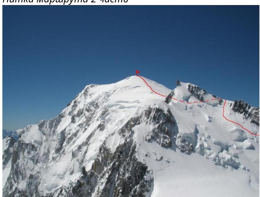
- across snow fields and indistinct ridges to the pre-summit tower.
- along the distinct ridge to the summit. II — 150 m, 35°
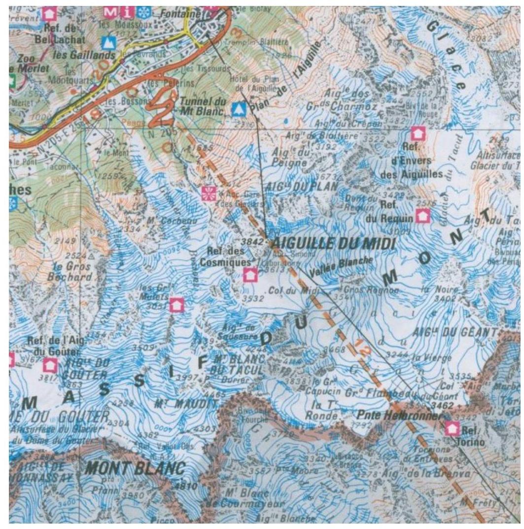
Area Diagram
Route thread 1
part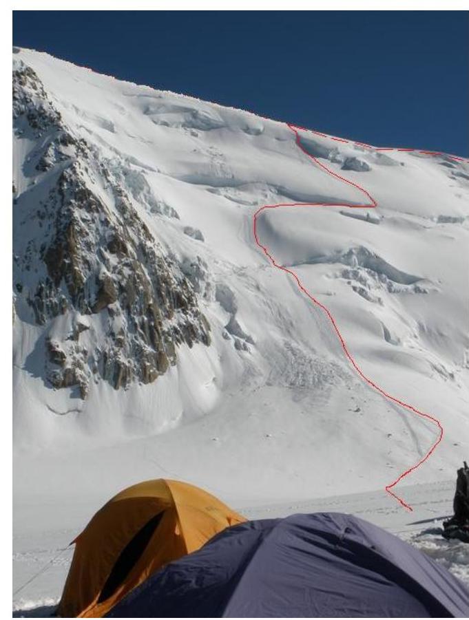
Route thread 2
part