Savoy Alps, France,
July 18-19, 2008
Climbing Passport
- Savoy Alps, France
- Mont Blanc, Southeast ridge, via the classic route.
- Estimated difficulty: 2A.
- Route type: snow and ice climb.
- Elevation gain: approximately 1610 m (3200–4810).
- Leadership: Dusharin Ivan Trofimovich — Master of Sports, 1st category; Ovchinnikov Alexey Yuryevich, 1st category, doctor, trainee; Bryk Roman, 1st category, trainee.
- Participants: Volkov Artem; Govorov Anatoly; Zyablikova Maria; Kalugin Dmitry; Klimov Alexander; Komarov Alexey; Konanchuk Denis; Kuteev Nikolay; Mikhailichenko Anna; Mrduляш Pavel; Nesterova Olga; Ovchinnikov Alexey; Rassadina Yulia; Solovyova Irina; Sugakova Anna; Tutaev Peter; Fetisov Donat; Shishkonova Olga; Shoptenko Vyacheslav
- Departure for the climb: 2:30 AM, July 18, 2008.
Reached the summit: 8:45 AM, July 19, 2008. Returned to the Aiguille du Goûter hut: 4:00 PM, July 19, 2008.
Area Description
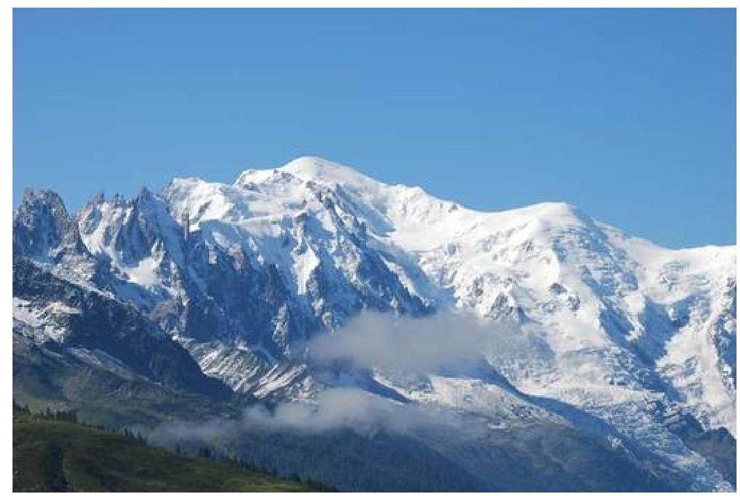
Mont Blanc is the highest mountain in Europe, located on the border between the French region of Upper Savoy and the Italian province of Turin. It serves as a watershed between the Rhône and Po rivers, standing at 4810 m. It belongs to the Savoy Alps and forms a distinct massif with neighboring mountains, predominantly crystalline in structure. The main ridge rises steeply as a rocky glacier between the Arve and Dora Baltea rivers and drops abruptly to the southeast. To the northwest, lateral branches diverge, separated by glaciers and snowfields. Notable peaks include:
- Aiguille de Trélaté
- Dome de Miage
- Mont Maudit
- Aiguille de Jardin
- Grandes and Petites Jorasses rocks
- Aiguille de Talèfre (3750 m)
- Aiguille de Triolet (3879 m)
- Mont Dolent (3830 m)
Passable routes are mainly found at the edges of the mountain, where the ridge dips below 3300 m. Crossing the ridge involves traversing icy paths, such as:
- Col du Géant (3362 m)
- Col de Miage (3403 m)
- Pas d'Argentière
Among the 30 glaciers, the most significant are:
- Argentière glacier
- Bossons glacier
- Mer de Glace
- Bosson glacier (to the west)
- Trient glacier (to the north)
- Glaciers de Miage, de la Brenva, du Mont Dolent, and de Salenoz (to the east)
The first ascent of Mont Blanc was made in 1768 by Jacques Balmat, followed by Dr. Paccard in 1787.
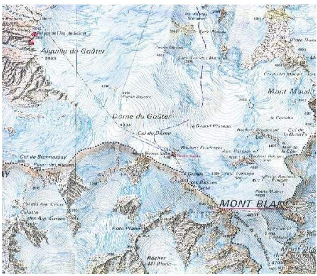
Area Map:
Route Description:
Chamonix — Saint Gervais — Aiguille du Goûter (Goûter hut, 3800 m.) — Mont Blanc (4810 m.)
The approach to the climb begins with a tram ride from Les Fayets or Saint Gervais. The journey takes about an hour, with the final stop at Nid d'Aigle (2372 m).
From Nid d'Aigle:
- Hike along a well-marked trail to a small mountain hut — 1 hour;
- Then, veer right along the trail, following a somewhat defined ridge — leading to a glacier;
- Cross a gentle and safe glacier, leaving the Tête Rousse hut to the right, heading towards a small saddle (less than 1.5 hours) in a long ridge separating two glaciers.
Tête Rousse hut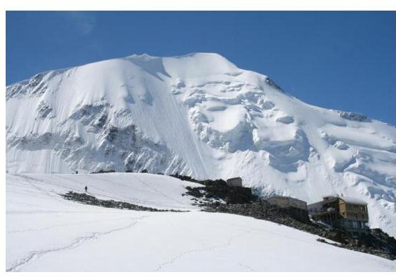
Next, cross a couloir prone to rockfall and emerge onto a long rocky ridge leading directly to the Aiguille du Goûter hut (3817 m, 4–6 hours from "Nid d'Aigle"). The path involves navigating through rocky blocks (up to category 2B difficulty), with elements of "Via Ferrata" — steel cables and steps in particularly challenging sections — leading to the Aiguille du Goûter hut. Just above the hut, it's theoretically possible to set up tents on the snow.
The ascent from Tête Rousse hut involves a "Via Ferrata" route along rocky ridges.
The climb begins from the Aiguille du Goûter hut at 2-3 AM. Crampons are put on immediately upon departure. The path follows a broad ridge (requiring navigation around crevasses) to the Dome du Goûter (2 hours), then descends to the Col du Dome, where the route from "Grande Mulet" converges. Further, the path bypasses the Vallot hut on the ridge, which narrows at this point. The group proceeds along the narrow ridge, roped together, towards the summit. The pre-summit ridge often experiences very strong winds. Eventually, the ridge leads to the summit.
Throughout the ascent, the group followed a well-trodden path.
Many climbers begin their ascent from 3200 m (from Tête Rousse hut).
The start of the ascent from Aiguille du Goûter hut involves moving along the ridge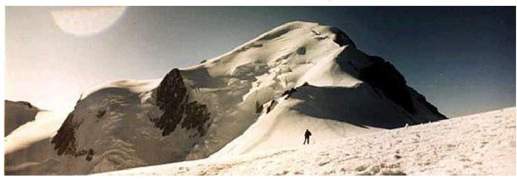
Photo from Vallot hut at 4200 m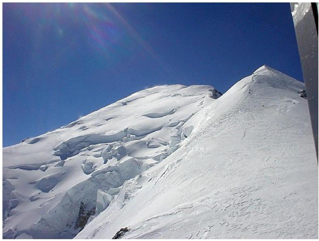
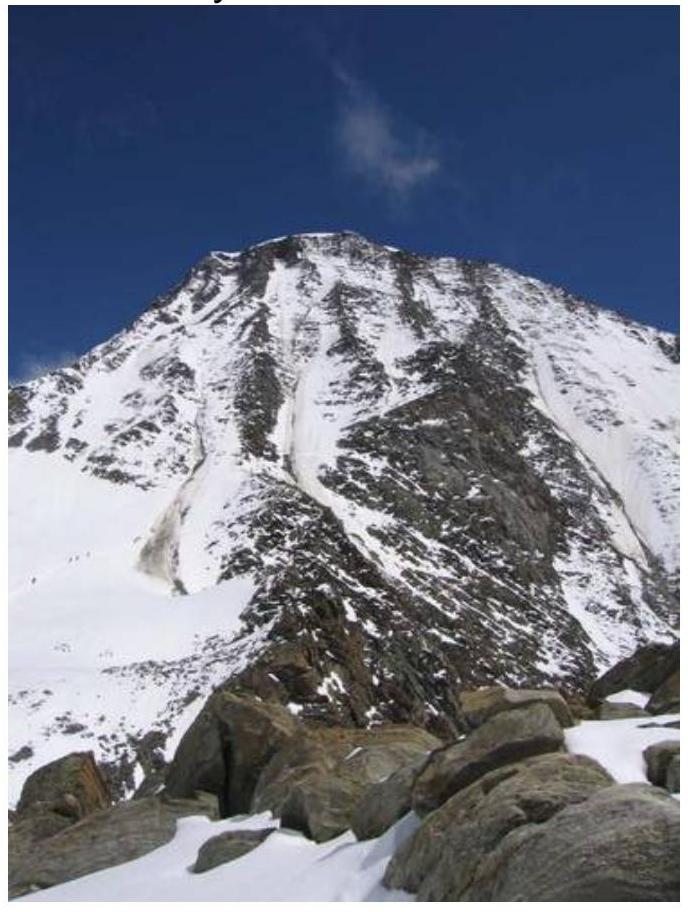
Photo from the summit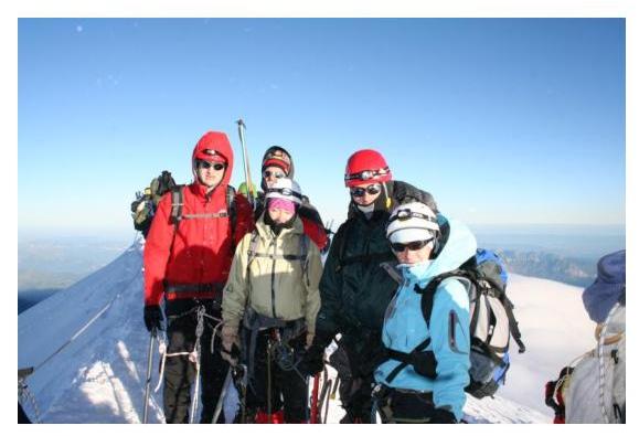
The total ascent time to the summit is 4.5–6 hours. The descent follows the same path — 2 hours.


