Passport
- Class: High-altitude ascents.
- Climbing area: Nepalese Himalayas, Manaslu region.
- Object of ascent: Phangyi 6538 m, Southeast face, First ascent.
- Difficulty category: proposed 6A.
- Route characteristics:
Height difference: 1500 m. Route length: 2000 m. Length of sections:
- 6th cat. diff. — 50 m.
- 5th cat. diff. — 1100 m.
Average steepness of the route — 61°.
- Pitons driven — 4
Protection elements:
- 2 ice screws
- 126 ice screws
- Snow stakes — 10.
- Climbing hours: 28 to the summit.
Days: on the route — 3 to the summit, 2 on descent via icefalls of 3rd grade.
-
Overnight stays: on ascent 3, on descent 2.
-
Climbing participants:
- Yuri Vladimirovich Koshelenko — Master of Sports of Russia, International Class
- Alexey Sergeevich Lonchinsky — Master of Sports of Russia
-
Team coach: Yuri Vladimirovich Koshelenko.
-
Route entry: October 26, 2017.
Summit: October 28, 2017. Return to ABC: October 30, 2017.
-
Organizations:
- Rostov Regional Federation of Alpinism and Rock Climbing
- Federation of Alpinism of St. Petersburg
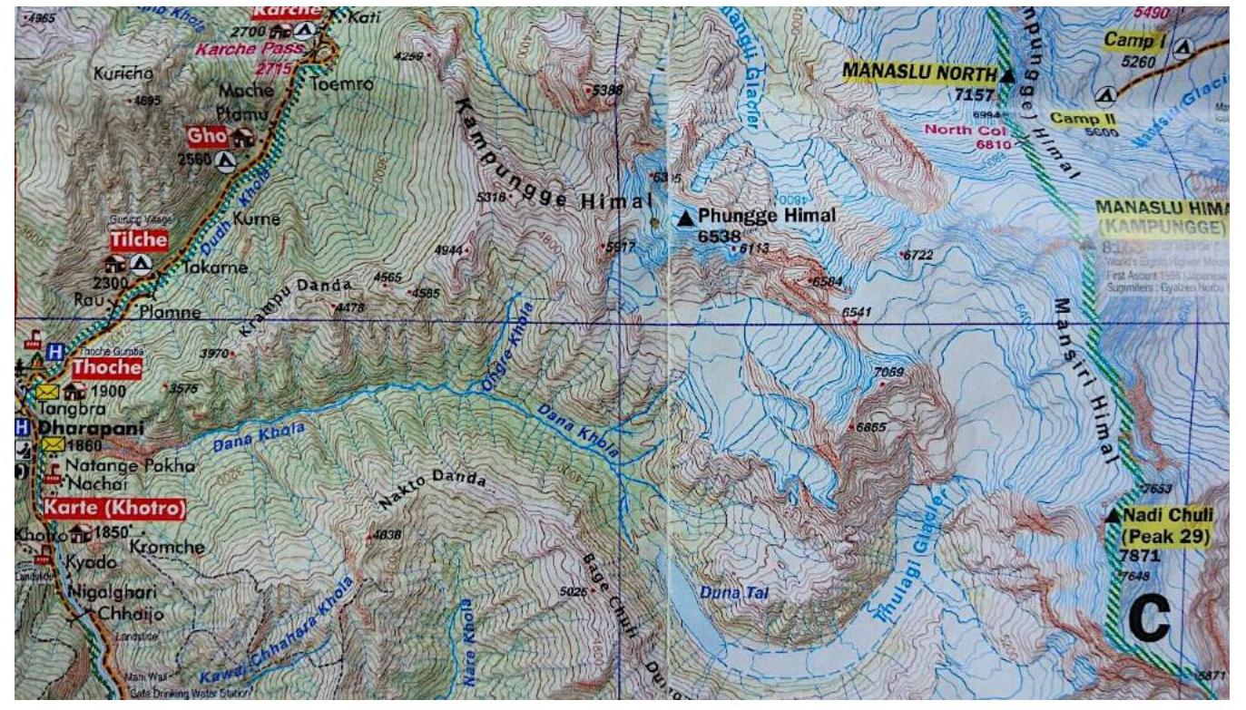
Description of the area
The Phangyi 6538 m peak is located in the lateral ridge of Kampunge Himal, which extends west from the eight-thousander Manaslu. We first explored this area together with Anatoly Moshnikov in 2010. We walked into the upper reaches of the Dana Khola valley. At that time, the path to the valley was quite laborious, requiring a climb of 1000 m; now a new trail has been cut into the valley, making access much easier. In the upper reaches lies the large high-altitude lake Duna Tal.
Objects for climbing in this area include:
- Manaslu SW face
- NaDi Chuli
- Tulagi
- Phangyi
The trail into the valley starts in the village of Darapani, then via the village of Nachhe into the Dana Khola valley.
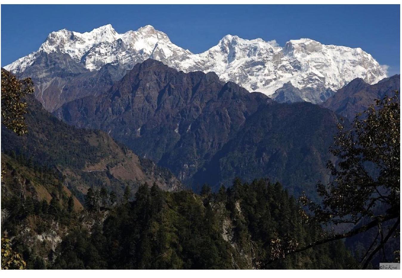
 Panorama of the area (2010). Phangyi 6538 m, Manaslu 8156 m.
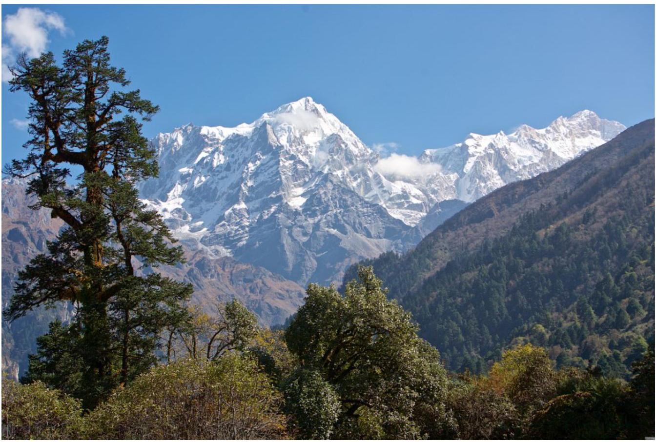
Panorama of the area. Phangyi 6538 m, Manaslu 8156 m, Tulagi 7059 m, NaDi Chuli 7871 m.
- Phangyi 6538 m
- Manaslu 8156 m
- Tulagi 7059 m
- NaDi Chuli 7871 m
 General photo of the summit, ascent route in orange, descent route in green.
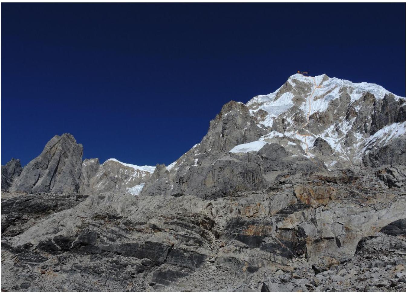
Photo from the opposite slope.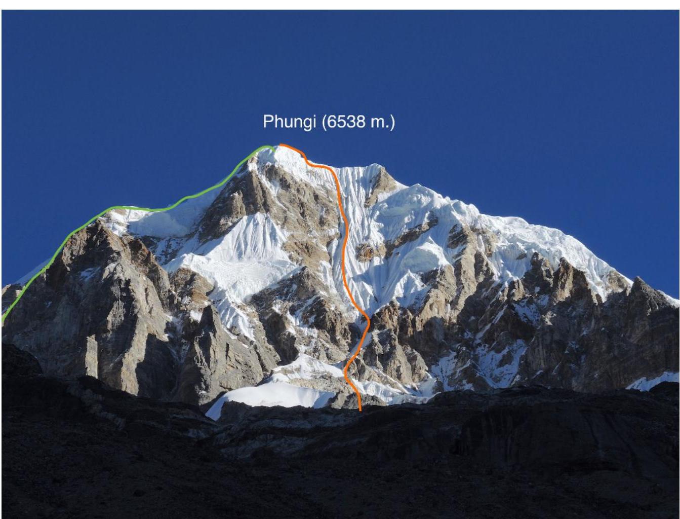 Technical photo of the route.
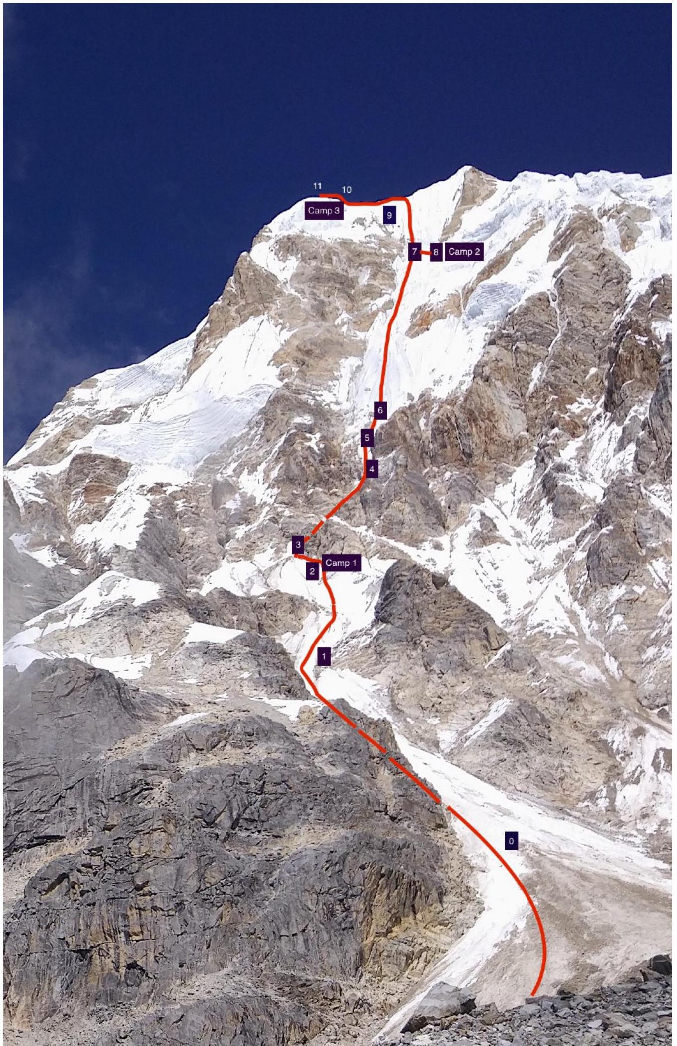 Photo of the route profile on the SE face of Phangyi.
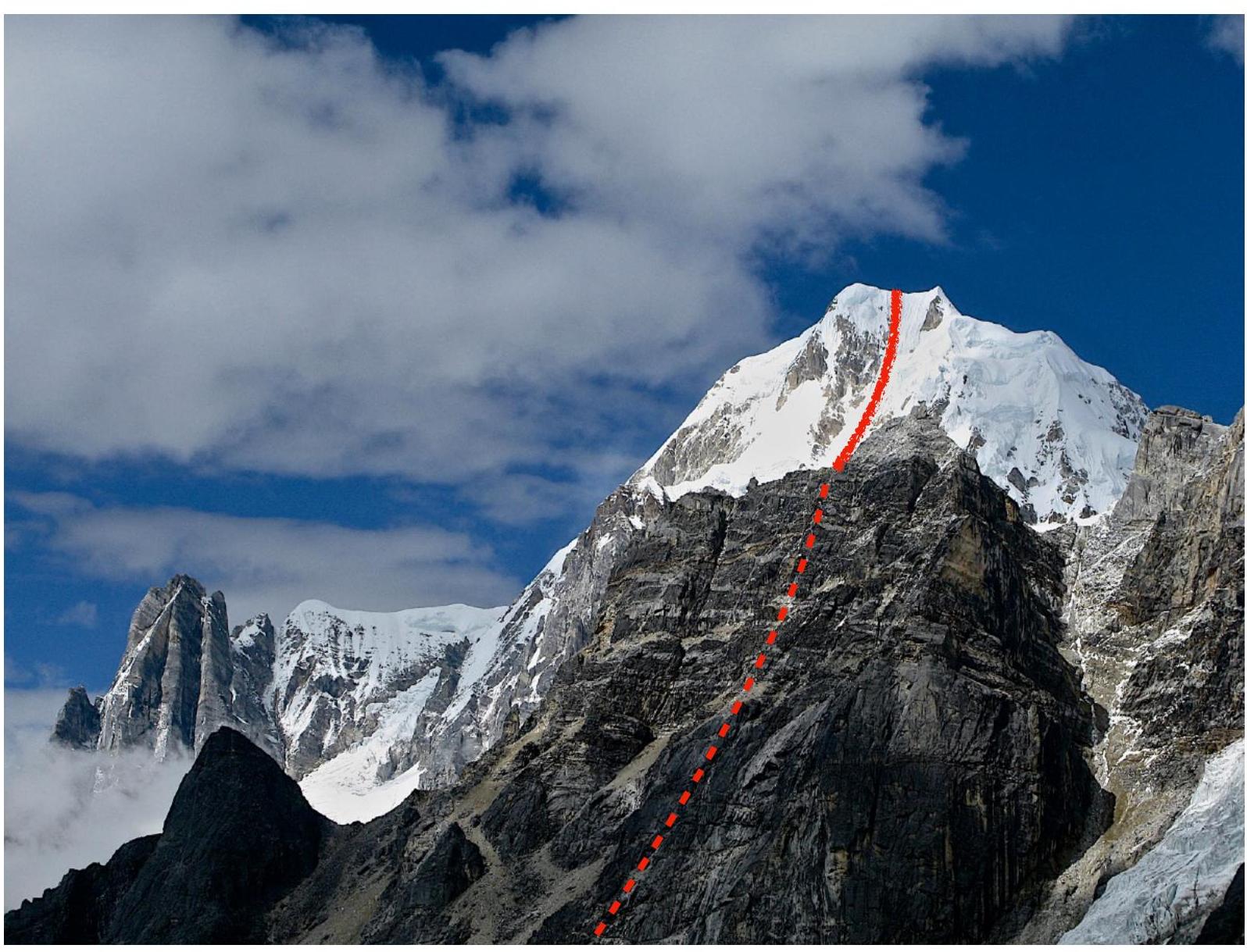 Ascent graph.
Ascent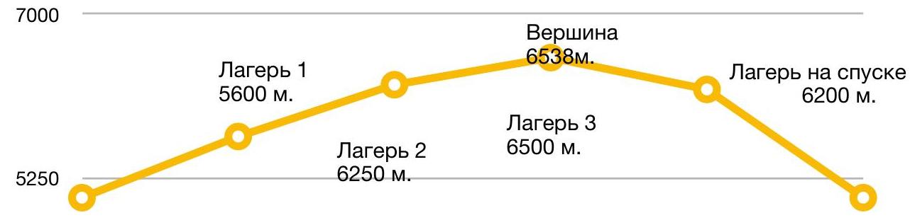
ABC 5050 m.
Start at 6:00, summit at 16:30
Tactical actions of the team
It was my first time in this area back in 2010 together with Anatoly Moshnikov. I had both my own photos and Anatoly's photographic materials. In October of this year, Alexey Lonchinsky and I arrived in the area to realize what was once planned together with Anatoly… Over seven years, the condition of the SE and S faces of Phangyi has changed. There is noticeably less snow and ice. A peculiarity of the area is that windows of good weather are short-lived, usually in the early morning hours.
In search of an optimal line, we spent several days examining the summit through binoculars from different angles. The final ascent plan was agreed upon after setting up ABC at 5050 m. We planned:
- a direct route up the SE face, starting via a broad couloir;
- a transition at 5600 m into a narrow throat, which we needed to traverse early in the morning;
- then the main snow-ice face would begin.
We started on October 26, 2017, following bad weather. On the first day, we climbed mostly simultaneously, except for the last 200–250 m before the first bivouac, where we encountered sections of fairly steep ice… We set up camp early, at 13:30, under the protection of a rock wall. In the narrow throat, as expected, rocks and ice were constantly falling.
October 27: We rose at night, quickly gathered, and climbed further, navigating through the dangerous narrowing of the couloir, which turned out to be 6 rope lengths; we managed to pass it before intense rockfall began… We worked all day on ice with a steepness of 60–80°. Along the entire vertical kilometer, there was nowhere to rest. Extended sections of steep ice on front points. We climbed a total of 18 ropes upward, as well as 2 traverse sections to the right to the site of bivouac 2, and set up camp at 19:30. It was a tense day.
October 28: We returned from the bivouac to the direct route, climbed another 5 ropes to the ridge. We reached the ridge at 14:00. Before the ridge, there were particularly unpleasant vertical sections of rotten snow and poor ice with bad protection; the day was very cold, windy, with snowfall and thunderstorm beginning… At one point on the ridge, it became very dangerous: the "iron" hummed, and there were micro-electrical discharges under our arms… We had to descend and climb a traverse along the wall of the ridge. Thus, along the ridge with cornices, another 2 ropes to the site of bivouac 3 under the summit… On the summit at 16:30.
October 29: We set out again towards the summit and began descending via the West ridge. The weather quickly deteriorated. After 7 rappel ropes in poor visibility, we set up camp under the protection of a rock outcrop.
October 30: We continued descending via the icefall and were back at ABC around 15:00.
Overall, our tactical plan proved effective: the anticipated bivouac sites were confirmed, we managed to safely navigate questionable sections, and our progress speed was higher than expected, despite our acclimatization being only up to 5100 m. We explored the mountain from two directions — from the SE and from the West. Another blank spot on the Himalayan map has been filled…
Brief description of the route by sections
- R0–R1 — The route starts from the classic bergschrund in a broad couloir, then follows a snow-ice slope, lined with couloirs and ridges of 45–60° steepness; there is a possibility to take shelter under rocks from falling ice and rocks; 3-4 cat. diff., about 400 m.
- R1–R2 — Ice and mixed terrain, before reaching the site of the first night's camp under a gendarme on the SE buttress; 4 ropes (200 m) 4-5 cat. diff. First night's camp, altitude 5600 m.
- R2–R3 — Firn 50 m, slope before entering the narrow throat; 3 cat. diff.
- R3–R4 — Ice and mixed terrain 4-5 cat. diff. in the narrow throat; 3 ropes, 150 m.
- R4–R5 — Steep ice slope with sections of mixed terrain 85°, 60 m, 5-6 cat. diff. The most dangerous place on the route. Station under a rock outcrop.
- R5–R6 — Exit onto a steep ice ridge. 70°, 50 m, 4-5 cat. diff.
- R6–R7 — The route then follows a system of ice-firn ridges and couloirs; 12 ropes, 600 m, 5 cat. diff., steepness 60–80°.
- R7–R8 — Two ropes of complex traverse, to the base of a rock wall; night's camp on a step in the icefall. 120 m, 4-5 cat. diff. Second night's camp 6250 m.
- R8–R9 — After returning to the direct route — 4 ropes of complex climbing with sections up to 6th category on vertical ice, ridges of rotten snow, and unreliable firn; 80–90°, 200 m.
- R9–R10 — Two ropes on a very unreliable corniced ridge 100 m, 4-5 cat. diff. Leading to the site of the third night's camp, under the summit.
- R10–R11 — Simple ridge 60–70 m to the summit. Route diagram in UIAA symbols.
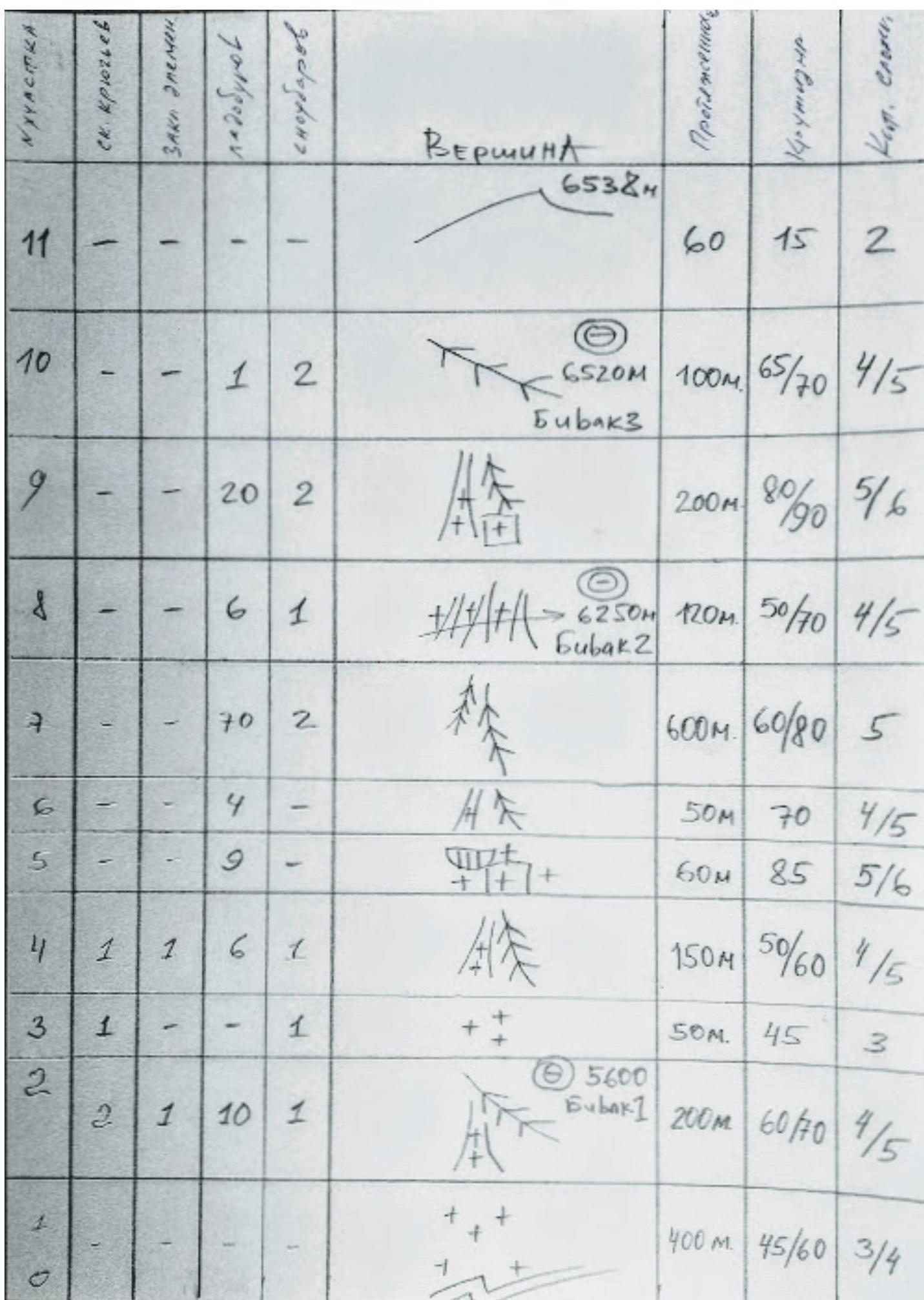 Route diagram in UIAA symbols.
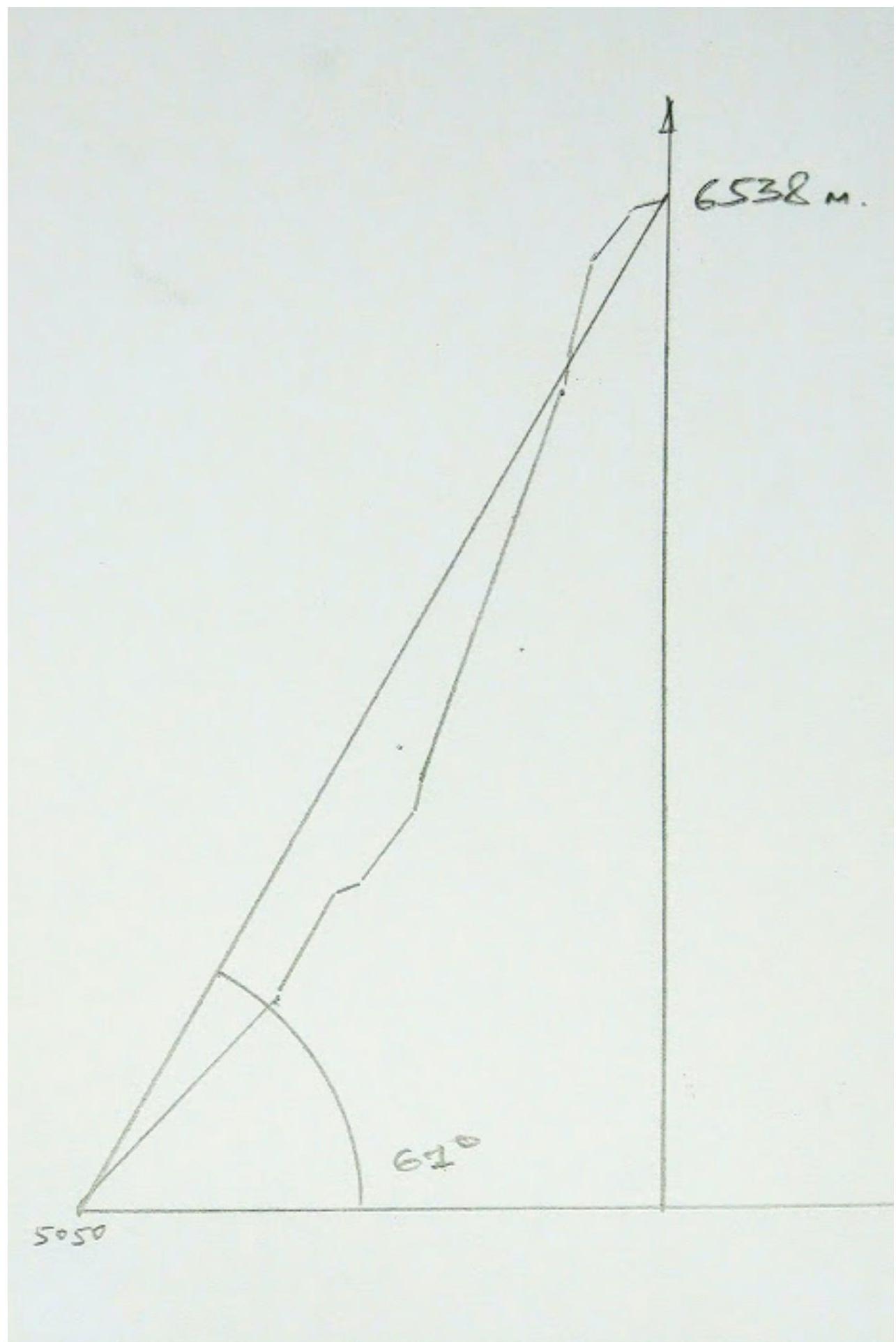 Drawn profile of the route.
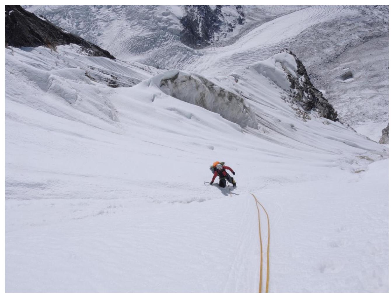 Photo illustration of the report. Start of the route.
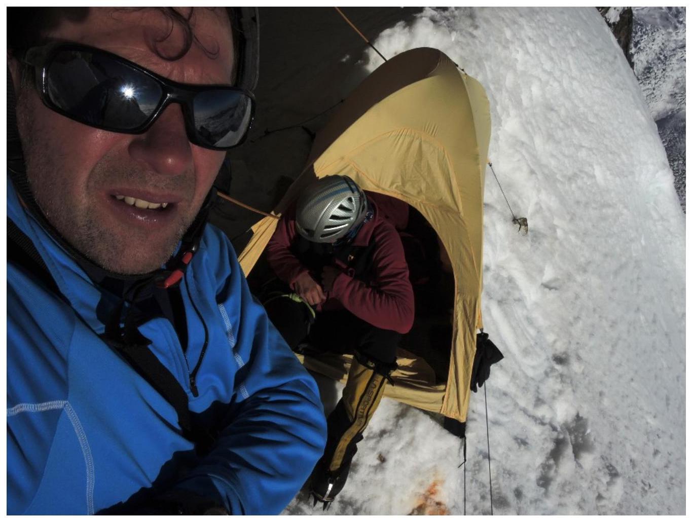
 Section R1–R2 and camp 5600 m.
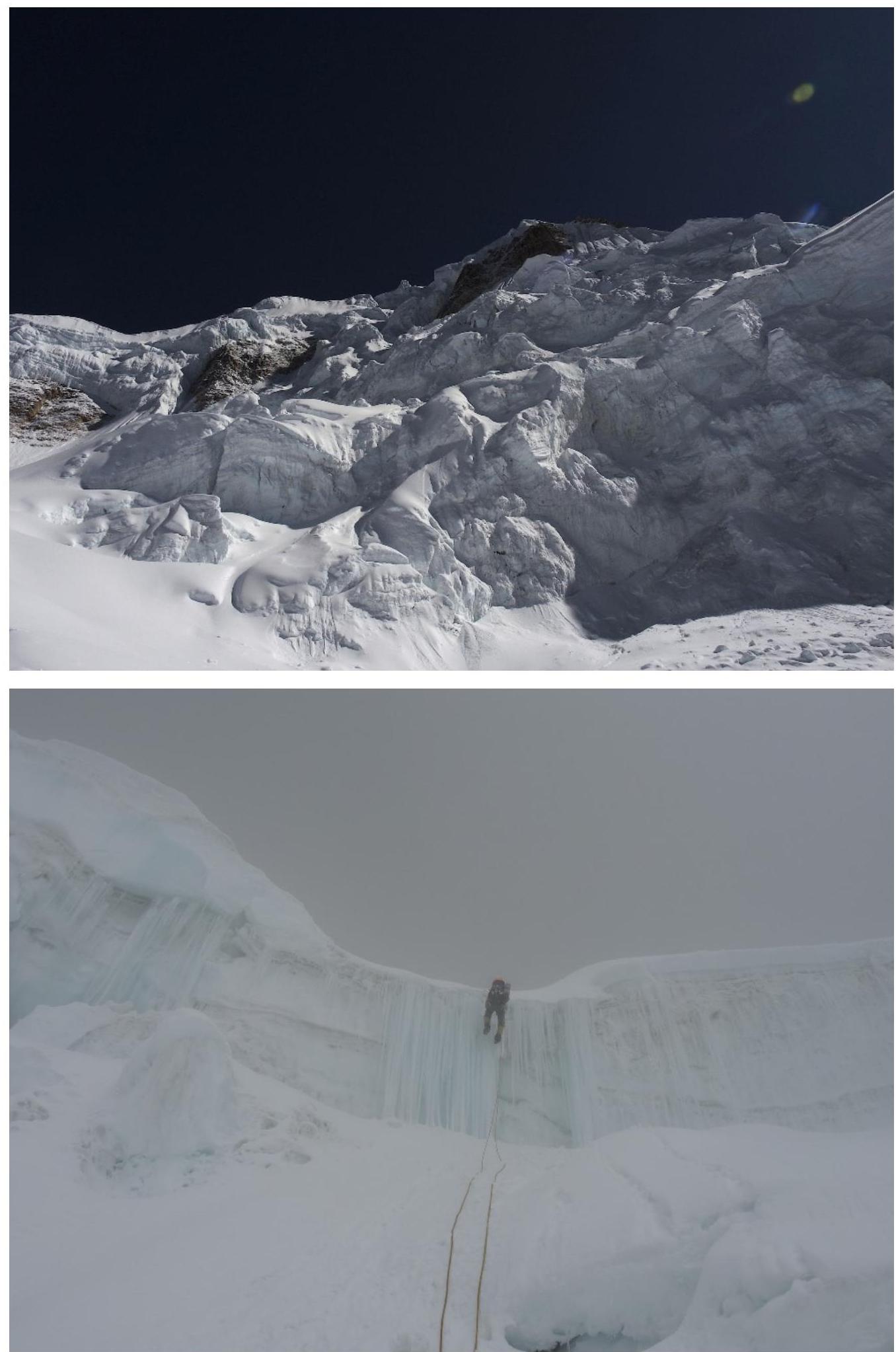
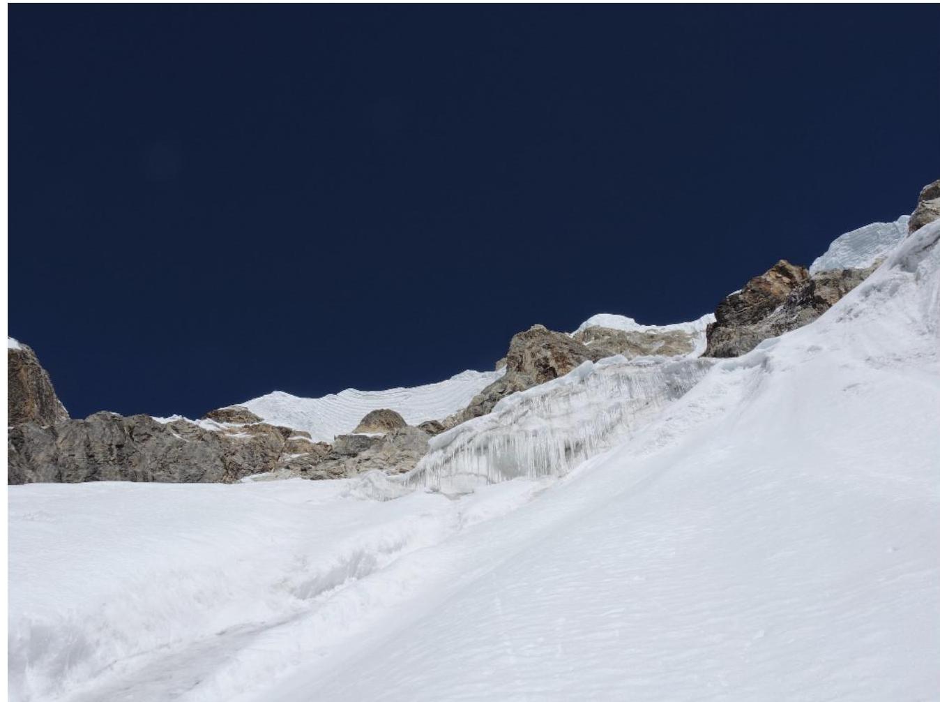
 Section R4–R5. And further, the main part of the face.
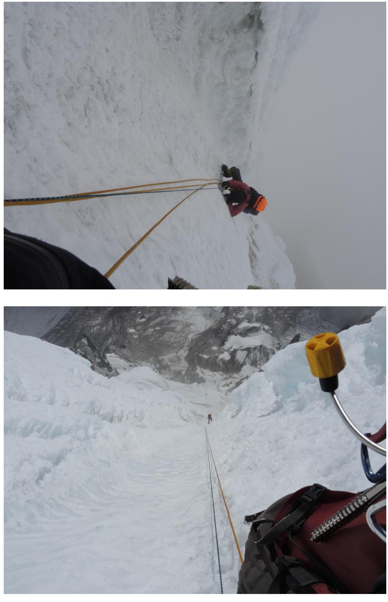
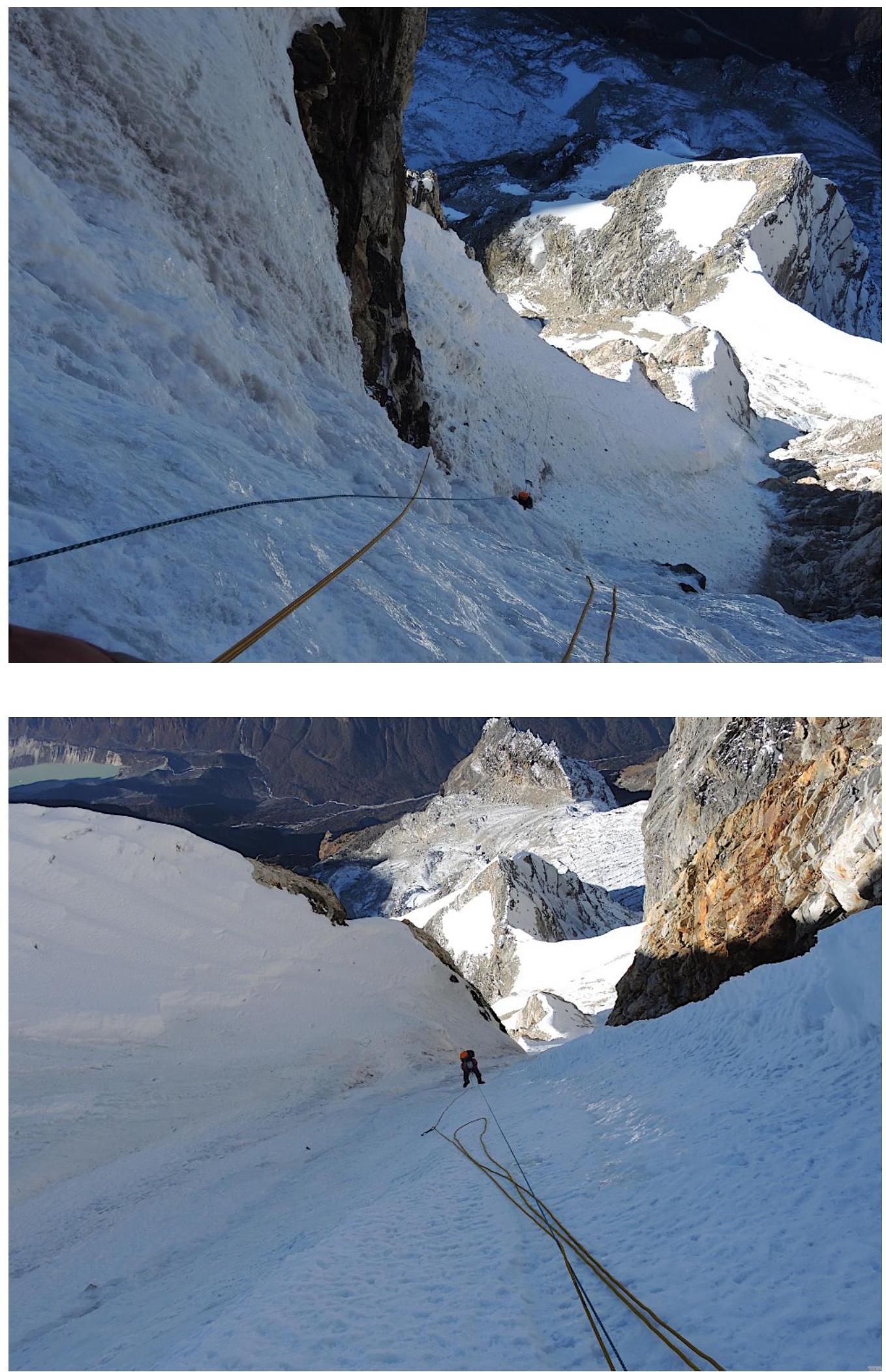 Section R6–R7.
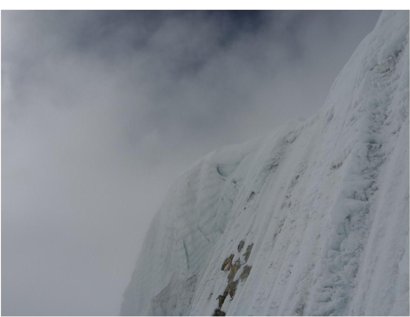
 Day 3, sections before reaching the ridge.
Ridge.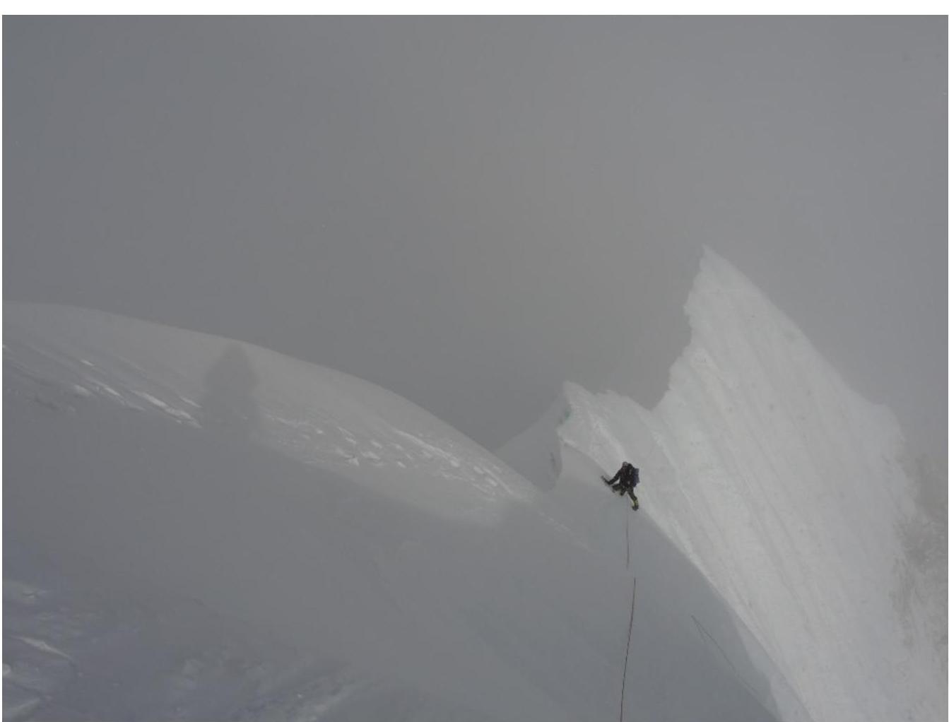 Pre-summit ridge and summit of Phangyi 6538 m.
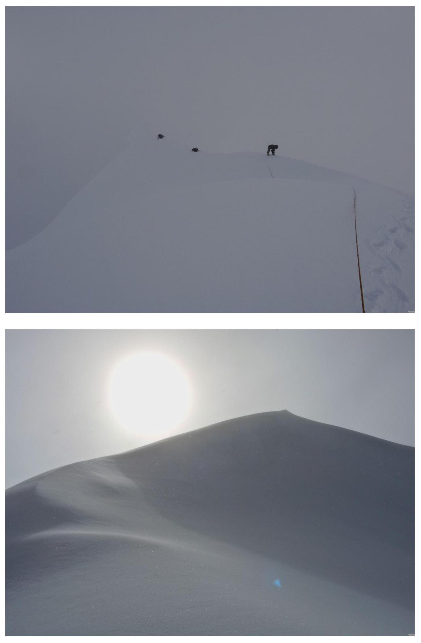 On the summit on October 28, 2017, at 16:30.
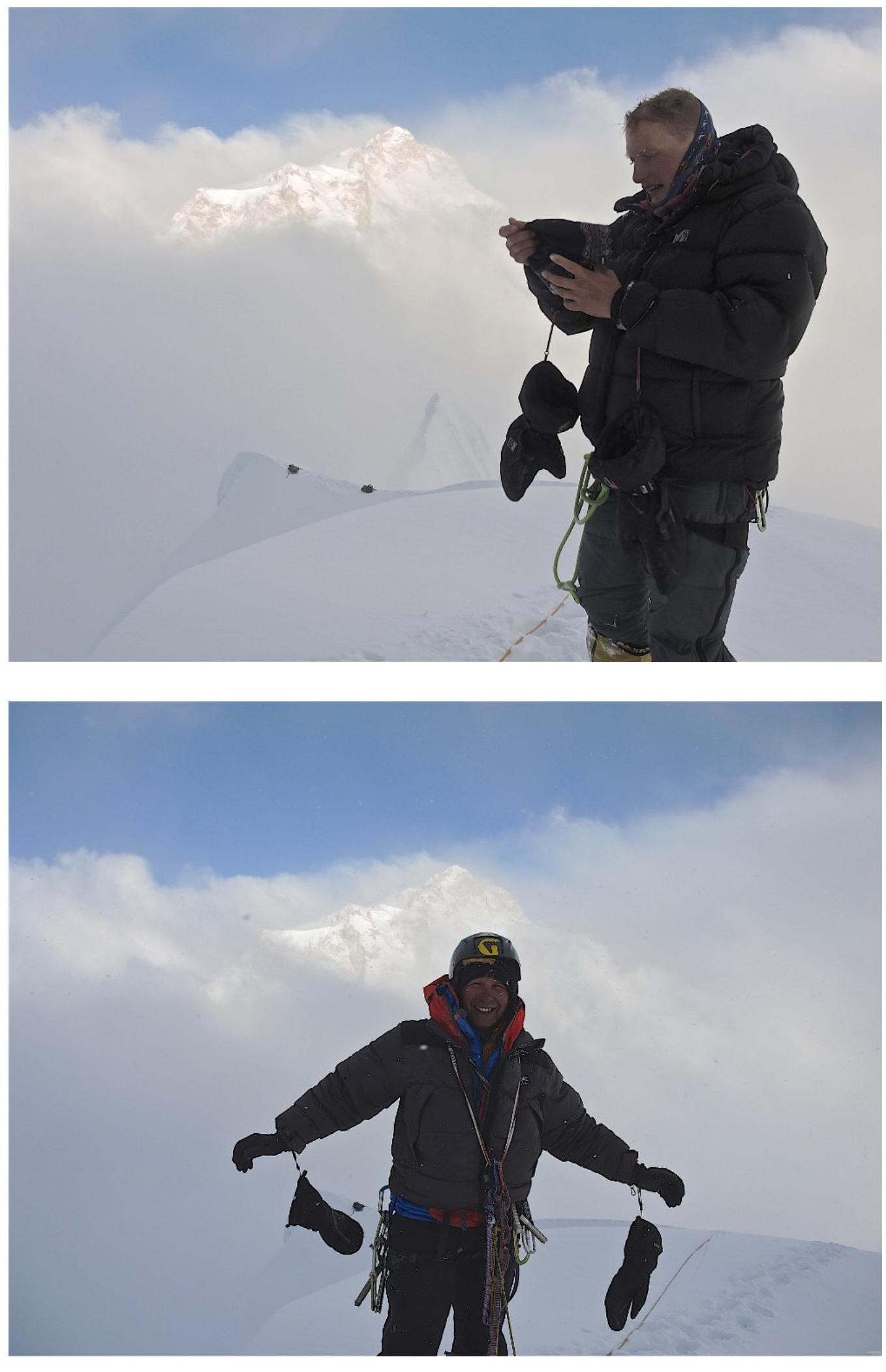 West ridge, terminating in an icefall, descent route.