
Ascent Passport
-
Ascent area: Tas Kystabyt Ridge (Sarychev Ridge), section 9.7
-
Peak: peak 2060 m (local name: Aphrodite). Northwest edge (N 64° 28.719 E 143° 14.297)
-
Proposed: Category 2B difficulty, first ascent.
-
Route type: rock climbing.
-
Route description: Elevation gain according to GPS 490 m
Distance 1400 m. Average slope 28°
Section lengths:
- 1 — 950 m
- 2 — 370 m
- 3 — 80 m
-
Total climbing time: 4 hours 30 minutes.
-
Leader: Valery Bogomolov, 1st sports category.
-
Participants: Vasily Ivanovich Ivanov, Candidate for Master of Sports.
-
Coach: Vasily Ivanovich Ivanov #72.
-
Approaching the route: approach to the route 0 hours 20 minutes.
Route started: 6:30 AM, June 20, 2019. Reached the summit: 11:00 AM, June 20, 2019. Descent from the summit via the ascent route.
-
Organization: Yakutsk, "Alpinism and Rock Climbing Federation of the Sakha Republic (Yakutia)"
-
Person responsible for the report: Valery Alexandrovich Bogomolov
Email and phone: bog_valera@mail.ru, +7 903 259 86 64.
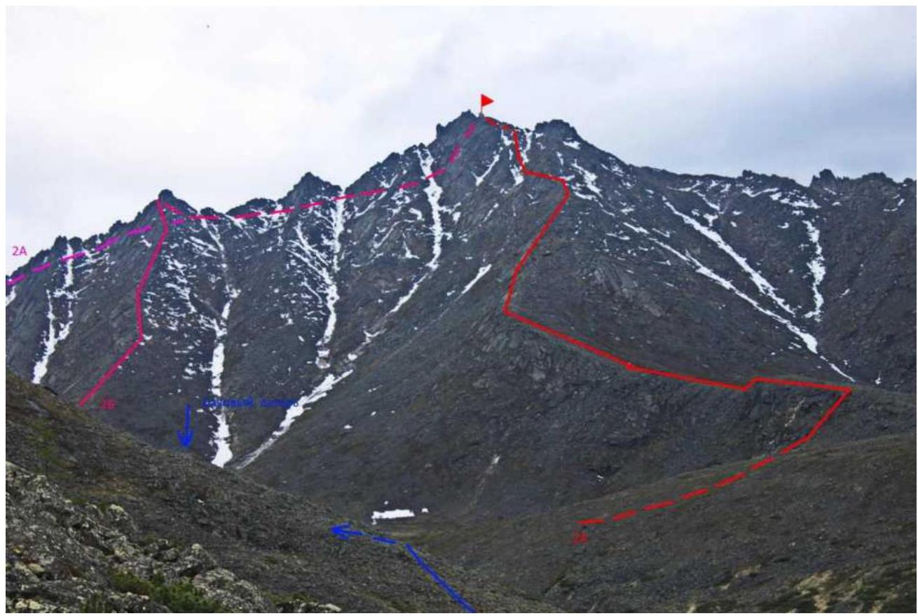
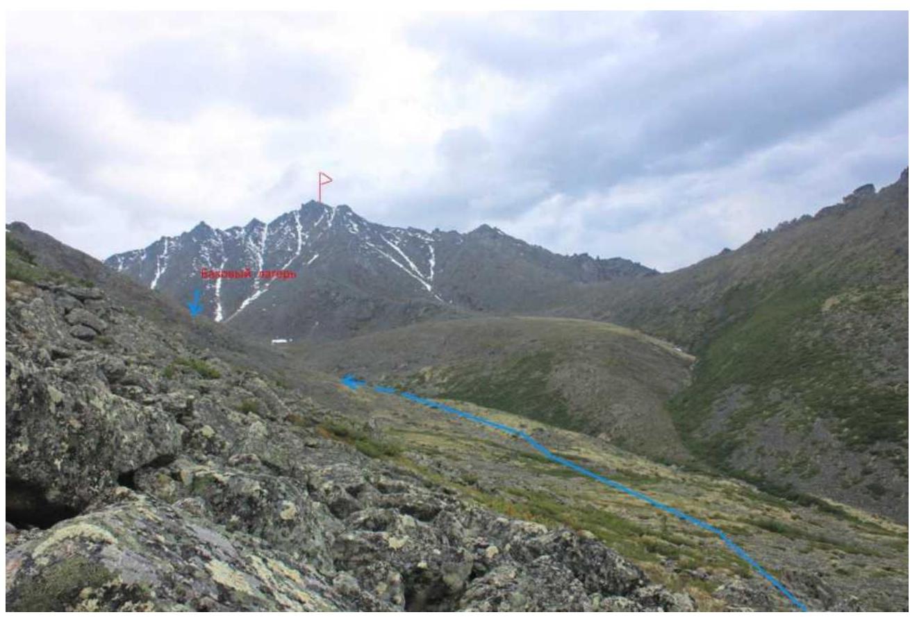
Photo of the peak on the approach to the base camp, June 16, 2019.
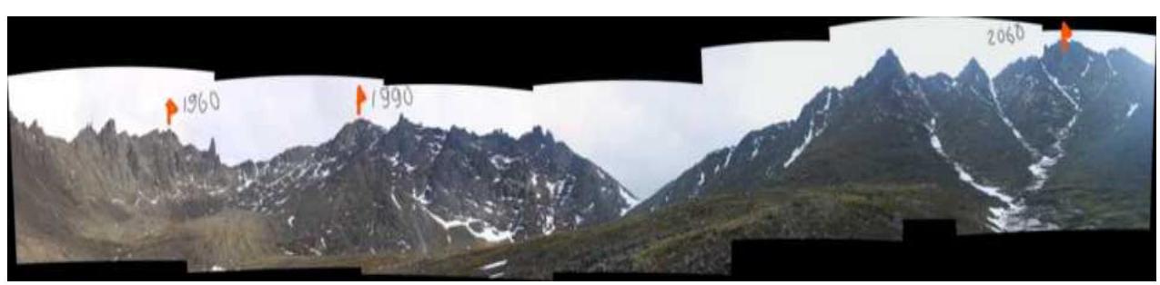
Photopanorama of the area. The cirque has three distinct peaks: p1960 m, p1990 m, p2060 m (Aphrodite). Photo taken from the base camp area.
Area Overview
In search of an accessible climbing area, the Alpinism and Rock Climbing Federation of the Sakha Republic (Yakutia) turned its attention to the mountain range near Ust-Nera settlement, located on the Nera River, a tributary of the Indigirka River. The area is promising for alpinism. Tas Kystabyt Ridge (Sarychev Ridge) is located in the Oymyakon district, known for its harsh climate. The area is characterized by low temperatures and high precipitation.
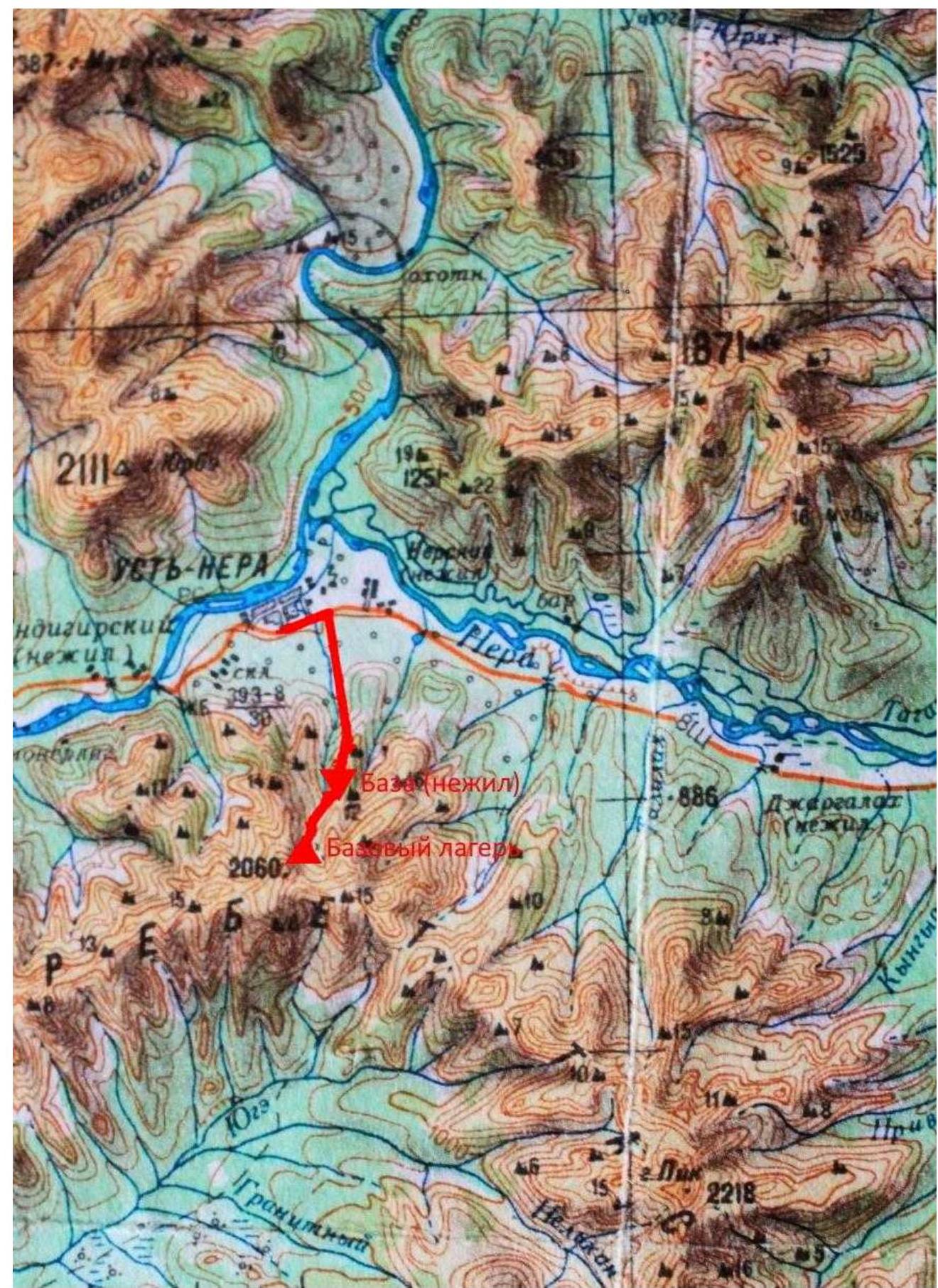
One can reach Ust-Nera from Yakutsk by car via the "Kolyma" highway (about 1000 km), involving two ferry crossings (Lena River and Aldan River). After the Aldan River, the road surface is gravel and very dusty. Alternatively, one can fly from Yakutsk to Ust-Nera. The airfield is in a mountainous area, and flights are highly weather-dependent.
From Ust-Nera settlement to the base camp, it's 11 km, heading south. There's a road from the settlement to an abandoned ski base (8 km). Unfortunately, only one single-story house remains at the base; the rest is destroyed. It's possible to arrange a pickup, but it depends on the road condition, which is currently not maintained. One can count on reaching 5-6 km. Beyond that, the approach to the former ski base is quite challenging. From the base to the BC is 3-4 km, with no trail. The route goes through stlanik, dwarf birch, and mountain tundra, which is sometimes soggy. A semblance of a trail appears when passing through a stream canyon. The best time for climbing is late June, July, and early August.
Technical Sections of the Route Table
| Section # | Length | Steepness | Terrain Characteristics | Difficulty Category | Number of Pitons |
|---|---|---|---|---|---|
| R0–R1 | 950 m | 20° | Broken rocks | ||
| R1–R2 | 330 m | 30° | Large blocks, slabs | ||
| R2–R3 | 80 m | 40°–50° | Blocks | 4 | |
| R3–R4 | 40 m | 35° | Slabs | 2 |
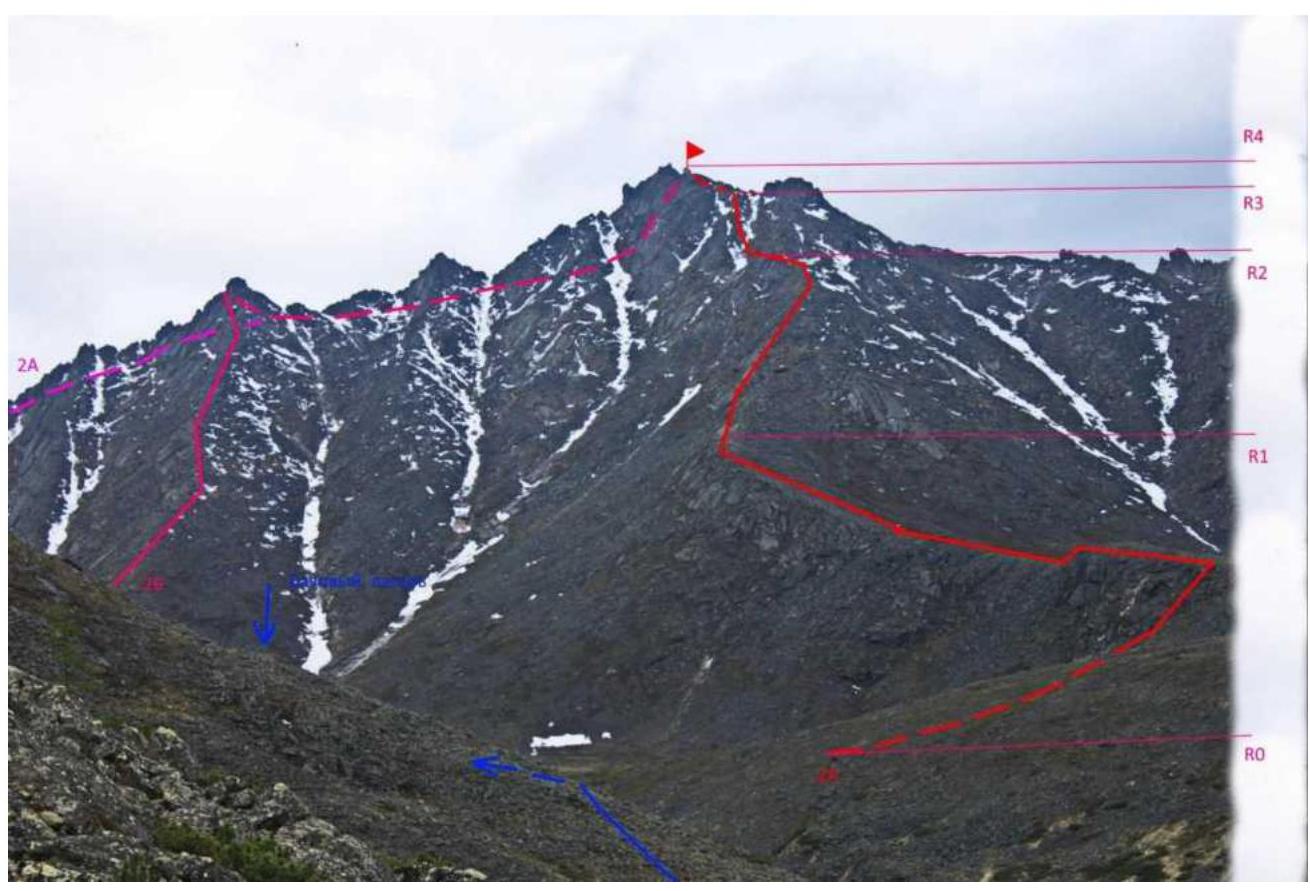
Brief Route Description
From the base camp, we cross the stream and, through a swampy area, reach the start of the route R0 in 20 minutes. Ascent to the edge: grass, medium scree, rock outcrops. The crest of the edge: broken rocks and fine scree overgrown with grass, easy to traverse. Gradually, as we gain height, the angle increases (R1), and we approach inclined slabs. Then, via inclined slabs (alternate belay), we approach a gendarme. We bypass it on inclined shelves between slabs and, via inclined slabs, reach a couloir R2. The couloir is filled with re-frozen winter ice covered with a thin layer of wet snow. We cross it and ascend to a ridge bend, having set up a rope (80 m) R3.
Beyond the ridge bend:
- across a monolithic inclined slab
- via a rope (40 m)
we reach the summit, R4.
Descent is via the ascent route. Despite the broken rocks, the route is not rockfall-prone. Recommended for training ascents.
Path to the base camp.
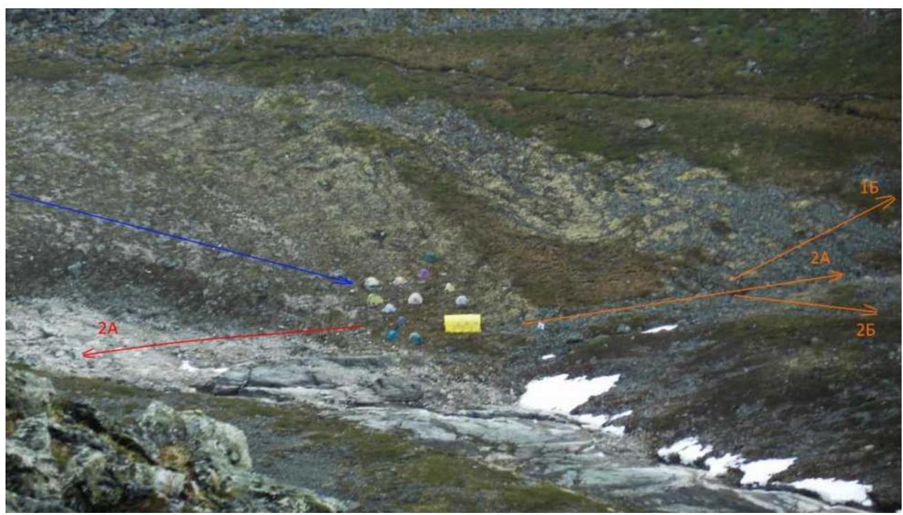
Base camp.
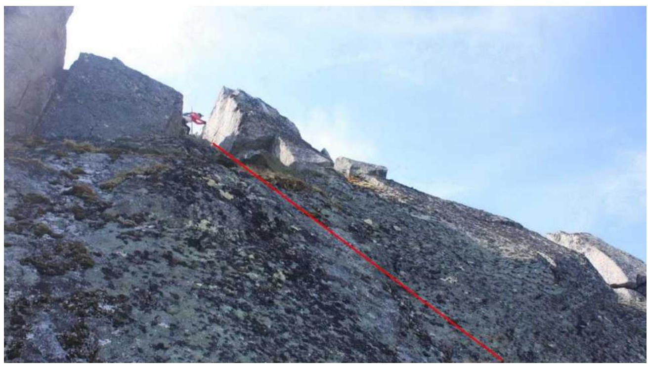
Reaching the summit (final part of the R3–R4 section)
Comments
Sign in to leave a comment