
Ascent Passport
- Ascent area: Tas Kystabyt Ridge (Sarychev), southwestern part of Chersky Ridge, Sakha Republic (Yakutia) section 9.7
- Peak, route: p. 2060 m (local name Aphrodite), E ridge from the pass.
Peak coordinates 64°28′719″ N 143°14′297″ E by GPS. 3. Estimated category of difficulty 2A, first ascent. 4. Route type: Rocky. 5. Route characteristics: height difference by GPS — 470 m
Route length — 1600 m
Section lengths:
- 1 — 1100 m
- 2 — 410 m
- 3 — 90 m
-
Time to summit: 5 h 30 min.
-
Leader: Ivanov Vasily Ivanovich CMS
Participants:
- Bogomolov Valery Alexandrovich 1st sports category
- Spiridonov Alexander Ilyich 2nd sports category
-
Coach: Ivanov Vasily Ivanovich #72
-
Departure from base camp: hour, day, month, year.
Route started at 8:00 on June 21, 2019.
Reached the summit at 13:30 on June 21, 2019.
Descent from the summit via the ascent route.
-
Organization: FAiS of Sakha Republic (Yakutia)
-
Responsible for the report: Ivanov Vasily Ivanovich, ivi4057@mail.ru, +7 950 406 60 61.
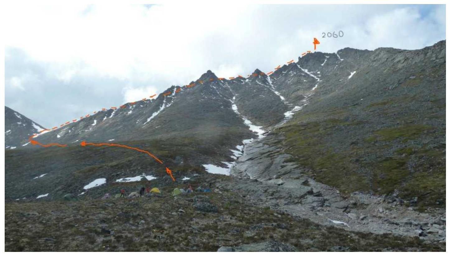
Photograph of peak 2060 (Aphrodite) from base camp. June 21, 2019.
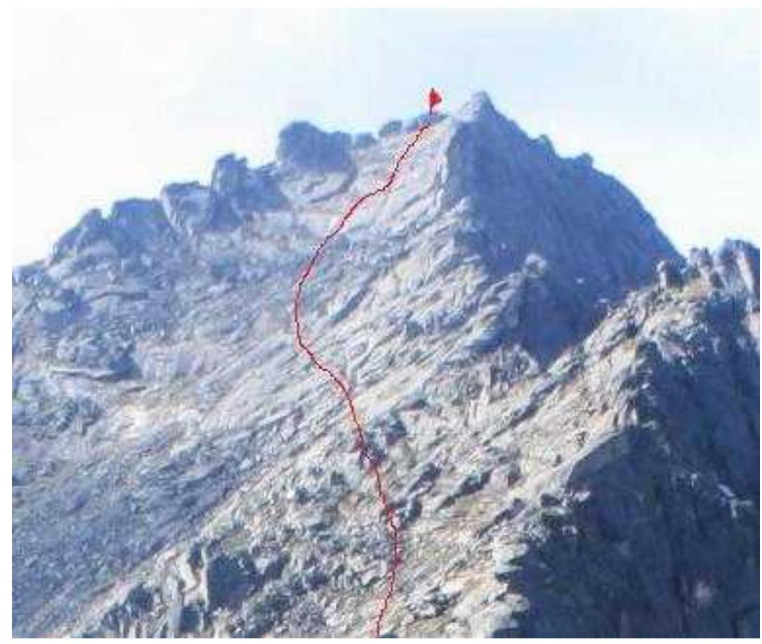
Photograph of the route from the pass. June 21, 2019.
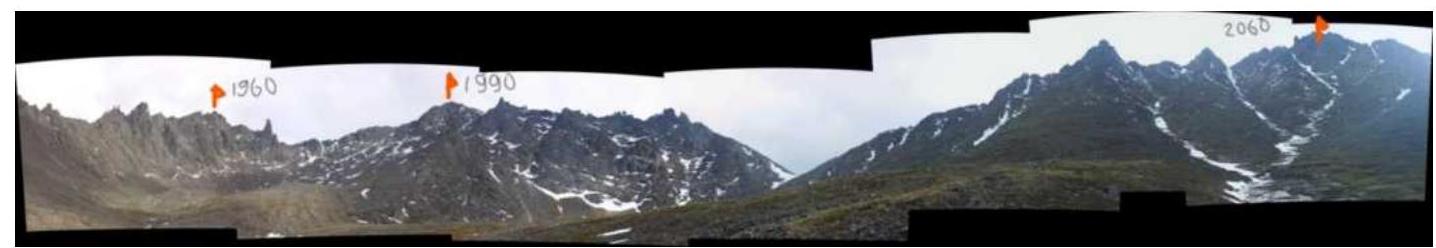
Photopanorama of the area. The cirque has three distinct peaks:
- p. 1960 m,
- p. 1990 m,
- p. 2060 m (Aphrodite). Photo taken from the base camp area.
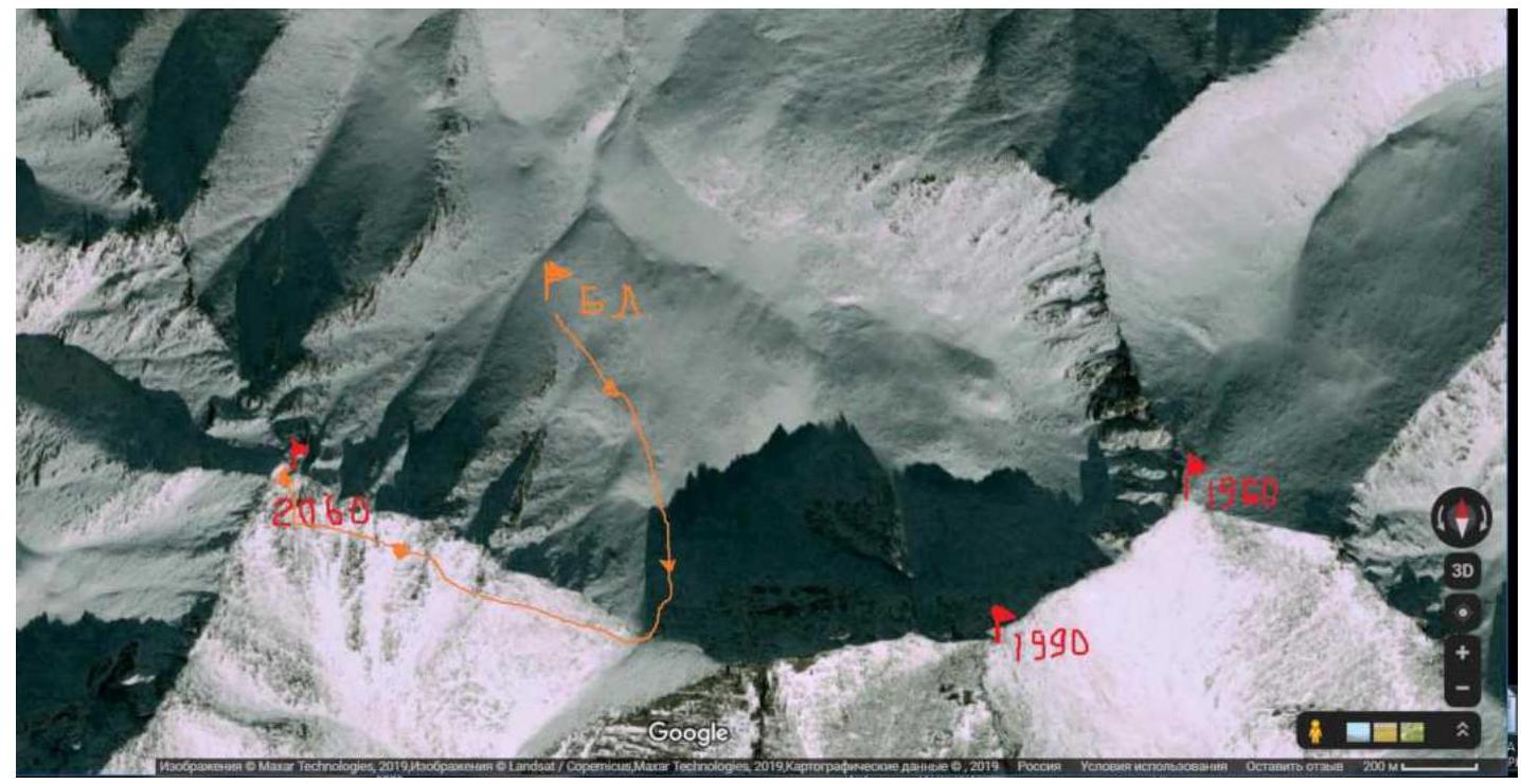
Satellite image of the cirque. Google Maps.
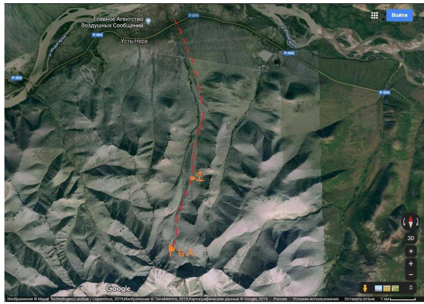
Map of the area (satellite). Number 1 indicates an abandoned ski resort.
Brief geographical description of the area
In search of an accessible area for ascents, the Alpinism and Rock Climbing Federation of Sakha Republic (Yakutia) turned its attention to a mountain range near the settlement of Ust-Nera, located on the Indigirka River. The area is promising for alpinism. The Tas Kystabyt Ridge (Sarychev) is located in the Oymyakon district, which predetermines harsh climatic conditions.
This area is characterized by:
- low temperatures,
- high precipitation.
Climbing conditions in the area
One can reach Ust-Nera:
- from Yakutsk by car via the "Kolyma" highway (about 1000 km),
- or by plane "Yakutsk – Ust-Nera".
By plane "Yakutsk – Ust-Nera". From Ust-Nera to base camp — 11 km. Move south.
First, there is a road to the abandoned ski resort (8 km). (Depending on the road conditions, one can arrange for a drop-off). Then to BC — 3–4 km. The best time for climbing is late June, July.
TABLE OF TECHNICAL SECTIONS OF THE ROUTE
| Section # | Length | Steepness | Terrain type | Category of difficulty | Number of pitons |
|---|---|---|---|---|---|
| R0–R1 | 1100 m | 20° | Broken rocks | ||
| R1–R2 | 410 m | 35° | Large blocks | ||
| R2–R3 | 90 m | 45°–50° | Slabs | 8 |
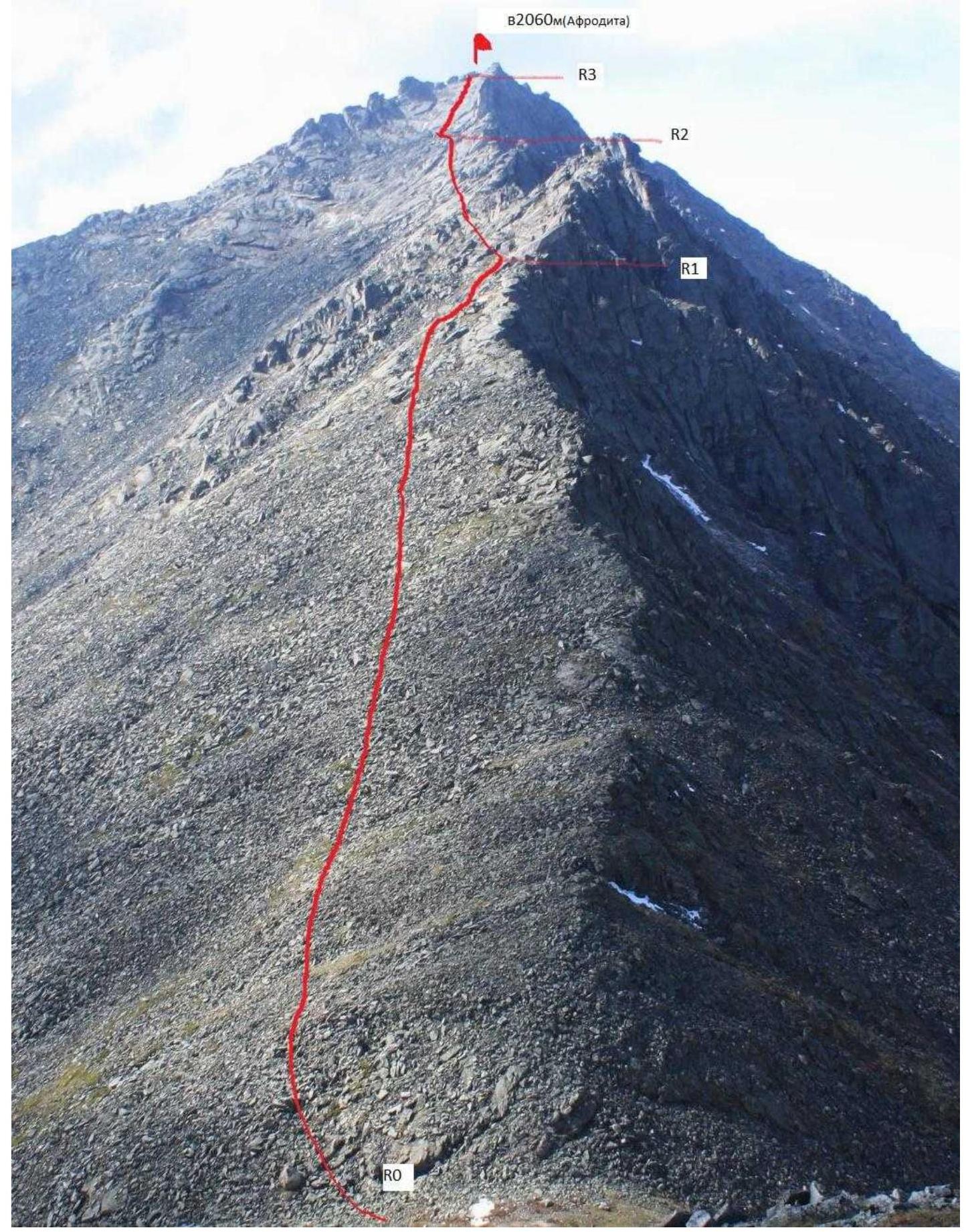
Technical photograph of the route. Route to peak 2060 m (Aphrodite) via the Eastern ridge, 2A category of difficulty (approx.), first ascent. From base camp, we move along a grassy slope towards the pass between peaks 1990 m and 2060 m (Aphrodite) — 50 min. Ascend to the pass (grass, medium scree) — 30 min.
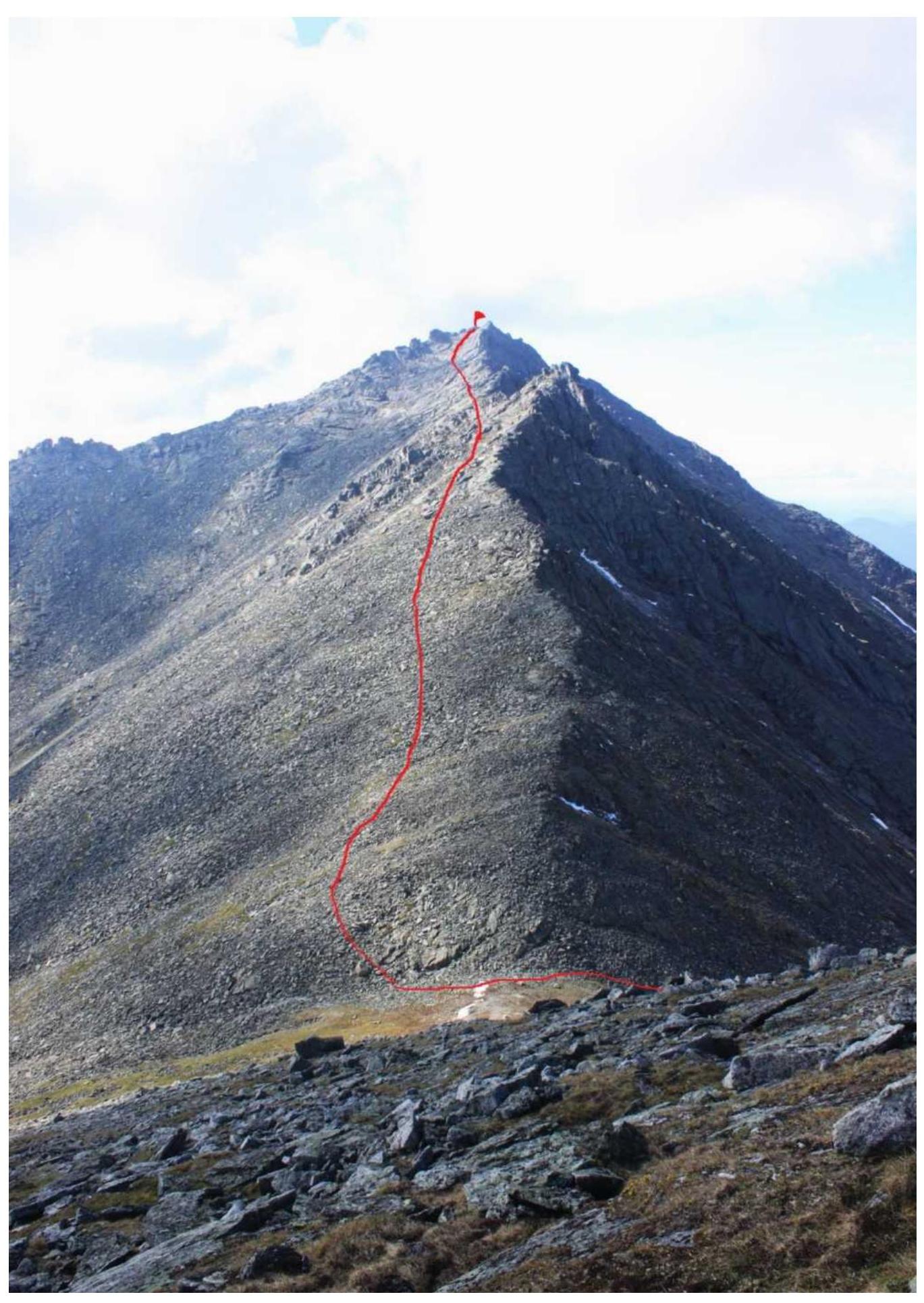
Start of the route R0. Move along the southern side of the E ridge. At the beginning of the route, we move along medium scree (stable), which gradually turns into large scree R1. Then:
- across large blocks
- across inclined slabs (alternate belay)
We approach the base of the summit tower R2. To reach the summit, we hang 2 ropes of fixed rope (90 m) in the center of the wall, consisting of:
- monolithic slabs
- "ram's foreheads"
R3. Descent via the ascent route. Despite the broken rocks, the route is not rockfall-prone.
The upper part is monolithic. Recommended for training ascents.
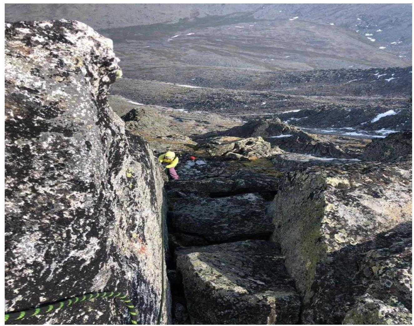
Photograph from the route. Section R1–R2.
Photograph from the route. Section R1–R2.
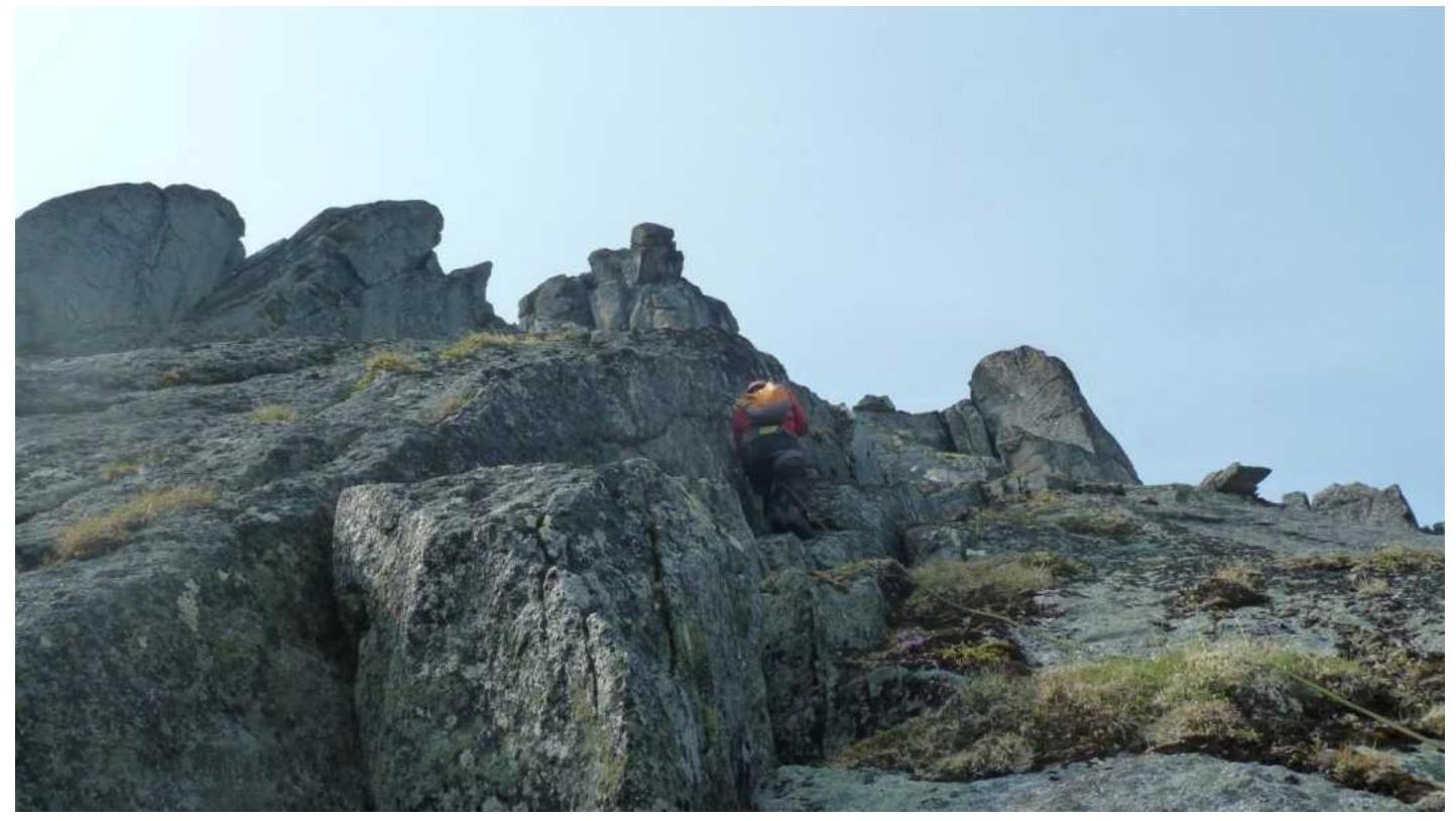
Photograph of section R2–R3.
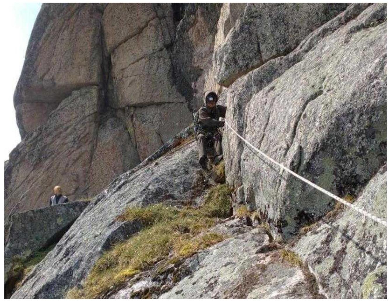
Section R2–R3.
Comments
Sign in to leave a comment