1.31
16
Protocol No. 15 dated November 24, 1997, item 3.
PASSPORT
- Ice and snow class
- Altai South Chuya Ridge
- Pik Altayskoy Pravdy 3579 m via the north-eastern slope
- Proposed category 1B difficulty (first ascent)
- Elevation gain 200 m, distance 450 m
- Not used
- 10.5 hours
- Overnight stay not required
- Leader Vinnikov K.E. 1st sports category
Participants:
- Egorov L.M. 3rd sports category
- Bochkarev A.N. novice
- Kryukov G.N. novice
- Andreeva N.P. novice
- Coach Mokhova V.M. 1st sports category, instructor 3rd category difficulty
- Departure and return on August 30, 1997
- Expedition by "Altayskaya Pravda" newspaper
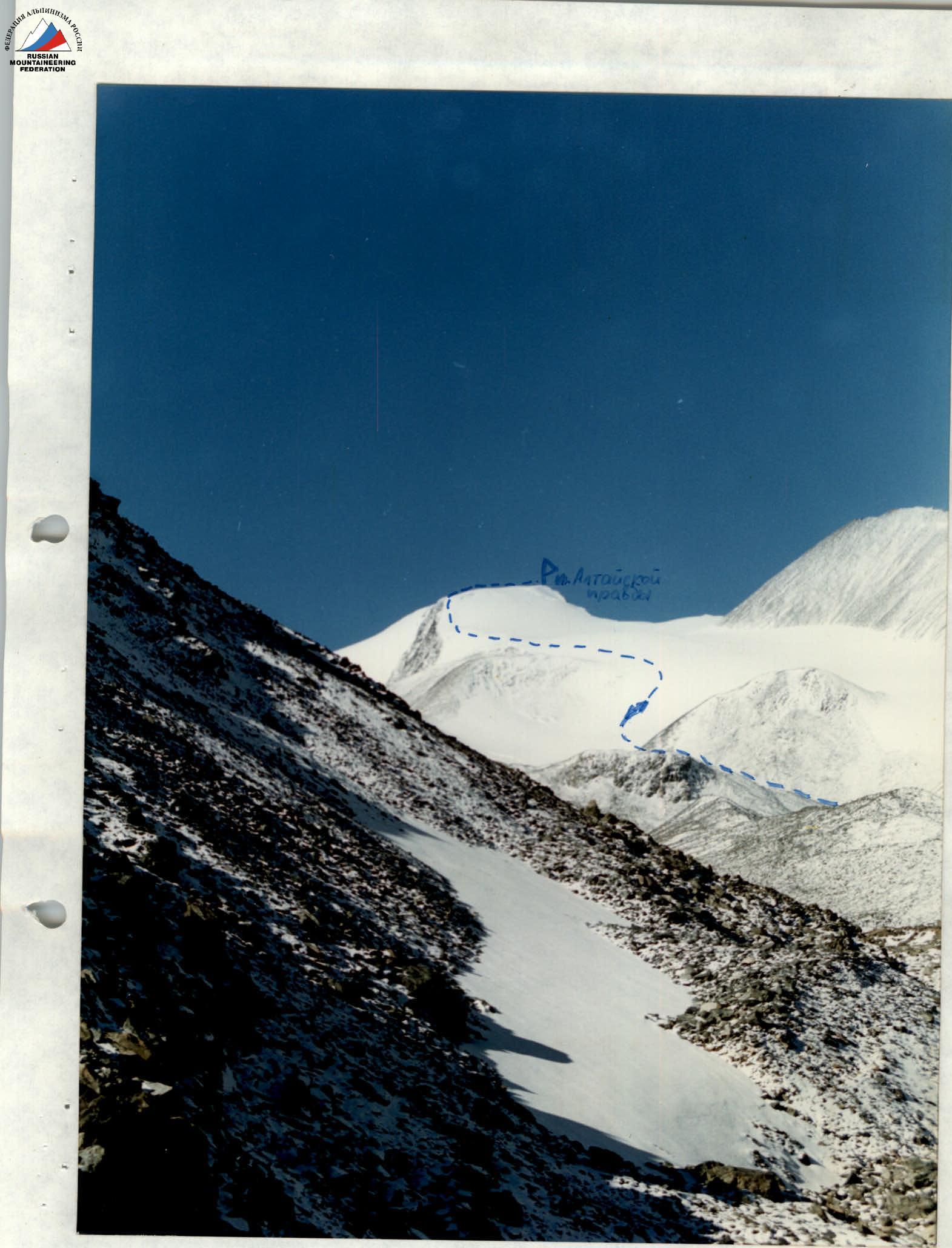
Shooting point No. 1, camera Smena 8M, lens LOMO T-43 4/40
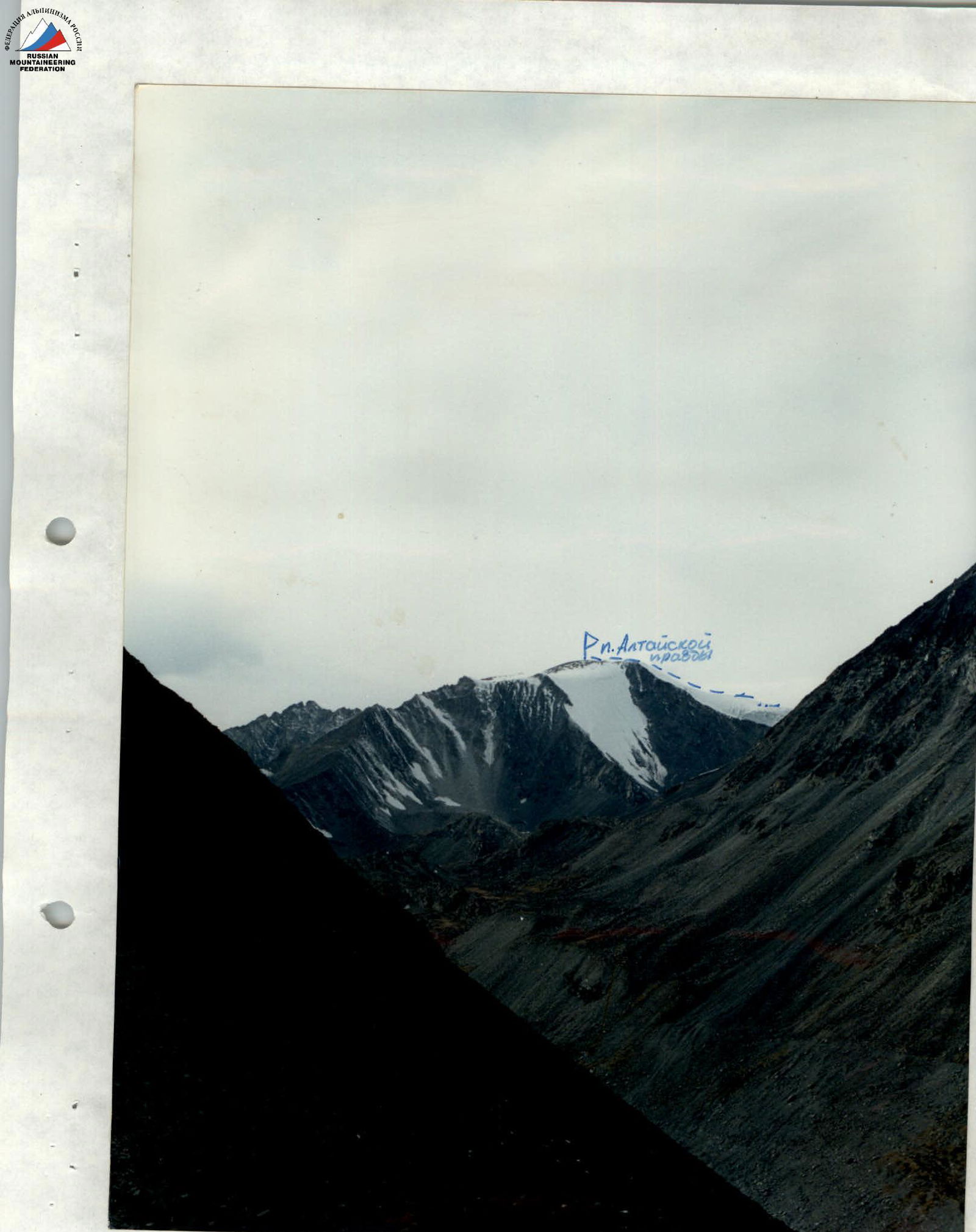
Shooting point No. 2, camera Smena 8M, lens LOMO T-43 4/40
R0–R1 300 m 15° Category I difficulty
R1–R2 1000 m 5° Category I difficulty
R2–R3 200 m 35° Category I difficulty
R3–R4 150 m 10° Category I difficulty
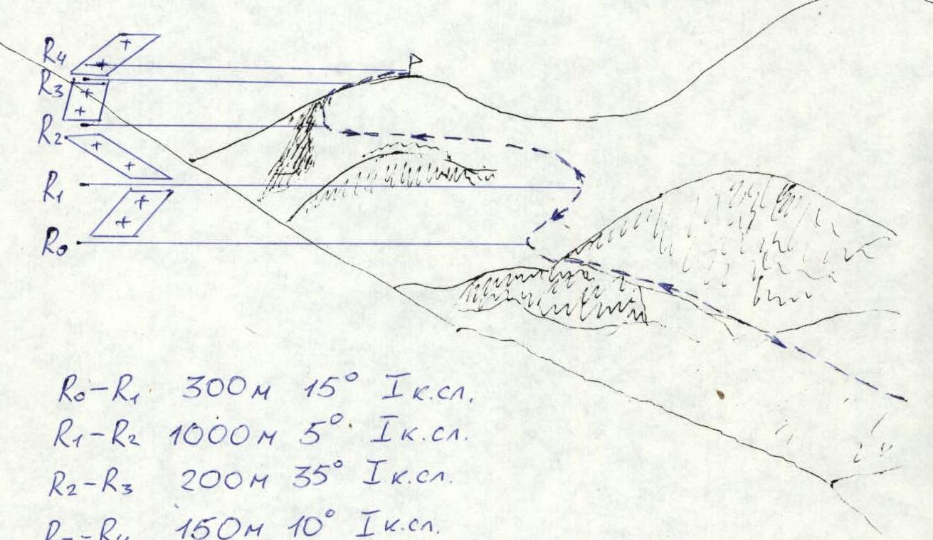
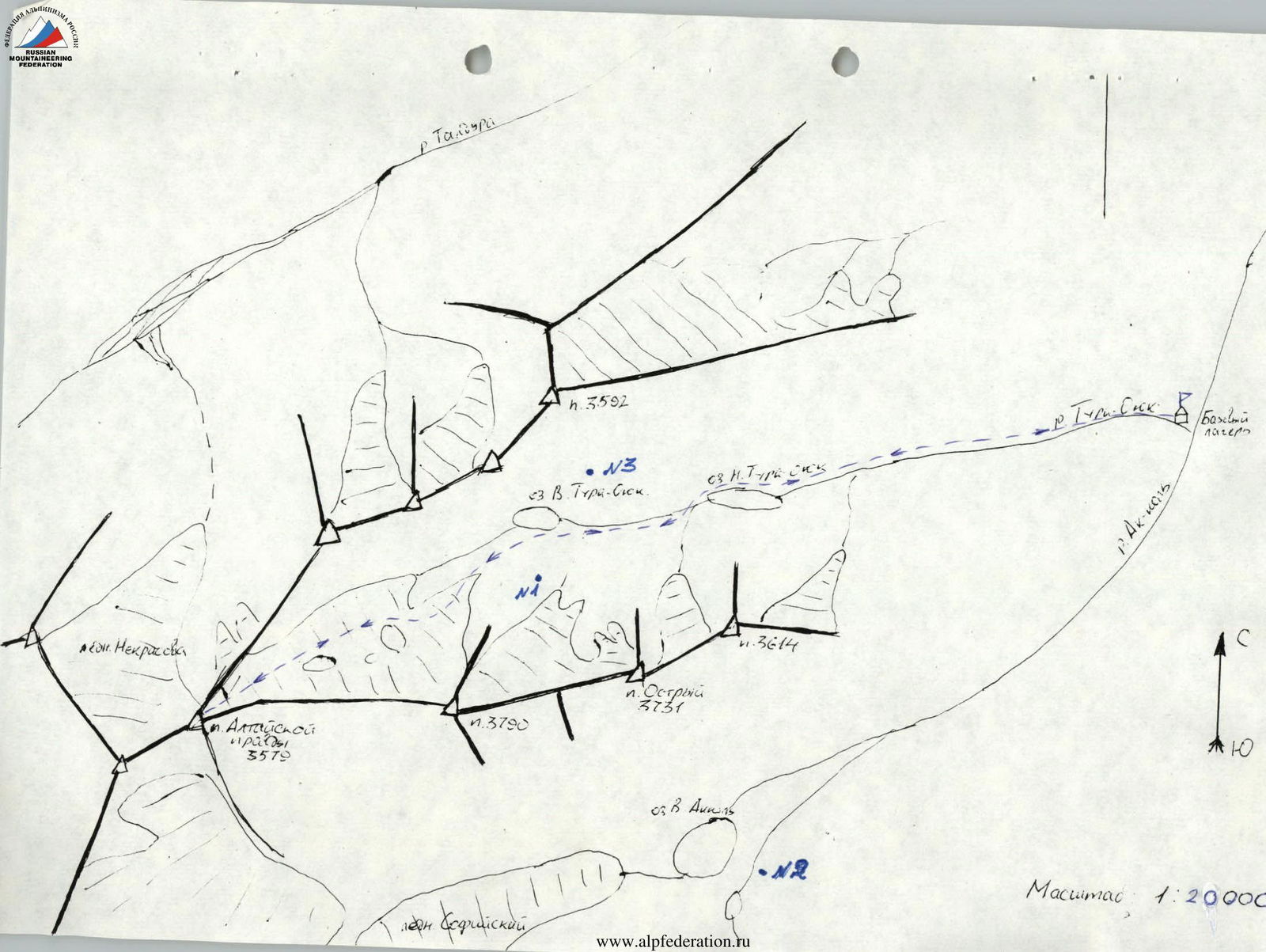
Route Description
From the mouth of the Tura-Oyuk river, ascend along the left bank via a trail to a ridge and then continue through meadows and scree to the lower Tura-Oyuk lake. The journey from the base camp takes 2 hours and 30 minutes. Then ascend via scree and stream crossings to the upper Tura-Oyuk lake, which takes 1 hour and 30 minutes. Next, ascend along scree shelves and a moraine ridge to beneath the scree slope leading to the right part of the Tura-Oyuk glacier. Then move rightwards across snowfields onto the main glacier, which takes 1 hour and 30 minutes. On the glacier, rope up and proceed along the center, veering left towards the summit, which takes 1 hour. The ascent to the summit should be made from the left along rock outcrops adjacent to rockfalls. The ascent involves a snow and ice slope with a steepness of up to 40° and a length of 300 m. The slope becomes gentler towards the top. The summit is a snowy dome with scree outcrops, and the highest point is located in the southwestern part of the dome. The elevation gain from the start of the ascent to the highest point is approximately 200 m. The ascent was made in roped teams, and crampons were necessary. Descent was made via the same route. Category difficulty is approximately 1B.


