V. Radistov (V.) via the couloir from the south. A.V. Altai. May 8, 1991
Passport
- Class — snow-ice.
- Altai, Severo-Chuysky ridge, Aktru gorge.
- V. Radistov (V.) via the couloir from the south.
- Proposed category 1B, first ascent.
- Height difference 1650 m, length 10 km (from the base camp at GMS Aktru).
- Moving time 7 hours.
- The ascent was made by a team of two. Drakin A.V. CMS. Rusakov Yu.A. 1st sports category.
- Organizing body — "Sibvest" club, Barnaul.

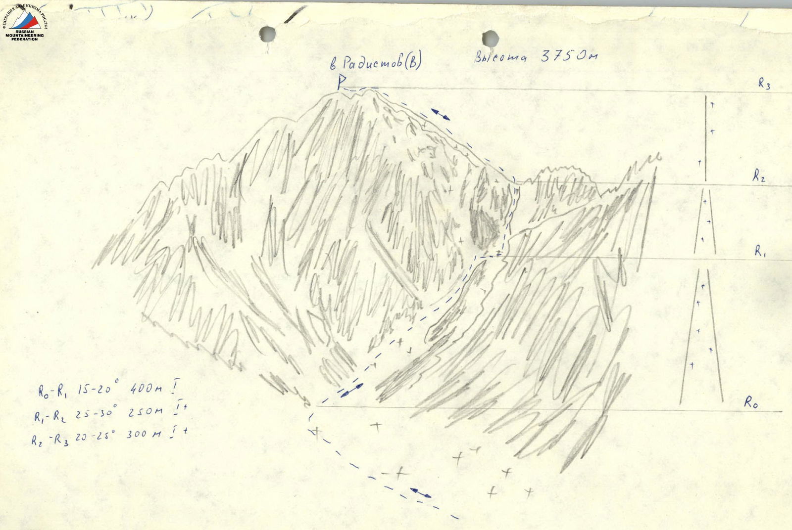
Photo 1 (taken from point 31 on the map of the area)
Route Description
From the base camp located at GMS Aktru, move along the Aktru river and then along the moraine of the left tributary of Aktru towards the hitchan. Time: 1–1.5 hours.
On the moraine under the hitchan, rope up. Move in rope teams along the slopes of the hitchan, bypassing the icefall under the slopes of V. Radistov on the left. Move along the glacier to a wide couloir located east of V. Radistov (V.). Time: 1 hour.
The ascent begins on the left side of the couloir under the slopes of the peak. The couloir is divided into two parts by a rocky ridge, which has a lower point at the top. Ascend via the left part of the couloir to this lower point and cross over to the right part. The couloir narrows and leads to a saddle between V. Radistov (V.) and a gendarme. The couloir is steep in this section; organize piton belays on the rocks if necessary. Move in crampons. Time to traverse the couloir: 2 hours.
From the saddle, ascend along the snow-ice ridge to the summit. Time: 1 hour.
Descend via the ascent route. Time: 1.5–2 hours.

