Passport
- Class — classification application.
- Altai, Severo-Chuysky ridge, Karakabak gorge.
- Peak Neizvestnykh Soldat via the 3rd ridge.
- Proposed category 1B.
- Height 3300 m, elevation gain 800 m, length 1600 m.
- Pitons were not used.
- Moving time: 7 hours from camp to camp; 6 hours from the start of ascent to the start of descent.
- Leader: Drakin A.V., CMS; participants: Kalinovsky N.V. 3rd sports category, Klimov V.N. 3rd sports category, Patrushev E.M. 3rd sports category.
- Coach: Drakin A.V., 1st sports category, No. 68.
- Date of ascent: July 24, 2003.
- Organization: Akturu branch in Karakabak gorge.
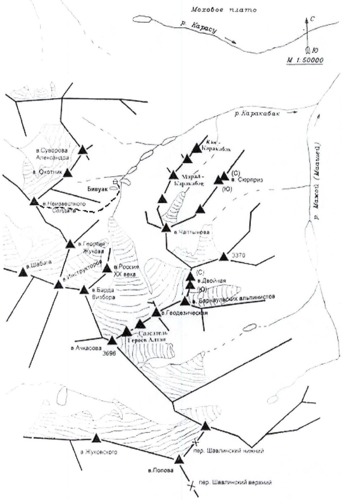
Fig. 4. Map-scheme of the path from the base camp to the summit of Peak Neizvestnykh Soldat
Peak Neizvestnykh Soldat via the SW ridge
From the base camp, located near the third lake, move initially along the stream flowing into the lake, then along the moraine ridges.
R0–R1: We move along the middle scree, gradually turning into small scree. We move traversing with a gain in height. This path is the simplest and safest to reach the ridge.
R1–R2: Movement along the ridge towards the "Peak Silantyev" gendarme. Movement does not require additional belay points and rope teams, but requires increased attentiveness — the trail is quite narrow (0.7 m).
R2–R3: Next, we move along a ledge on the left side of the ridge. Movement requires simultaneous belaying with the rope wrapped around выступs. The rocks are destroyed, crumbling. We approach the "yellow gendarme".
R3–R4: On the left side of the ridge, we approached a 7-meter wall with a steepness of 70°. We climb it to get to the other side of the ridge, as continuing along this side of the ridge is quite difficult. Climbing is not complicated and interesting. The wall resembles a brick wall with missing bricks. We use alternate belaying. The wall is moderately destroyed.
R4–R5: On the right side of the ridge with simultaneous belaying with the rope wrapped around выступs. We move along a ledge closer to the summit, reach the ridge, and ascend to the summit.
All rocks are destroyed, covered with moss and lichen, many "live" stones. The route is prone to rockfall.
The route has been previously climbed. A note from a group of climbers from the EMERCOM training camp in Barnaul dated July 19, 2001 was found on the "Peak Silantyev" gendarme. A note from a group of climbers from Omsk dated August 5, 2001 was found on the summit.
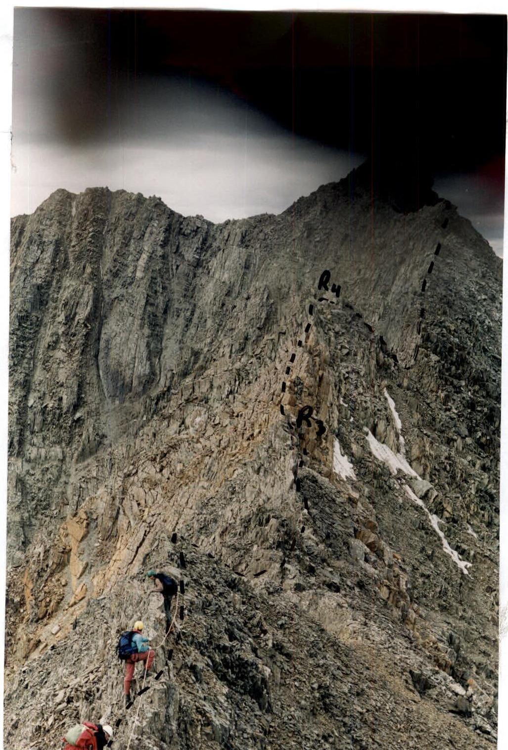
Photo 1. Route to the summit of Peak Neizvestnykh Soldat (key section R3–R4).
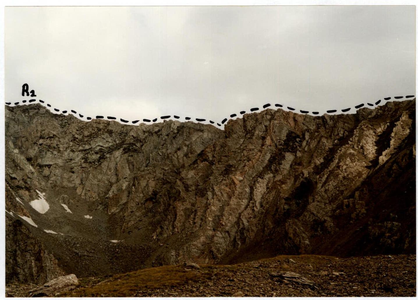
Photo 2. View of the route along the ridge.

Photo 3. Beginning of the ascent to Peak Neizvestnykh Soldat.
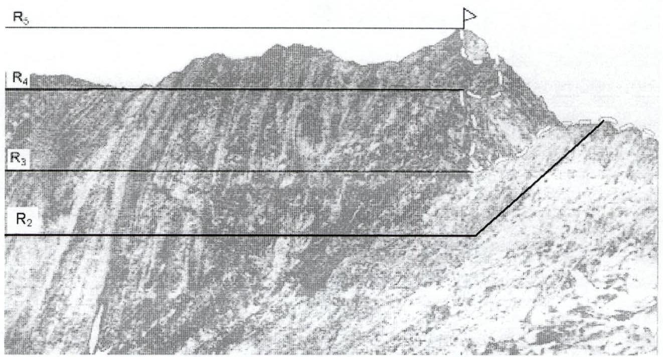
Fig. 1. Scheme of the upper part of the route with the key section R3–R4.
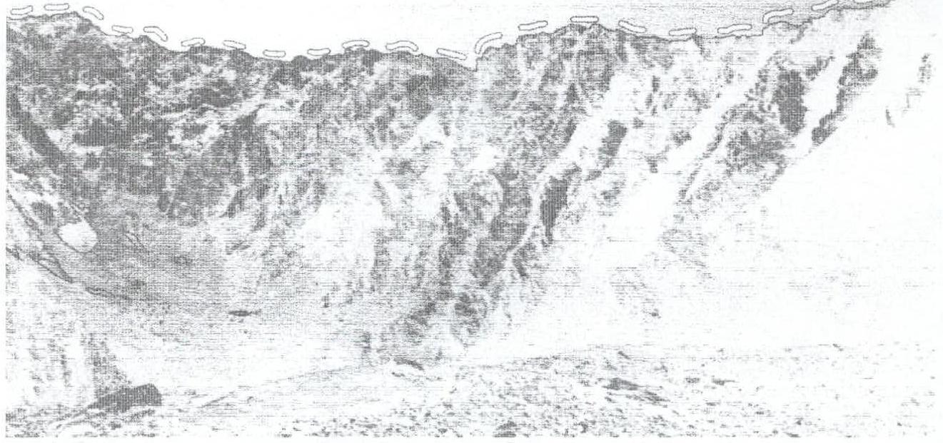
Fig. 2. Scheme of the main part of the route along the ridge.