Ascent Certificate
- Altai, Aktru gorge, section 1.2.
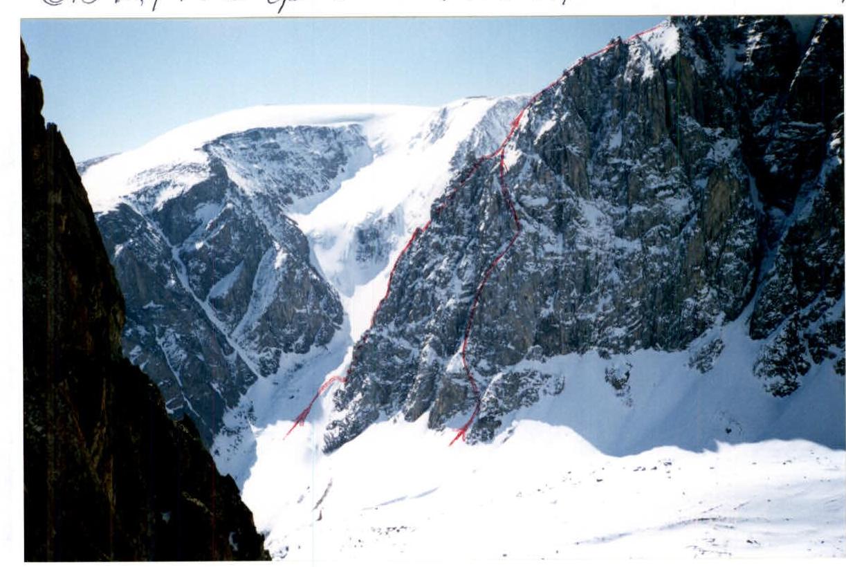
- Peak Karatash 3535 m, via North-Eastern ridge.
- Proposed category 4A, variant.
- The route is rocky in nature.
- Height difference 1100 m, length 2500 m, average steepness of the main part of the route 60°.
- Pitons driven: rock and placement 50, ice 2.
- Team's travel time 18 hours, 2 days.
- One overnight stay: cold, lying down.
Team Leader: Afanasiev A.E. MS
Participants:
- Ziatkov N.A. 1st sports category
- Salin A.V. 1st sports category
- Kuznetsova T.Yu. 2nd sports category
- Coach: Afanasiev A.E.
- Departure to the route July 25, 1998, summit July 26, 1998, return July 26, 1998.
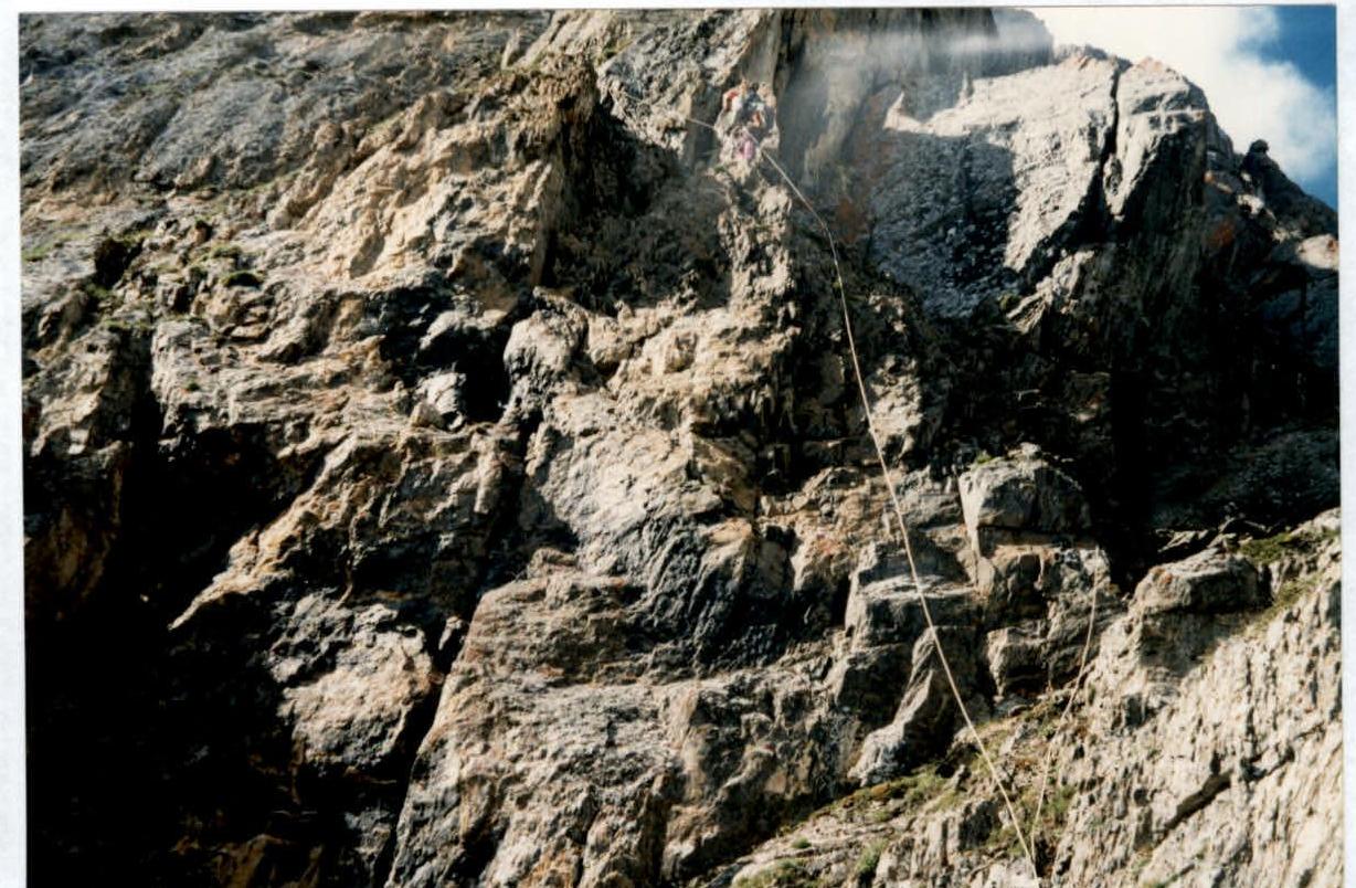
Description of the ascent route to peak Karatash 3535 m via North-Eastern ridge, approximately category 4A, Variant.
Sections:
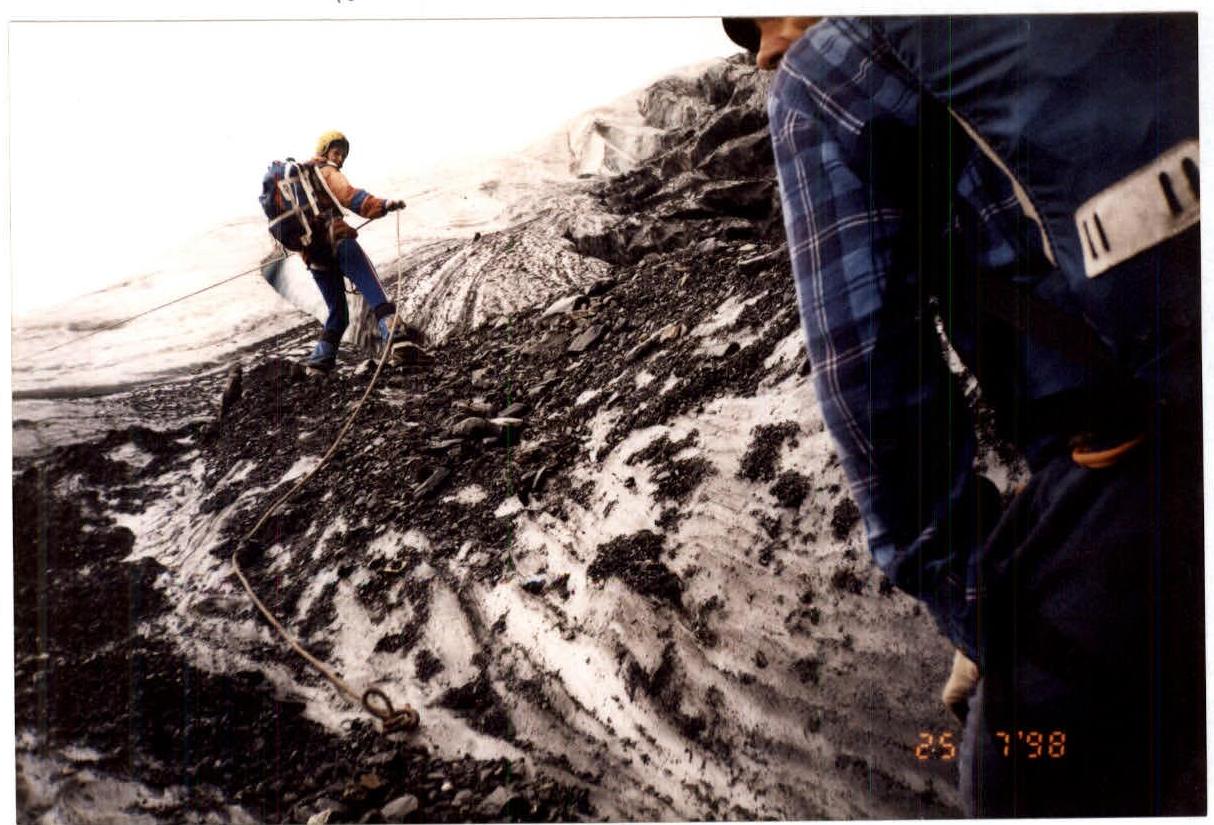
- R0–R1 40 m, 45°, III+. Sport descent into a rantkluft on ice. Belay via ice screws.
- R1–R2 30 m, 60°, IV–. Sheep's backs, pitons, ropes.
- R2–R3 150 m, 45°, II+. Sloping scree, turning into grassy, shelf left upwards to the right. Exit onto the ridge line. Indicative cairn. Further movement along the easiest path.
- R3–R4 40 m, 50°, IV–. Slippery rocks overgrown with moss and grass. Movement in crampons is desirable.
- R4–R5 20 m, 80°, IV+. Chimney on the left.
- R5–R6 20 m, 50°, III–. Crossing along ledges and short walls from left to right onto the ridge. Control cairn.
- R6–R7 20 m, 80°, IV+. Inner corner along the ridge line. In the upper part, transition to the left.
- R7–R8 15 m, 55°, III–. Rock.
- R8–R9 7 m, 95°, V+. Narrow chimney in the left part of the ridge.
- R9–R10 15 m, 45°, II+. Oblique slope.
- R10–R11 30 m, 80°, IV–. Chimney. Exit left onto a ledge. Detour to the left along the ledge of reddish rock. Exit onto the ridge line.
- R11–R12 20 m, 55°, III–. Rocky ridge.
- R12–R13 15 m, III+. Traverse of a grey gendarme. On the left. Exit onto a saddle.
- R13–R14 40 m, 60°, III+. Rocky ridge of grey rocks.
- R14–R15 45 m, 85°, IV–. Detour around the reddish gendarme on the left via oblique cracks. Exit onto a saddle.
- R15–R16 50 m, II–. Traverse left along a ledge, moving away from the ridge into a large rocky depression, with an overall steepness of up to 55°. Campsite area of groups from the 60s. Here, the proposed variant connects with the camp route. Above, we found pitons and loops.
- R16–R17 60 m, 60°, III+. Series of ledges and walls on the left side of a large rocky depression (trough).
- R17–R18 30 m, 40°, II+. Slabs, exit onto a gendarme near the left edge of the trough.
- R18–R19 15 m. Descent onto a saddle.
- R19–R20 20 m, 60°, III–. From the saddle, slightly to the left. Exit onto the southern ridge.
- R20–R21 20 m. Traverse along a ledge to the left of the gendarme.
- R21–R22 12 m. Rappelling down a wall with a negative slope onto a saddle before a large square gendarme at the junction of the Eastern and Southern ridges.
- R22–R23 Detour around the gendarme along a scree slope to a gendarme in the form of an outstretched finger. Here, the routes of category 3A from the south and 4B from the north converge. Further along the route 3A to the summit. Descent via route 2A along the Maly Aktru glacier.
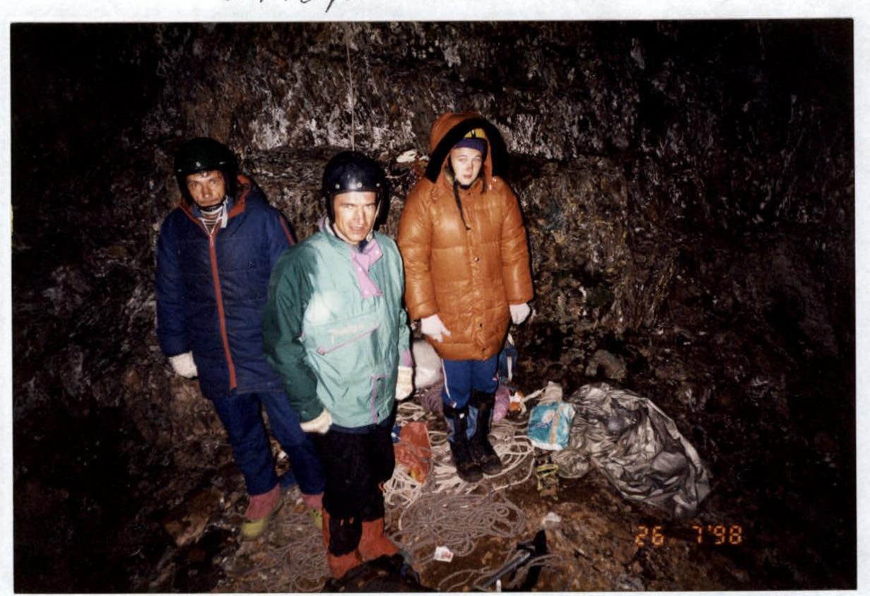
Mt. Karatash Cold overnight stay Approach to the key section of the route.
Mt. Karatash, route category 4A, section R0–R1.