
PASSPORT
-
Rock class
-
Altai, Katunsky ridge. Akkem lake area.
-
Assumed 1B category of difficulty first ascent
-
Height difference 800 m, length 1300 m.
-
9.5 walking hours from the camp on the shore of Akkem lake to the camp
-
Drakin A.V. CMS
- Belyaev P.A. 3rd sports category
- Vinnikov K.E. 1st sports category
- Egorov L.M. 3rd sports category
-
Coach Drakin A.V. CMS 1st category No. 3450
-
Exit to the route and return on July 10, 1994
-
Event organized by the Altai regional sports committee
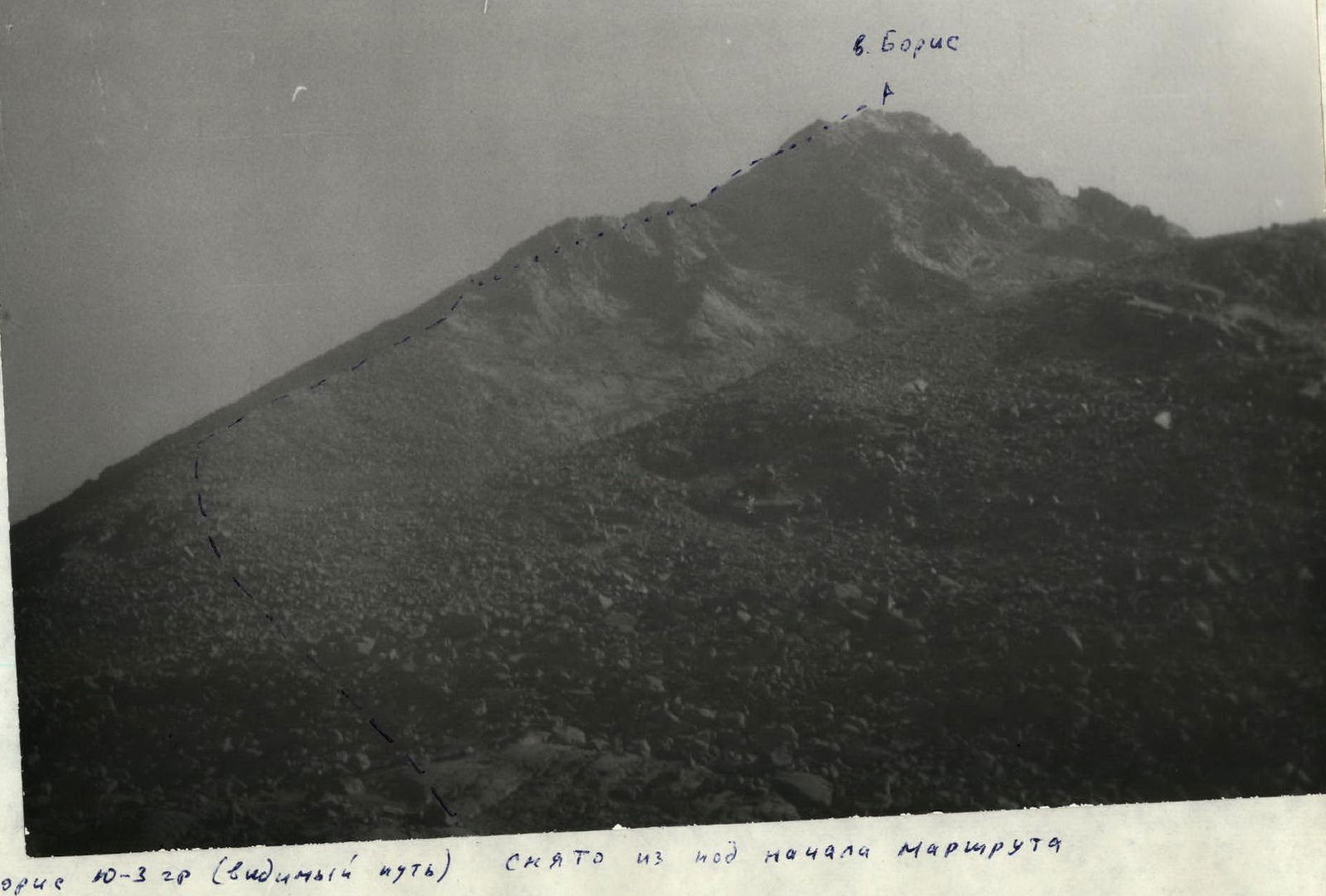 Mt. Boris S-3 ridge (visible path) — not visible path. Taken from under the beginning of the route.
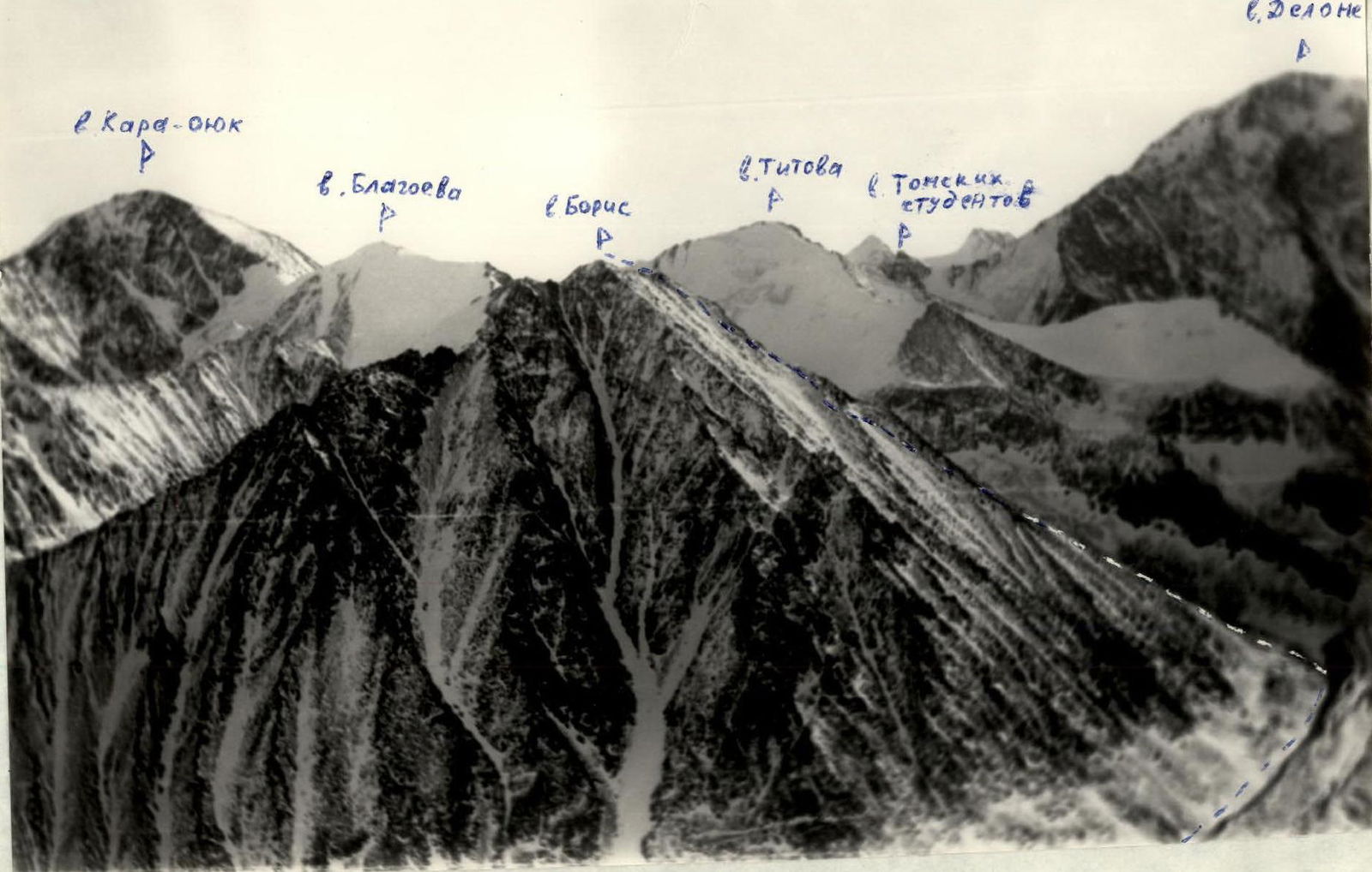 Mt. Boris S-3 ridge — ascent route (taken from v. Bronya).
Mt. Boris 3375 m
R3–R4 20° + 200 m, R2–R3 30° I 400 m, R1–R2 25–30° I 250 m, R0–R1 25° I 500 m.
Mt. Boris S-3 ridge
From the base camp located on Akkem lake, move along the lake to the place where the Akkem river flows into the lake. (40–50 min.) The river is forded with insurance.
After crossing:
- move along the trail to the Akkem glacier;
- climb to the left along the lateral moraine to the tongue of the glacier;
- then go along the tongue of the glacier along the Mt. Boris to the beginning of the S-3 ridge of the summit.
The moraine rampart located to the left along the route separates a green clearing from the glacier, convenient for a bivouac. The descent to the clearing is along a large scree overgrown with lichen (very slippery in the rain). Travel time from the camp to the clearing is 3–3.5 hours.
Climb up the large scree to the S-3 ridge of Mt. Boris and ascend along it to the summit ridge. Rocks encountered on the ridge are bypassed to the left along the large scree. In the upper part, the ascent goes along a couloir with medium scree.
- Ascent time to the summit ridge: 2.5–3 hours
- Technical difficulty: none
- Movement along the summit ridge: simultaneous, on short sections — alternate
- Insurance: through an outcrop
- Travel time along the ridge: 2.5–30 min
- Descent: along the ascent path
 Mt. Boris S-W ridge (view from v. Bronya).
Comments
Sign in to leave a comment