REPORT on the first ascent to the summit of Shaitankhana (peak Kotina) along the central counterfort of the northwestern wall category 6A complexity by a combined team from Tomsk, Leningrad, and Kemerovo regions from July 22, 2018 to July 24, 2018 2018
Climbing Passport
| General Information | |
|---|---|
| Full name, sports rank of the team leader | Temerev Ivan Mikhailovich, Master of Sports |
| Full name, sports rank of the participants | Aldyn-Kherel Timur Valerievich, 1st sports rank; Kashevnick Anton Aleksandrovich, Candidate Master of Sports; Suzdaltsev Egor Evgenievich, Candidate Master of Sports |
| Full name of the coach | Temerev Ivan Mikhailovich |
| Characteristics of the ascent object | |
| Region | Gissar-Alay |
| Valley | Karavshin |
| Section number according to the 2013 classification table | 5.4.3 |
| Name and height of the summit | Shaitankhana (Kotina), 4521 m |
| Characteristics of the route | |
| Route name | Along the central counterfort of the northwestern wall |
| Proposed category of complexity | 6A |
| Degree of route exploration | First ascent |
| Relief characteristics of the route | Rock climbing |
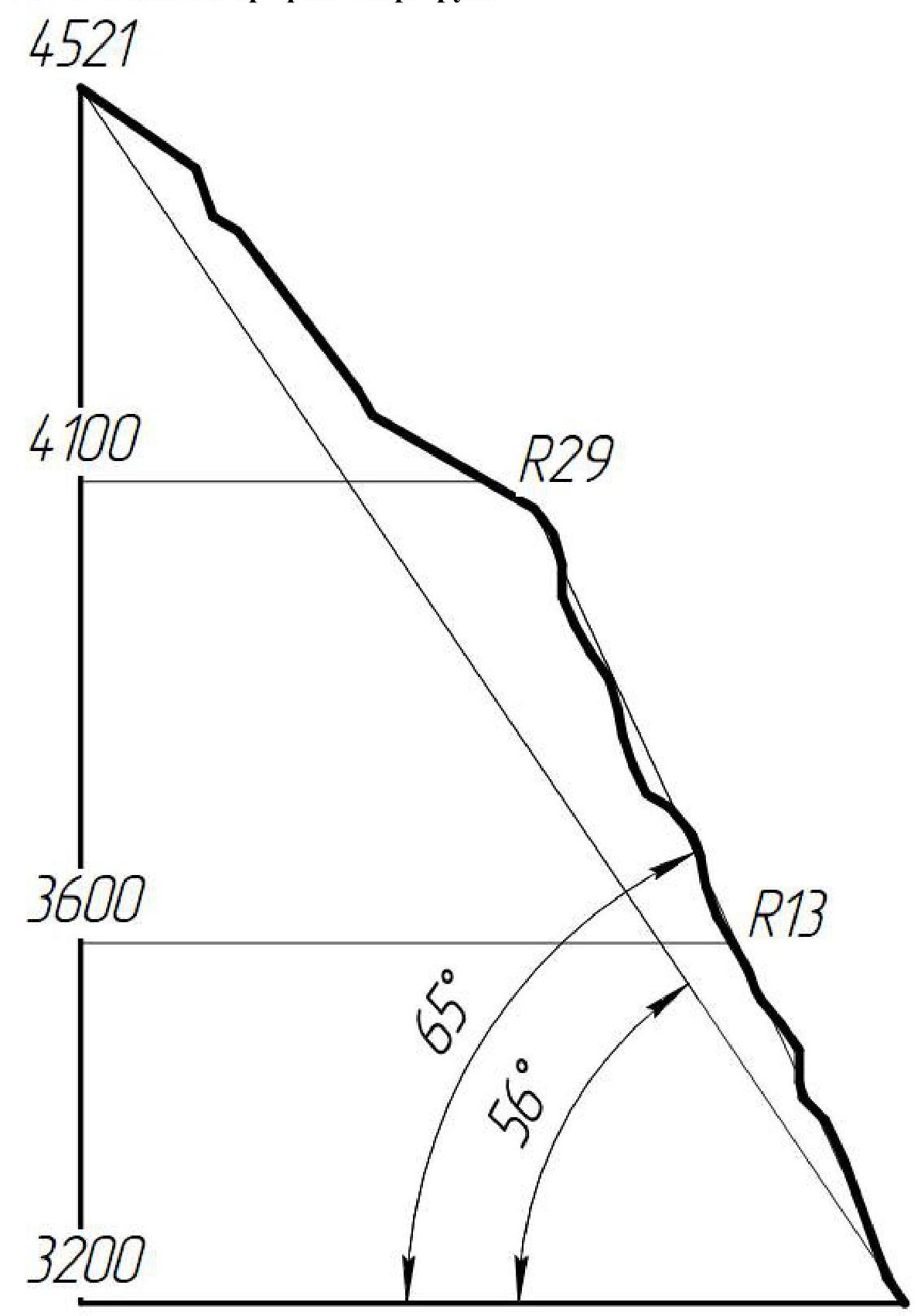
| Height difference of the route | 1321 m |
| Route length | 1500 m |
| Technical elements of the route (total length of sections of varying complexity with indication of relief characteristics) | Category I rocks — 350 m. Category II rocks — 85 m. Category III rocks — 90 m. Category IV rocks — 170 m. Category V rocks — 267 m. Category VI rocks — 522 m. Rocks A1 — 8 m. Rocks A2 — 8 m |
| Average steepness of the route | 56° |
| Average steepness of the main part of the route | 65° |
| Descent from the summit | Via category 4B to Dukharchi |
| Additional route characteristics | After passing the wall, it's possible to gather snow |
| Characteristics of the team's actions | |
| Time in motion (team's walking hours) | 27 hours, 2.5 days (+8 hours for descent) |
| Overnights | Overnights on ledges |
| Route processing time | 2 hours |
| Start of the route | 8:00, July 22, 2018 |
| Reaching the summit | 15:00, July 24, 2018 |
| Return to base camp | 11:00, July 25, 2018 |
| Person responsible for the report | |
| Full name, e-mail | Suzdaltsev E.E., e.e.suzdaltsev@gmail.com |
Ascent Description
1.1. Characteristics of the Ascent Object
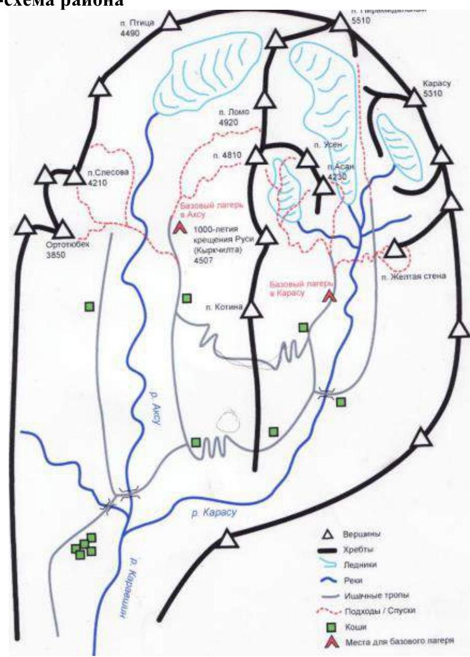
The Karavshin region is located in the Batken region of Kyrgyzstan and is a Mecca for technical mountaineering, attracting climbers from the post-Soviet space and beyond. Most routes in Karavshin are categorized as 5B and 6B difficulty, and the region is relatively compact and monolithic.
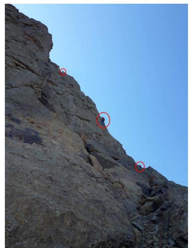
Peak Shaitankhana, also known as peak Kotina (4521 m), is situated near the standard base camp location in the Karasu valley. The first ascents to the summit date back to 1988, marking the beginning of the region's exploration. The ridge of Shaitankhana–Kyrkchilta–Odessa is a classic composition for photographs taken by most tourists and climbers visiting the region. The FAR database contains only 4 classified routes to Shaitankhana: the South Wales ridge (Igolkin 4A, 1990), the Northern ridge (Vasilkov 4B, 1988), the Northeastern wall (Maksimov 5A, 1988), and the Right part of the Eastern wall (Portyanko 5B, 1988). Both wall routes are located in a neighboring valley, Ak-Suu. The western side of Shaitankhana remains relatively unexplored; there are no recorded routes on this side in the Russian classifier. We found limited information on two routes: the Polish route "Czarna Wolga" and an American route. As one of the most interesting aspects of mountaineering is considered to be first ascents of a technical nature, our choice of ascent object and route was guided by the proximity to the base camp and the lack of exploration on the western side of Shaitankhana.
The relief on the western exposure of the mountain is diverse and relatively safe for climbing and belaying. The route taken by our team turned out to be logical, relatively safe, and interesting, not only for the participants but also, we hope, for future climbers. The northwestern edge can be conditionally divided into 3 "bastions":
- R0–R9
- R9–R19
- R19–R31
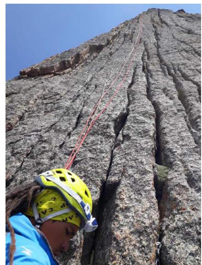
and the pre-summit ridge R31–R37. The majority of the route was ascended by free climbing, with ITO used on only seven short (2–4 m) sections.
In the future, this route may serve as a good warm-up before ascents of higher complexity categories.
The descent from the summit can be done along the northern ridge (Vasilkov's route, category 4B) or via one of the routes on the western wall.
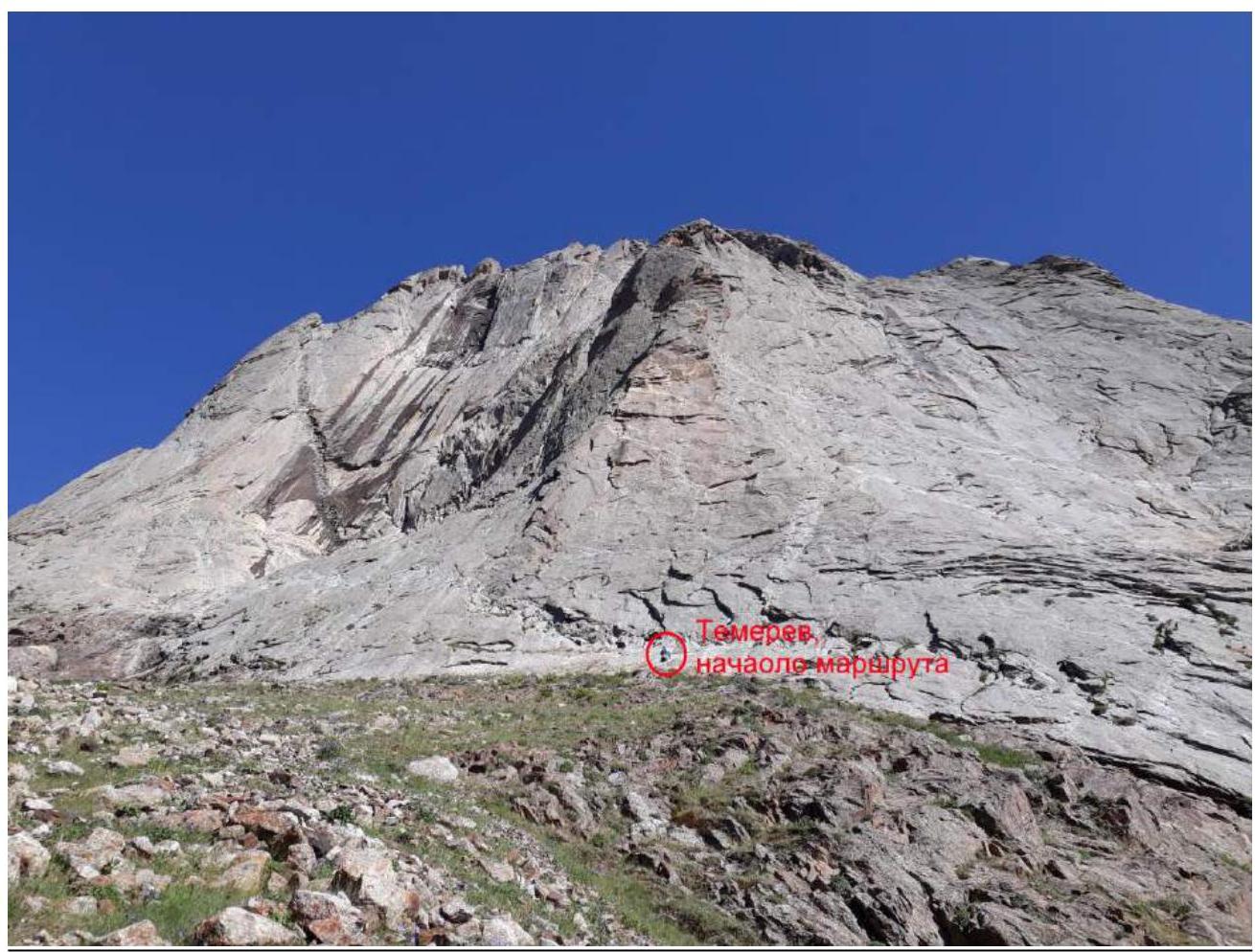
1.2. General Photo of the Summit
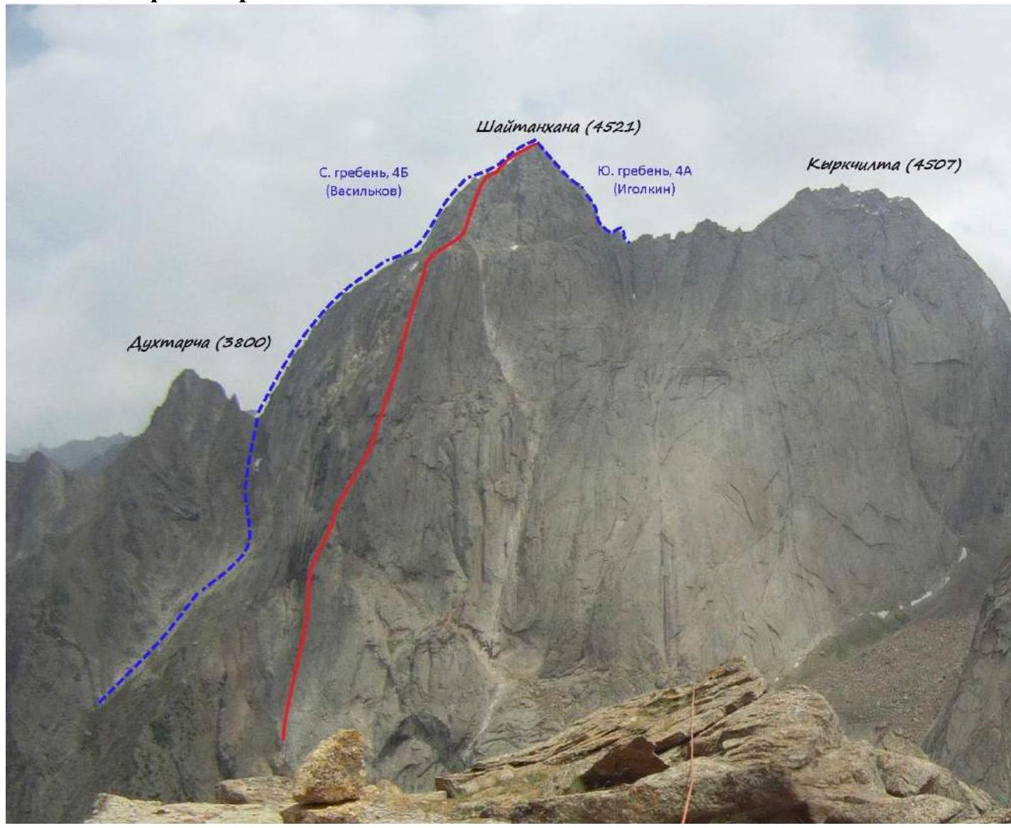
View from the summit of Yellow Wall 3800 m, July 2018.
1.3.1. Photo of the Route Profile
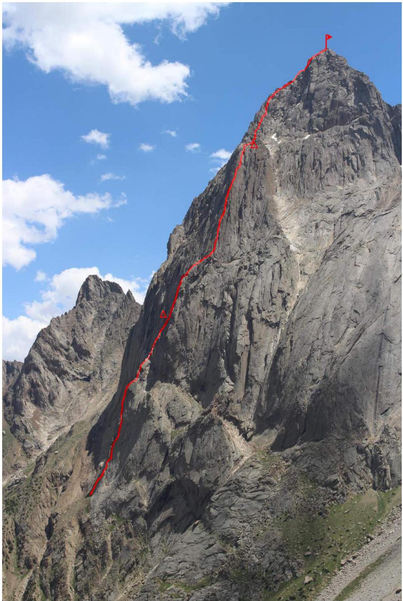
Taken from the direction of peak Yellow Wall.
1.3.2. Photo of the Route Profile
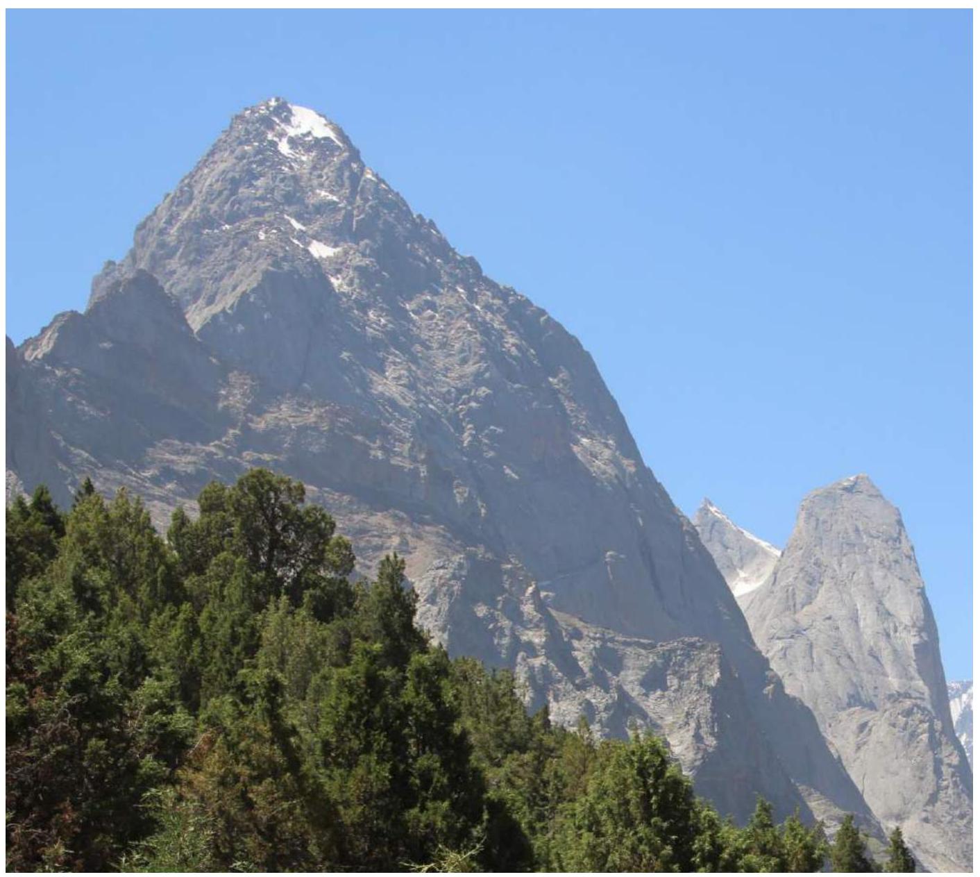
Taken from the north from the Karasu valley.
1.4. Hand-Drawn Profile of the Route
1.5. Map-Scheme of the Region
2. Characteristics of the Route
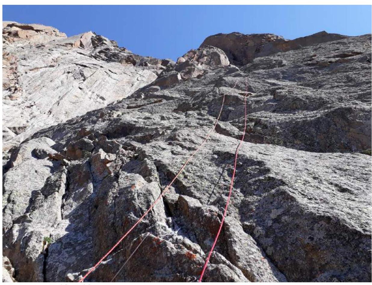
2.1. Technical Photograph of the Route

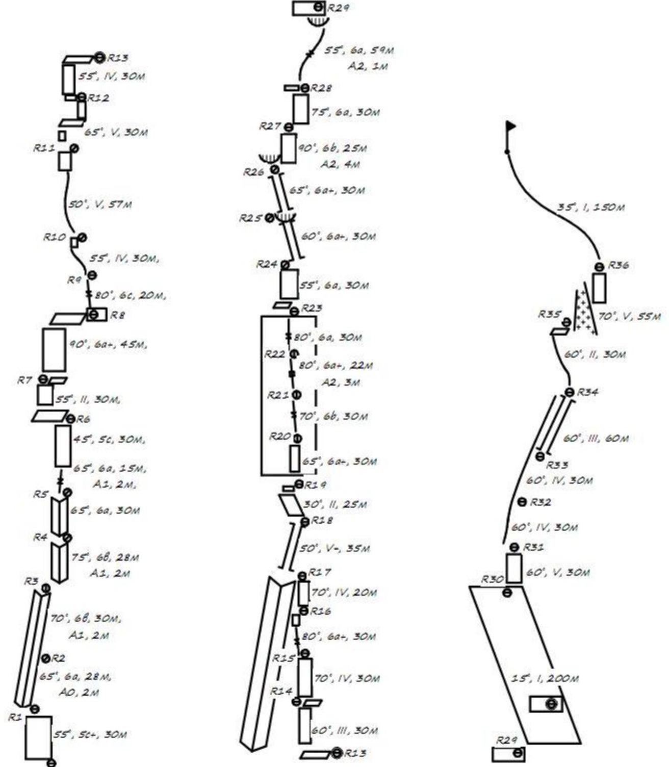
2.2. Route Scheme in UIAA Symbols
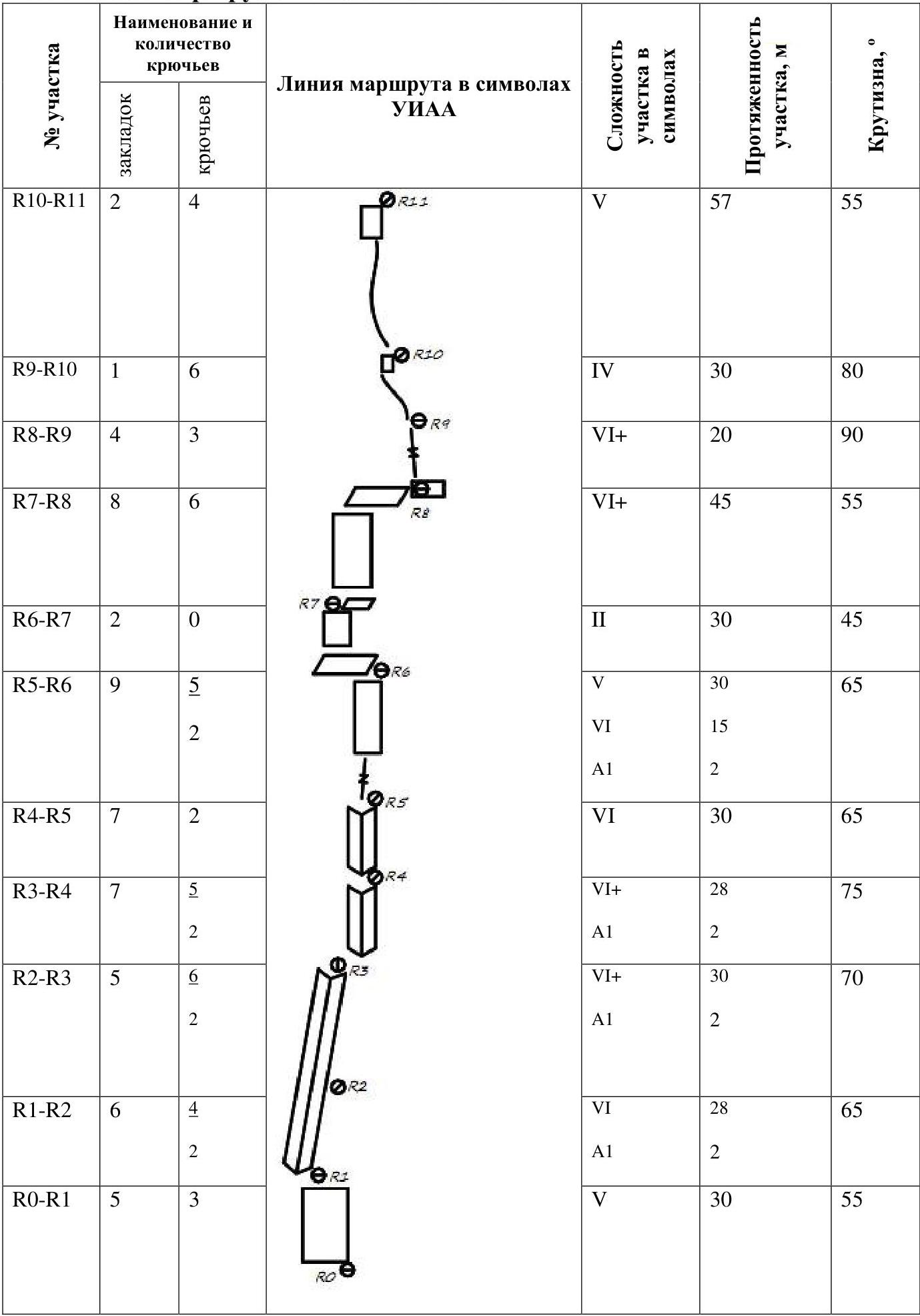
| Section # | Name and quantity of pegs (protection) | Name and quantity of pegs (pitons) | UIAA Route Symbol | Section Complexity in UIAA Symbols | Section Length, m | Steepness, ° |
|---|---|---|---|---|---|---|
| R0–R1 | 5 | 3 | V | 30 | 55 | |
| R1–R2 | 6 | 4, 2 | VI, A1 | 28, 2 | 65 | |
| R2–R3 | 5 | 6, 2 | VI+, A1 | 30, 2 | 70 | |
| R3–R4 | 7 | 5, 2 | VI+, A1 | 28, 2 | 75 | |
| R4–R5 | 7 | 2 | VI | 30 | 65 | |
| R5–R6 | 9 | 5, 2 | V, VI, A1 | 30, 15, 2 | 65 | |
| R6–R7 | 2 | 0 | II | 30 | 45 | |
| R7–R8 | 8 | 6 | VI+ | 45 | 55 | |
| R8–R9 | 4 | 3 | VI+ | 20 | 90 | |
| R9–R10 | 1 | 6 | IV | 30 | 80 | |
| R10–R11 | 2 | 4 | V | 57 | 55 | |
| R11–R12 | 6 | 1 | V | 30 | 65 | |
| R12–R13 | 3 | 2 | IV | 30 | 55 | |
| R13–R14 | 4 | 0 | III | 30 | 60 | |
| R14–R15 | 6 | 1 | IV | 30 | 70 | |
| R15–R16 | 3 | 3 | VI+ | 30 | 80 | |
| R16–R17 | 3 | 1 | IV | 20 | 70 | |
| R17–R18 | 2 | 6 | V- | 35 | 50 | |
| R18–R19 | 1 | 0 | II | 25 | 30 | |
| R19–R20 | 7 | 0 | VI | 30 | 65 | |
| R20–R21 | 6 | 2 | VI+ | 30 | 70 | |
| R21–R22 | 6 | 3, 2 | VI, A2 | 22, 4 | 80 | |
| R22–R23 | 7 | 2 | VI | 30 | 80 | |
| R23–R24 | 5 | 1 | VI | 30 | 55 | |
| R24–R25 | 7 | 1 | VI | 30 | 60 | |
| R25–R26 | 6 | 1 | VI | 30 | 65 | |
| R26–R27 | 5 | 4, 3 | VI+, A2 | 25, 3 | 90 | |
| R27–R28 | 6 | 2 | VI | 30 | 75 | |
| R28–R29 | 7, 2 | 0 | VI, A2 | 59, 1 | 55 | |
| R29–R30 | 0 | 0 | I | 200 | 15 | |
| R30–R31 | 6 | 0 | V | 30 | 60 | |
| R31–R32 | 5 | 0 | IV | 30 | 60 | |
| R32–R33 | 6 | 0 | IV | 30 | 60 | |
| R33–R34 | 5 | 0 | IV | 60 | 60 |
2.3. Route Description by Sections
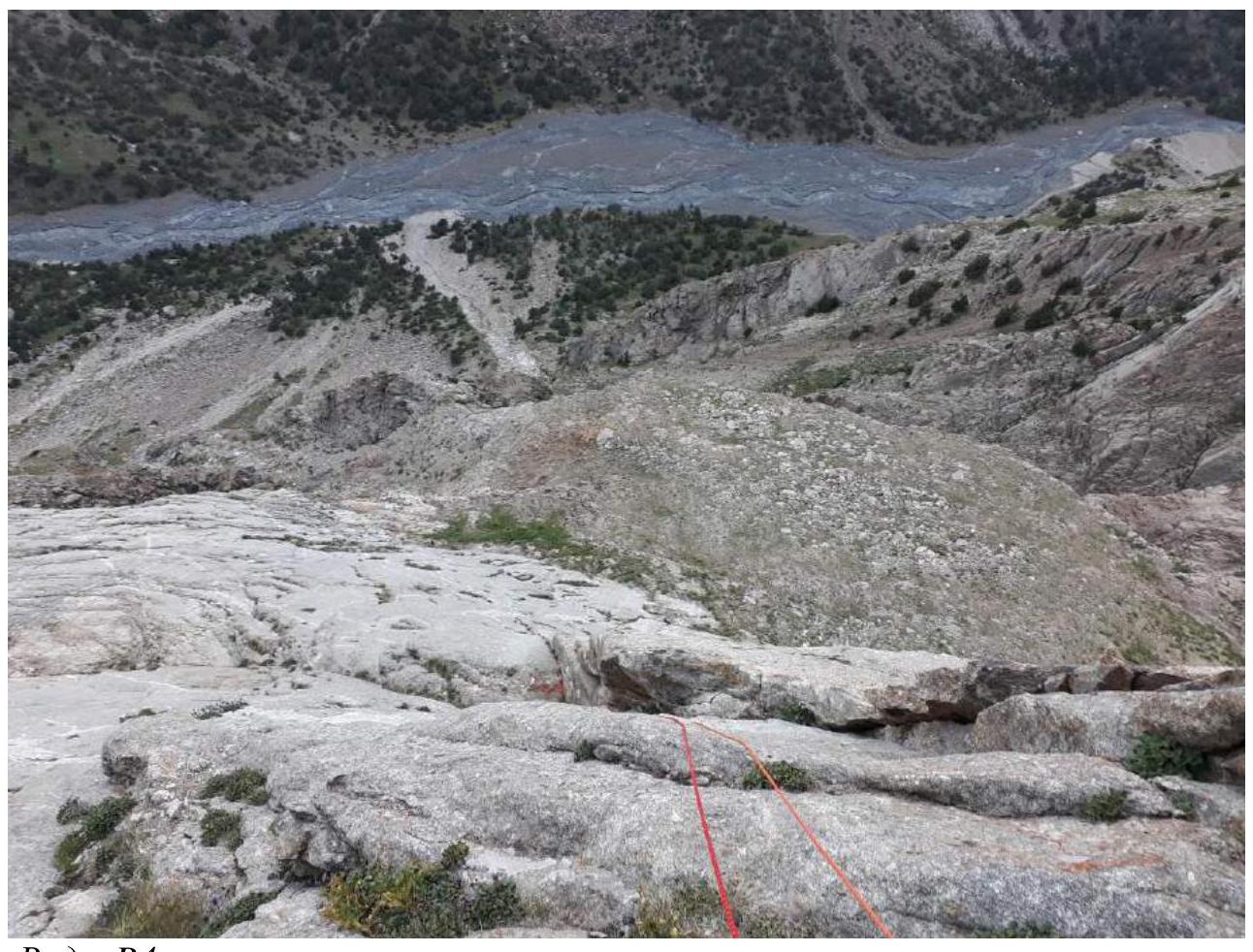
Approach to the start of the route: From the base camp in the Karasu valley, follow the trail towards peak Odessa, proceed to the second large rocky scree, turn left upwards along the scree, orienting towards a couloir that leads to the upper tier. Ascend the couloir (staying on the left side) to the start of the route.
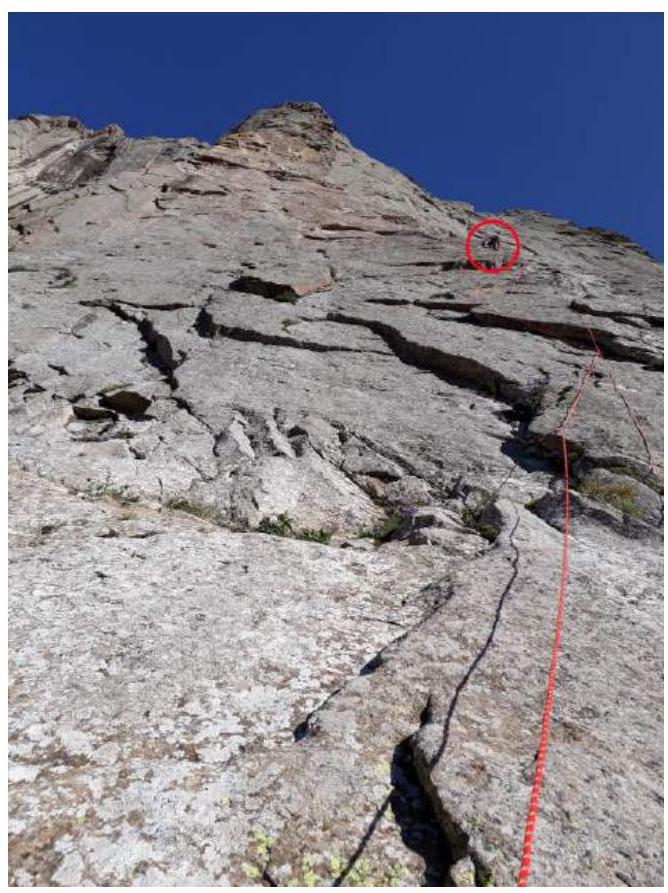
R0–R1: The start of the route is on a grassy ledge. Inclined slabs, move right towards the base of a large internal angle that goes through the first bastion.
R1–R3: Move through the internal angle. Challenging climbing. At the end of the section, the angle is interrupted by a small wall.
R3–R4: Cross the slab to the right into the next internal angle. Continue moving through the internal angle.
R4–R5: The angle starts to turn left, bypassing an overhang.
R5–R6: Move left around the corner through a wide groove that the internal angle transitions into. Further along the slab to a good horizontal ledge.
R6–R7: Along the inclined ledge, move left, with many loose stones.
R7–R8: Vertical wall, rocks are fragile. Reach a ledge; there is a platform suitable for a tent.
R8–R9: Straight up through a vertical crack. Challenging climbing. The crack leads to a ridge that leads to the base of the second rock bastion.
R9–R10: Rock ridge, ends with a small wall.
R10–R11: Rocky ridge.
R11–R12: Climbing along inclined slabs.
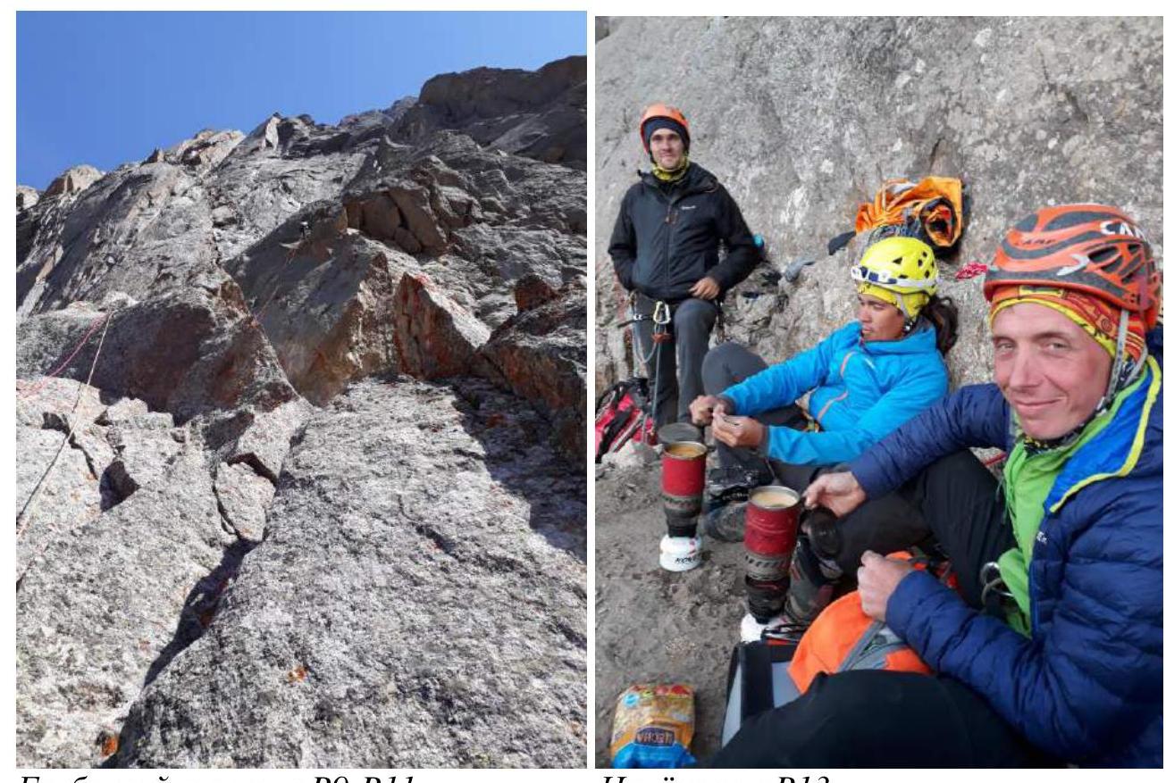
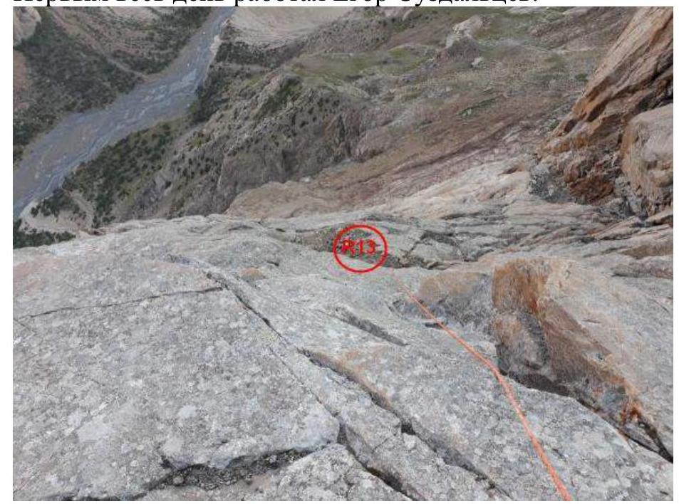
R12–R13: Move along inclined slabs. Reach a horizontal ledge 1.5 m wide.
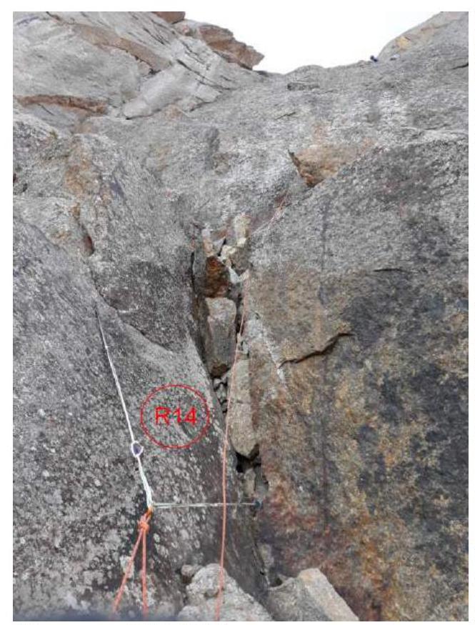
R13–R14: Easy rocks. Move along inclined slabs.
R14–R15: Move along inclined slabs. On the left is a large internal angle with many loose stones. Stay on the right wall.
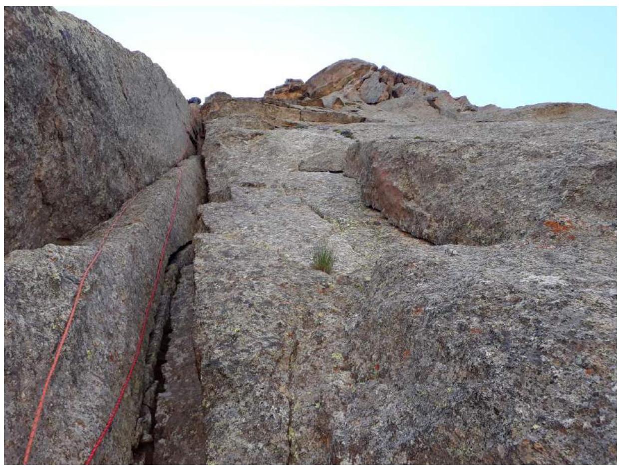
R15–R16: Vertical, blind crack. At the end of the section, a small wall.
R16–R17: The relief pulls left into an internal angle. Move along its right wall.
R17–R18: The angle ends with a wet chimney with strongly fragmented walls. Careful climbing.
R18–R19: The chimney leads to good ledges. Very easy climbing.
R19–R20: Start of the third rock bastion. Inclined slab.
R20–R21: Rock wall. Holds are vertical ledges, poor footholds, challenging climbing.
R21–R22: Challenging climbing through vertical cracks. At the end of the section, a large loose block. Under it, traverse right onto ITO. Station on the ridge.
R22–R23: Series of parallel vertical cracks. Climbing on ledges. Initially, move left, then straight up. The wall ends with a small shelf.
R23–R24: Move along inclined slabs.
R24–R25: Right around the corner into the base of a large chimney. Further, bypassing a ledge, left around the corner into a rock recess, bypassing a plug in the chimney.
R25–R26: Return to the chimney, which ends with a vertical cave. At the end of the section, move right.
R26–R27: Vertical wall, challenging climbing.
R27–R28: Straight up onto a small rock ledge on the ridge.
R28–R29: Along a monolithic slab, moving right under a cornice. The left wall slightly overhangs. Traverse the cornice on ITO. Further, a large rock field.
R29–R30: Simultaneous movement along a ledge, first right, then towards the ridge.
R30–R31: Rock wall leading to the ridge.
R31–R33: Move along a wide rocky ridge, easy climbing. The ridge is fragmented.
R33–R34: To the right of the ridge, a wide chimney. Many loose blocks.
R34–R35: Simultaneous movement under a snow-ice rise.
R35–R36: Moving right, cross a snowy couloir. Further along a rock wall to the base of the summit ridge.
R36–R37: Ridge leading to the summit.
3. Characteristics of the Team's Actions
3.1. Brief Description of the Route Passage
July 21:
Ivan Temerev and Anton Kashevnick, taking the main gear and 3 ropes, approached the start of the route, outlined the line, and began processing the first ropes at 18:00, with Temerev leading. Later, Egor Suzdaltsev arrived, brought another rope, empty bottles, and worked on finding and collecting water for the route.
By 20:00, about 120 m (R0–R4) was covered, the necessary amount of water was collected and stored under the route.
After processing, all participants descended to the base camp.
Temerev on section R0–R1.
Temerev on section R1–R2.
View from R4 downwards.
July 22:
The team arrived under the route, distributed gear and equipment, and began ascending via fixed ropes at 7:30. Further, good climbing with convenient belaying. On R8, a suitable ledge was found, laid out for a tent, where a control cairn with a note from Alperin's team from 1988 was discovered. R9 marked the end of the first bastion; thereafter, until R11, a ridge with traversing sections followed. The team reached the R13 ledge by the end of the day. Overnight stay was comfortable, without a tent, as the weather permitted.
Until 17:00, Ivan Temerev led, followed by Egor Suzdaltsev.

R8 ledge — a comfortable overnight stay, laid out by Alperin's team. Egor Suzdaltsev, Ivan Temerev, Anton Kashevnick.
View from R5.

View from R6.
Temerev on section R8–R9.
Section R12–R13.
July 23:
Ridge section R9–R11.
Overnight stay on R13.
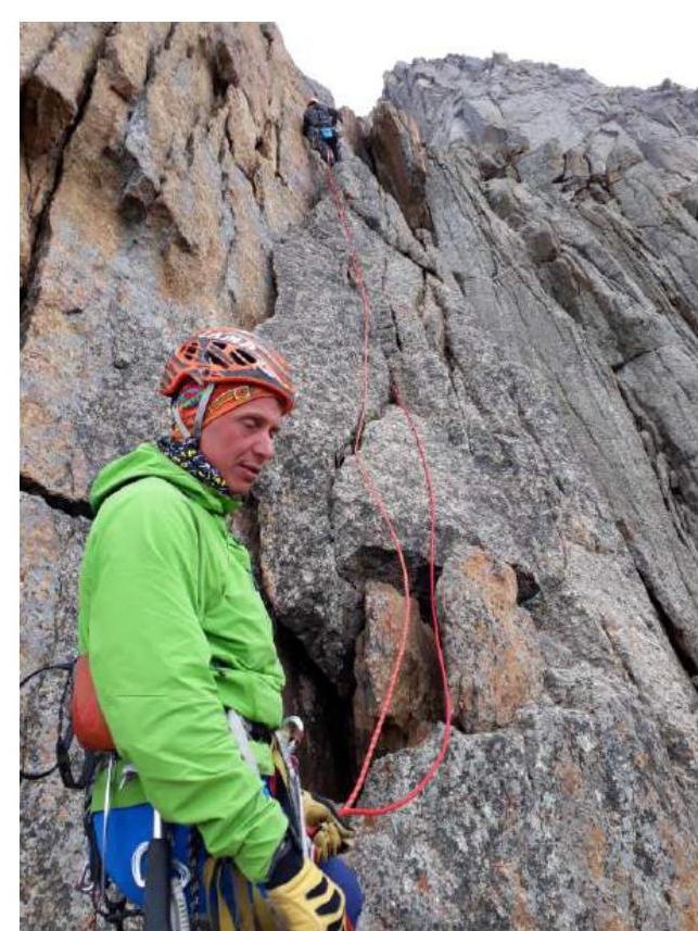
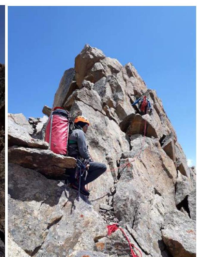
Above the overnight stay, the terrain becomes simpler, followed by more complex relief: interesting and varied climbing. The second bastion ends on R19. The third bastion's rock is more fragmented; at times, it's necessary to stand on ITO to avoid dropping "feathers" on the belayer. Overnight stay on flat rocks with large ledges. Egor Suzdaltsev led throughout the day.
View from R14 downwards.
Section R14–R15.

Chimney R17–R18.
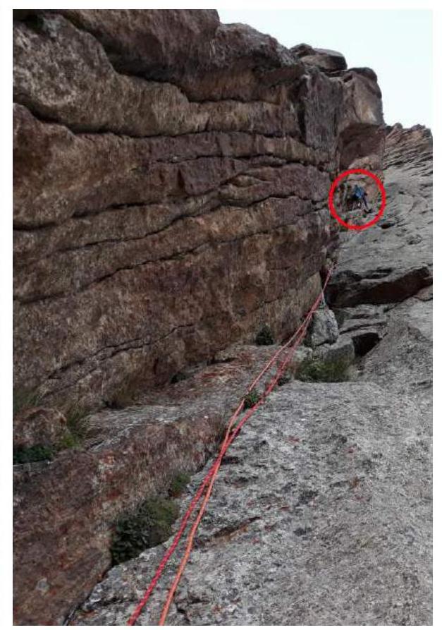
R19–R21. Sudzaltsev, Temerev, Aldyn-Kherel.
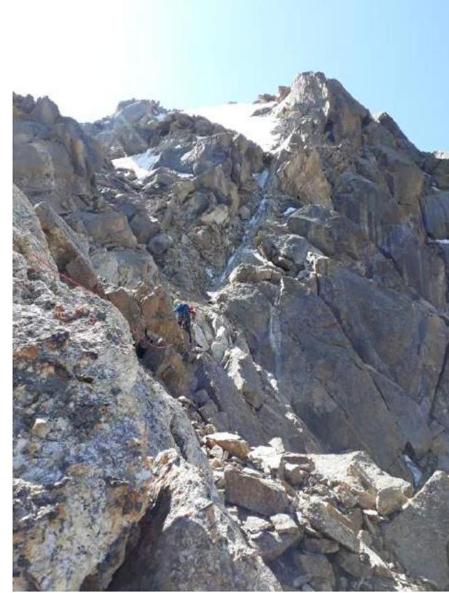
Section R22–R23.

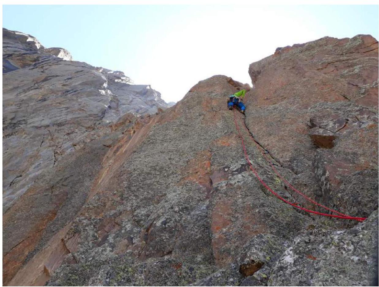
Section R28–R29. I. Temerev, E. Suzdaltsev.
Overnight stay on R29–R30 (simple terrain). Process of preparing the site.
July 24:
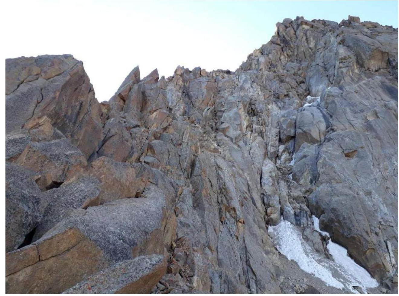
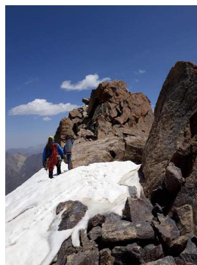
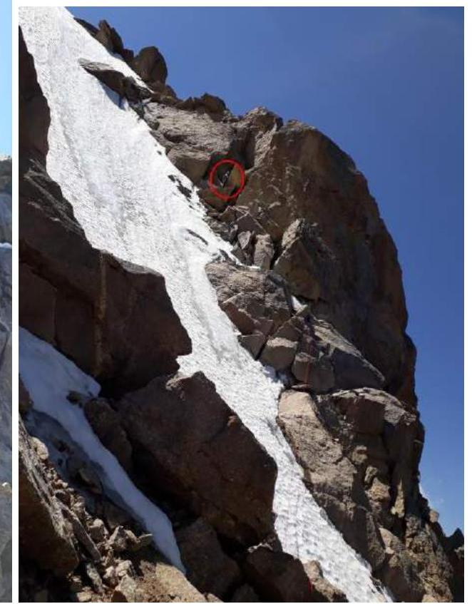
Continued movement towards the summit. Simple rocks and ridge leading to the summit. Climbing is not challenging — mostly sections of category IV–V complexity. Directly under the summit, there is an icy couloir; to cross it, crampons are necessary for the first climber. Rocks to the right of the couloir are suitable for climbing and belaying. Timur Aldyn-Kherel led throughout the day.
Ridge leading to the summit.
Cross the couloir and climb to the right.
R35–R36, Timur Aldyn-Kherel.
Snowfield before the summit.
Section R36–R37.
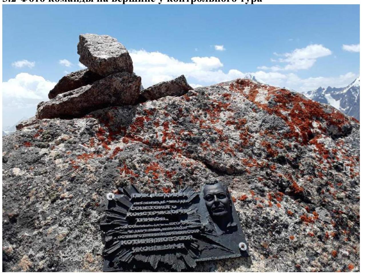
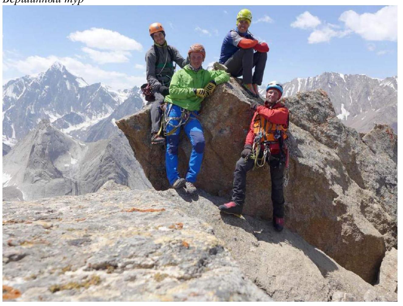
3.2. Team Photo at the Summit by the Control Cairn
Summit cairn.
3.3. Safety Assessment of the Route. Recommendations for Future Climbers. Detailed Information on Descent from the Summit with Landmarks.
We consider the route we took to be relatively safe, logical, interesting, and worthy of category 6A. Its proximity to the base camp in the Karasu valley may make it a popular route.
Recommendations for the ascent:
- a one-and-a-half times set of protection gear
- anchor pitons
- rock shoes and crampons for the first climber
- obligatory use of a double rope
- there are sufficient ledges for a tent on the route
- a "sit pad" for the belayer is not required
Descent from the summit can be made along the northern ridge (Vasilkov's route, category 4B) — our team descended this way. It's worth noting that we found no information on recent passages or descents via this route; some rappel loops we encountered were in very unexpected places (e.g., 3 m from the ground). Unlike the route we ascended, the Northern ridge was very fragmented: descent to the pass was done via "dullyfera" with mandatory upper belay, and the first climber regularly had to "clean" the route from huge rock blocks. We recommend future climbers descend via the eastern, more monolithic side of the mountain.
3.4. Additional Information
Route scheme on a single sheet.