Passport
-
Category — rock climbing.
-
Pamir-Alay, Turkestan Range, Kara-Su gorge (upper reaches of the Karavshin river).
-
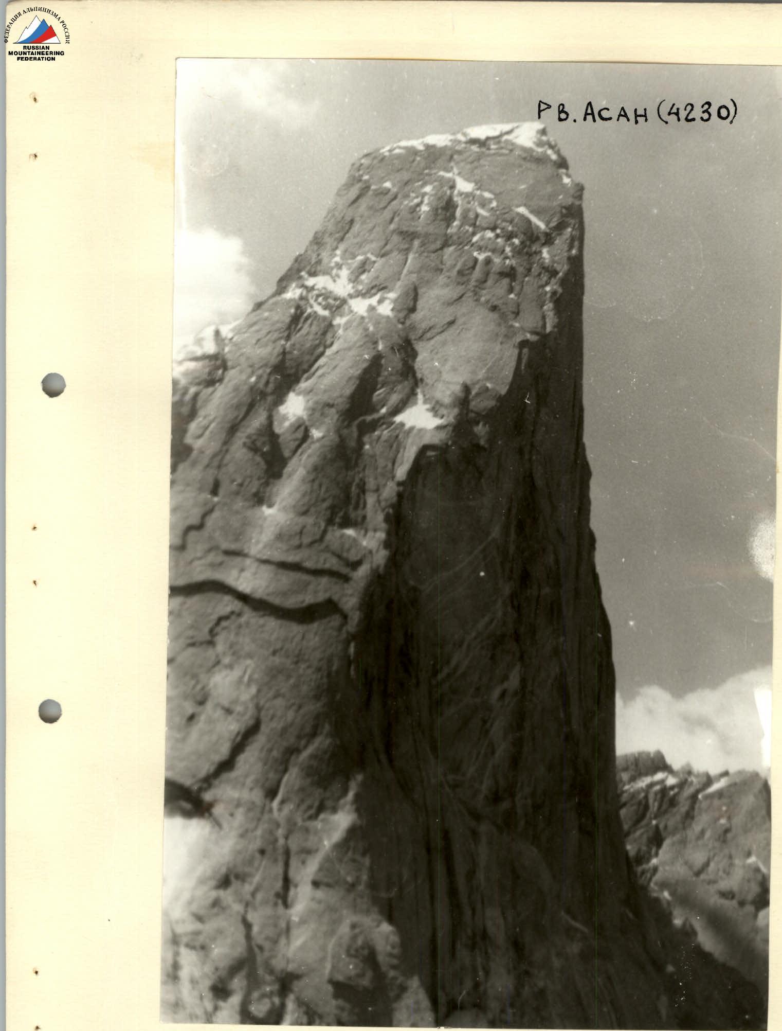
Peak Asan, centre of the North-West wall (Rusyayev's route).
-
6B category of difficulty.
-
Height difference — 730 m.
Length — 1095 m. Length of sections with 5–6 category of difficulty — 950 m. Average steepness of the main part of the route — 72°.
-
Pitons hammered:
| Rock Pitons | Bolt Pitons | Nuts | Holes for sky-hooks |
|---|---|---|---|
| 43 | 1+54* | 146 | 57 |
| 4 | 47 | 19 |
-
Team's travel hours — 30 hours, days — 3.
-
Overnight stays — 1 seated on a rock shelf.
-
Team Leader — Klenov Alexander Valerievich MS
Bruk Mikhail Alexandrovich MS, Borisov Sergey Viktorovich MS, Bugachevsky Igor Borisovich CMS, Donskikh Mikhail Fedorovich CMS, Solodovnevich Anatoly Petrovich CMS
-
Coach: Honored Coach of the RSFSR Mikhailov Alexander Alexandrovich.
-
Approach to the route — July 16, 1991.
Summit — July 18, 1991. Descent — July 18, 1991.
-
Organization — SKA-16, Sverdlovsk, PriUrVO.
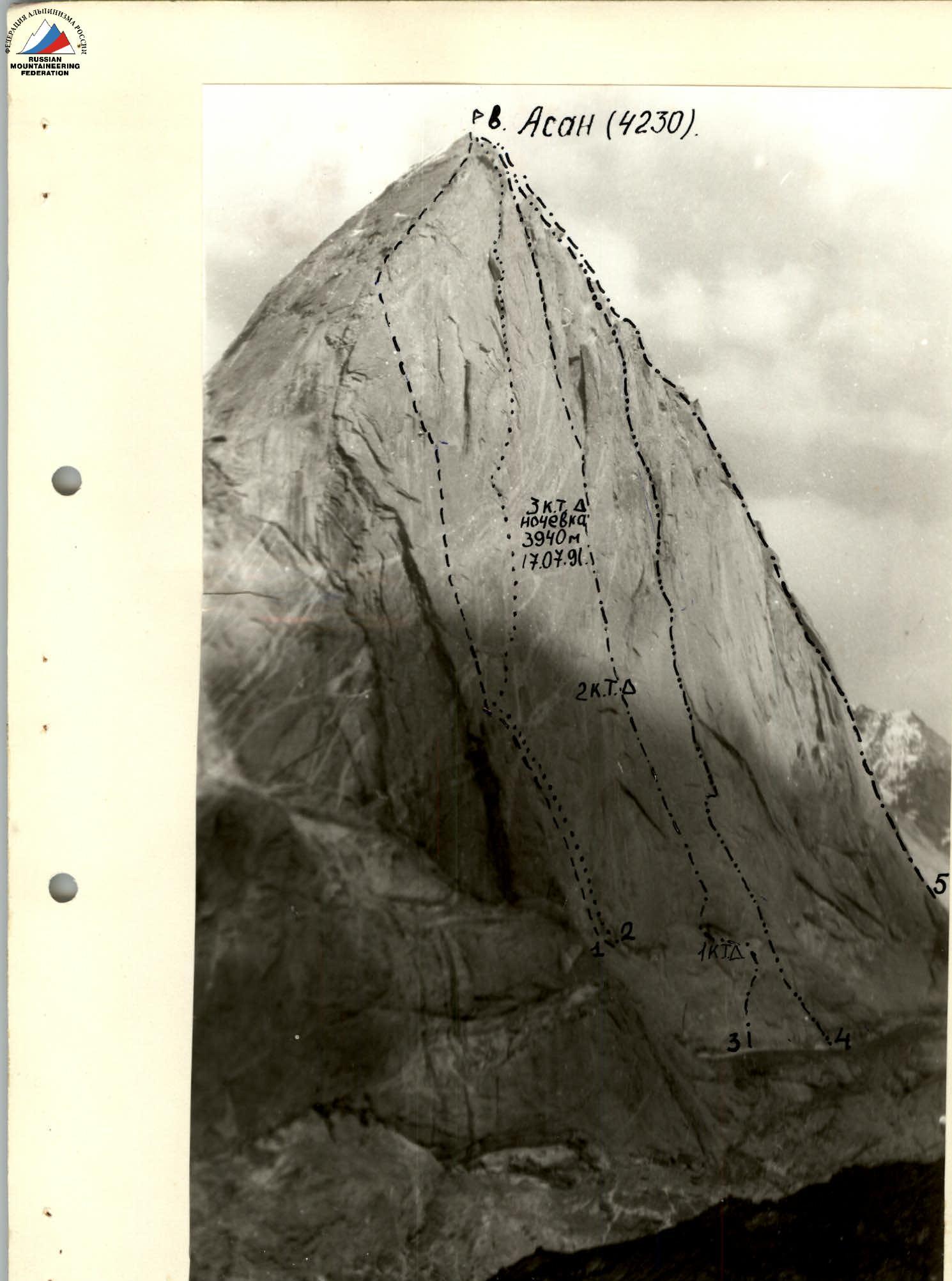
General photo of peak Asan. July 1991. All photographs taken with a Zenit-E camera, Helios-44-2 lens.
- Pogorelov's route;
- Gorbенко's route;
- Rusyayev's route;
- Timofeev's route;
- Alperini-Teveneni's route (0)
PROFILE of the wall from the left. The photo was taken from a helicopter.
Tactical Actions of the Team
When drawing up the tactical plan for the ascent, we were guided by:
- the time schedule of the participants in the USSR Championship who had already completed this route;
- our own experience of passing other routes of 6B category of difficulty on this wall;
- the terms of the Championship, which limited our choice of backup options.
Our plan allocated three days for the route, including a day for processing, which was precisely fulfilled. On July 18, 1991, at 18:00, the team reached the summit in full force.
In terms of physical fitness, the team composition is fairly even, which allowed each rope team to lead on the route. The first climber moved on a double rope, one of which was marked UIAA, and the second was later used as a belay. All other participants ascended on a fixed rope with two ascenders and additional (upper or lower) belay. Backpacks were attached to the harness and carried on themselves. Every day, the first climber wore rock shoes. For belaying and climbing, the team used the entire arsenal of modern mountaineering equipment:
- friends;
- sky-hooks;
- various types of nuts;
- removable bolt pitons;
- conventional rock pitons.
The team started moving along the route between 6:00–7:00 and finished no later than 20:00, ensuring a full rest overnight. Hot meals were provided in the morning and evening, and the entire team received high-calorie snacks for the whole day.
Throughout the ascent, stable radio communication was maintained with observers using the R-147 radio station. Part of the rescue team was under the route. The main rescue team was in the base camp, with which there was reliable communication.
Route diagram in UIAA symbols M 1:2000
| Rock Pitons hammered/remaining | Nuts, friends hammered/remaining | Bolt Pitons static/removable | Holes for ITO | Section No. | Length (m) | Steepness (deg) | Category of difficulty |
|---|---|---|---|---|---|---|---|
| 2/12 | 2/- | - | 2 | R1 | 40 | 85 | V |
| 22/2 | 34/4 | 6/- | 3 | R2 | 120 | 75 | VI |
| 16/- | 28/- | 6/- | - | R3 | 120 | 65 | V |
| 6/4 | 15/8 | 8/- | 14 | R4 | 100 | 70 | VI |
| 12/6 | 18/8 | 6/- | 8 | R5 | 90 | 75 | VI |
| 7/4 | 8/6 | - | 7 | R6 | 80 | 80 | VI |
| 18/10 | 32/15 | 11/9 | 16/10; 20 | R7 | 130 | 80 | VI |
| 37/25 | 24/15 | 6/2 | 10/10; 12 | R8 | 120 | 85 | VI |
| 28/20 | 25/5 | - | - | R9 | 90 | 90 | VI |
| 11/- | - | 20/- | - | R10 | 45 | 95 | VI |
| 18/10 | 34/25 | 10/5 | - | R11 | 130 | 90 | VI |
| 20/8 | 38/20 | 4/- | 8/5; 5 | R12 | 90 | 85–90 | VI |
| 8/4 | 10/10 | - | 4/4; 10 | R13 | 30 | 95 | VI |
| 10/- | 17/- | 1/- | - | R14 | 130 | 70 | V |
| 2/- | 2/- | - | - | R15 | 80 | 65 | IV |
| R16 | 250 | 55 | III/IV | ||||
| Total: | |||||||
| 204/93 | 297/106 | 34/22 | 56/34; 110 |
Travel hours: 113 hours. Length: 1640 m. The route continues along the ridge to peak Sitnik 5B category of difficulty, peak Rusyayev 6B category of difficulty.
Description of the Route by Sections
All internal corners mentioned in the description (except for two specifically noted) are slightly pronounced (palm-width) depressions on the wall.
Sections:
-
R0–R1: The route begins at the upper left edge of the avalanche cone. The highest point of the snowfield. Via a cleft, then through heavily dissected vertical terrain. Climbing grade 5.
-
R1–R2: Initially, up a vertical smooth slab (ITO, holes) into an internal corner (nuts, pitons). Climbing is complex, grade 6. At the end of the section, a passage between two cornices on friction without obvious holds.
-
R2–R3: The entire section is traversed by free climbing (grade 5) from one flake to another, slightly deviating to the right.
-
R3–R4: The route approaches the right part of a large cornice (bolts). It is passed on the right, closer to the end.
-
R4–R5: Further up through flakes between two cornices. Climbing is complex, grade 6. Through internal corners, alternating between climbing and ITO, deviating left, we reach a sloping narrow shelf. Can be sat upon. Control tour is hung in a recess. Overnight stay on a platform.
-
R5–R6: From the shelf at 45° to an internal corner. Climbing is very complex, then up to a passage between cornices. The left cornice is passed "head-on".
-
R6–R7: Complex climbing upwards. For belaying, removable bolts are used. 15 m from the cornice, traverse right to a small flake. From the flake, very complex climbing, alternating with ITO. Under the ceiling of a large cornice, a series of traverses along overhanging flakes and a smooth wall for 10 m. Overnight stay. The cornice is traversed where the ceiling turns into an overhanging wall (ITO, holes, removable bolts for 7 m). After the cornice, very complex climbing on a monolithic slab into a depression (station R20).
-
R7–R8: From station R20, up to a cornice "hollow" 10 m. Here is the upper point for a pendulum swing right, through a small cornice into a slightly pronounced internal corner. At its end — station R21. Further right along a smooth slab at 45° for 10 m (ITO) to the upper point of the pendulum (static bolt). Pendulum swing right for 8 m to the start of a large internal corner. Up this corner — complex climbing for 15 m (to station R22).
Second control tour in a recess. Overnight stay.
The internal corner is traversed by alternating ITO and complex climbing. The internal corner ends at the left edge of three rusty cornices.
Before reaching the cornice from station R23:
- traverse 4 m right to a flake (climbing) to the left cornice;
- under the cornice, traverse right for 6 m.
The section is traversed by complex climbing along an overhang. Belay on pitons, medium nuts, and friends.
The traverse ends at a vertical thin crack that connects the three lower cornices with the three upper ones (ITO), pitons.
At the upper cornice, R24 ends, station on nuts and pitons. The upper cornices are bypassed on the right by complex climbing and lead to a smooth vertical wall. Overnight stay.
-
R9–R10: Further, there are two options:
- through the thin crack using ITO;
- along the smooth wall on holes.
R26 ends on a narrow shelf the width of a palm.
-
R10–R11: Begins with complex climbing along an overhanging flake for 8 m. Then very complex climbing along a smooth slab with rare flakes, alternating with ITO.
-
R11–R12: R29 enters a large first short internal corner. The corner is smooth, no holds. After the short corner, along a cleft, traverse right and complex climbing to the start of a long giant corner. Overnight stay. The corner begins with a chimney with smooth opening walls. Climbing is very complex for 8 m (bolts and nuts). The second rope ends on a narrow shelf, two people can sit. Overnight stay.
-
R12–R13: From here, exit from the corner along its overhanging left wall onto a slightly pronounced "ridge". All ITO.
-
R14–R15: Two ropes along a slightly pronounced ridge to a sloping shelf where a tent can be set up.
-
R15–R16: Further along the ridge to the summit, about 300 m (Sitnik's route, 5B category of difficulty). There is little snow on the ridge this year, with some small walls encountered.