V. Fagitor, 3A, via the Southern Ridge (V. Babeshko route)
Climbing category: rock climbing. Climbing area: Pamir-Alay, Zeravshan Range, Fann Mountains. Peak, its height, and ascent route: Mt. Fagitor (3900 m), 3A, via the Southern Ridge. Difficulty category: 3A. Route characteristics: — elevation gain — 600 m.
Route Description
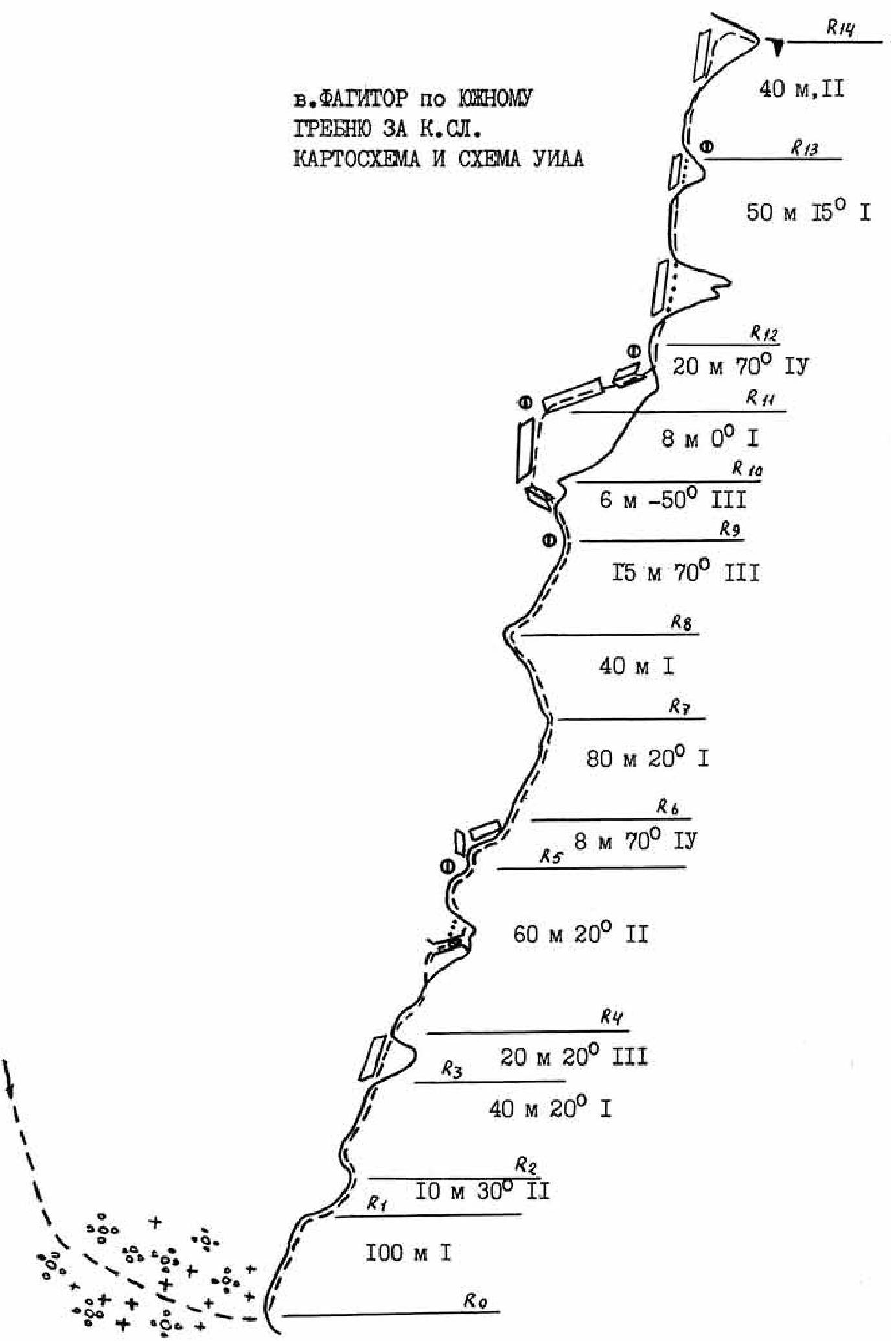
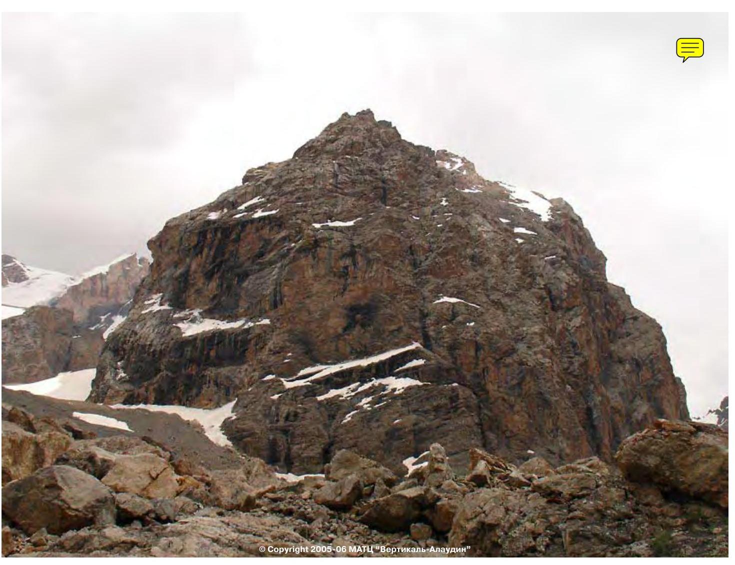
Ascent from Alaudin Lakes along the trail to the campsites near Mutnye Lakes — 3 hours. From the campsites, head left towards Mt. Fagitor, crossing a stream near a large boulder. Then ascend via scree and snowfields, gradually bearing left, to reach the saddle between Mt. Fagitor and Mt. Chinal. From the campsites, 1.5–2 hours. When ascending, avoid veering too far left onto broken rocks with loose stones. From the saddle, proceed left along the severely damaged ridge to the first pinnacle. Here, rope up and put on helmets. Overcome the pinnacle head-on (300 m, 10 m, 2–3) via broken rocks with loose stones, then reach the rocky ridge (20°, 40 m), along which move to the second pinnacle (simultaneously, protection through выступы). The second pinnacle is bypassed on the left via a scree ledge, exiting onto the ridge (20 m, protection). Continue along the ridge to a small pinnacle with a cleft and a plug, which is passed to the right and upwards under the plug, exiting onto the ridge. Move along the ridge simultaneously, protection through выступы, to a wall (8 m, 70°, 4). Here is a small ledge, a belay station. Overcome the wall cautiously — loose stones. Further, the ridge becomes gentler (80 m, 20°, simultaneously), and then transitions into a descent of 40 m to a steep ascent, which is overcome head-on (15 m, 70°, 3). At the end, there is a convenient belay station. Before the steep ascent of the ridge, there is a descent along an internal corner to the left and downwards (6 m, 50°, 3) onto a scree ledge with loose stones (protection), along which move 8–10 m to a sloping wall transitioning into a vaguely defined internal corner in its upper part (crux). The wall is overcome with piton protection (20 m, 70°, 4), loose stones, exiting onto the ridge under a large pinnacle with a forked summit, which is bypassed on the right via ledges with loose stones (protection through выступы), exiting onto the ridge. Along the ridge, movement is simultaneous, bypassing a small pre-summit pinnacle on the right, exiting onto the ridge. From here to the summit, 40 m, first descending along the ridge, then exiting onto a rocky ledge and ascending to the right and upwards via rocks to the summit. From the saddle, 2.5–3 hours. Descent is via the ascent route.
 © Copyright 2005–2006 MATC «Vertikal — Alaudin»
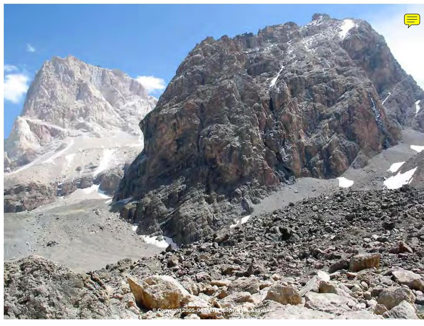 Mt. Fagitor via the Southern Ridge, 3A category. Cartographic diagram and UIAA scheme
2002 2003 2004 2005 2006 2007 2008 2009 2010 2011 2012 2013 2014 2015 2016 2017 2018 2019 2020 2021 2022 2023 2024
 © Copyright 2008–2008 MATC «Vertikal — Alaudin»