Description
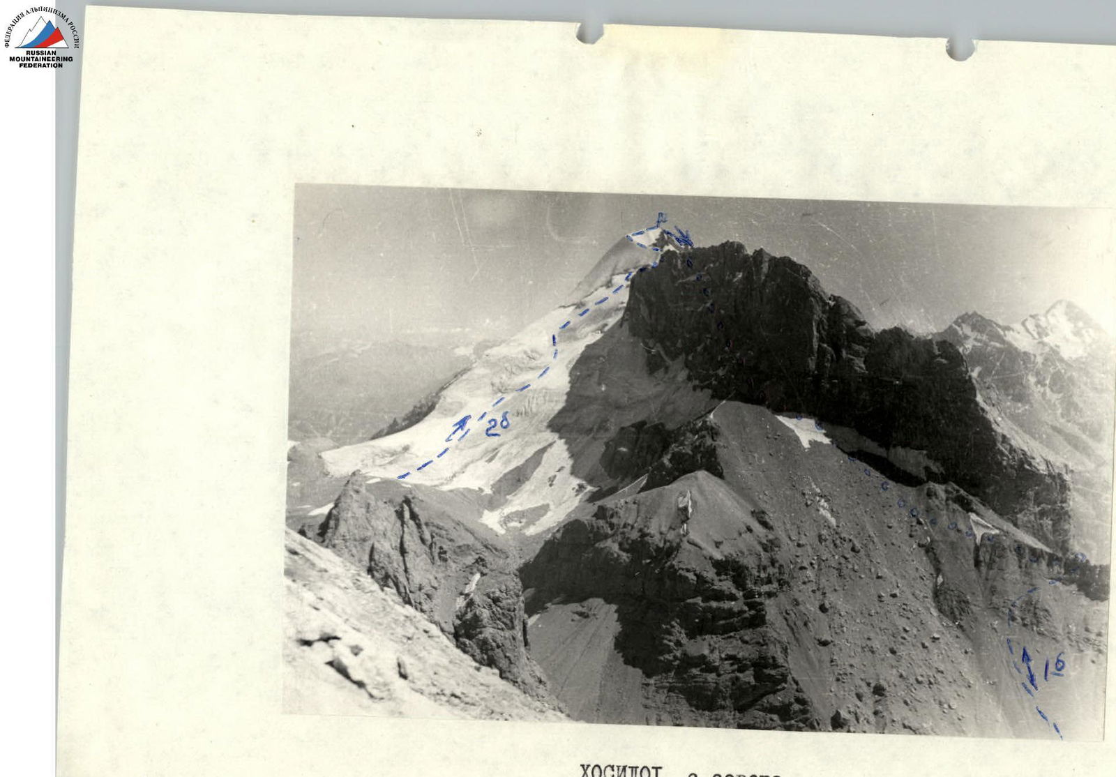
Ascent from the north to p. Khosilot 2B cat. sl. and descent along route 1B cat. sl.
I. Climbing Area.
p. Khosilot (4650 m) is located in the Yaghnob Wall area.
- To the north, from the summit to the Ledovyy col between the Eastern peak of the Yaghnob Wall and Khosilot, lies a glacier.
- To the northeast, a steep ice-rock ridge descends into the Yaghnob river valley.
- To the west, a rocky ridge stretches, ending in 200-meter sheer cliffs.
- The southern slopes of the peak are more eroded and drop down with sheer walls and wide ledges to a nameless col.
The peak itself is a horseshoe-shaped massif with five distinct summits, between which lies a plateau at approximately 4000 m with a small glaciation.
II. Ascent Description
From the Yaghnob river (from the bridge past the Anzob pass), it takes 4–4.5 hours to reach the upper part of the canyon beneath the Yaghnob Wall. From the campsite, the path goes up the river to the Ledovyy pass (1.5 hours) at a height of 4000 m. There's a cairn on the pass. From here, the path to the summit is clearly visible. The ascent goes up an ice slope with a gradient of 30° at the bottom to 40–45° at the top, leading to a rocky outcrop. Depending on the time of year, ice may be patchy, or by late July–August, it may be largely exposed. The ascent is made wearing crampons, occasionally with step-cutting and ice screw protection. Three crevasses are crossed. The last one, located just below the ridge, is the widest (3 m); its upper edge is significantly raised. It poses a serious obstacle if snow bridges collapse. The ascent to the ridge is via a rocky groove with a 50° gradient (1×50 m), using two pitons. From the ridge, there's a descent to the south (1×40 m) using a rappel, and then the route follows a broad, 1–1.5-meter wide, gently sloping (25–30°) ice ridge — 200 m, leading to the main summit. From the summit, the descent to the south along route 1B cat. sl. is clearly visible. Initially, there's a traverse to the saddle between the Main and South summits (100 m of easy rock), a descent via scree to the plateau, and then following a stream flowing south, on its right-hand side (downhill). The path goes through easy rocks, beneath the southeastern walls of the peak's western ridge. The movement is simultaneous, but caution is needed due to sections with ice and snow in spring and summer, and steep 100-meter rock drops to the left. The descent leads to the southern base of the peak. From here, it takes 30–35 minutes to ascend back to the ridge, from where there's an easy descent to the campsite. If the slope conditions are good, a descent via the ascent route is possible.
First ascent was made in June 1968 by a group consisting of:
| Tkachyov V.K. | CMS |
|---|---|
| Komarova R.I. | 1st sports cat. |
| Dzhurabekov T. | CMS |
| Suzdalv S.S. | 2nd sports cat. |
Equipment:
- ropes
- crampons (1–2 pairs)
- ice screws (2–3)
- rock pitons (2–3)
Time taken for the ascent from the pass to the summit is 5 hours, and descent to the campsite via route 1B cat. sl. takes 2 hours.