Protocol № 052.788
Climbing category — Visual. Climbing area — Ugizakov area. Peak, its height and ascent route — Ular, 3700 m, via the counterfort of the southern wall. Proposed difficulty category — 3B. Route characteristics: height difference — 400 m, average steepness — 30°, length of sections: 1. 110 m, 2. 230 m, 3. 140 m, 4. 30 m, 5. ... m, 6. ... m. Pitons hammered: for belay: rock — 20, ice — 0, bolt — 0. for creation of I.T.O.: regular — 5, segmental stoppers — 7. Number of travel hours — 5. Number of overnight stays and their characteristics — 1 overnight stay in the base camp.
Surname, name, patronymic of the leader and participants, their sports qualification:
- Repin Sergey Vladimirovich — 1st sports category
- Chilin Alexander Valentinovich — 1st sports category
- Kuzmina Margarita Vasilyevna — 2nd sports category
- Skachkov Anatoly Stepanovich — 1st sports category
- Lorenz Evgeny Olegovich — 1st sports category Team coach — Rizaev L.M. Date of departure and return — October 15, 1978.

| Date | Designation | Average steepness in degrees | Length in meters | Nature of terrain | Difficulty | Condition | Weather conditions | ROCK | ICE | BOLT |
|---|---|---|---|---|---|---|---|---|---|---|
| 15.10.78 | R0–R1 | 60° | 80 m | gully | 3 | dry rocks | good | 7 | – | – |
| R1–R2 | 60° | 70 m | gully, chimney | 4,3 | dry rocks | good | 9 | – | – | |
| R2–R3 | 50° | 100 m | couloir | 2 | dry rocks | good | 2 | – | – | |
| R3–R4 | 50° | 60 m | wall | 3,4 | dry rocks | good | 4 | – | – | |
| R4–R5 | 20° | 120 m | ridge | 2 | mixed terrain, rocks, snow | good | 2 | – | – | |
| R5–R6 | 20° | 100 m | ridge | 2,1 | mixed terrain, rocks, snow | good | 1 | – | – |
Brief description of the approach to the route
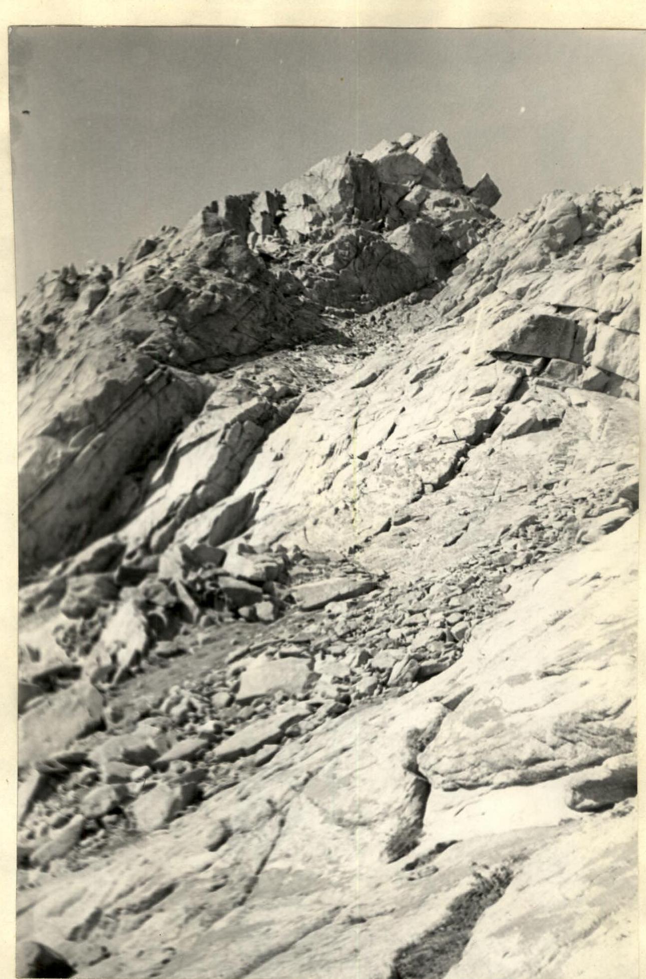
From the overnight stay at the entrance to the gorge leading to the "Vorobiny" pass, move up along the scree and grassy slopes. Before reaching the pass, turn right into a wide couloir leading to the saddle between the main massif of the "Ular" peak and the south-eastern ridge.
Up the couloir and left to a narrow saddle between a large rock pinnacle and the southern counterfort of the massif. The approach takes 2 hours 30 minutes.
Brief explanation of the table
The route can be started in two ways:
- via a 15-meter chimney with a plug. Rocks of moderate difficulty.
- left of the chimney, from a narrow saddle between the rock pinnacle and the southern counterfort, via a crack.
Rocks of moderate difficulty.
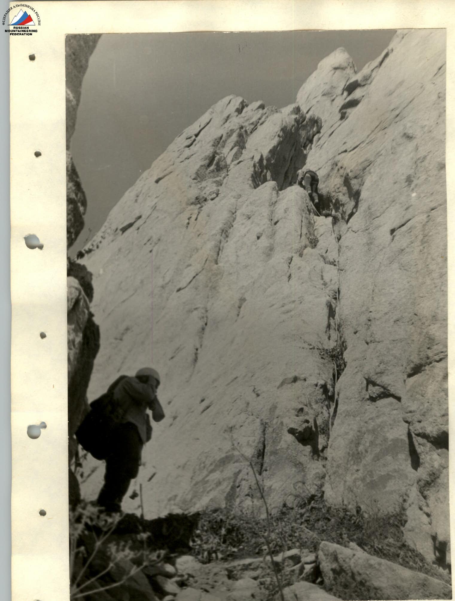
R0–R1. Up via the mentioned options for 40 m to small ledges. Then left along a wide gully to a large, sloping, grassy ledge (in spring - snow). Control cairn.
R1–R2. From the ledge upwards, left of the sloping slab, via a vaguely defined gully turning into a chimney, 10 m of difficult climbing. The upper part of the gully, which is a plug, slightly overhangs.
Up the narrow chimney to a short, broken ridge, keeping to the right side, to a narrow ledge. 70 m.
R2–R3. Then down a bit, via easy rocks, to a sloping slab with wide cracks. Up the slab for 7-8 m and down into a wide couloir. Up the left side of the couloir and then 20 m up via a crack formed by the sloping slab and the left wall of the couloir — rocks of moderate difficulty — to a wide, scree-covered ledge.
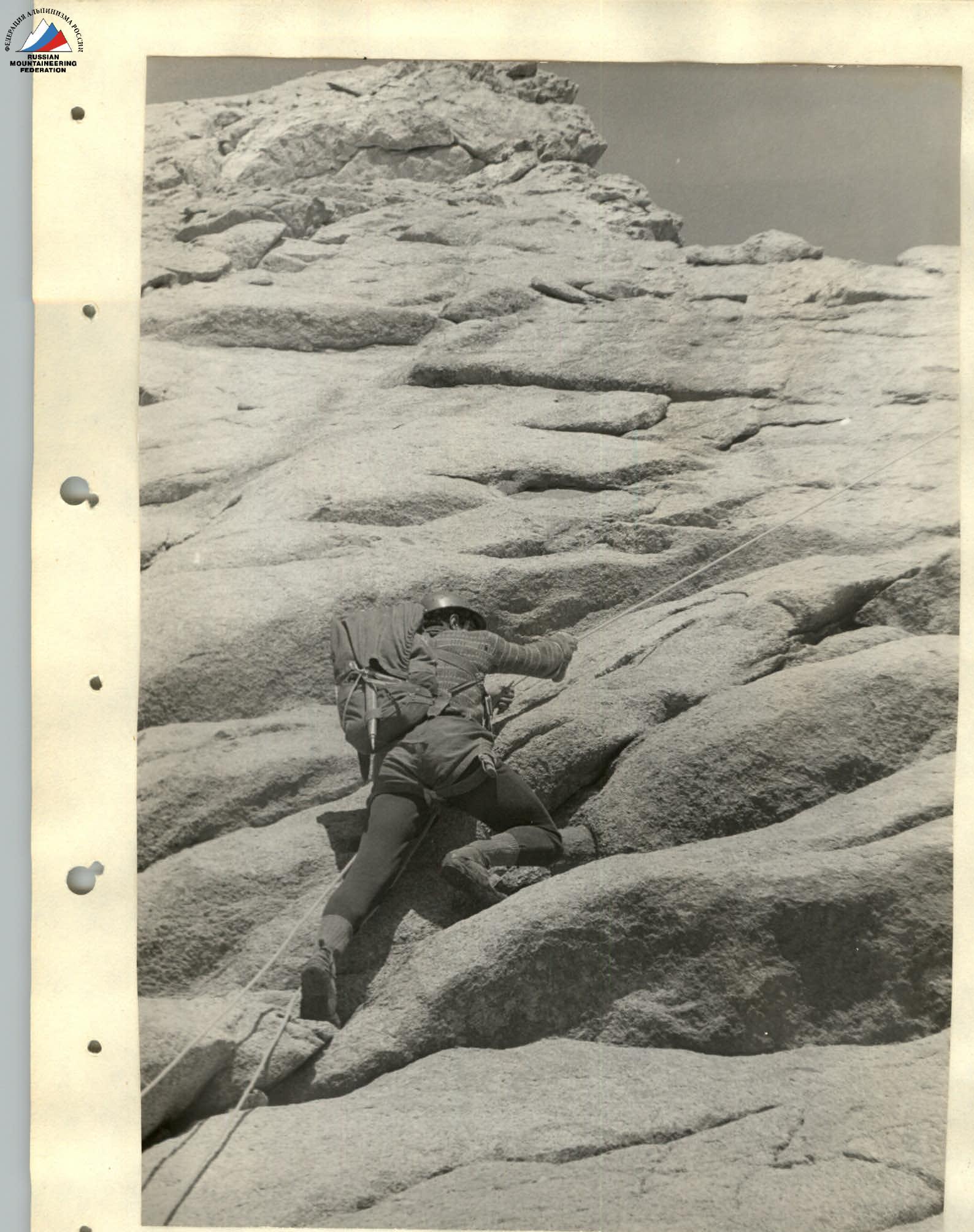
R3–R4. From the ledge, up and to the right in the direction of the lowering between two monolithic "gendarmeries" via a 30-meter wall. Rocks are heavily smoothed, climbing is complicated due to the small number of cracks for piton placement. Exit onto the saddle.
R4–R5. Then left, bypassing the "gendarmerie", descend 3 m into the couloir and exit onto a narrow ridge leading to the summit. Along the ridge for 40 m to the "finger". To the right of the "finger", descend 5 m into the gap "sportingly". Then along the ridge for 80 m of easy rocks and descend 15 m down a sheer wall.
R5–R6. Reach the summit via 100 m of easy rocks.
Descent from the summit via the couloir to the glacier – 1B category of difficulty.
The ascent takes 8-10 hours.
R0–R1. 2nd variant of the route start — via the crack.

R1–R2. Via the gully turning into a chimney.
R3–R4. 30-meter wall, rocks heavily smoothed.
R5–R6. Summit ridge, summit.