ASCENT DOCUMENT
- Ascent class — Rock climbing
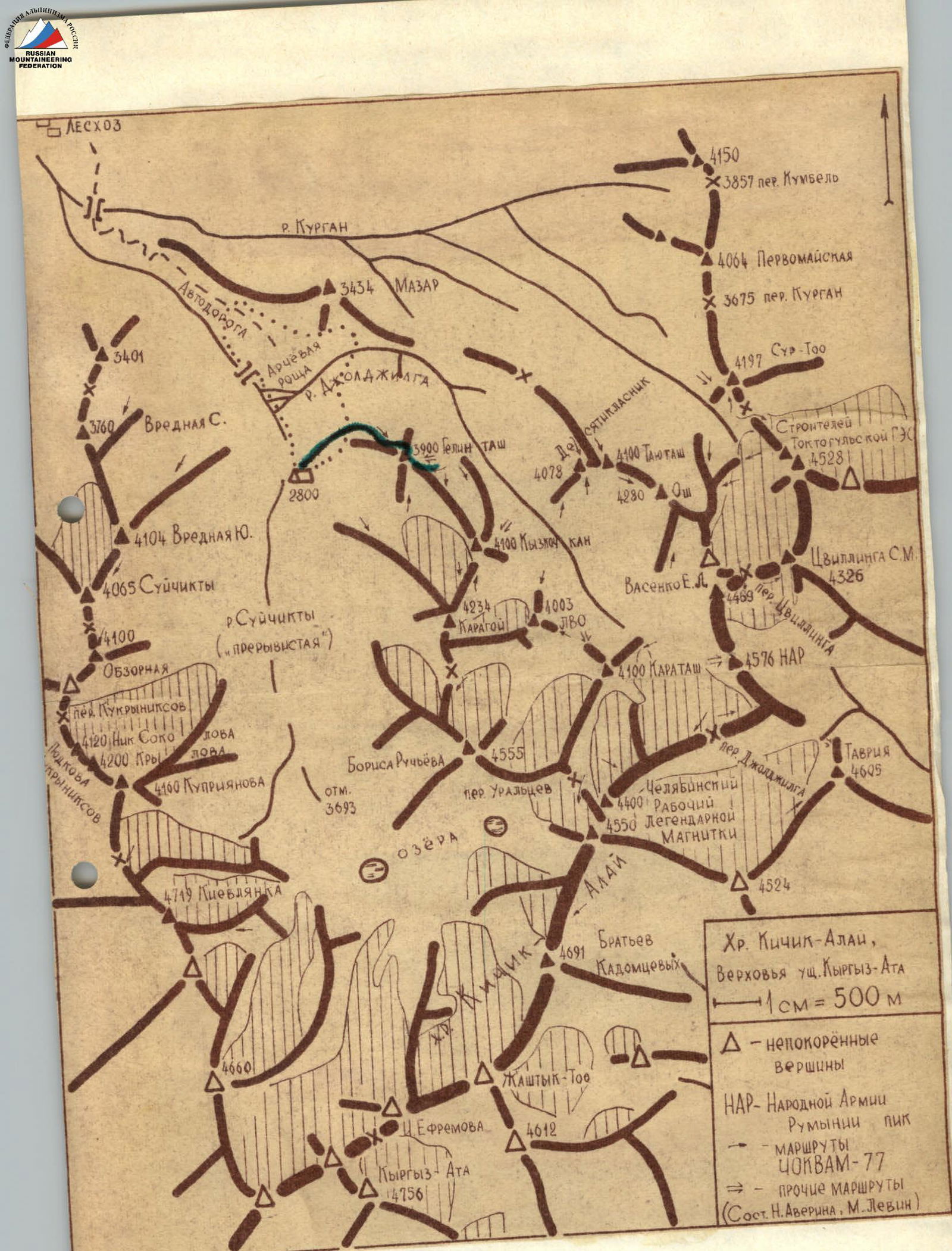
- Ascent area, Pamir-Alay range, Kikik-Alai ridge
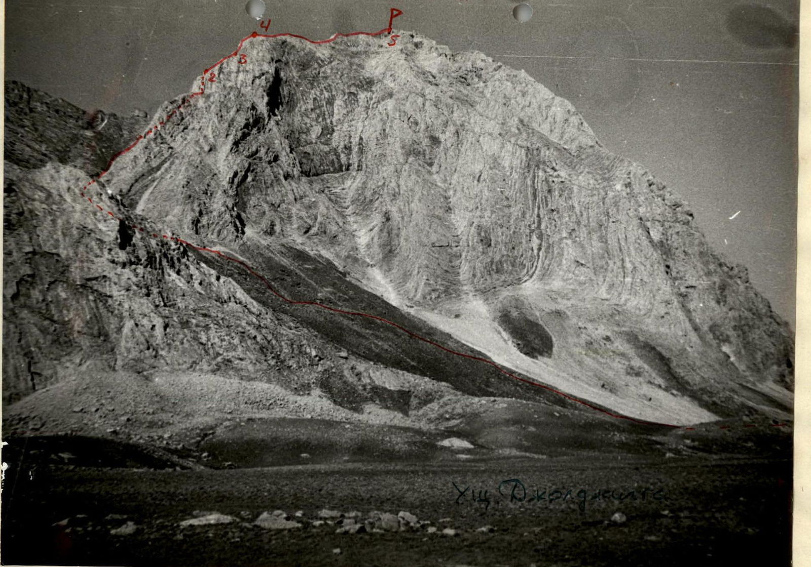
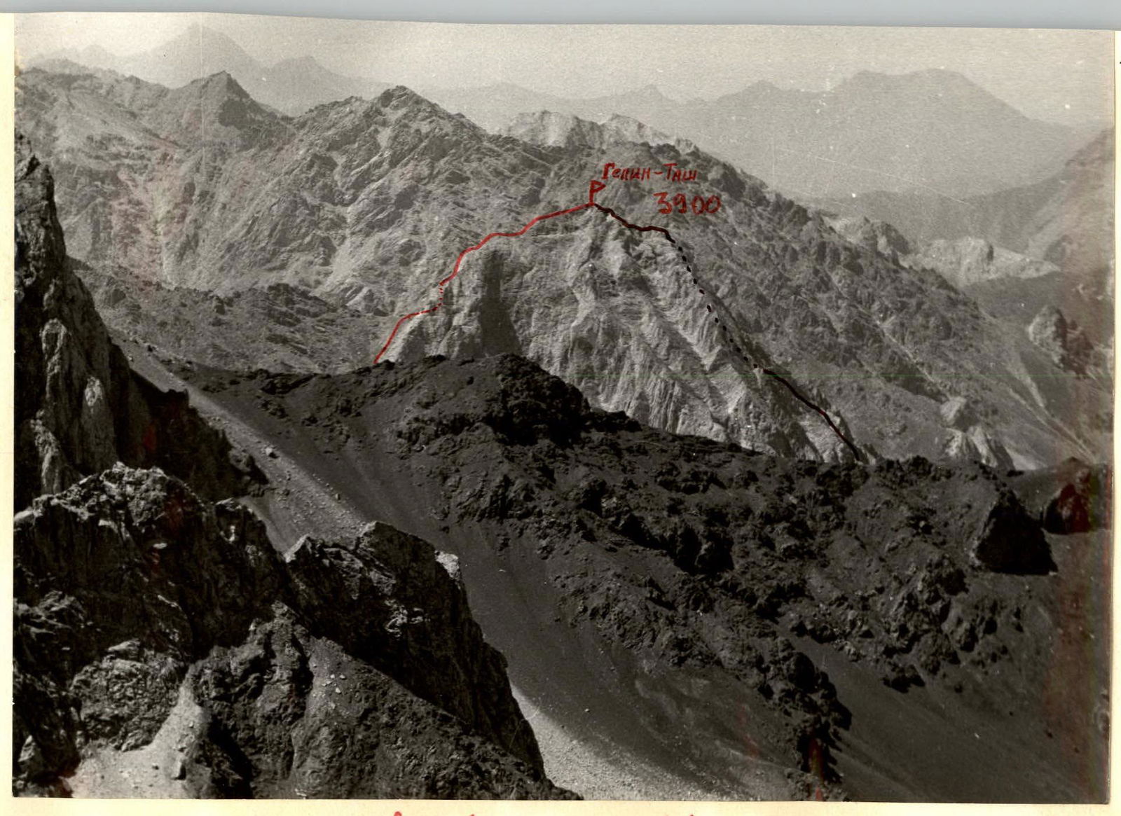
- Peak — Gelin-Tash Height — 3900 m Ascent route — via the southern ridge
- Proposed difficulty category — 2–6
- Route characteristics: Height difference — 650 m Length of sections with 5–6 difficulty category Average steepness — 400 m
- Pitons driven: For belaying: Rock — 10 Ice — — Bolts — — For creating artificial anchors — —
- Total climbing time — 2 hours 30 minutes
- Number of overnight stays and their characteristics —
- Full name of the leader, participants, and their qualifications:
- Andreev N.F. — 1st sports category
- Vidyakin V.A. — 1st sports category
- Team coach — Master of Sports Pevin N.S.
- Date of departure and return — August 22, 1977
 www.alpfederation.ru↗
Date, time, designation, average length, terrain characteristics, difficulty, condition, weather conditions, belaying, passage
www.alpfederation.ru↗
Date, time, designation, average length, terrain characteristics, difficulty, condition, weather conditions, belaying, passage
August 22, 1977 — approach to the start of the scree couloir from the "2800" base camp in the Suychikty gorge — 1.5 hours.
9:00–9:40 R0–R1 35° 600 m. Couloir. Difficulty category: 1. Rocky outcrops among medium and small scree. Self-belaying with an ice axe while moving. Simultaneously, in close formation.
9:40–10:10 R1–R2 70° 20 m. Wall with a chimney. Difficulty category: III. Unstable rocks. (Four rock pitons). Free climbing — with a rope, carefully.
10:10–10:20 R2–R3 30° 80 m. Rocky ridge. Difficulty category: I–II.
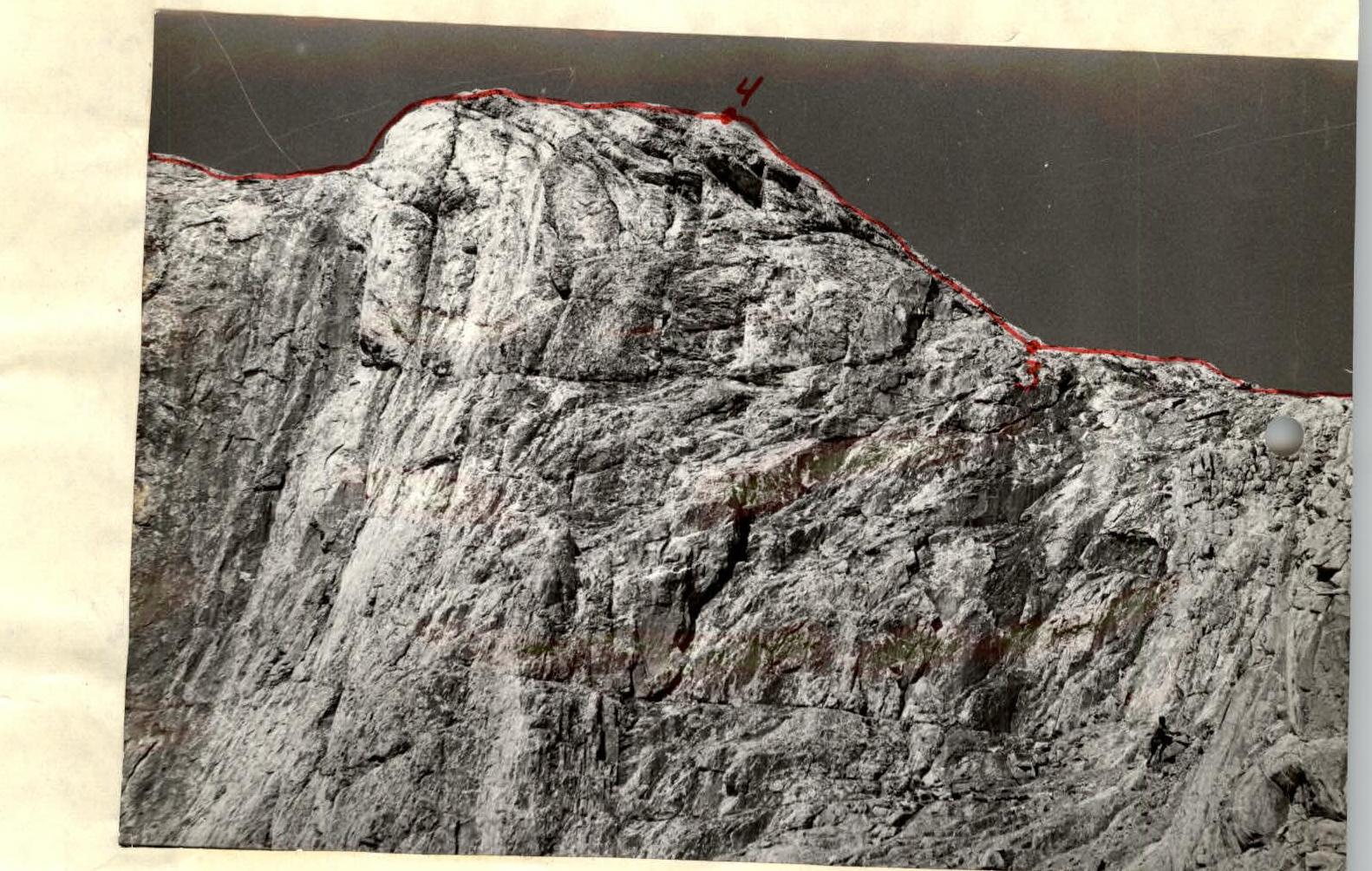
10:20–11:00 R3–R4 50° 40 m. Rocky wall. Difficulty category: III–IV. Sloping wall with small holds and few reliable cracks. No good standing or belay points. Climbing simultaneously, free climbing. Six rock pitons — alternately. Rope not shorter than 40 m!
11:00–11:20 R4–R5 20° 250 m. Rocky ridge. Difficulty category: I–II. Unstable rocks. Many loose stones. Precipices on both sides. Simultaneously, free climbing over undulations, carefully.
Descent via the ascent route (2 rappels with rope retrieval) — 1 hour 12 minutes.
Approach: from the Kuragan river, along the right (or.) bank of the Suychikty river to its confluence with the Joljylga river from the east. Up the Joljylga river, bypassing the northern and eastern walls of Gelin-Tash. The start of the route is visible behind them — no more than 2 hours 30 minutes from the Kuragan river with a load.
Classification proposals: Considering that the first ascent was made: a) by two climbers; b) each having a 1st sports category in rock climbing; c) and in perfect weather on completely dry rocks, we find it difficult to precisely determine the difficulty category: too short for "3A", too technically saturated for "2B" compared to Amangel'dy 2B, 1 Zapadnaya Shkhelda 2B, MNR Yuzhnaya 2B. But since badge holders are rare in this area, and the route is an excellent training before a complex rocky traverse, we request to include the route we climbed in the CTMRV USSR as:
Gelin-Tash 4000 m, 2B, rock, via the southern ridge.