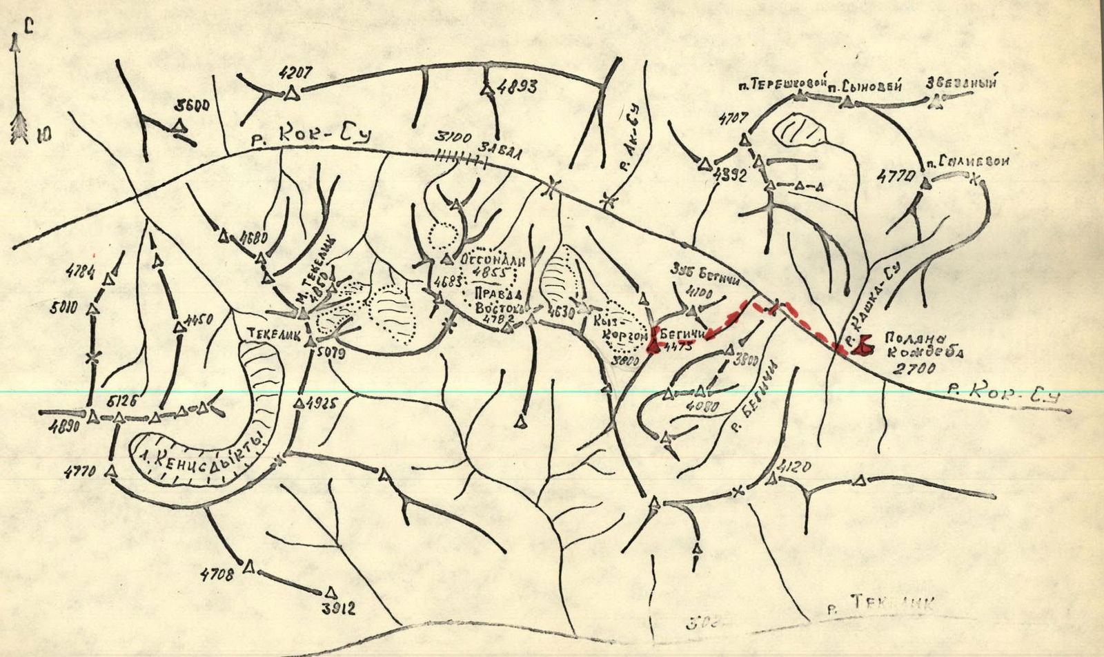
Route Description
Climbing Mt. Begich (4473 m) via the Eastern Ridge, category 2B difficulty (tentative).
From the base camp at Kozhdeba meadow:
- Up the Kок-Су valley along a dirt road to the bridge
- Then across the bridge and along a trail on the right (orographically) bank of the Kок-Су river to the first left tributary
- Up the tributary, staying on its right side
- Then along a grassy ridge to the wall of the eastern ridge of the peak
From the base camp — 3–4 hours.
Further, 40 meters up the inner corner of the wall, then 40 meters up and to the right onto the eastern ridge. Protection is via pitons.
After crossing the ridge, the movement continues along a wide snow depression to a narrow snow couloir and then an ascent to the pre-summit shoulder of the eastern ridge.
Here is a control cairn.
From the start of the route — 2 hours 0 minutes.
From the control cairn, straight up to the 1st snow pitch (160 m, slope 30–35°) and then to the “sheep’s foreheads”. Along the “sheep’s foreheads”, on their left side, to the 2nd snow pitch (1st rope). Along the 2nd snow pitch for 20 m, slope — 40° to a small rock ledge. From the ledge along the 3rd snow pitch (120 m, slope 30–35°) — exit onto the pre-summit ridge. Along the ridge — exit to the summit. From the control cairn — 3 hours 0 minutes.
Descent follows the ascent route. In the lower part of the inner corner, a rope is hung for a “sporting” descent (30 m).
| Date | Notation | Average slope, ° | Length | Terrain characteristics | Difficulty | Distance | Weather conditions | ic | glac | tal |
|---|---|---|---|---|---|---|---|---|---|---|
| June 29, 1978 | R0–R1 | 60° | 80 | Wall, inner corner | III | Weakly broken rocks | 4 | - | - | - |
| R1–R2 | 25° | 280 | Snow slope, depression | 1 | Dense snow | - | - | - | - | |
| R2–R3 | 35° | 160 | Wide snow slope | II | —"— | - | - | - | - | |
| R3–R4 | 30° | 40 | “Sheep’s foreheads” | II | Monolithic | - | 2 | - | - | |
| R4–R5 | 40° | 120 | Snow slope | III | Dense snow | —"— | - | - | - | |
| R5–R6 | 40° | 120 | Wide snow slope. Couloir. | III | —"— | —"— | - | - | - | |
| R6–R7 | 30° | 160 | Ridge, easy rocks | II | Broken rocks | —"— | - | - | - |
Map of the Kор-Су area