
ASCENT REPORT
-
Ascent category — technical
-
Ascent area — Pamir-Alai, Kollektor Range, spur of the Alai Range.
-
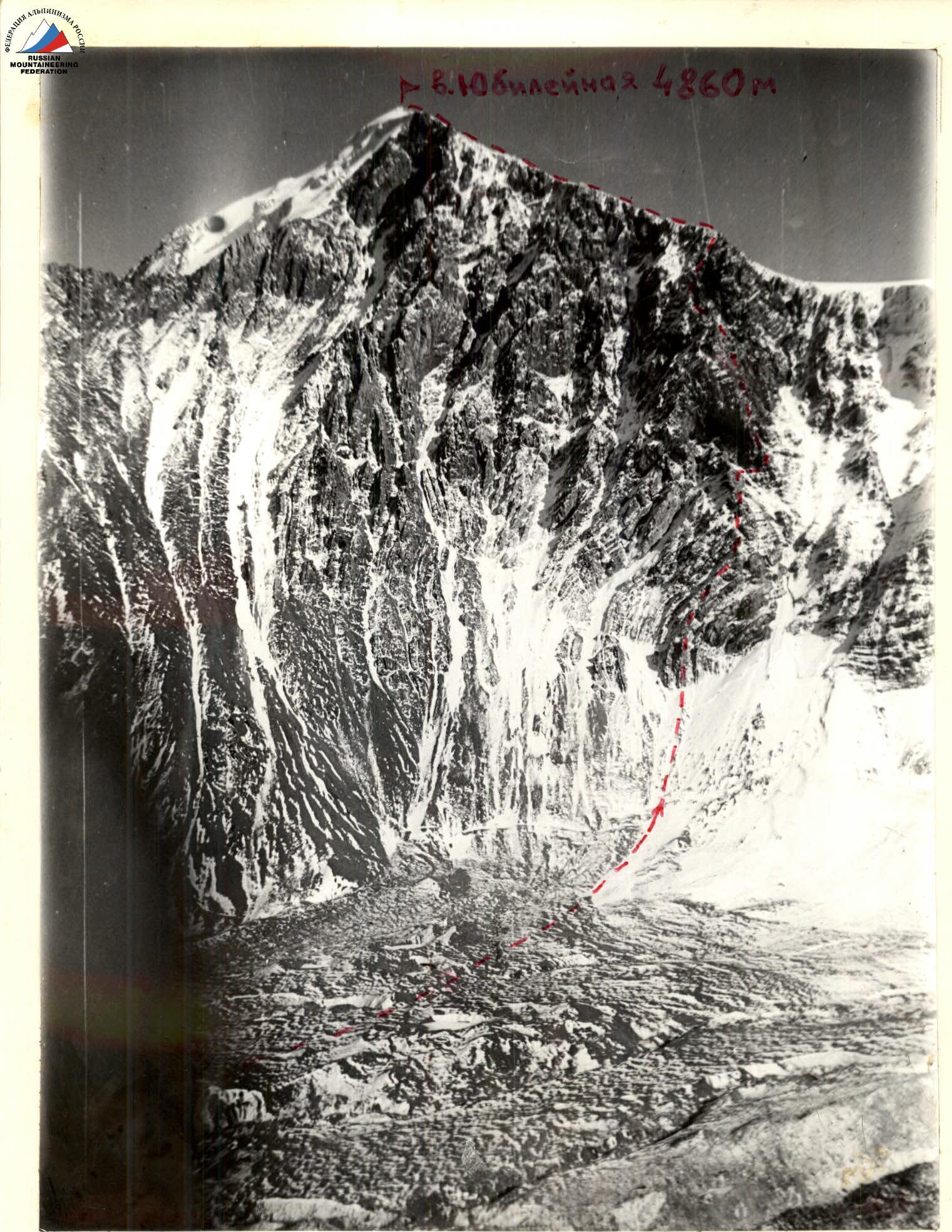
Summit — Yubileynaya, 4860 m, right buttress of the S–3 wall, rocky.
-
Proposed difficulty category — 4A
-
Route characteristics:
elevation gain — 1200 m average steepness — 45° length of sections with 5th cat. diff. — 60 m
-
Pitons driven:
Rock Nuts 35 12 0 0 -
Total climbing time — 11.5 hours
-
Number of nights on the route — none
-
Ascent participants:
- Plitus B.B. — 1st sports category — leader
- Ilyashenko P.I. — 1st sports category — member
- Shestakov N.V. — 1st sports category — «»
- Oleinik E.N. — 1st sports category — «»
- Klimov A.I. — 1st sports category — «»
- Ignatenko B.V. — 2nd sports category — «»
-
Team coach — Ilyashenko P.I., 2nd category instructor.
-
Date of departure on the route — August 2, 1986 Return — August 2, 1986
-
Organization: branch of AUSB "Dugoba".
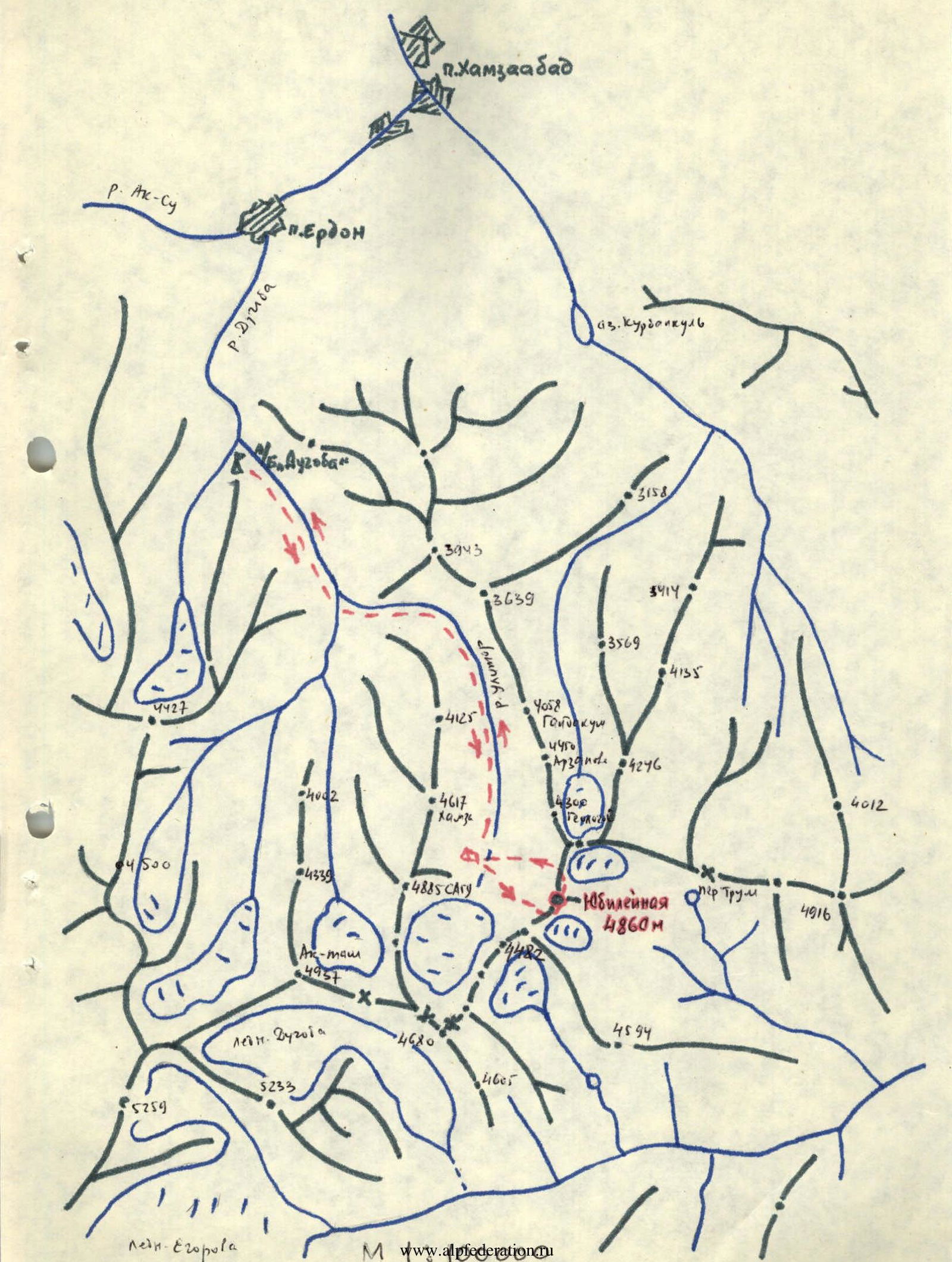
Brief description of the approach to the route
From the "Dugoba" alpine base, follow the left orographic side of the Dugoba River until the turn into the Ulitor gorge (where the rivers merge) — 2 hours. Cross the bridge and move along the Ulitor gorge on the left orographic side of the Ulitor River to the Edelweiss meadow — 1 hour, then continue up the gorge past the Rakdakush and Geologov peaks to the large, final moraine of the Ulitor glacier, which closes the entire gorge. The Yubileynaya peak is located to the left of the moraine — 3 hours walk. Overnight stay on the moraine opposite the peak.
The entire approach from the "Dugoba" alpine base takes 6 hours.
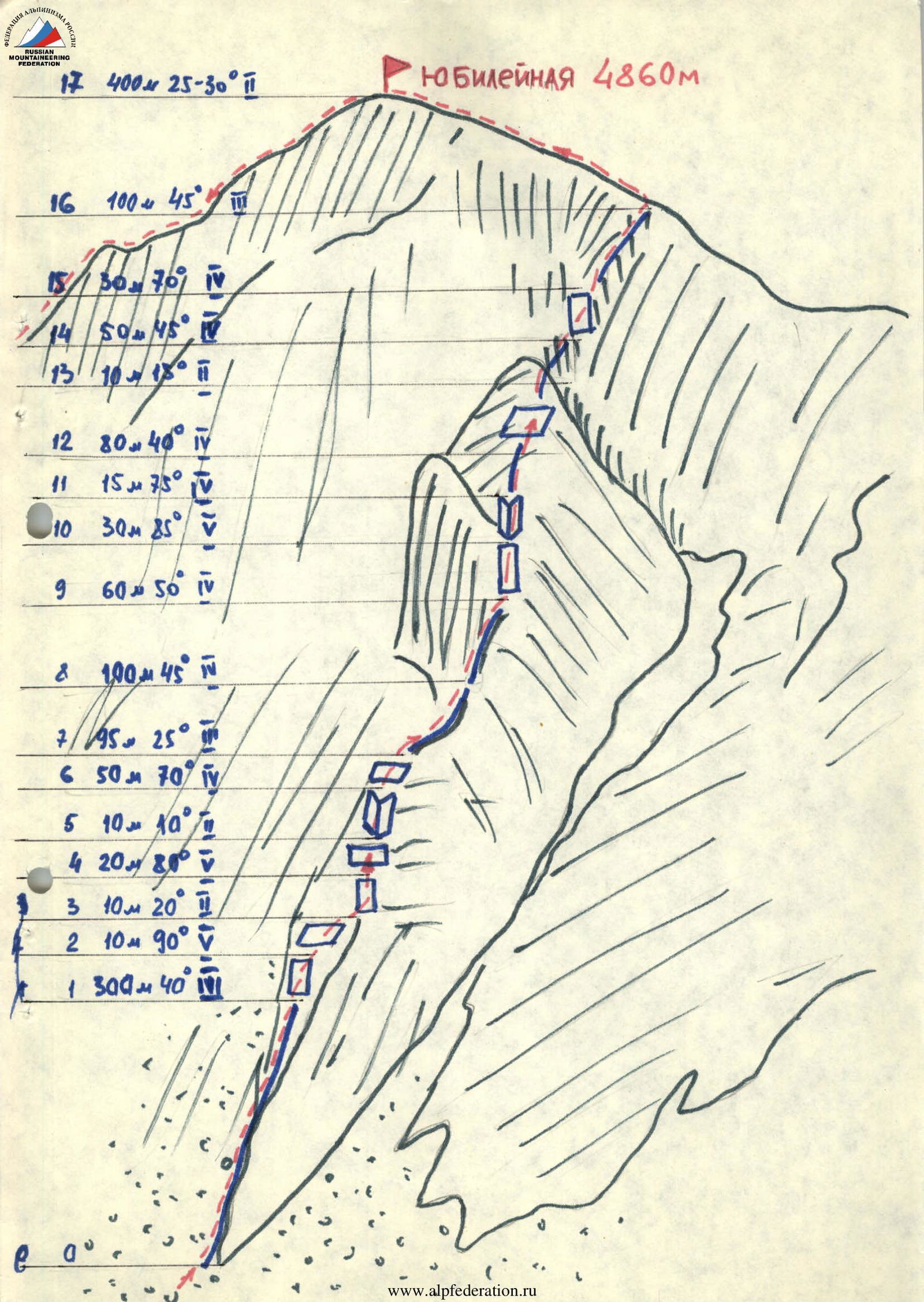
Brief explanation of the route diagram in UIAA symbols
| Section # | Length, m | Steepness, ° | Terrain characteristics | Climbing technique | Piton usage |
|---|---|---|---|---|---|
| R17 | 400 m | 25–30 | Snow ridge, 2nd cat. diff. | Simultaneously | |
| R16 | 100 m | 45 | Destroyed ridge, 3rd cat. diff. | Simultaneously | Protrusions |
| R15 | 30 m | 70 | Wall, destroyed, 4th cat. diff. | Alternately | 1 rock, 3 nuts |
| R14 | 50 m | 45 | Ridge, partially destroyed, 3rd cat. diff. | Alternately | 2 rock |
| R13 | 10 m | 15 | Ledge | ||
| R12 | 80 m | 40 | Ridge, 4th cat. diff. | Alternately | 4 rock, 3 nuts |
| R11 | 15 m | 75 | Inner corner, 4th cat. diff. | Alternately | 3 rock |
| R10 | 30 m | 85 | Wall, 5th cat. diff. | Alternately | 7 rock |
| R9 | 60 m | 50 | Ridge, partially destroyed, 4th cat. diff. | Alternately | 1 rock, 4 nuts |
| R8 | 100 m | 45 | Destroyed ridge, 4th cat. diff. | Alternately | 3 rock, 2 nuts |
| R7 | 95 m | 25 | Slabs, 3rd cat. diff. | Simultaneously | |
| R6 | 50 m | 70 | Inner corner, 4th cat. diff. | Alternately | 6 rock |
| R5 | 10 m | 10 | Ledge | ||
| R4 | 20 m | 80 | Wall, 5th cat. diff. | Alternately | 4 rock |
| R3 | 10 m | 20 | Ledge | ||
| R2 | 10 m | 90 | Wall, 5th cat. diff. | Alternately | 4 rock |
| R1 | 300 m | 40 | Destroyed edge, 4th cat. diff. | Alternately | Protrusions |

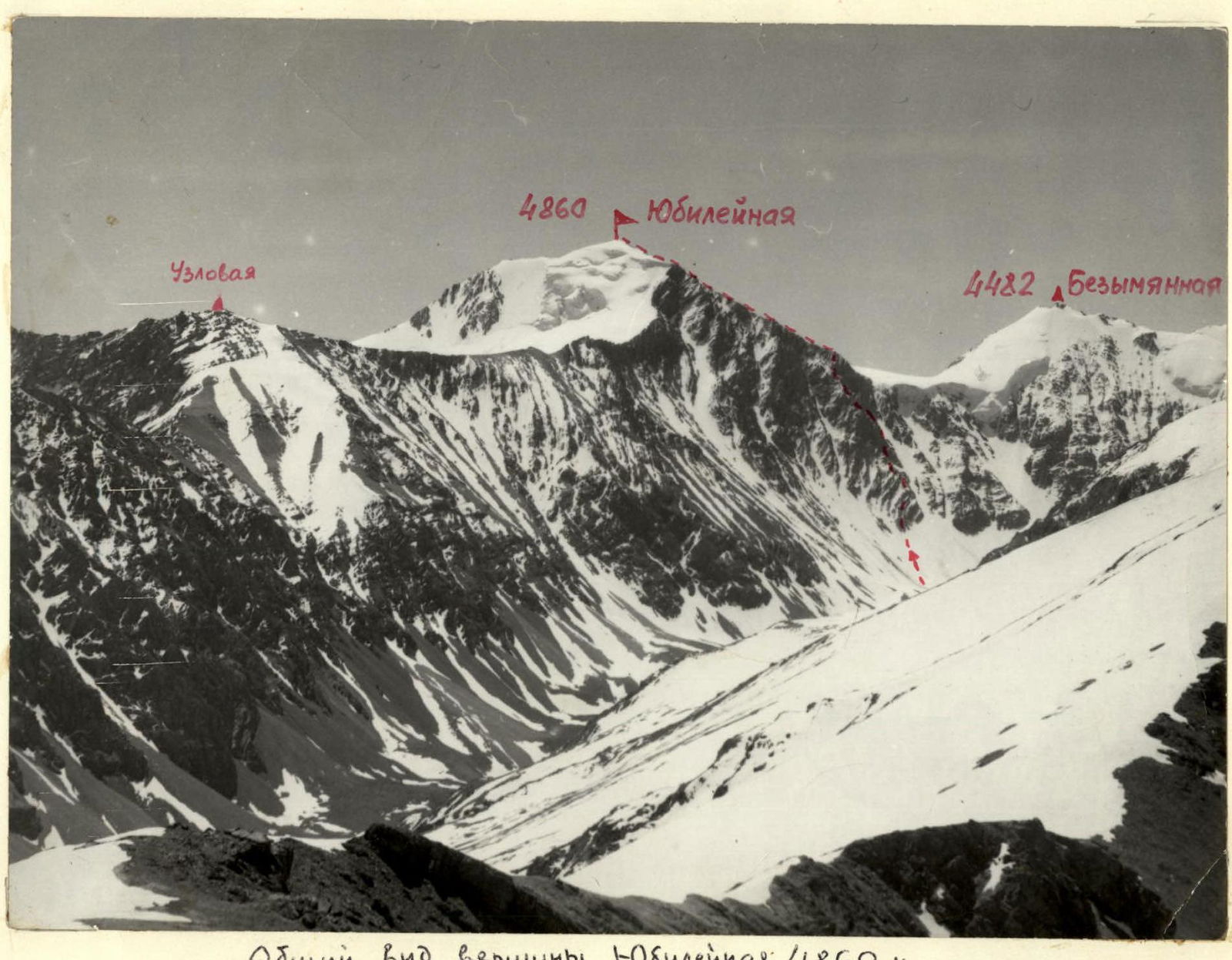
General view of Yubileynaya peak 4860 m Map of the ascent area
Comments
Sign in to leave a comment