7.16.9. Category of complexity 3A
Description of the ascent route to the peak "4505 m" (named after V. Shipilov) via the north-eastern ridge
From the base camp on the green meadow, after crossing the Sary-Kainou River, you need to move along the left lateral moraine of the Zapadny Bayankol glacier in a westerly direction. Having reached a small stream, you need to turn right and continue moving up this stream until you reach the ridge. At this point, you can set up a temporary camp. The next morning at 5:00, we head out onto the glacier, moving in a northwesterly direction towards the visible northeastern ridge of the "4505 m" peak. We cross the glacier in teams, as it is cut by numerous crevasses. Reaching the end of the northeastern ridge along the average talus and rocks, we come out onto it and begin complex climbing. The first obstacle is the "zero" gendarme, marked with a cross in image No. I, which is bypassed through the snow on the right side and then about 200 m of the ridge (up to the first "gendarme") - medium rocks and occasional snow. Descent from the first gendarme 55–60 m along difficult rocks to a saddle, behind which "gendarme" No. 2 and No. 3 stand in the way (see photo No. 8), they are more correctly called "needles" due to their pointedness and small height. The height of each "needle" is about 20 m, and they are overcome by difficult climbing, using 4 rock pitons for their passage.
Descent from the second "needle" into a dip (30 m) along difficult rocks with ascent to the shoulder of the fourth "gendarme" along a 15-meter wall (2 pitons), the steepness of which and all other rock walls is clearly visible in images No. 8 and No. 9 attached to the description. From the shoulder, we go up another 25 m along the wall (3 pitons) and then traverse along medium rocks to the dip between the "horns" of the fourth "gendarme".
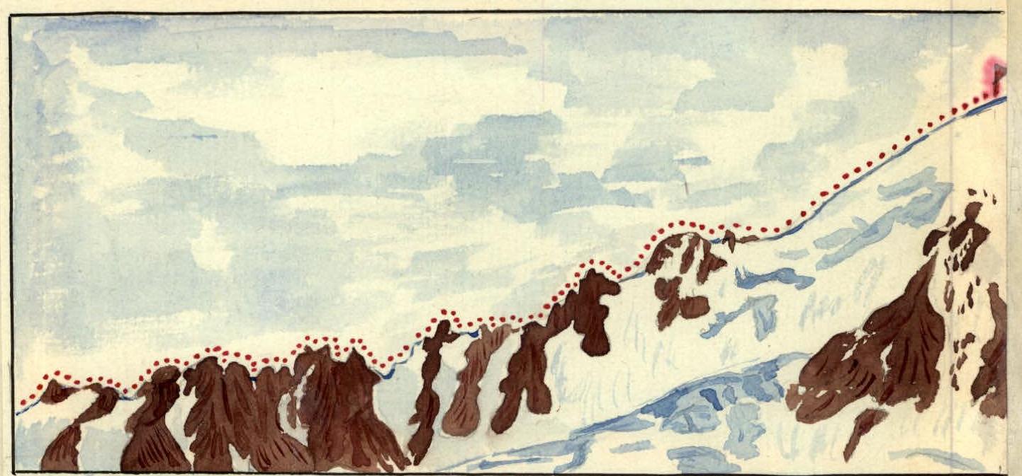
Profile of the northeastern ridge of the peak "4505 m" (V. Shipilov). View from the wall of the peak "4710".
The exit from the dip for the length of one rope is made along two crevices 8 and 10 m and an inclined ledge, where it is impossible to hammer in a single piton along the entire length. Further, there is a 10-meter ascent to the second "horn" of the gendarme along difficult rocks and descent to the base of the fifth "gendarme" along medium-difficulty rocks. The passage of the fifth "gendarme" "head-on" is of exceptional complexity (see photos No. 8 and No. 9, number 5).
Its 25-meter sheer wall requires high climbing technique. 6 rock pitons are hammered in here for insurance. Descent from the "gendarme" onto the snowy saddle is 2 x 20 m by the method of "sitting on the rope". Having descended onto the snow a few saddles, we begin the ascent with insurance through an ice axe along a snowy slope, the steepness of which is about 45° and the length is 60 m. Further, for about 250 m - climbing along medium, sometimes difficult rocks, in the form of short walls, along a heavily jagged ridge. Having reached the finger (see photo No. 9), we approach a 100-meter wall, one section of which is visible in image No. 13.
When passing this wall, about 12 pitons are hammered in, the ascent is made along a chimney, sometimes turning into a wide crevice. Descent onto the snowy ridge along a short 20-meter wall by simple climbing with top insurance. The snowy 40° ridge leads to the base of another wall. Traversing to the left along the snowy slope, we approach a 25-meter internal corner, having ascended which and hammering in three pitons, we come out onto a small ledge where three people can stand. Further ascent along the chimney up the length of the rope with exit under the plug. On this entire section and the 100-meter wall, a total of about 16 pitons are hammered in. After exiting again onto the ridge, we move along medium, sometimes difficult rocks, using ledges for insurance. In photo No. 14, the last "tooth" of the rocky ridge is visible, which Anatoly Borzut bypasses with subsequent exit onto the snow. The first sections of the pre-summit snowy field are quite gentle and do not present particular difficulties in passage. On the contrary, the subsequent 400 m of slope (see photo No. 10) finally exhausted the already fairly tired climbers. The depth hoar formed between the ice base and the upper snow crust, which could not withstand the weight of the climber, made the slope almost impassable, constantly slipping underfoot. We were witnesses to a most interesting spectacle when a "person was slipping". It was necessary to overcome the slope by climbing onto each other's shoulders. And so, at 19:52, a group of climbers from the Kazakh Republican Climbing Club consisting of 5 people reached the summit: Mansurov Babir - leader, Boris Krasilnikov, Anatoly Borzut, Vladimir Gonyalin, and Boris Kuklichev - participants. The descent from the peak "4505 m" is made along the southern ridge - along medium rocks to the saddle, from which they moved to the glacier and then to the intermediate camp, which they reached at 21:30. Early the next morning, we return to the base camp. The ascent to the peak "4505 m" (named after V. Shipilov) with exit from the intermediate camp on the ridge and return to it took 16 hours 30 minutes and is assessed by the group as a route of category 4B complexity. The ascent from the base camp took less than 3 full days, since the path from the base camp to the camp on the ridge takes about 5 hours of walking. August 25, 1957. Description compiled by B. Mansurov.