Ascent Passport
- Ascent class — rock climbing
- Ascent area — Tian Shan, Chatkal Ridge
- Peak, its area, and ascent route. Bolshoy Chimgan, 3277 m, via the Western counterfort of the Northern ridge
- Route characteristics: elevation gain — 1700 m, average steepness — 30°, length of sections: R1–50 m, R2–60 m, R3–80 m, R4–60 m, R5–200 m, R6–50 m, R7–2.5 m, R8–40 m, R9–400 m.
- Proposed difficulty category — 2B category of difficulty
- Number of pitons used: for belaying, for creating belay stations: rock — 5, ice — 0, bolt — 0.
- Number of travel hours — 10 hours
- Number of nights and their characteristics — one-day ascent
- Full name of the leader and participants, their sports qualification:
- Kuzaeva O.B. — leader
- Korovkin O.A. — CMS (Candidate for Master of Sports)
- Kiyatkin A.A.
- Mirkarimov A.M.
- Khudoteplov A.I.
- and others
- Team coaches: Nodova I.A. and Celo Vozki V.V.
- Date of departure and return: May 6, 1978
Route Description
Ascent to peak Bolshoy Chimgan (3277 m) via the Western counterfort of the Northern ridge, 2B category of difficulty (approximate).
From the base camp located at the foot of the Northern counterfort of the Western ridge of peak Bolshoy Chimgan, the path goes through the Aksay gorge to a triangular rock wall dividing the gorge into right and left parts. Further movement is along the left (in the direction of travel) couloir to the lower support of the abandoned cable car. The approaches take approximately 1 hour. From the couloir, right — up, first along a snow patch (40 m), and then along a steep (30°) grassy slope (15 m), exit to the ridge rocks. Here is a control cairn. Start of the route.
R0–R1
- From the cairn, 5 m to the right, and then up the rocks.
- Climbing of medium difficulty.
- "Live" rocks!
- Piton belay.
- Rock steepness 70°.
- Move along the left side of the counterfort for approximately 50 m.
R1–R2
- Further — bypassing rocks on the left along a grassy-scree couloir, the steepness of which is 50°, the length is about 60 m.
- Exit to the counterfort ridge.
- A characteristic yellow wall remains on the left.
R2–R3
- Further movement along easy rocks of the wide gentle part of the counterfort.
- The nature of the relief allows simultaneous movement with belay through ledges.
- Section length 60–80 m.
- Average steepness 15°.
R3–R4
- Above the gentle part of the counterfort — a powerful rock ascent with a height of 15 m (gray rocks with black streaks).
- The ascent is bypassed on the right along small scree and gentle rocks.
- Simultaneous movement, 50–60 m.
- Steepness 35–40°.
R4–R5
- Exit to a snowy section.
- Movement along strongly destroyed rock outcrops along the boundary of snow and rocks.
- Stick to the ridge part.
- On the left — steep snow slopes, on the right — sheer rock sections.
- Section length 180–200 m.
- Average steepness 20–25°.
- In the upper, steeper part, move with belay.
- Traversing the snow slope is prohibited due to avalanche danger.
R5–R6
- We approach a rock ridge perpendicular to the Northern ridge of peak Bolshoy Chimgan.
- Move, sticking to the right side of this ridge.
- In some places, the steepness of the section reaches 45–50°.
- There are small ice sections.
- A dangerous section of the route, 50 m long.
- There are ledges for belay organization.
Orographic diagram of the peak Bolshoy Chimgan
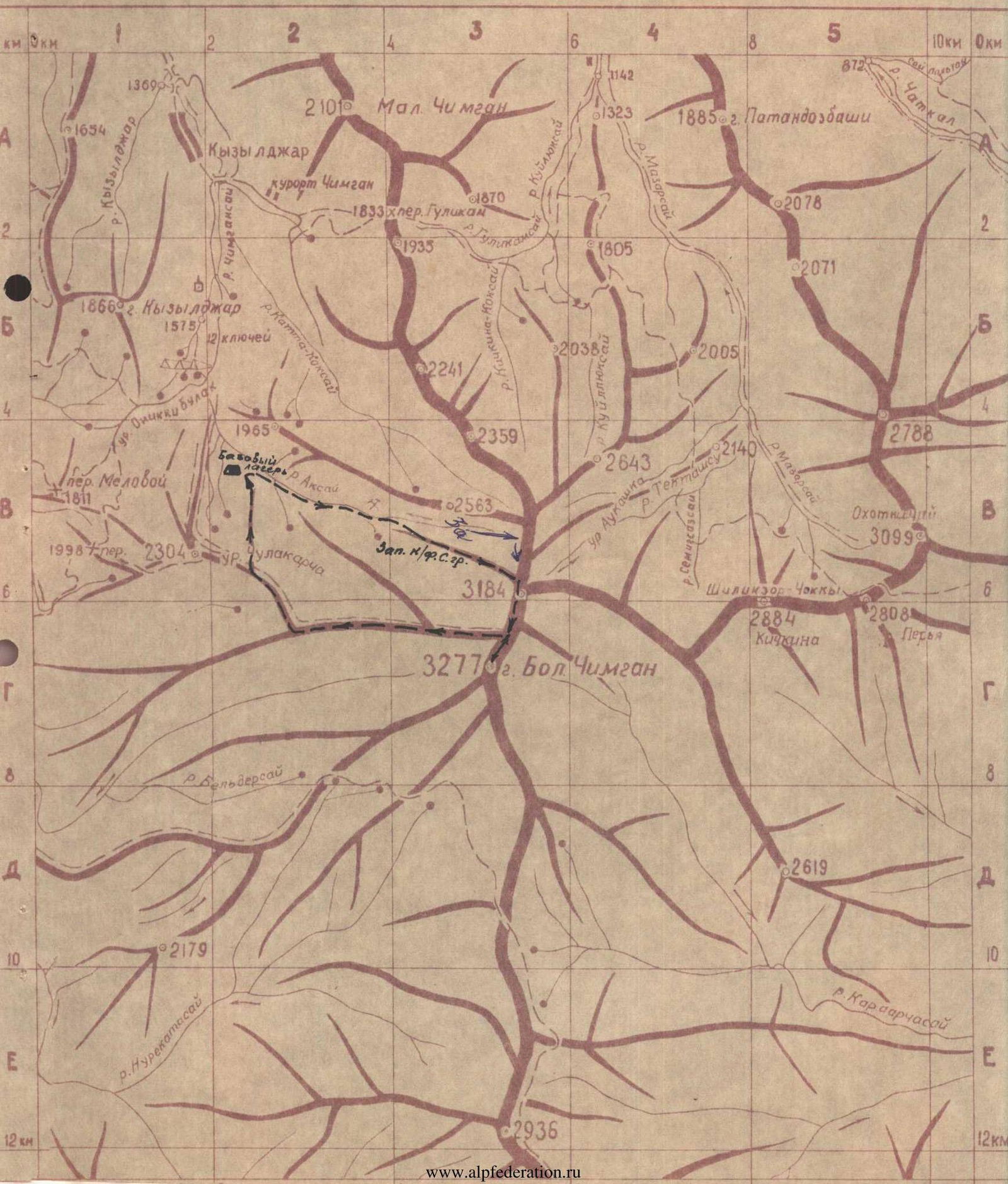
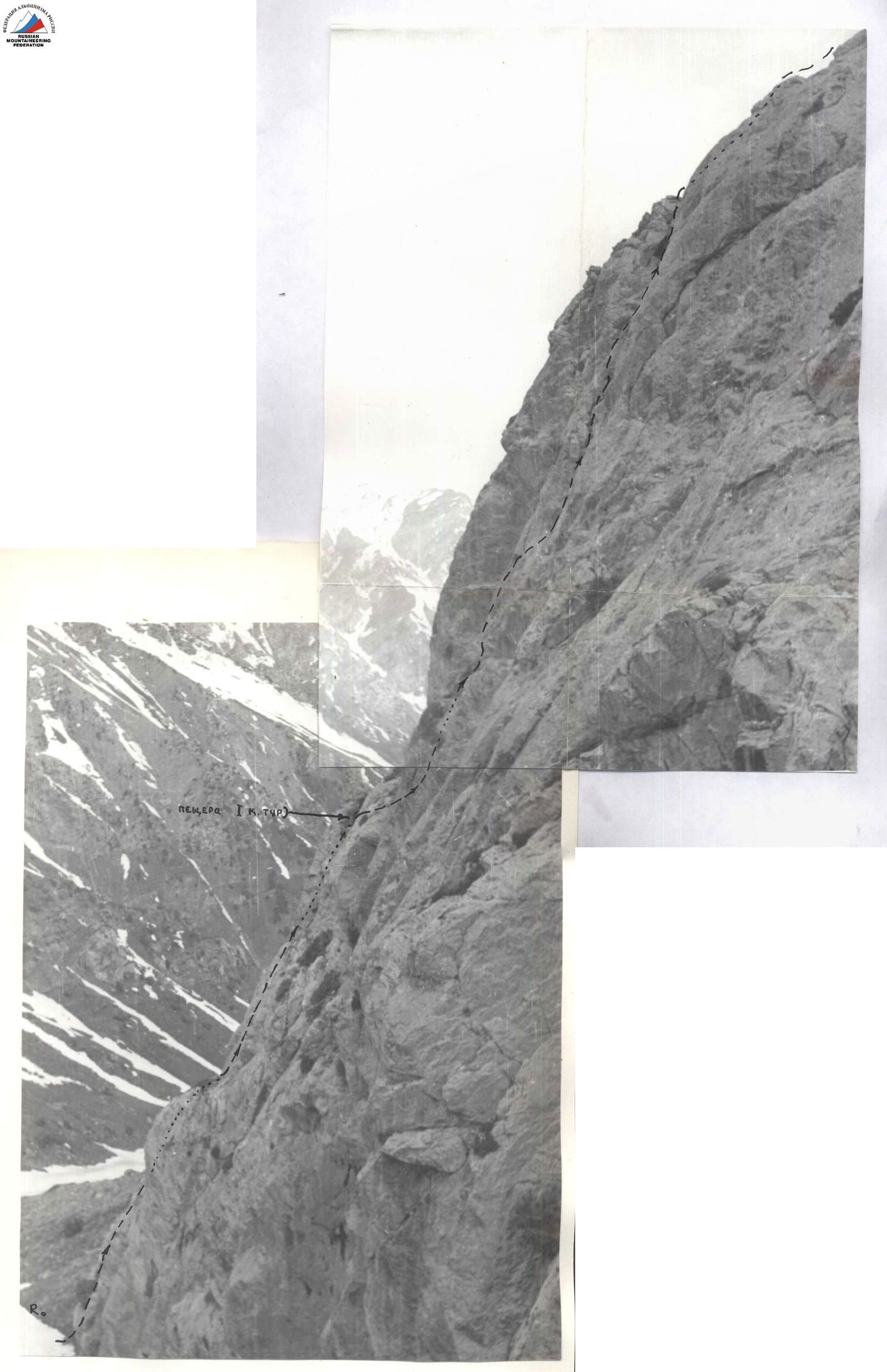
Photo 2. Section R0–R4. View from the south.
R6–R7 The rock ridge ends with a sheer wall. It is overcome in the lowest part, where the wall height is 2.5 m. Careful belay is necessary!
R7–R8 Further ascent to the right-up along a snow slope, approximately 40 m. Steepness 35°. Exit to the Northern ridge.
R8–R9 The Western counterfort exits to the Northern ridge of peak Bolshoy Chimgan to the junction with the Western ridge of peak Kichkina. The section of the gentle snow ridge leading to the peak Bolshoy Chimgan is only 350–400 m. Simultaneous movement.
The ascent route from the base camp to the peak takes 6–7 hours. Descent from the peak is convenient along the Western ridge, 1B category of difficulty.
The value of the route is in the combination of rock and snow work in rope teams with simultaneous movement. The route is logical, clearly expressed, entirely visible from below, and is one of the shortest paths to the peak from the northwest.
The group of first ascenders evaluates the route difficulty as 2B category of difficulty.
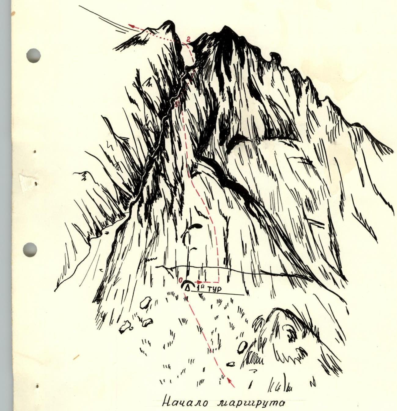
Start of the route
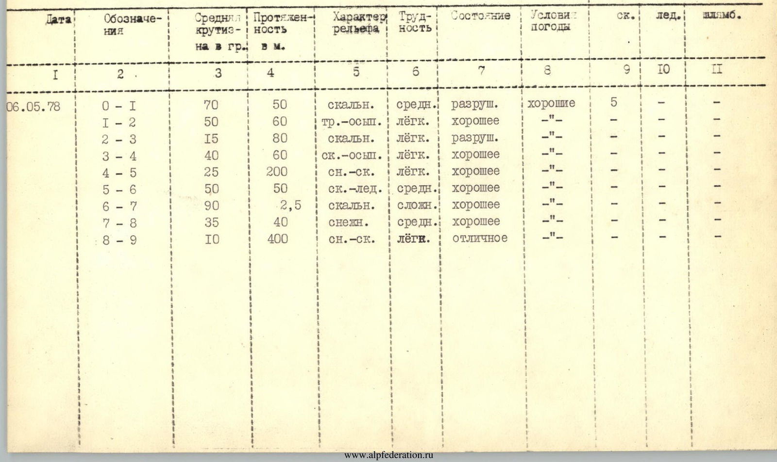
Character of the section