Ascent Passport
- Ascent class — rock climbing
- Ascent area, ridge — Western Tian-Shan, Ugam Ridge
- Peak, its height, ascent route — p. 4100 (p. Bratstva) via the North Ridge.
- Proposed difficulty category — 3A cat. diff. (first ascent)
- Route characteristics: — height difference — 500 m. — length of sections with 5–6 cat. diff. — none — average steepness — 50°.
- Pitons driven: — for belaying: rock — 17, ice — —, protection — 3. — for creating intermediate belay anchors: rock — —, ice — —, protection — —.
- Number of climbing hours — 8
- Number of nights — none
- Surname, name, patronymic of the leader, participants, and their qualification Timofeev Alexander Veniaminovich — Master of Sports of the USSR, leader Podgainy Evgeny Viktorovich — III sports category Podgainy Sergey Viktorovich — III sports category Mailov Teymur Eynullaevich — II sports category Pletnev Tikhon Ivanovich — III sports category Gorn Viktor Fedorovich — III sports category
- Team coach — Timofeev A. V.
- Date of departure and return — September 22, 1981
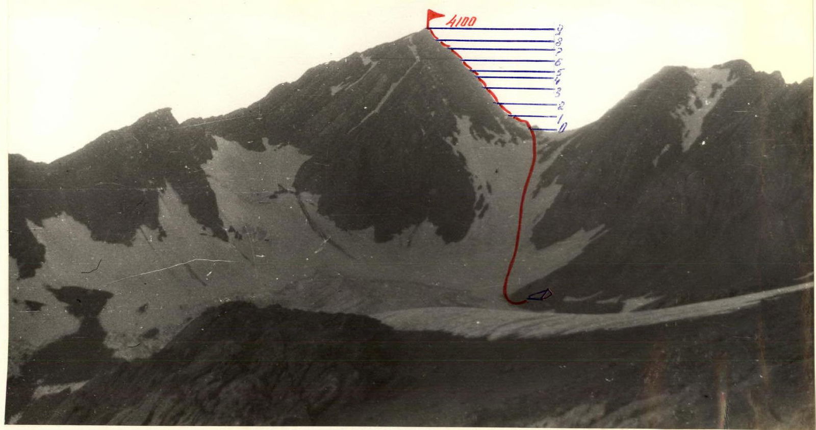
General View of the Route
Table of Main Route Characteristics
| Date | Designation | Average steepness, degree | Length, m | Terrain character | Difficulty | Condition | Weather conditions | Rock pitons | Ice pitons | Bolt pitons | Protection pitons |
|---|---|---|---|---|---|---|---|---|---|---|---|
| I | 2 | 3 | 4 | 5 | 6 | 7 | 8 | 9 | 10 | 11 | 12 |
| 22.09.1981 7:00 | R0–R1 | 30 | 200 | ridge with gendarmes | 2 | destroyed rocks | cloudy | ledges | – | – | – |
| R1–R2 | 40 | 100 | ridge | 3 | –"– | –"– | 1 | ledges | – | – | |
| R2–R3 | 60 | 60 | edges | 3 | –"– | –"– | 2 | – | – | – | |
| R3–R4 | 65 | 80 | edge | 3 | –"– | –"– | 3 | – | – | – | |
| R4–R5 | 80 | 5 | wall | 4 | monolith | –"– | 1 | – | – | – | |
| R5–R6 | 50 | 40 | ridge | 3 | destroyed | –"– | 1 | – | – | – | |
| R6–R7 | 45 | 90 | ridge | 3 | rocks | –"– | 2 | – | – | – | |
| R7–R8 | 70 | 50 | edge | 3 | –"– | –"– | 3 | – | – | 1 | |
| R8–R9 | 75 | 40 | wall | 4 | monolith, partially destroyed | –"– | 4 | – | – | 2 |
Departure at 7:00. Climbing hours — 8. Summit at 15:00.
Brief Explanation of the Table
R0–R1 From the saddle along the ridge, bypassing gendarmes on the left. Simultaneous movement, belaying through ledges. R0–R1 From the saddle, move below the ridge with gendarmes. The first two gendarmes are bypassed on the left (200 m). R1–R2 From the second gendarme, exit to the ridge. Along the ridge with a steepness of 40° for 100 m, exit to the edge. Alternating movement, belaying through ledges and rock pitons. R2–R4 Along the edge with a steepness of 60–65° for 140 m, exit under the wall. Alternating movement, piton belaying. Here is a control cairn. R4–R5 The wall (5 m) is climbed directly with an exit to the ridge. R5–R7 Along the ridge, exit to the edge with a steepness of 45–50° for 130 m. Alternating piton belaying. R7–R8 Along the edge with a steepness of 70° for 50 m, exit under the pre-summit wall. R8–R9 The wall is climbed directly with an exit to the summit. Piton belaying. Descent to the SW to the moraine. Along the moraine to the camp.