Ascent Passport
- Tian-Shan, Ugam ridge, Sayram-Su gorge, 7.11.
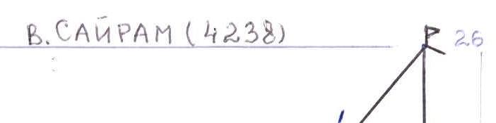
- Name of the peak: SAYRAM, route via the right buttress of the North face.
- Assumed to be 5B cat. sl. First ascent.
- Nature of the route: rock.
- Height difference: 913 m.
Route length: 1127 m. Length of sections:
- V cat. sl. — 504 m.
- VI cat. sl. — 73 m.
Average steepness:
- main part of the route — 77°
- entire route — 72°.
- Number of "hooks" driven on the route: total 151; including bolted — Number of hooks used on the route: bolted stationary — including P.A.S. — bolted removable — including P.A.S. — Total number of artificial points of support (P.A.S.) used – 17
- Team's walking hours: 20 hours over 2 days (including 9 hours of preparation)
- Leader: Paveliev Anatoliy Vasilievich: CMS Participants: Pavelieva Nelya Abbasovna: CMS, Kolmakov Nikolai Nikolaevich: 1st sports category
- Coach: Paveliev Anatoliy Vasilievich
- Departure to the route: 10:00 August 5, 2001
(6.08.01 — waited for bad weather to pass)
Reached the summit: 18:30 August 7, 2001
Return: 23:00 August 7, 2001
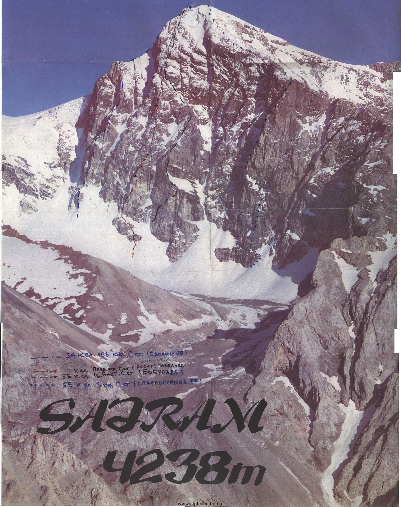
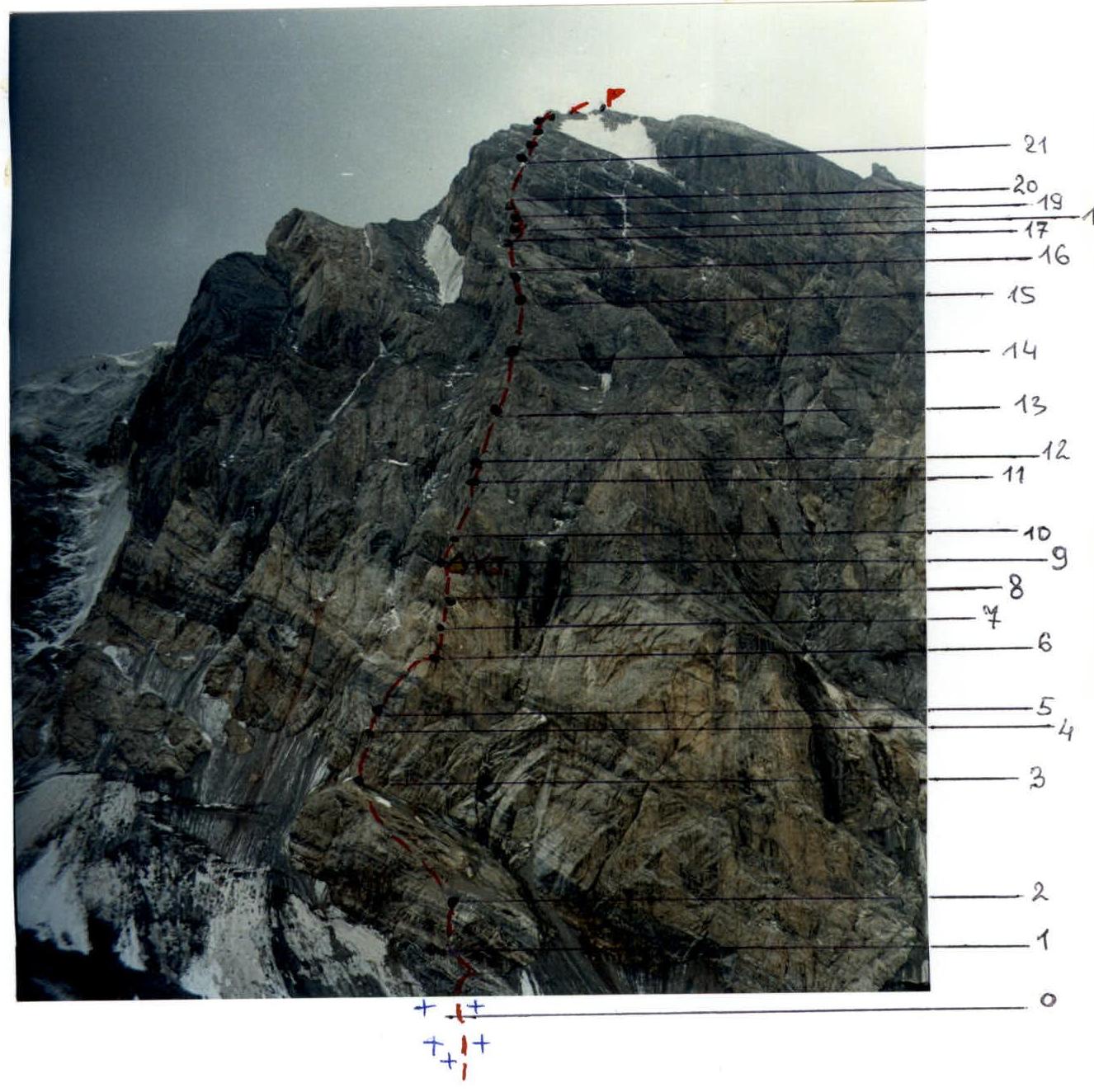
General photo of the summit on August 5, 2001. From Sayram glacier
- Yu. Svolik's route, 1988, 5A cat. sl., left buttress of N wall
- V. Sedelnikov's route, 1977, 5B cat. sl., N wall
- Route taken by the team, 2001
- A. Bobrov's route, 1986, 5B cat. sl., central part of N wall
-
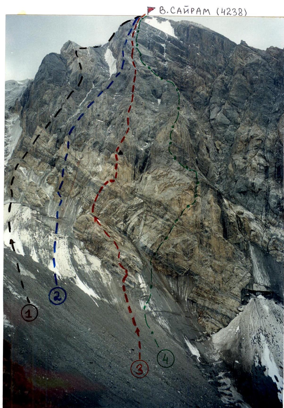
- Team's route, 2001
-
- V. Sedelnikov's route, 1977, 5B cat. sl.
-
- A. Bobrov's route, 1986, 5B cat. sl.
-
- Starlychanov's route, 5B cat. sl.
-
- Yu. Svolik's route, 1988, 5A cat. sl.
Photo of the route profile on the right. (Wall on the right)
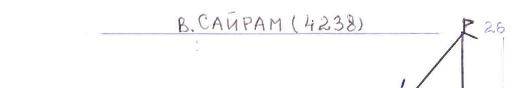


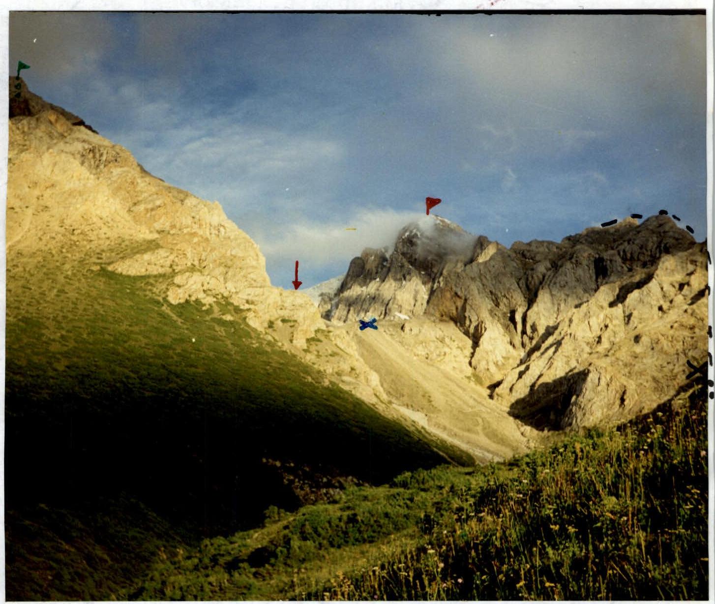
Mt. Sayram (4238) Approach to the moraine of Sayram glacier at 3190 m NW ridge of Mt. Enbek (3850) Solnechny pass and NW ridge leading to Mt. Sayram Col between Mt. Enbek and Mt. Sayram
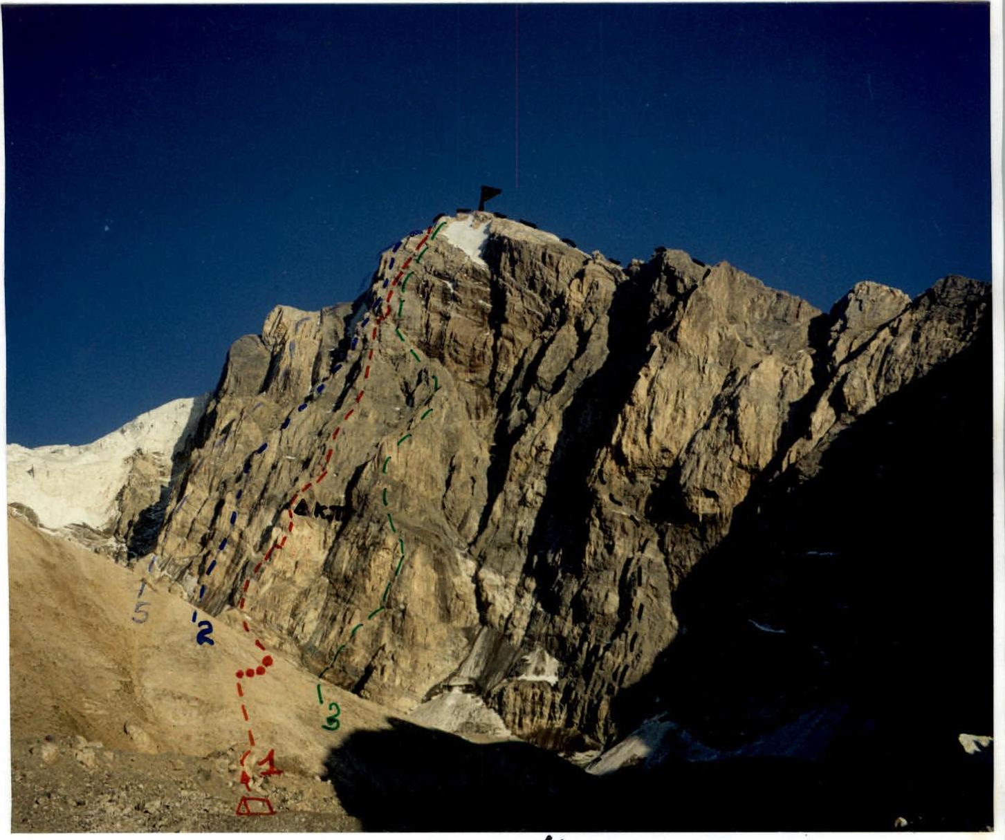
Panorama of the area
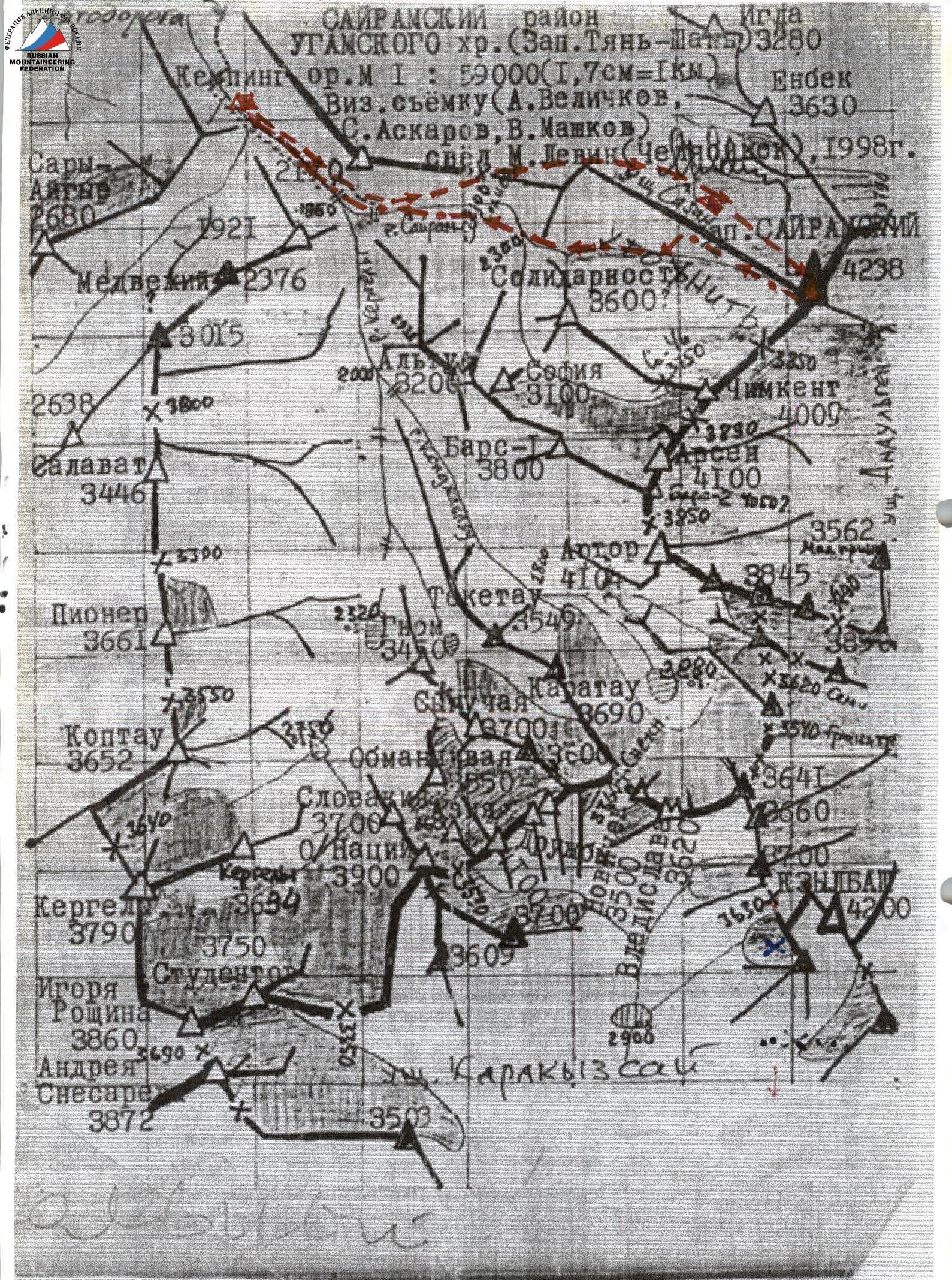
Object ascent map
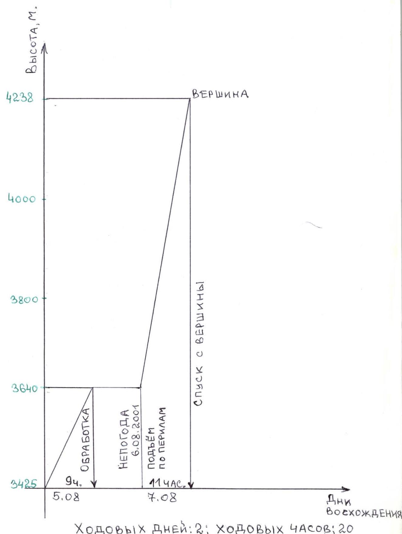 Ascent graph Summer 2001
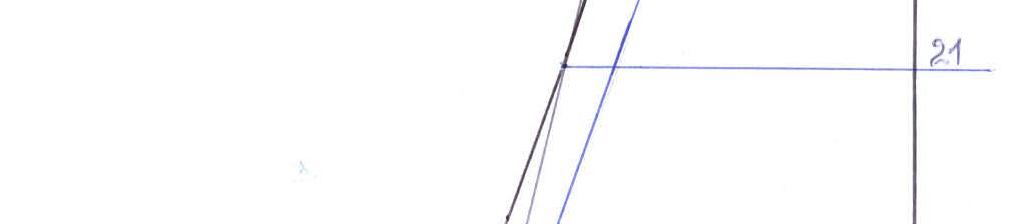
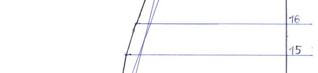
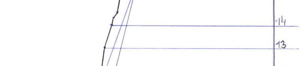
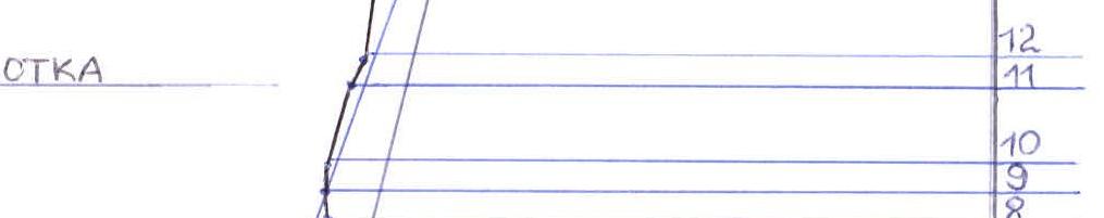
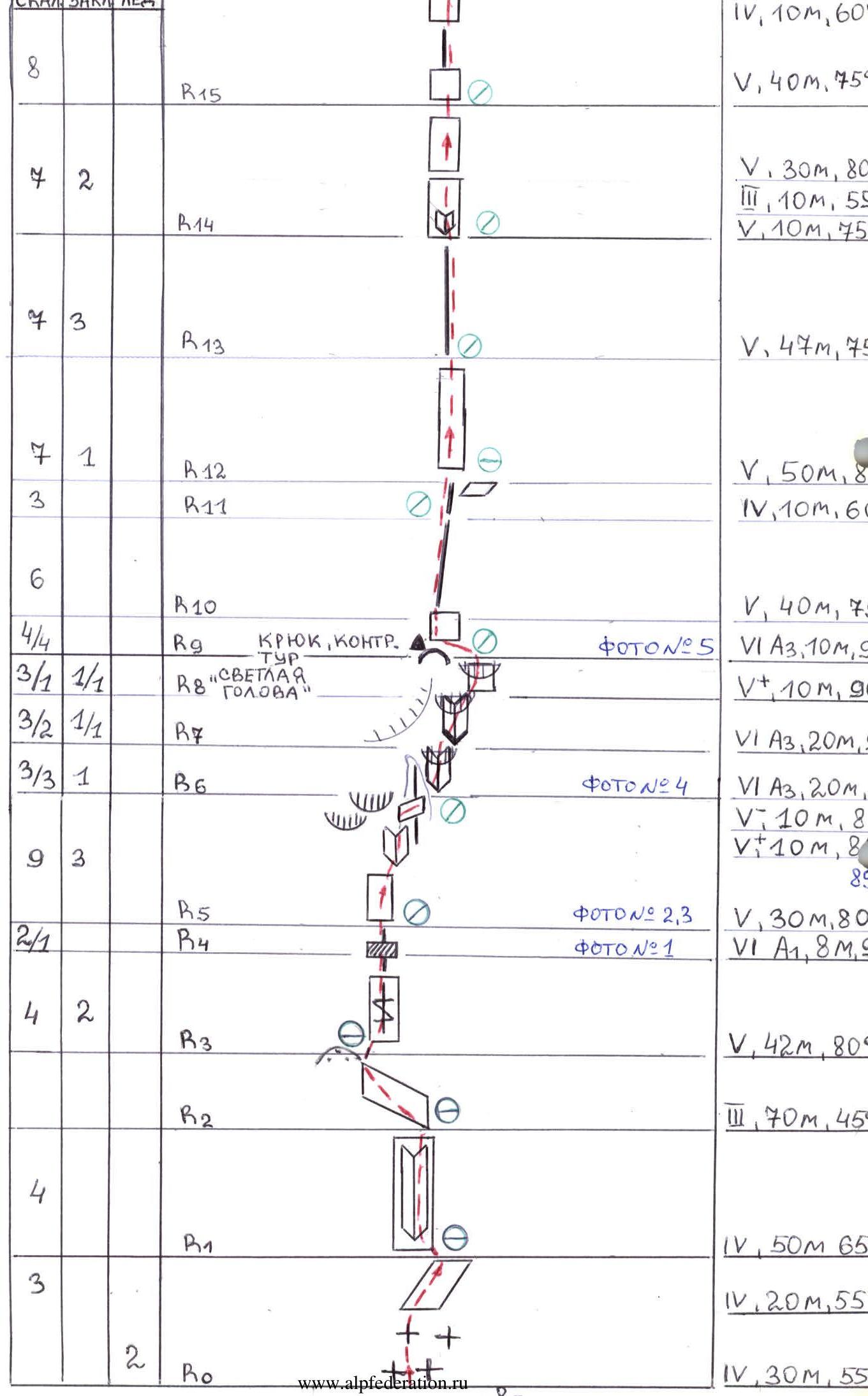 Route diagram in UIAA symbols M1:2000 scale

Route description by sections
R0–R1 From the talus moraine, 30 m, 55°, across the ice, then rightwards, 20 m, 55°, across broken rocks. Danger of rockfall from the wall. Should be traversed early in the morning.
R1–R2 Up leftwards along an inner corner, 50 m, 65°. Rocks are solid.
R2–R3 Leftwards along a rock ledge, 70 m, 45°, to a talus shoulder at the base of the buttress.
R3–R5 Upwards along a system of crevices, 42 m, 80°; a crevice without holds, 8 m, 90°, is traversed with P.A.S.
R5–R6 Across smooth monolithic rocks, up rightwards, 30 m, 80°, and up an inner corner, 10 m, 85°. A light-colored wall with overhangs remains on the left. In the middle, rocks with protuberances have through holes in the upper part; a traverse rightwards, 10 m, 80°, is made on a ledge to the edge of this rock.
R6–R9 Upwards along a steep inner corner, 20 m, 95°, with overhangs (P.A.S.) in the direction of the "light head" of this part of the buttress. Then a traverse rightwards to the next inner corner with overhangs, 20 m, 90°. And further rightwards through a wall with an overhang, 10 m, 90°. Exit to the "light head" via a hook (control cairn).
R9–R10 In the left part of the wall, upwards, 10 m, 90°, P.A.S. Exit to the edge of the buttress.
R10–R11 Along the edge of the buttress, 40 m, 75°.
R11–R13 Along the edge, 10 m, 60° — exit to a comfortable ledge, where an overnight stay is possible (may not have water or snow). Up the wall, 50 m, 80°.
R13–R14 Again along the edge, 47 m, 75°, under the wall to an inner corner.
R14–R15 Through an inner corner, 10 m, 55°; then the wall becomes less steep — 10 m, 55° — and upwards, 30 m, 80°.
R15–R16 The wall turns into an edge, 40 m, 75°, and again up the wall, 10 m, 60%. We reach the first smooth "rock slab" up to 100 m long.
R16–R17 In the right part of the "rock slab", up an inner corner, 50 m, 70°, under the base of the wall falling from the second upper "slab". The slabs have snow sections.
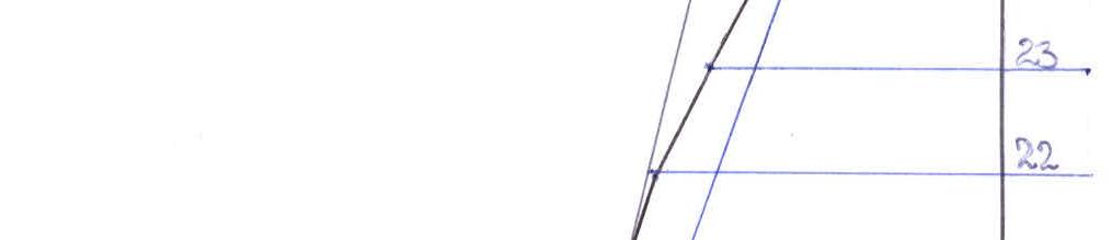
R17–R20 From the "middle of the slab" rightwards along an inclined ledge, 10 m, 70° (exit from the lower slab to the upper one) and up a crevice with two overhangs with P.A.S., 15 m, 90°; then 25 m, 75%. Exit to the "upper slab".
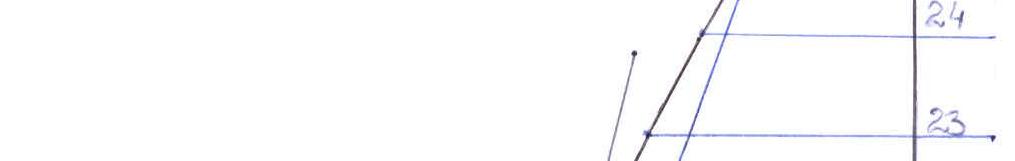
R20–R23 Up leftwards along the slabs, 200 m, 65–70°.
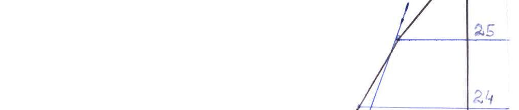
R23–R24 Leaving the edge of the slab on the left, along it, 50 m, 60°, in the direction of the ridge — exit to the north-eastern ridge.
R24–R25 Along the ridge, 70 m, 60°.
R25–R26 Along a simple ridge to the summit, 150 m, 50°. Summit.
Descent along the NW ridge, 3A cat. sl.
Technical photo of the route
Note from the control cairn on Sayram summit
August 5, 2001. A pair of climbers consisting of:
Natalya Rafikova (2nd sports category)
Alexander Toporkov (2nd sports category)
Made an ascent via a 5A cat. sl. route — Left.
Reached the summit at 20:10.
There's a whole tome in the cairn.
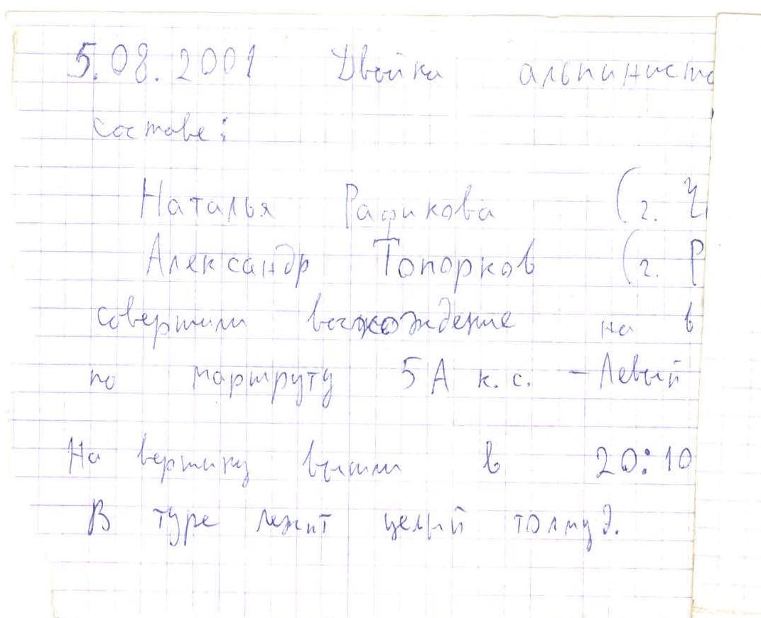
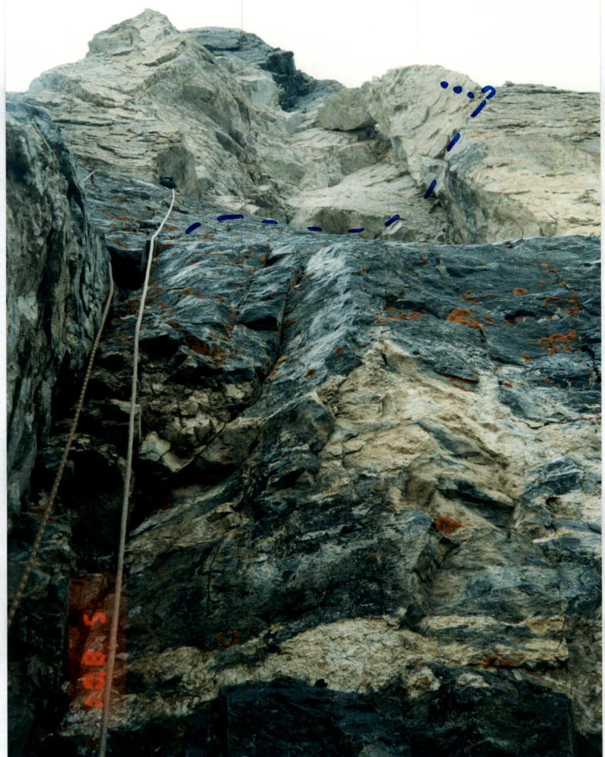
Photo #2. Section R5–R6. The first climber moves towards the rock protuberance.
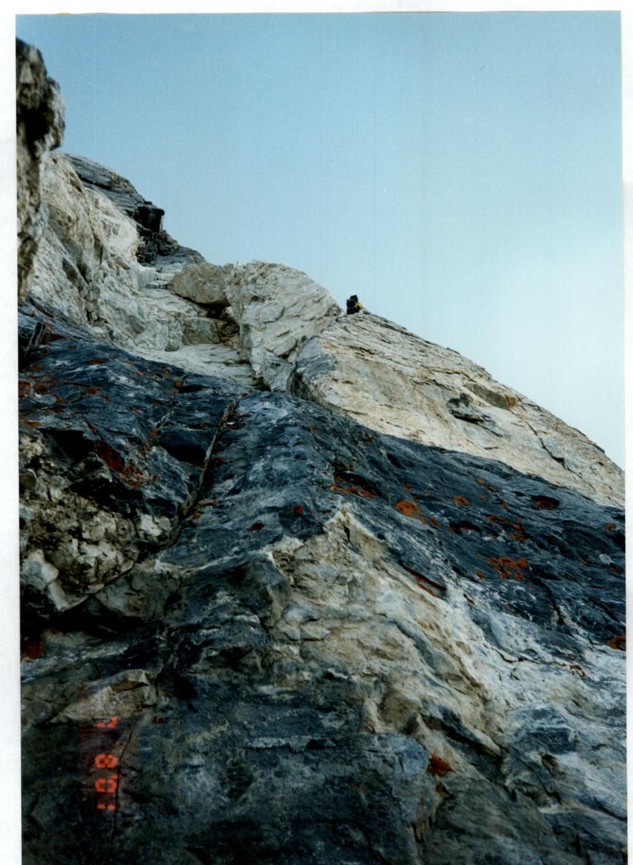
Photo #3. Upper part of section R5. Traverse along a ledge through the edge of the rock protuberance.
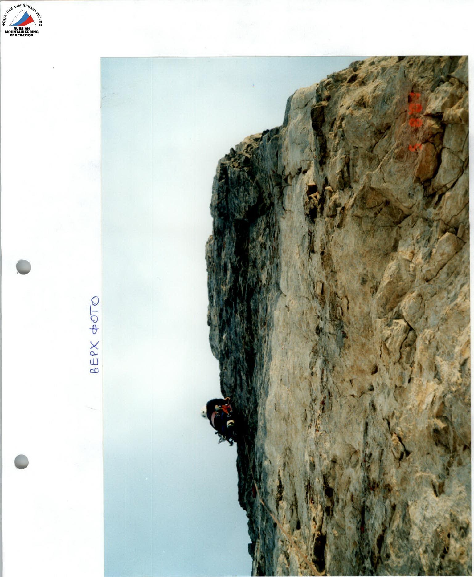
Photo #5. Traversing sections R9–R10. The first climber works with P.A.S.
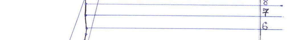
Photo #6. Section R17–R18.
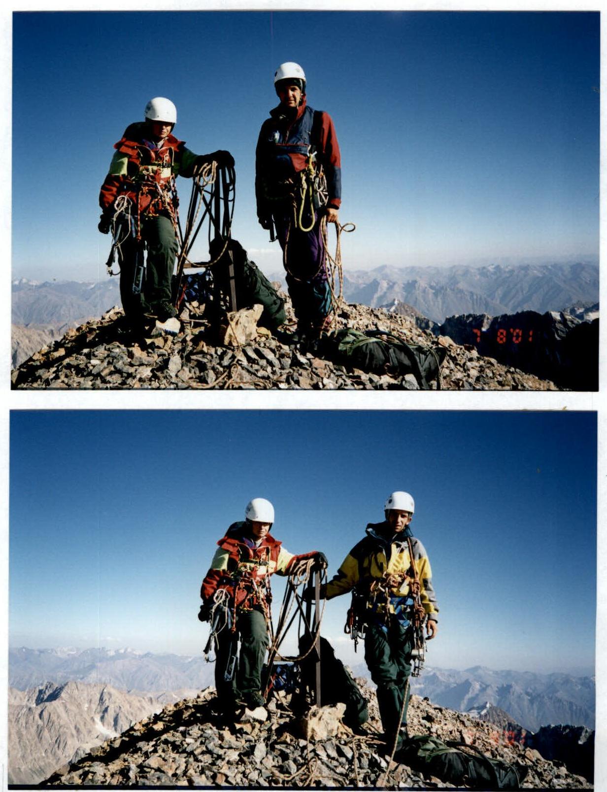
Photo #8. Group on the summit at the control cairn