Ascent Passport
- Climbing category: Technical
- Climbing region: Tian-Shan, Terskey Ala-Too ridge, Tong pass area, Ashutor tract.
- Peak, route: First ascent of the peak named "Tolomusha Okeeva"
via the central couloir of the southern slope.
- Expected category of difficulty: 2A.
- Height difference: 1013 m.
- Total route length: 2255 m.
- Length of key sections: 358 m.
- Of which 2nd category of difficulty — 235 m.
- Of which 3rd category of difficulty — 88 m.
- Of which 4th category of difficulty — 25 m.
- Pitons hammered: rock pitons 6, chocks 8.
- Number of walking hours/days: 12 hours.
- Leader: Bogolyubov V.V., CMS.
- Participants: Zhyrgalbekova Zh.Zh., Bekbolotova K.N., Dootu uulu Nursultan
- Coach: Bogolyubov V.V., CMS.
- Departure on the route: 6:00. Date October 5, 2013.
- Reaching the summit: 14:00. Date October 5, 2013.
- Return: 18:00. Date October 5, 2013. Route description
| Section # | Category of difficulty | Steepness | Length | Insurance | Notes |
|---|---|---|---|---|---|
| R0–R1 | 1st cat. diff. | 10-30^{*} | 1800 m | ||
| R1–R2 | 1st cat. diff. | 30^{*} | 20 m | ||
| R2–R3 | 4th cat. diff. | 50^{*} | 25 m | Alternating-piton. | |
| R2–R3 | 2nd cat. diff. | 30^{*} | 200 m | Alternating for ledges | |
| R4–R5 | 2nd cat. diff. | 35^{*} | 210 m | Alternating |
R0–R1 — the route starts from the Ton gorge, ascent along the moraine to the central couloir of the southern slope.
R1–R2 — exit to the ridge. R2–R3 — wall 50×25 m. R3–R4 — ridge. R4–R0 — talus couloir. Descent via the
ascent path.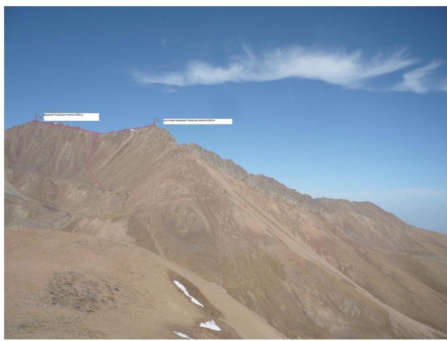 □
□